
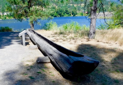
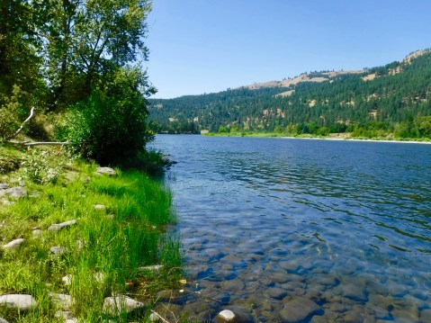
MHT Day 21: Their Columbia River is Gone
I knew last winter, long before I began this ride, that a series of dams built beginning in the 1930s and continuing into the 1970s stretched across the Columbia River and the rivers that flow into it. Some of the dams are above the confluence of the Snake and Columbia Rivers where I was yesterday, but four of them are between Pasco and Astoria, including one of the largest at The Dalles where I am tonight. I passed two others on the way here: The McNary Dam (1954) and the John Day Dam (1971). I understand the need for flood control and the production of renewable hydroelectric power, but the presence of all those dams, as well as those on the Snake River and the Missouri River, have buried hundreds of historic sites related to the presence of the 1804-1806 Corps of Discovery, as well as thousands of Native American sites. The rivers Lewis and Clark paddled, rowed, sailed and towed their various craft on are gone.
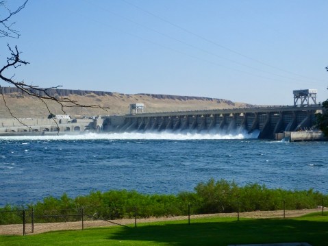
The McNary Dam

The John Day Dam
Today I realized something else is also gone. The air through which Lewis and Clark saw distant mountains, especially in Oregon and Washington, was clear and the horizon could be seen 100 miles away. Mountains such as Mt. Hood and Mt. Saint Helens which they recorded in their journals could be seen from the right promontories at a distance of 70 miles or more. I still haven’t seen them and I’m getting close to the Cascades. I.m not saying I want to endure the rigors they endured, but I sure would like to see the world they saw.
During today’s ride, I stopped at several sites mentioned in their journals, but unlike the sites I saw east of the Rockies and even in Idaho, there doesn’t seem to have been much effort on the part of Washington or Oregon to preserve or interpret Corps of Discovery sites, at least in the western parts of both states. A couple of roadside historical markers with a paragraph or two was the extent of the historical explanation I saw today. It reminded me of the “Kilroy was here” graffiti popular in WWII.
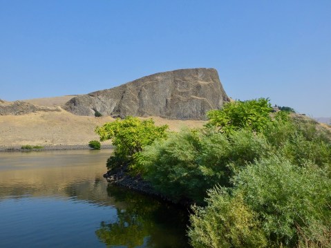
Travel for the Corps was fairly rapid going downstream on the Columbia, as long as they didn’t encounter serious rapids or, especially, waterfalls. On October 19, 1805, for example they covered 36 miles on a day in which Clark recored a large rock formation shaped like a hat, caught the first glimpse of the volcanic, snow-covered Mt. Adams and spent two-hours dragging the party’s canoes over a long shoal; before they even began the day on the water they had a two-hour meeting with a chief of the Walla-Walla band and 30 or so of his people to announce their intentions and offer gifts.
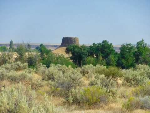
Hat Rock was mentioned by Clark in his journal. In fact, it does strongly resemble beaver-skin hats popular in 1800. The formation is the result of a series of volcanic eruptions that lasted for 10-15 million years and covered parts of Washington, Oregon, and Idaho with nearly 40,000 cubic miles of basalt. Formations like this are common in the area as erosion during the last two million years washed away the top soil and softer rock leaving basalt formations behind.
I also stopped at Celilo Park, thinking there would be some mention of Celilo Falls also known as the Great Falls of the Columbia, which Clark recorded on October 22, writing I beheld an emence body of water Compressd in a narrow Chanel of about 200 yds in width, fomeing over rocks maney of which presented their tops above the water. The falls, which had been a prime salmon fishing location and meeting place for tribes in the area for thousands of years, required a strenuous portage the next day by the Corps. Clark’s description suggests some of the problems they encountered:
I then decended through a narrow chanel of about 150 yards wide forming a kind of half circle in it course of a mile to a pitch of 8 feet in which the chanel is divided by 2 large rocks at this place we were obliged to let the Canoes down by Strong ropes of Elk Skin which we had for the purpose, one Canoe in passing this place got loose by the Cords breaking, and was cought by the Indians below. I accomplished this necessary business and landed Safe with all the Canoes at our Camp below the falls by 3 oClock P. M.
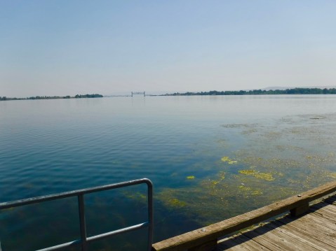
Today this prime fishing spot, this meeting place for hundreds of generations of native people is completely submerged by the waters behind The Dalles Dam. A ramshackle group of buildings and a small rock ledge where Natives of four different tribes are allowed to fish with dip nets according to agreements with the Federal government is the sole remnant of the Celilo Falls fishing culture.
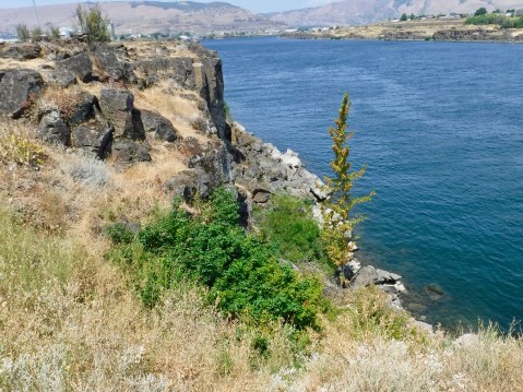
Somewhere under the water is the Great Falls of the Columbia, about which Lewis and Clark wrote extensively.
I had one more stop to make related to Lewis and Clark, and once again, I found that their alleged campsite at Fort Rocks in what is today The Dalles contained several interpretive panels, but nothing else. One of the problems with determining exactly where they camped is the lack of physical evidence to prove they were in a specific location. Even the journals and Clark’s mapping coordinates are sometimes at odds with each other, and historians can often only approximate where they might have camped.
I stopped early today and wrote this in the afternoon while the blazing sun raised temperatures to 100° again today. This evening I’m going to get out and try something different. If everything works out, I’ll amend this post later today.
[It’s about five hours later and I’m back with a small addendum.]
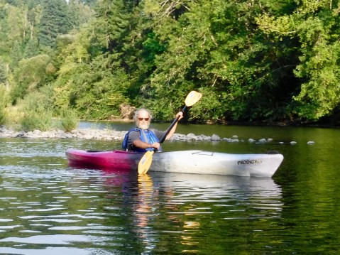
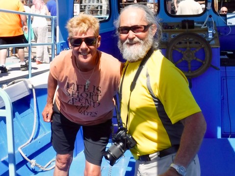
One of the things I had hoped to do on this trip was get ON the water that the Corps of Discovery travelled on. The boat trip up the Gates of the Mountains covered the Missouri River, though I still wish I could have made the three-day canoe trip. Time and money constraints meant I missed the Clearwater and the Snake Rivers. But tonight, at least, I could check off the mighty Columbia River. I booked a “Sunset Kayaking Tour” with the Gorge Paddling Center out of Hood River, Oregon. The plan was to kayak on the Columbia down river from Hood River, but when the kayaks were put in the water at the launch site, the 30 mile per hour wind–which draws hundreds of kite surfers every day to the Columbia River Gorge–made going on the Columbia a little dicey. So, we paddled up the Wind River, a Columbia tributary, in the hopes that the wind would abate later on. Toward the end of the tour, the wind died down enough for Todd, the owner and chief guide, to take me out on the mighty Columbia River, the same one (sort of) that Lewis and Clark and the gang floated down in late October 1805. The Wind River diversion actually worked well, because unlike the lake-like Columbia, it had a current. I’m now even more convinced than before that the Corps of Discovery MUCH preferred going downstream to upstream. I’ll know tomorrow just how sore I’m going to be, but whatever discomfort these old bones feel, it will be worth it to have joined Lewis and Clark, briefly, on their trip down the great western river.
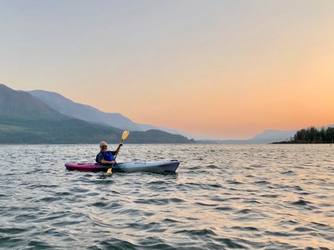
The sun had sunk below the horizon by the time we paddled onto the great river.

The Wind River offered a shelter from the wind.
Paddling upstream was not nearly as much fun as floating back downstream with a well-deserved glass of Chardonnay.
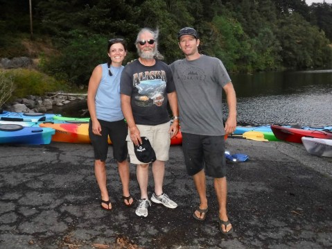
Lindsey, Todd and one worn out old man.
.
MHT Day 20: From Confluence to Confluence
From October 11 to October 16, 1805, the expedition paddled 154 miles downstream, overcoming several treacherous rapids along the way, in their five dugout canoes plus one canoe with two helpful Nez Perce guides from the confluence of the Clearwater and Snake Rivers at present-day Lewiston, Idaho, to the confluence of the Snake and Columbia Rivers at present-day Pasco, Washington. What they saw then is what I saw today. Not much.
With temperatures in the 90s much of the ride and reaching 100° by the time I reached Pasco, a little shade along the way would have been nice. But that would have required trees. And there weren’t any. Nor were there any when the Corps made its downstream run on the Snake River in 1805. Three days after leaving the Clearwater River, Captain Clark noted in his journal that, with the acquiescence of their two Nez Perce guides, the lack of any trees made them do something they would have preferred not to at a temporarily uninhabited Indian fishing camp.
we have made it a point at all times not to take any thing belonging to the Indians even their wood. but at this time we are Compelled to violate that rule and take a part of the Split timber we find here bured for fire wood, as no other is to be found in any direction.
The next day, Sergeant Gass added a similar comment in his journal, noting that “we had great difficulty in procuring wood to cook with, as none at all grows in this part of the country.”
What I did see, for the first 100 or so miles as I headed west, was rugged, sometimes rocky, treeless prairie grassland, followed by miles and miles of wheat and hay fields being harvested by teams of huge tractors and harvesters, clearly not a family farm operation. At one point, I passed a parade of green agrotechnological behemoths lumbering in the opposite direction looking for a fertile field to ravage; it was a good thing I was on a motorcycle because there wouldn’t have been room for these giant machines and a car on the narrow road at the same time. When I got to within 30 miles of Pasco the temperature dropped a few welcome degrees and a couple miles later the wheat fields were replaced by fecund orchards, fructuous vineyards and a few hopeful fields of hops.
Swallow Rock, so named for the thousands of swallows that build nests there, sits across the Snake River from the Hells Gate State Park.
I began the morning in Lewiston/Clarkston by visiting a small Lewis and Clark Interpretive Center at Hells Gate State Park in Idaho. While the displays were limited, they did have one of the best short videos I’ve seen of the Expedition, focusing on the time the Corps spent between the Bitterroot Mountains and the Pacific Ocean and the aid provided to the Corps by various native tribes, including the Nez Perce. Without exception, I think, each time I visit one of these small museums or interpretive centers I learn something new. Today, for example, I learned that when the captains and enlisted men wrote their daily observations and occurrences in their journals, they used powdered ink which, when mixed with water, gave them the indelible medium they needed for their quill pens and for posterity. Not earth shattering, I realize, but this minor details helps me develop a more complete picture of the Expedition.

This osprey at Hells Gate State Park was looking for breakfast when he turned his head to look at me.
Knowing today’s ride wasn’t going to be a long one and based on a breakfast conversation with other bikers, I took a 20-mile detour before leaving Clarkston to ride what is referred to locally as the “Spiral Highway,” an old section of U.S. 95 with 64 turns in its eight-mile, 2,000 foot climb up Lewiston Hill. Very few guardrails line the shoulder to ensure careless motorists (or bikers) don’t go sliding down the hill. Unfortunately, the road was covered with “tar snakes,” an asphalt sealer used for crack repair that produces significantly dangerous traction challenges for two-wheelers, and I had to moderate my speed considerably, especially going into each of the 64 turns. One final note: It’s said this precipitous grade inspired the 1955 rockabilly hit “Hot Rod Lincoln.” That’s probably as important to know as that the Corps used powered ink. But there you have it.
Sections of the “Spiral Highway” can be seen in the foreground. Running through the middle of the photo is the Clearwater River, to the right is the Snake River.
When Lewis and Clark reached the confluence of the Snake and Columbia Rivers, several hundred Yakima and Wanapam Indians greeted them, singing and dancing and providing “eight fat dogs and Some fresh sammon” for dinner. This was not the first time during the expedition the men had hot dogs for dinner; over the course of the trip they consumed, according to one count, more than 200 dogs, which they preferred over fish or horse meat.
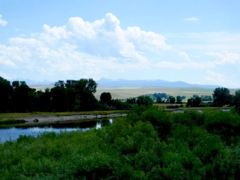
Because the Snake and Columbia Rivers are so wide where they meet, it’s hard to get a good photograph. I’m standing on the point where the two rivers merge. To the right is the Columbia River; to the left is the Snake.
When I reached the confluence of the same rivers, on the other hand, I was greeted by a locked door at the Sacajawea State Park Museum. Seems they’re closed on Monday and Tuesday. If anyone’s wondering, I had a club sandwich for dinner.
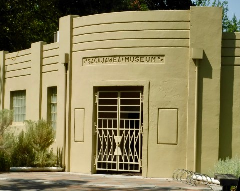
A locked door kept me from seeing what the Sacajawea Museum in Pasco had to offer.
Tomorrow I work my way down the Columbia toward the Pacific Ocean. I’ve just about reached the half-way point of this adventure.
MHT Day 19: Over the Bitterroots to Nez Perce Country
On September 11, 1805, the Corps of Discovery left their camp at Travelers Rest and started their trek up and over the Bitterroot Mountains. Eleven days later they emerged from the mountains onto a prairie where they received food and a friendly greeting by a band of Nez Perce. That eleven day period was the most dangerous and most difficult stretch the Corps had experienced since leaving St. Louis.
The first several days of the journey the route was steep and game was scarce but they continued on, even finding a hot springs on September 13 used by Indians for bathing. Private Joseph Whitehouse, who also kept a journal during the Expedition, wrote that they
passed a warm Spring, which nearly boiled where it Issued out of the rocks a Short distance below the natives has dammed it up to bathe themselves in, and the water in that place is considerable above blood heat. it runs out in Sundry places and Some places cooler than others. Several of us drank of the water, it has a little sulpur taste and verry clear. these Springs are very beautiful to See, and we think them to be as good to bathe in &c. as any other ever yet found in the United States.
An omen of what was to come, however, occurred after they left the springs and their Shoshone guide, who they called Toby, took them down the wrong path resulting in a laborious trek up the side of a steep mountain to regain the correct path. The next day, because the hunters had been largely unsuccessful in their pursuits, the party killed and ate one of the horses they had purchased from the Indians. They named the place where they camped that night “Colt Killed Creek.” On their fifth day crossing the Bitterroots, September 15, after a particularly arduous climb during which several horses fell down the mountainside, Clark offered this description:
From this mountain I could observe high ruged mountains in every direction as far as I could See. with the greatest exertion we Could only make 12 miles up the mountain and encamped on the top of the mountain near a Bank of old Snow about 3 feet deep lying on the Northern Side of the mountain and in Small banks on the top & leavel parts of the mountain, we melted the Snow to drink, and Cook our horse flesh to eat.
On the next day, with more than half of their mountainous trek still ahead of them, snow fell on the party making conditions even more precarious as they trudged through some of the most rugged mountains in the continental United States. Private Whitehouse wrote this description of that depressing day:
We were all surprized when we awoke this morning; to find ourselves covered with Snow, which was 2 Inches deep . . . some of our party are without Socks, and are forced to wrap Rags round their feet to keep out the cold. The Snow fell so fast that it is now from 5 to 6 inches deep & where old the Snow remained it was considerably deeper . . . . The party were all much fataigued & hungry, our officers had a Colt killed and the party eat the half of it this evening.
By the seventh day, having killed and eaten three horses, Clark took six hunters and went ahead of the party, hoping to kill game and leave meat near the trail for the remainder to find and eat. Clark described the plan this way:
The want of provisions together with the dificuely of passing those emence mountains dampened the Spirits of the party which induced us to resort to Some plan of reviving ther Sperits. I deturmined to take a party of the hunters and proceed on in advance to Some leavel Country, where there was game kill Some meat & Send it back, &c
On September 19, from a high peak over which they were crossing, Lewis saw a level plain in the distance, about 60 miles away, but they, quite literally, were not out of the woods yet. Sergeant Patrick Gass wrote in his journal about both privation and hope:
The men are becoming lean and debilitated, on account of the scarcity and poor quality of the provisions on which we subsist: our horses’ feet are also becoming very sore. We have, however, some hopes of getting soon out of this horrible mountainous desert, as we have discovered the appearance of a valley or level part of the country about 40 miles ahead. When this discovery was made there was as much joy and rejoicing among the corps, as happens among passengers at sea, who have experienced a dangerous and protracted voyage, when they first discover land on the long looked for coast.
Clark and his advance party made contact on September 20 with a small village of Nez Perce on the plains Lewis had seen, but the latter would not emerge from the mountains until September 22, when he wrote, “the pleasure I now felt in having tryumphed over the rocky Mountains and decending once more to a level and fertile country where there was every rational hope of finding a comfortable subsistence for myself and party can be more readily conceived than expressed.”
The Nez Perce, who numbered in the hundreds in this area and could easily have killed the weakened troops, provided camas roots and salmon for the famished men who wolfed down huge portions of the unfamiliar food only to be stricken for the next several days with severe cramps and diarrhea, prolonging their recovery and, in several cases, nearly killing a couple of them. But they finally recovered enough to begin building five canoes that would take them down the Clearwater River to the Snake River and on to the Columbia River. On October 7 they launched all their new canoes, built with the help of the Nez Perce who had also agreed to look after the expedition’s 38 remaining horses until they returned. Four days after launching their new craft, they reached the confluence of the Clearwater and Snake Rivers, where I am spending the night.
Well that was their trip from Lolo/Travelers Rest to the Snake River at Clarkston, Washington. Mine was a damn site better. The day started off cool, but not as cool as I had thought it might be up in the mountains. After a hardy breakfast in Missoula, I packed my gear on the bike, donned my leather jacket and gloves and headed to my first stop–Lolo Hot Springs. I knew it had been commercialized but not to what extent. There no longer exists a free-flowing hot spring, only a worn-out, swimming pool and soaking pool at a cheesy resort. I did find some warm water to stick my hand it, but it must have been some distance from the source since no skin peeled off. So, I proceeded on.
I’m sure it was a beautiful spot when Lewis and Clark were there.
At Lolo Pass, I stood at or near the spot where the Corps crossed the Continental Divide before being led astray again by their Shoshone guide and having to backtrack and climb one of the steepest inclines they encountered just to get back on the trail. I also had a chance to visit Packer’s Meadow, where they rested, grazed their horses, and got fresh water.
But the best part of the ride between Lolo and the Clearwater River on the other side of the mountains was. . . .well, it was the ride. U.S. 12 is one of the great motorcycle rides in the west. More than 100 miles of mostly gentle curves along a beautiful, flowing Lolo Creek on the Montana side and the Lochsa River on the Idaho Side. Interestingly, the waters of both rivers eventually ends up in the Columbia River. This road is a motorcyclist’s dream. Lots of pull offs to use if you want to see the river at a much slower pace or if slow-paced cars with courteous drivers want to use them to let impatient bikers pass.
I mostly behaved myself with the throttle, but I found I disagreed from time to time with Law Enforcement’s suggested speeds and I exceeded their recommendations, especially on the Idaho side where they laid about 50 miles of new surface just last year. If they went to all that trouble to make the roads more conducive to speed, it was the least I could do to oblige them.
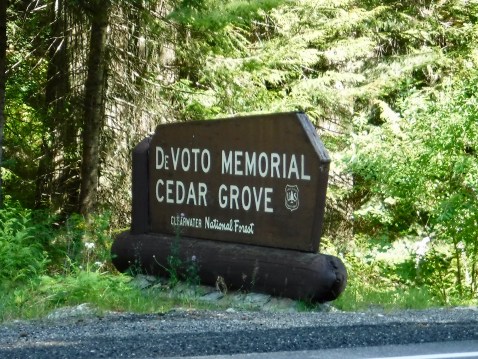
I did make one other stop that had been recommended to me by one of the historians I met at the beginning of this trip. A grove of old-growth cedar trees was named for Bernard DeVoto, one of the great historians of the American West and an early editor of the Lewis and Clark Journals. I stopped there, looked in awe at those 2,000 year old trees, said a thank you to DeVoto at a marker in the grove, and headed down the road once more.
I had planned a stop at Weippe Prairie (pronounced Wee Ipe), which is where the expedition emerged from the mountains and met the Nez Perce. But my Google GPS, after taking me up an incredibly steep and winding asphalt road to get to the top of the prairie, consistently wanted me to go down a gravel road for about 10 miles. No thank you. So I kept going on the asphalt hoping for a better route. But no, two miles later, another command to go down another gravel road. And again about two miles after that. So I just stayed on the asphalt. Until the asphalt ended and I found myself on a very narrow gravel road that made turning around difficult, but not impossible. So I headed back down the same way I came up and decided there wasn’t much to see at Weippe Prairie after all.
Another 30 miles down the road, I spied an historic marker located at the “Canoe Camp” where the Corps members and the helpful Nez Perce built the pine canoes destined for the Pacific Ocean. So, I missed Weippe Prairie but saw where they built and launched the canoes. And Canoe Camp was next to an asphalt road.
One final stop for the day at the National Park Service Nez Perce National Park headquarters. While there I picked up several brochures and maps for the Nez Perce National Historic Trail which follows the route of the 1877 flight from the army. I think I see another road trip in my future.
The day started out cool but it was 100 degrees when I pulled into Lewiston, Idaho, across the Snake River from Clarkston, Washington. To my delight, the Hell’s Canyon Harley-Davidson store was on the same road I was on, so I stopped in to get a Harley-Davidson t-shirt. The other one I brought with me is starting to smell.
MHT Day 18: Ups and Downs
Today was a day of ups and downs. Of course, when you’re riding a motorcycle in the mountains there are always ups and downs (and twisties). But in a more general sense, today had ups and downs as in good and bad.
Good: 55° and clear skies to start the day
Bad: First planned stop closed to public
Good: Great stop at Big Hole Battlefield in Montana
Bad: Disappointing stop at Sacajawea Interpretive Center in Idaho
Good: Floorboard-scraping ride going down and then back up on U.S. 93 in Idaho from Lost Trail Pass
Bad: Pull-your-hair-out road going down U.S. 93 in Montana from Lost Trail Pass
Good: Less than 90° degrees this afternoon and a cold beer in Missoula
Sometimes (most of the time?) these posts can be a little confusing. Today’s may be of that nature, but I’ll try to make the chronologically-challenged nature of my travels today as clear as I can. I’ve been writing most of the time as if I’m following the trail of Lewis and Clark on their 1804-1805 outward bound journey. Except, for example, when I followed the Yellowstone River upstream, backtracking on William Clark’s 1806 return trip or when I made an 1877 side trip to Bear Paw Battlefield.
The first part of today’s ride covered part of Clark’s 1806 return trip with another side trip to 1877.
In 1805, just before crossing over the Continental Divide at Lemhi Pass, the Corps had cached some supplies and canoes at Camp Fortunate on the Jefferson River, not far from where I stayed last night in Dillon. They expected to return to there the following year. When Lewis and Clark decided to split up after re-crossing the Bitterroot Mountains in 1806 on their way home, Clark took a route that would bring him back to Camp Fortunate but on an easier path than the one they took in 1805. Today I followed Clark’s 1806 route, only backwards. Clear?
At any rate, as Clark and his party crossed the Big Hole Valley in 1806 they came to a bubbling hot springs in the middle of the valley. Clark wrote on July 7,
we arrived at a Boiling Spring . . . this Spring contains a very considerable quantity of water, and actually blubbers with heat for 20 paces below where it rises. it has every appearance of boiling, too hot for a man to endure his hand in it 3 seconds. I directt Sergt. Pryor and John Shields to put each a peice of meat in the water of different Sises. the one about the Size of my 3 fingers Cooked dun in 25 minits the other much thicker was 32 minits before it became Sufficiently dun.
So, I wanted to stop and see the hot springs where they cooked their dinner. But, I discovered to my chagrin, it’s on private land and no long accessible to the public, even though I could see it from a highway pullout. The best I could do was a long distance picture of steam rising up from the ground.
Hot Springs at Jackson, MT, visited by William Clark on July 7, 1806.
My second stop of the day was also chronologically misplaced, but since I don’t even know what today is, I guess it doesn’t matter if I mix up some events from hundreds of years ago. This stop had me back on the Nez Perce trail that I first mentioned when I stopped at the Bear Paw Battlefield a week ago. This was another battlefield during the same desperate cross-country flight of the Nez Perce in 1877. I knew it was there and expected to stop for 15 minutes, take a couple pictures, and move on. But the National Park Service has a great interpretive center and, once again, I struck up a conversation with an informed and knowledgable NPS staff member, and then spent time walking on the battlefield itself. My 15 minute stop took an hour and a half.
The Nez Perce were camped on the prairie to the right when they were attacked on July 9, 1877.

NPS employee Joey Wohl provided great help in explaining this historic site.
In August 1877, as 750 Nez Perce were attempting to escape pursuing Army troops, they stopped to rest for a few days on a prairie in the Big Hole Valley just over the Continental Divide in Montana. In the pre-dawn hours of August 9, U.S. 7th Infantry troops and a few civilians attacked the quiet village, shooting men, women and children as they slept in their tipis. The Nez Perce warriors, led by several warrior-chiefs, recovered from the initial attack, drove the troops back and began a siege which gave the surviving Indians under the leadership of Chief Joseph a chance to escape once more.
The National Park Service has done an excellent job preserving the site and explaining why the Nez Perce consider it sacred ground today and why they hold ceremonies each August commemorating the battle and honoring their people who died there. Seasonal interpreter Joey Wohl walked me through the details of the battle, pointing out in the landscape spread before us where the action took place. We talked at length about the different concepts of land and land ownership that separated, fatally it seems, whites from Indians. After we talked, I rode to the site and spent time trying to image the chaotic scene from 1877.

Sacagawea and Jean Baptiste (Pompey)
For months, as part of my Lewis and Clark trip planning, I had strongly considered literallyfollowing their 1805 route over the continental divide at Lemhi Pass where an historical marker signifies their achievement. But after talking with several people who had been there (and paying heed to Marilyn’s importuning), I opted not to challenge the 35-mile dirt and rock, one-lane road over the mountains. Instead, after leaving the Big Hole Battlefield, I crossed over the divide at Chief Joseph Pass (fitting, no?), continued on to Lost Trail Pass on U.S. Highway 93, then headed down the mountains to Salmon, Idaho, near where Lewis and Clark traded for horses with the Shoshone and where today there is a Sacajawea Interpretive Center. I had thought this would be an important stop on my educational journey, but I was sorely disappointed.
The small interpretive center and museum, operated by the town of Salmon, didn’t offer any new information about Sacagawea, repeated several myths that have grown up around her, and sugar-coated parts of the story that could have been dealt with more honestly. I’m hardly an expert on her or the Lewis and Clark expedition, but I’ve learned enough in the past year to know when its history is being presented through distorted lenses. Tourists who know little about the expedition can learn some important truths at this center, but scholars seeking to expand their knowledge about this important but largely unknown woman would be better off at the Interpretive Centers in Great Falls or Washburn at Fort Mandan. I thinks it’s important to note that no Shoshone any longer live in Salmon, having been forced onto reservations hundreds of miles away about 150 years ago.


(Click on the images above to enlarge.)
The Lewis and Clark Expedition spent two weeks with the Shoshone from August 13 to August 31, 1805, bargaining for horses, locating a guide, and exploring the Salmon River looking for a shortcut to the Columbia, even though the Shoshone had told them that navigating the river was impossible. They were right, and so the Expedition spent a tortuous 10 days hacking their way north over a series of mountains until they finally reached what they referred to as Travelers Rest, and camped for several days to rest and provision themselves before turning west for what would be one of the toughest challenges of the expedition: crossing the snow-covered Bitterroot Mountains as winter set in.
While their experience traveling from the Salmon River in Idaho to Travelers Rest in Montana was much worse than mine, my ride down from the top at Lost Trail Pass was awful. “Road Construction Ahead” was my first sign (literally) that there could be a problem. For nine grueling miles, highway crews were resurfacing the road with chip seal, something I hadn’t encountered since my Alaska trips in 2013 and 2016. They had just put a fresh layer of fine gravel down, and the pilot car led us at 10 miles an hour for nearly an hour of dust, flying chips (rocks), and a very hot air-cooled Harley-Davidson. When road conditions are good, that road is a great ride. That was my final “bad” and I washed some down some of the dust with a 23 ounce Scottish Ale at the end of the ride.
Tomorrow I should have a beautiful ride over the Bitterroots, which almost ended the Expedition in 1805.
MHT Day 17: One Very Long River
The Missouri River is 2,341 miles long, measured from the confluence of the Jefferson, Madison, and Gallatin rives in Three Forks, Montana, to the confluence with the Mississippi River just north of St. Louis. The Big Muddy is the longest river in the United States, and it seems like it to my Harley butt. Since I left Maggie Valley, I’ve ridden 3,748 miles to get to Three Forks today, including a few planned and unplanned detours. The last two miles of today’s ride, I rode through moderately hard rain, the first time I’ve dealt with that since I started this Magical History Tour. I’ll take 16 dry days in a row, even if some of them were hot.
I also had two other firsts today. A tour boat trip through the Gates of the Mountains canyon marked the first time I’ve been ON the Missouri River this trip. The final first for the day was my first spotting of snow on the distant peaks of the Rocky Mountains looking over the Jefferson River.
As I looked beyond the Jefferson River, which the Corps of Discovery went up in July and August 1805, I could see snow glistening at the tops of some of the distant mountains. Not big is this picture, but the white spots on the tops of the mountains are snow.
On July 19, 1805, Captain Lewis wrote in his journal about an unusual river canyon in which he was encamped for the night.
this evening we entered much the most remarkable clifts that we have yet seen. these clifts rise from the waters edge on either side perpendicularly to the hight of 1200 feet. every object here wears a dark and gloomy aspect. the tow[er]ing and projecting rocks in many places seem ready to tumble on us. the river appears to have forced it’s way through this immence body of solid rock for the distance of 5¾ miles and where it makes it’s exit below has thrown on either side vast collumns of rocks mountains high. the river appears to have woarn a passage just the width of it’s channel or 150 yds. it is deep from side to side nor is ther in the 1st 3 miles of this distance a spot except one of a few yards in extent on which a man could rest the soal of his foot. . . . from the singular appeaerance of this place I called it the gates of the rocky mountains.
Lewis’s Gates of the Rocky Mountains canyon is still there, though the presence of a dam downstream a few miles from the entrance to the canyon has raised the water level by about 18 feet. Today’s two-hour trip once again offered me a chance to see what the Corps of Discovery saw, with only a few changes. The rock walls still tower more than 1200 feet above river travelers and the canyon still inspires awe in those who pass by. Bald eagles and ospreys still soar overhead, occasionally plunging to the surface in search of a meal. Swallows still dart in and out of the canyon walls where they build their nests. The monstrous rocks still tower overhead, threatening, as Lewis noted, to tumble from their lofty perches into the cold, clear water below. Native American pictoglyphs painted by unknown shamans or artists more than a thousand years go still catch the eye of the observant voyager. Two hundred years haven’t changed this landscape much.
I was lucky once again to have found a knowledgable guide for this tour. Kari (pronounced Car ee) has been piloting tour boats, pointing out hard to find features, and relating history and stories related to the canyon for seven years. She knew how Lewis felt on entering the Gates and what he wrote about it. She told the story of the Mann Gulch Fire in the canyon in 1949 that took the lives of 13 smoke jumpers and is still used to teach fire fighting skills today. She knew the history of the first steamboat to go through the canyon. She explained the almost sacred relationship between the previous owners of the land bordering the river and the canyon. I would love to be able to spend a full day in a small boat with Kari slowly coursing through the towering canyon and hearing more of what she knows about this powerful landmark in the voyage of Lewis and Clark.
Kari shared a wealth of knowledge about the Gates of the Mountains.
Although they didn’t know it, when the men of the expedition exited the canyon they were only 90 miles and five days from the beginning of the Missouri River at Three Forks.
Clark arrived on foot at the Three Forks on July 25, having gone ahead of the main party hoping to make contact with the Shoshone (Sacagawea’s people), from whom they had to obtain horses if they were to continue their march to the Pacific Ocean. Lewis arrived by boat with the rest of the Corps on July 27 and they spent the next several days scouting, trying to determine which of the three rivers would be the real headwaters of the Missouri.
The river to the right is the Missouri; the river behind me is the Jefferson which the Corps ascended, the river to the left is the Madison. The Gallatin enters the Missouri about 1/2 mile downstream.
On July 28, Lewis recorded his and Clark’s decision to discontinue using the name Missouri to designated any of the rivers above Three Forks:
Both Capt. C. and myself corrisponded in opinion with rispect to the impropriety of calling either of these streams the Missouri and accordingly agreed to name them after the President of the United States and the Secretaries of the Treasury and state having previously named one river in honour of the Secretaries of War and Navy. In pursuance of this resolution we called the S. W. fork, that which we meant to ascend, Jefferson’s River in honor of 〈that illustrious personage〉 Thomas Jefferson. the Middle fork we called Madison’s River in honor of James Madison, and the S. E. Fork we called Gallitin’s River in honor of Albert Gallitin.
On July 27, 1805, Meriwether Lewis wrote that he ascended the point of a high limestone clift from whence I commanded a most perfect view of the neighbouring country. His vantage point was the cliff in this photograph, from which he could see all three rivers for a distance of 10 miles or more and helped him decide the Jefferson River was the river they should continue on.
By August 10,1805, the party had reached the place where I am now, Dillon, MT on the Jefferson River. On August 1 Lewis and three others made their first contact with the Shoshone and a few days after that, following an emotional meeting between Sacagawea and her brother Chief Cameahwait, they crossed the continental divide at Lemhi Pass and left the United States.
Tomorrow I’ll follow the Corps over the divide, into Shoshone country and on to the foot of the Bitterroot Range of the Rocky Mountains.
MHT Day 16: Great Falls and the Mountains
When I think a route is going to take four hours to ride, it’s likely to take six. When I think I can go visit a museum in an hour, I usually spend two hours and should spend four. Everything seems to take longer than planned or expected.
Lewis and Clark encountered the same problem, but on a much larger scale. When they spoke with Mandan and Hidatsa at Fort Mandan during the winter of 1805-1805, they were told about a “great fall” on the Missouri River near the mountains. The captains were looking forward to finding it, believing that it would require only a one-day portage around the falls and that they would be nearer to finding the source of the Missouri River, which had been one of their charges from Thomas Jefferson.
On June 11, 1805, as Clark and most of the party were depositing some of their goods in a cache at Decision Point, Lewis took four men and started walking up river, hoping to find the falls and scout the easiest portage for the boats that followed. Two days later, he wrote, . . . my ears were saluted with the agreeable sound of a fall of water and advancing a little further I saw the spray arrise above the plain like a collumn of smoke which would frequently dispear again in an instant caused I presume by the wind which blew pretty hard from the S. W. I did not however loose my direction to this point which soon began to make a roaring too tremendious to be mistaken for any cause short of the great falls of the Missouri.
The next day, as he looked upriver for the best portage route, he came to another fall, and another, and another, and another. Not one, but five falls blocked their route. The hope of a quick, one-day portage disappeared in the mist of the great falls.
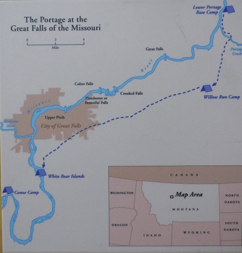
It would be nearly a month of the most arduous work on the entire voyage before the Expedition was once again on the water in search of the Missouri’s source and an easy passage over the snow-covered mountains, which at the Great Falls were clearly in sight. During that month most of the men hauled canoes and most of their remaining equipment and trade goods 18 miles over uneven, cactus-covered ground, up and down ravines, through oppressive heat and a ferocious hail storm that left them battered and bruised. At the same time, others in the party prepared Lewis’s “Experiment,” the iron boat they had carried since setting off from Pittsburg in August 1803. Once the iron boat was assembled, wood slats made for the bottom, elk and buffalo hides attached and the seams caulked, it was launched. And it sunk, as did Lewis’s spirits. Additional delay was needed to make two more canoes to replace the now worthless iron boat.
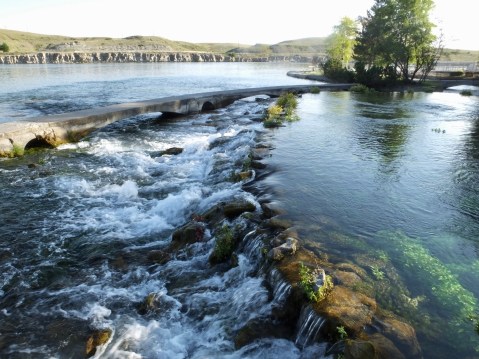
The Giant Springs emerge from the ground yards away from the Missouri River, pouring 150 million gallons of pure spring water into the river each day. Of the spring, Clark wrote on June 18, 1805, that it was the largest fountain or Spring I ever Saw, and doubt if it is not the largest in America Known, this water boils up from under th rocks near the edge of the river and falls imediately into the river 8 feet and keeps its Colour for ½ a mile
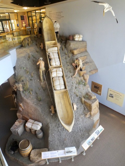
One of the most impressive displays at the Interpretive Center shows men of the expedition hauling a canoe up a ravine slope. I questioned a docent about the gradient and he admitted that there were none on the portage as steep as the one in the exhibit, but that there were several places where the men struggled mightily to get the one-ton canoes up a hill. Note the wooden wheels made from cottonwood trees which the men called “trucks.”
The story of the Great Falls portage is the focus of one of the best interpretive centers on the Lewis and Clark Trail at Great Falls, operated by the Department of Agriculture’s Forest Service. Today I visited the Center for the third time and also saw the Giant Springs next door, found by the party as they explored the area near the portage. I spent an hour at Giant Springs State Park and Fish Hatchery, then spent four hours at the interpretive center, trying to learn as much as I could from the outstanding exhibits.

Jess the Intern is learning while helping others learn about the flora and fauna encountered by Lewis and Clark.
I was aided in my learning quest by two interns at the Center, Hanna from Montana, who filled in a couple of gaps for me on the boats used on the Expedition and Jess from Florida, who reminded me just how dangerous and prevalent grizzly bears were in 1805. Scientists, she informed me, have determined there were once about 50,000 grizzlies in what would become the lower 48 states. Today there are approximately 1,500 in the lower 48, and most of those are in Montana, Wyoming and Idaho. Jess also led a tour outside the building to look at some of the native plants the Corps of Discovery would have seen and used.
I had one more stop to make in Great Falls before heading for Helena for the night. One of the great Western American artists, Charles M. Russell, lived and painted in a small studio next to his house in Great Falls. Today, on the same property as the original house and studio, is a wonderful museum dedicated to the works of Russell and to other western artists. Russell was himself a working cowboy before he took up painting full time, and his works are dominated by realistic scenes of cowboys busting broncs and roping cattle and of Native Americans whose cause he fought for most of his life.
I toured both the studio, which is furnished today based on pictures of it taken while he was alive, and the house. He built the studio, a log cabin, next to his house because his wife Nancy, who served as his business manager, insisted that he had to paint somewhere other than their living room. He also wanted a place where Indian, cowboy and artist friends could gather and talk about the western life they loved but which they knew was disappearing.
After I left Great Falls and headed to Helena, I realized, like Lewis and Clark, that my long days crossing the Great Plains were over. The mountains truly are in sight, at least some of the smaller ones, and in a few days I’ll be headed through the most spectacular and difficult country they encountered.
I have reached the edge of the Rocky Mountains.
MHT Day 15: Decision Time
On June 2, 1805, the expedition unexpectedly came upon the junction of an unknown river with the Missouri. During the winter of 1804-1805 at Fort Mandan, the captains had spoken at length with natives and French and British trappers and traders to discover as much as they could about the Missouri River they would ascend when the ice broke. They learned about several rivers and about a waterfall on the Missouri, but no one mentioned the large river they had just encountered.
On June 3, Lewis wrote in his journal:
This morning early we passed over and formed a camp on the point formed by the junction of the two large rivers . . . . An interesting question was now to be determined; which of these rivers was the Missouri, or that river which the Minnetares . . . . had discribed to us as approaching very near to the Columbia river. to mistake the stream at this period of the season, two months of the traveling season having now elapsed, and to ascend such stream to the rocky Mountain or perhaps much further before we could inform ourselves whether it did approach the Columbia or not, and then be obliged to return and take the other stream would not only loose us the whole of this season but would probably so dishearten the party that it might defeat the expedition altogether. convinced we were that the utmost circumspection and caution was necessary in deciding on the stream to be taken.
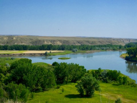
Decision Point. On the left, the Marias River flows into the Missouri. On the right, the Missouri flows downward from the Rocky Mountains on its way to the Mississippi River.
One of the readers of this blog recently asked how the captains decided they were headed in the right direction. The decision they faced on June 2 exemplifies how they made the choices they did. The party stayed for nine days at this river junction, repacking their gear, deciding what to cache when the time came to leave some of it behind, and, most importantly, sending exploring parties up both rivers on foot for several days to learn what they could. At the conclusion of their river explorations, the men in the group all argued for taking the river on their right and going north.
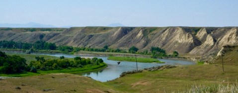
Standing on the same bluff–perhaps on the very spot–from which Lewis and Clark surveyed the Missouri and Marias rivers, I had this view of the Missouri River, which they proceeded up on June 12, 1805, on their way to the Pacific Ocean.
But the two captains overruled the common consensus, noting that the new river, the Marias River named for Lewis’s cousin, was muddier, indicating to them that it arose not in the mountains, but in the plains where it picked up dirt and mud as it made its way south. The river on the left, however, was clearer, indicating to them that it arose not in the dirt plains but in the rocky mountains. And so, at Decision Point, they correctly chose the Missouri River and proceeded on. Their decision was justified only a few days later when they discovered the Great Falls of the Missouri.
There are few places left on the Lewis and Clark Trail where today’s traveler can see what the Corps of Discovery saw. Decision Point is one of those locations, as was Pompey’s Pillar which I climbed yesterday. Standing in the same spot and seeing the same views is part of what this journey, for me, is about. It’s not the same experience, of course, but there’s something special about literally following in the footsteps of these intrepid explorers.
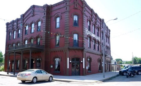
The Grand Union Hotel in Fort Benton was the finest lodging in the territory during that city’s prime years.
Up the river, about 10 miles as the crow flies or 15 miles as the river bends, one finds the historic town of Fort Benton, the commercial center of Montana in the 1830s to 1870s. With the appearance of hundreds of steamboats beginning in 1860 which brought supplies to the territory and returned its furry and golden treasure to the East, Fort Benton was the most inland port anywhere in the world. I stopped there today, in part to see the town where I would have started my canoe adventure had that been in the cards and to see the historic Grand Union Hotel I had planned to stay in. While most of Fort Benton’s history is unrelated to Lewis and Clark, their voyage of discovery in 1804-1806 opened the door to further exploration and exploitation of the area.
A small center, but full of interesting displays interpreted by a knowledgable staff.
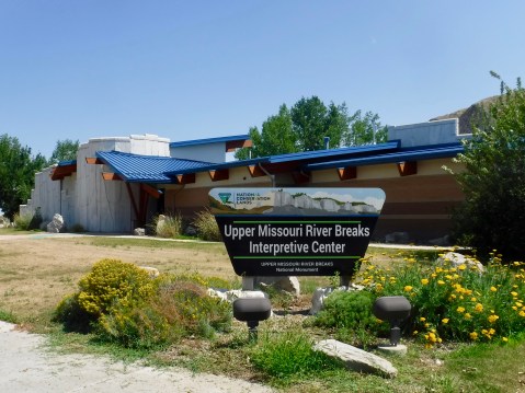
But I also wanted to visit the Upper Missouri River Breaks Interpretive Center operated by the Bureau of Land Management, which oversees the Upper Missouri River Breaks National Monument. Why was this important? Because the Upper Missouri River Breaks National Monument is the most pristine part of the Lewis and Clark Trail that remains, as the Missouri River flows past towering white sand stone cliffs and rock spires that inspire the imagination.
A few days before he reached Decision Point, Lewis had been mesmerized by the geologic wonders he saw as he made his way up river:
. . . . water in the course of time in decending from those hills and plains on either side of the river has trickled down the soft sand clifts and woarn it into a thousand grotesque figures, which with the help of a little immagination and an oblique view at a disance, are made to represent eligant ranges of lofty freestone buildings, having their parapets well stocked with statuary; collumns of various sculpture both grooved and plain, are also seen supporting long galleries in front of those buildings; in other places on a much nearer approach and with the help of less immagination we see the remains or ruins of eligant buildings; some collumns standing and almost entire with their pedestals and capitals; others retaining their pedestals but deprived by time or accident of their capitals, some lying prostrate an broken othes in the form of vast pyramids of connic structure bearing a sereis of other pyramids on their tops becoming less as they ascend and finally terminating in a sharp point. . . . . As we passed on it seemed as if those seens of visionary inchantment would never have and end; for here it is too that nature presents to the view of the traveler vast ranges of walls of tolerable workmanship, so perfect indeed are those walls that I should have thought that nature had attempted here to rival the human art of masonry had I not recollected that she had first began her work.
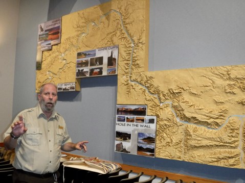
Bruce and a three dimensional map of the Monument helped me develop a mental picture of the sights and the Lewis and Clark history I missed by not going on the Missouri River Breaks canoe trip.
When I visited the Interpretive Center, I was assisted in my continuing Lewis and Clark education by a BLM staffer named Bruce and the Upper Missouri River Breaks National Monument Manager, Zane Fulbright. Bruce answered my questions about the Monument (which spans nearly 150 river miles and a narrow strip of land adjacent to the river) and about its appearance in 1805 compared with today. The short answer: There isn’t much difference. Toward the end of my visit, Zane spread out a Montana state map and together we went over the things I should see in the next couple of days. I don’t have time to see them all, but with Zane’s help I picked out the most important stops.
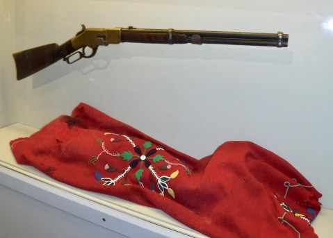
Chief Joseph’s rifle and a worn and faded blanket traded by a Nez Perce woman for food at the end of the siege at Bear Paw Battlefield.
Yesterday, I noted my visit to the Bear Paw National Battlefield. Today, in a sense, that visitation continued, when, to my surprise, I saw in the small collection of artifacts at the Center the very rifle that Chief Joseph held and surrendered to General Nelson Miles to end the New Perce War in 1877. It’s odd that the BLM has possession of the rifle. It seems odder that I stumbled on it today during my Lewis and Clark continuing education.
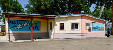
 At Decision Point, I had a decision of my own to make. At Ma’s Loma Cafe less than a mile from the point of land where the Corps camped, I had to decide which among half-a-dozen delicious looking slices of homemade pie I would have for lunch today. I chose the extraordinarily rich and heavy Sour Cream Raisin pie. Like Lewis and Clark, I made the right decision.
My glass is empty so this post must be done. But I’m sure there’ll be more tomorrow.
