
MHT Days 36 & 37: End of the Tour
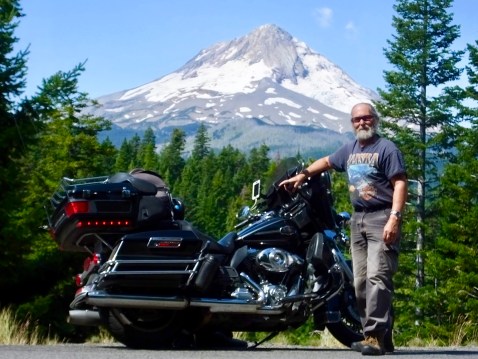
The 2019 Magical History Tour is over. Yesterday I rode the remaining 650 miles in one day instead of two, covering the route from Conway, Arkansas, to Maggie Valley in about 11 hours in 90+° heat. My conclusion was not unlike that of the 1804-1806 Corps of Discovery, whose exhausted members paddled harder and with more determination as they neared the end of their incredible journey, even foregoing hunting and eating only what remaining supplies they had and fruit they found for the final several days.
I covered 8,540 miles, according to my trip odometer, on a very dirty motorcycle that had more than 96,000 miles on it when I drove up my driveway five weeks after I pulled out.


Meriwether Lewis, William Clark and the unsung members of the Corps of Discovery explored unknown territory recently added to the young United States; discovered new species of plants and animals for eager scientists to study, catalog and classify; mapped previously unmapped lands and rivers; and encountered industrious people whose roots in those lands went back thousands of years. They did, in short, most of what they set out to do. They did not, of course, find an easy water-route connecting the eastern part of the continent with the Pacific Ocean because there wasn’t one.
What about me. Did I do what I set out to do? I think so. I spent hundreds of thoughtful hours contentedly cruising endless asphalt on a Harley-Davidson enjoying incredible and varied scenery offered everywhere by the bountiful country. I greatly expanded my historical understanding about a vital piece of American history and, through my daily journal entries, perhaps expanded others’ knowledge as well. I identified new outlets for my insatiable wanderlust that will return me to ground already covered and offer new roads to explore. I met, as I always do, scores of people who were kind, cordial, helpful, sharing, engaging, interesting–in short the civil, caring and humane people who make this country and the world worth living in despite the trials that challenge us on a daily basis. And finally, my brief but important contact with friends and family rewarded me with love, laughter and life-lessons.
Each motorcycle adventure I take provides serendipitous encounters, unanticipated meetings and unexpected pleasures. Sometimes they come in the form of people I meet along the way who surprise me with their kindness or a unique perspective. Sometimes they come in the form of a sunset or sunrise or mountain view or common cuisine that stops me in my tracks and make me truly appreciate my aging senses. Sometimes they come in the form of a long-sought accomplishment that helps complete my life. The blog’s daily posts can’t always capture the joy I experience as each day unfolds and the chapters of my journey are penned, but know that these encounters, meetings and pleasures fill me with wonder and delight.
This trip is done. The bike is in the garage waiting to be washed. The final words of the final post are about to be written. But the memories from this trip–people, places, scenes–will stay with me and, years from now, make me smile as they creep for an instant into my consciousness.
MHT Days 33, 34 & 35: Family Matters
 I left brother Jon’s house early this morning to avoid riding in some of the worst heat of this trip. It didn’t work. For most of the afternoon, temperatures hovered around the century mark, and several times today I saw readings of 102° with a heat index of 120°. I almost think I’d rather ride in the rain.
The three days spent at Jon’s were good but bittersweet. Ulla was diagnosed with cancer about a year and a half ago and has fought the disease courageously since then. But she and Jon knew when the diagnosis was made that her time was limited. Although she is still smiling, laughing, and active, even to the point of driving her car and enjoying her favorite pastime at a local casino, she is often fatigued and in the care of hospice professionals who visit her at home, monitor her condition and do what they can to make her as comfortable as possible.
Her best friend from her childhood in Germany, Petra, was visiting while I was there, as was her brother Axel. Unfortunately, Axel suffered a heart condition a few days ago and was recovering in the hospital in Andover (near Wichita), adding stress to Ulla’s life at a time when she needed it least. He will stay until his scheduled return September 2 and then look for cardiac care in Germany. Despite all the health issues, everyone’s attitude was upbeat, and the days I spent there were as normal as possible under the circumstances. Ulla, Petra, Axel and Janice (Ulla and Jon’s daughter), had most of their conversations in German, and I sat there pretending to know what they were saying and laughing about, adding my “Ja” and nodding my head. They all speak English too, but it was interesting being the foreigner for a while.
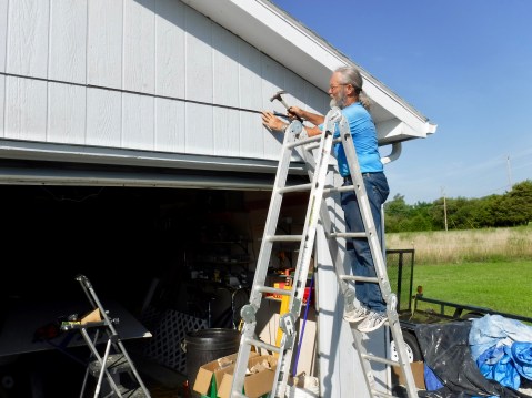 Jon was doing repair work on his garage siding and I helped with that. The work only took a couple hours a day to finish up, but, even when we started working before 8 a.m., in only a few hours we were drenched with sweat. Still, we got all the siding up, and all that remains for Jon to finish is replacing the trim and doing some caulking. And then he’ll be off to another building or yard project, which he enjoys despite the fact that, as with me, such work seems to get harder each year.
When I left this morning I hugged Ulla, told her we loved her and said my final goodbye. She is a great addition to our family and we will miss her.
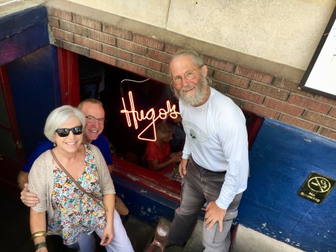 As I passed through Arkansas on my way home today, I stopped for lunch with Mike and Dianne at Hugo’s, a Fayetteville hangout popular with Razorbacks. They were our best friends from our Tullahoma days, and Mike and Hilary and I spent many hours chasing little white balls on local golf courses. We only had an hour together, but once again it was fun to reminisce and remember good times past and to be updated on their grandparenting lives today.
These motorcycle trips, which always involve long distance riding to new and interesting places, also involve visits with dear friends and family. More and more I find these trips give me time to think about the past and the future, to consider what’s important in life, to say things I should have said but hadn’t or to repeat things that weren’t said often enough. The too-short time spent with friends and family make these trips more than just motorcycle adventures; it makes them a vital part of my life.
Tomorrow will be my penultimate day on the road for this trip. Another day riding in the heat with perhaps some afternoon thundershowers thrown in just for fun. There probably won’t be much worth writing about tomorrow, but when I return to Maggie Valley in two days I’ll add a summary post to wrap up this year’s Magical History Tour blog.
MHT Day 32: Back in Kansas Again
After leaving Linda’s ranch Thursday, I drove out of Wyoming, into Colorado, and today into Kansas. For the next couple days I’ll visit with my brother Jon and sister-in-law Ulla, catching up on family matters and telling lies about out two other brothers who aren’t here. Jon and Ulla also have company from Germany–her best friend from childhood, Petra, and her brother Axel. So it’s a houseful but we’ll all manage for a day or two.
When I leave here in a few days, I’ll write a summary post like I did for my visit to Croonberg Ranch. Then I’ll head back to North Carolina with a few notes along the way and a final wrap-up post when I’m back in Maggie Valley.
The Magical History Tour, it seems, is coming to an end.
MHT Days 28-31: Hay There
Before I get to my activity for the past three days, I’ll quickly finish up the Corps of Discovery’s final days on the Missouri River. Clark and his party, having emerged from the Yellowstone River, waited several days on the Missouri for Lewis and his group to rejoin them, which happened on August 12, 1806. Once all members of the expedition reunited, reaching St. Louis was in sight. Two days later, moving quickly downstream, they again met Hidatsa and Mandan Indians near present-day Mandan, N.D. They stayed several days, attempting to persuade some chiefs to join them and go to Washington, D.C. to meet President Jefferson, but had little success.
While at the Mandan Villages, the permanent party of 33 people and one dog began to break up. John Colter, who had been with the expedition since 1803, requested and was given permission to be discharged at that point so he could return up the Yellowstone River to trap beaver. Colter would be the first European-American to see the natural wonders of what is now Yellowstone Park, though no one believed his incredible tales of shooting geysers and boiling mud for several years until additional reports confirmed his fantastic descriptions. The other members of the party who left at this point were the interpreter Toussaint Charbonneau, Sacagawea, and their son Jean Baptiste, aka Pompey, who returned to the Hidatsa village they lived in before Charbonneau signed on in 1805. Clark offered to take Pompey back to St. Louis and raise him and have him educated, but his offer was declined. Years later, Clark did help raise Pompey.
The remainder of the trip to St. Louis was relatively unremarkable. They met several large parties of traders and trappers coming from St. Louis, proof that the country they just explored would be explored and exploited without their remarkable trip. Nevertheless, it was their incredible journey that solidified the United State’s hold on the Louisiana Purchase and gave weight to the American claim to the northwest territory between the Rocky Mountains and the Pacific Ocean.
The Corps reached St. Louis September 23, 1806, more than 28 months after leaving it, covering the distance from the Mandan Villages to St. Louis in a little more than a month, five times faster than the upriver voyage in 1804. As they approached St. Louis and once there, countrymen welcomed them with surprise and celebration–most people thought they had perished in the wilderness because there had been no communication from them since they left the Mandan Villages 18 months earlier.
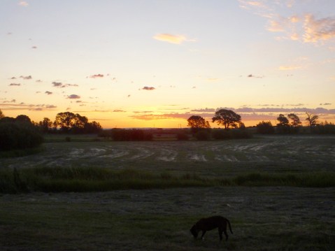
Sunrise at the Croonberg Ranch outside Laramie, Wyoming. Time to go to work.
Linda Croonberg has been a great friend of ours since she and Marilyn met in an accounting class at the University of Wyoming in 1988. She currently lives on and operates an 8,000-acre ranch south of Laramie that has been in her family for more than a century. Linda is the epitome of a Wyoming native: independent, proud, land-conscious and hard-working. But she is also fun, daring, adventuresome and maybe just a little nuts That pretty much describes Linda.
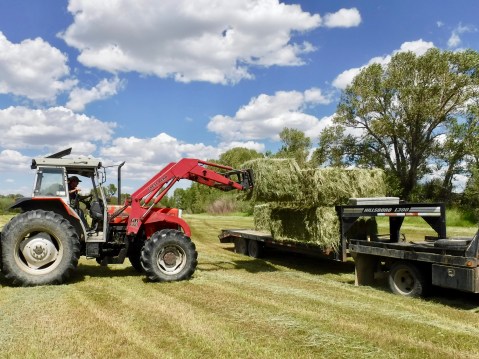
She runs about 250 pairs of cattle (mother and calf) scattered across the ranch, fattening on the thin grass that grows on the hills and mountain sides. Cattle are important, but the raison d’être of the ranch right now is hay, and she has about 250 acres of it to mow, rake, bale and store. I arrived at her place Tuesday just in time for the start of haying season, and when you visit Linda during haying season, you pitch in and do what you can.
For years Linda sold hay mainly to horse owners, producing and selling 5,000 “small square” bales. This year, however, marks a change in strategy. With the purchase of several pieces of computer-assisted haying equipment, she has started to bale “large-square” bales.
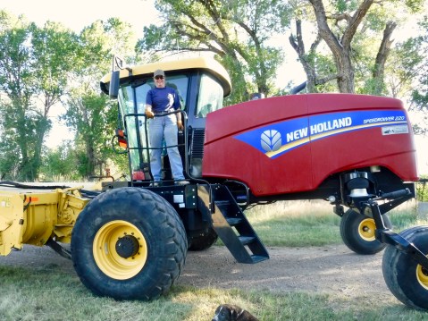
Linda prepares to mow one of her large meadows with the recently-purchased New Holland mower. This New Holland cuts hay twice as fast as her tractor mounted side-cut mower. The front of the mower is to the left.
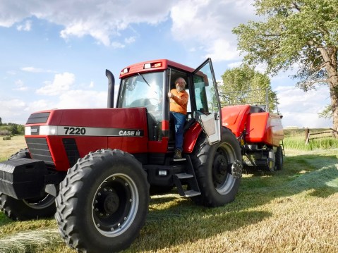
I climbed in but did not operate Linda’s Case IH tractor, which is pulling her brand new Massey Ferguson large square baler.
I arrived at Croonberg Ranch Tuesday afternoon following a five-mile ride down a gravel road to reach her two-mile long driveway, aptly named Croonberg Trail. Getting to her house via the rocky, two-track Croonberg Trail, balancing a large, fully-loaded motorcycle is an adventure I try to take only twice each visit–once coming in and once going out. Linda had already mowed a couple small meadows, but the real production would start the following day with the delivery of her New Holland self-propelled mower that looks like it once performed in one of the Star Wars movies and the final setup of her new Massey Ferguson baler. And the weather gods were smiling on her–only a 10-20% chance of rain for the next couple days.
She gave me a tour of the place to show me the changes that had been made since my last visit in 2016 on a return trip from Alaska. A new ranch house she and some friends built, several new pieces of equipment in addition to the big ones already mentioned and a new dog rounded out the tour. There were significant changes since 2016, but nothing to compare with the changes she’s made since she first started operating the ranch by herself 25 years ago. A little bit at a time and now it’s a first-class operation.
We turned in early; work on a ranch during haying season starts shortly after sunup and often continues for the next 12-14 hours. First thing Wednesday morning, Linda gave me a short tutorial on operating her 1950s vintage Ford tractor with a side-delivery rake. She drove the old but reliable tractor through a thin-hay, dry-land, 12-acre meadow with my butt precariously-perched on the animated steel tractor fender to demonstrate how to operate the ancient two-piece setup. then turned me loose for several hours while she took a bigger tractor with a newer rotary rake to rake windrows in another freshly-mowed meadow. I bounced along on the suspension-challenged little Ford, trying to get my windrows lined up and looking neat, only to watch the Wyoming wind and the occasional hay devil (first cousin to the dust devil) spread my work across the field.
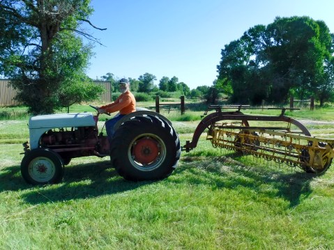
My first effort as a hayer. I’m not sure which was older–the operator or the equipment.
Just when I’d think I’d gotten the hang of the raking thing, I’d look behind me and discover I turned the wrong direction or swung too wide, creating a windrow on the wrong side of where I wanted it to be and then have to make two more passes to put it where I wanted it in the first place. It quickly became clear why my very perceptive friend gave me a small, thin-hay meadow to make my bones on. Still, by noon, I was a full-fledged, Croonberg-certified, Ford-tractor-operating hay raker.
By then, the New Holland self-propelled mower had been delivered from across the state on a big flatbed truck by a friend of Linda’s and driven to the ranch yard. The mower attachment had been too big to take on some roads, so it had been removed and delivered on a separate trailer. After only a little trouble getting the mower unit off the trailer (it took a tractor and a skidster lifting from both sides to lift it so the trailer could be driven out from under it), the two units were reassembled and the monster mower was ready to take on the biggest hay meadows at Croonberg Ranch.
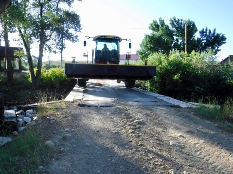
Big mower, small bridge. 5″ to spare on either side. No problem.
Now it was time to finish assembling the new baler, which was stored with its tractor in her large Morton building. I wanted to help with the final assembly, but, since I know nothing about balers or machinery more complicated than a 1949 Dodge sedan, I was probably just in the way. But Linda’s friend Brad and his helper were understanding and found things for me to do that usually required me getting something from the other side of the building, giving them the opportunity to do their work. Other than a couple of missing bolts and the consequent inability to attach the (apparently not crucial) guide wheels, the assembly was finished by about 4 p.m., time enough for Linda to get her first lesson operating the computer-assisted Massey Ferguson large-square baler (remember, she doesn’t even have Internet at her ranch).
She and Brad climbed aboard the large tractor, and began picking up windrows in the meadow directly in front of the new ranch house. And it picked that row of loose hay right up, slick as whistle. And down the windrow they went. And then the first bale came out of the baler, down the rollers, and broke apart ignominiously as soon as it hit the ground. Brad and Linda got out of the tractor, engaged in a discussion next to the untwined pile of hay, and got back in the tractor. Off they went again. And the next bale came out. And stayed together. But they stopped again and got out with a tape measure which they applied to the bale. More discussion. Back into the cab of the tractor and off they go again. Another bale. Another measurement. Another bale. Another measurement.
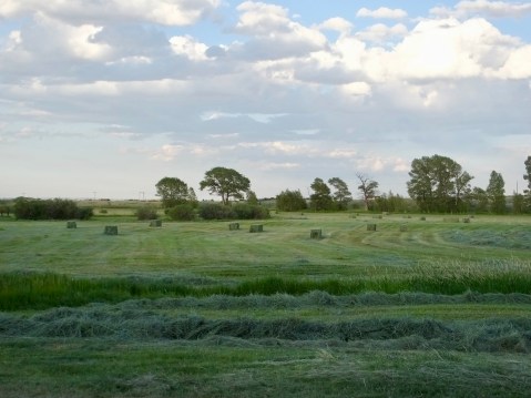
At close of business on Wednesday, the front meadow was full of perfectly-formed, 600-pound hay bales. Note the same meadow in the sunrise picture above.
Being an uninitiated hayer, I assumed there were problems. Not so. First bales, apparently, don’t always get tied properly. And, I learned later, large-square bales can be made in various lengths. Linda wanted eight-foot bales and the new Massey Ferguson was spitting out 10 foot bales. Not a problem, since the computer mounted in the tractor cab can make many adjustments to the baler, including the length of the bale. Once adjusted, the baler dropped 3 x 3 x 8 bales onto the meadow just like it should. In an hour, the meadow was scattered with glimpses of Linda’s future. Time for a beer and a dinner of lambs ribs and potatoes. Then time to hit the hay, so to speak, and an early bed time since Thursday’s work would start again just after sunrise.

The ancient Ford wasn’t my only ride. I’m Croonberg-certified on one of her Massey Ferguson’s, too.
What, Linda must have thought Thursday morning over a cup of hot coffee and cold oatmeal, can I give him to do that (1) won’t seriously impede the haying operation, (2) would be hard to screw up, and (3) isn’t liable to result in serious damage to him or my equipment. After some serious pondering, she ultimately decided I should fuel up all the tractors and add hydraulic fluid to one of her favorites that had a pesky leak. So that was my first job Thursday. And I managed it with no serious problems, narrowly avoiding adding gas to the radiator of the little Ford tractor and spilling some hydraulic fluid on the ground as my aged muscles struggled to lift a full five-gallon can of hydraulic fluid high enough to pour into a small funnel that I couldn’t see. But the work got done and the tractors were ready when needed.
What next? Another, bigger, more hay-rich meadow needed raking to prepare it for the digestive process of the new baler, which feeds loose hay into the front and drops compact bales out its rear end. My orders, from Linda who was about to learn how to use her New Holland mower, were to take the little Ford and the side-delivery and begin raking. Off I went, bouncing through cattle pens and uneven fields until I reached the East Meadow where the hay had been cut and needed raking. I was just the hayer to do it. Calling on my extensive knowledge of raking picked up the day before, I developed a plan, sectioned off a triangular section of the meadow and went to work. I had just finished raking that section and had made two passes around the much bigger portion of the meadow when Linda, fresh from a successful mowing of a large meadow across the river, showed up on her larger tractor equipped with a rotary rake.
“Are you ready for this one?”
“Uh. Yeah. I guess.”
I listened carefully to another five-minute lesson about levers and gears and clutches and up-and-down and other tractory-rakey things and we changed mounts. No sweat, I said to myself. I’ve got this. And I did. As long as I was going in a long straight line. But when I got to the end of a windrow all hay hell would break loose. Hay would fly in a thousand different directions as I tried to turn the damn tractor, raise the whatcha-macallit, semi-clutch it, and start another row. I’d like to say I got better. Maybe I did by about the 20th windrow. But not by much. Later, when I asked Linda for a brutally honest appraisal of my work, she gave me one. And then she placed her hand on my head and forgave my raking sins.
“Have you ever use a skid steer?”
“Uh. No.”
“Time to learn.”
Linda loads big bales on her big trailer.
And I got a third five-minute operating tutorial. My next job was to pick up and move the bales scattered around the front meadow and line them up so a truck and trailer could drive up to them and load them quickly. After a couple of chiropractic-quality jerks and nearly tipping the thing over in a small ditch which I didn’t see because it was covered with grass, I got into the meadow and began spearing the 3 x 3 x 8 bales with the bale-picker-upper attachment and lining them up with the precision of a drunken sailor. But eventually they got properly aligned in time for Linda to come by with her truck and trailer and load them with one of her big tractors. Then it was off to the 50 x 100 foot hay shed to unload.
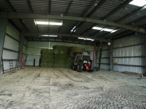
This was just the beginning of a five to six week long effort that will result in around 750 bales stored here, waiting for the right buyer.
Linda thinks a great deal of her hay shed, which she built. She unloaded and stacked all the bales without my help.
The shed remains mostly empty, but Thursday we moved only a small part of what’s been baled and only about 20% of the meadows have been cut. There’s a lot more left to do and Linda, with help from a young man trying to start his own cattle-raising, hay-baling career, will get it all done, weather-gods permitting, in about five to six more weeks. She’ll have to do it without me, though, since my planned three-day stay was almost over.
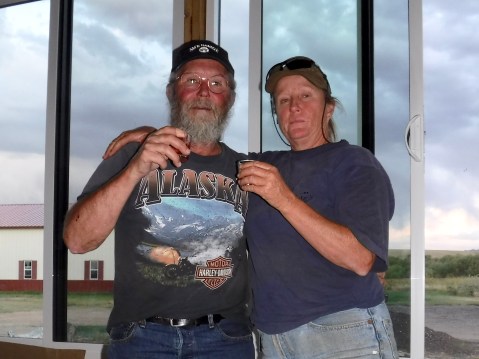
We had one more tradition that had to be taken care of. Since 1990, for reasons I don’t remember, Linda and I toast tequila shots when we’re together. Whether it’s during one of my rides and I’m passing through or she’s visiting Marilyn and me or even at my baby girl’s wedding reception, it’s a tradition that must be honored. So last night, we duly celebrated our time together with a tequila toast. And another. And another. And I lost count. It was a good thing she had to get up early again today because it meant a short toasting night.
This morning, we said our goodbyes with plans to visit again soon, and I bounced down Croonberg trail to the gravel road to the asphalt road and closer to home.
MHT Day 27: Completing the Loop
On July 13, 1806, Captain Clark and 12 others, including his slave York, the interpreter Charbonneau, Sacagawea, and their 18 month-old son Jean Baptiste, left Three Forks heading east to find and travel down the Yellowstone River to the Missouri. Two days and about 50 miles later he and his party found the river that has its beginnings in Yellowstone Park and empties into the Missouri at roughly the Montana–North Dakota border. It is currently the longest free-flowing river in the lower 48 states.
This photo was taken near the spot where Clark crossed into the Yellowstone watershed. The right to left slope in the foreground marks the valley into which he descended to locate the Yellowstone River, about 10 miles away. At this point, he was about 40 miles north of Yellowstone Park at the Wyoming/Montana border.
Interstate 90 generally follows the route Clark took from Three Forks to Billings, a few miles from Pompey’s Pillar, where I stopped a little more than two weeks ago on my way west. During the past three weeks I have covered Clark’s1806 return route from Traveller’s Rest, but I ended up doing it on three separate days, twice going the wrong direction. Nevertheless, today’s ride from Three Forks to Billings completed the loop I wanted to make of the expedition’s entire 1804-1806 travels, with three exceptions: the Missouri Breaks where I had hoped to canoe, the dirt/gravel road at Lemhi Pass, and Lewis’s 1806 diversion into Blackfoot country following the Marias River while Clark was on the Yellowstone.
Clark’s group traveled by foot for three days along the Yellowstone before he found cottonwood trees big enough to make dugout canoes. From July 20 through July 24 he and his party halted to make two small canoes, which they lashed together to provide greater stability. As Clark pushed off in his canoes, he split his party again, sending a sergeant and 3 men with the remaining horses overland to try to reach the Mandan villages before the rest of the expedition regrouped and arrived there.
Two days after the men with the horse sset off, Indians stole the herd and the four men were forced to return to the river, construct buffalo-hide covered bull boats and attempt to catch Clark in his canoes. They eventually did, but not until Clark had reached the Missouri river on August 3, three weeks after he left Three Forks, and was waiting for Lewis.
Lewis, meanwhile, after his escape from the rightly irritated Blackfeet, slowly made his way down the Missouri with the rest of the party, nearly a week behind Clark. On August 11, while Clark waited patiently at a camp on the Missouri, Lewis and one other man, who happened to be blind in one eye and terribly nearsighted in the other, went ashore to hunt elk. Lewis, dressed in buckskin, apparently looked like an elk to the visually challenged hunter, who mistakenly shot Lewis, sending a ball through both buttocks. Lewis at first thought they were being attacked by Indians, but they soon discovered the mishap was a friendly fire incident.
The next day, Lewis’s party caught up with Clark’s group and the expedition–all 33 persons and a dog–were once again united and continued their journey, though Lewis was in considerable pain and could not walk or sit, forcing him to ride face down in one of the large pirogues for more than a week.
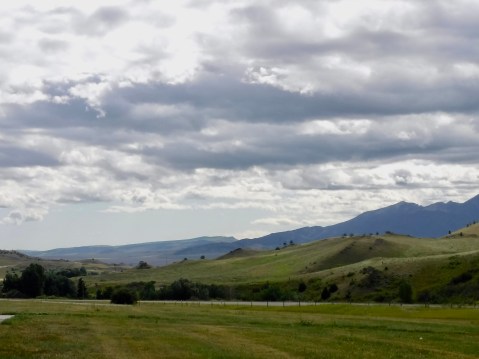
At Billings, Interstate 90 turns south toward Wyoming, and I followed its path. My connection to the Lewis and Clark Trail is now severed, though I’ll continue over the next couple of postings to track them until they reach St. Louis. As I exited Montana and entered Wyoming, the Big Horn Mountains, still with traces of snow at the highest elevations, rose on my right side. I can still see them from my location this evening in Buffalo, Wyoming.
The Big Horn Mountains rise in the distance.
Tomorrow I’ll reach a friend’s ranch just outside Laramie and stay there until Friday. Linda, who owns and operates an 8,000 acre ranch by herself, does not yet have internet or cell service at her beautiful but isolated house. I’ll keep writing while I’m there and will post those pieces Friday after I return to the 21st century. I’ll continue to write and post until I return to Maggie Valley in about 11 days.
In the meantime, here’s another link to the map I started this blog with for those who to try to make geographic sense of their and my trips.
ROUTE MAP: Click here for a PDF map of the entire Corps of Discover route. This map opens in a new window.
MHT Day 26: Back Over the Mountains
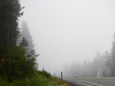
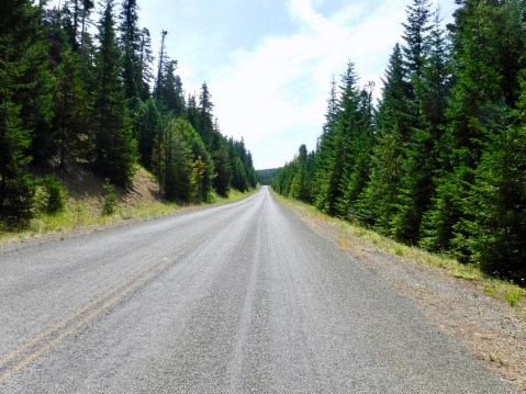
Today I woke to cool temperatures in the 50s, made dreary by foggymistycloudy skies and the expectation of rain. Nevertheless it wasn’t actually raining, so I donned rain pants just in case, left the rain jacket off and began my ride to the base of the beautiful Bitterroot mountains on Highway 12 along the Middle Fork of the Clearwater River. To my great delight, in about 20 miles, before I even started climbing the winding river road to the summit at Lolo Pass, the foggymistycloudy stuff cleared up and, while cool temperatures remained, at least I saw blue skies from time to time.
So that was my start to the day returning back over the Bitterroots. What about the Corps of Discovery? Despite warnings from the Nez Perce that the forbidding mountains were not yet passable, the expedition resumed its eastward trek toward home on June 15, 1806. Two days later, Lewis wrote
we found ourselves invelloped in snow from 12 to 15 feet deep even on the south sides of the hills with the fairest exposure to the sun; here was winter with all it’s rigors; the air was cold, my hands and feet were benumbed.
Duh. Maybe he should have listened to the people who had lived there for 500 generations. At any rate, the captains decided to leave the baggage where they were and return with their horses to the flats below until they could procure Indian guides and the barely-marked path became passable. Not until June 25 could they return to the place where they had left their baggage, accompanied by several young Nez Perce guides who not only knew the trail, even in deep snow, but who knew where grass would be abundant for their four dozen horses. Five days later they were back at Travellers Rest on the east side of the mountains, having covered the 156 miles from Weippe Prairie in six days with the Nez Perce guides what it had taken 11 days to cover with the Shoshone guide in 1805.
At Travellers Rest the captains confirmed earlier plans to split the party first into two groups, then to split those two groups again into two groups. Historians and other scholars have criticized that decision, though ultimately the expedition survived intact. Lewis would take himself and nine others north, following the land route known by the Nez Perce and other mountain tribes as the “Trail to the Buffalo” and go to the Great Falls of the Missouri. There they would split again, one group preparing to portage what had been left at the Great Falls in 1805 while Lewis and the rest of the group would explore the Marias River north toward Canada and to conduct a “peace” mission to the notoriously hostile Blackfeet. Clark, with the remaining 23 persons, would return to Camp Fortunate, where they had met the Shoshone on the Jefferson River, recover the cached items there, then follow the Jefferson River to Three Forks where the Missouri River begins. At Three Forks, a sergeant and nine men would continue down the Missouri until they met with the part of the Lewis contingent that stayed at Great Falls. Clark and 12 others, including Sacagawea and her son, would take most of the horses and go until they found the Yellowstone River, then build canoes and paddle to the Missouri, where, if everything worked out, all the disparate parts of the expedition would regroup and head for St. Louis.
Most of this plan worked out, except that Lewis’s “peace” mission turned out to be the only time during the three-year expedition where there was a violent encounter with Indians. They met a small party of young Blackfeet and attempted to explain their new relationship with the United States. But the young warriors attempted to their guns and horses, and Lewis and his party killed two of the warriors. Presuming that the “peace” mission was shot to hell, they galloped as fast as they could for 24 consecutive hours back to the Missouri to escape a retribution-seeking war party they believed would pursue them. There they met with the men on the Missouri, and continued down river to the Yellowstone to meet Clark’s group.
Much of my day today was spent successfully dodging serious but scattered thunderstorms all over Idaho and Montana while retracing at least part of Lewis’s northern route. I had to forego part of that route knowing I would head into heavy rain if I didn’t, but at least I covered part of the “Trail to the Buffalo,” which, as the Indians had know for thousands of years, was the shortest route between the Columbia and the Missouri rivers. (Note: On the way west on this Magical History Tour, I covered part of Clark’s route, except that I was going the wrong direction when I stopped at Pompey’s Pillar on Day 13 and at the Big Hole Battlefield on Day 18. Tomorrow I’ll follow the rest of Clark’s route to the Yellowstone River, this time going in the right direction. I’m getting dizzy trying to remember where I was, when I was there, and what direction I was going.
Because of the threat of rain and because I had made most of the important stops on the outward half of my journey, today I didn’t stop at any historic sites or interpretive centers. I did, however, make one stop based on a recommendation of a North Carolina friend. (Thanks, Janet.) I stopped for coffee at the Lochsa Lodge, originally built as a hunting lodge in the 1920s, long before U.S. Highway 12 was finished in 1963. It sits about 1/4 mile from where Lewis and Clark camped when they were struggling through the mountains in 1805 with their Shoshone guide.


While I was at the lodge enjoying a warming cup of pretty decent coffee, I struck up a conversation with another motorcyclist. Ned, a sixth-grade teacher from Portland was headed home at the end of a nearly three-week long solo trip through Oregon, Washington, Idaho, Montana, and British Columbia. Ned’s journey featured a dual-sport bike good for on-road and off-road riding, while mine, of course, is a big Harley bagger that much prefers asphalt to rocks and gravel. But we both have a wanderlust satisfied only on two wheels, and enjoy the solitude that riding alone offers. We didn’t have long to talk since he was trying to beat the rain in Idaho and I was hoping to do the same in Montana, but our conversation reminded me again of how many interesting people I meet while traveling on a motorcycle. The history lessons I learn are good; the country I see is amazing; but most of all I love meeting people from all over who help enrich and round out my life.
Tomorrow I’ll follow Clark’s Yellowstone track for a while, then say goodbye to the Lewis and Clark Trail as I dive south into Wyoming. But I’ll keep writing if anyone wants to keep reading.
MHT Day 25: In the Land of the Nez Perce
On May 1, the expedition, guided by several Indians of different tribes, left their remaining canoes, the Walla Wallas, the Yakimas, and other Columbia River tribes behind and headed east on foot with pack horses. Their land route to the Snake and Clearwater rivers, which they had canoed down five months ago, was about 80 miles along creeks and rough and rocky grasslands and took four days to complete. From there, the route to the foot of the Bitterroot Mountains was only another 125 miles. So why did they delay starting over those mountains until June 15? What kept them in the land of the Nez Perce for five long weeks?
Snow. They had left Fort Clatsop early. They had moved as quickly as they could up the Columbia. But they could not hurry the snow melt in the Bitterroots. They knew they had to wait and the Nez Perce confirmed it. On May 7, Clark recorded in his journal that
the Indians inform us that the snow is yet so deep on the mountains that we shall not be able to pass them untill the next full moon or about the first of June; others set the time at still a more distant period. this unwelcom inteligence to men confined to a diet of horsebeef and roots, and who are as anxious as we are to return to the fat plains of the Missouri and thence to our native homes
The winter of 1805-1806 had been a hard one for the Nez Perce. When the Corp traveled across western Washington in early May, they marched through blowing snow and sleet and slept in the cold without tents. The salmon had not started their spring run up the Snake and Clearwater rivers, and the Nez Perce were still eating roots and tree bark to get by until the rivers filled with fish.
The first order of business when Lewis and Clark reached Nez Perce lands in Idaho was to reclaim the horses left in the Indian’s care in 1805. Although there were difficulties involved with that effort, ultimately they added the horses left behind to the horses they brought from the Columbia for a total of 50-60 usable animals. Those that weren’t usable were often eaten because the few deer available coudn’t feed the 33-member expedition.
During the month they spent at Camp Choppunish (about 1 1/2 miles from where I am tonight in Kamiah), they traded with the Nez Perce for necessary and useful goods. Clark used his skills and the limited medical supplies they had to treat various Indian ailments. It’s unlikely his skills or his medicine actually cured much, but in a placebo sort of way, the Indians believed it did and many of their conditions improved.
From May 10 to May 13, 1806, the expedition camped near where I am now in Kamiah, Idaho. On May 14 they crossed to the east side of the Clearwater River, about 1 1/2 miles upstream from here, where they stayed until June 10. Their stay at Camp Choppunish (their name for the Nez Perce) was longer than at any other spot except Fort Mandan and Fort Clatsop. During that time, the captains learned more about the Nez Perce and worked to advance the diplomacy necessary to incorporate them into the unfolding Indian policy of the United States.
But the men of the Corps were anxious to go home. On June 14, having moved their camp to Weippe (pronounced wee ipe) Prairie, where they first emerged from the mountains, famished and haggard the preceding September, Lewis wrote
we have now been detained near five weeks in consequence of the snows; a serious loss of time at this delightfull season for traveling. I am still apprehensive that the snow and the want of food for our horses will prove a serious imbarrassment to us as at least four days journey of our rout in these mountains lies over hights and along a ledge of mountains never intirely destitute of snow. every body seems anxious to be in motion, convinced that we have not now any time to delay if the calculation is to reach the United States this season; this I am detirmined to accomplish if within the compass of human power.
And so, on June 15, 1806, they headed back into the looming, snow-covered Bitterroots.
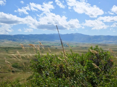
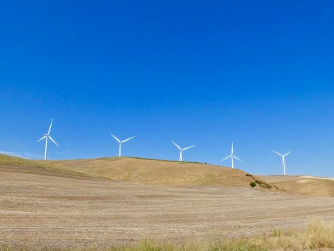
Much of my time today was spent riding. I stopped at the most significant sites in this area a little more than a week ago, and what I wanted today was to see the geography, to ride the hills and valleys they walked through or camped near. I’m not sure they would recognize the land were they to be magically transported to 2019. Where they saw rough and rocky grasslands and semi-arid desert, today I saw farms, wheat fields and giant wind turbines.
This picture was taken within a mile of where the expedition would have marched.
But the weather was good, as were the roads, and I had a pleasant ride from Walla Walla, Washington, to Orofino, Idaho. Not challenging in a “twisty” sort of way, but a nice gentle ride with sweeping curves, long-range vistas and time to think about changes that occurred in the past 200 years.
When I rode through here on August 5, less than a week ago, I wrote about the problem I had trying to go to Weippe Prairie using my GPS-provided guidance, which apparently forgot I was on two wheels and expected me to travel down unmeasured gravel roads. Coming from the opposite direction today, however, the GPS promised me a State Highway to Weippe that I knew would be paved. So, as directed, I crossed the Clearwater on a bridge under construction, and began the steep climb up the towering river hills. I had gone less than 1/2 mile when a sign announced “Loose Gravel Ahead. Motorcycles Proceed with Extreme Caution.” Hmmmm. How loose? How far? Important, but unanswered, questions.
Seized by yet another case of raging optimism and determined to see today what I failed to see five days ago, I proceeded on. The loose gravel was a result of the chip seal operation the state highway department was employing to resurface the road. OK, I thought. They’re going to work on a short stretch of road. I can handle this. But no. As it turned out, they’re resurfacing the entire 5 1/2 miles of twisting mountain road with a dozen or more hairpin turns leading from the river to the prairie plateau. On loose gravel. Once on the gravel, there were no safe places to turn around, so, onward and upward I went. At about 15-20 miles per hour with gravel clinking and clanking against the underside of my fenders. I finally reached the top of the river hills and the end of the road construction, but not before one particularly tight and steep section caused the bike to lose traction with both tires at once. It was only a momentary slide, but I have to admit that slide raised my “pucker factor” to an 8 on a 10-point scale.
Shortly I came to the town of Weippe (remember it’s wee ipe) on the Weippe Prairie where I knew there was a Lewis and Clark exhibit and interpretive center at the local library and where I could learn more about the first and last meetings the expedition had with the Nez Perce. I pulled up at precisely 1 o’clock only to learn that Saturday hours were 9 a.m. to 1 p.m. I opened the unlocked door, stepped in, and pled my case to a kindly assistant librarian. She kindly allowed me 10 minutes to look quickly through the displays, and I appreciated her timely flexibility.
She locked up the little library and I left the site to look at the small and growing smaller town. Not much there, but they did have a local museum with hours posted outside indicating it stayed open until 4 p.m. on Saturdays. I didn’t expect much on Lewis and Clark and got what I expected. But the sole operator of the museum talked with me for a while about the Prairie itself and her declining town. She also confirmed my suspicion that there was a third road that led to the prairie from the river highway. It would be longer by as much as 20 miles, but, hopefully, it wouldn’t have any loose gravel on it. Given the choice of going back down the “Loose-Gravel-Ahead. Motorcycles-Proceed-With-Extreme-Caution” road and taking a chance on another, longer road, I opted for the latter.
As it turned out, that road, unnumbered but named for a town I don’t remember seeing, was a great motorcycle road. Good surface. Nice turns with no hairpins. Winding through an aromatic pine forest. It was about 20 miles long and brought me out in Orofino where I started today’s journey to Weippe Prairie. It was a good way to end the day.
Rain obscured the horizon as I pulled into the parking lot of my old-but-clean motel in Kamiah, and a few drops splattered my windshield and muddied the dust on my fenders, but I was mostly dry. Tomorrow, however, may be another story. Thunderstorms are forecast for western Montana. Nevertheless, I’ll proceed on.
MHT Day 24: The Return East Begins
For five weeks after the Corps bid adieu to Fort Clatsop, they paddled and pulled against the current, up the Columbia River, portaging around various falls and rapids as they went. Three weeks after they began their eastward journey, they lost one of the canoes in the rapids and it smashed to pieces, which meant that they had to overload the remaining canoes and carry some of their baggage on their backs. What they needed were horses, and on April 15, Captain Clark made the first attempt to purchase several from Indians above the falls but failed because his short supply of stores and trade goods limited his purchasing power. What they could trade, the Indians didn’t want; what the Indians wanted–guns, kettles, iron goods–,they couldn’t trade.
On April 18, Clark finally purchased their first four horses, which were desperately needed to portage their dwindling but still substantial baggage around the great cataract at Celilo Falls (now buried by The Dalles Dam). Each day, when they encountered another group of Indians, they attempted to buy more horses. By April 20 they had eight. A few days later the number had increased to 14 and they made a like number of pack saddles to carry their stores.
Finding and buying horses wasn’t the only problem. Lewis became increasingly irritated by petty thievery practiced by Indians they encountered along the way. On April 21, he lost his temper, struck an offending Indian and had pilfered a small piece of metal and ordered the men to kick him out of the camp. That evening he wrote about Indian misdeeds, saying
they have vexed me in such a manner by such repeated acts of villany that I am quite disposed to treat them with every severyty, their defenseless state pleads forgiveness so far as rispects their lives.
A few days later they reached the point where the Columbia turns north to meet the Snake River, about 30 miles south of present day Pasco. By that time, the captains had determined to heed the advice of a Nez Perce warrior traveling east with his family back to the land where the Nez Perce had fed and cared for the starving party when they emerged from the Bitterroots the previous fall. They would leave the river and march cross country until they reached the confluence of the Snake and Clearwater rivers and reclaim the Shoshone horses they had left there the previous fall. On April 28, after noting they had purchased an additional 12 dogs to supplement their pounded fish diet during the overland march, Sergeant Ordway wrote:
our Indian guides who are going over the mountains with us inform us that their is a nearer way across the plains to the forks of Lewises river [Snake] at the entrence of Kooskooske [Clearwater] which is a Smooth way and only 3 days march to that place which is allmost as near again as to follow the river round.
For the first time since leaving Fort Clatsop, they were going to travel an uncharted route.
Since I had followed the route down the Columbia a few days ago on my way to Astoria, I thought I would make today a motorcycle ride with sight seeing detours and no museums or interpretive centers. I had missed seeing Mount Hood on the way west, so at Portland I ventured southward to get a view of the mountain which had become one of Lewis and Clark’s important landmarks.
It was cloudy (of course) in Astoria when I left this morning wearing my heavy gloves and leather jacket, and, to my chagrin, the clouds didn’t lift as I motored east. Still, I thought, maybe they’ll clear as I near Mount Hood. So, with a raging case of optimism, I sought out Mount Hood. Still cloudy when I got to Mount Hood Village and no mountain was visible. But I was committed to my detour, so I started up the grade that goes over the south shoulder of the mountain. Here is what I saw:
Somewhere in there is a mountain. Use your imagination.
I decided, as I rolled down the eastern slope of the shoulder that as long as I was detouring, I would leave the U.S. highway and find something a little more isolated. I saw a sign with highway numbers that I presumed indicated a county road or a forest service road. No matter. It looked inviting, so I executed a sharp right turn and headed into the alluring unknown. Here is what I saw:
Not wilderness, but at least I was off the main road and having an adventure. And the sky was clearing.
As I putted along, a little north, a little east, a little north, a little east, I knew I was going generally in the direction I needed to go and that eventually I would probably emerge from the woods somewhere near The Dalles. There were some nice twists and turns, but the condition of the road meant keeping my speed a little lower than some adventures allow. And then I turned another corner. Here is what I saw:
Not as much snow as I expected, but I had finally found Mt. Hood.
That discovery made my day, and the rest of the afternoon spent on the highways again went by pretty fast.
Tomorrow, I’ll go cross-country as did Lewis and Clark, back to the land of the Nez Perce.
MHT Day 23: Nice Fall Day . . . in August
Many pleasant things about the Magical History Tour deserve mention, but let me start with this: Other than a brief two-minute shower in Dillon, Montana, this trip has been rain free for more than three weeks. I don’t believe I’ve ever done a long motorcycle ride where I had 23 straight days of dry weather. And today the temperature in Astoria never reached above 70°. People in most places consider that Fall, but here it’s just another summer day.
Speaking of weather, when the Expedition finally decided, by a vote that included Sacagawea and York (Clark’s slave), to make a permanent camp on the south side of the Columbia River a few miles up a small creek, they started a habitation of 106 days, only 12 of which it didn’t rain. And of those 12 days, they only saw the sun six times.
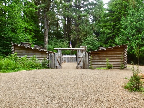
The National Park Service based this reconstruction of Ft. Clatsop on descriptions and measurements found in the expedition journals. One row of four rooms for the enlisted men and one row of three rooms for the officers and the interpreters faced a small parade ground. All 33 persons in the expedition lived in this 2500 square foot structure.
The Corps wintered for slightly more than three months at Fort Clatsop in two small log structures of seven rooms enclosed by pickets and a gate. All 33 members of the expedition lived in this small fort in addition to the occasional natives who stayed overnight by invitation only. Construction on the fort began December 10, 1805, and was mostly completed by Christmas Day. Private Whitehouse recorded events of the 25th this way:
We had hard rain & Cloudy weather as usual. We all moved into our new Garrison or Fort, which our Officers named after a nation of Indians who resided near us, called the ClatsopNation; Fort Clatsop.— We found our huts comfortable, excepting smoaking a little.—
From December until they packed up and left, the men of the expedition repaired equipment, traded with the Clatsop and Chinook for goods needed for the return trip, scraped and tanned hides, made clothing, and sewed more than 300 pairs of moccasins from the 130 elk and 20 deer the hunters killed during their soggy stay at the Pacific coast camp. The life span of a pair of moccasins in the desert or on the river rocks was often only a week and multiple pairs would be required to get the Corps back to St. Louis. In addition to eating elk and deer meat that wet winter, the expedition also traded with natives for dried salmon, dogs, and wapato roots, which Indian women dug from marsh bottoms with their bare feet.
The winter the Corps spent at Ft. Mandan in 1804-1805 was brutally cold. The winter at Ft. Clatsop in 1805-1806 was miserably wet. I’m not sure which overwinter the men would vote as the worst. At any rate, despite having set their departure date as April 1, by the third week of March they had had enough of Fort Clatsop, so they left their humble abode on March 23, 1806, in three of their remaining canoes, plus one they bought from the Clatsops and one they stole from them. That evening, Captain Clark wrote, perhaps a little sarcastically,
at this place we had wintered and remained from the 7th of Decr. 1805 to this day and have lived as well as we had any right to expect, and we can Say that we were never one day without 3 meals of Some kind a day either pore Elk meat or roots, not withstanding the repeeted fall of rain which has fallen almost Constantly
If their canoes had been equipped with rear-view mirrors, they would have declared they were glad to see Ft. Clatsop in them.
During their time at Ft. Clatsop, a contingent of three to five men were tasked with making salt for the return trip by constantly boiling sea water on the beach at a location 15 miles from the fort that required a hike over a small mountain range and across two small rivers. By the end of their salt-making activities, they had collected enough to fill three casks. Today there’s a pitiful structure in the middle of a nondescript neighborhood in Seaside, Oregon, marking the location of their work. Unfortunately, the site wasn’t even significant enough for me to find a parking place and get off the bike. A little disappointing.
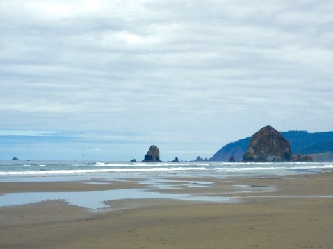
The tide is out at Haystack Rock on the Oregon coast.
In January 1806, they received word from a Clatsop leader that a whale had washed ashore about 15 miles south of the salt-making operation, so Clark and a handful of others, including Sacagawea, journeyed to the site in hopes of obtaining some blubber and oil. When they arrived, all they found was a skeleton, which Clark measured at more than 100 feet. Local Indians had stripped the carcass to the bones, and Clark was forced to buy about 300 pounds of blubber (which he said tasted like dog or beaver) and a cask of rendered whale oil to supplement their diet and flavor their elk meat.
I rode to Cannon Beach where the whale had washed ashore to look around and get a few pictures of the area. While walking on the beach, to my great luck, I met Alonna Woodward, a professional photographer, who took several pictures for me with my camera and one with her Nikon, which she forwarded to me to use in today’s post. Thanks, Alonna!
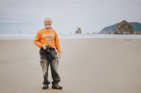
No washed up whale, just a washed up historian.
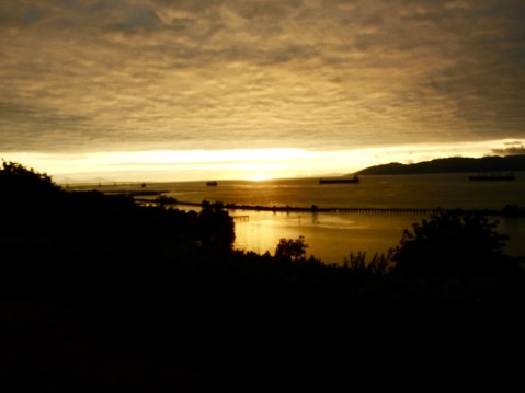
Tonight, I started early on the blog and sat outside my hotel in Astoria above the expansive Columbia River writing and watching the sun set on the Pacific Ocean. Although that doesn’t have anything to do with the Lewis and Clark Expedition, it is a huge part of making the Magical History Tour magical. Tomorrow I ride east on my return trip home, continuing to make Lewis and Clark stops when they present themselves, especially on those parts of the return that deviated from their westward trek.
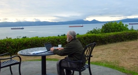
One of the guests at the hotel thought I should have a picture of myself writing the blog.
MHT Day 22: Half Way There
Great joy in camp we are in View of the Ocian,. . . . this great Pacific Octean which we been So long anxious to See Captain William Clark, November 7, 1805
Oh Crap. Now I have to turn around and go back. Dr. Dennis Frobish, August 7, 2019
Captain’s Clark’s comment when he reached the Pacific Ocean on a cold, rainy November day in 1805 is often quoted; my comment, after achieving the same goal, will no doubt rightly be consigned to the dust bin of history. Nevertheless, more than two and a half years after starting his trek with Captain Meriwether Lewis on the banks of the Ohio River, Clark and the Corps of Discovery fulfilled another of President Thomas Jefferson’s instructions to Lewis and the expedition:
The object of your mission is to explore the Missouri river, & such principal stream of it, as, by it’s course & communication with the water of the Pacific ocean may offer the most direct & practicable water communication across this continent
I’m not bragging, but I made the outward bound trip in three weeks. Of course, I had GPS. And I was standing on the shoulders of giants. Metaphorically, of course, because I was actually riding a Harley-Davidson.
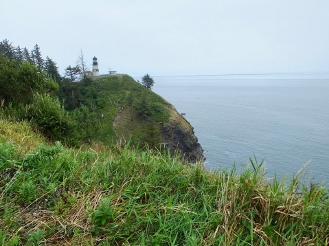
Cape Disappointment and the Cape Disappointment light house, where the Columbia River meets the Pacific Ocean. The river flows in from the left.
Technically, Clark was seeing the expansive bay at the mouth of the Columbia River and not the ocean when he made that comment and the weather and high wind and massive waves meant it would take another 10 days before he actually reached Cape Disappointment, and he had to cover the final 12 miles on foot. Still one has to admit, he and the members of the party had just completed, with the help of countless Native Americans, an amazing, incredible, awe-inspiring, stupendous, historic trip.
During the final three weeks of their westward voyage, the Corps encountered more falls, more rapids and a variety of animals they had never seen before, including seals that swam all the way to Celilo Falls. And they also encountered more than a dozen new, but relatively small, tribes of west-coast Indians whose culture, language and various skills related to life in a wet, coastal climate posed new challenges and new opportunities. These Indians had experience with white Europeans for more than a decade, beginning with American sea captain Robert Gray’s first visit to the waters of the Columbia River in 1792 followed by English ships shortly thereafter. Trade with other tribes had been part of Columbia Indian culture for thousands of years, and trade with the white newcomers continued that tradition. That trading practice was fortunate for the Corps, of course, because it allowed them to trade trinkets and small goods for the food that kept them alive until they found game on the south side of the river where they wintered.
But they also encountered dramatic geologic formations and geographic climate changes and they passed through a landscape sculpted over hundreds of millions of years. For example, as they moved from the semi-deserts of western Washington and Oregon to the Cascades and coastal areas, the areas went from an annual rainfall of 10 inches to an average rainfall of more than 100 inches, most of the latter falling during the months spent on the Pacific coast. Yesterday I ended my day on the semi-desert side with temperatures of more than 100°; today, 170 miles further west, I finished the ride at 69° with my leather jacket on.
On October 31, Clark recorded in his journal that
a remarkable high detached rock Stands in a bottom on the Stard Side near the lower point of this Island on the Stard. Side about 800 feet high and 400 paces around, we call the Beaten [NB: Beacon] rock.

850 foot tall Beacon Rock dwarfs my ride.
Beacon Rock is still there today, and Clark’s estimate of its height was off by only 20 feet. Clark did not, and probably could not, have climbed that massive rock. But today, thanks to an early 20th century entrepreneur, a steep and rocky path with a series of bridges and boardwalks and scores of switchbacks allow visitors to Beacon Rock State Park in Washington to climb to the top. The path is almost a mile long and is the equivalent of climbing a 75-story building. But it’s not a building; it’s a volcanic core that hardened 57,000 years ago whose outer layers were eroded away by ice-age floods 600 feet deep and moving at 60 mile-per-hour, sweeping by the small volcano and eroding its outer layers leaving only the rock visible to Clark and to us today.
Since I gave my shoulders a work-out last night kayaking on the Columbia River, I thought I’d balance my on-the-road work-out routine with a a quick scamper to the top. Well, with a slow climb to the top, anyway. It took nearly 30 minutes to make the one-mile climb, but the view of the Columbia River Gorge more than matched the effort.
So. I’ve ridden the outward bound journey of the Lewis and Clark expedition. In the process, I’ve learned new things and confirmed other things I thought I knew. The Lewis and Clark crew, as I came to realize while reading the 5,000 pages of their journals last winter, were hard-working, disciplined, tenacious, determined, resourceful, and damned lucky not to have died on this expedition into the unknown. While I knew, to some extent, the degree to which the natives they encountered aided them in reaching the Pacific Ocean, I now believe that without that aid, the expedition would have been a failure. For historians who have studied the expedition, this is common knowledge. For me, it was a revelation and has given me much to consider.
I wish I could have seen the country they saw as they saw it. But what I saw of Missouri, Kansas, Nebraska, Iowa, South Dakota, North Dakota, Montana, Idaho, Washington and Oregon reminded me, as all my cross-country motorcycle trips remind me, that we live in a gorgeous country full of amazing people.
In the winter of 1805-1806, the Corps spent a miserable four months on the south side of the Columbia River near the Pacific coast. More on that tomorrow after I’ve visited Fort Clatsop where they huddled, wet and cold, until they could begin the trip back to St. Louis. After tomorrow, I too will turn around and head east, retracing some of the same route but also following, when I can, deviations they made to accelerate their return to their pre-expedition lives.
