
Day 15: In Alaska
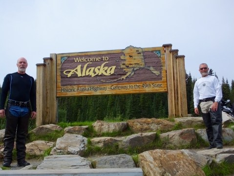 Well, we made it to Alaska. About 5,500 miles for Mark from Forida and about 5,000 miles for me from North Carolina. We’ve seen some great scenery and met some great people and we still have about 4 weeks left in this Great Advenure.
I’m unable tonight to connect to the Internet on my MacBook Pro and consequently will post this short blog using my ancient iPad. I’m hopeful the problem will correct itself tomorrow when we move to a new hotel. If it doesn’t, the blog will likely continue but in an abbreviated format. Stay tuned.
Edit Sunday Morning: I now have a connection. I’m not going to add anything else now, but since it’s going to be raining in Fairbanks when we get there I’ll have plenty of time for an extended post tonight, covering today and some of yesterday. I’m delighted to learn that the problem last night was NOT in my laptop.
Edit Sunday Afternoon: I’m in much better humor now than last night when I first started this post. I was bummed, to say the least, to think that I would have to try to maintain this adventure’s blog on my old iPad. It could be done, but it’s difficult and time consuming to write and post photos from that device.
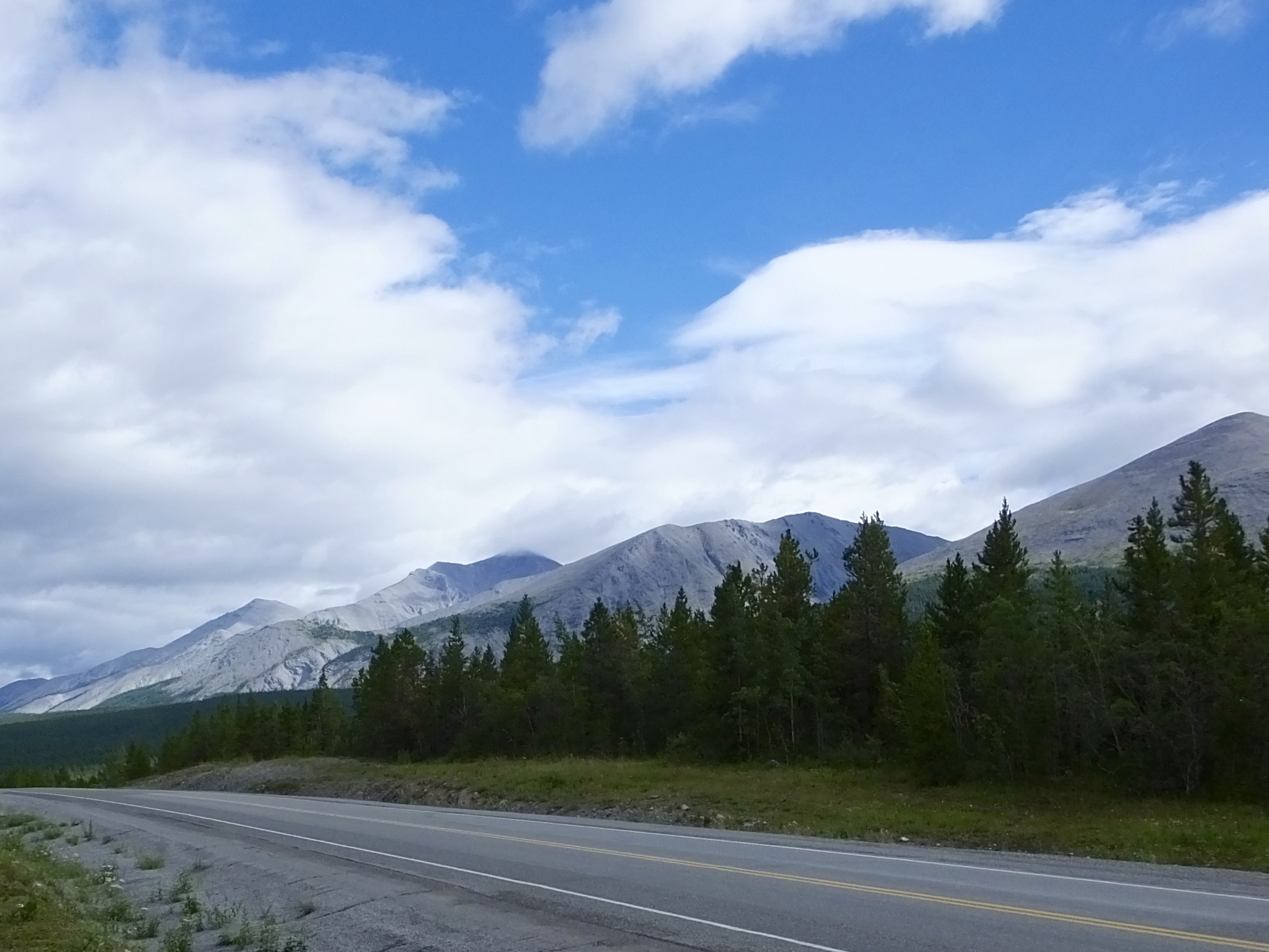
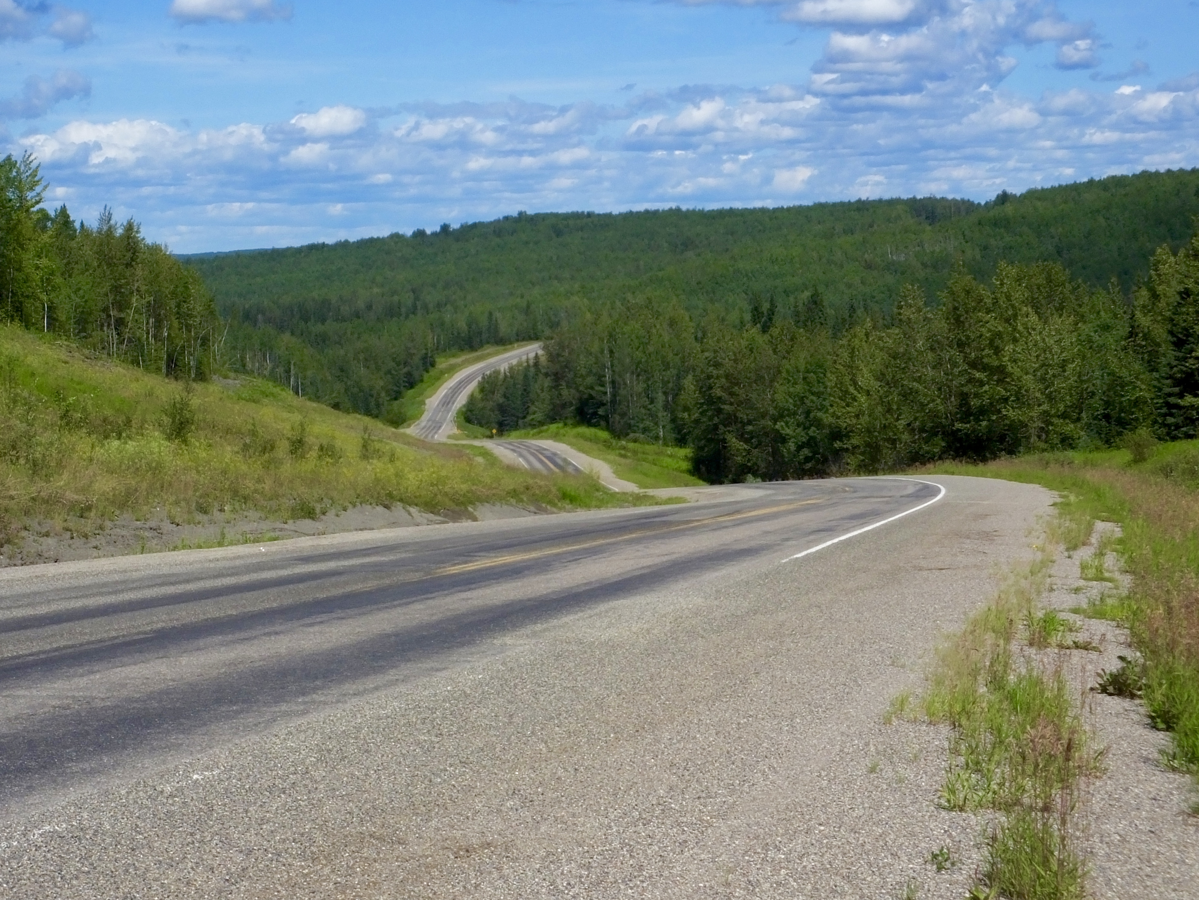
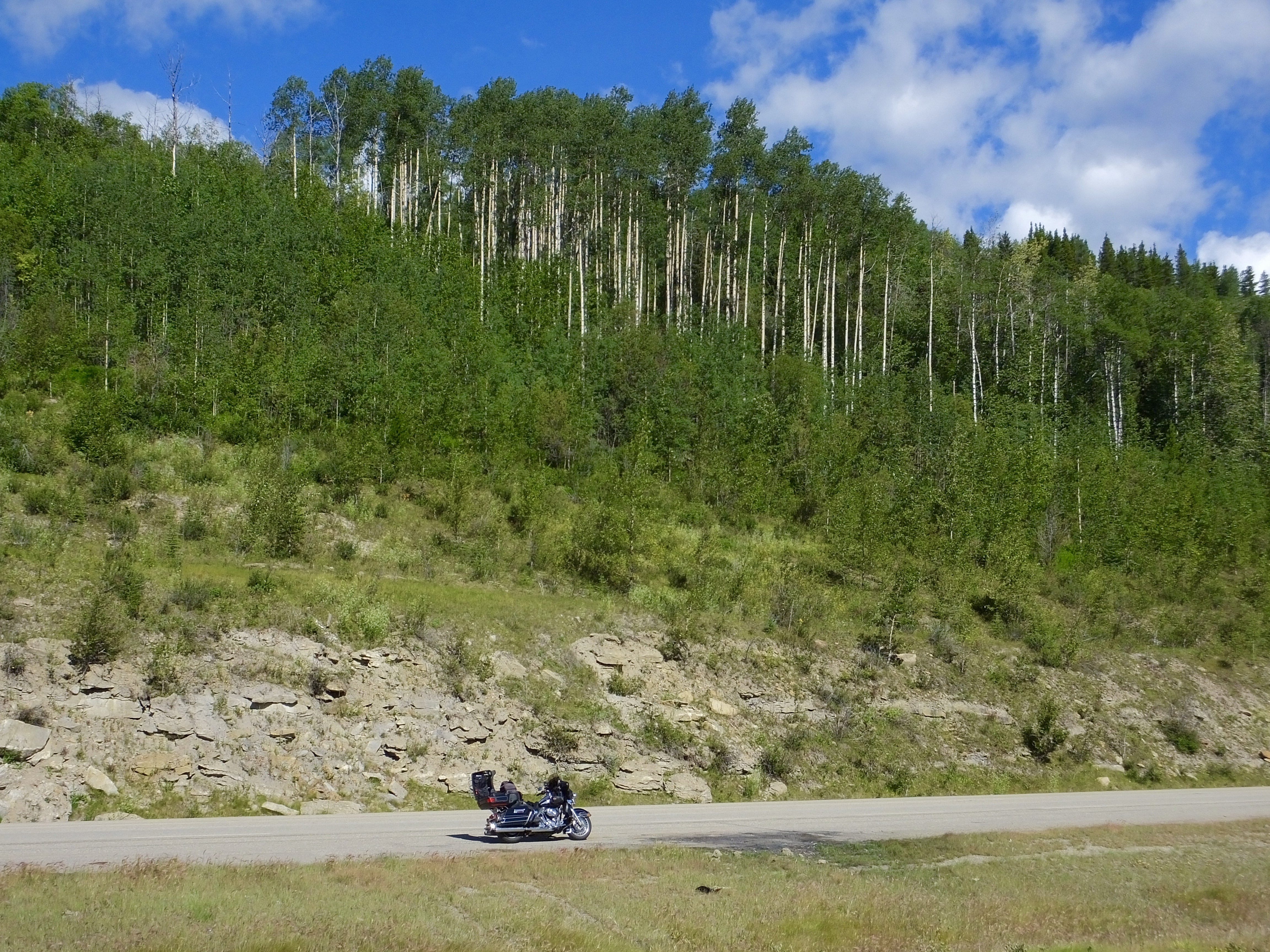
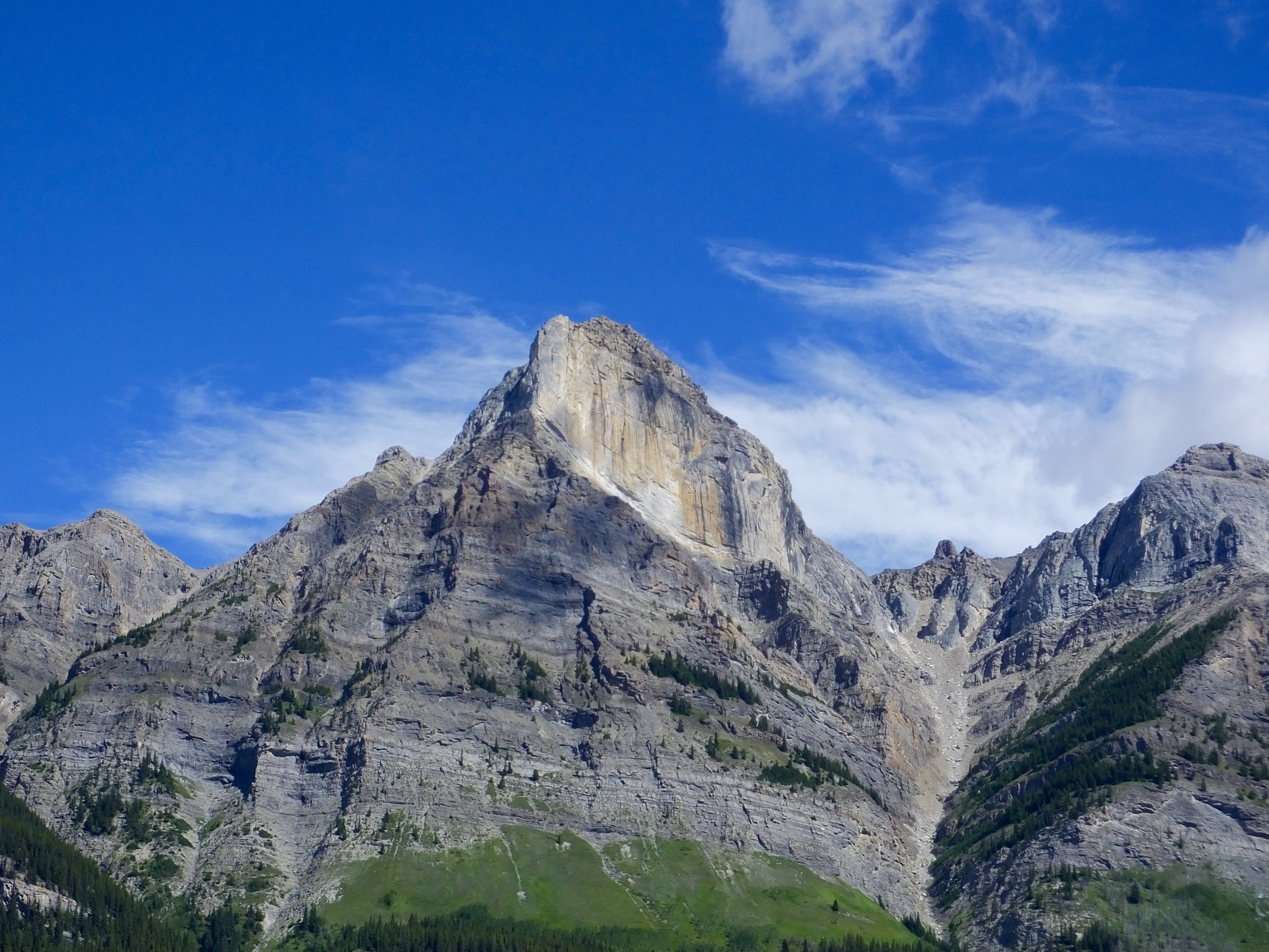
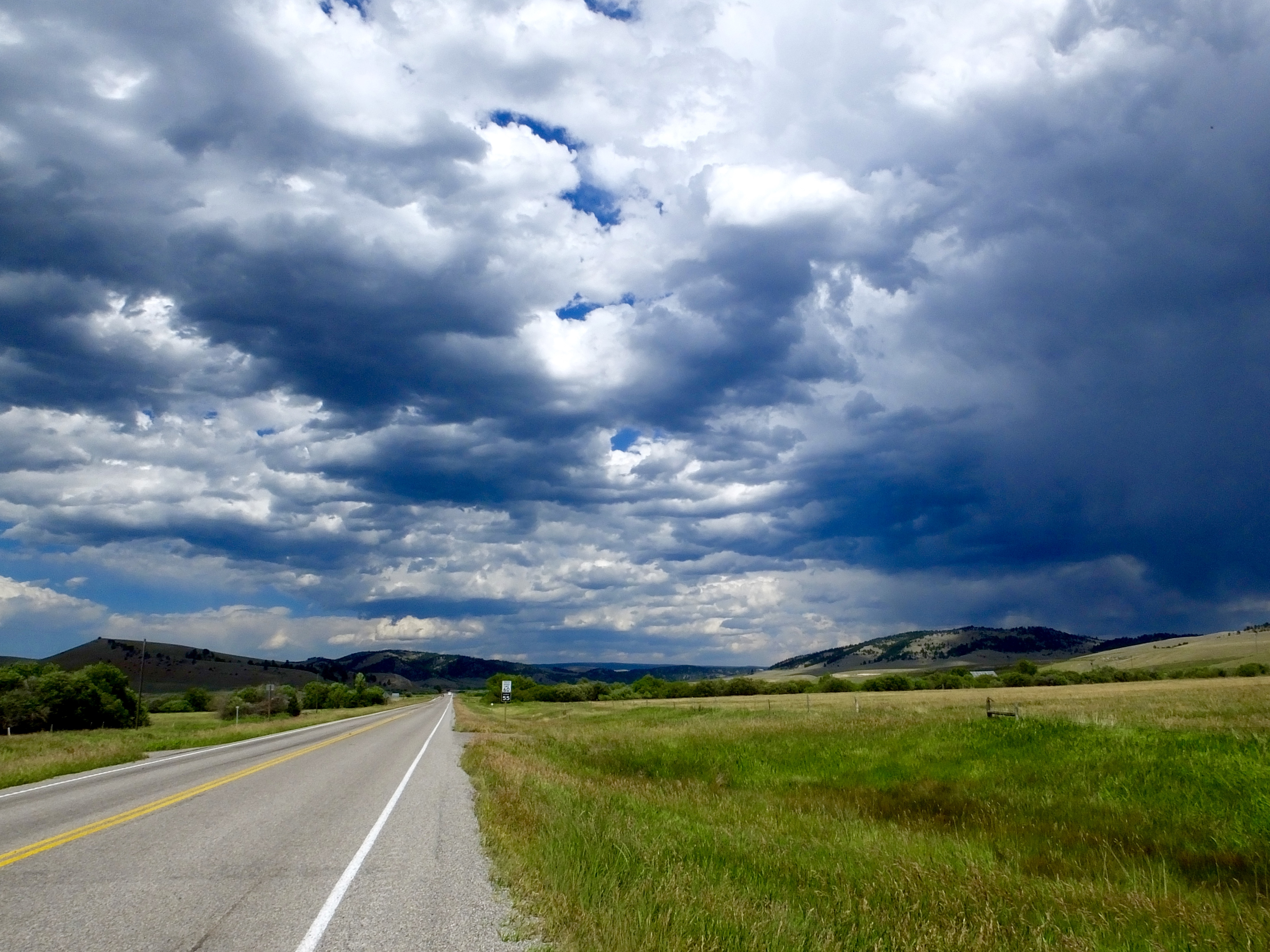
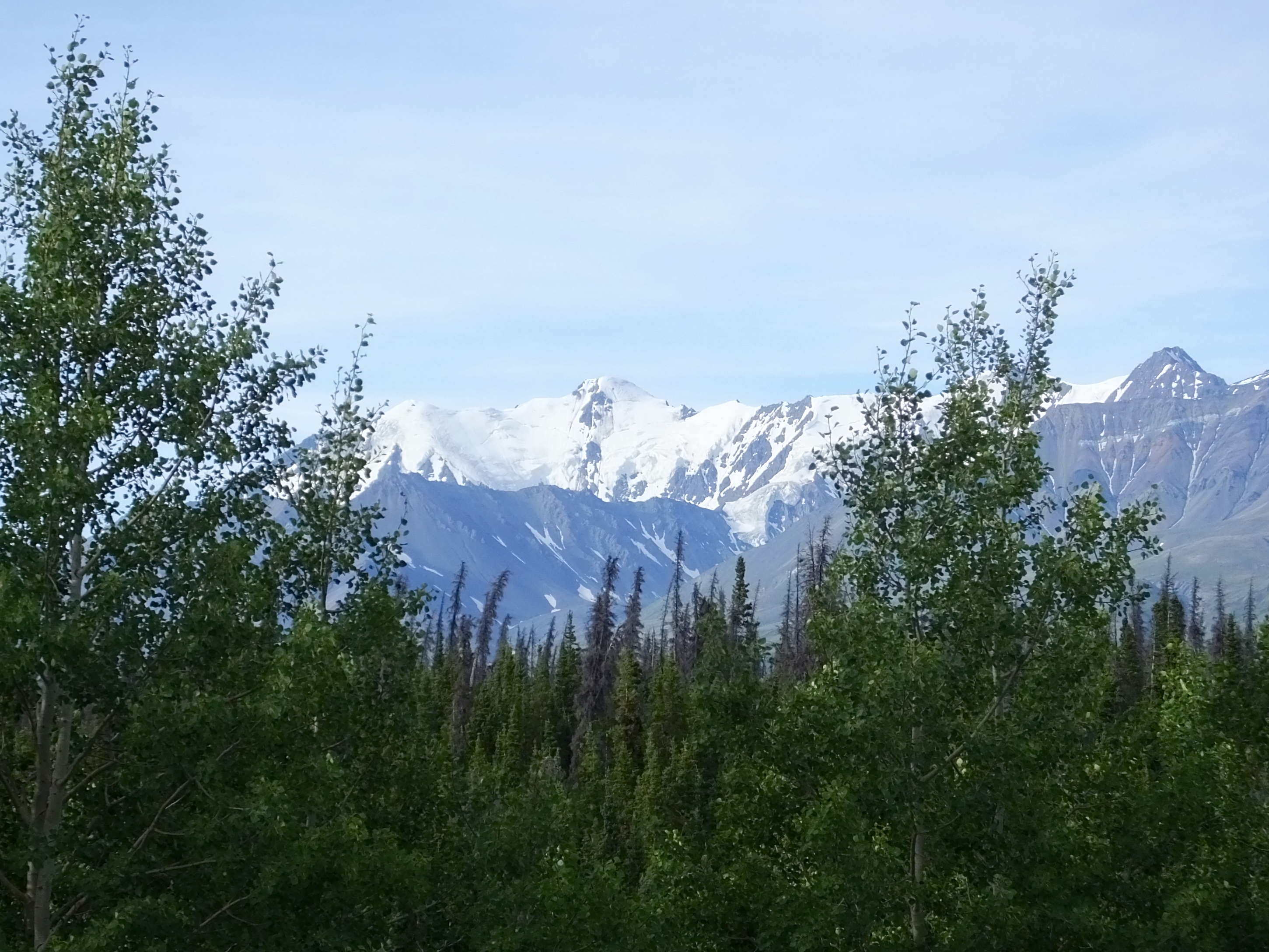 We departed Haines Junction Saturday fully outfitted in our cold-weather gear. It was 41 degrees when we woke up at 5 a.m. and about 43 when we left the Raven Hotel. But the sky was only a little hazy and we had great views for an hour or so of the snow-covered St. Elias Mountains, a sub-range of the Alaska-Yukon Mountains, and the beautiful Kluane (klu áh nee) Lake. We stopped a couple of times just to take in the view (and to adjust equipment that I always forget to adjust before I start the engine that requires getting out of half of what I’m wearing and then putting it on again before we can head down the road).
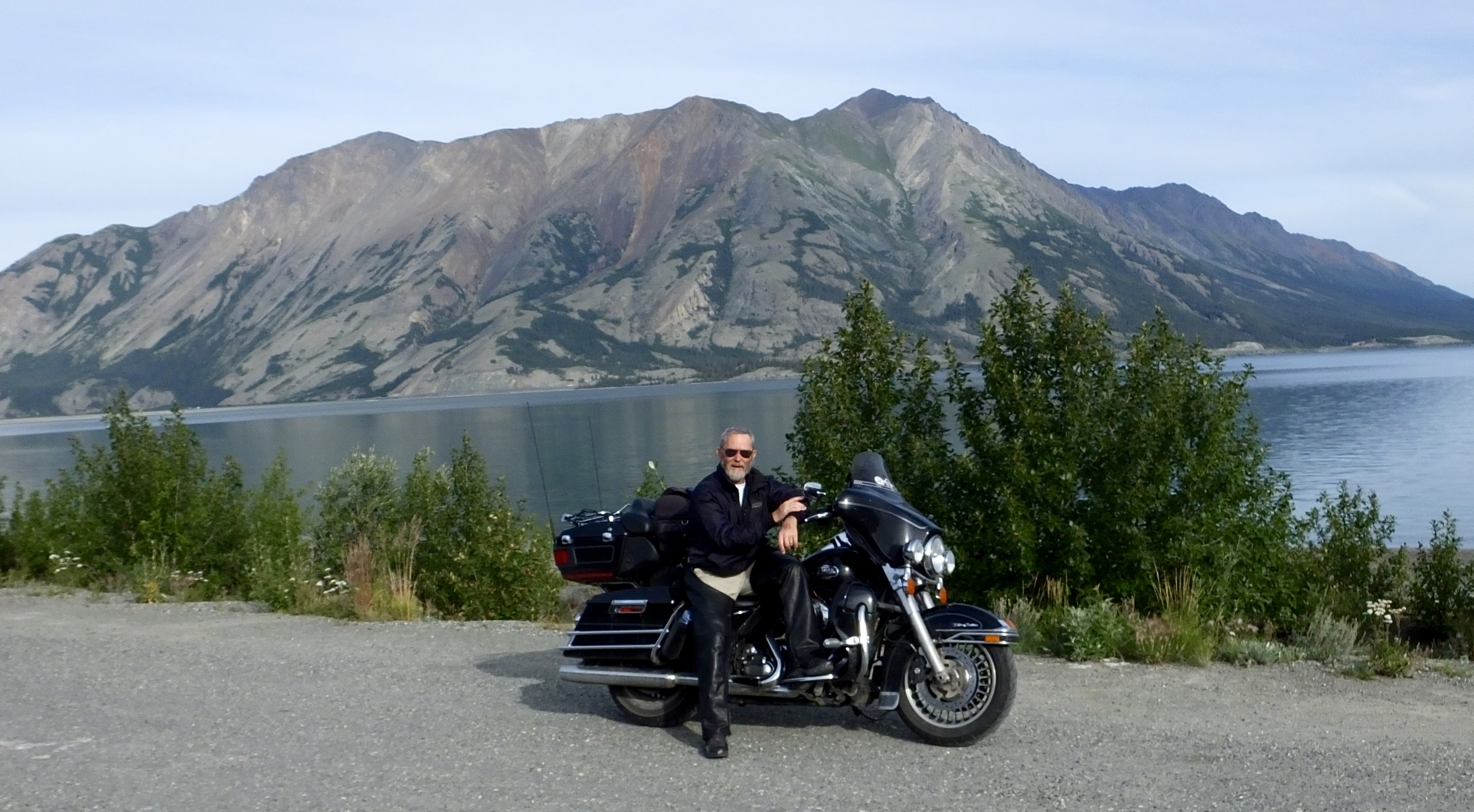 I also planned a stop at Kluane Lake to take a picture like the one Marilyn took in 2013. If you happen to have one of my “business” cards, compare it to this one. If not click here to see a 2013 version.
As we rode along the 23-mile long lake constant reminders of the history of the Alaska Highway construction in 1942 lay all around us. We looped around the lake in the picture and rode at the foot of Sheep Mountain (pictured behind me) where the highway was officially completed on a cold day in November 1942 when crews coming south from Fairbanks and crews going north from Dawson Creek met, opening the rough but completed road to never-ending convoys of army vehicles packed with men and supplies.
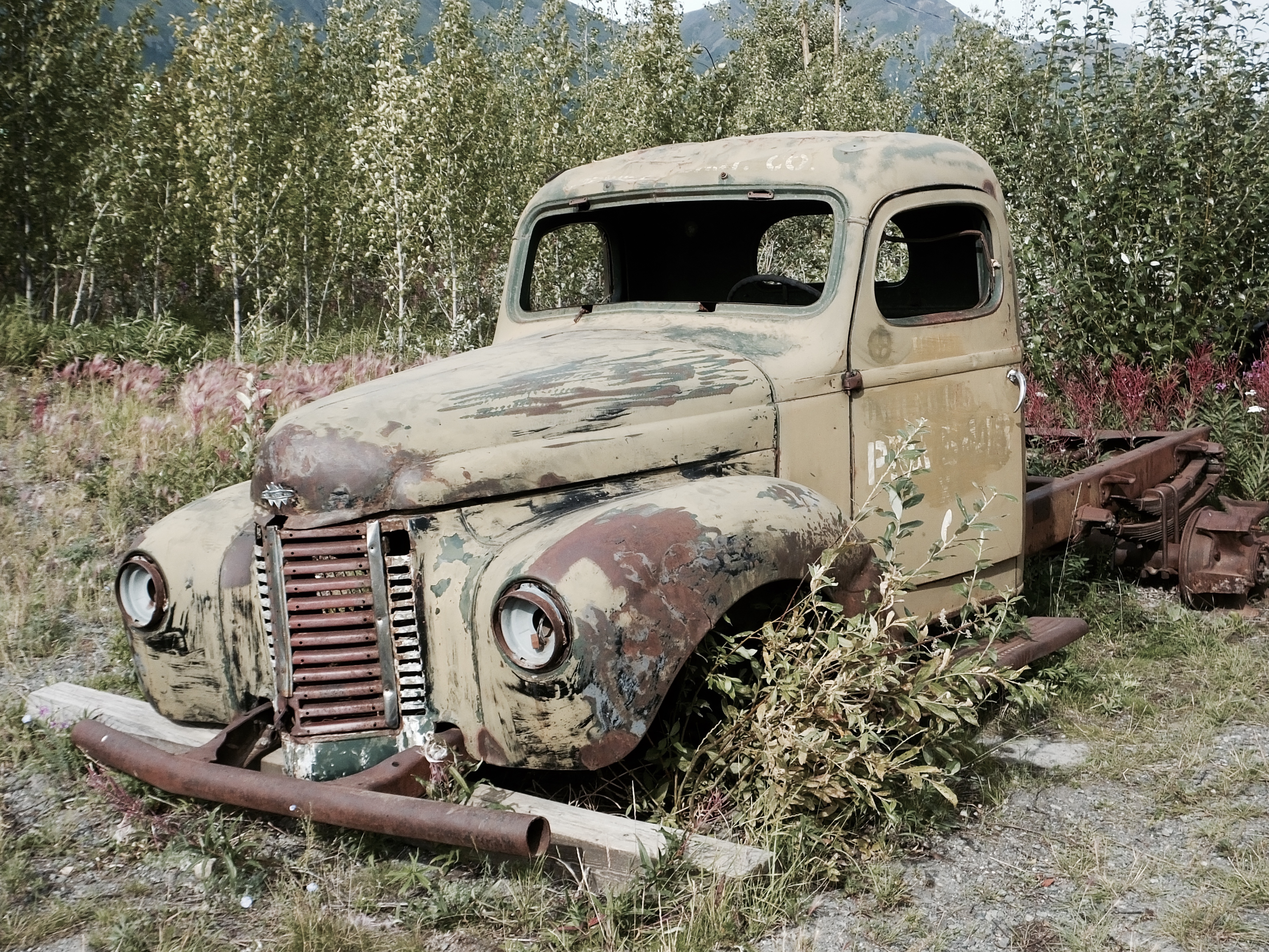 I’m also reminded of the 1942 history and the early years of the Alaska Highway by the decaying carcasses of trucks, cars, and road equipment displayed or maybe just discarded along the way. Some of the old timers are taken care of by kindly historical societies with an occasional coat of fresh paint and maybe a sign identifying the vehicular veteran of the war, while others are neglected, rusting away to forgetfullness and oblivion.
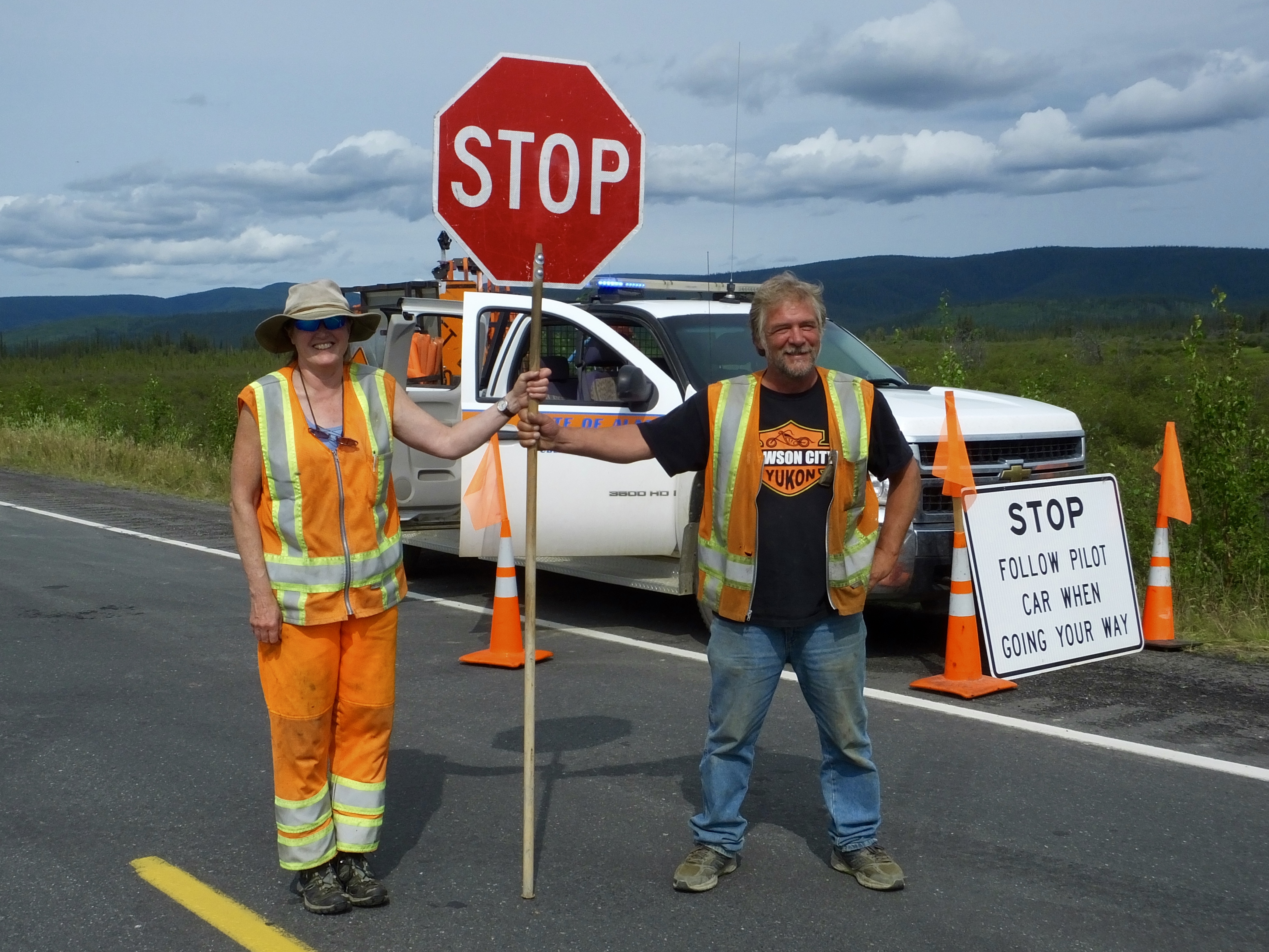 The day before we started this leg of the journey we were told to be wary of road construction and were pleasantly surprised when we didn’t encounter any. But our joy was premature. We found the torn-up pavement, construction dust and mud, softball sized rocks, and the evil, time-killing, red-vested flagger. That 30-mile stretch of pseudo-road, with three separate delays waiting for slow-moving pilot cars, added an hour to the ride, which began later that usual anyway since we expected an easy day and wanted to eat the free 7:30 breakfast at the Raven Hotel.
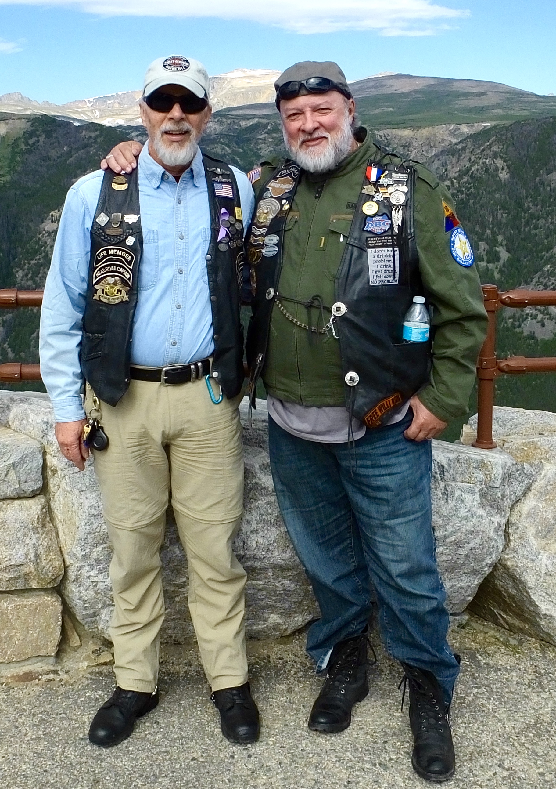
One final note before I close out this twice-edited blog post. Everyone needs moments that reel in unearned and undeserved hubris. Just when I’ve convinced myself that I’m doing something special, that I’m on the edge of adventuresome greatness, I find someone who reminds me that what I d0 isn’t so special after all, that pales in comparison to their adventures. Toward the end of yesterday’s ride we stopped at the Teslin Wildlife Refuge Visitor’s Center about 10 miles inside Alaska to look around. 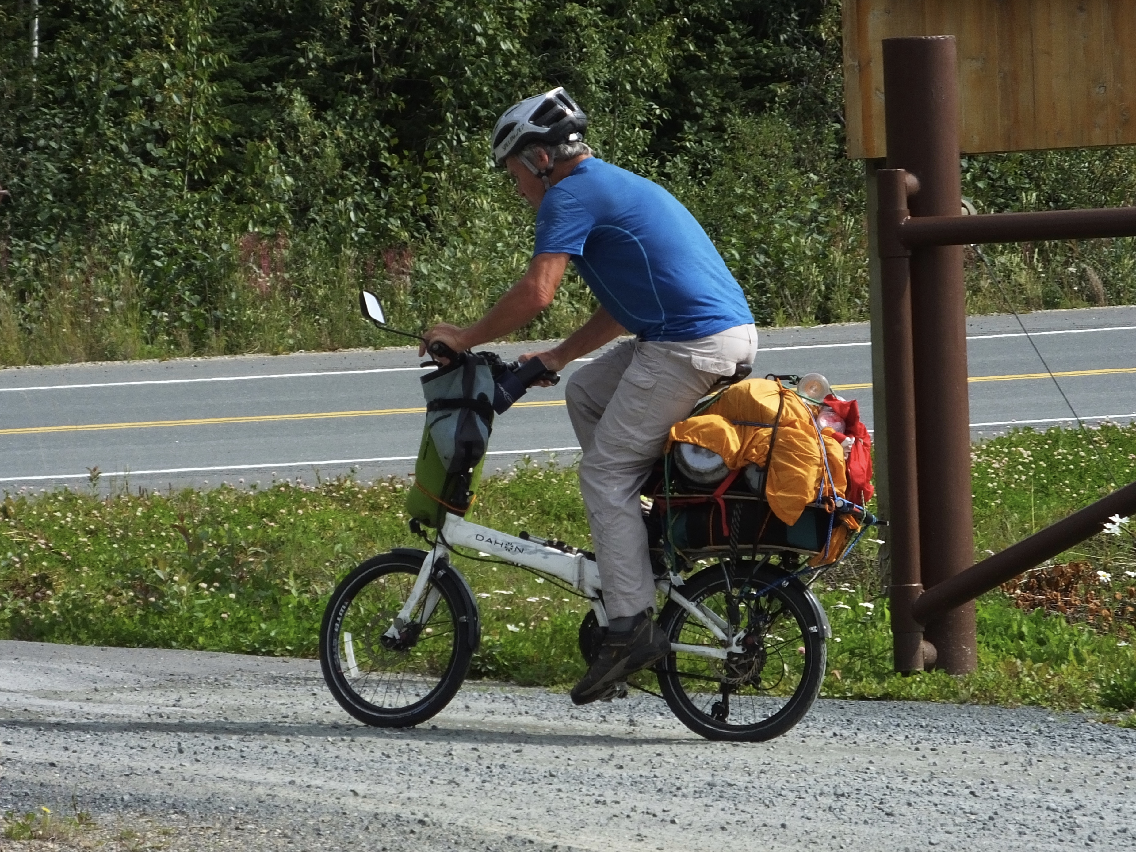 I noticed an odd looking bicycle at the entrance and approached a likely looking 60-ish character to ask if it was his. It was, he said, and he proceeded to regale us with his travels all over Canada and Alaska on that bicycle. As if that wasn’t impressive enough, he also pointed out that it folded up and stored neatly in the canoe that he usually towed behind the bike. He spent as much time paddling down Canadian rivers, he said, as he did on his diminutive velocipede. I didn’t get his name, but wished him a safe journey as he pedaled off on the final 26 miles of that day’s ride to Beaver Creek. And then I meekly climbed on my motor-propelled bike and rode humbly north.
Day 14: Coldest Ride Yet
Adventures, as I’ve said before, get interesting when unplanned events or circumstances turn the routine into something more. Today qualifies as “something more.” We left Watson Lake shortly after 7 a.m., expecting a long day on the Highway based on a road report from another rider that highlighted considerable construction delays west of Whitehorse. Temperatures were cool when we fired up, in the mid-50s according to my not-very-accurate Harley-Davidson thermometer, but not cold and the sun was shining, so we expected a good ride except for the ubiquitous sporadic road destruction.
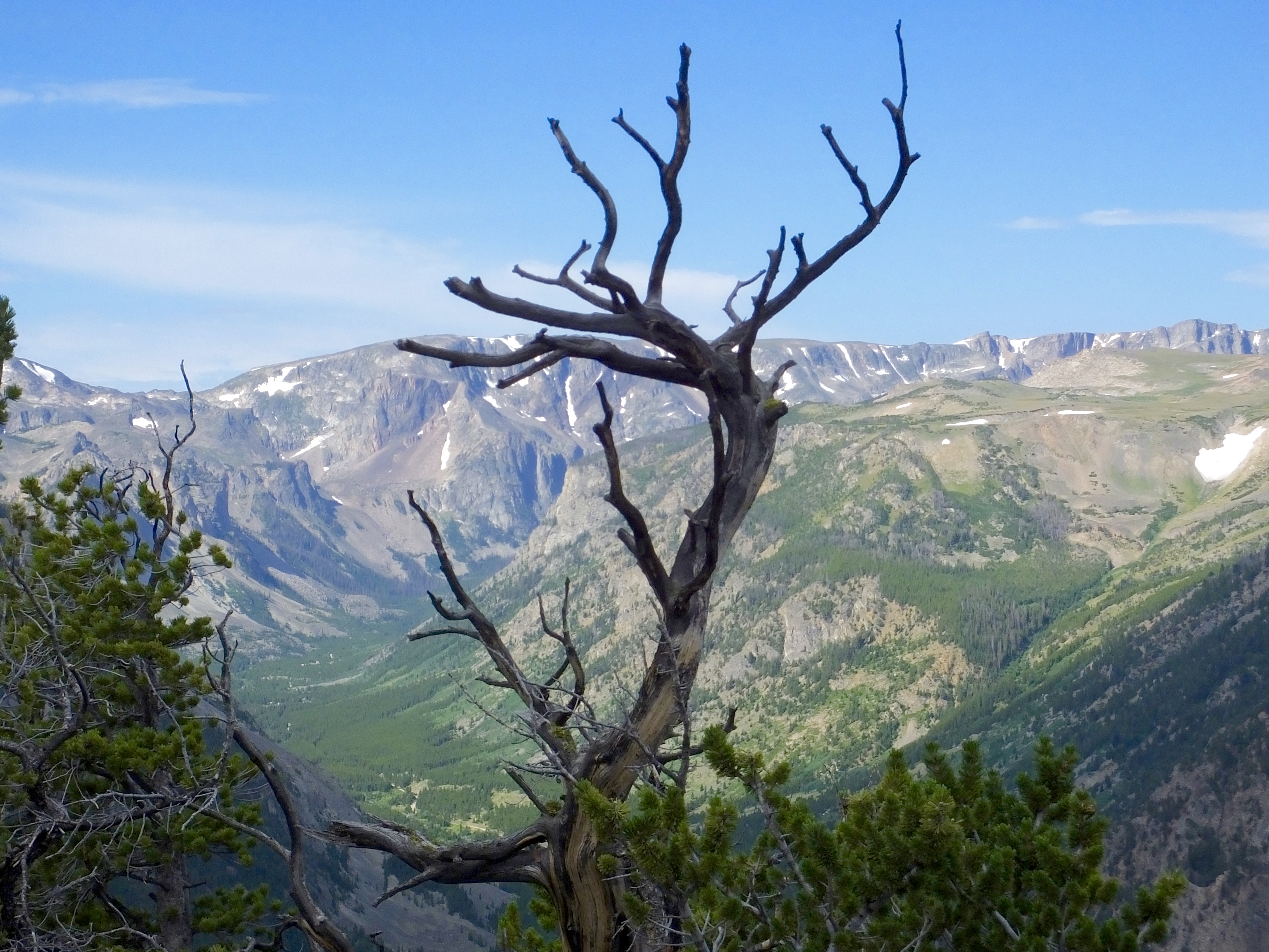
 As we rolled west, though, gray then black clouds began to build and the temperature began to drop. We stopped on the Highway’s gravelly shoulder, popped opened the saddlebags and added Harley-Davidson emblazoned rain gear over our heated gear. Soon we found ourselves riding in a mizzle–a misty drizzle–in temperatures we suspect were in the upper 40s, though it may have been a couple degrees less. The rain gear over the heated gear is the perfect combination for weather like this, leaving us warm and dry with only raindrop speckled face shields and rain-slicked roads to contend with. That iffy weather combination lasted off and on until the final 100 miles of the ride when the pavement dried and gray overcast skies began to display hints of welcome blue. We finished the ride with amazing views of the snow-capped St. Elias Mountains to the west, along which we’ll ride tomorrow.
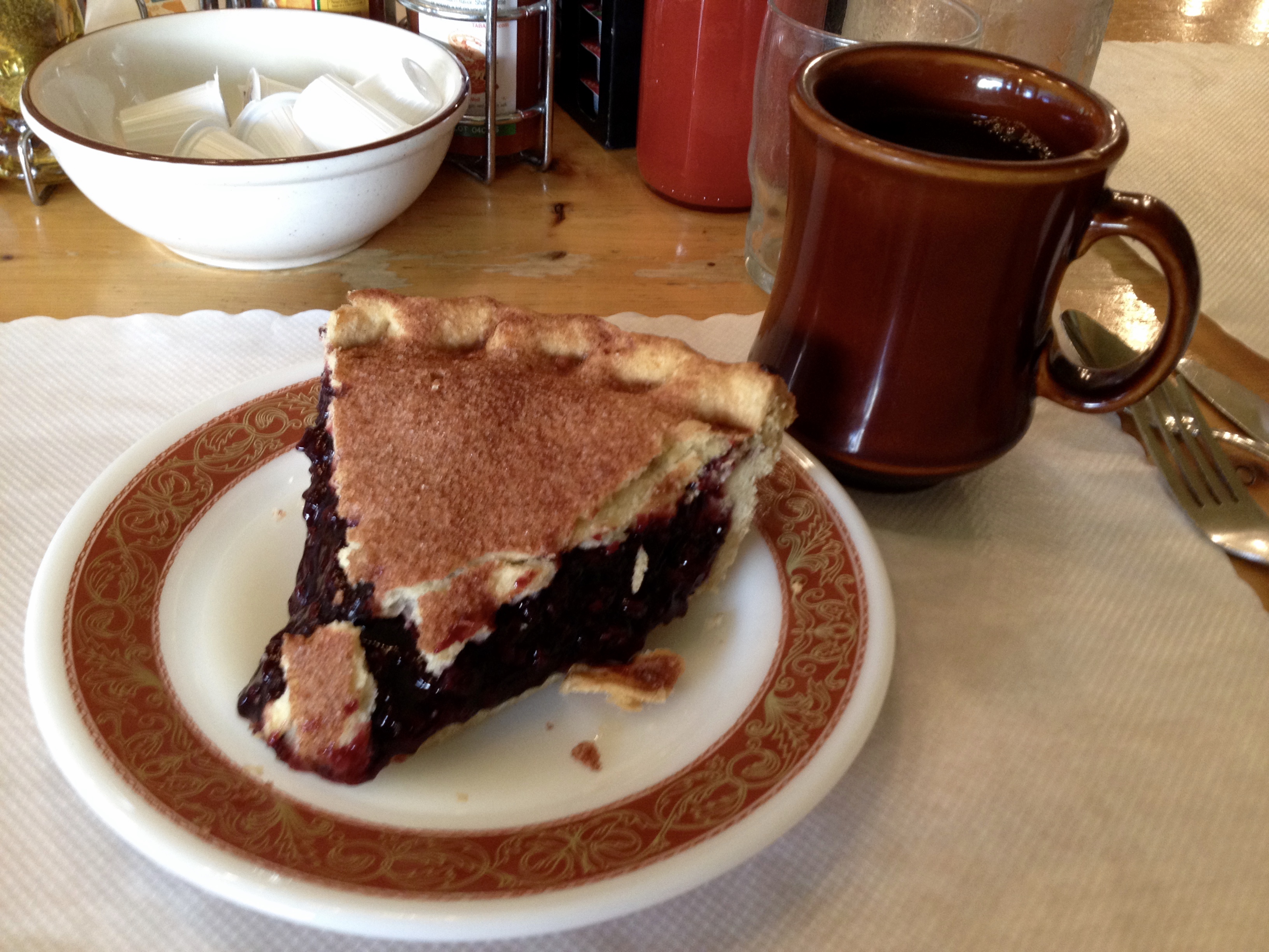
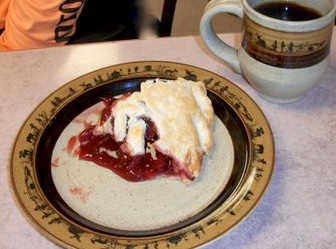 It was chilly when I made my morning pie and coffee stop in Teslin, home to the longest bridge on the Alaska Highway. A big slice of hunger-killing cherry pie at the Yukon Resort where we’ll be staying in a couple weeks on the return trip didn’t warm me up, but the coffee and over-heated dining room did.
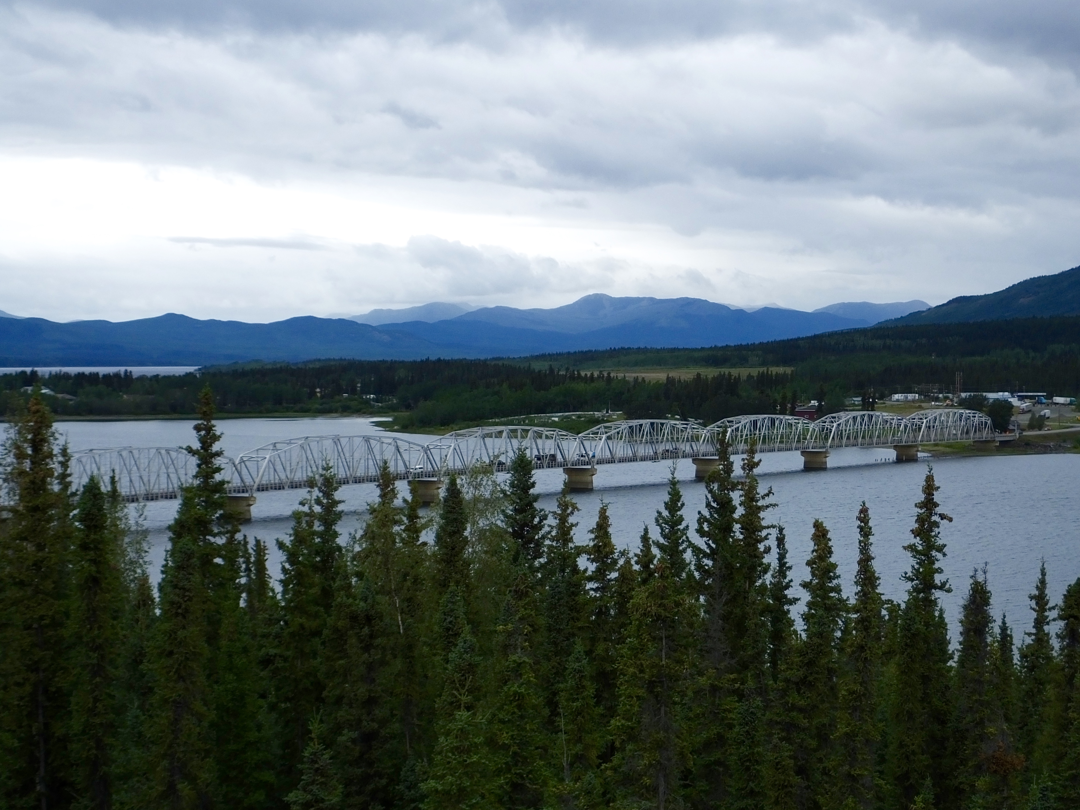
So the weather didn’t fully cooperate with us. But the Yukon Highway Department did. Shortly after we left our petrol stop at Whitehorse, we passed a convoy of road crew trucks headed the opposite direction. Although we came upon some recently resurfaced and extraordinarily dusty sections of recently repaired road, the resurfacing crews had apparently completed their assigned tasks, and we were never seriously slowed down or stopped by the much despised orange-vested flag person. The result of this good fortune was that we didn’t need the extra hour or so I had added for today’s ride and arrived before 4 p.m. at our Haines Junction motel.
I asked Gwen, one of the co-owners of the meticulously kept Raven Hotel, if the Village Bakery, which I had visited three years ago with Marilyn, might be hosting a musical performance tonight on the stage I remembered graced the outdoor seating area. “Yes,” she said, “and they’re also having a salmon bake, which you might still be able to get a ticket for.” After unburdening our dirty bikes of the dusty bags and packing away our now-dry rain gear, we walked the two blocks to the Village Bakery, bought tickets for dinner and a show and are, as I write this, getting ready to enjoy fresh salmon and some local musical talent. When I return tonight, I’ll finish the day with a Jack and a final addition to this post, reporting on this evening’s gastronomical and entertainment outing.
Day 14 Part Two
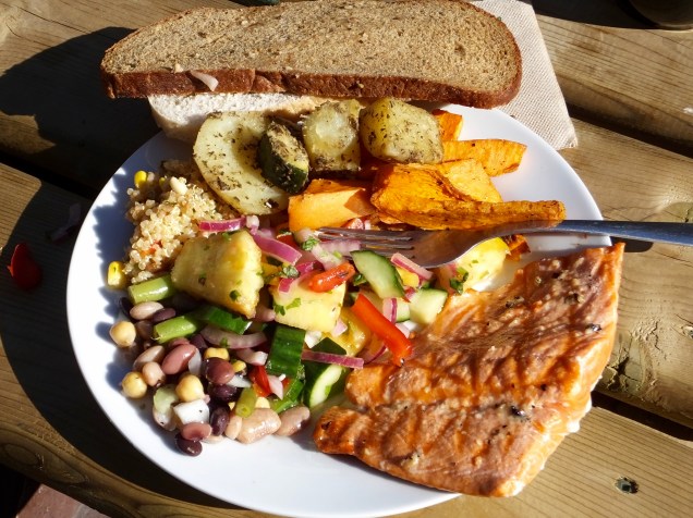 The Village Bakery is probably the best place to eat in Haines Junction and the salmon and salads tonight demonstrated that. Perfectly cooked salmon hot off the grill; an array of salads that included quinoa with corn, chilis and lime, fatuoush, a bean medley and a pineapple Thai salad; delicious fresh-baked, melt-in-your mouth bread smeared with artery-clogging butter; and a Village Bakery brownie with cream cheese icing I didn’t need but ate anyway was easily the best meal I’ve had since my too-kind sister-in-law stuffed us with schnitzel in Wichita 10 days ago. Our dinner companions, Jim and Brenda from Norfolk, England, and Rachel-the-traveling-physical-therapist whom we had met earlier on the road at Liard Hot Springs and the Sign Post Forest, provided amenable table conversation about various travels while we savored the salmon.
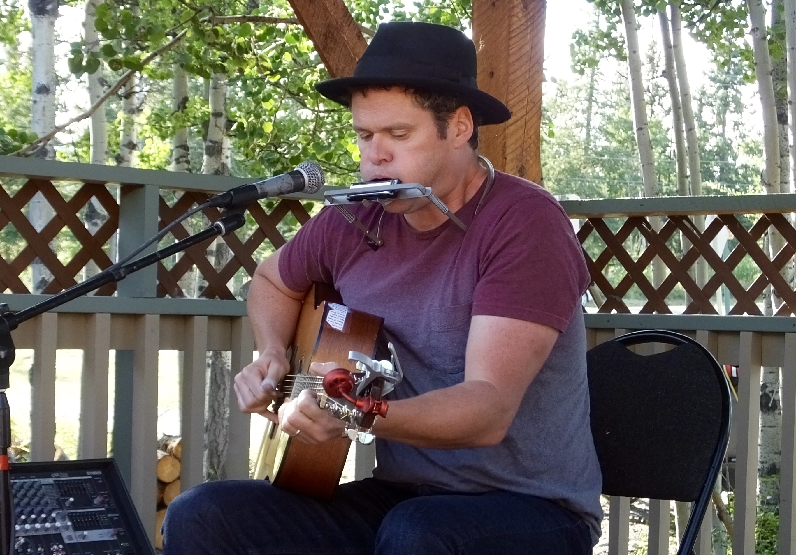 Regarding the entertainment, well, the food was delicious. The musician, a poet-singer-songwriter from Whitehorse, named Gordie Tensleeps, was, well, loud, though that might have had something to do with my proximity to the speaker. He had a slight musical resemblance to Bob Dylan, but only slight. To his credit, he could blow the harp and pick the guitar with knack and inventiveness. Did I mention the food was delicious? I’m not sure whether Gordie’s a frustrated poet who wants to be a musician or frustrated musician who wants to be a poet. But the food was delicious and I wish Gordie well in his musical journey.
Tomorrow, our own journey takes us north through some beautiful Yukon country into Alaska.
Day 13: Amazing “Typical” Day
Today as I rode steadily west by northwest on the Alaska Highway , I found myself with two complementary trains of thought. First, I was amazed at the incredible variety of things we encountered: wild critters most people only see in a zoo, regal mountains rising to the clouds, a natural hot springs that soothes aching muscles, dusty road construction, and an historic site that has become a shrine of sorts for travelers. Second, I considered that what I saw today can be seen on nearly any 300 mile drive on the Alaska Highway. Today was fairly typical. Was it Amazing? or was it Typical? My conclusion is that amazing IS typical on this road, and I’ll settle for amazing any time I venture forth on two wheels.
 For the first hour we rode on fairly flat ground as we left Fort Nelson and headed toward the northern terminus of the Rocky Mountains north of the Liard (pronounced Lee Ard) River. But soon we saw the Rockies in the distance and before another hour passed, we were in them, climbing and descending, leaning into curves, and enjoying the thrill that mountain roads give only to motorcycle riders. The weather was chilly enough to require heated gear, but not so cold as to be uncomfortable. At least we had dry, smooth roads. Until we didn’t.
It’s said in this northern country there are two seasons: Winter and road construction. We are clearly in the resurfacing season, as work crews appear out of nowhere spreading oil and crushed rock on the roads to reseal them, giving travelers the job of smashing the rock into the oil and thereby sealing it to the surface. Unfortunately one of those rocks didn’t adhere as it should have and a passing RV took perfect aim at my bike. Now I have a star-like crack in the middle of my windshield; I think of it as an Alaska Highway Badge of Honor and will probably not replace the windshield. At a couple locations, road crews had obliterated the old road and were laying a completely new base and surface. In the meantime, cars, trucks and motorcycles detoured on a dusty parallel road after waiting 15 minutes for a pilot truck to return to their end of the road. Fortunately, accepted practice calls for motorcycles to go to the head of any line that forms, so at least we didn’t have to eat road dust thrown up by the other waylaid vehicles.
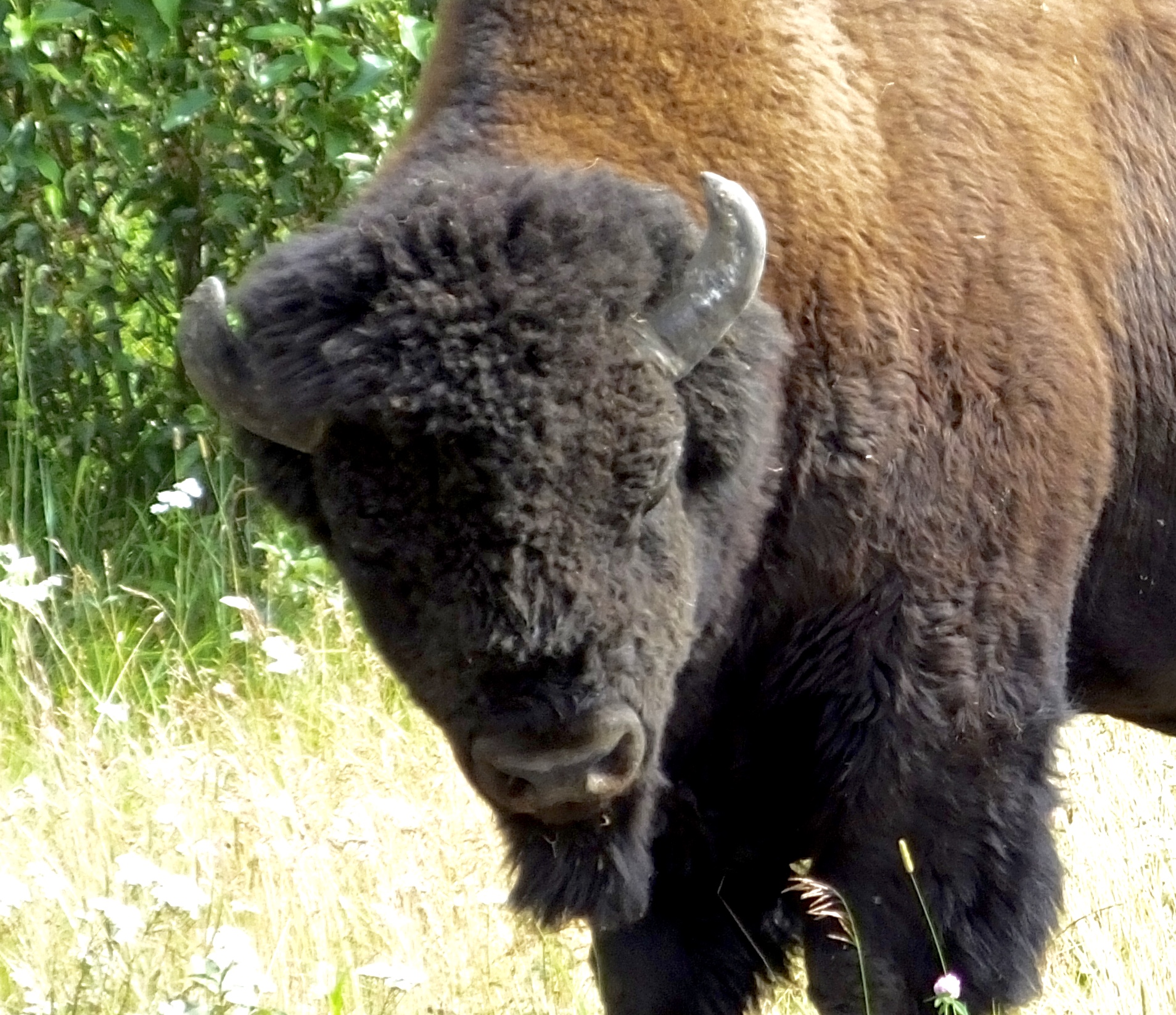
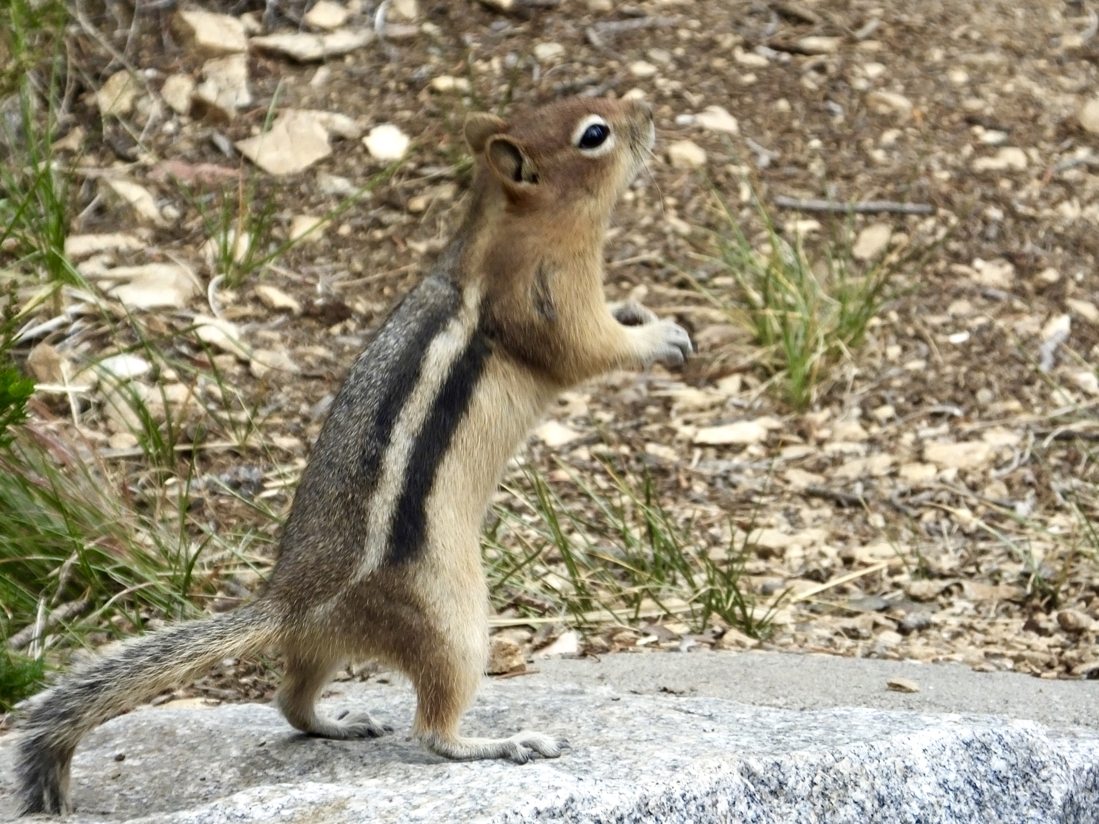
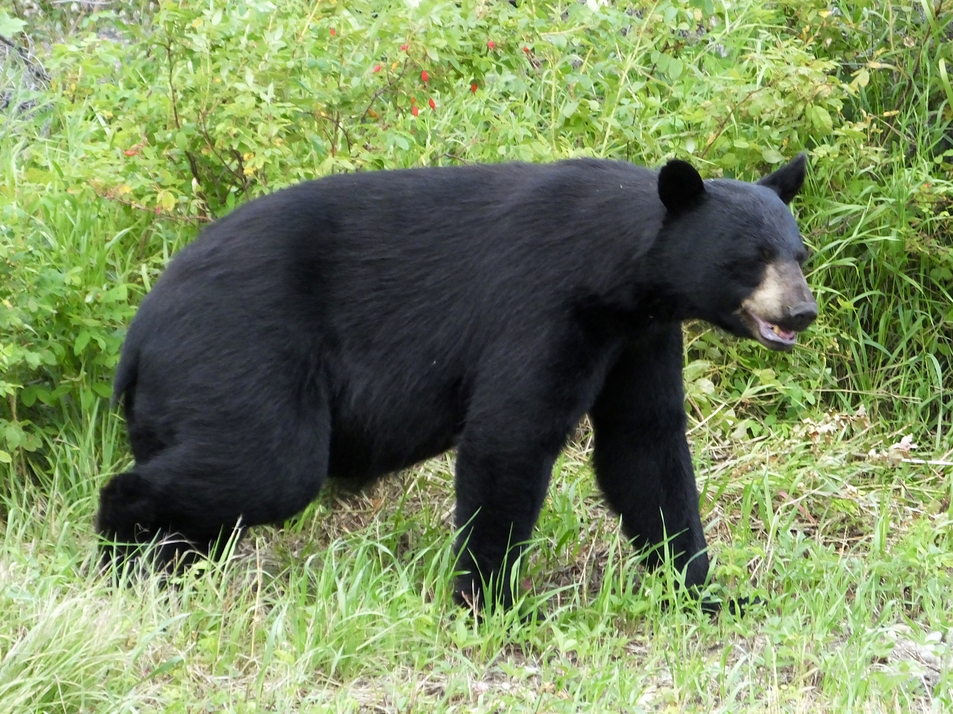 If Critter Bingo was a game (and it probably should be), we would have done well today. We spotted a deer, Stone Sheep, a young caribou, a black bear and a herd of Woods Bison. I’m still waiting to be moosed. Some days are better than others for critter spotting on the Highway, but you are unlikely to get skunked. Unless you hit a skunk.
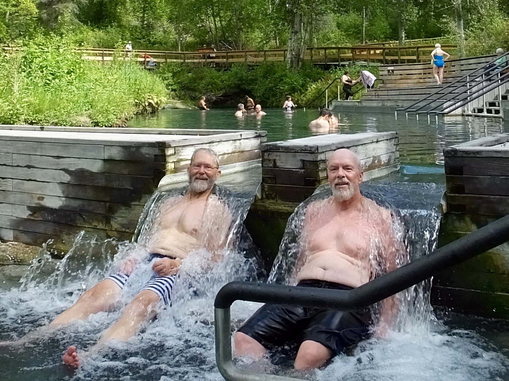 By noon we had been on the road for nearly six hours and even the huge cinnamon roll we had at Tetsa Campground wasn’t enough to keep us going. But we were prepared because we had our swimming trunks handy and spent an hour at the Liard Hot Springs, soothing our aging joints and aching muscles. I had stopped there three years ago and looked forward to another soak in the hot mineral water. Mark and I duplicated a picture taken when Marilyn and I came through in 2013 on the first Great Alaska Adventure. (To see the original, click here.)
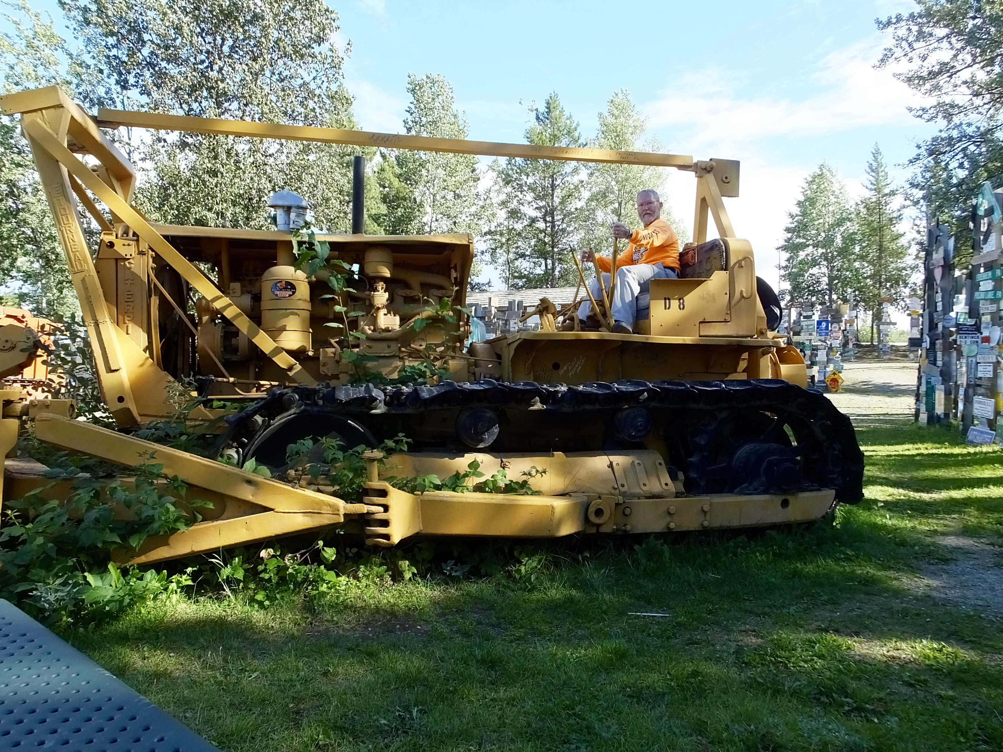
This D8 Cat, parked at the Signpost Forest, helped build the Alaska Highway.
The day ended in Watson Lake, famous for the Sign Post Forest. This iconic spot on the highway started in 1942 when a lonely soldier erected a sign telling everyone that his hometown in Illinois was more than 3,000 miles away. Soon other soldiers joined in and by the end of the war there were dozens of poles with signs pointing the direction home. During the next 70 years, people from all over the world have left names, hometowns, and various handmade signs to prove that they, too, had passed through Watson Lake, Yukon Territory and were thinking of home. Mark and I did not add to the signage proliferation, but I did see three different people nailing new signs to well-used sign posts, adding their number to the total of nearly 100,000 signs.
Tomorrow, we go mostly west across the Yukon. We just overheard a conversation between two other bikers at our historic motel that indicated tomorrow’s ride will also be full of construction. Another typically amazing day on the Alaska Highway seems to be in store.
Day 12: On the Alaska Highway At Last
We fired up the V-Twins early this morning, anxious to get started on our trek north on the Alaska Highway, and before 7 a.m., properly attired in heated jackets and gloves to accommodate the low 50s temperature, we logged our first miles on this 1,300 mile leg of the Adventure.
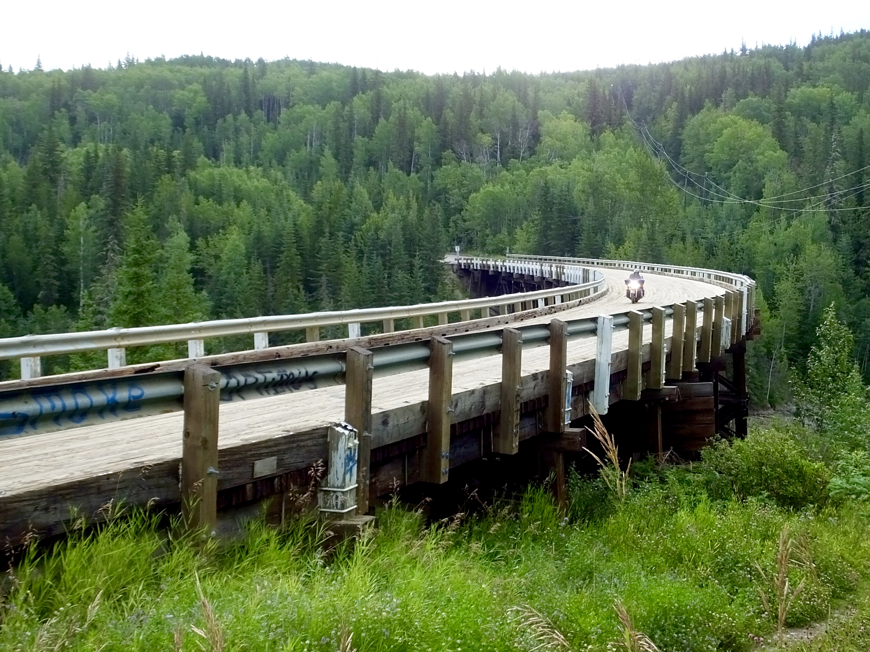
Only 21 miles out of Dawson Creek, I took a short detour to ride some of the original route, including the historic curved Kiskatinaw Bridge built in 1942 over the river of the same name .
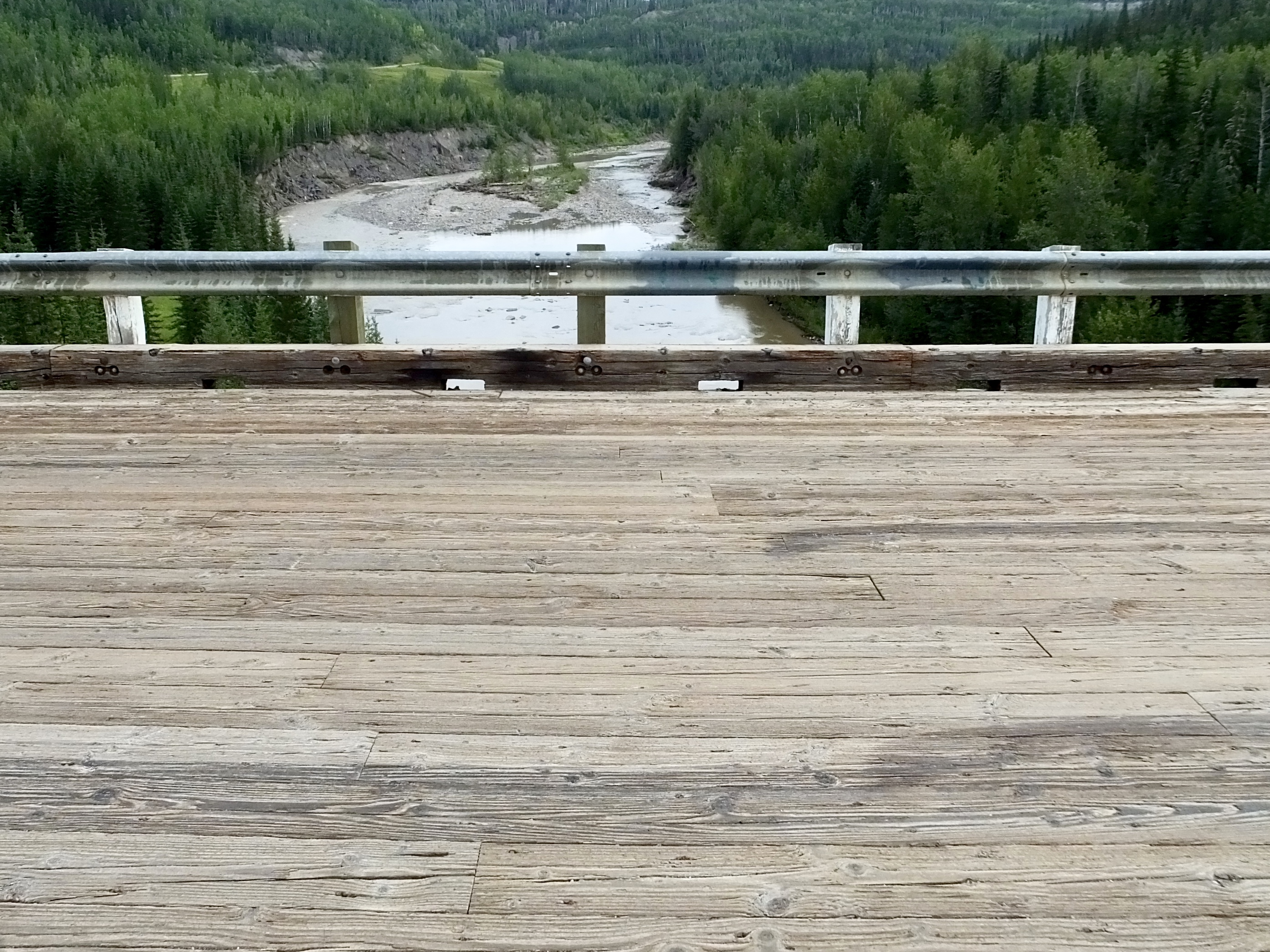 The bridge still boasts the original wooden decking, and we found several places where the wood has begun to deteriorate seriously. The Alaska Highway has been straightened and a new bridge was built several miles upriver, but tourists who miss the Kiskatinaw Bridge miss an important piece of history and and an engineering marvel that still stands high above the river after nearly 75 years.
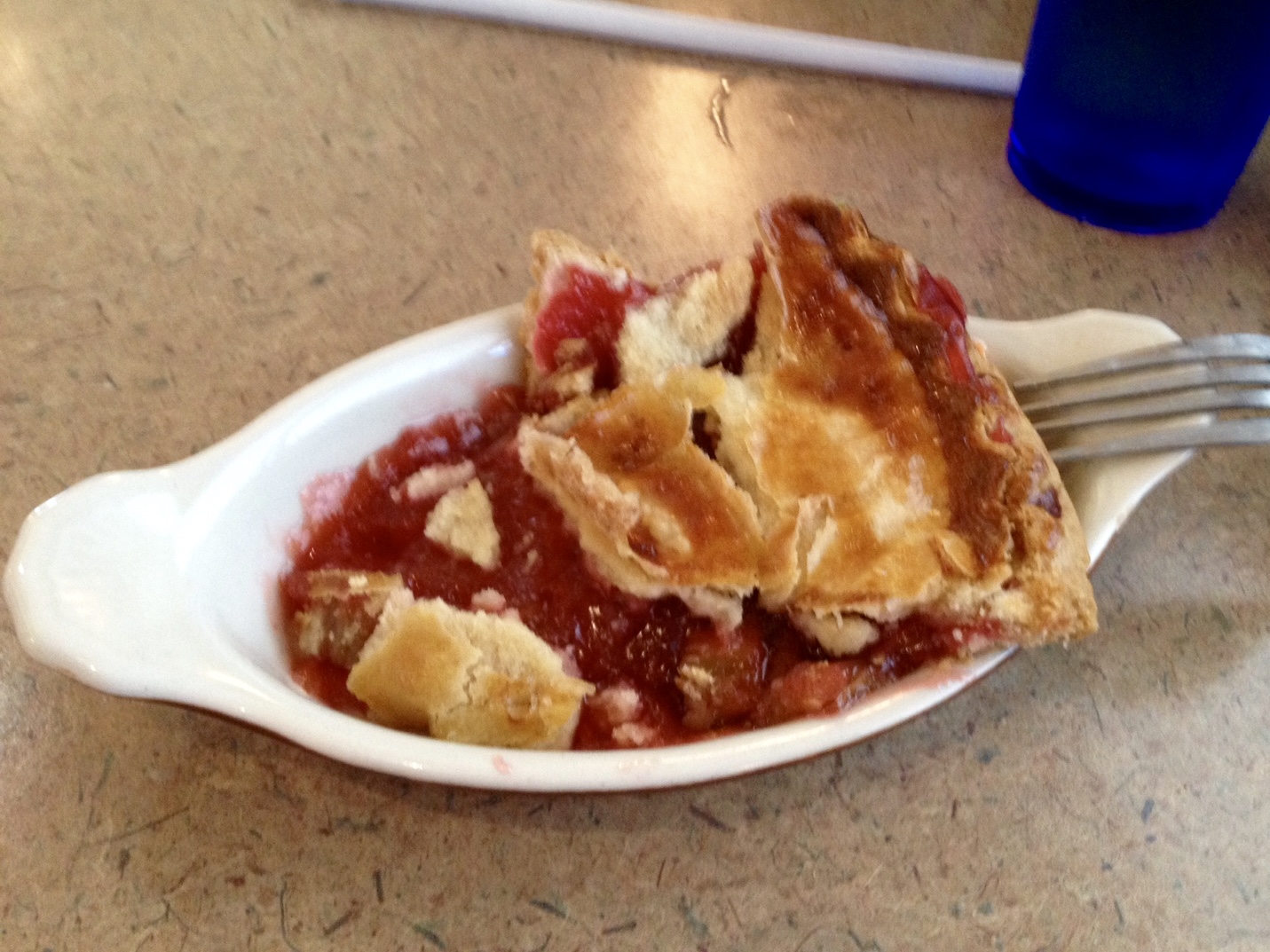
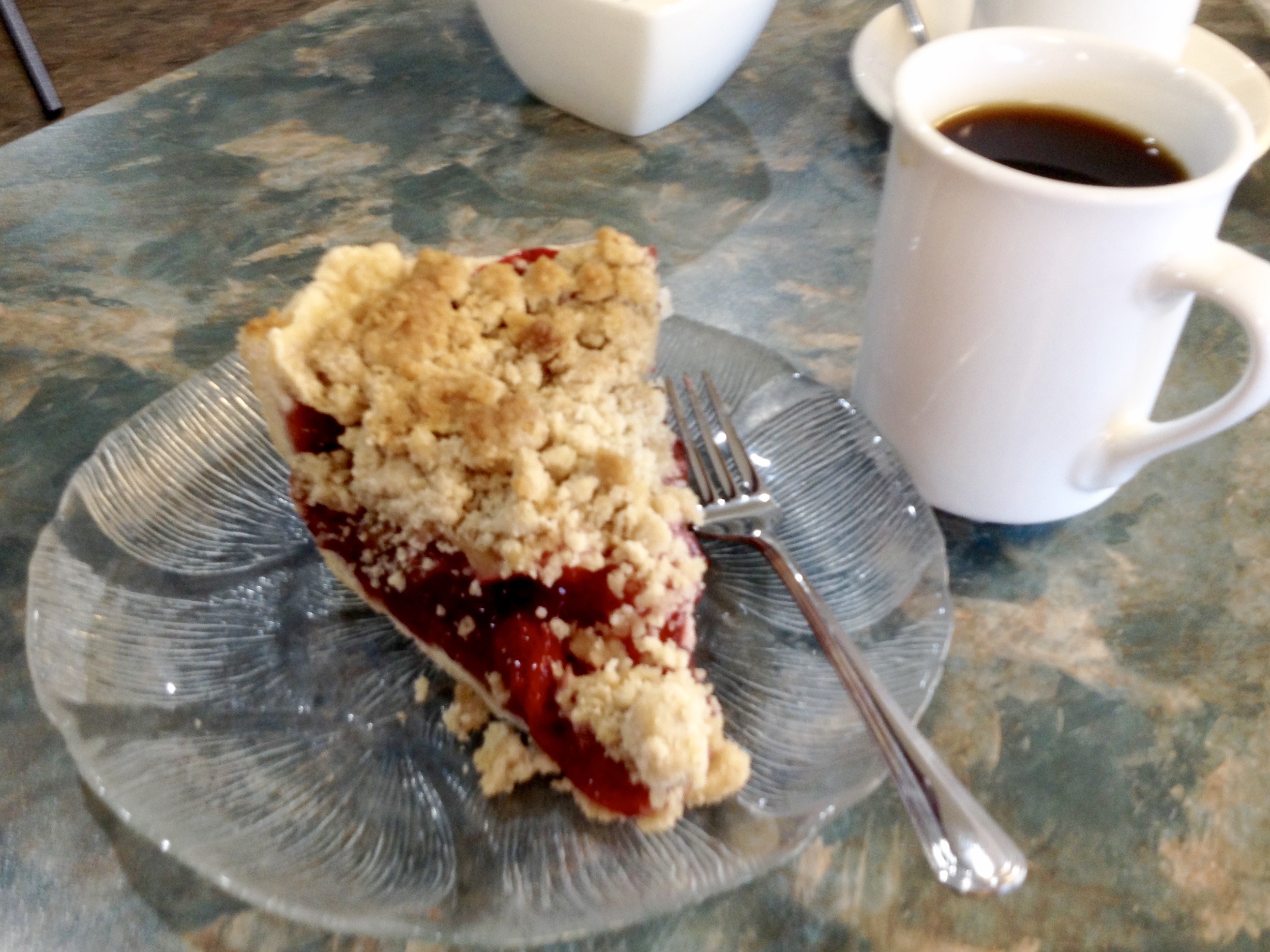 With such an early start, a pie stop was called for at 9 a.m. and we stopped at Mile 72 at the Shepherd’s Inn where three years ago, I enjoyed a huge piece of apple pie. Today, however, we each enjoyed a huge piece of strawberry-rhubarb pie and several cups of coffee.
 Today’s ride took us through some of the more gentle terrain of the Alaska Highway, though several river crossings provided some downs and ups with sharp curves thrown in. For the most part, though, the ride was flat or gently rolling land through heavily forested pine and birch with only occasional road construction that stopped us in the middle of the road to wait for a pilot car to escort us to the other end of the resurfacing. In one instance, the entire road surface had been removed and we proceeded on dirt/gravel for about a mile. I promised Mark that this was a taste of what to expect later as we reached the more northerly portions of the Alaska Highway. For the first 150 miles or so today, heavy truck traffic related to logging and the oil fields caused us to be especially vigilant on the road, but for the final half of the ride, traffic consisted of mostly tourists with a few transport trucks in the mix.
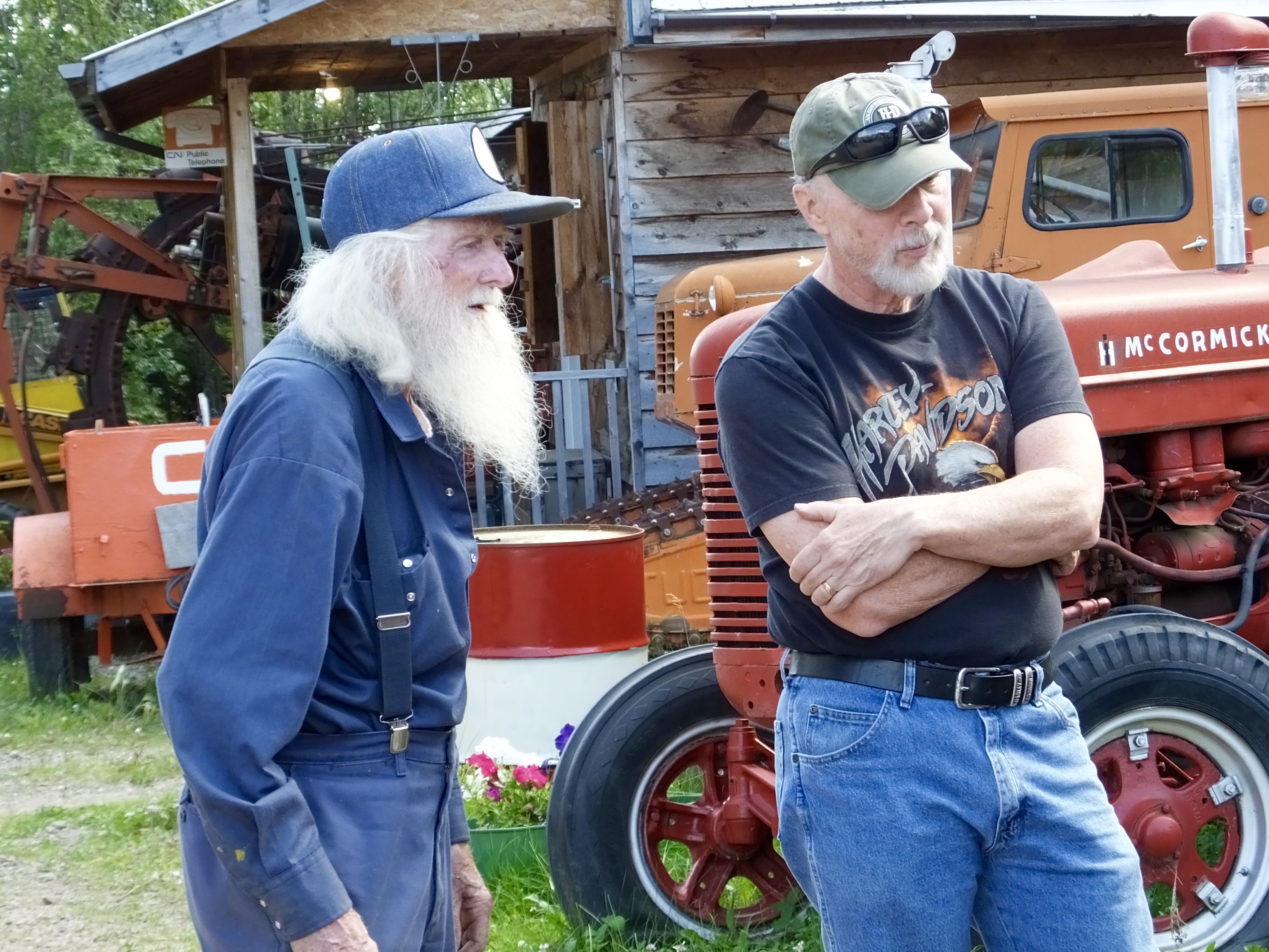
We arrived early in Fort Nelson by design because I wanted to make sure we had time to explore the Fort Nelson Historical Society Museum on the north end of town. I had visited there once before three years ago with Marilyn and met an interesting character; I hoped he would be there again. As we dismounted from our bikes in the dusty parking lot, I spotted the white-bearded man I hoped to meet again. Marl Brown was out front and I introduced myself as someone who had met him three years and fondly remembered him and the incredible museum he founded .
Eclectic only begins describe this museum, a treasure trove of memorabilia and artifacts that reflects the town of Fort Nelson and the hearty souls who live there. We toured the inside of the museum, probably only aware of 10% of the flotsam and jetsam it contains that reminds visitors of the area’s fascinating history. Hundreds of taxidermy displays, household goods, remains of professional careers, mining equipment, military reminders–literally tens of thousands of items scattered throughout the building. And outside, it was much the same.
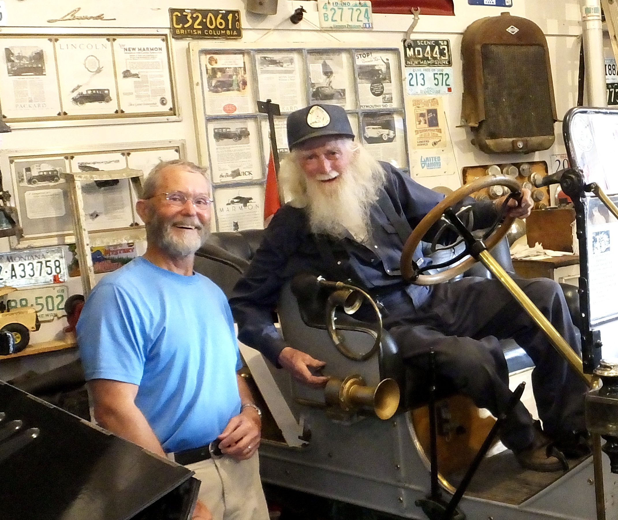 But the highlight of this visit, was the tour through the garage conducted by Marl (I misrepresented him as Merl three years ago). In the garage were parked more than a dozen antique automobiles owned by Marl, surrounded by old tools, road signs and parts and pieces of other autos and engines. Marl agreed to re-create the photograph I captured three years ago, much to my delight. (For the original picture, click here.) And then he walked us through the garage, explaining a little about each of the cars and actually starting a single-cyclinder 1906 Brush (which I had never heard of).
 Mark also enjoyed the tour conducted by the museum’s founder and driving force, asking dozens of questions about the cars and trucks 84-year-old Marl had bought and restored during many decades of an active life. When I asked him what he did before he started the museum, he replied with a wink, “Pretty much what I’m doing now.”
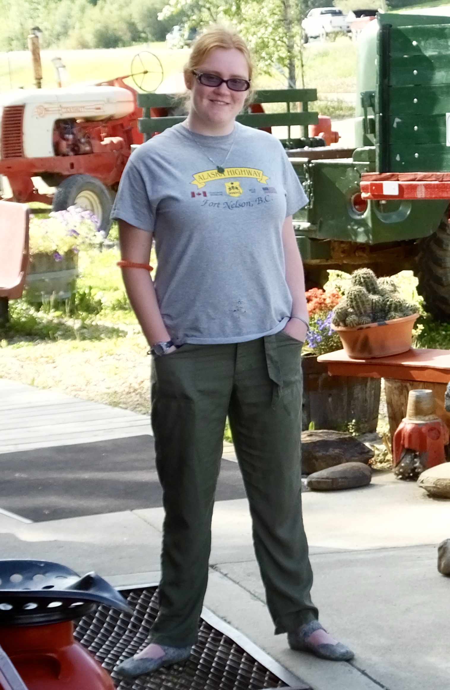 We were also fortunate that museum summer employee Katelyn took time to show us through several other out buildings with exhibits ranging from telephone equipment, to postal services, to a trapper’s cabin and to explain some of the many artifacts scattered around the grounds. She was enthusiastic about the museum and her respect and admiration for Marl came through in everything she said.
Tomorrow, we continue westward on the Alaska Highway, finishing the day in the Yukon Territory at special accommodations with a history as old as the highway.
Day 11: A “Mile 0” Interlude
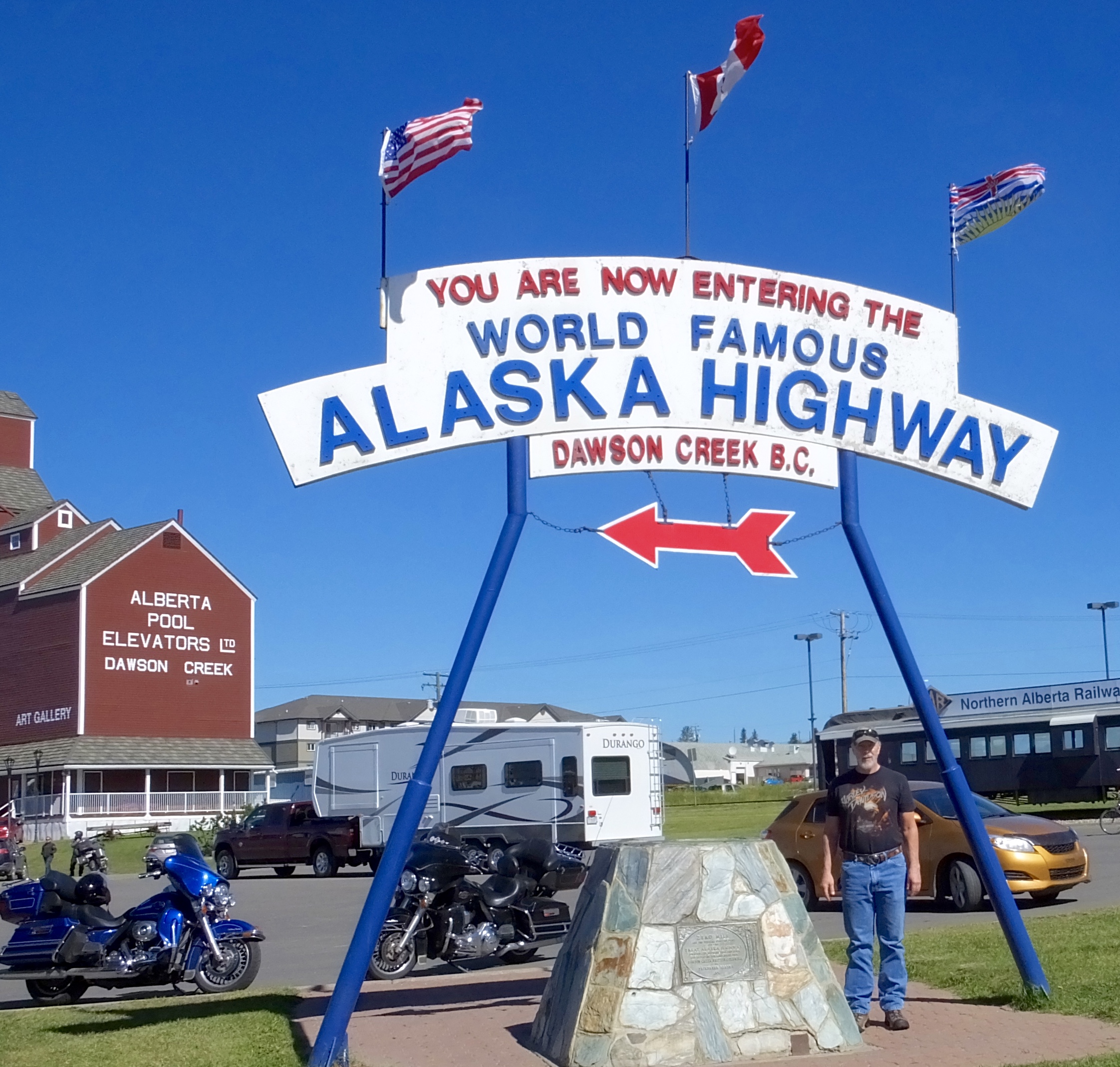
When I plot routes for various adventures, I usually include a non-riding day every 6 or 7 days for such things as sight seeing, laundry, resting, and just taking deep breaths. Today in Dawson Creek, British Columbia, was such a day. There’s much to see when riding (mountains and grizzlies come to mind), but there’s a multitude of sights to be enjoyed and things to learn when the wheels stop spinning for 24 hours.
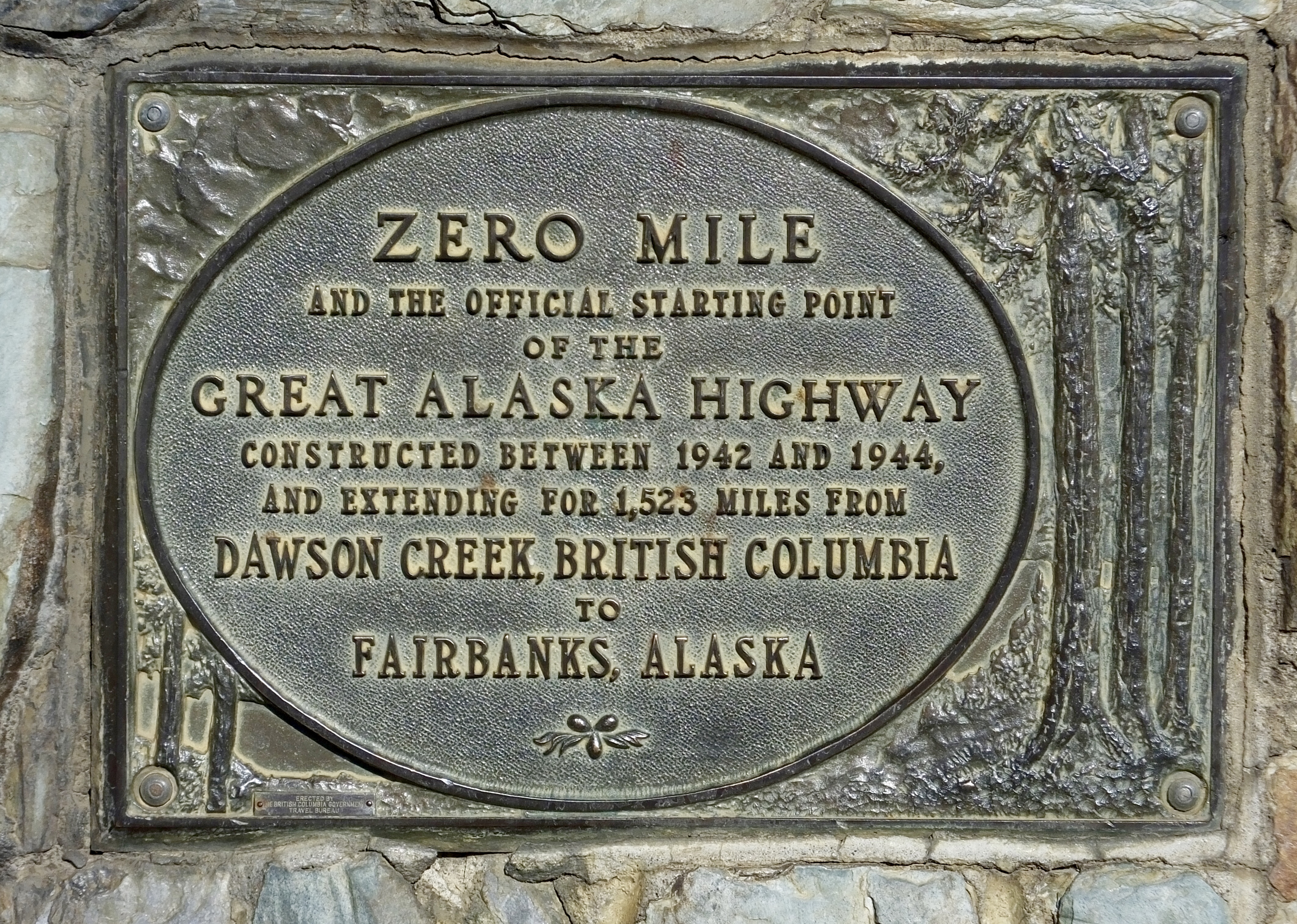 After taking care of various domestic chores this morning, we rode two miles into downtown Dawson Creek. For those who may not know, in March 1942 Army engineers designated Dawson Creek as Mile Point 0 as they began the daunting task of building a road through the wilderness to Fairbanks, Alaska, in response to the urgency of World War II and the fear of a Japanese attack on North America. Eight months later, they had completed the 1500+ mile road that skeptics said couldn’t be built in any amount of time.
 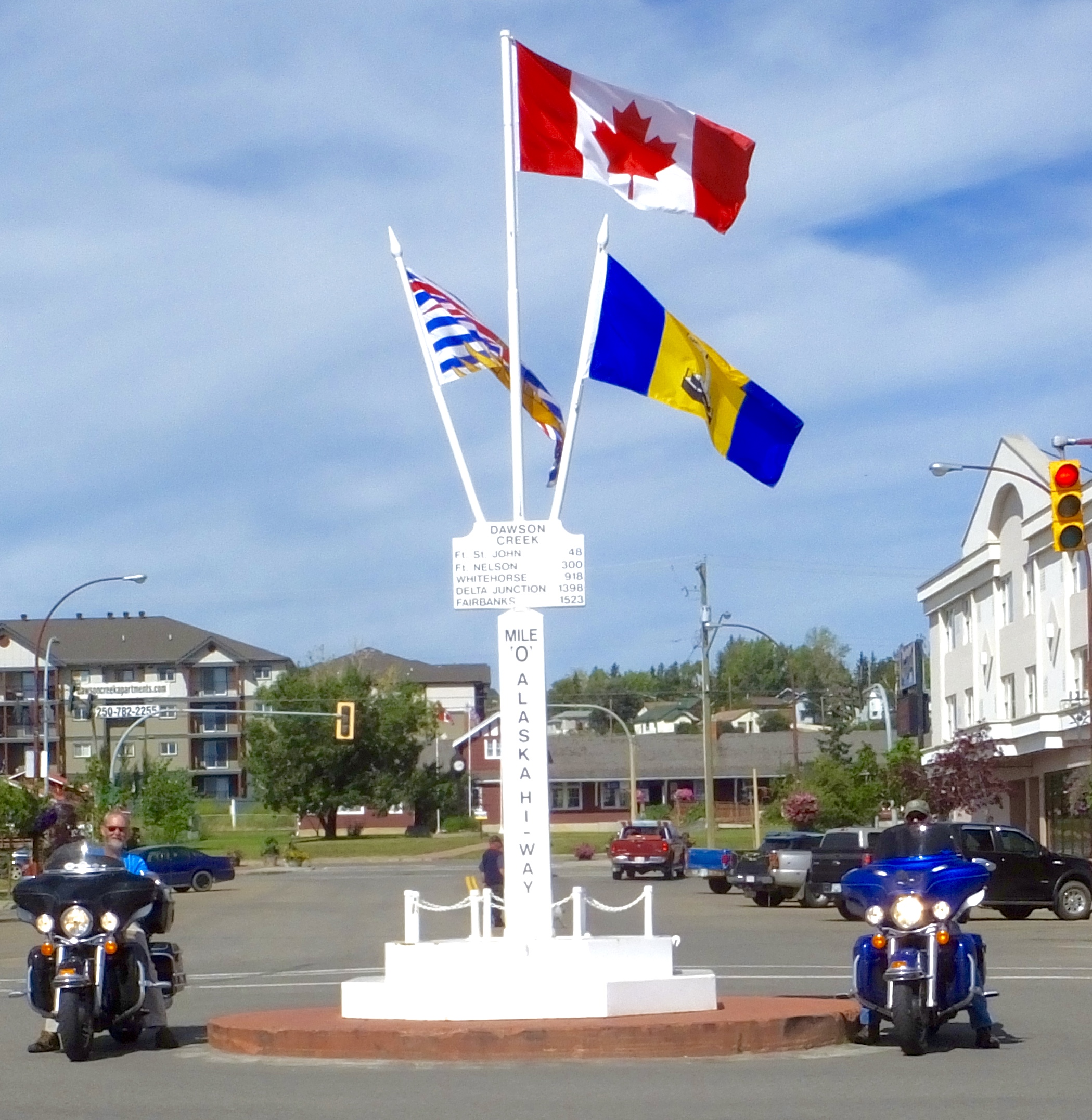 More than 30,000 military and civilian construction laborers, heavy equipment operators, truck drivers, and the vast army of logistical support workers needed to feed and supply them worked in some of the most unimaginably dangerous conditions outside of combat that the war would produce. Landslides, explosions, drowning, freezing and various illnesses took their toll on the heroes who built the road that Mark I and will have the pleasure to travel on for the next five days as this Adventure continues.
 Much of the original road is gone, as later generations of engineers and road builders straightened, flattened and paved the original dirt and gravel road that connected Alaska to the lower 48 states (via Canada of course) in 1942. In fact, the road is about 200 miles shorter today than when first completed. But many parts of the original road still remain, and as I motor along, I’ll say a distant but heartfelt thanks to the courageous and dedicated men and women who cut, blasted and bulldozed their way through the wilderness and opened a vast and beautiful territory to tourists, entrepreneurs and, of course, adventurers.
At the Visitor’s Center in the old railroad depot, museum exhibits not only focus on the Alaska Highway (sometimes but incorrectly called the AlCan Highway) but on early life in Dawson Creek and Northern British Columbia. Relying on material donations from Historical Society members and others willing to part with family memorabilia, the museum reflects the importance of the land and its animal inhabitants. Hundreds of taxidermically preserved furry, feathered and scaly critters line the walls of the small museum, along with collections of children’s toys, telephones, kitchen gadgets, medical equipment, parlor pieces, homespun and handmade household goods and–well–you name it. In its totality, it tells the story of the people who lived and died, worked and worshipped, and suffered and succeeded in a harsh country.
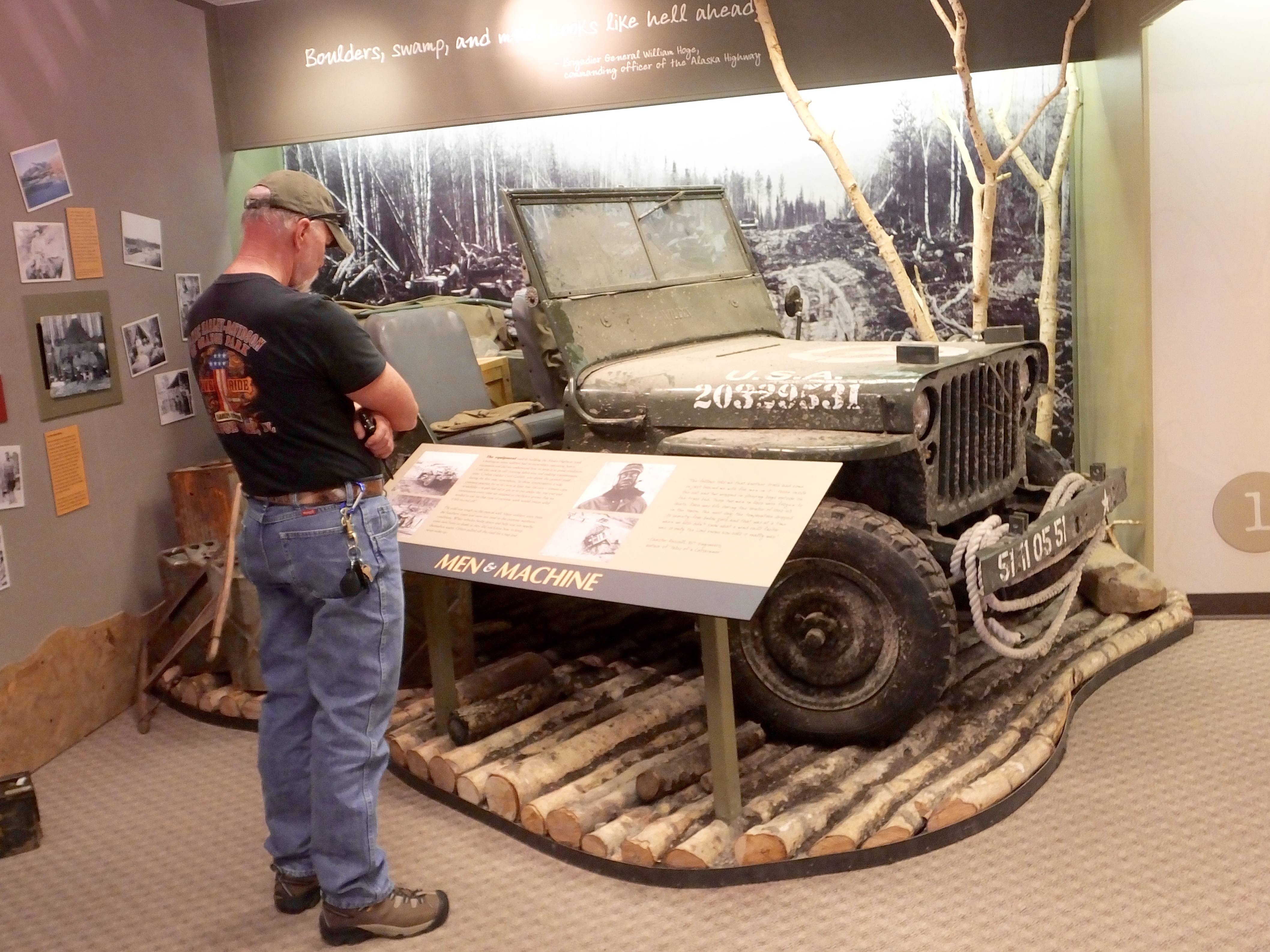 Additionally, a block away, the Chamber of Commerce has created a mini-museum they hope to expand to a larger presence focussing exclusively on the building of the Alaska Highway. Although it only takes half an hour to go through this small collection of artifacts and photographs, it is professionally done and does an excellent job of describing the trial and tribulations involved in building this incredible road. I hope they succeed in their quest to create a more extensive museum to tell this inspiring story that unfolded during World War II.
One other visit today worth noting was to the local art gallery which is housed in a converted grain elevator. Beautifully restored and repurposed, the gallery has three floors of locally produced art, as well as an art studio on the top floor where today young artists were experiencing the childhood joy of finger painting. It’s a great facility and although all the art was not to my taste, much of it was of professional quality. Entry was free but they provide a donation box and as I dropped my offering, I thought about how important institutions like this one are to the identity of small communities everywhere.

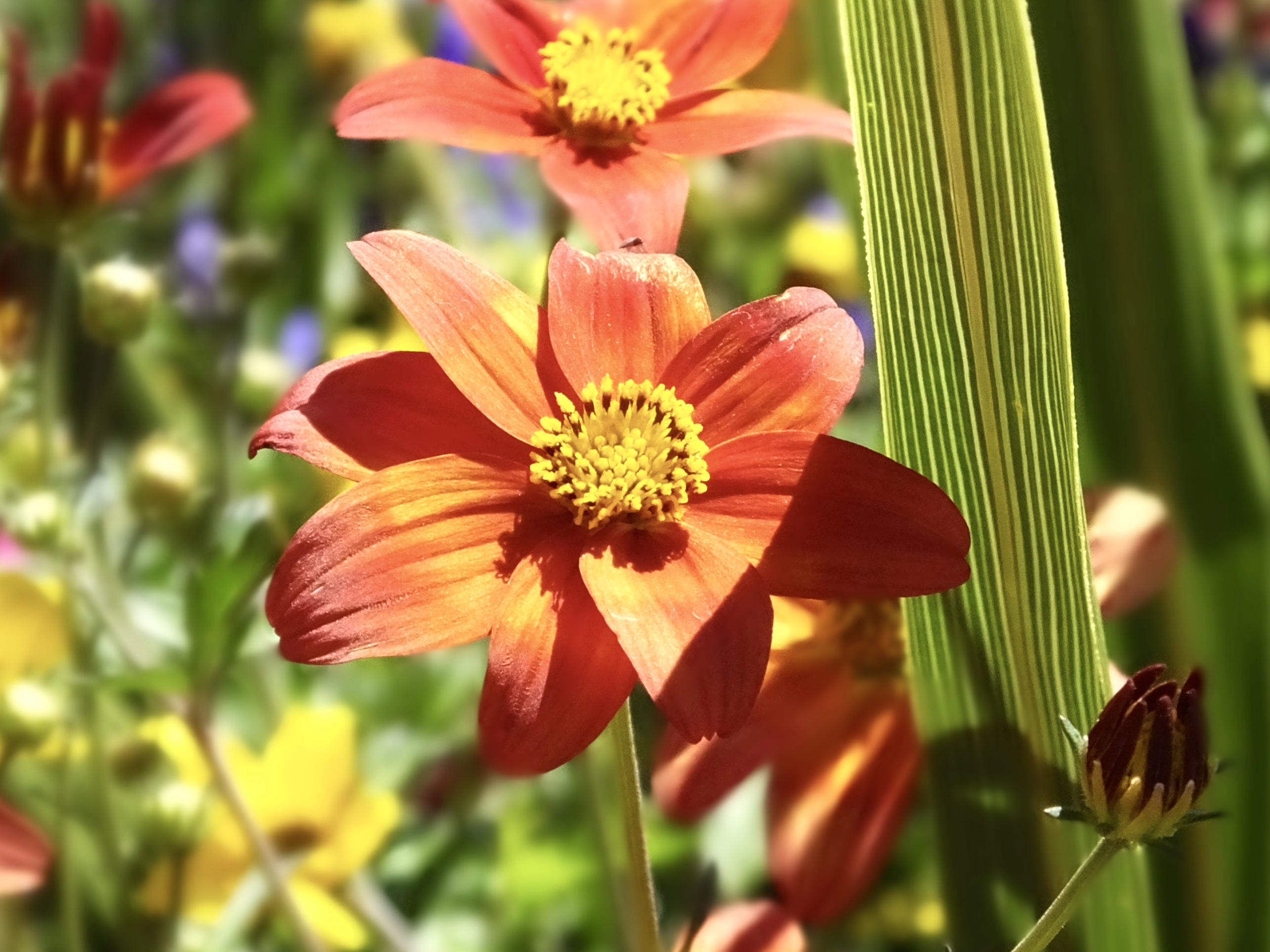
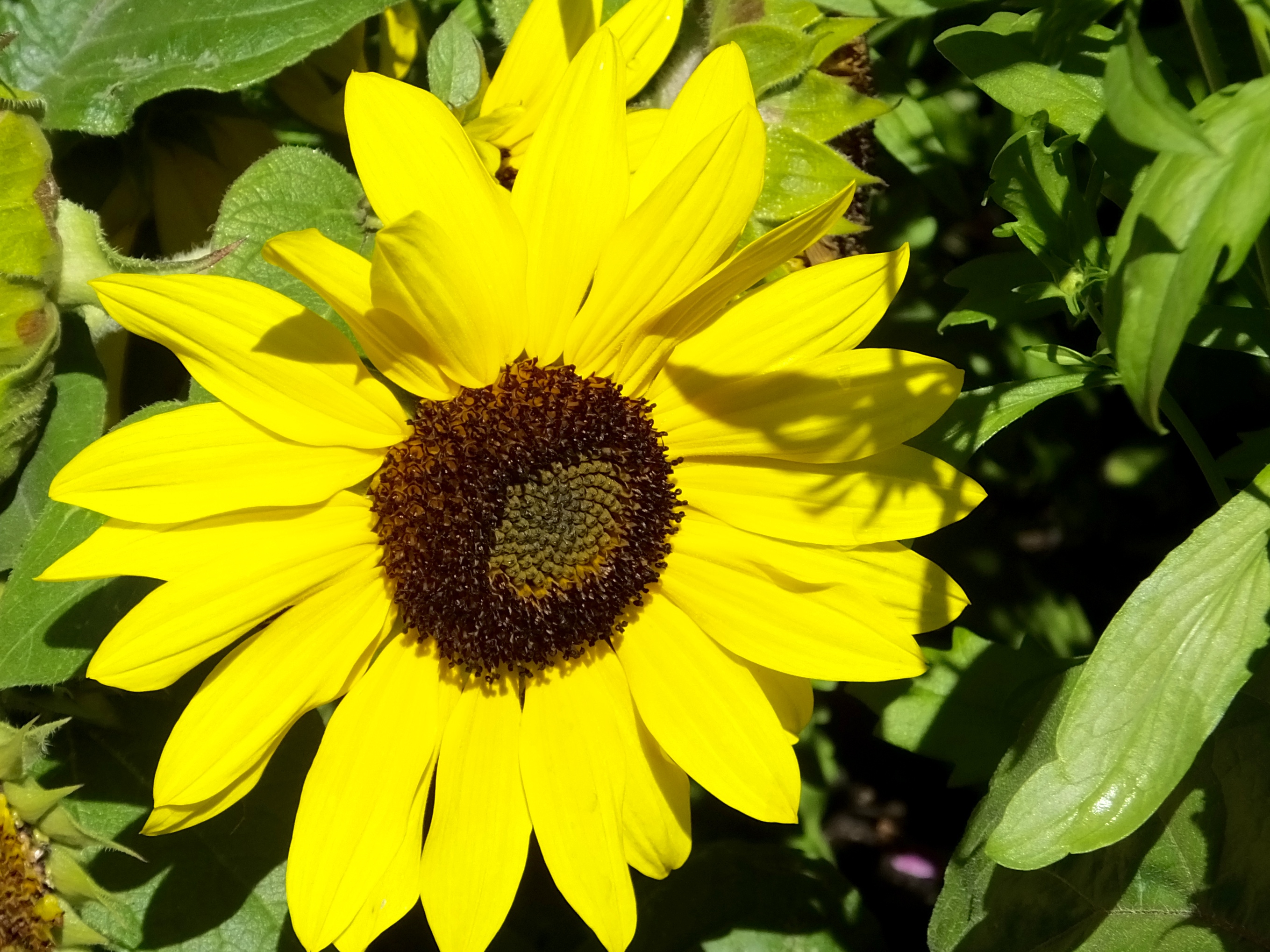
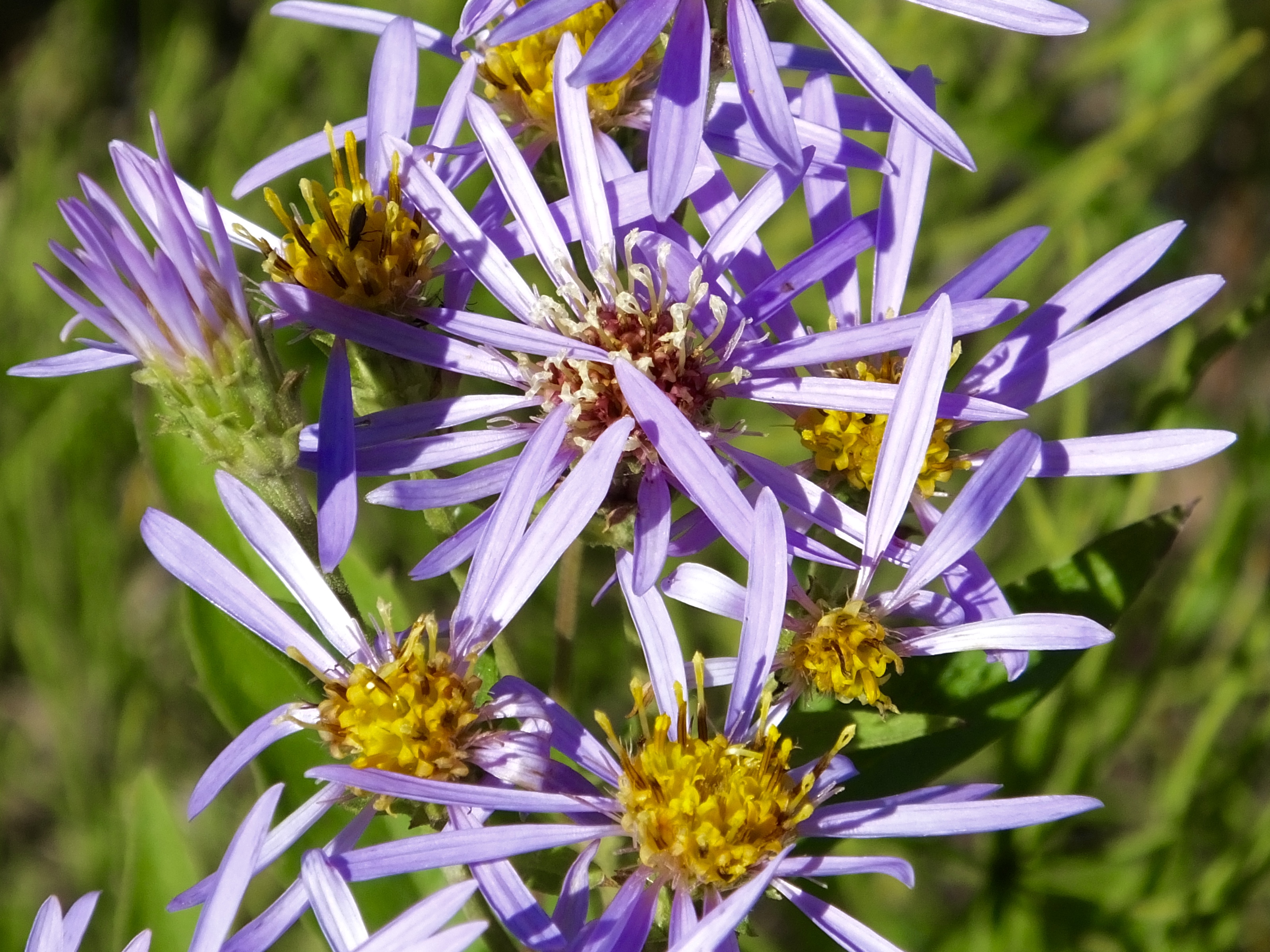
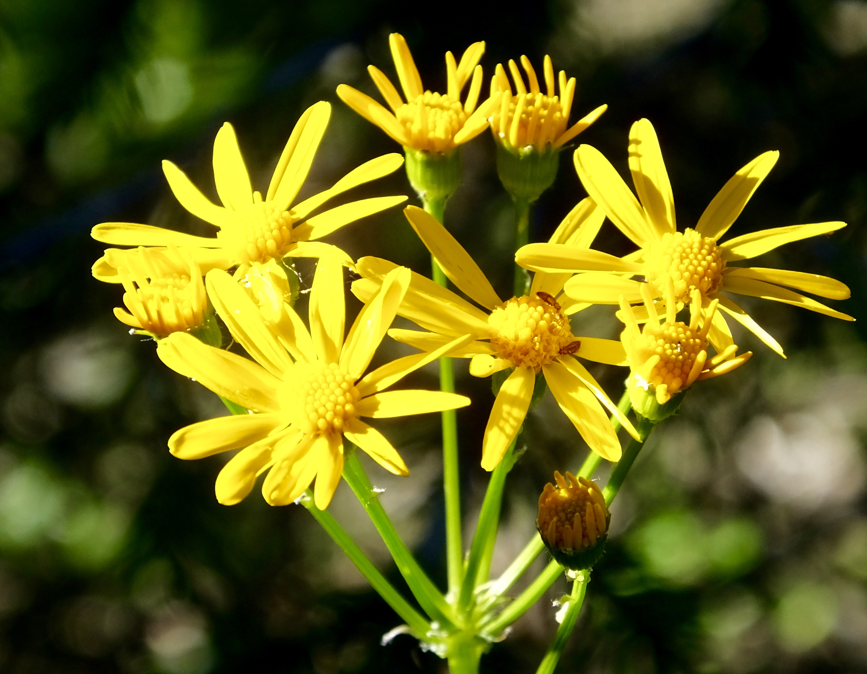
Winters are brutal in this country, but the short summers, filled with 20 hours or more of daylight, are wonderful. I noticed lush fields and deep hay meadows on the ride here, and today, as I looked at the abundance of prismatic flora planted everywhere, I realized what a green thumb and lots and lots of sunlight can produce, even if it’s only temporary. I guess if you live in a cold and stark winter environment for nine months of the year you create as much beauty as you can during the other three.
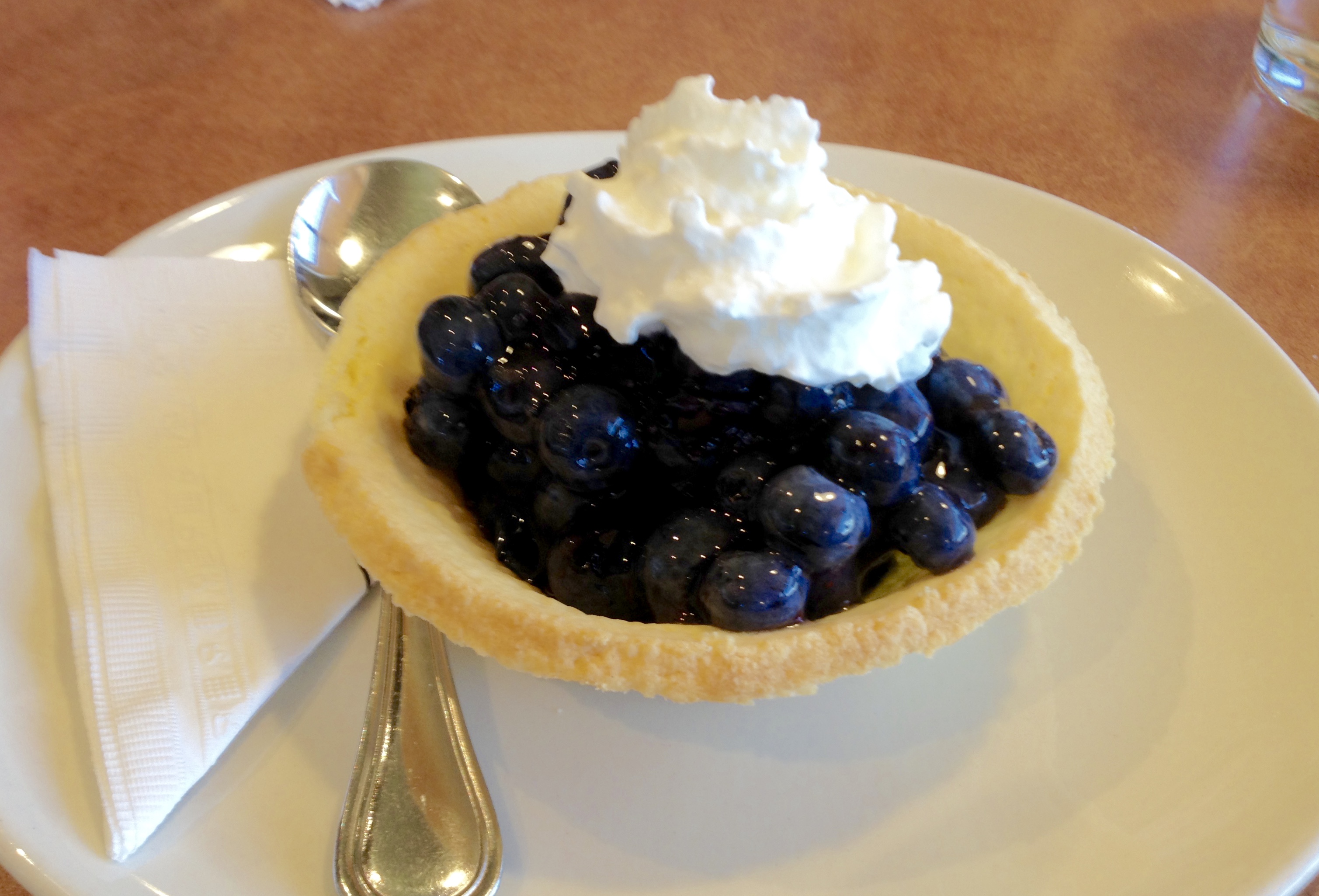 I saw a sign on a restaurant that offered fresh blueberry pie with a burger entree, so we went in. It was unlike any blueberry pie I’ve had before, but the blueberries were absolutely the freshest, sweetest I’ve ever had. What a treat.
Tomorrow we’re back on the road, enjoying the improbable result of the Herculean labors of soldiers 75 years ago.
Day 10: Two Grizzled Bikers
After several hard, long rides in the past week, we looked forward to today’s ride from Hinton, Alberta, to Dawson’s Creek, British Columbia, a distance of only 285 miles over lightly traveled roads. We got off to a relatively late start, at least for us, pulling away from the Husky gas pumps at 7:50 with tanks full of $4.40 per gallon fuel and wearing heated gear to ward off the early morning chill.
 As we rode west for a few miles before turning north again, we beheld the beautiful Canadian Rockies. We would stay in sight of them most of the day, though we only rode on Alberta highways through smaller mountains and foothills as we skirted the massive mountains to the west.
 The views, of course, remained beautiful most of the day with viridescent forested hills as far as we could see in front of us and bright blue skies punctuated by billowing, cumulous clouds. Even as we moved slightly away from the mountains and onto the plains of northwest Alberta where yellow-topped canola fields and lush hay and alfalfa meadows spread out around us, the fecund fields gave us a pleasing palette to look at as we rolled by.
 When we left the domain of Parks Canada, we joyously left the crowded haunt of tourists behind and, relative to yesterday’s ride, we often seemed to have the road to ourselves. Only two towns between our starting point and our destination interrupted our pace and the Alberta highway department carefully placed warning signs that gasoline and other services would be unavailable for 125 kilometers (75 miles). A leisurely sub-speed limit pace gave us time to stop and see the views and smell the roses (or whatever flowers happened to be blooming nearby).
One of those towns was Grand Cache, otherwise known as the home of the Canadian Death Race. Unfortunately, Mark and I were four days too early for this year’s extreme running event or we could have challenged the 75-mile course up, over, through and down the nearby mountains and canyons. And we would have had 24 hours to complete the course. Darn the timing that made us miss this 14th annual test of endurance and sanity. If you’re interested in participating, check them out at www.canadiandeathrace.com. We did, however, enjoy coffee and a muffin (sorry, no pie) at the local A&W before continuing on our own modest test of endurance and sanity.
 The only downsides to today’s ride were several stops and slowdowns for construction, including one 10-mile stretch that had us parked on the highway frequently when traffic narrowed to one lane while paving took place in the other. But even stops of 10 or 15 minutes didn’t result in long lines of cars and trucks since there weren’t too many of us on the road to begin with.
Not much else to report today.
Oh, did I mention I shot a grizzly?
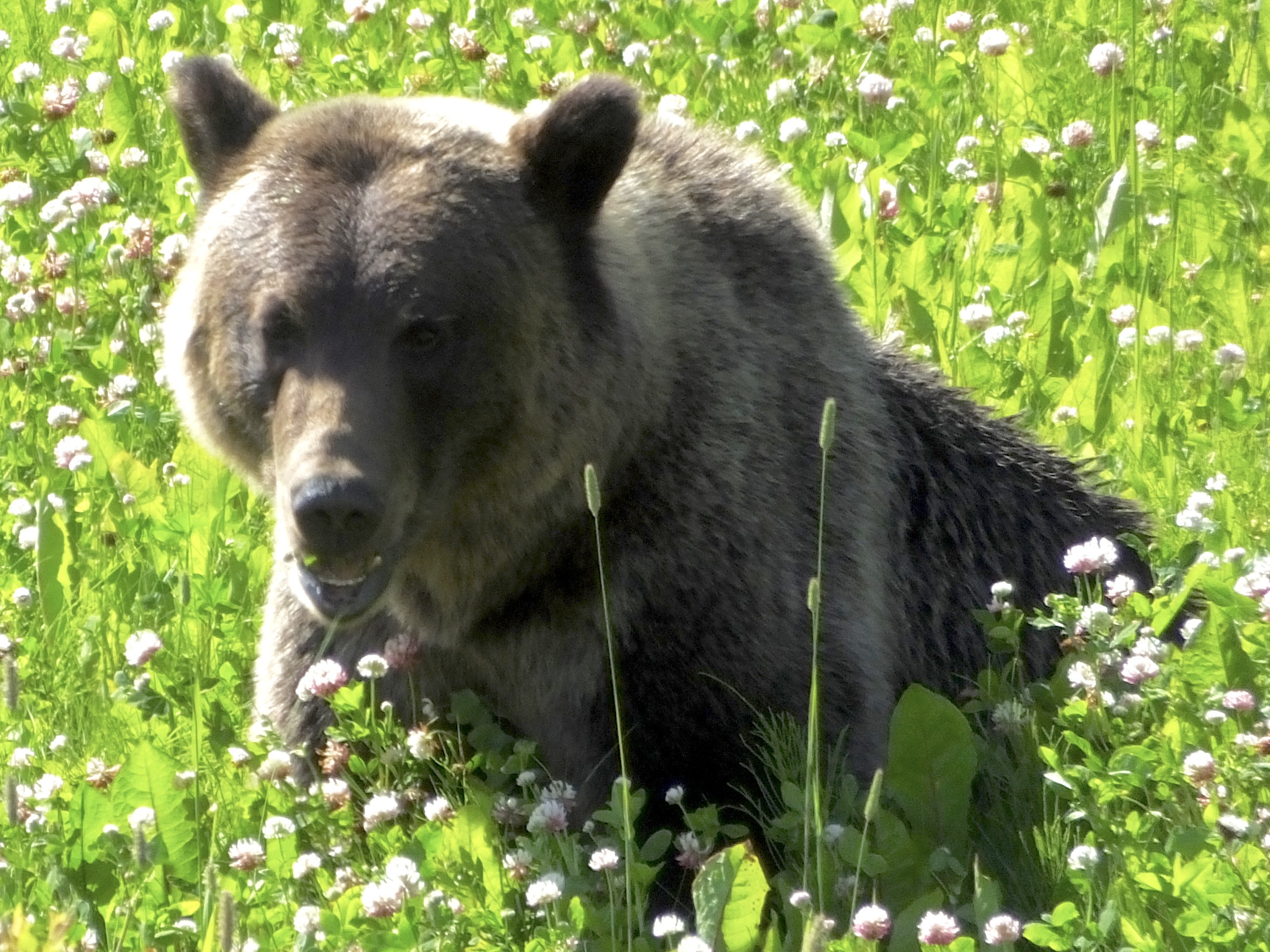 Rolling down the road, I saw a brown lump grazing in the clover next to the road and radioed back to Mark: “Bear, bear, bear. Stopping now.” Even before I rolled to a quick stop I noticed the hump on the bear’s back that marked it as a grizzly or brown bear and not the smaller black bears we had seen briefly yesterday. I grabbed my camera and started shooting, but realized the sun was ill-positioned behind the bear. I needed to be between the bear and the sun.
 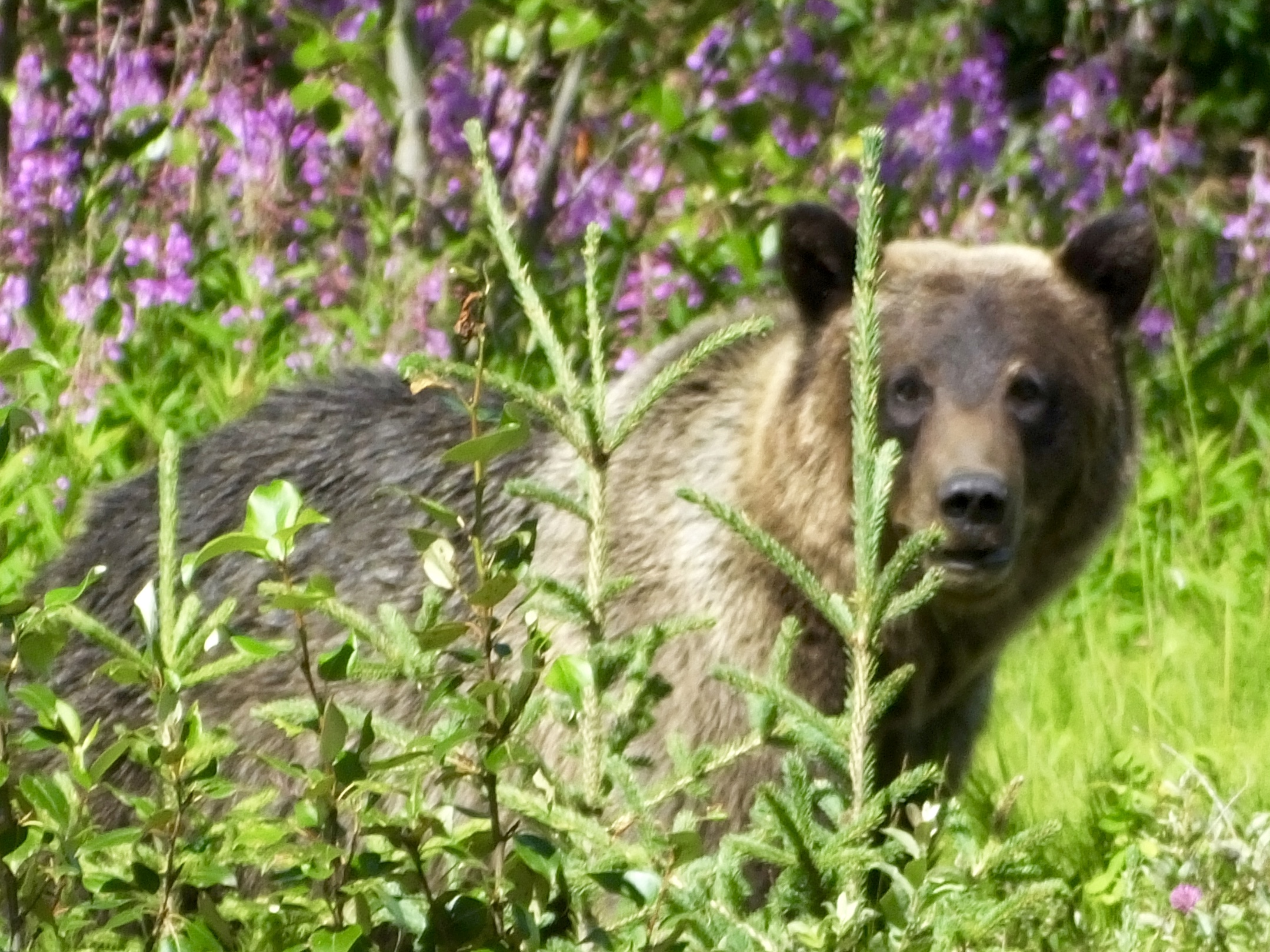 So I mounted up, made a sharply executed u-turn and got on the sunny side of the target for a better photo opportunity. We had the bear to ourselves; no other travellers stopped and most of the few that did go by didn’t even slow down. That was good news and bad news since with no cars around I had no place to seek shelter if the bear decided he (or she) preferred to be an omnivore rather than an herbivore. Consequently I kept a greater distance than I would have liked, but still managed to capture a couple of decent shots.
I think I’ve discovered a new word, or a new meaning for an old word. If you encounter a grizzly bear on the side of the road, you have been “grizzled.” Next I’m hoping to get “moosed.”
Tomorrow is a non-riding day, but much to do in Dawson Creek, “Mile 0” of the iconic Alaska Highway.
Day 9: Spectacular Again
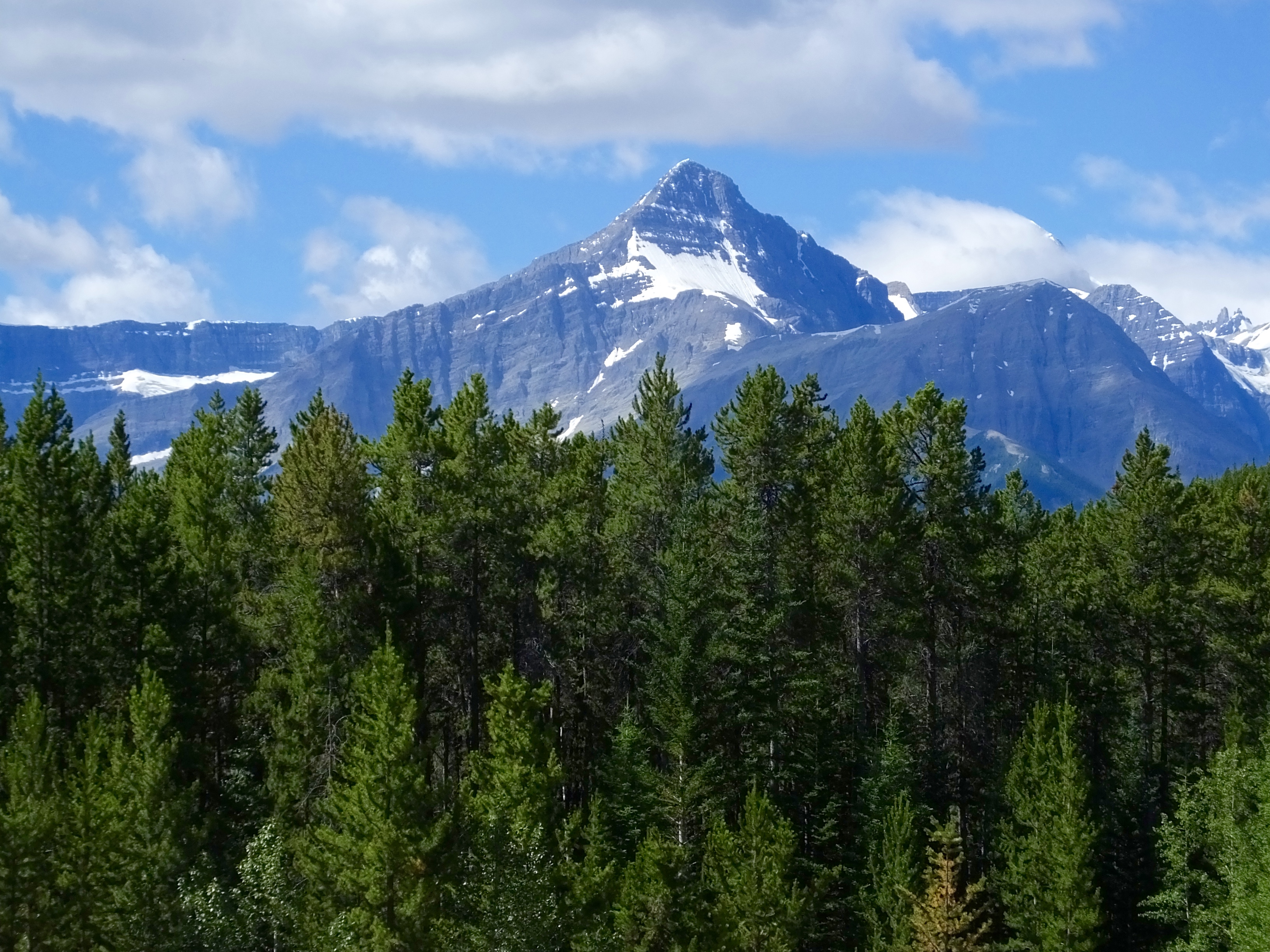 Three years ago when I rode the Icefields Parkway in Alberta with Marilyn on our way back from Alaska, I searched for a word to properly describe what we beheld and settled on “spectacular.” It still is. Blue skies, aquamarine lakes and rivers, multiple shades of green aromatic trees carpeting the valleys and encroaching on the mountainsides, and soaring, rugged, rocky mountain peaks definitely deserve”spectacular.”
 In three days we’ve covered four of the most special motorcycle roads in North America, and for me, and I think for Mark, today was the best of all. Not because it’s a technically challenging road; it’s not. There aren’t many sharp twists and turns that floorboards fear. But the scenery is second to none. The powerfully rising Canadian Rockies, a relatively young mountain range as those things go, bulge skyward in jagged peaks of gray, yellow, red and brown, often spotted with crystalline white snow accumulated over centuries or remaining from last winter.
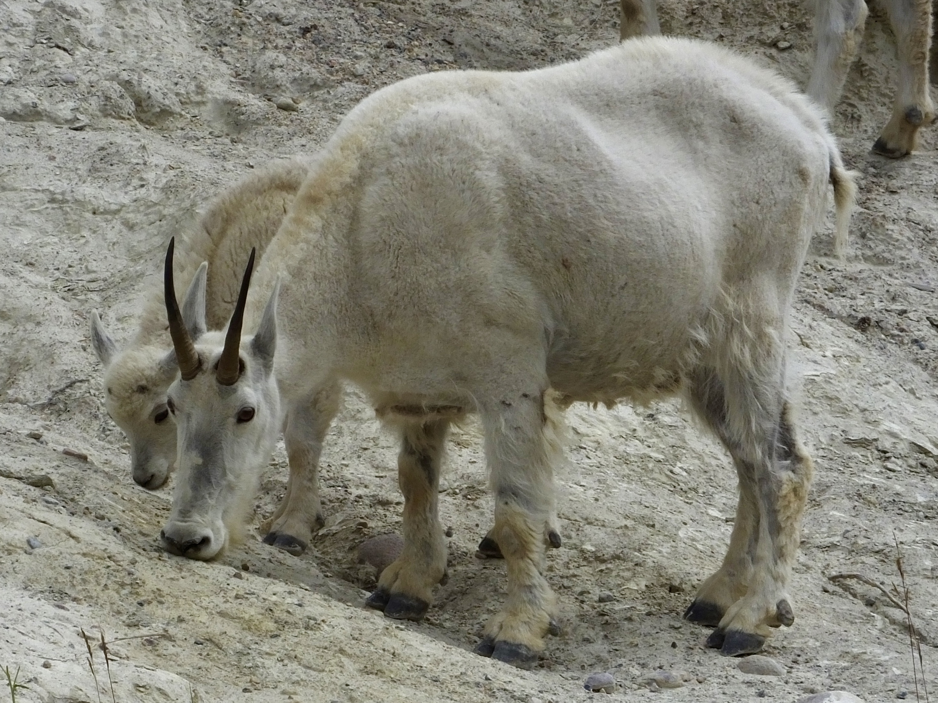 On two separate occasions we passed black bears, but the first bruin was not in area where I felt safe stopping on the road (though that fear didn’t enter the mind of the idiot driving an RV who stopped for his own special photo shoot), and the second one was already being hounded by a platoon of plaid-clad touristas menacing his privacy. I think I’ll have plenty of time to shoot bears in the Yukon and Alaska, photographically speaking. But I did stop when the opportunity to capture a couple of mountain goats grazing in the dirt, looking for minerals their goaty bodies need.
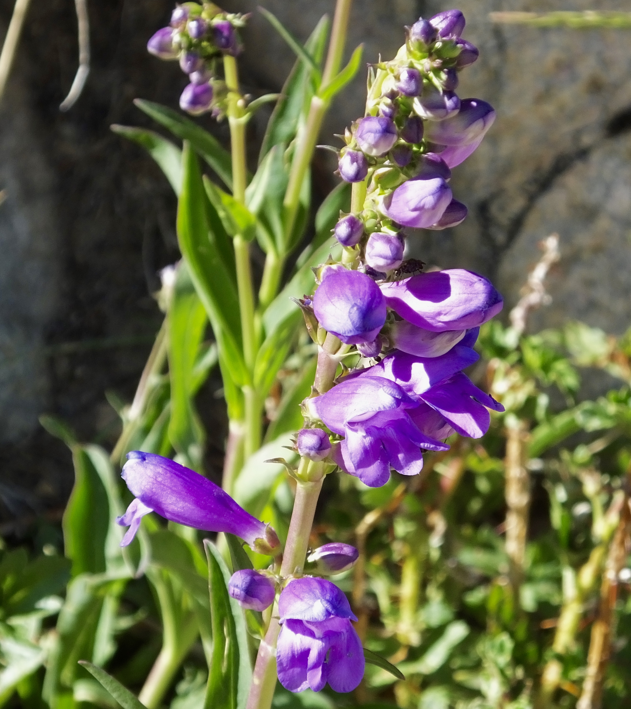
 It’s difficult to ride these mountains and not have, as Mark said, a sense of personal insignificance against a backdrop of so much power and majesty. We count our lives in years; the mountains count their lives in hundreds of millions of years. We are here for an instant, their time is nearly limitless. They are vast, yet they show off the smallest flowers with exquisite perfection. Last year’s Great Adventure literally took me around all the Rocky Mountains from New Mexico to the Yukon, yet I can’t sate my mountain craving.
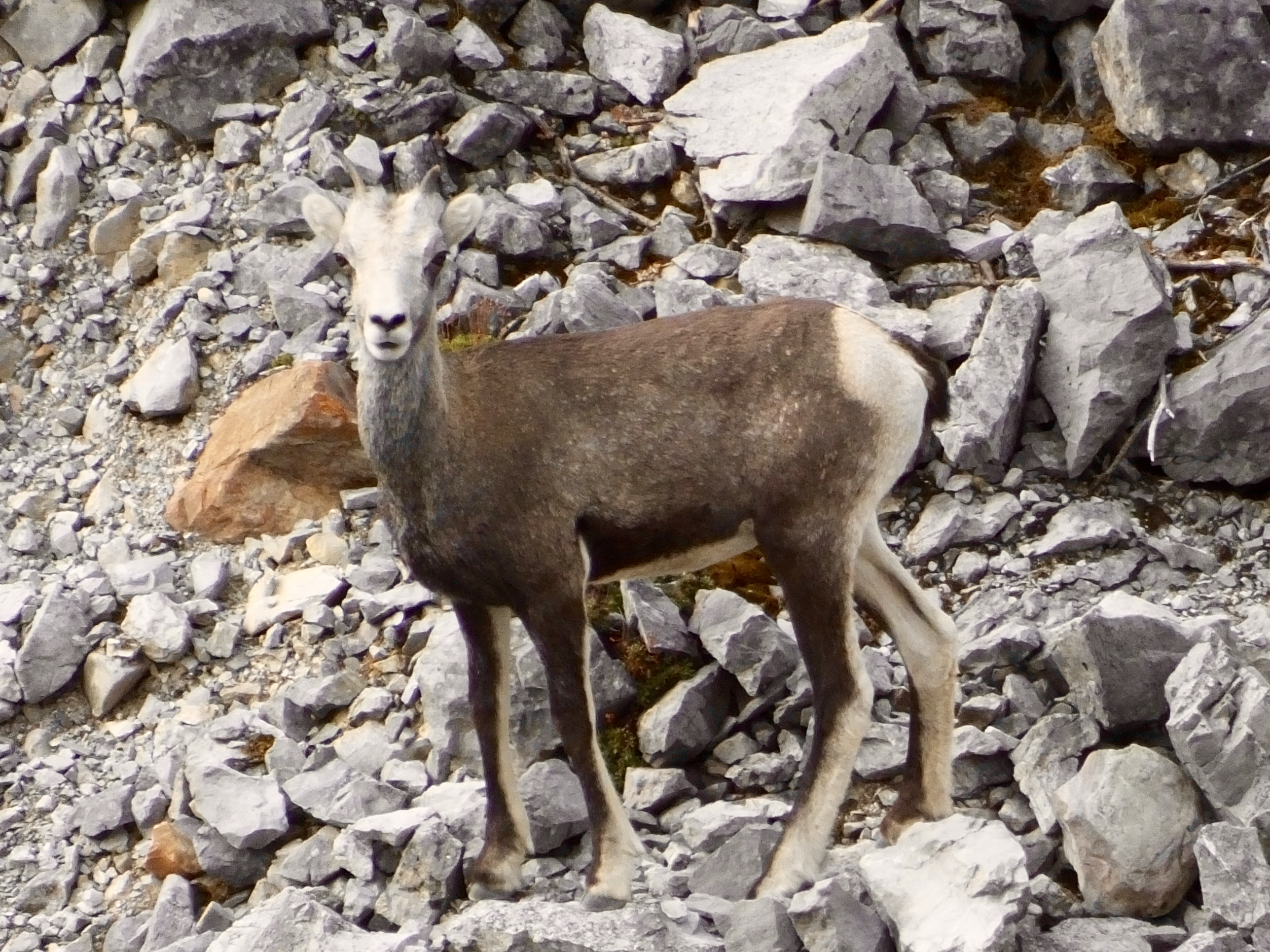
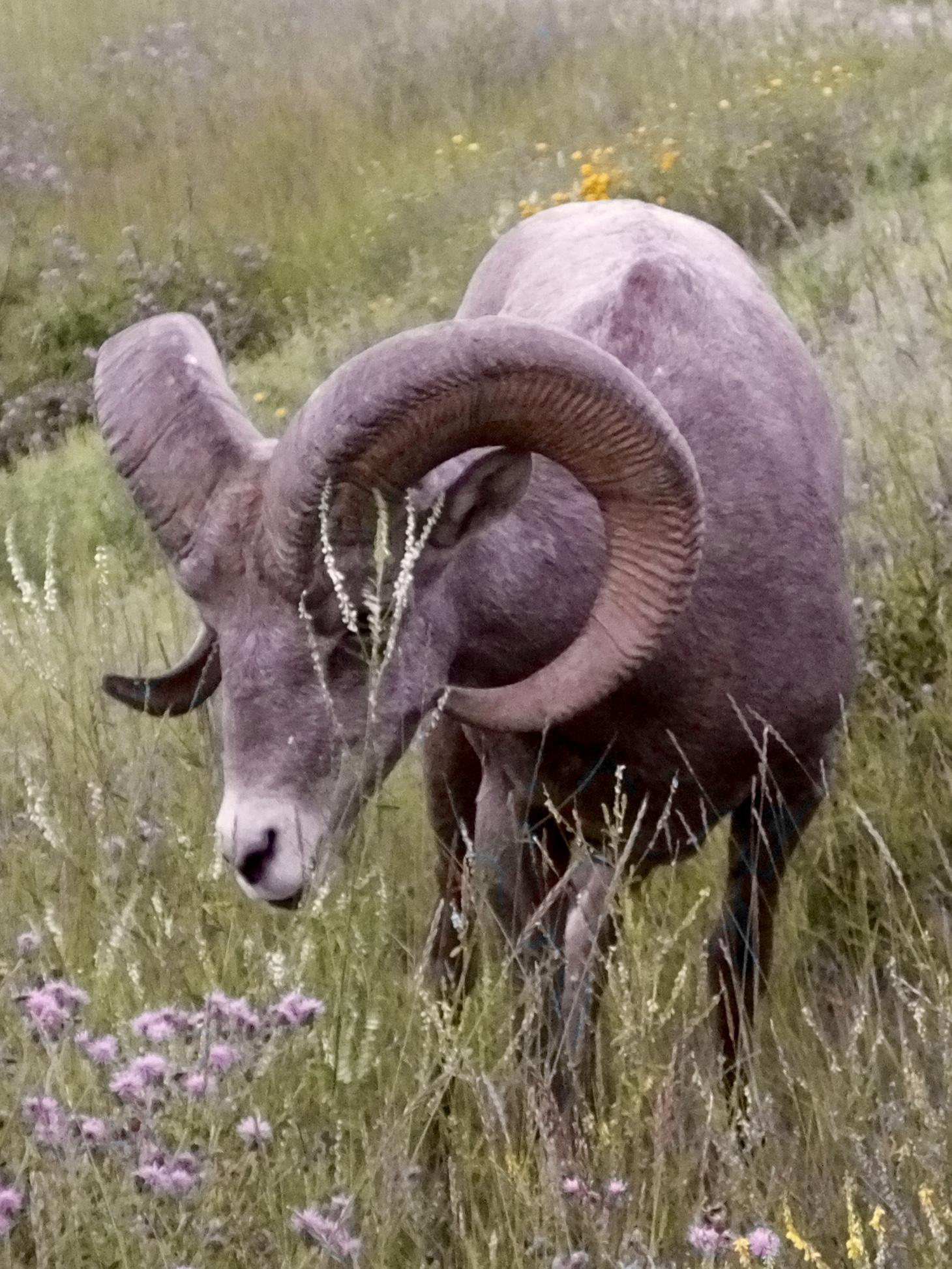 Sunday in Radium Hot Springs generally gets off to a slow start. About the only things moving at 6:30 this morning were two fuzzy old motorcyclists and a small herd of a dozen Rocky Mountain Sheep grazing in the grass a couple hundred yards from our motel. No gas stations open, no restaurants open. But to the relief of our caffeine-deprived bodies, a coffee house that also baked some fine blueberry muffins had a small yet inviting “open” sign in the window. By 7 a.m. we were topping off with petrol and motoring into the mountains.
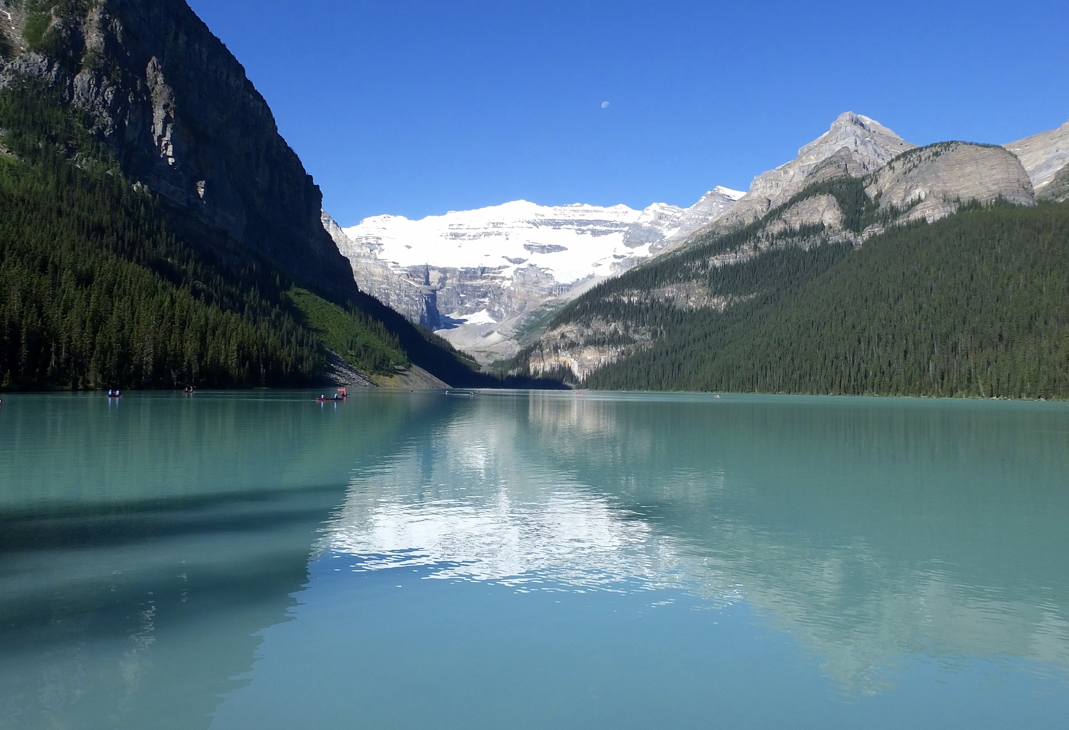 Once we crossed the first range of mountains, our initial stop was Lake Louise, a return trip for me and a first for Mark. We marveled at the lake’s beauty, wandered through the five-star Chateau Lake Louise, converted some U.S. currency to colorful Canadian bills and a few Loonies and Toonies, paid our senior-discount fees to the Parks Canada fee collectors, and were on our way north on the Icefields Parkway.
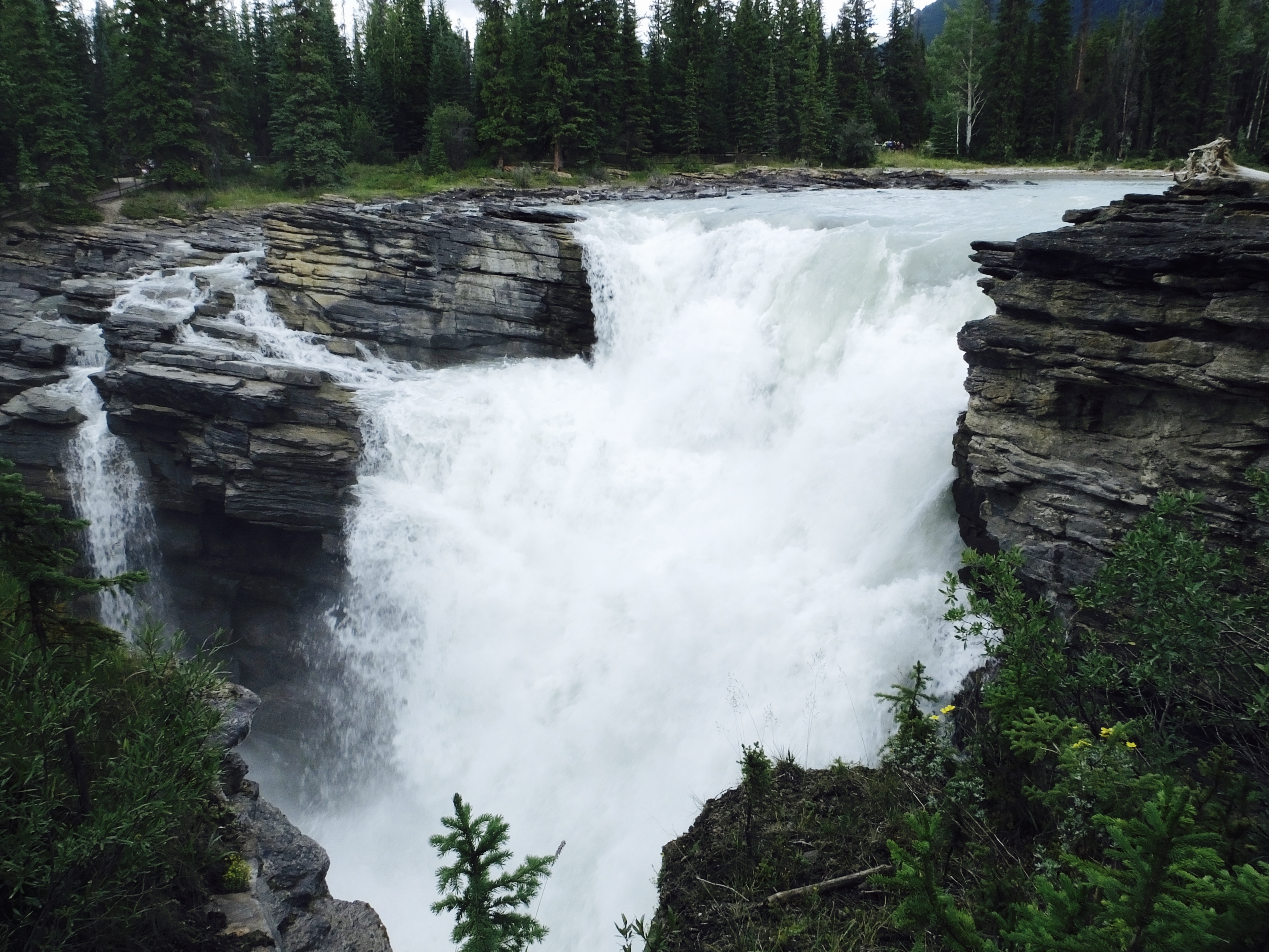
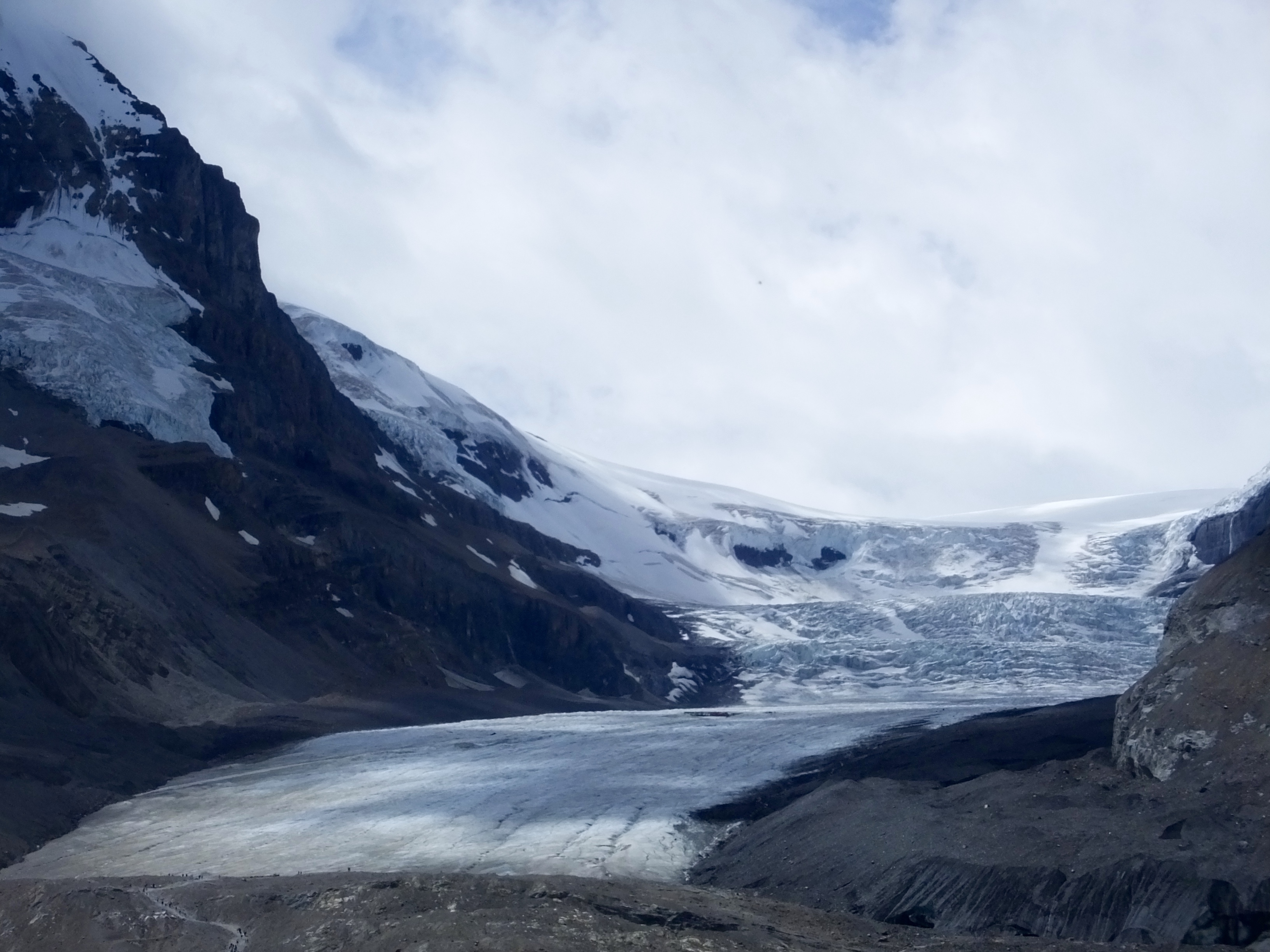 It’s hard not to stop at every scenic viewpoint on the Parkway, but doing so would stretch a four-hour ride into a four-day ride. We judiciously tried to take in the sensual scenery while keeping a wary eye on the tourist hordes, some of whom were combining an annual vacation with driving school. Several stops along the way for pictures and leg stretching sufficed, including a pause at the Icefields Center at Athabasca Glacier and another halt at Athabasca Falls where an army of ant-like tourists crawled over the landscape and into our camera shots.
 We were in heated gear all day, with temperatures at times dropping to the mid-40s though rising to the mid-60s as we finished our ride under storm clouds with occasional sprinkles. But we were never uncomfortable and certainly preferred cooler temperatures to the ovens we rode through getting to Canada.
I’m reminded as I try to write and try to insert pictures that the deeper I get into the backcountry, the less reliable are the internet connections I need to post the blog. I think this one will get done sometime tonight, but there may be days when I’m unable to post. Please bear with me. I’m trying.
Tomorrow we head for Dawson Creek and the beginning of the Alaska Highway.
By the way, don’t forget to click on the pictures for larger images.
Day 8: A Long and Winding Road
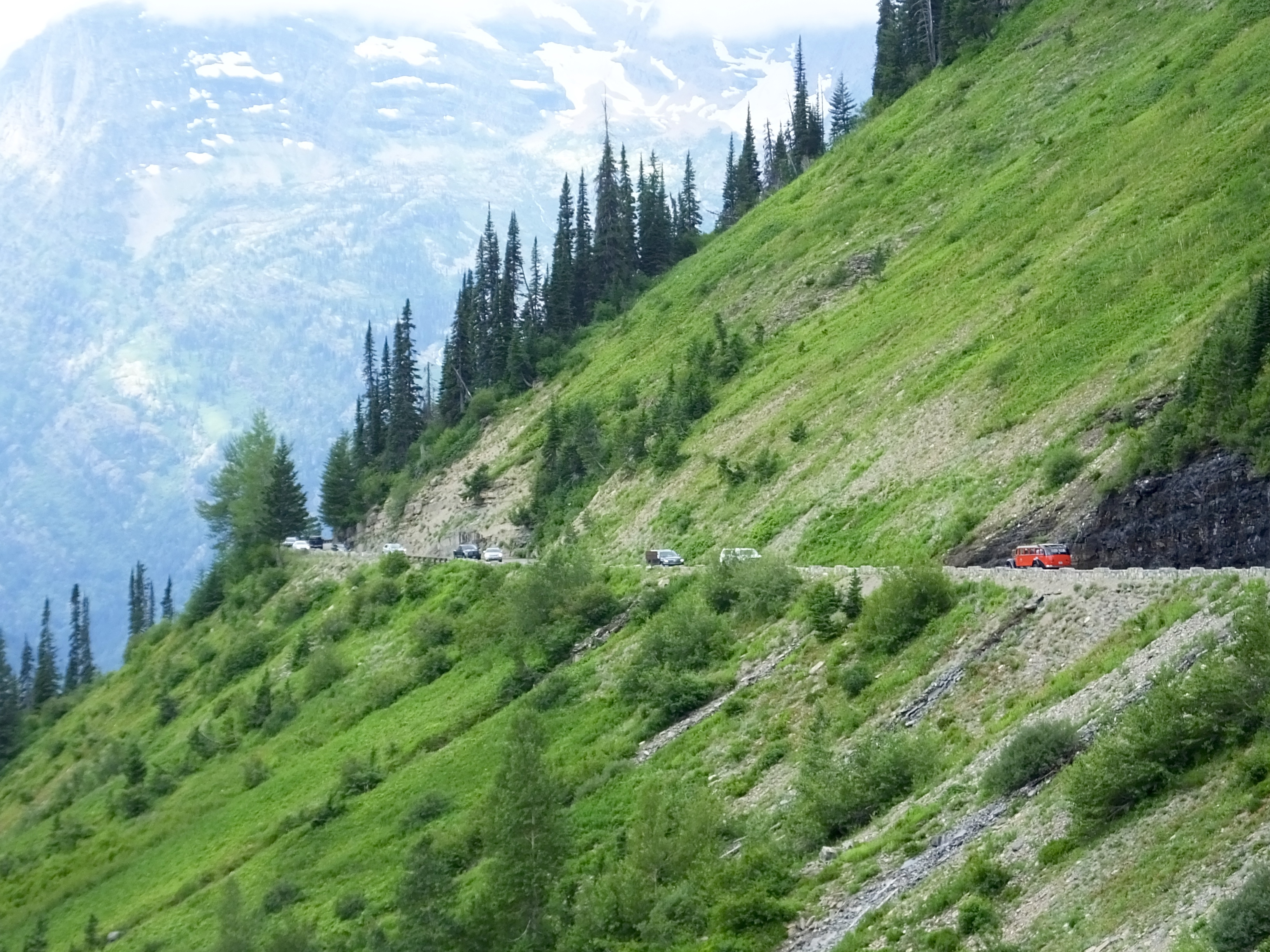 A long but enjoyable stop in the middle of the ride on Going to the Sun Road in Glacier National Park made for an 11-hour day that began a little before 7 a.m. and ended about 6 p.m. in Radium Hot Springs, British Columbia. I’m a tired old motorcycle rider.
I’ve said before that these Adventures are always better because of the people I meet along the way. Today’s special person was our waitress at breakfast. Michelle seated us and, noticing our Harley-Davidson motorcycle T-shirts asked what we rode. “Harley-Davidsons,” I said. “No shit, Sherlock,” she responded. “What kind of Harley do you ride.” And it got better from there. Michelle rides a Harley Davidson Road King, we learned, and as the conversation progressed we also learned that she retired after 25 years as an ER nurse, spend time in the Navy and was the first woman to go to ETN (Electronic Technician–Nuclear) school, and knew many of the places Mark knew since she worked on a Sub Tender. Mark and I agreed that Michelle would be fun to knock back a few beers with and trade sea stories.
 The clear highlight of today’s ride was motoring up and over Logan Pass in Glacier National Park on the Going to the Sun Road. (Note: The picture at the top of the blog was taken on the Going To the Sun Road on the Fourth of July in 2009 when Marilyn and I did a two-up ride across Canada and in the Rockies.)
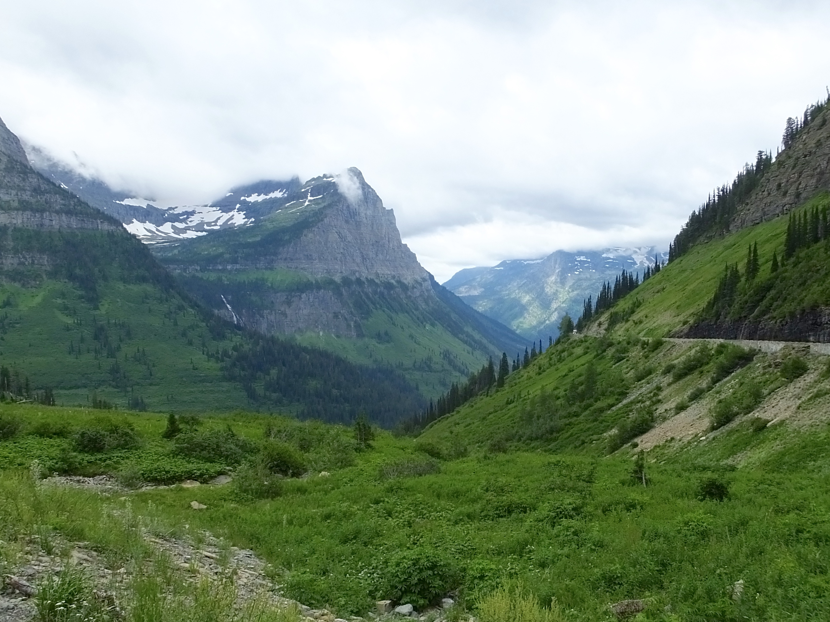
As expected, we saw absolutely stunning views, despite the cold gray clouds and misty overcast sky hiding many of the tall peaks from view. But the peaks we could see and the lush valleys below them were some of the best scenes so far this trip. 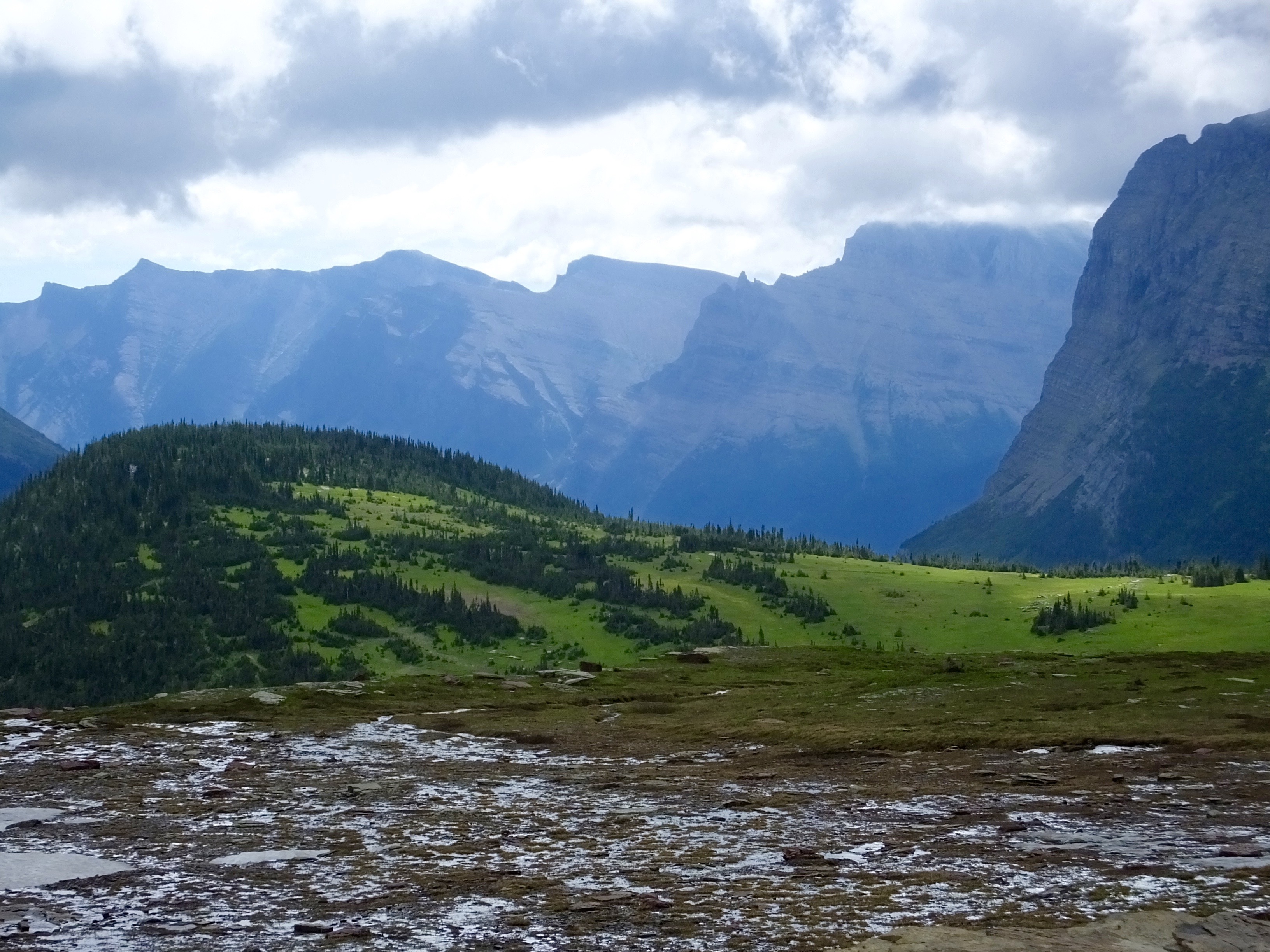
The road and the visitor’s center at Logan Pass were crowded and the slow traffic on the road made an aggressive ride impossible. But we stopped at the visitor’s center and went for a one-hour hike in 48 degree weather up and down the mountain side. As clouds slid effortlessly from peak to peak, the changing views made the climb worthwhile and when I focused my attention on the distant soaring peaks, I could ignore the throngs of troublesome tourists.
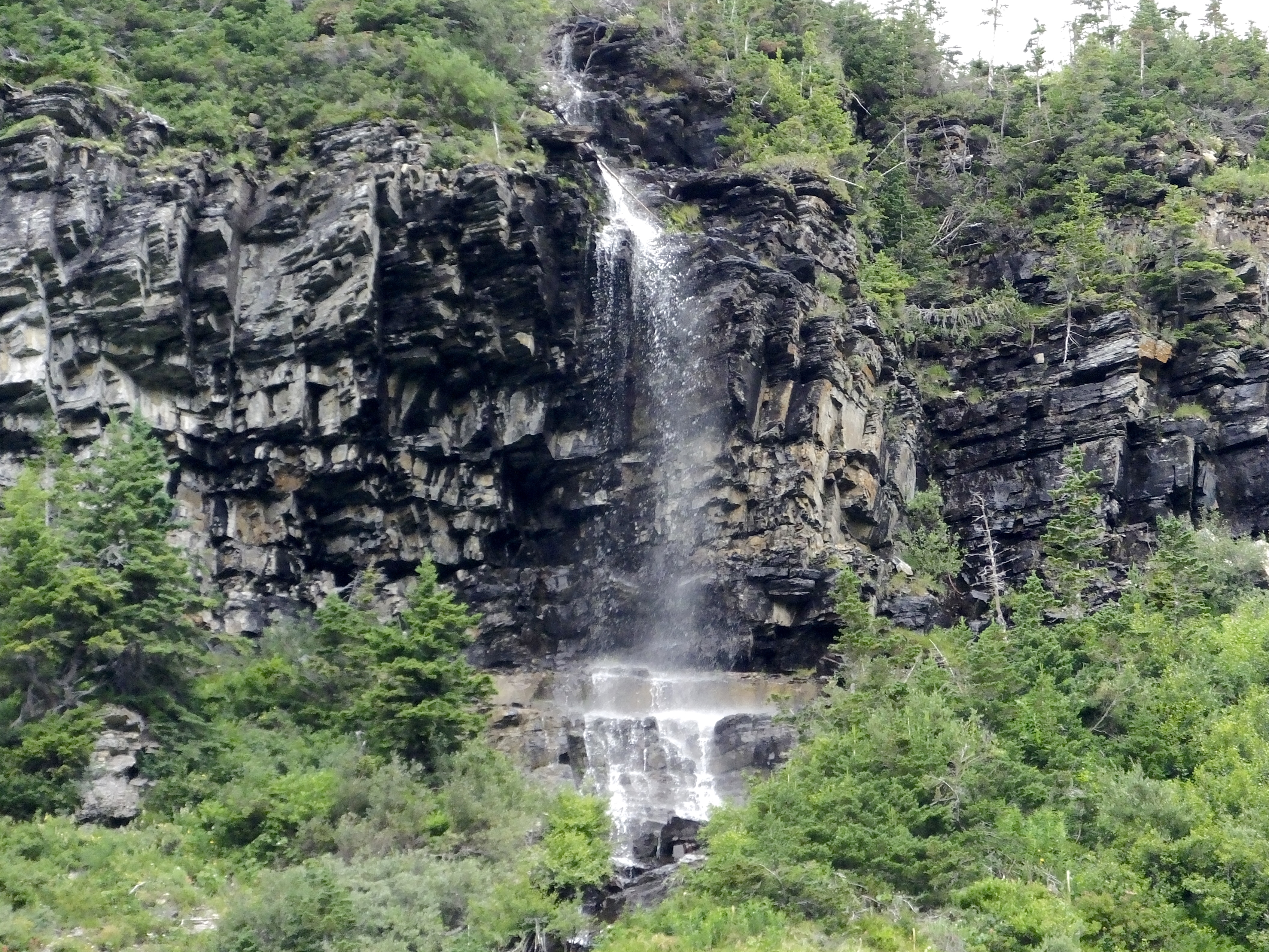 We made another short stop on the way down from the Pass to look at a beautiful valley below us and a cascading waterfall above us. Then we plugged in our heated gear again (weren’t we roasting just two days ago?) and followed the cars in front of us until we reached the end of a very beautiful, long and winding road.
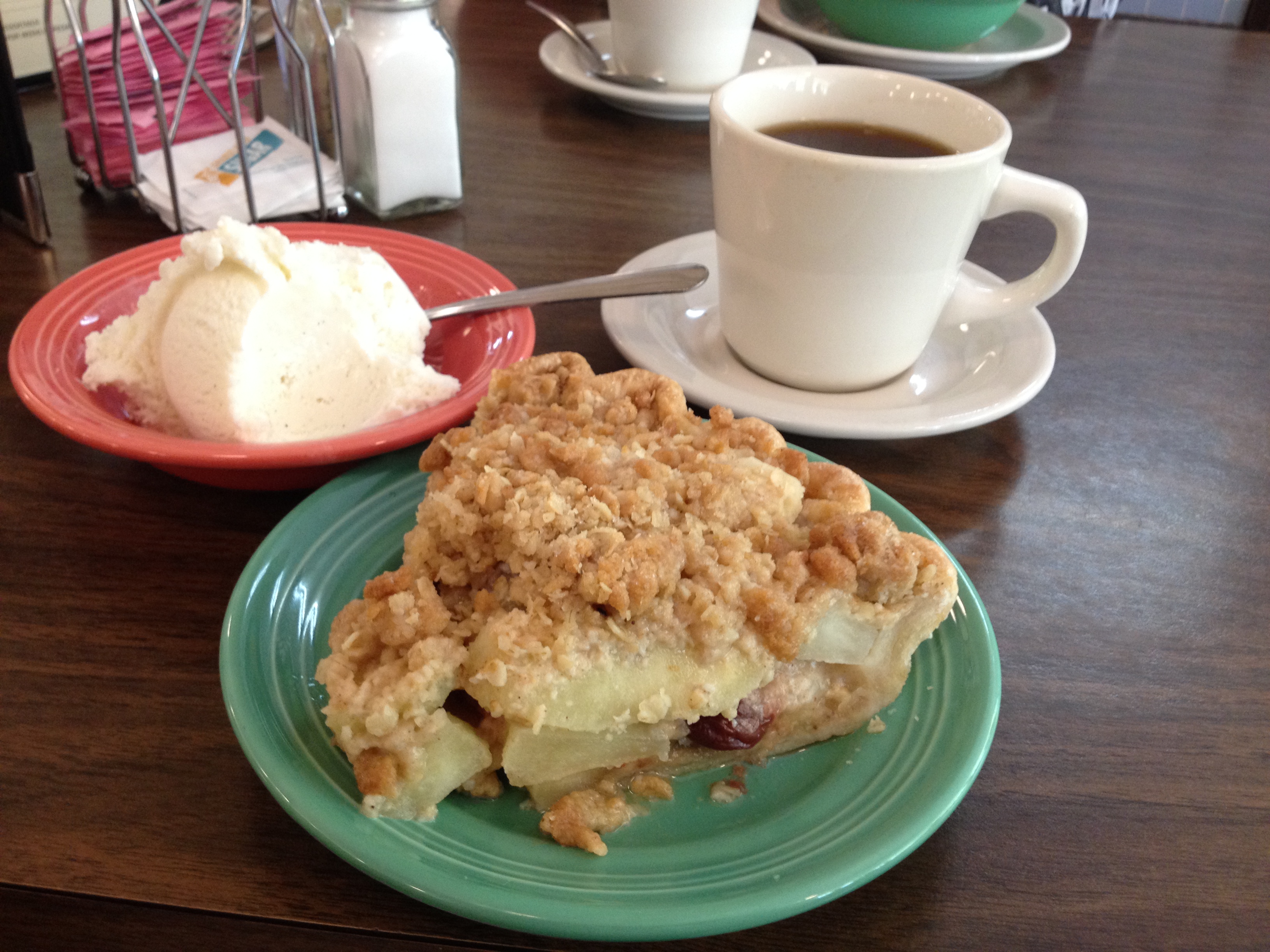 As we left Glacier National Park at West Glacier, we stopped for lunch and I found yet another unique pie: Apple-Cherry-Walnut. Outstanding pie made fresh on the premises. Warmed up with a scoop of ice cream, it was another perfect lunch. Mark opted for more traditional fare.
We continue to have minor GPS problems. Routes created last winter that looked good on the computer screen seem to confuse our Garmins which keep demanding that we make u-turns at via points. We’re getting used to ignoring the pleadings of the person in the Garmin and just going where we know we should be going.
About 3 p.m. we left the land of Uncle Sam and crossed into Maple Leaf country. This was one of the smoothest and shortest border crossings I’ve had. “Where’re you from? Where are you going? Bringing in any firearms or other weapons? Have a nice day.” Immediately I started converting kilometers per hour to miles per hour in my head to make sure the Mounties wouldn’t mount up and chase me down.
If a road can be more spectacular than the Beartooth Highway or the Going to the Sun Road, it’s the one we’ll be on tomorrow as we go north through British Columbia and Alberta on the Icefields Parkway in the heart of the Canadian Rockies.
I’m tired and frazzled now, but by tomorrow morning I’ll be ready to get on the road again.
Day 7: A Day Adventures Are Made Of
 Today unfolded with most of the ingredients motorcycle Adventures are made of. We had 10 hours of hot and cold, wet and dry, windy and still, ubiquitous road construction, various animals, and, of course, unbelievably gorgeous scenery. Oh yes, and pie. In short, it was a great end to the first week of Alaska Redux.
Shortly after we left Cody at 7 a.m., we turned onto Chief Joseph Scenic Byway and shortly after we began the climb up Chief Joseph Scenic Byway we encountered road construction with severely reduced speed limits, one-lane roads and dirt bypasses that required a pilot car. While the construction didn’t last the entire 47 miles of the road, it did include some of the most scenic and exciting motorcycle sections of the Byway. Still, on the sections unencumbered by orange cones and orange-vested flagmen, we had a good ride in perfect, early-morning weather.
 The Chief Joseph Scenic Byway intersects with one of the iconic motorcycle roads in America–the Beartooth Highway (U.S. Route 212) that traverses Wyoming and Montana and peaks at 10, 977 feet at Beartooth Pass. First opened in 1937 (but much improved since then), this road has some of the greatest switchbacks, twisties and scenic views available on a paved road. But at nearly 11,000 feet the temperature can easily drop to below 50 on a day like today and the winds at the top make the cold even more chilling.
  We no sooner reached the Beartooth Highway than both of us donned heated jackets over our thin warm-weather shirts. Properly attired, we enjoyed the ride, stopping frequently to stand in awe at the amazing views.
 At one popular viewing site we chanced upon a group of Germans touring on motorcycles and Richard-from-Stuttgart noticed that Mark wore the same HOG vest patch he did, and we struck up a conversation. Turns out he was formerly in the German army and had been at the same base where my brother Jon had been stationed and the hometown of my sister-in-law Ulla, Wildflecken. It’s a small world, even when you’re in Big Sky country.
 After several stops in the 30-mile ride on the Beartooth Highway, we finished the morning in Red Lodge at the Red Lodge Cafe where we each had a lunch of coffee and boysenberry pie. It had your fruit, it had your grains–hey, it was a healthy lunch.
Arguing with an obstinate GPS that constantly wants you to make U-turns is pointless, so despite protestations from our Garmins, we continued on the roads WE wanted to take. Good thing, too, or we would have missed the herd of 25-30 elk mercilessly munching a rancher’s pasture. Unfortunately, the road was shoulderless and there was no place to pull off and get a picture. But it was fun to watch them watch us go by.
 After a brief run on I-90, we returned to Montana back roads. We watched storm clouds build to the south of us and hoped we would miss any rain. But as we approached yet another road construction project that precluded stopping anywhere, big drops of rain pelted us and kept it up for about 15 minutes. The drop in temperature and the wind chill of a 50 mph motorcycle made for chilly riding, but we knew (hoped) it would be short-lived. After it stopped, we were dry in about 15 minutes, but it was a cold 30-minute interlude.
A beautiful ride through the Lewis and Clark National Forest and then a hot, flat-land finish into Great Falls completed the day’s ride. Like I said, today had a little bit of everything, distinguishing an memorable Adventure from a mere vacation.
 Tomorrow we end the day in Canada, eh, but not before we take on the challenging Going to the Sun Road in Glacier National Park. I can’t wait to get on the road again.
Day 6: Wyoming Adventures
Today marked our second consecutive 500+ mile day, but the trip through Wyoming marked a significant improvement over yesterday’s boring ride across Kansas and eastern Colorado. About half the ride today was off the interstate and on much more interesting state and U.S. highways.
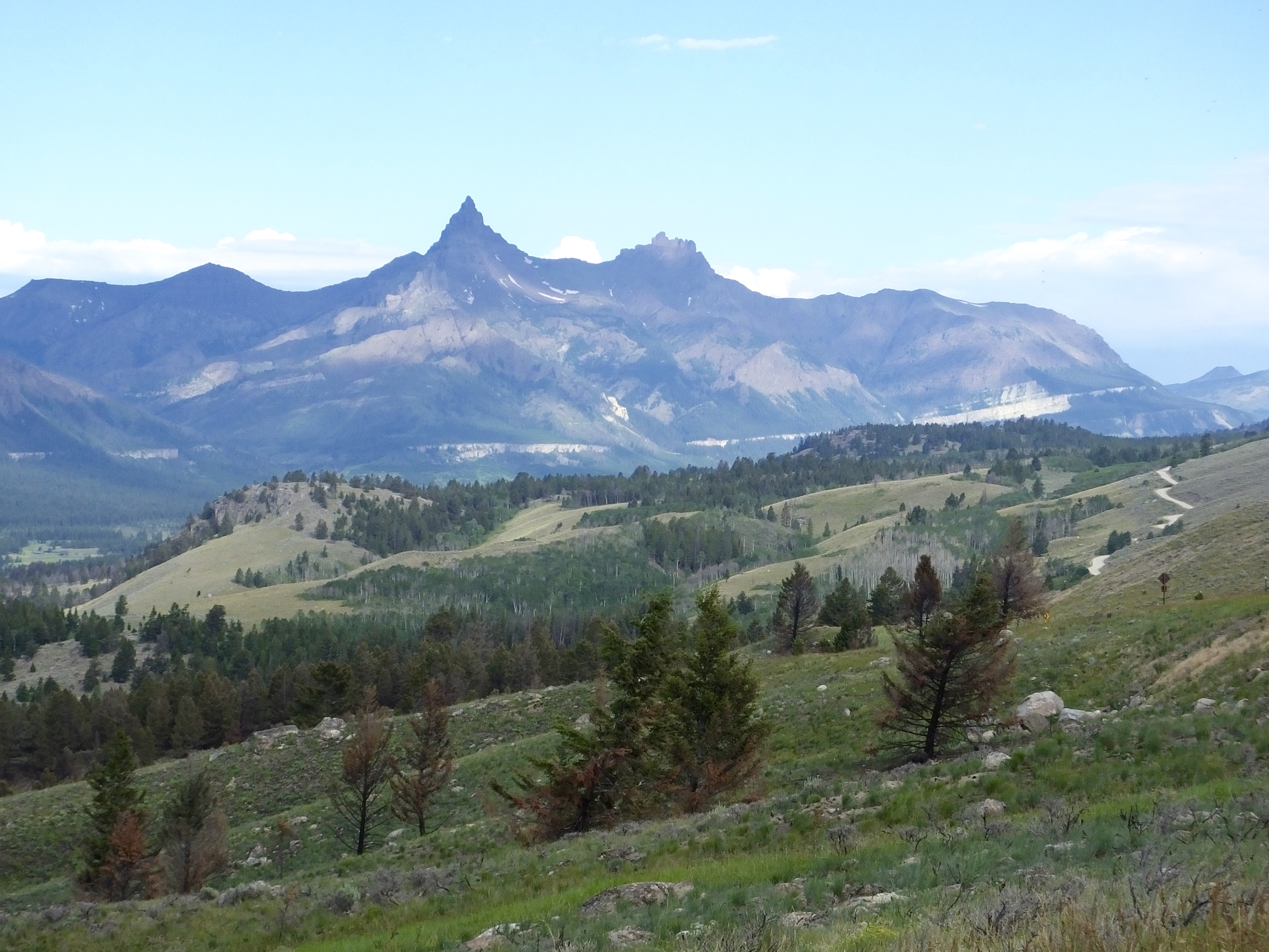
This is how I remember Wyoming: Big and beautiful
We tried to get an early start out of Denver, but by 7 a.m. rush hour traffic had begun and we crawled along the interstate for nearly half an hour before the highway congestion cleared and we could twist the throttles more aggressively. 100 miles to Wyoming then another 150 miles to Casper on the long concrete slab, but at least for the Wyoming leg we were going 80 mph, which happens to be the speed limit on Wyoming interstates.
 A gas stop in Casper and lunch at the Parkway Cafe made a good halfway point, especially the lunch, where Tiffany, the only server in the entire place, was running, literally, to provide service to all the customers. I don’t know why she was solo today, but every business should have an employee like her. Despite the workload, she was friendly and attentive to everyone, and delivered me a hot slice of strawberry pie. I had never had strawberry pie hot before; it was flavorsome and satisfied my pie craving for the day.
Going west out of Casper, we finally left the interstate behind, and followed a two-lane road to Shoshone where our direction took us north. A dozen or so antelope and my anecdotes from my Wyoming past crackling over the CB offered the occasional distraction from the road which seemed to be constantly under construction. 70 mph, 45 mph, 70 mph, 45 mph, 70 mph, 45 mph, and on and on. There can’t be any unemployment in Wyoming–everyone’s busy tearing up the roads or lining up orange construction zone cones.
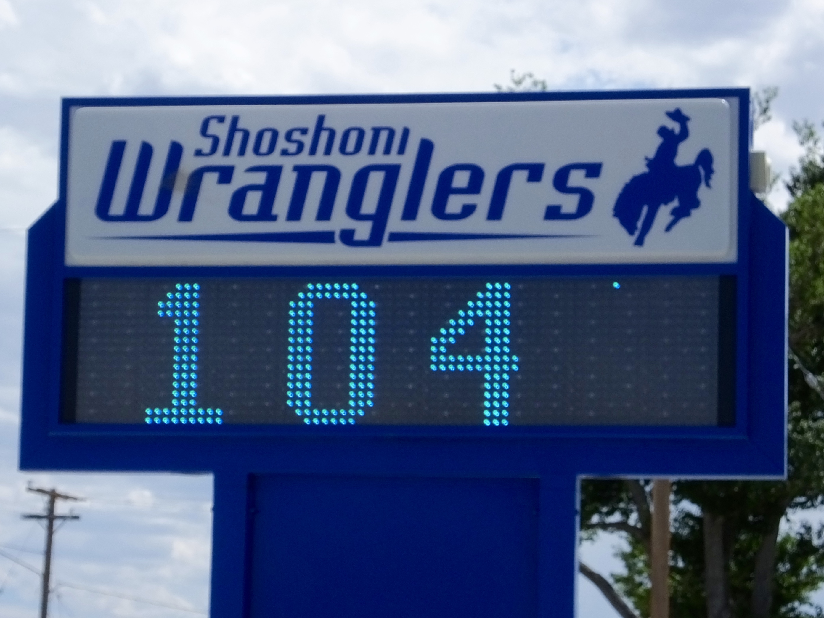 I had expected today to be at least a little cooler than yesterday, but the temperature on the sign at Shonshoni High School dashed my expectations. Maybe tomorrow we’ll cool off as we climb to 10,000+ feet on the Beartooth Highway between Wyoming and Montana.
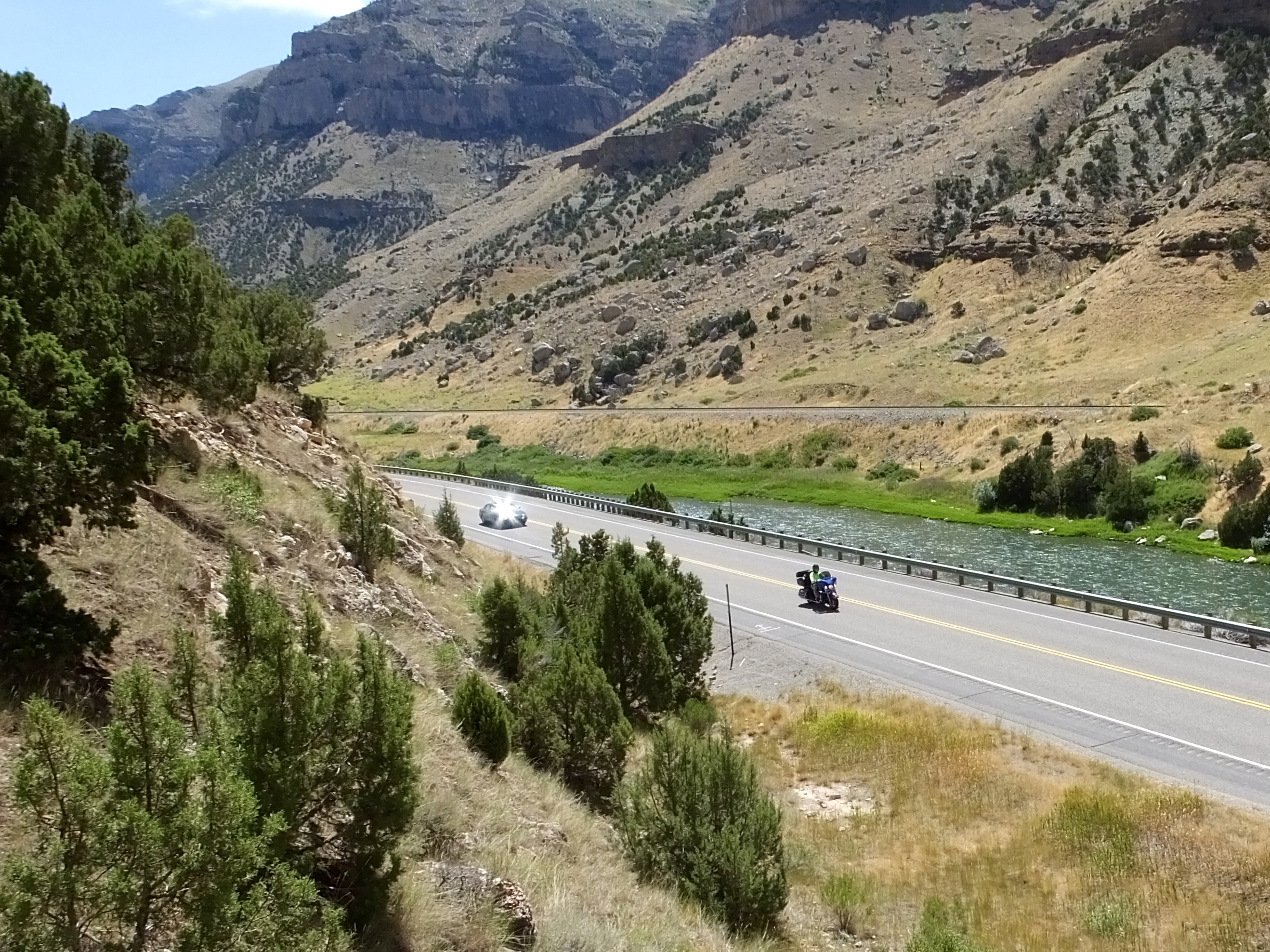 The best part of today’s ride was the run down the Wind River Canyon. Some challenging twists and turns and beautiful views to interrupt one’s focus on the road made this the best ride since we left the Arkansas mountains. I told Mark to hang back at the beginning of the canyon while I rode ahead looking for a good photo op. I pulled over at a wide place in the road and decided that an even better view the intrepid traveller could be had by scalingthe canyon wall, so I scrambled a short way up and just as I got to my perch Mark came roaring by. I got three shots off as he sped down the canyon. Then came the hard part. I had to climb down, which was considerably more difficult than the ascent.
  I slowly descended to the roadway without falling and without smashing my camera which dangled precariously in front of me, loaded myself back on the bike and chased after Mark. He had stopped at the next pull out so it turned out to be a short chase. He noted that he was about to come back to look for me to make sure I made it back down to the bottom in one piece.
Several construction zones later we rolled into Cody, checked in, relaxed briefly then had dinner at the restaurant at the historic Irma Hotel, built by Buffalo Bill Cody and named for his wife.
Tomorrow we’re off to Montana and a couple of great riding roads to add to this year’s Adventure.
