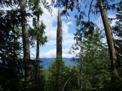
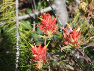
GRMA Day 25: Checkin’ Off My Check List
For anyone who may have read the blog in the last couple of hours and saw the message regarding iPad problems, I think I fixed it. Most of my apps, including Safari, were crashing after being open for a minute or two. I re-installed an upgraded version of the operating system for the iPad and so far that seems to have taken care of it. I’m thankful my motel tonight has a strong WiFi connection.
Now that the iPad issue is disposed of and the GPS glitch (another story) seems to have been repaired, I can move on to today’s blog post.
Remember I said I wanted to shoot a moose and a grizzly to go along with all the animals I’ve photographed on this trip? Well the Animal Spirits must have been listening because today I nailed them both.
 About an hour after I began riding, I saw a big brown thing walking in the weeds on the other side of the road. I slowed down and discovered there was also a small brown thing trotting after the big brown thing. A mama moose and a calf. Eureka! I stopped on the shoulder and mama moose also stopped abruptly and little moose headed for the nearby woods. I got off my bike, casually opened the tour pack and picked up the camera. Then I struck my best “I’m not interested in moose so go about your ungulate business” pose. Mama stood there watching me for several minutes and then, as I’d hoped, baby moose rejoined her from its hiding place in the trees. Mama moved on but was still wary and kept an eye on me as I started snapping pictures. After a few minutes, she decided the woods on my side of the road looked more inviting and crossed the road behind me and, with her young one trailing dutifully behind, sauntered into the woods and out of sight. But I had what I wanted.
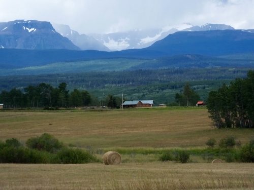
 My moose encounter happened only a few miles before I started climbing the Canadian Rockies to cross the continental divide yet again. I think I’ve crossed it seven times so far It felt good to get into the mountains on good, twisty roads again after traveling on the relatively flat and constantly-under-construction Alaska Highway yesterday. I paused several times to take in the great views and to add a few more mountain shots to my growing gallery.
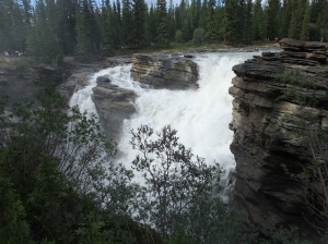
 I also took a small detour into a B. C. Provincial Park when I saw sign announcing the Bijou Waterfall. I was rewarded with a small but very nice cascade in a wooded setting that provided a nice break and good place to take a deep breath and smell the forest.
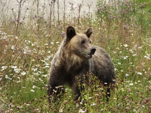
 About 25 miles from my destination at McBride, BC, I saw a couple cars pulled off the road onto the shoulder. My hunting instincts were aroused. Sure enough, a small grizzly, maybe three or four years old, was wandering through some roadside foliage looking for a snack. Once again, I grabbed my camera and took aim at my prey. He was docile and not terribly interested in a two-legged interloper, but when he started walking my direction at one point I indicated to one of the stopped cars that they may have company soon. But the young griz changed course and wandered around for about 10 minutes going into and out of nearby bushes, giving me all the shots I needed to check off the remaining item on my photo list.
Now. I know I said I wanted a grizzly and a moose, and that’s what the kindly animal spirits provided. But I would REALLY like a bull moose with a record-setting rack wading in a lilypad-covered pond and a full-grown grizzly standing fully erect baring his teeth and claws and posing long enough for me to set up my tripod and get about a dozen different shots. Is that asking too much? Yeah, I guess it is and I’m grateful for what I got today.
I finally arrived at a motel early enough in good weather so that I could wash three weeks of accumulated Canadian crud from my once-shiny bike. I had thought about not washing it until I got back to North Carolina, but I couldn’t stand it any longer. Even after I washed it and stood back to admire my handiwork, I realized it’s probably still dirtier than when I would normally wash it at home. Nevertheless, it looks presentable and respectable and the chrome has a little twinkle to it.
Tomorrow I get to make my return run south on the Icefields Parkway. Last week, it was raining much of the time when I made the northward journey. I think tomorrow should provide clearer views.
More pictures I liked from today:
GRMA Day 24: Dusty Roads and a Nice Dam Valley
 The Yukon Territory and British Columbia are big places, but it’s still a small world. Two nights ago when I stayed in the Air Force Lodge at Watson Lake, I met an older couple named Alex and Shirley Jackson from Ontario and had a brief conversation about the Lodge, the roads, where are you going, etc. We said goodbye and parted ways. This morning when I was at breakfast in my hotel, there they were again, and again we engaged in small talk. Shirley mentioned that they had a relative who worked at the museum on the edge of town. “It isn’t Merl, is it?” I said. Why yes, she said, Merl is Alex’s cousin. For those who followed the blog when Marilyn and I went to Alaska two years ago, Merl was the man who started the Museum and who told me all about his antique car collection. Click here to link to the page where I discussed the Fort Nelson Museum and my encounter with Merl. The picture to the right is Alex, Merl’s cousin. It is, indeed, a small world.
(Tap or click on pictures to enlarge.)
The first part of today’s ride was unremarkable and unexciting. In fact, I spent four straight hours in the saddle from Ft. Nelson to Fort John, a distance of about 240 miles. My gas light was on when I got to St. Johns. There were occasional glimpses of the mountains to the west, but most of the time it was forested hills, including one blackened stretch of several miles that had recently burned and still smoldered in places. Oh yeah, and road construction. Dusty, bumpy, gravelly road construction made more unpleasant by hundreds of trucks servicing the area’s oil field boom. I was looking for something better in the final 100 miles of the ride to Chetwynd.
 And I found “something better” in the form of the Peace River Valley, a beautiful farming valley probably carved by glaciers hundreds of thousands of years ago. In the distance I could see the Rockies where I’ll be riding tomorrow. The valley, by the way, will be buried under a reservoir in the next 10 years or so as B.C. Hydro builds a third in a series of dams on the Peace River. It was , for today at least, a lovely one-hour ride through the valley to Hudson’s Hope, which I had singled out as my main stop for the day. Hudson’s Hope has a connection to the old Hudson’s Bay Company and is one of three oldest European settlements in British Columbia, having been occupied by fur trader Simon Fraser in 1805. The town has a small museum, which I visited because I like to get the feel of an area via its past.
 The primary feature near Hudson’s Hope is the W.A.C Bennet dam, the largest earthen damn in British Columbia and one of the largest in the world. Built by B.C. Hydro (a power company) in the 1960s, the generators buried deep below the dam can supply 1/3 of the power needed for the entire province. All the fill in the dam (rocks, gravel, soil, silt) came from a nearby glacial moraine and was moved to the dam site by the world’s longest conveyor belt, nearly six miles long. BC Hydro offer tours of the site, so following my guide Katy (on the left in the picture), I saw where the 10 huge turbines spun by water flowing through 10 huge underground pipes generate a massive amount of power. The dam is 1 1/4 miles long across the top and half a mile wide at its base on the canyon floor and the 500′ deep lake it creates is more than 220 miles long. It was an informative visit and worth the one-hour stop.
 No pie today and only one animal, a deer munching along the side of the road. And I was in prime moose country, I was told. Maybe tomorrow I’ll bag a moose.
GRMA Day 23: Wildlife and the Alaska Highway
NOTE: All pictures today should enlarge when clicked on or tapped on.
The scenery–the mountains, the rivers, the lakes–should satisfy any rider who chews up tires and consumes expensive gas in this part of the world. But when the weather is good and the wildlife cooperates and makes several appearances in a day, riding in the Yukon and northern British Columbia is hard to beat for a two-wheel traveler.
 Today was one of those days. I left Watson Lake at 7 a.m. with blue skies mixed in with the clouds and before I had been rolling 30 minutes a red fox caught my attention on the side of the road. Making the most out of my ABS brakes, I stopped quickly and looked back. He was still there, wondering if he should scoot back into the wet grass and brush from which he had emerged. He decided to stay put, much to my delight. The camera came quickly out of my tour pack and, like the Silver Fox I shot yesterday, this red fox stood still long enough for me to practice my growing photo skills. He even advanced several steps toward me and while I was never really concerned, I was surprised that his curiosity was as great as mine. Finally, after a car stopped to see what was going on, the fox headed for the woods and down the road I went.
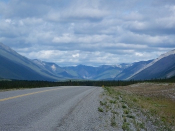 Following the Liard River, the Alaska Highway borders small mountains. But once the highway and the river part ways and the road turns in a more southernly direction, the magnificent Rocky Mountains rise up and fill the landscape. After traveling for the last day in the British Columbia Interior Range, the rugged rockies made for a nice change. I didn’t stay in the mountains all day and by the time I pulled into Fort Nelson, the big mountains were miles to the west. But I’ll be headed that way again tomorrow.
 Along the Alaska Highway near the BC/Yukon border, road signs indicate that bison could be on or near the road, thanks to the recovery of a substantial herd of Wood Bison, a larger cousin of the Plains Bison. Sure enough, as I was riding down the road, I saw a bison, and then a couple more, and then a small group of about 20. Conscious of the several tourist gorings in Yellowstone this year, I parked my bike on the edge of the road, keeping an eye on the grazing group, and grabbed my camera. They seemed not too interested in me, though one of the bulls stood up and took a couple steps in my direction before deciding to go back to eating. I got the shot I wanted and remounted my bike. Not bad. A Fox and a Bison.
 Rolling down the highway, I spotted another black lump on the other side of the road and thought, “Bison.” But being the crack naturalist that I am, as I drew nearer I concluded it was a black bear, not a bison. They don’t even look very much alike. Except they’re both big. I stopped again, though this time a little further down the road. Not wanting to put too much distance between myself and my two-wheeled escape vehicle, I opted for a long-range shot and contentedly counted up my trophies: Fox, Bison, Bear. Oh, but it gets better.
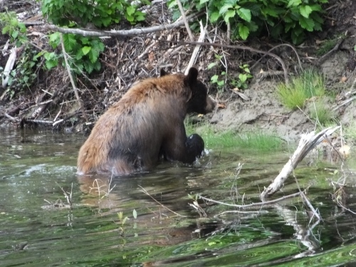
 Less than an hour later, I saw another black bear, though of the cinnamon-colored variety. Able to stop closer this time, I decided the bear was more interested in herbaceous delicacies than Harley riders and I followed him warily for a while as he meandered along the tree line. I even watched as he waded into a small pond/creek and swam to the other side where he finally opted for the cover of the forest. OK. Now the count is Fox, Bison, and two Bears. But wait. There’s more.
 As I reached the Summit Lake area of the Alaska Highway, I spotted some sheep on a rocky hillside. It turns out they’re Stone’s Sheep, a version of the Dall Sheep. Dismounting once again and securing my camera, I went back for a closer look. As I glanced down I got an even closer look at a Stones Sheep than I thought I would; a nice-sized ram was in the ravine near the road and posed for a couple of close-ups while the juveniles on the hillside did their best to strike a pose as well.
What a great day for a non-lethal big game hunt. I probably won’t have another day filled with a mountainous menagerie like this one and I don’t want to seem greedy, but I would still like to find a grizzly and a moose. Maybe tomorrow. Or the next day. Or the day after that.
You never know what’s in store as the Adventure unfolds.
More pictures from today I like:
GRMA Day 22: The Yukon and the Northern End of the Rockies
In 1942 American engineers and servicemen worked under brutal conditions to construct a highway to Alaska so supplies and war materiel could be transported there for shipment to our Russian ally. The U.S. also built a series of landing strips for the Army Air Force to use in its shuttle efforts. Today I rode on the the Alaska Highway which they built and will sleep in a building constructed as barracks for a dozen Army Air Corps officers to use as they shuttled planes and supplies from the the lower 48 to Alaska. It’s the oldest building in Watson Lake and my room is 9×14 with a single twin bed, a small desk and a small TV on a shelf in one corner (an upgrade since 1942). I will share showers with other men staying here tonight just as the pilots did 73 years ago. Women who stay here also have to share their own showers. And all this for only $82.95. It’s all part of the adventure.

The ride from Dease Lake was pleasant and not very long. Under blue skies, at least for the first hour, I motored north on the Cassiar Highway (Highway 37). About 15 minutes into the ride a small black fox crossed in front of me and ran into the brush. I determined to slow down a little and if I saw any more critters to try to get a picture. An hour or so later, I saw a second black fox standing on the edge of the road. I stopped as quickly as I could, about 75 yards from the fox, and shut the motor off. He sat down, cocked his head, perked up his oversized ears and tried to figure out what I was. I dismounted and opened the tour pack for the camera. He remained seated and I fired off a couple shots with my lens fully extended to 1000 mm. I decided to move as close as I could and started walking slowly up the road. He stood and unhurriedly began to saunter back across the road. When I stopped, he stopped. I got to within 50 yards when two cars came up behind me and I had to wave them through. As they went by me, the fox left the road and disappeared noiselessly into the thick woods. But it was a nice encounter while it lasted.
When I got to my room (cell?) I looked for my furry friend on the (slow WiFi) Internet. Turns out he’s not a black fox but a Silver Fox, some of whom, apparently, can have significant black coloring. I think this one was a youngster because he wasn’t very big. If you’ll notice in the picture, the tip of the tail is white and there is some silver visible on his tail fur. The photo would have been better if I had been able to use a tripod; you can’t hold a 1000 mm lens still enough in your hands, especially if it’s overcast and the shutter speed is slow. But, anyway, that was my Wild Kingdom encounter for the day. Pretty cool, eh?

As I drove southeast on the Alaska Highway and crossed the Liard River, I realized that half my Rocky Mountain loop has been completed. I’ve gone from south of Santa Fe, New Mexico, to the Yukon Territory of Canada along the great Rocky Mountain range. I’ve ridden for hours in some of the most scenic country North America has to offer and met some fine people along the way. I’ve seen animals I haven’t seen before up close but not real personal. I have a disgustingly dirty bike with 57,000 miles on it that runs a lot better than it looks.
Retirement is a good thing. I know people get tired of hearing me say that, but I’ve decided to become an evangelist for retirement. It’s my new calling, my new mission. “Hear Me My Brothers and Sisters! Give Up Your Working Ways! Join Me on the Retirement Trip to the Promised Land!” I know I have the advantage of being old which makes retirement easier. But, damn, this is fun.

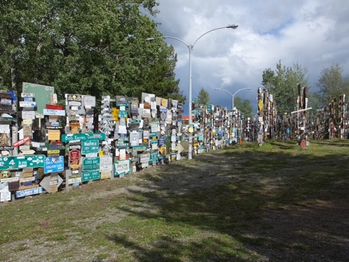
When in Watson Lake, I think its obligitory to pay homage to the Sign Post Forest, where, since WWII, travelers have been adding their names and their hometowns to what is now a collection of more than 100,000 signs. They’ve quit counting, I think. I still haven’t put one up yet. Maybe the next time through, eh Mark?
This evening, I went for a relaxing hike around a small lake near where I’m staying. The only wildlife I saw were some unidentifiable ducks, but it was pleasant to stretch my motorcycle muscles on an hour-long stroll through the woods and along the shore, watching the clouds change shape and a rainbow form following an earlier afternoon shower. I even found some Arctic Lupine, cousin to the flowers that colored my trip through Prince Edward Island, Nova Scotia and Newfoundland last year. It was a peaceful way to end the day.

Tomorrow I’ll spend all day motoring southeast on the Alaska Highway to Fort Nelson. Hopefully, there will be more adventures and I’m sure there’s going to be more awesome scenery.

GRMA Day 20: Halfway Point
A note: For at least the next couple days and maybe longer, I’m only going to post small file-size photographs. The WiFi service is just not strong enough to download the large images. Later, I may go back and post the larger images, but for now I’m going to increase the size of the small ones and not post any full-size images.
Sometime today, yesterday or tomorrow and somewhere on the road in the past couple days, the Great Rocky Mountain Adventure reached its halfway point. I’m 20 days in on a roughly 40-day ride and the trip odometer rolled over 5,500 miles today. Seems like I just got started and now I’m on the inward half of the Adventure. So what do you think so far? It’s been good for me. Beautiful scenery, lots of wildlife, a little hiking and more riding in three weeks than most riders get in a year. And there’s an equal amount yet to come.
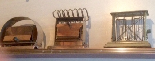
I mentioned the “quaint” Ripley Creek Inn I stayed in for two days in Stewart, and I can’t leave there without a shoutout for their onsite restaurant–“The Toasterworks.” As I understand the story from my waitress who was a niece of somebody, one of the family ancestors had a thing for old things electronic–especially toasters and toaster-related items. I’m not sure how or why it started but over the years he collected maybe a thousand antique toasters and a variety of other small-scale household appliances. So they decided to put them in the restaurant. Everywhere. On the walls. On the tables. On shelves. On the floor. And they’re really cool. Given the progress in toaster technology, most of us have never seen the early ones which were simply hot, coiled wires surrounded by a rack of some sort to hold the bread which usually had to be flipped over to toast both sides. The inn/restaurant is operated by a husband & wife team; he does the inn and she does the restaurant. Next time you’re in Stewart, British Columbia, you should stop in and look around. It’s a unique operation to say the least.
 I left Stewart this morning in a 55 degree drizzling rain. I arrived in Dease Lake this afternoon in a 55 degree drizzling rain. Between those two points I rode much of the time in a 55 degree drizzling rain. Not always, but probably more than half the ride today fits that description. The half that doesn’t fit only had wet roads and 55 degrees. I know there were mountains around me, but most of the time they were topped by a cloud layer that was either very large or a small one that just happened to be taking the same route I was taking. Note to anyone thinking about long-distance riding: Get a good rainsuit and heated gear. Those two items kept me toasty and dry all day. My bike has now gone about 18 days without being washed. Filthy only begins to describe its current condition. Like Little Orphan Annie, however, I hold fast to the belief that the sun will come out tomorrow, tomorrow.
 Today’s road is one that Marilyn and I covered on the return trip from Alaska and not much has changed. Imagine a narrow country road without any yellow or white lines. Now imagine that country road is 300 miles long. That pretty much sums up the Cassiar Highway (Highway 37). There’s some logging and some mining and the occasional recreation site beside one of the many small lakes that dot the area but not much else. Mile after mile of tree-covered mountains that you can sometimes see sticking up above the uncut brush that grows on the shoulder. There’s some wildlife (I saw another black bear early this morning) but there’s so much space up here that they don’t seem to spend too much time on or near the road. Saw a sign warning about caribou in the area but wasn’t fortunate enough to spot one. I had to keep reminding myself that when one is driving on twisty roads one shouldn’t spend too much time looking from side to side.
Tomorrow is another relatively short ride of about 250 miles and it will take me to the northern end of the GRMA at Watson Lake on the north side of the Liard River which most geologists agree is the end of the Rocky Mountains. The mountains north of that are considered to be separate ranges.
Other pictures from today that I liked:


GRMA Day 19: A Semi-Successful Bear Hunt
I’m not a very happy Adventurer right now. I spent an hour writing this post already and when I tried to publish it, it disappeared into the cyber netherworld. Don’t know if it’s the Internet connection, the blog program, or the iPad, but I’ll try again. Writing something a second time never seems to produce the same results. Damn.
NOTE: Pictures will not enlarge.
Rain overnight had ended by the time I left the Ripley Creek Inn a little before 7 this morning, but the sky was gray and low hanging clouds covered the surrounding mountains. It would stay that way all day: cool and damp but not cold and rainy. A decent enough day to go bear hunting.
When I crossed the Canada/US border and headed toward the Fish Creek observation area, I had great anticipation for what lay in store. So did the other half dozen bear hunters who arrived at the site before I did. The number of observers continued to grow throughout the day and by the time I left this evening at 6:15, more than 50 had gathered in hopes of spotting bears.
 Today’s hunt was semi-successful. I watched a half dozen black bears come, catch fish, and go; saw soaring bald eagles frequently fly over the creek looking for a fishy meal, and, equally as important, became acquainted with a handful of Canadians who continued to enhance my warm feelings for the people who live in this country.
The best bear encounter all day was a large black, probably male, that stayed around for about 15 minutes while he looked for salmon, crossed the creek a couple of times, ate berries in the bushes nearby and then slowly ambled off into the thick undergrowth to take a Sunday afternoon nap. Normally, the black bears don’t stay around long because the grizzlies who frequent the same aquatic buffet don’t like to share their food or the space with the black bears and will rough them up if they discover them shopping for salmon at the local fish market. The size of the black that hung around–probably more than 300 pounds made him a little less concerned about the grizzlies. Or maybe he knew what we didn’t: The griz were taking Sunday off. At any rate, it was fun to watch him doing bear things for a quarter of an hour.
 In addition, an immature bald eagle (probably about three years old) flew up and down the creek several times before landing and feasting on the carcasses of salmon bears had cavalierly discarded the day before. Sometimes a bear will eat all of a fish, but other times he’ll take only the parts he wants and leave the rest. The juvenile–recognized by his non-white head–spent a leisurely 10-15 minutes eating, drinking from the river and thinking about going after a swimming salmon before giving up the notion for the free lunch that lay around him. At any rate, he kept the cameras clicking for as long as he was on the ground and the few seconds he was in the air and still visible.
 But maybe the best part of the day was spending time with newfound Canadian friends, talking about who we are, what we do, where we’re from and where we’re going. One of our group that hung together when there was no wildlife activity was an excellent amateur wildlife photographer who plied his avocation with a $6,000 Nikon camera and a $4,000 lens that probably wouldn’t fit on my motorcycle. Gary, who was a retired Victoria fire fighter and current employee of a mining company, shared his substantial photography skills with several of us who are still challenged when it comes to the finer points of modern cameras. His advice will no doubt make me a better photographer as I look for images to break up the text on these blog pages. Two women friends were on a three-week quest to photograph BC wildlife in their rented Jeep and, like me, they were frustrated at not seeing a grizzly today to round out their extensive list of sightings and shootings over the past two weeks. And an Alberta couple learned new photography tricks and, after conversations with some of us who have traveled in this area altered their itinerary to take in recommended routes.
Canada/Yukon/Alaska is a vast territory, but in some ways its like a small town with very long streets. Because there are so few roads to travel and towns to visit, everyone, it seems, has been to the same places, hotels, and restaurants, or will be going there soon. “Have you been to the bakery at Haines Junction?” “Oh yeah. Best cinnamon rolls on the road.” Or “When you get to the Northway Inn don’t expect much, but the owners are very nice. And get gas the night before because when the station opens its two pumps at 7 in the morning there will already be a line of RVs and trucks.”
When I get “on the road again” tomorrow, there’s a chance I’ll see some bears along the way, according to folks who traveled the same roads in the past few days. I’ll try to stop without irritating the bears and get a few more pictures, especially if the forest wayfarers are of the grizzly variety.
I’ll try to add pictures to this tonight if I can. If not, I’ll put them up when I find a suitable Internet connection.
Watch out for bears. I know they’re out there somewhere.
More pictures I liked from today:


GRMA Day 18: Beautiful Country–But Isolated
The Great Rocky Mountain Adventure has temporarily left the Rockies and is now situated in the Pacific Coast Range Mountains where glaciers and glacier-fed rushing streams abound. The mountains here in Stewart, BC/Hyder, Alaska have no foothills or preliminaries: They just rise dramatically and ruggedly skyward.
But the area is also very isolated. Paved roads only came here in the past 50 years and hi-speed broadband Internet services have yet to arrive. Consequently, I’m going to post today’s blog as text only and then see if I can add a few pictures. Each guest at the Ripley Creek Inn, where I’m staying tonight and tomorrow night, is alloted only 75 MB per day, and between communicating home and checking e-mail, weather and news, I’m not sure how much remains.
 As I was leaving New Hazelton this morning, Howard, the owner of the Bulkley Valley Motel where I spent the night, suggested I take a short detour to Old Hazelton over a one-lane steel bridge spanning a 262-foot deep canyon. So I did. As promised, the views of the canyon and the mountains beyond were outstanding and the bridge itself was an engineering feat when constructed in the 1950s. I believe it’s one of the highest suspension bridges in Canada.
Following that short detour, I headed west on the Yellowhead Highway for about 20 miles until I reached the Cassiar Highway, which will eventually take me to the Yukon Territory. About 60 miles north on the Cassiar I veered west to take a side trip to Stewart, BC/Hyder, AK. Stewart is the northernmost ice-free port in Canada and Hyder is the southernmost town in Alaska and both are surrounded by the soaring mountains of the Pacific Coast Range. They are also both home to bears–lots of bears. Grizzlies and blacks. And throw in a few wolves and a bunch of eagles. What brings them here? Salmon, swimming from the Pacific Ocean upstream to spawn and die.
 One site in particular a few miles north of Hyder draws hundreds of tourists like me hoping to watch the bears in action on Fish Creek, scooping up salmon at an all-you-can-eat fish buffet. After I arrived in Stewart and checked in at my hotel, I made a quick run from Canada to the United States to check out bear-watching opportunities. I caught one quick glimpse of a grizzly but no picture. I also saw the reason for the bears’ interest in fish creek: Hundreds of chub salmon spawning in the beds they carved out of the river gravel. Reports were that another grizzly and several blacks had been there earlier in the day. I’ll go back tomorrow and hope to have better luck shooting ursus arctos horribilis close up.
Also nearby flows one of the largest glaciers in North America–Salmon Glacier–but travel to it involves about 12 miles of riding on a dirt/gravel road up a steep mountain so I’ll have to scope it out tomorrow and see if its something I think the Ultra Classic can handle.
 A word about the Ripley Creek Inn. I decided on this place because TripAdvisor reviews had referred to it as “interesting,” “eclectic,” and “a little odd,” but it was generally well-reviewed and the only other place in town was an older hotel with standard rooms that had seen better days. As I understand it, the owners of the Ripley Creek Inn purchased several old buildings in the area and had them moved to a location on the edge of town. A couple houses and an old brothel appeared to have been added to a property which already had an existing but older inn with about 10 rooms in it. The grounds are scattered with remants of mining machinery and other antiques. The interior of the building I’m in is also full of antiques, though the room itself is cozy and modern with two big windows overlooking the estuary, which is, in a sense, the interior edge of the Pacific Ocean which lies about 90 miles away down a long fjord. The on-site menagerie includes an psychotic Canadian goose that attacks guests from time-to-time and a rooster that crows about every 30 minutes. Yeah, I think “interesting” is a good description.
I’m now washing down a $15 hamburger with a $38 quart of Jack Daniel’s. Isolation clearly has a negative impact on the cost of necessities.
Tomorrow I’m going bear hunting. Wish me luck.
GRMA Day 17: A Surprising Finish to the Day
For a while today I thought all I would have to write about was rain, the World’s Biggest Fly Rod, and some nice but smallish mountains. I could have probably mined those three topics for enough to fill the blog, but it wouldn’t have been terribly interesting. And then, once again, the trip turned into an Adventure not of my own making.
Two years ago, when Marilyn and I rode to Alaska, we stumbled on a Native American (Tlingit) festival in White Horse, Yukon Territory, where our First Nations hosts fed and entertained us for the better part of a day. It was like striking cultural gold. Well, the same, on a slightly smaller scale, happened to me again today.
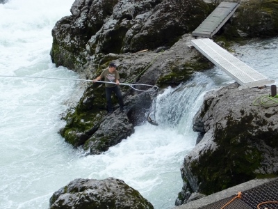
I was riding along the Yellowhead Highway, not far from my destination for the day, looking for a place on the river where I had heard I might see natives using dip nets to catch salmon in a very narrow canyon. I saw a bunch of cars parked along the road and, at first, thought there might have been an accident. Then I saw a tent and people milling around and I thought it might be a flea market. Then I saw the canyon I had been looking for. So I stopped and asked someone what was going on.
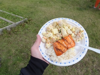 A member of the Moricetown Band of the Wet’suwet’en First Nation told me it was a community celebration of the salmon run and a chance to show non-tribal members (like myself) a little bit about how they live. “Join us. Have lunch with us,” she said as she herded me to a line where huge plates of fresh grilled salmon, rice and potato salad were being dished up. While I chowed down on the salmon and sides, I walked to the high bank of the river and looked down on a group of men and women precariously moving on rocks above the roaring canyon. As I watched, one man pulled up his dip net with a monster salmon that easily went twenty pounds or more. Others were making similar catches.
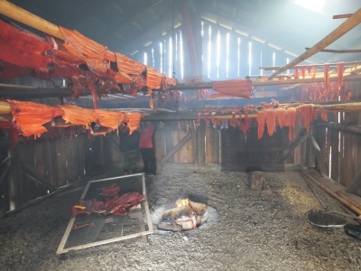
Hearing an announcement about the “smokehouse,” I walked down the riverside cliff to a structure with smoke coming out of it. (I can always spot the obvious.) When I got there, another member of the Moricetown Band named Stan took me on a personal tour of the smokehouse, explaining how the salmon were impaled on poles and hung on racks to be slowly smoked for several days. He pointed out that all of this was community effort: Some caught the fish, some brought wood for the fire, some tended the fire, some hung the fish, some filleted it and let it smoke a while longer until it was nearly dried out. And for what? For everyone. Stan said this was a community event not unlike activities for a thousand years or more and all families who participated shared in the fishy bounty.
This was not just a one-time event for tourists. This is what they do all during the salmon run so that everyone will have enough food during the winter. One of the women at the smokehouse shared with me a piece of dried, smoked salmon (salmon jerky, I guess) that was from her last supply from the previous winter. I was touched, and savored the moment and the salmon.
The pictures below should give some idea of how the fishing/smoking process worked:




 Geologically speaking, I’m no longer in the Rocky Mountains. I’m in the Intermountain West/British Columbia Interior Range, specifically the Skeena Mountains. Tomorrow I’ll move even further west to spend a couple days in the Pacific Coast Range before moving east through the BC Interior Range and back to the Rockies. Sometimes its like driving through six suburbs of a major city: They all look sort of alike but are different enough and have a separate history that warrants their own designation. Suffice it to say that all the mountains are uniquely wonderful. And they’re all rocky even if they aren’t all Rockies.
Other pictures I liked from today:
GRMA Day 16: Smaller Mountains and Lots of Forest
I hated to leave the big mountains of the main range of the Canadian Rockies, but I know I’ll be back in a week. There is much more of British Columbia, Alaska, the Yukon, and Alberta to see between now and then.
 The GRMA has been like a trip to the zoo, except that the zoo won’t let me ride my motorcycle among the animals. I haven’t been keeping track of all the wildlife I’ve seen, but it includes antelope, deer, big horn sheep, a black bear that ran in front of my bike yesterday, and two elk I saw today on the Yellowhead Highway (photo right). Plus a whole bunch of little critters and birds of various kinds. Still looking for a moose, a grizzly, a mountain goat and an eagle. I wouldn’t be surprised if I don’t check those four off in the next couple of weeks.
 About an hour out of Jasper I stopped at Mt. Robson, but the Canadian Rockies’ tallest mountain (a few feet shy of 13,000 feet) was shrouded in heavy clouds (photo left) as it frequently is. The summit is only seen about 50% of the time. I stopped by the visitor center to look around and talk to the friendly Parks Canada staff about things I should see on my way to Prince George. While there, I found out that the weather is so bad on top of Mount Robson that only five climbing parties out of 70 each year make it to the peak. Those are about the same odds as trying to climb Denali in Alaska.
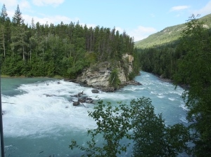 The friendly staff at the visitor center made two suggestions, both of which I decided to follow since I had a relatively short ride (250 miles) scheduled for today. First, they said, stop by Rearguard Falls on the Robson River, only about 15 minutes down the road from the visitor center. The falls (picture right) are the stopping point for any salmon that manage the 800 mile swim from the Pacific waters. The current here is too strong and the falls too high for any of them to continue their journey. But apparently those who make the 800-mile effort are among the biggest that swim up the Fraser River from Vancouver to the Robson River. Rearguard Falls isn’t as tall as the Athabasca Falls, but the setting was certainly as picturesque and you could hear the waters’ roar from the trailhead 1/4 mile from the falls.
 The second suggestion was to go for a hike in the Ancient Forest, about an hour shy of today’s destination. (picture left) I wasn’t sure that I’d stop longer than it took to read any interpretive displays on view, but when I arrived I decided I had time for a woodland stroll since I gained an hour (again) when I crossed back into Pacific time. (I’m now three hours ahead of Florida and NC.) So I put on my hiking shoes and began the climb through an old growth (very old) forest of Red Cedar.
 This is an area that has never been logged and is now protected by various Canadian agencies. What a wonderful walk along a boardwalk several miles long built by hundreds of volunteers over the course of three years. The boardwalk protects the fragile forest floor eco-system and makes the area much more accessible. This particular growth is in an Interior Wetbelt Rainforest, the furthest inland of any such rainforest in the world. I only spent an hour hiking through the Ancient Forest but it was a refreshing ramble through an aromatic cedar forest. One of the trees (picture right) on the trail is designated as “The Big Tree” and is suspected to be between 1,000 and 2,000 years old.
Following my arboreal assignation, I rolled into Prince George and checked into a rather seedy Econolodge. My purpose in arriving mid-afternoon was to be able to change the oil on my bike before plunging into the scarcely-populated wilds of northern British Columbia and the Yukon. I located my preferred lubricant (AMSOil) and went to Walmart to buy a drain pan and a funnel. But the service manager there said I couldn’t change my oil in their parking lot (like Walmartians haven’t done weirder things in their parking lot), so I went down the street to a Canadian Tire dealer who said sure, no problem, leave the old oil in the recycle area. So at Canadian Tire I bought a pan and funnel and 30 minutes later had fresh oil in bike.
Tomorrow looks like another short ride, this time to New Hazelton. There are some First Nations sites, exhibits and museums along the way I hope to visit.
More pictures from today that I liked:
GRMA Day 15: An Up and Down Day
(Note: For those who were using the GPS Tracker, it will be offline for the next 10 days. It uses very expensive cellular data which I have turned off for now.)
I had looked forward to this day since I began incubating plans for this Adventure. Two years ago Marilyn and I rode the Icefields Parkway south on our return trip from Alaska so I knew the scenery would be spectacular. And today, the scenery didn’t disappoint. When I could see it.
Unfortunately, rain fell intermittently throughout the day and combined with mountain temperatures in the low 50s made for less than ideal conditions. Still, when the clouds parted and I could see the awe-inspiring beauty of the Canadian Rockies I pulled over when I could just to be able to drink in the mountains for more than a two-second glance through my face shield.
The skies were blue when I began today and the ride up the western slope of the very steep mountains energized me like a double shot of espresso. Leaning into the curves, twisting the accelerator and drawing on the power of the Harley-Davidson V-Twin to pull me up the hills is a feeling only motorcycle riders who ride hard can fully appreciate. But as I neared the top of the mountains and the Icefields Parkway, I could see the darkening clouds gathering in the north. I covered my bag, removed my chaps, put my rain suit on over my heated jacket, and broke out the rain gloves. I was ready. And in about 10 minutes the first shower hit as I rollied down a 7% grade with sharp curves. I was glad I had new rubber under me on the back.
Even when the rains abated, I kept the rain gear on because I knew I would probably need it again and changing in and out of it was time I wouldn’t be able to spend riding and taking in the view. Rain fell on four different occasions as I motored north to Jasper, but never hard enough to cause me to think about seeking shelter. Good thing too, because there wasn’t any.
I did have one other unfortunate delay today. For more than two hours the Parkway was closed in both directions as police and emergency services worked what I’m certain was a fatal motorcycle accident. I was stopped about 30 cars back from the scene of the accident and heard various reports from people who walked up to see what was going on. A Yamaha bagger, apparently went off the road, killing one of the people on it. The other person was life-flighted about an hour and a half after the accident. No one knows, I guess, what happened, but I wouldn’t be surprised to learn that the driver was distracted by the beauty all around him and in a split-second went off the road and down the hill. It was tough knowing what was going on 500 feet in front of me and knowing that a brother road warrior had probably been killed. You never know when your time is up, so live life to the fullest while you can.
I had hoped to take far more pictures today than the rain and the accident delay allowed, but I snapped a few shots that may hint at the spectacle this 150-mile long postcard presents. I love the Rockies in the United States and, of course, the cute little Smokey Mountains, but the Canadian Rockies have to be the best in North America. Forest-covered lower slopes and soaring jagged summits capped with snow and ice, thrusting into the cerulean blue sky–these are mountains that make memories. The lakes and the streams that thread down the mountains and through the valleys are not blue and not green but an alchemist’s unholy cross between the two. “Rock flour” produced as massive glaciers systematically grind and crush granite into minuscule particles goes in the meltwater to float suspended in the lakes or tumble downhill in the streams and rivers. What a sight.
Tonight I’m in Jasper where the residents seem to have developed a unique economic system. First they determine a fair price for such things as hotels and restaurant fare and then they double it for all the tourists who come to admire the mountains. And the tourists do flock here, with more languages than may be found at the United Nations. Jasper is packed with camera-toting interlopers (like myself) and the over-priced hotels are booked solid. I had a good $20 meal this evening. But it cost me $40. If that’s the price I have to pay to see these mountains, so be it and a bargain it is.
No pie for lunch today. No lunch at all for that matter. I was pretty much astraddle the saddle from 7:30 a.m. to 6 p.m. except when I walked around waiting for the road to clear.
Tomorrow I’ll make a downhill ride similar to this morning’s uphill gallup as I leave the largest peaks of the range and travel parallel to the mountains again on my way to Prince George where, if all goes well, I’ll take care of some motorcycle maintenance. When I finish the northern loop of the GRMA in about a week, I’ll get another shot at the Icefields Parkway.
Another note: I expect the WiFi to get weaker as I move around for the next week and stay in the boondocks at mom & pop places, but I’ll post pictures when I can.
More pictures from today I like:


