Day 34: Beginning to Feel Like Civilization
I was up this morning at 4:30 trying to post pictures to yesterday’s blog to no avail. But tonight I posted them from my motel in New Hazleton, BC, on the Yellowhead Highway.
Many things changed today, including the temperature, which was a chilly 43 degrees when we started out and a balmy 81 degrees when we arrived with me sweating in long johns. Gas is now about 30% cheaper, even though it’s still expensive by U.S. standards. Our menu choices for dinner last night included fried frozen chicken patties or hot dogs or hamburgers. Tonight’s menu at Rob’s Restaurant (where I always eat when I’m in New Hazleton) included braised lamb shanks, Thai curry chicken and clams steamed in a light white-wine-butter sauce served over squid ink infused spaghetti. At the grocery store here, bananas were $.79 a pound versus $1.89 a pound last night. And the quality of our motel rooms was comparable, but tonight’s bill is $40 less than last night. Traveling through the wilderness is expensive.
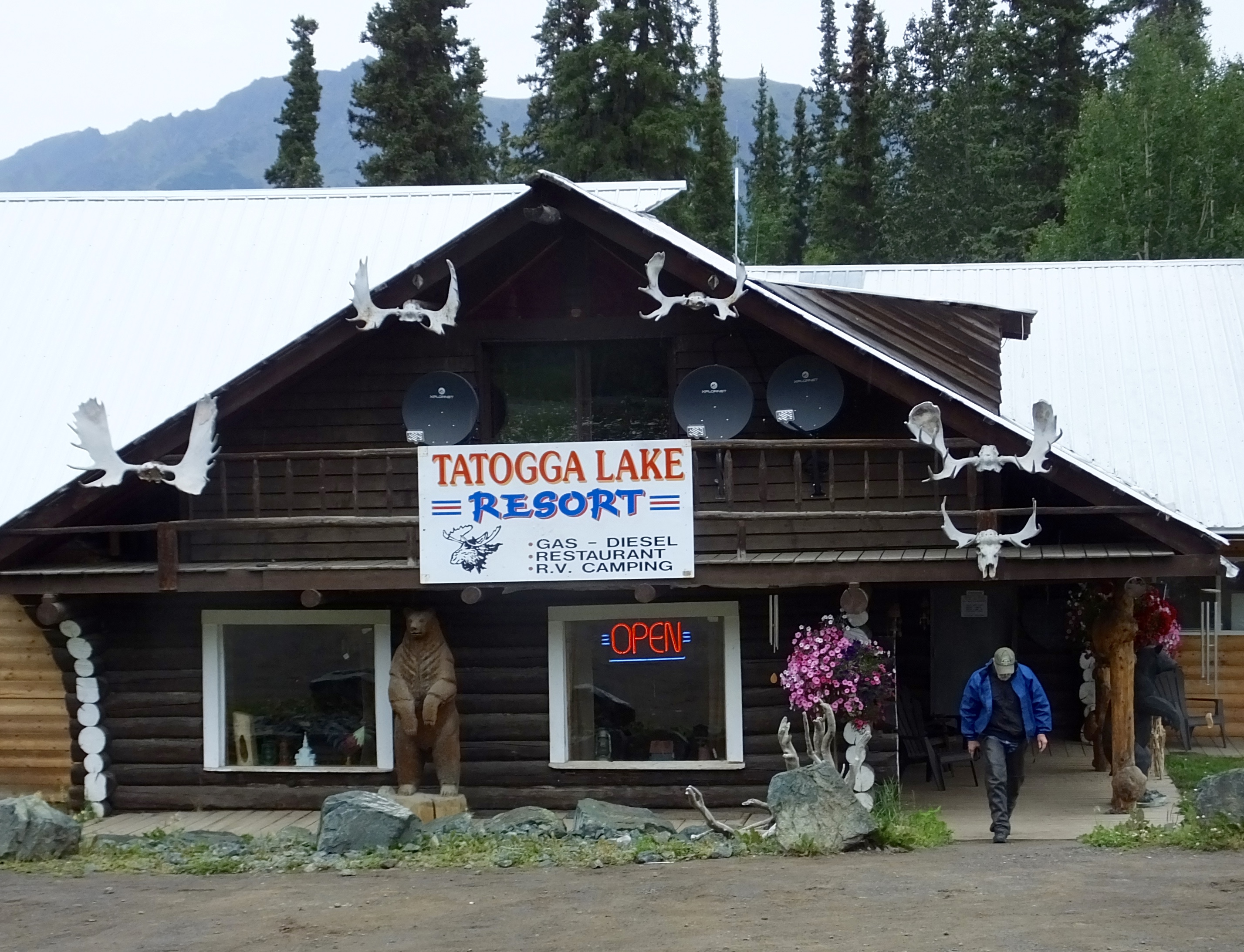 Breakfast options this morning in Dease Lake were almost non-existent since the town’s only restaurant closed last year. The hotel clerk recommended we drive 50 miles south to the Tatogga Lake Resort where we could get a decent breakfast, so we did since that’s the way we were headed anyway.
 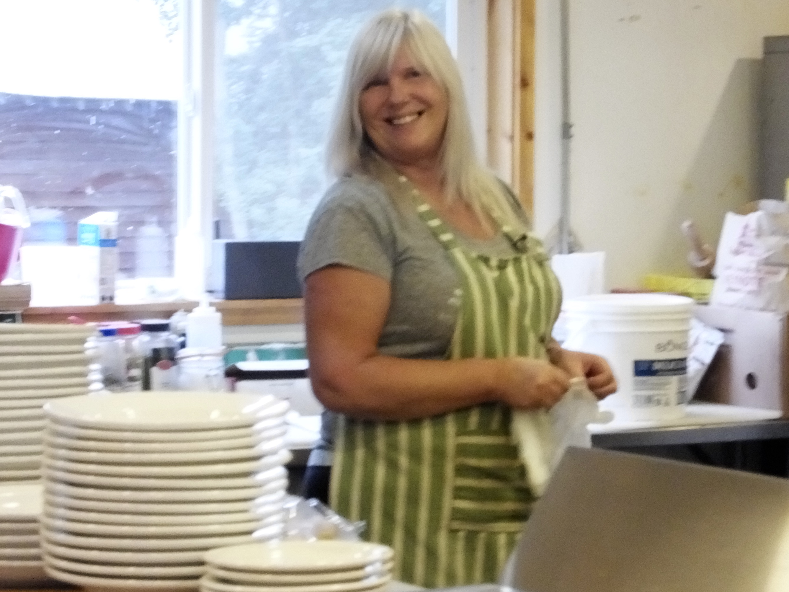 There we met Tina, owner, gas pump attendant and chef. She was fun to talk with and is one of those down-to-earth folks you enjoy meeting on the road. She runs the place with the help of a friend who waits tables and her kids who can be counted on for various odd jobs. And she cooks a monstrous three-egg ham-bacon-mushroom-pepper-tomato omelet with fresh fried potatoes on the side washed down with help-yourself hot coffee.
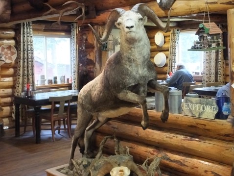
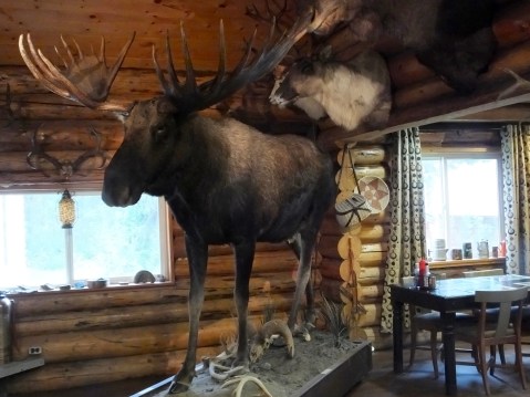
They claim to have the oldest operating restaurant on the Cassiar Highway and I don’t doubt it. It’s in an old log building but with a modern kitchen and the dining area was filled with a variety of taxidermy specimens. They also have cabins and campsites we didn’t see but another couple having breakfast expressed their satisfaction with their overnight accommodations. The Tatogga Lake Resort was a great stop and a good way to start the morning.
Click on any picture for a larger view.


Immediately after leaving the resort, we bumped along through 35 miles of road construction. I think half the people in British Columbia and the Yukon are training for the Road Construction Olympics. Fortunately, today’s construction trek wasn’t very dusty. Unfortunately, that’s because it started to rain, turning choking dust into slippery mud. Waiting for a pilot car at one of the active parts of the construction site, however, gave us a chance to talk with listen to another character, this time Sandy the Flagger, decked out in her lime green coat and pants accented with a lovely orange vest and twirling a red and yellow STOP and SLOW sign. Sandy expounded at length about what a great job she had because she was outdoors in the mountains and the boss of the road and only worked five months a year and then had seven months to go lay on a beach somewhere because beaches are sandy and she’s Sandy and see how well that works 0ut and Pensacola Beach was her plan for this winter but did we know anywhere else and maybe she would go to one of the Caribbean islands and here’s the pilot car gentlemen start your engines bye bye.
My tour of duty through the construction zone earned me another battle star in my windshield when an 18-wheeler roared by launching rocks at anything or anyone in range. I was in range. Now I have two fresh cracks in my previously pristine windshield. I’m sure I’ll discover other surprises beneath the dirt and grime when I get home and wash the bike.
Other than interesting people along the way and the daily construction gauntlet, today’s ride was uneventful, except for a black bear on the roadside. There was no shoulder on which to safely park the bikes, so we let him or her graze without the paparazzi interfering with breakfast.
Most of the time, today’s scenery would have been pretty special, but after two weeks of awesome in Alaska and the Yukon, today’s mountains, frequently hidden by untrimmed roadside growth weren’t all that special, so we mostly just rode in silence, alone with our thoughts on the past four weeks and what awaits us at home.
 Today we went almost due south until we came to the Skeena River and the Yellowhead Highway. Tomorrow our heading will take us east on the Yellowhead to McBride at the foot of the Northern Rockies. Both directions take us closer to home, though we still have nine days left on the road with more things to see, people to meet and adventures to unfold.
Some readers have expressed grave concern over the lack of pie reports. In truth, I’m not eating as much pie as I have in the past, though I still eat more in six weeks on the road than I do in 46 weeks when I’m not traveling. Indeed, I was intent on ordering pie tonight at Robs but after Tina’s gigantic omelet and Rob’s generous portion of wonderful warm potato salad with chicken skewer and chicken vegetable soup and a very dark beer brewed in Okanagan, British Columbia, there was no room for pie.
The 4:30 effort to post pictures this morning failed to work but it did cost me an hour of sleep, which I’m going to make up for as soon as I post this.
Day 33: A Turn South
Note: Aug 18 I’m able to post pictures from my motel in New Hazleton but I’m going to leave the snarky comments about Dease Lake up just because I can. It’s my blog.
Note: Internet service in Dease Lake is insufficient to post pictures. I will try to add pictures in a day or two. Please check back.
Up until today it seems like we’ve been dawdling, unconsciously trying to avoid returning to southern and warmer climes. But no longer. Yesterday, we crossed an Alaska border for the last time this trip, and today we left the Alaska Highway behind us as well as we dove southward on the Cassiar Highway (Highway 37) in British Columbia about 11 this morning. All things Alaska are now in our rearview mirrors.
I thought we might have a travel delay issue on Highway 37 when I read a flashing highway sign warning of an active forest fire down the road and declaring that all motorists should not stop on the road. I took their “no stopping” declaration as a challenge and looked forward to blatantly stopping on the road to take some pictures. But, although the smoke from the fire was visible and irritating to nose and eyes, we saw no photogenic flames and were through all the smoke in about 10 minutes. “Going to have to shoot something else for the blog,” I thought.
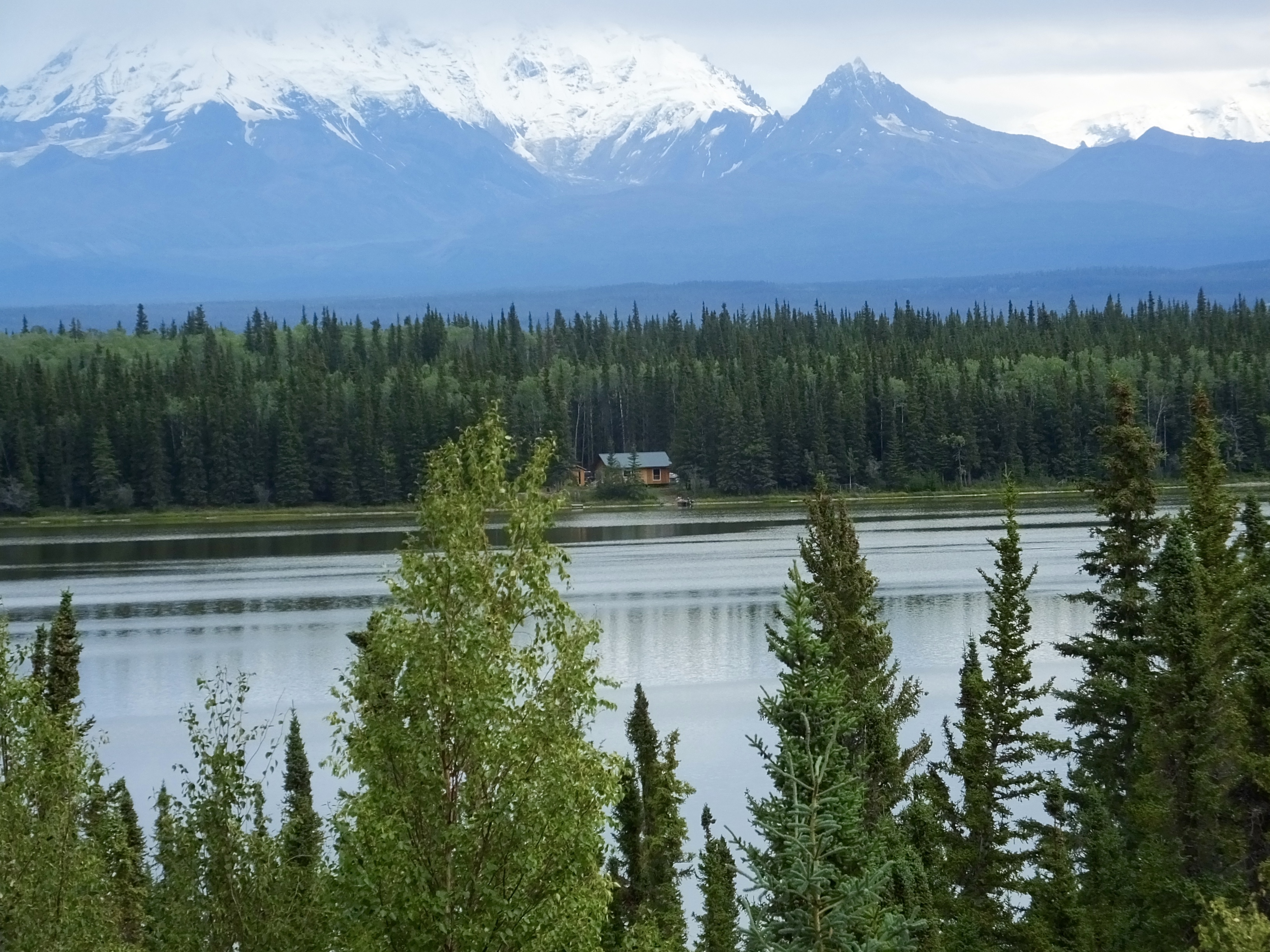
 As we rolled south on the Cassiar, I spied a sign notifying us of an upcoming turnoff to Boya Provincial Park and remembered a conversation on yesterday’s ferry ride where Boya Provincial Park received high praise. So I made the turn and we motored about a mile off the highway down to a small lake with about four dozen campsites. Boya Provincial Park, operated by BC Parks, has a lake, rentable canoes and kayaks, hiking trails, a playground for kids, fishing, beautiful mountain views, and probably several other parky things we didn’t see. The ferry passenger was right; it is a nice place to spend a day or two. (A beautiful picture of a lake and mountains would go here if I could post it.)
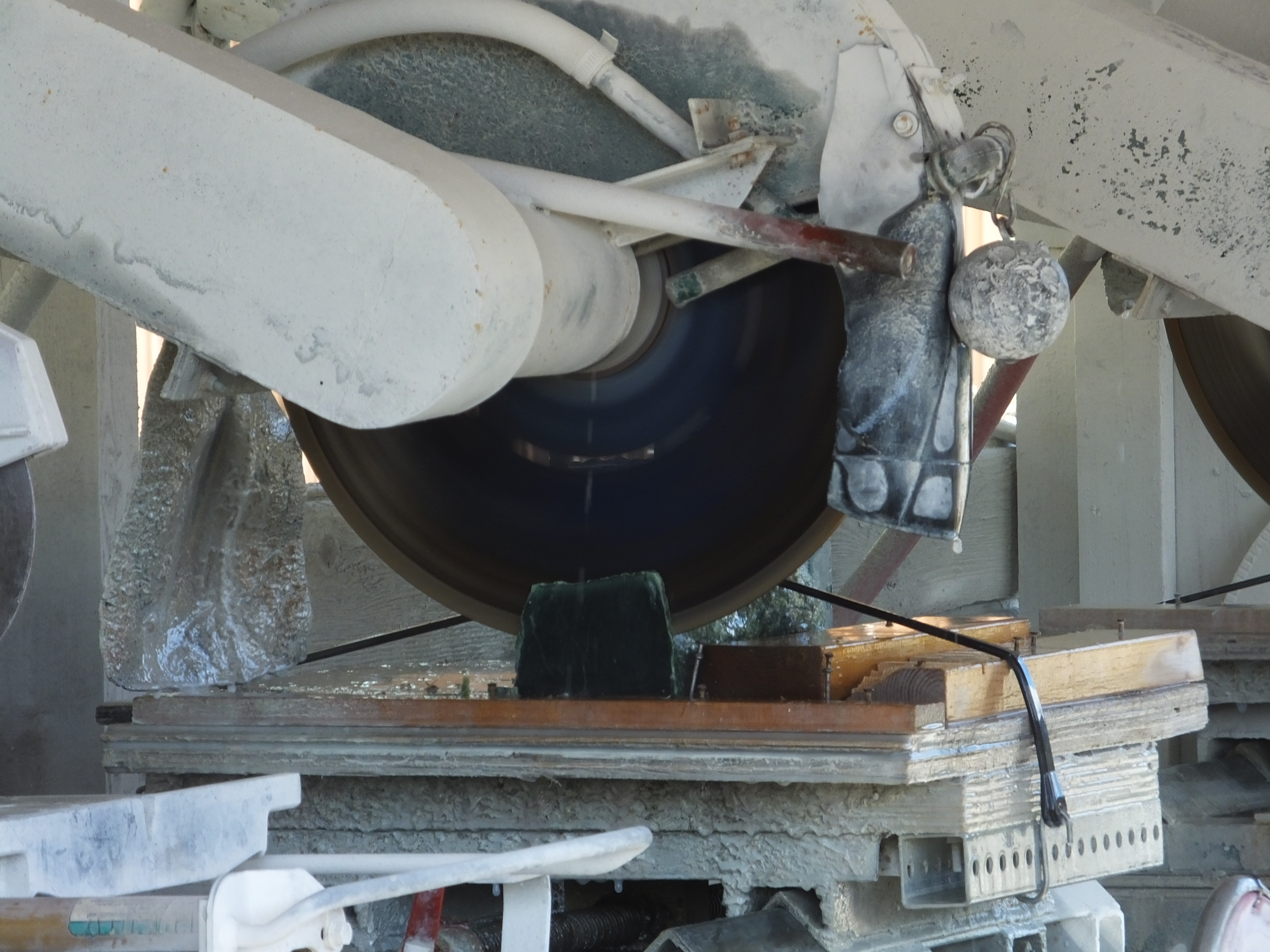 After talking with some campers at Boya and comparing Alaska fishing notes that revealed similar weather-related problems, we continued our two-wheel journey southward. I’ve visited Jade City twice before on trips through the six-building burg and have two small pieces of Jade sitting on my Maggie Valley mantel to prove it, but I thought Mark might like to spend some of his money there as well, so we stopped. (A mediocre picture of a saw cutting a chunk of Jade would have been inserted here if the *&$^%# Internet service was better). We looked at the jade cutting setup next to the retail store and then went in and perused their rocky green wares. Mark gamely resisted the lure of various carved jade bears, bisons, fish, jewelry and even polished hunks of jade with no discernible purpose and he emerged from the enterprise with all the money he entered with. Still it was worth a few minutes stop because I scored a free cup of coffee.
(By the way, I haven’t stopped eating pie when it’s available; I’ve just stopped reporting on it.)
The Cassiar Highway resembles a quiet country lane because it’s narrow and has no lines delineating directional lanes or passing zones. Except this forest-lined country road is 350 miles long and has large mountains looming over it and long blue lakes sloshing beside it which you can see when the trees and brush have been trimmed which is almost never. There are few cars and fewer trucks on this road , making it far preferable to me than the over-travelled Alaska Highway. If one travels south through the valley, the northern Rocky Mountains rise on one’s left while the Cassiar Mountains of the British Columbia Interior Mountain Range appear on one’s right. These are two separate ranges, according to professional geographers and geologists, but are highly pleasing to look at even if you’re just old motorcycle riders.
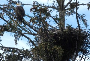
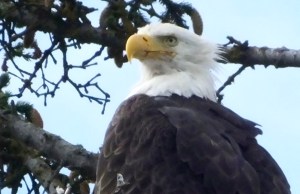
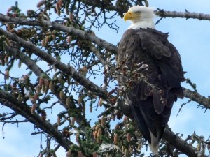
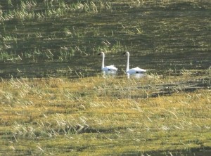
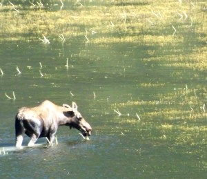
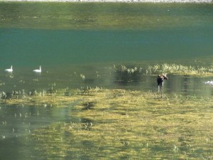
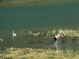
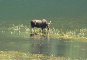
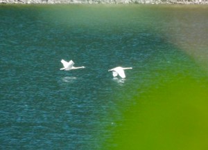
At one point as we passed a large lake on our left between the road and rising Rockies, we simultaneously spied a big brown object moving in the water. “Moose” I yelled into the CB radio and made a quick stop at a convenient gravelly pull out. Closer examination of the ungulate revealed no rack, but the cow, 500 yards or more away from us, was splashing her way across a grass bed in the water, nibbling selectively as she went through the water. Two beautiful white swans kept her company while a bald eagle circled lazily overhead, no doubt keeping an eagle eye on all activity below. We stayed for awhile, and with my lens extended to its full 1000 mm range and sitting solidly on a small tripod, I took pictures for about 15 minutes. The meandering moose waded and swam to the far side of the lake, the swan pair noisily beat the water with their wings and took flight and the eagle soared soundlessly down the valley and out of sight. (Several pretty good shots of the moose and the swans from nearly a half mile away should be here but aren’t because the motel’s lousy internet service can’t handle a couple of crummy pictures.) I removed the camera from the tripod, stored my photo equipment back on the bike and we returned to the road.
Click on any picture below to see larger views of all of them.
One final note: We had been warned yesterday by a fellow traveller that the final 20 miles or so of today’s ride would be through a dusty construction zone. It was. And it was probably the dustiest we’ve been through on this trip. Nary a water truck in sight to sprinkle anti-dust liquid on the road. Following a pilot truck or being passed by dust-belching vehicles going north meant a lung-full of powdery road dust and, at times, visibility limited to a couple dozen feet. When we got to our expensive hotel with crappy internet (it’s the only game in town and it’s sold out), I probably permanently soiled a fresh white washcloth just washing off my eyeballs. All part of the Adventure, I guess.
Tomorrow we continue down the Cassiar Highway to the Yellowhead Highway where I don’t expect the Internet signal to increase much at our next stop. But I’ll keep trying to post pictures.
Day 32: North From Alaska
This morning in Haines began as have most days in Alaska this trip: cloudy, chilly, and trying hard to rain. Undaunted and suitably attired in our heated apparel and rain gear, we resolutely headed back to the bear viewing area at the Chilkoot River to try again for the perfect shot of a grizzly snagging salmon or defending its territory that would secure my place in the Grizzly Bear Photographers Hall of Fame. We arrived about 9 a.m., long after the first hopeful but dejected photographers showed up at 5:30.
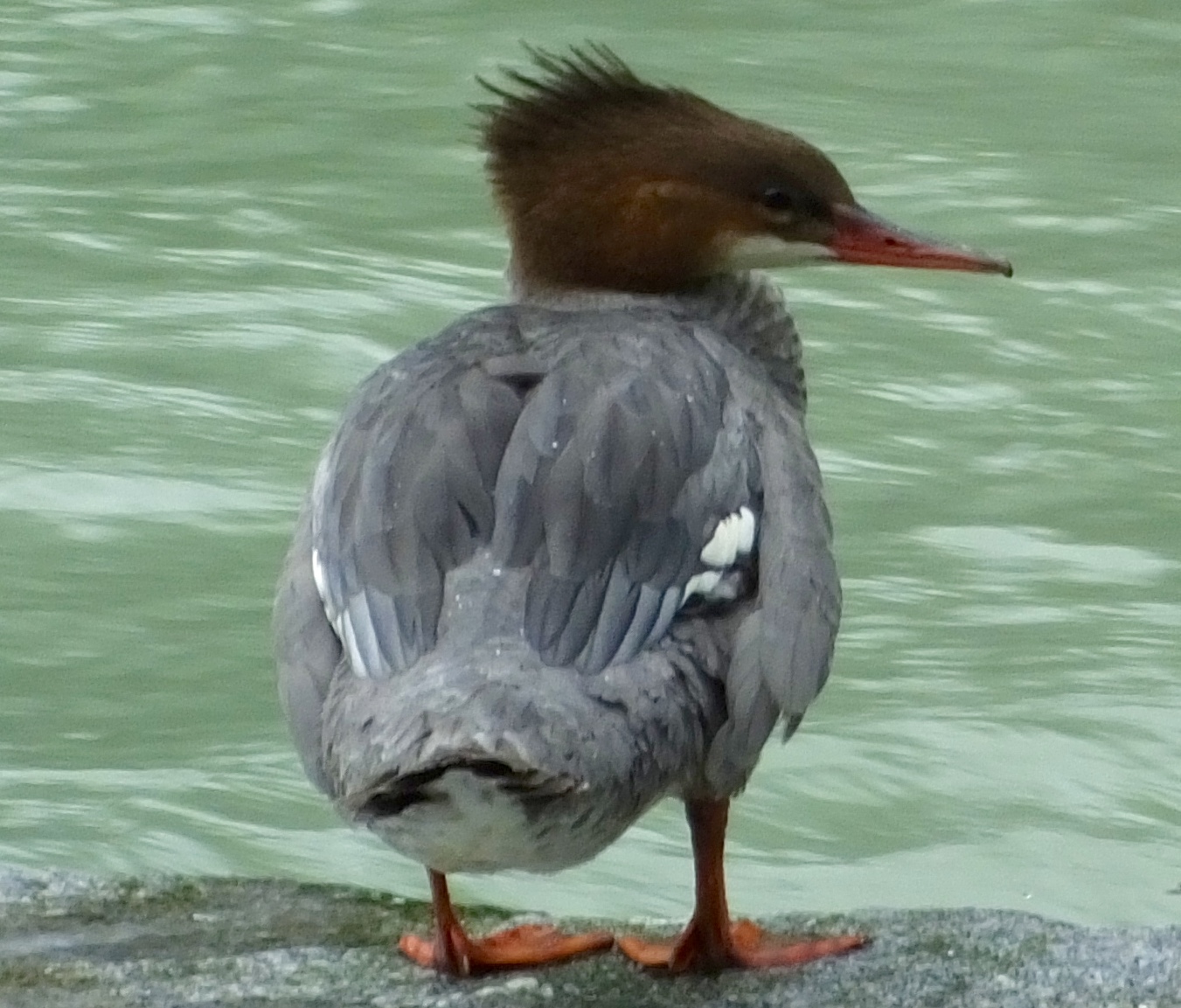 But the bears must have watching, because they continued to stay hidden, I assume, until after we left at 10:30 to catch the 12:30 ferry to Skagway. I departed with only a couple of out-of-focus shots of distant eagles and a shot of a duck with a haircut like my great-grandson.
We had standby status for boarding since we hadn’t reserved space in advance, but the ticket agents assured us the boat crew could always squeeze in a motorcycle or two, so I wasn’t too worried. They sold us the tickets, and we lined up with other standby vehicles and waited. 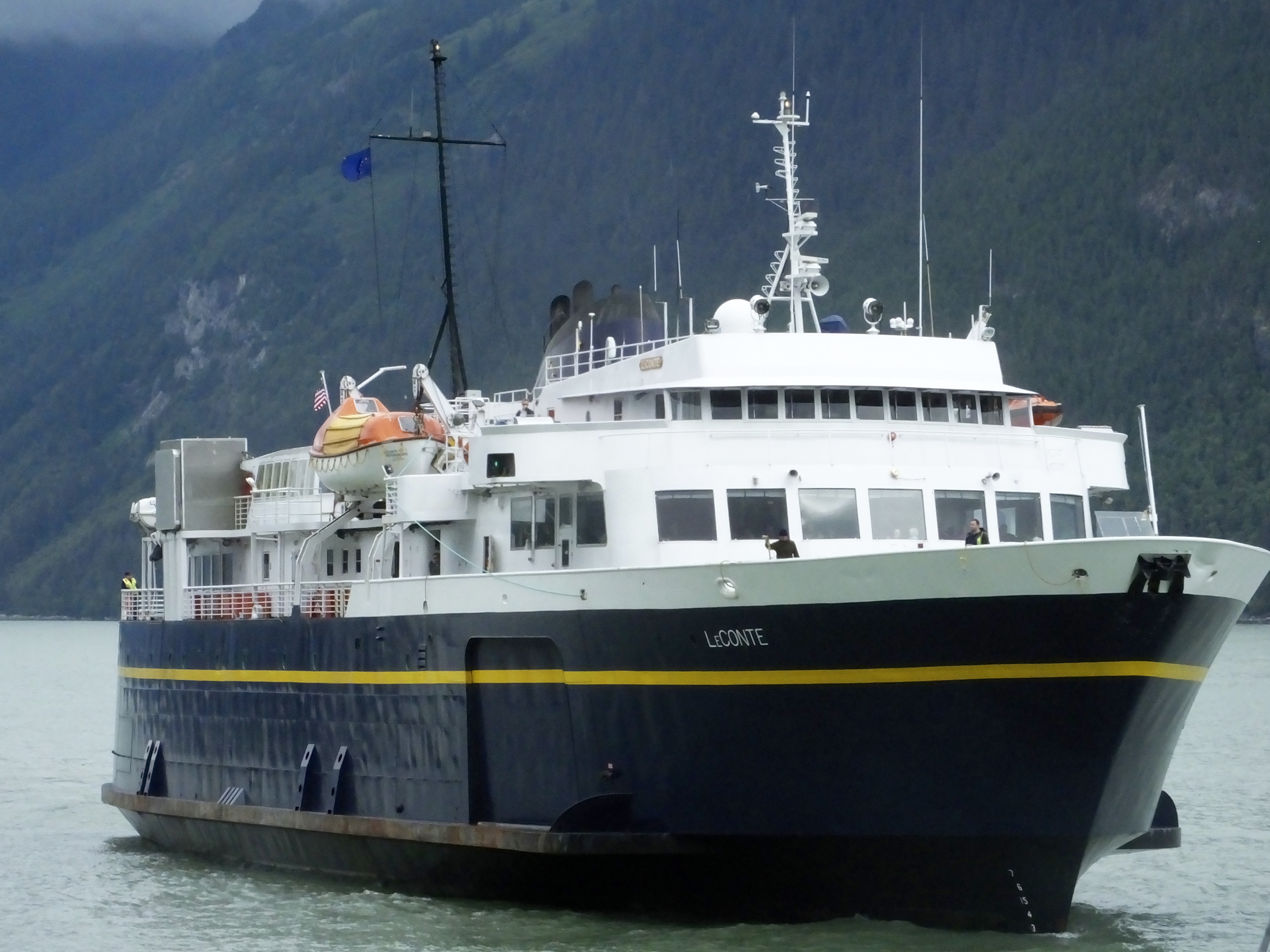 Our ferry, the LeConte, was relatively small and completing its run from Juneau to Skagway. Cars towing trailers that boarded in Haines had to back down the ramp (!) onto the ship. Fortunately all drivers made the maneuver with no mishaps, but the time-consuming process delayed our departure by nearly 40 minutes, making our arrival in Teslin, which is on Pacific not Alaska time, even later,
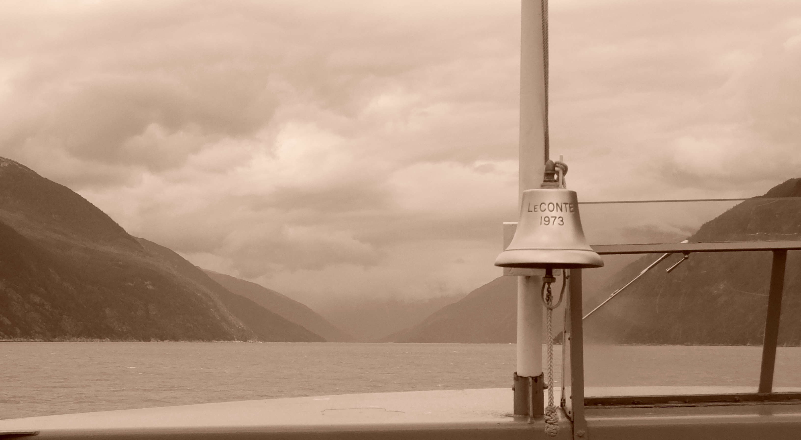 As the LeConte cleared Haines’ harbor and made its way up the fjord to Skagway, thoughts of enthusiastic young gold miners in the 1890s making a similar trip on a lesser ship, dreaming of nuggets and riches, came to mind. What must have been on their minds as they saw the same steep mountain sides, covered with scores of rushing waterfalls and overhanging blue-ice glaciers staring down at them? Did they have the same feeling of awe I had today as the modern ferry slowly ploughed through the cold water for an hour to the waiting dock in Skagway? I think they must have. They must have paused to consider the beautiful journey they were on, whether they struck it rich or not.
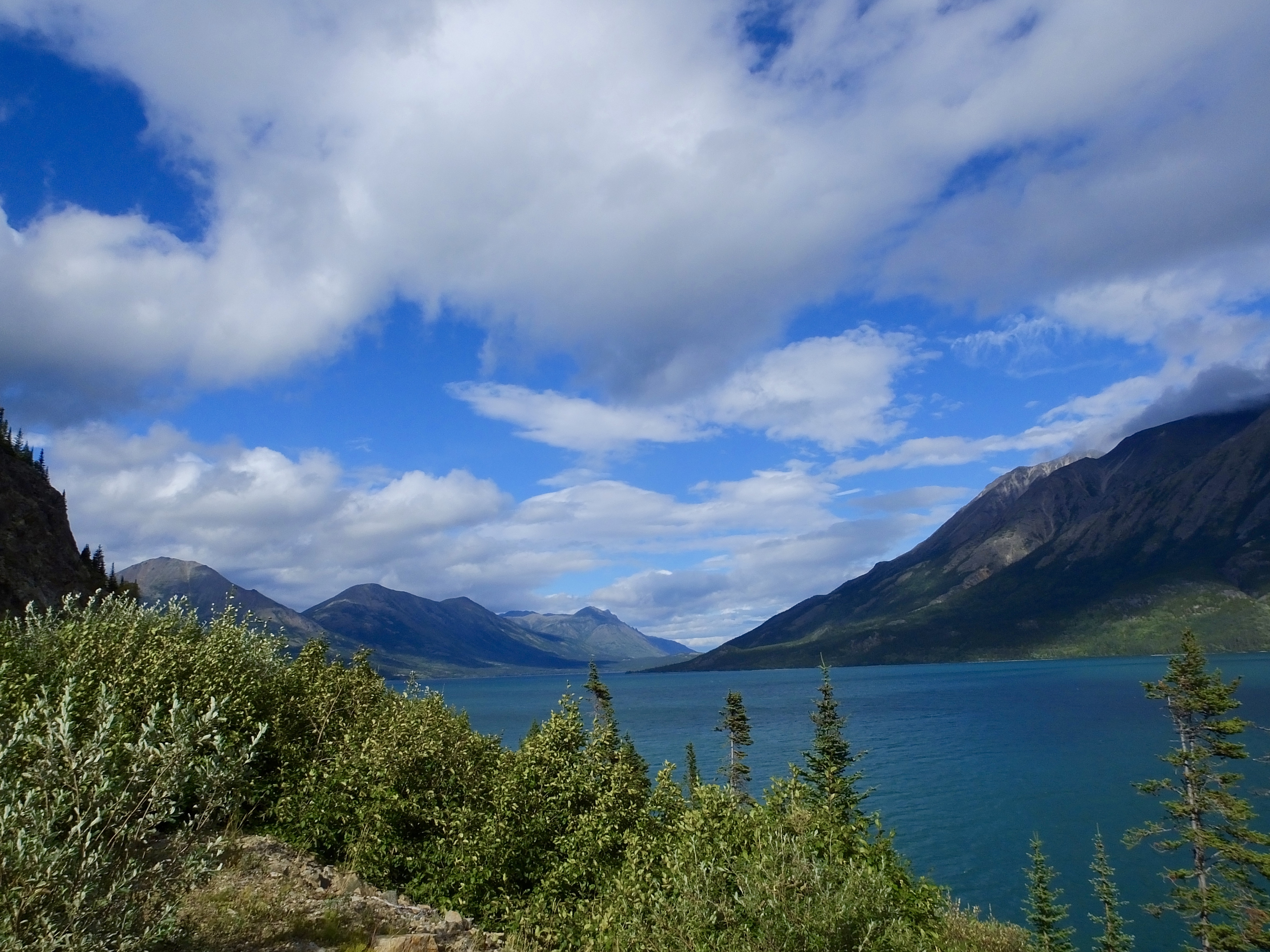 We had been told by other riders that the highway north out of Skagway would be a great ride. It was, climbing more than 3,000 feet quickly up the sides of the valley to views unlike any other we’ve had this trip. As we reached the mountain summit not far from the Canadian border and the waiting border agents with their now routine questions about weapons, alcohol, and wads of cash, the landscape became more rugged, almost treeless, and stretched nearly infinitely into the distance with small pools and large lakes adding color to the inspiring scene. The cool temperature dropped further, the whistling wind rose higher, and the gray clouds began to break up, showing hints of precious blue. Repeatedly we keyed the obvious into our mikes: “This is gorgeous.”
We added more cold-weather gear when we stopped at the border crossing, but the temperature never got colder, and as we rode back down out of the starkly beautiful mountains, we twisted the setting knobs on our rheostats lower and lower. The view on the highway from Skagway to Carcross was amazing and so was the road surface, apparently far less abused by heavy trucks and RVs than the cracked, broken, pot-holed rutted Alaska Highway. We had only one brief encounter with a repair crew clearing a small rock fall on the side of the road and the flagger’s STOP sign changed to SLOW before our tires could come to rest.. Today’s ride was, for several hours as we made our way to Teslin, wonderful.
Our lodging tonight at the Yukon Motel is clean and warm and quiet. I’ve no complaints there. But the wifi is problematic. Each person is given one-hour’s worth of Internet at a time, and it can only be used within yards of the small router near the check-in desk. The signal doesn’t even reach to our room, which is part of the same building. Having travelled in the far north cyber wilderness before, I’m not surprised. But if you note in the next few days that I haven’t posted anything, it’s not because I haven’t recorded that day’s adventure for posterity. There just may not be a way to share it with the 21st-century world.
As always, thanks to everyone following along on this incredible adventure.
Day 31: Eagles and Bears? Nope.
The weather has again conspired against me as the side trip to Haines for a photo shoot of eagles and brown bears yielded not a single shot. The rain during the past week or more throughout southern Alaska has raised river levels to the point that animals have changed their behavior. The 300-400 American Bald Eagles that reside permanently in or near the Chilkat Bald Eagle Preserve about 20 miles north of Haines were mostly absent, according to the caretaker at the reserve, having left temporarily to seek fish elsewhere because the Chilkat River water overflowed the hundreds of islands where the eagles would normally rest. We saw a couple juveniles and one adult as we rode by on our way to Haines, but when we stopped at several lookout points, there were no eagles to be seen.
OK, I thought, we’ll see some on the Chilkoot River where dozens of brown bears and many eagles gather to gorge on thousands of spawning pink salmon. But in the afternoon when we went to the Chilkoot, no bears were fishing or roaming the sodden river banks, though one sow with two two-year-old cubs had, we were told, shown up in the morning. We returned for an hour in the evening when feeding grizzly (aka brown) bears would be more likely to show up. But still no action and we stood talking for an hour and half with two dozen other would-be nature photographers. Although sockeye salmon were migrating up river, few pinks had started the journey, and pinks are what the absent bears prefer. We did see a couple of eagles but too distant to even think about photographing.
The day wasn’t a total bust, since once again we rode past breathtaking mountains and through lush forests. In addition, we had a chance to meet and talk with a retired RCMP couple who, in their early 50s, are beginning a life of travel and sightseeing. It was interesting to compare retirement systems in Canada and the U.S. Retired Americans suffer badly by comparison, but Canadians pay more taxes.
I didn’t take a single picture today. The ride to Haines was mostly cloudy though with very little rain. At one point, we were riding in the clouds with visibility reduced to about one hundred feet and the temperature dropped to the low-to-mid 40s. When we weren’t in the clouds, they shrouded most of the snow-covered peaks we could see. And, I figured I’d have plenty of eagle and bear shots to post.
I may make one more effort to shoot bears tomorrow morning before we catch the expensive ferry for a one-hour ride to Skagway, but given the river and weather conditions I’m not hopeful of capturing anything with my lens. But you never know. I’ll try to do better tomorrow.
Day 30: Dusty Ride to Cultural Jewel
Having ridden north on the Alaska Highway two weeks ago, I knew we could expect a long stretch of road construction shortly after we entered Yukon Territory, so I wasn’t surprised. But that didn’t make the one-hour ride over 30 miles of dust, mud, bumps, gravel, ruts, and rocks any easier to take. I survived the construction gauntlet, having lost only two teeth, a kidney and an artificial aortic valve. Just kidding. About the teeth.
I didn’t think my bike could get dirtier. I was wrong.


I think I’ll have some service, any service, done at a Harley dealer so they can offer me a free bike wash. Suckers.
Other than the extended stretch of road (dis)repair and a couple of short stretches, today’s ride wasn’t bad because no rain fell. And the road that wasn’t torn up was in pretty good shape.
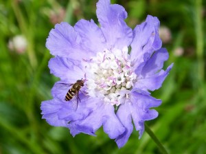
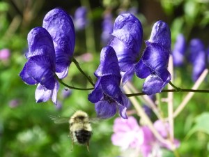
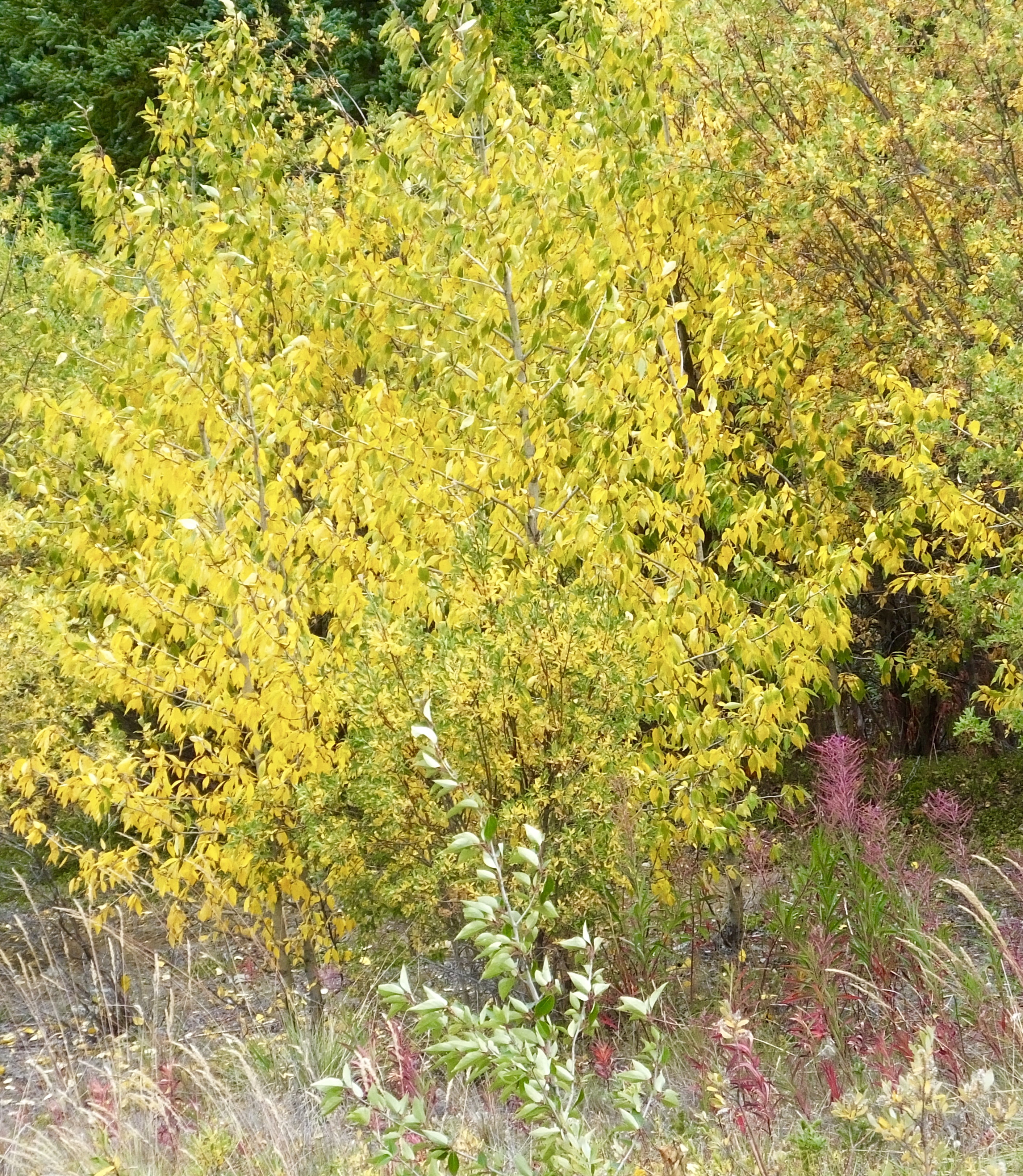 We had heard from several folks in Alaska that they saw signs of an early winter, and today we may have seen a couple more. Two weeks ago when we went north along Kulane Lake, all the leaves were green along the way. Today, most of the aspen had broken out in a serious case of fall yellow, and all the fireweed had lost its signature bright purple blooms. I think Mark and I are headed south at a propitious time.
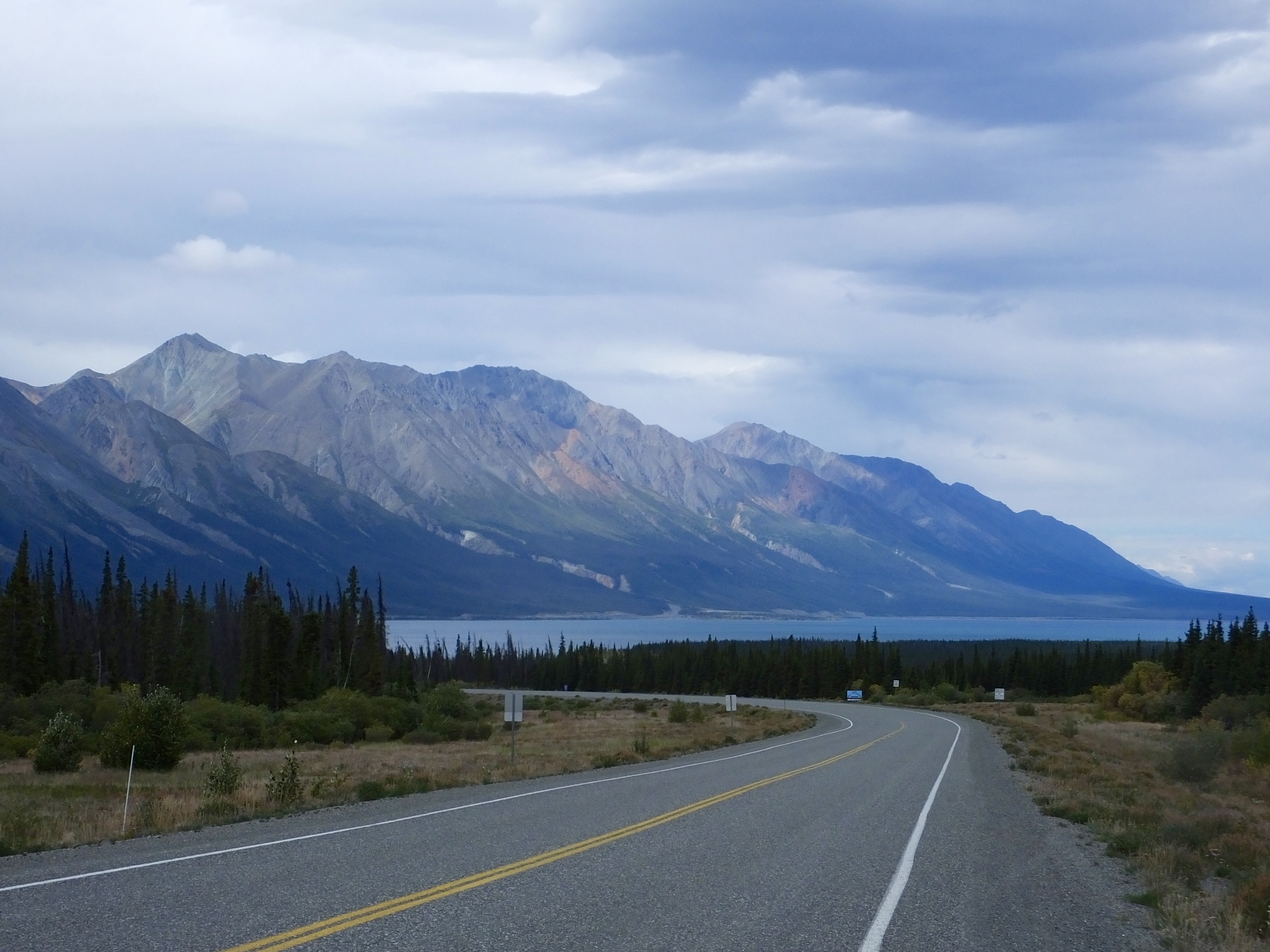 We stopped for a short visit at the Kluane Lake Visitor Center where the lone ranger (no, not The Lone Ranger) pointed out some of the 98 Dahl Sheep she spotted so far today on Sheep Mountain using a high-power scope, which she kindly let us use to see numerous ewes and lambs precariously balanced on the upper reaches of the rocky red mountain. She also told us about a potentially significant change to Kluane Lake, which up until this year had been fed by meltwater from a glacier. That glacier has now retreated to the point where its meltwater drains to another river that in turn drains into the Gulf of Alaska on the other side of the St. Elias mountain range. The lake level has apparently dropped five or six feet this year and geologists are not sure how low it may drop before finding non-glacial stasis. The upper reaches of the lake bed have dried out and today winds blowing up to 25 or 30 mph caused a mini dust storm we had to ride our already filthy bikes through while holding our breaths. Dust seemed to be the word of the day.
We pulled into Haines Junction early, about 2 p.m. Alaska Time and 3 p.m. local time, so we had plenty of time to visit the one place on today’s agenda: The Da Kų Cultural Centre.
Three years ago when Marilyn and I were riding back from Alaska we stopped for a couple hours at the Da Kų Cultural Centre but I didn’t see everything there was to see. Today I remedied that oversight. The Centre houses the Yukon Visitors Bureau, the Kluane National Park Visitors Centre and the Champagne and Aishihik First Nations Cultural Facility. I had toured the first two but not the last one, which is the raison d’être for the Da Kų Centre.
When possible, I try to learn something about the people who live or lived where I travel, whether it’s the decedents of Irish fishermen in Newfoundland, the pre-historic Cliff Dwellers of southern Colorado, the Nez Perce of Idaho, or, in this case, the native people of the Yukon.
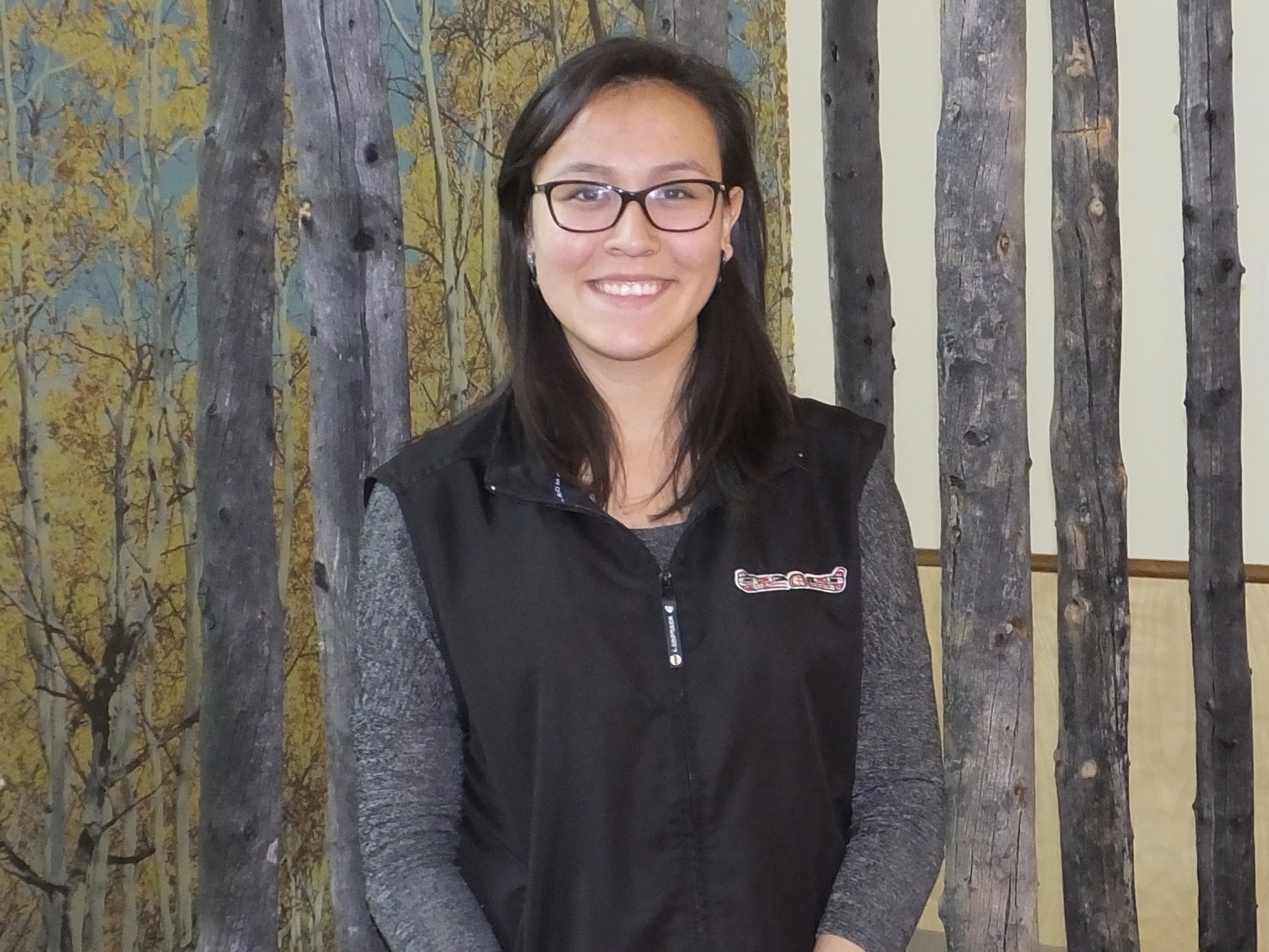 As I walked through the Centre, reading and learning from the professionally-produced exhibits, I met one of the Centre workers, a young woman named Näntsäna, whose Northern Tutchone name means “Smell of the Earth After It Rains,” a lovely name, a lovely smell and a lovely young woman. Näntsäna helped me understand the importance of elders in their culture, the reasons they have two clans (Wolf and Crow) which each person inherits matrilineally, the importance of family and the familial structure that raises young people, the spread of the Athapaskan-speaking peoples (including the Navaho of the southwest United States), the important efforts to save traditional language as fluent-speaking elders pass on, the use of trails as communication links long before Europeans arrived, and the cultural intermingling of the Athapaskan and Tlingit First Nations people. In short, Näntsäna was a wealth of knowledge and an enthusiastic ambassador for her culture. Once again, a chance meeting with a kind stranger has enriched my motorcycle adventure more than she knows.
 As I continued my stroll through the Da Kų (trans: Our House) Cultural Centre, I thought about what Näntsäna had said, and the artifacts and artwork housed there took on greater meaning. It was a short visit, but the lessons learned there will stay indelibly etched in the recesses of my elderly brain and for that I’m grateful. I love these Adventure vignettes.
Tomorrow it looks like rain will return, but I’m determined to hunt eagles and bears as we head back to Alaska, back to dollars not loonies, back to gallons not liters. Wish me luck.
Day 29: Slowly Leaving Alaska
 Today wasn’t our last day in Alaska. Or even our next to last day. We’ll be in Alaska for at least part of each of the next three days. But our time here is wistfully winding down and except for what I expect to be a short but exciting adventure in Haines, we’re at the end of our too-short, two-week stay in the incredibly beautiful and awe inspiring 49th state.
 We have closed a road-trip loop that began two weeks ago at the same place I am right now: the crossroads town of Tok, which frankly has little to recommend it except some hotels and roads to other parts of Alaska. From Tok we went to Fairbanks (flight seeing), Talkeetna (hiking), Seward (aquarium), Soldotna (fishing), Palmer (history lesson), and Valdez (kayaking and glacier hiking). And everywhere we went we saw breathtaking scenery. And everywhere we went we met amazingly friendly and helpful people–both residents and visitors. And we still have two adventure-filled weeks and almost 5,000 butt-numbing miles remaining.
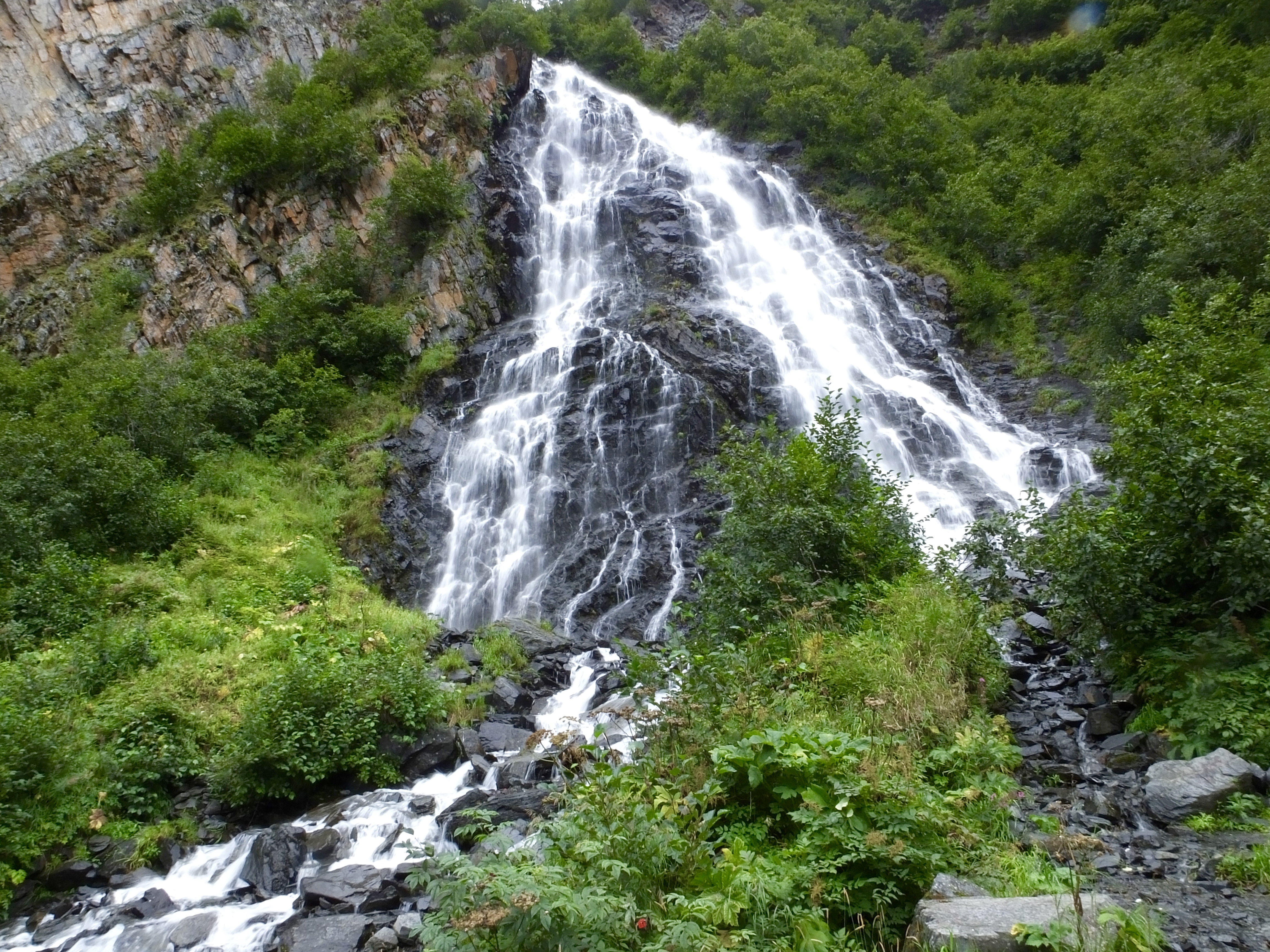
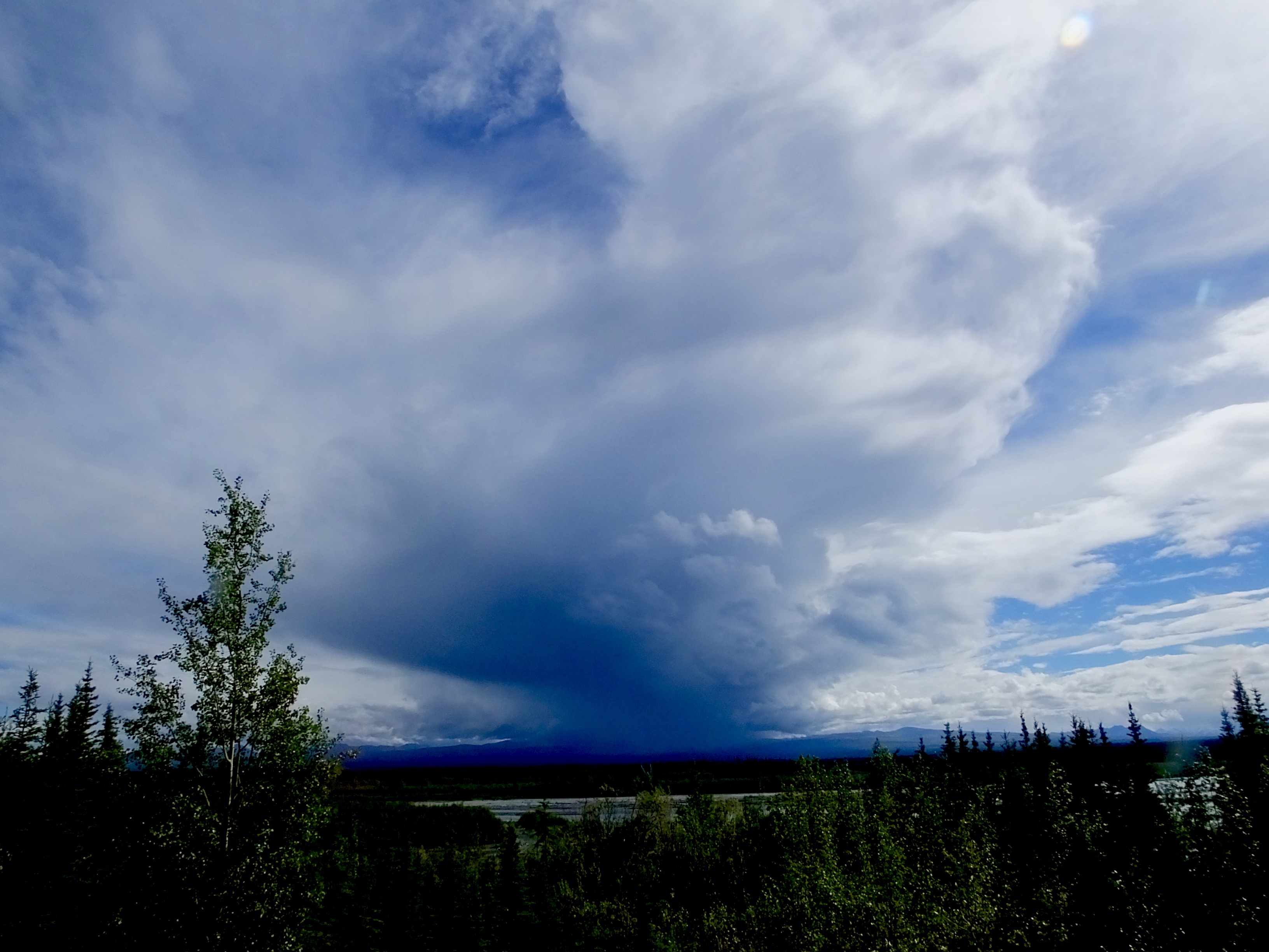
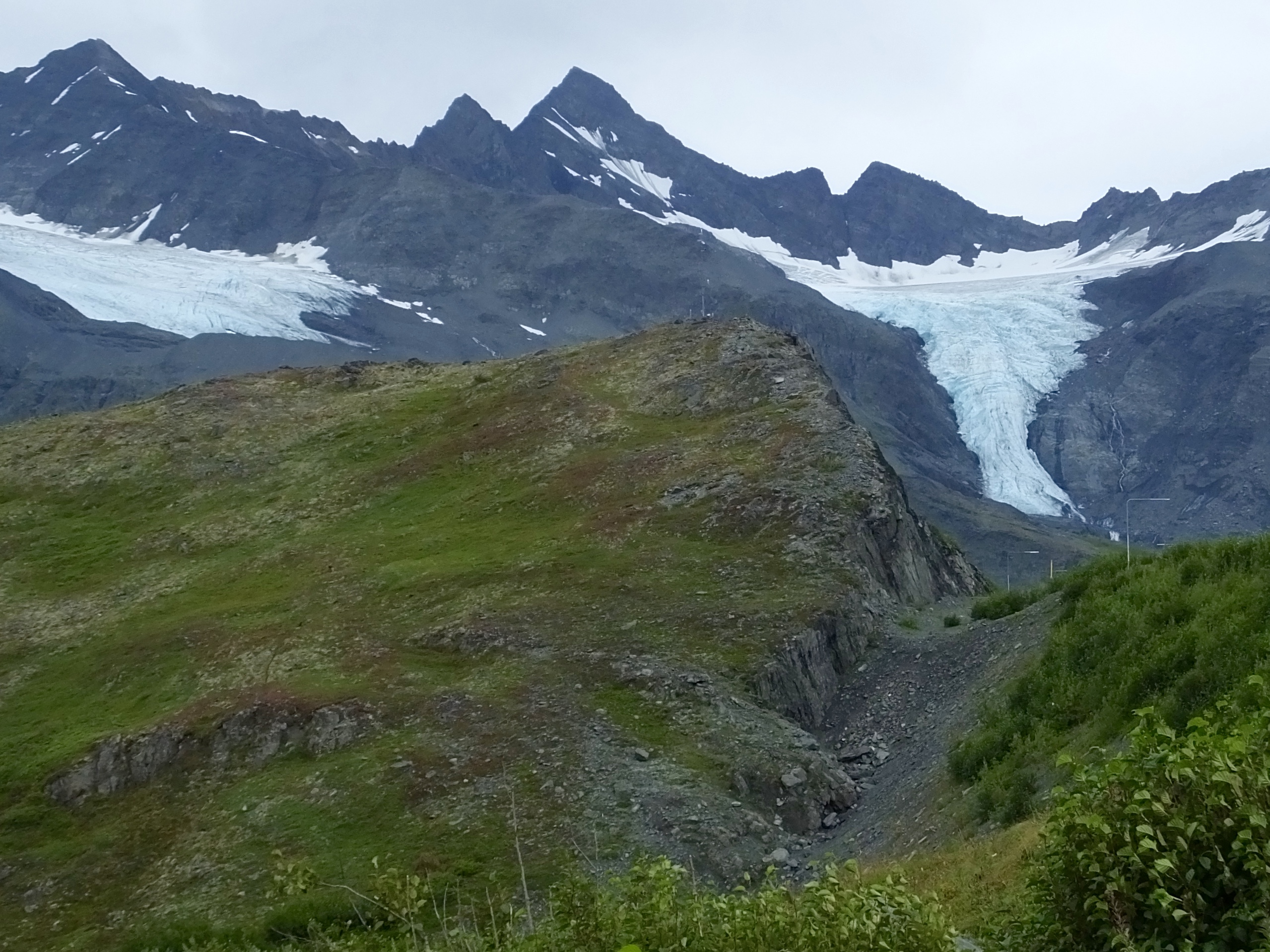 After days of rain, today was nearly dry. Overcast but non-precipitous skies bid us adieu as we rolled out of a chilly and water-logged Valdez and back up to Thompson Pass. We stopped briefly at Horsetail Falls, then again at the summit to take in six glaciers at once from the spot where gold seekers in 1899 trekked to distant Klondike gold fields.
 Another short stop gave us a view of Mount Wrangell, the largest active volcano in North America, which was topped with clouds today, and Mount Blackburn, at 16,360 feet, the tallest peak in the Wrangell-St. Elias sub-range of the Alaska-Yukon mountain range. That giant was also covered with clouds. But we could see snow-clad slopes up to about 11,000 feet and they were impressive as they disappeared into the clouds. Apparently, these two landmarks are often cloud covered, which seems to be the case with many Alaskan peaks.
 By the time we reached our half-way point today, the threat of rain seemed to be gone, so, for the first time in a week, we rode unencumbered by bulky rain gear. Unfortunately for us, another 100 miles down the road, storm clouds again appeared on our horizon and we suited up again for the final dash to Tok. We skirted most of the rain and ended up with only about five minutes of soft showers to spoil an otherwise pleasant ride.
Tomorrow, federal border control officers permitting, we spend the night in Canada, then back to Alaska the day after, then back to Canada the day after that and remain in Maple Leaf country for the next four days.
The shortest distance between two points may be a straight line, but memorable routes require zigs and zags, twists and turns, ups and downs and the occasional fortuitous detour.
Day 28: Moving at A Glacial Pace
Cold rain fell continuously as Alaska Redux took a day off from riding to spend sight seeing in Valdez. The adverse environmental conditions almost guaranteed today would be less than memorable and would barely merit a passing blog glance. Almost. Because, despite being cold and wet and sore today, we had a great day, thanks in large part to the great guides at Anadyr Adventures in Valdez who led us on a kayak paddle on a glacial lake then hiked us through an informative tour on Valdez Glacier.
 I had planned such a tour in Valdez seven months ago when I laid out this Adventure. But my plans, as I recall, called for 65-70 degrees and sunshine, not 45 degrees and constant rain. But adventures demand you take what the weather gods give and today they gave crappy.
I reserved and paid for this trip five days ago when we were in Soldotna, so we were committed to go or lose our money. We went, trying to maintain good spirits but wondering with some trepidation what lay ahead.
Arriving 15 minutes early, we waited with other members of our group of soggy sojourners for the cold and wet adventure to begin. One of our growing group, who worked on the Wild Rose Farm in Fairbanks, used an abundance of zucchini to bake delicious zucchini bread with an amazing crust that she gratefully shared with all. It was absolutely wonderful and the day looked better already.
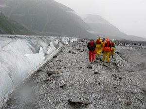
The guides introduced themselves, had a piece of the zucchini bread, and showed us where the gear was. They provided rubber boots, rain coats, rain pants and extra dry wear for those who needed one more non-cotton layer (like Mark and me). We suited up, grabbed a personal flotation device, had the obligatory informational and safety briefing, and loaded ourselves into a van towing a trailer loaded with two-person inflatable kayaks for a short ride to the glacial lake at the foot of Valdez Glacier. Good cheer–fueled by the zucchini bread–pervaded the van, despite the gloomy weather on the outside.
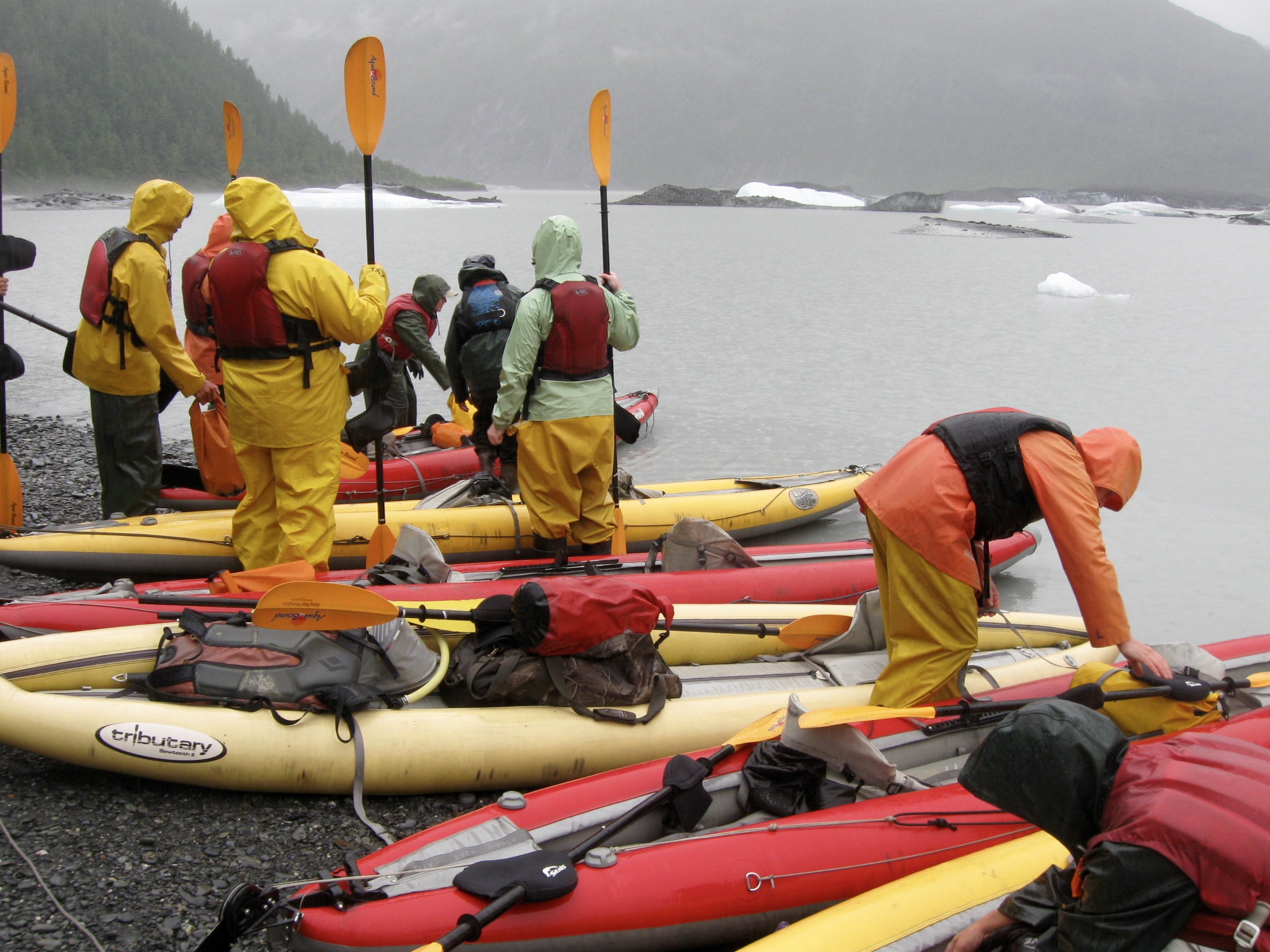 At the lake, the two guides, Bagel and Dalton, split the five groups of two into a group of four and a group of six, the latter being our group and Dalton being our guide for the day. In our group we had a banker transplanted from Iowa to Anchorage, an Iowa corn farmer, a young woman traveling from Spain by herself, a young man from Japan also traveling by himself, and two retired old guys (Mark and me).
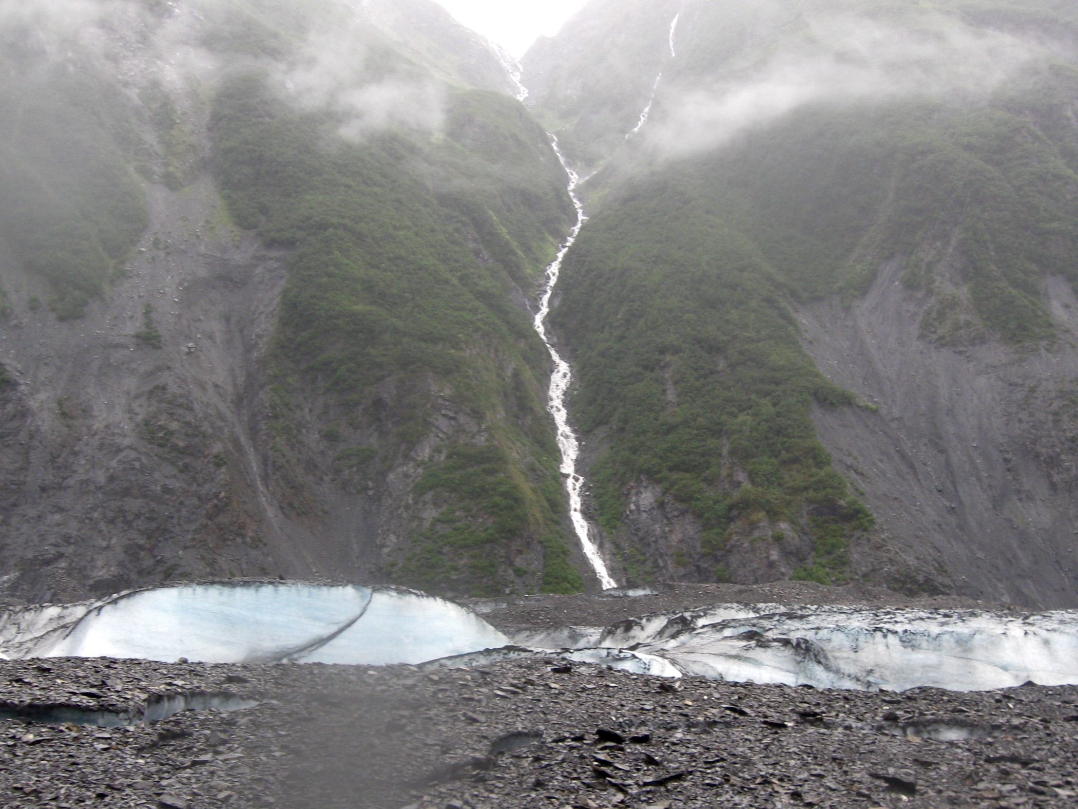
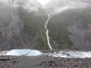
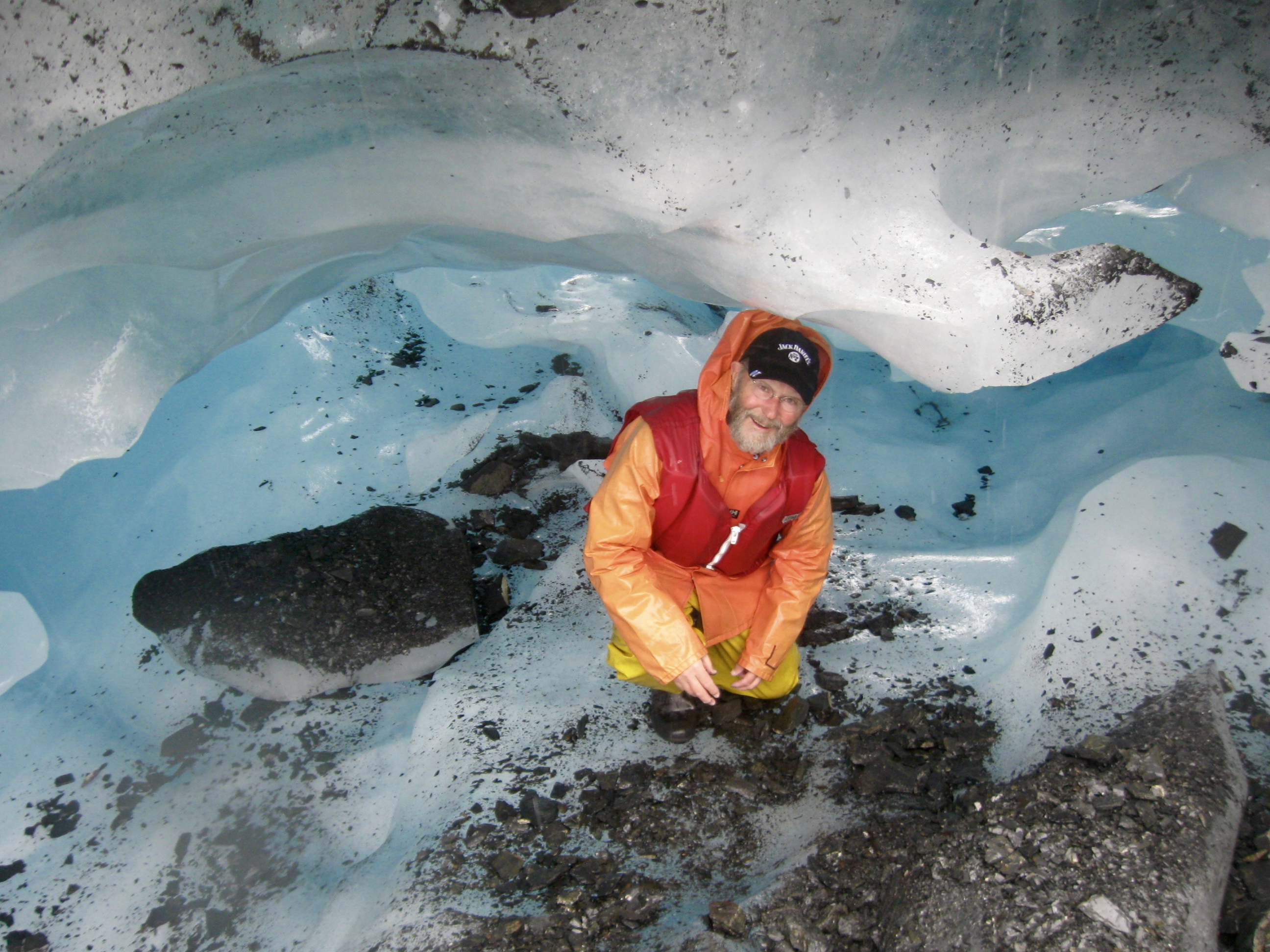
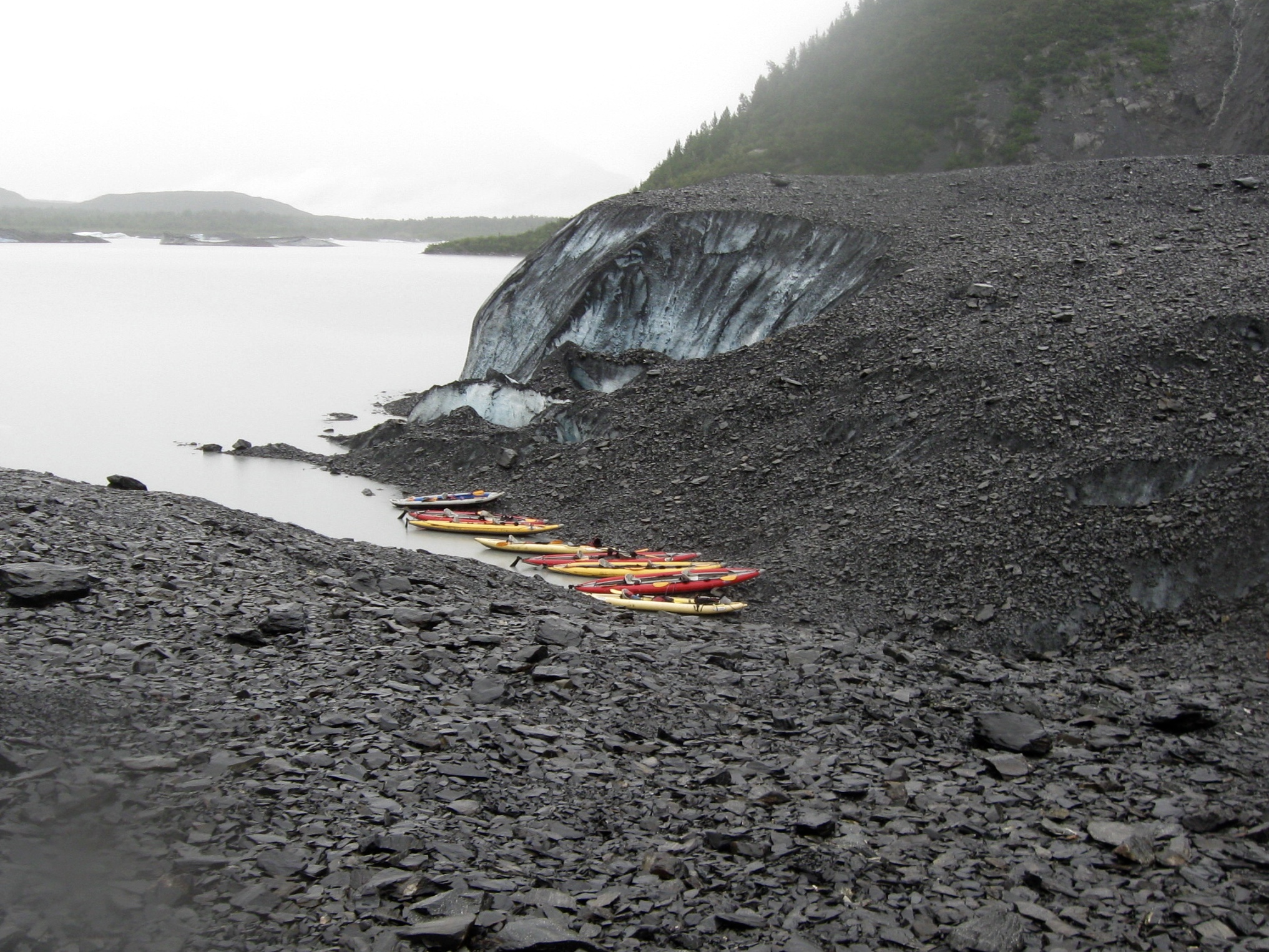 Into the kayaks we climbed despite the rain and began our paddle across the lake, through the glacial icebergs that looked like small rocky islands, and to the toe of Valdez Glacier, where, heeding Dalton’s advice not to disembark more than two or three feet from the shore because the drop-off to the bottom of the lake was more than 600 feet, we hauled ourselves and our crafts onto the rocks.
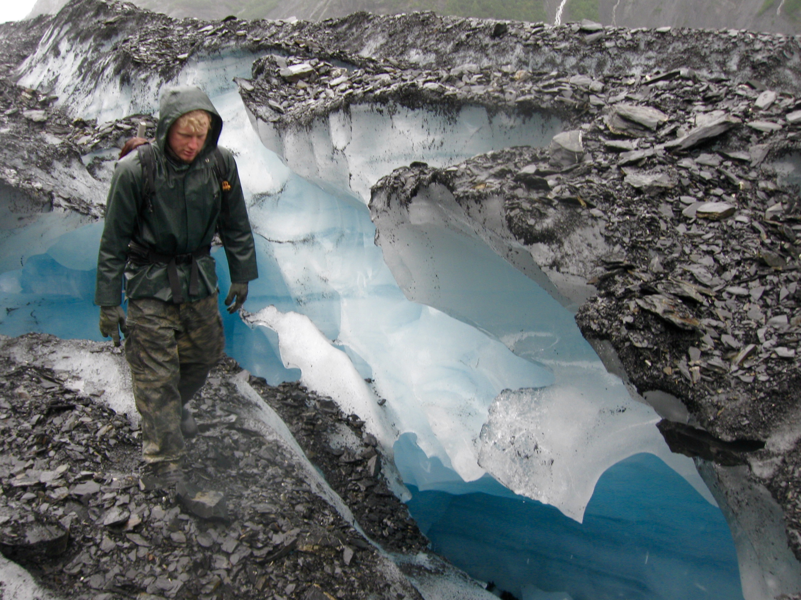 Dalton’s passion for guiding and for the Alaska outdoors turned what could have been a cold, wet, boring hike across the rocky surface of the glacier into an educational and enlightening history/geology/glaciology lesson. We walked in the rain, at a glacial pace you might say. He walked and talked, telling of and pointing out various features found on the glacier–blue ice, crevasses, moulins, moraines, erratics, u-shapes, and more. Along the way, he found time to tell of the miners of 1896 who tried–and failed miserably–to use the glacier as a highway to the Klondike gold fields. And he told of Valdez’ early history and of the ever-present 1964 earthquake with its epicenter a mere 50 miles from Valdez and the devastating impact it had on the port and the people living and working here.
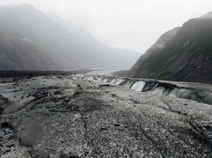

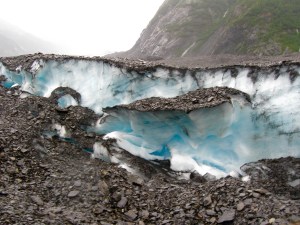
To say that today was a learning experience for me is a serious understatement. It was a glacial revelation, in part at least because after seeing dozens of glaciers from afar I was finally able to walk on one. I had noticed on other glaciers what appeared to be dirt, especially at the lower elevations, besmirching the pristine whiteness most people ascribe to glaciers. Today I discovered the brown stains aren’t dirt but rocks. Millions of them scattered across the top of the glacier. Some fall from the sides of mountains past which the glaciers flow and some drop from rocky outcrops or uplifts that split a glacier’s flow. But they both contribute to the rocky build-up as the glacier glides relentlessly down the valley.
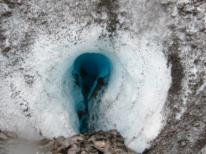
 Dalton pointed out that the glacier’s surface changes weekly, even daily, as new crevasses open and snow bridges collapse, as moulins (holes in the ice) grow bigger and deeper when ice melts and water flows hundreds of feet to the bottom of the glacier where it lubricates the glacier’s downhill slide. We carefully avoided places where thinning ice was dangerous, but had several opportunities to step down into fantastic icy features never seen from a 10-mile view.
On the way back down the glacier I chanced upon several broken pieces of purple glass. What fool would bring a bottle to a glacier, I wondered. Dalton said it was probably an artifact from the thousands of miners who tried to use the glacier as a shortcut in the late 1890s. Indeed, he said, guides and tourists often find debris broken and left behind by the miners. Later, when our day on the glacier had ended, I showed the zucchini-bread-baker the glass I found and she her friend, who were both archeologists as it turned out, said yes that historical explanation was certainly possible because the purple color was caused by manganese in the glass which was in common use before but not after WWI. Exposure to sunlight caused the once-clear glass to turn purple.
As we reached the area where we beached our kayaks and prepared to eat whatever lunch we brought with us, Dalton broke out cups, hot water and tea or cocoa. It was a welcome, warming treat and a thoughtful gesture by the folks at Anadyr.
We paddled slowly back across to the launch point, taking time to examine some of the larger icebergs and learning about their inevitable death in the lake. Growing increasingly cold and wet, we loaded the kayaks back on the trailer and returned to town. Taking off the borrowed rain gear, I discovered that my shirt and pants had both absorbed no small amount of water; that helped explain why I felt chilled. Most of the others, including Dalton and Bagel, had the same experience. Even with the rain gear, the constant rain plus the dripping from the kayak paddles found its way to out-of-sight dry spots.
We expressed our sincere thanks to our guides and quickly made the short walk back to our warm hotel room where soggy clothes soon tumbled merrily in the hotel washing machine. We were cold. We were wet. We were a little sore. But we were pleased that a potentially bad day had turned out so well. Another example of Great Adventure magic.
Tomorrow we begin our leg out of Alaska as we head to Tok (where I had internet connection problems the first time through). I’m looking forward to leaving the rain and entering warmer temperatures.
Day 27: Moving on to Valdez
Even through a rain spattered face shield and partially obscured by constant gray clouds from horizon to horizon, Alaska never ceases to amaze and never disappoints. Heated jackets helped ward off the chill, but ignoring the cold was impossible as temperatures today started in the upper 40s in Palmer, moved to the mid 50s near Glennallen, and probably settled in the upper 40s again as we approached Valdez. Fortunately we only had a little rain at the beginning and for the final two hours of the ride, and that made it possible to enjoy most of the ride on dry pavement.
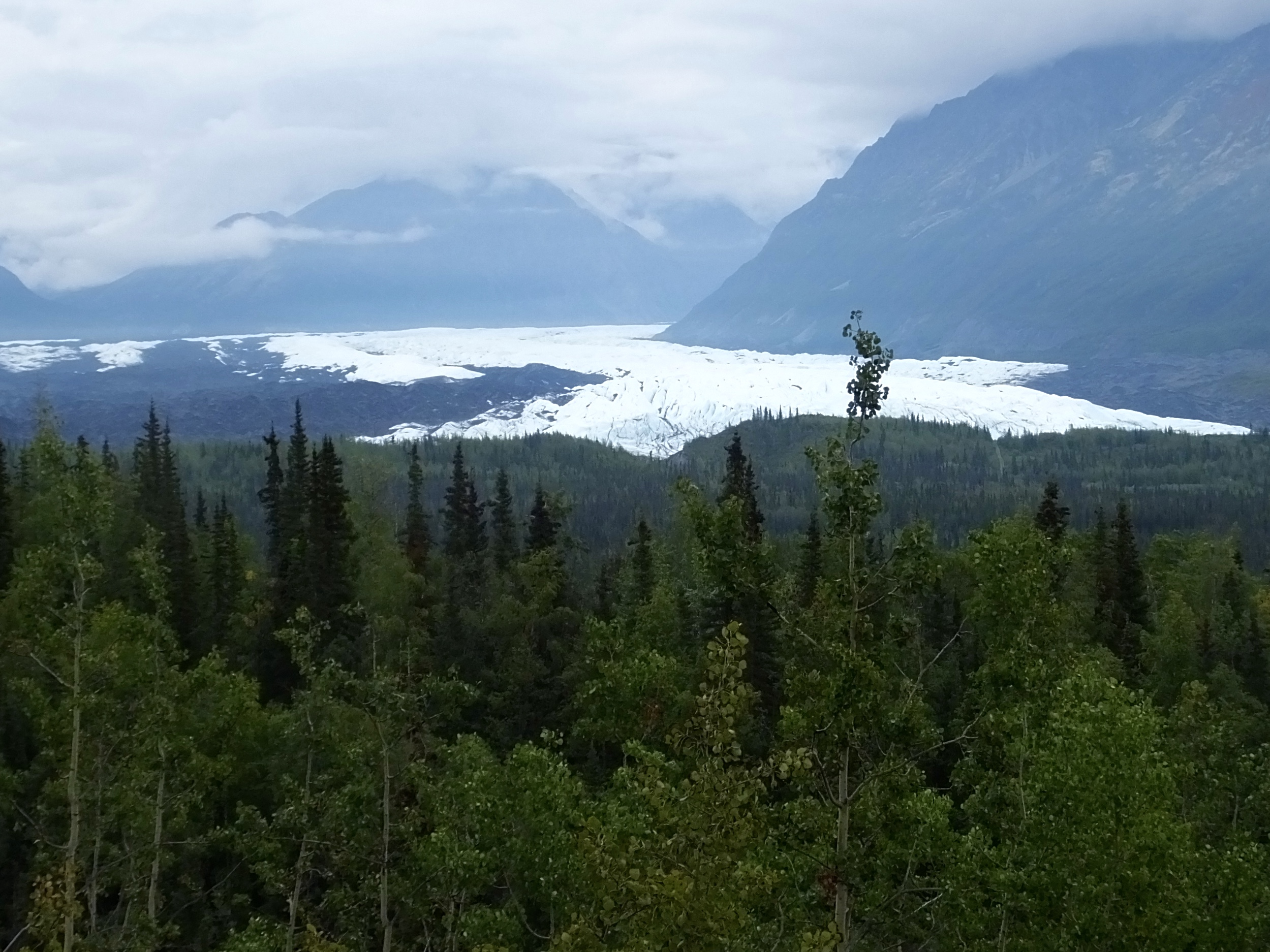 After stopping for a short time to marvel at the Matanuska Glacier visible from the Glenn Highway but receding further from it every year, we continued on to the Eureka Roadhouse, across from which flows the Nelchina Glacier in the Chugach Mountains. Marilyn and I saw the Nelchina three years ago and I’m convinced it has visibly receded during that three years. I was amazed at how little of the glacier is now visible from the Roadhouse.
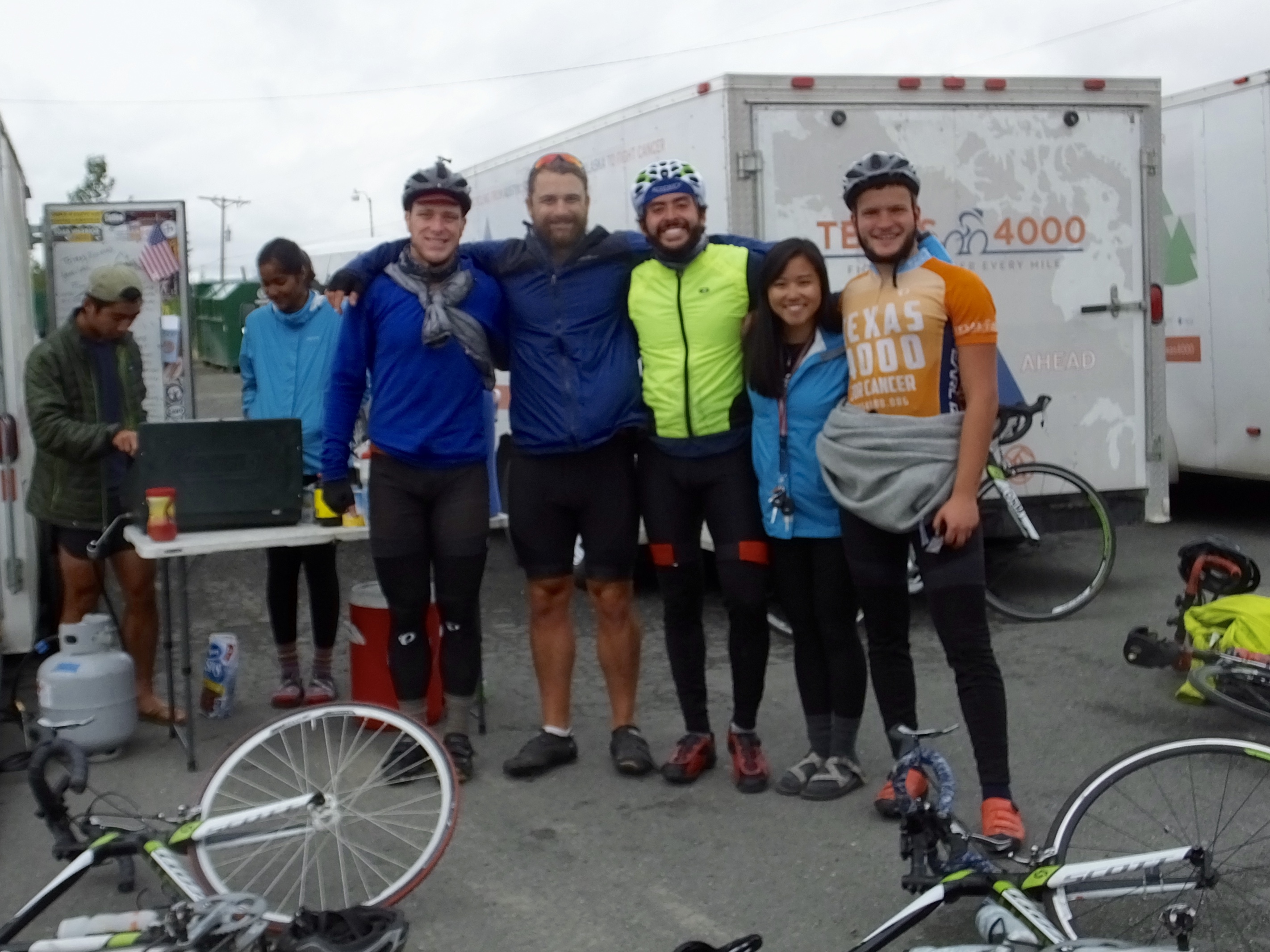 I’ve noted before on this blog that meeting interesting people is one of the bonuses of these Adventures. Today at the Eureka Roadhouse where we stopped for a mid-morning breakfast, we met some of a contingent of 60 bicycle riders pedaling from the University of Texas at Austin to Anchorage, a 70-day adventure that today was one day short of completion. The group, part of an organization known as Texas4000, was riding on the world’s longest charity bike ride to raise money (nearly $2,000,000 this year) for and awareness of cancer research. I had a chance to talk with a couple of the riders and was impressed with their dedication to this cause and their youthful stamina that carried them about 5,000 miles so far. I would have liked to spend more time hearing their stories, but they were headed toward Anchorage while we were leaving it behind. I wished them well and honked and waved at additional riders we passed on the road as they headed for hot beverages at the Roadhouse.
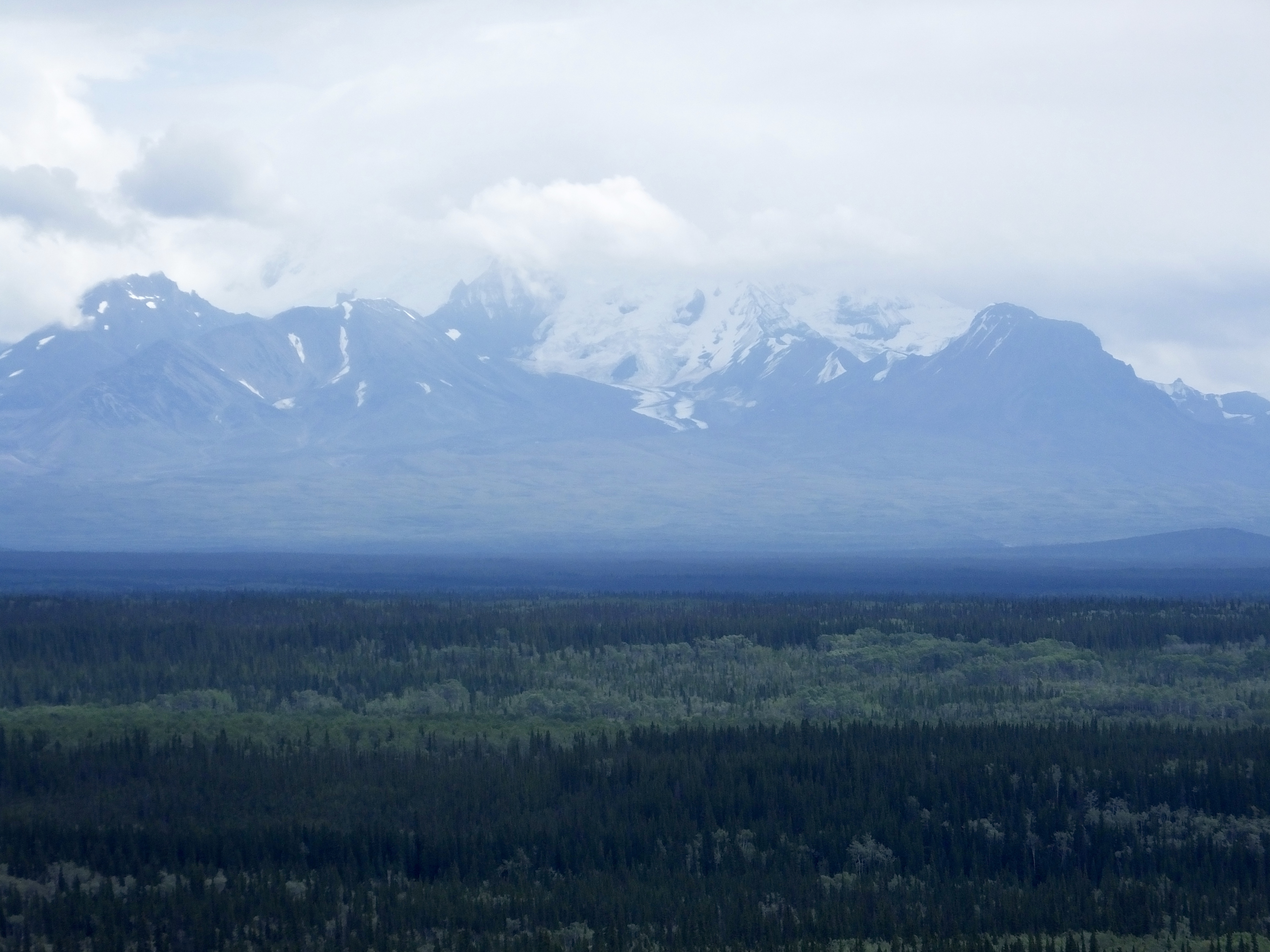 We had been riding with the Chugach Range to our right and the Talkeetna Range to our left as we rolled along the Glenn Highway, enjoying the snow covered peaks when low lying clouds allowed an opportunity. But when we reached Glenallen and turned south toward Valdez, the massive, 16,000′ Wrangell Range rose up before us and kept us company much of the way to Valdez. Mountains in Alaska, at least in the parts we have been riding through, are ubiquitous. For the nearly two weeks we’ve been here, we’ve never been out of sight of these reminders of the power of nature.
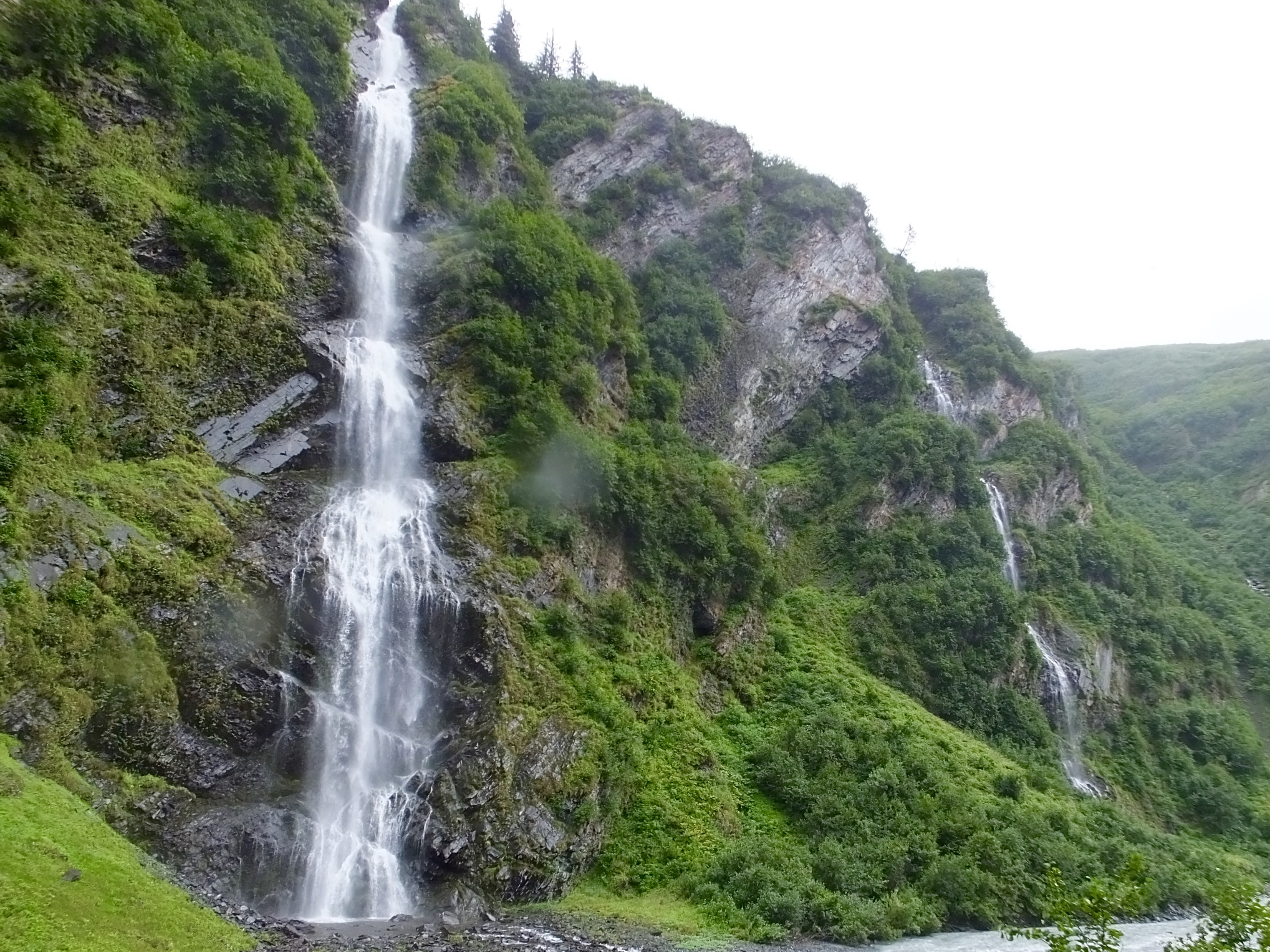 I had heard from several sources that the road to Valdez was spectacular, and what I could see of it through the distorting droplets on my face shield for the last 80 miles certainly was. Snow covered peaks, massive blue-ice glaciers sliding precariously off rocky mountain tops, treeless Thompson Pass (the snowiest place in Alaska in the winter), dozens of snow-melt waterfalls cascading down the sides of tree-covered slopes all provided a marvelous postcard-like panorama. But the rain and the wet pavement focused my attention on the road and the hassle of getting out of and back into gear if we stopped kept me rolling past available roadside pull-outs. When I saw Bridal Veil Falls, however, I had to stop for a longer look at the water splashing down the side of a 250′ cliff. Beautiful.
A short, chilly while later we were in Valdez, greeted by more rain and clouds snaking along the mountains that blocked much of our view. Tomorrow the adventure continues as we take a day off in Valdez and explore by kayak and by foot this cold, wet corner of Alaska.
Day 26: Leaving Kenai Peninsula
For nearly a week, the Kenai Peninsula has been my home, either in Seward or Soldotna. The Peninsula ranks as a special place, and even when it rains more days than not, it’s beautiful and hard to leave. But today was the day to pack gear, look once more at the misty mountains, the rushing rivers and the still lakes and leave.
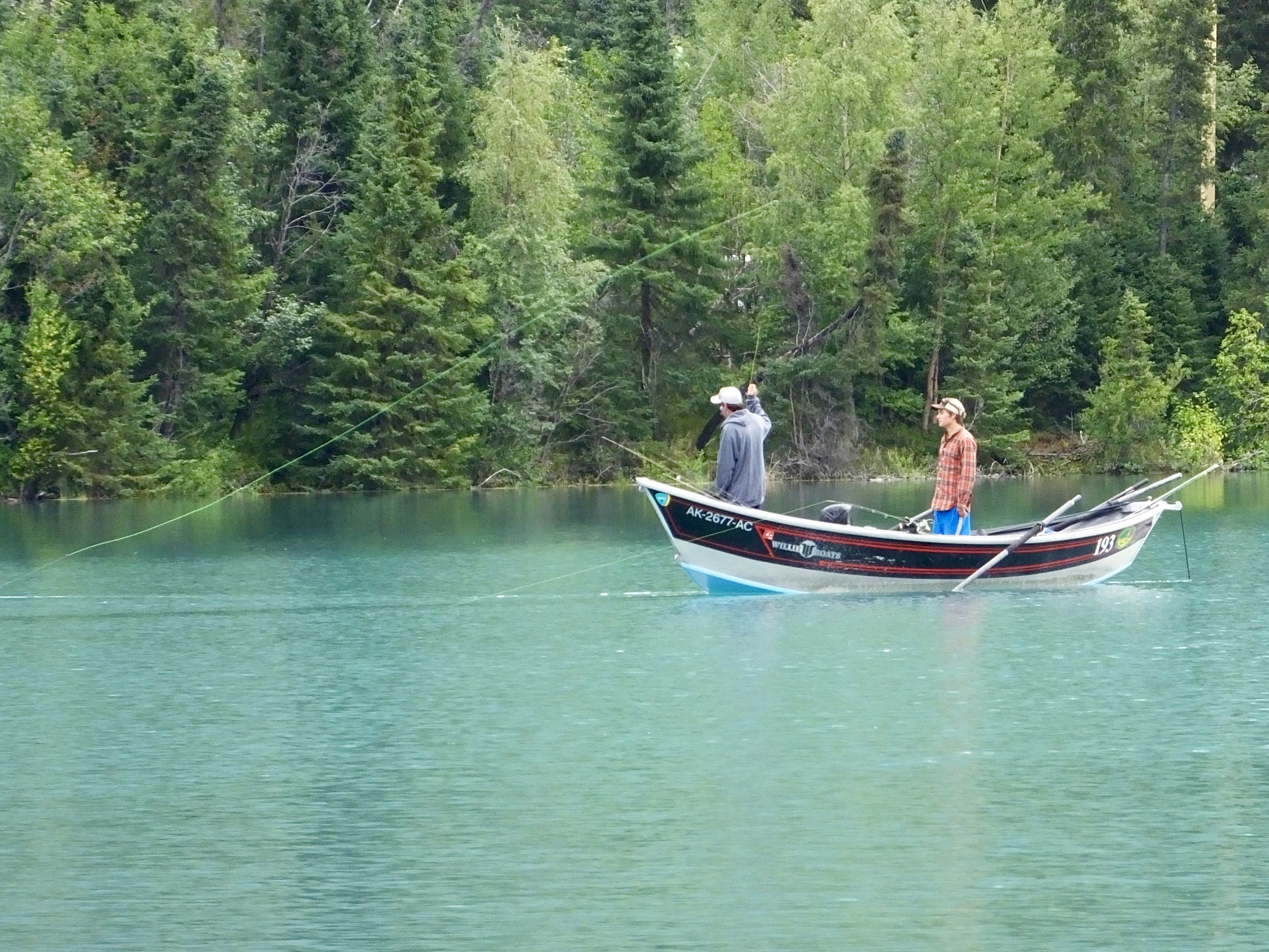 We paused a couple times along the way (once to replace a burned-out bulb in one of my spotlights but that doesn’t really count), to watch fisherfolk on the Kenai River casting from drift boats and to linger a little longer in the face of the peninsular mountains.
 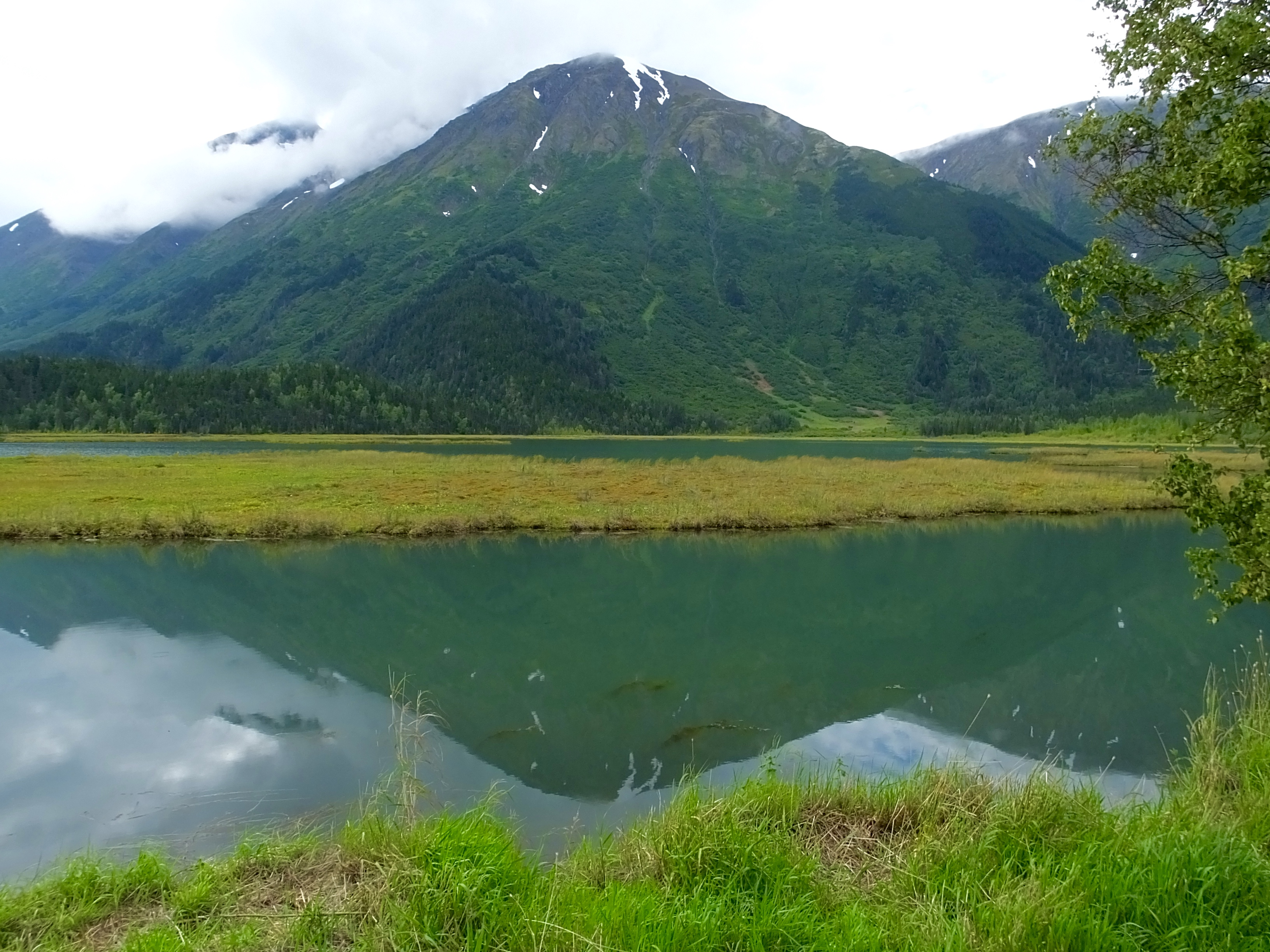 Today’s ride was only 190 miles, so we had plenty of time to pause and reflect on Alaska’s beauty one more time. And one more time after that and one more time after that.
We rounded the east end of Turnagin Arm where the melt water from Portage Glacier flows to the sea and we were off the Peninsula. We hadn’t stopped at the old mining town now ski and outdoor recreation town of Girdwood on our way to the Peninsula, so we stopped there for lunch at a rough-looking bar/eatery that served decent coffee and pretty good reindeer chili. The Girdwood stop could have been exciting, however, because road construction workers had just severed a natural gas line as we rode into town and copious amounts of gas were hissing into the air. As we ate, we watched volunteer firemen scream toward the construction site, but when we left a few minutes later by the same road we came in on, one-lane traffic was flowing past the still-leaking pipe. So there was nothing to write home about. But I just did so I guess there was.
A quick stop at the Anchorage Harley-Davidson dealer to replace the overpriced light bulb I borrowed from Mark and to add a spare bulb to my took kit, and we drove the final 40 miles to Palmer where we are spending the night.
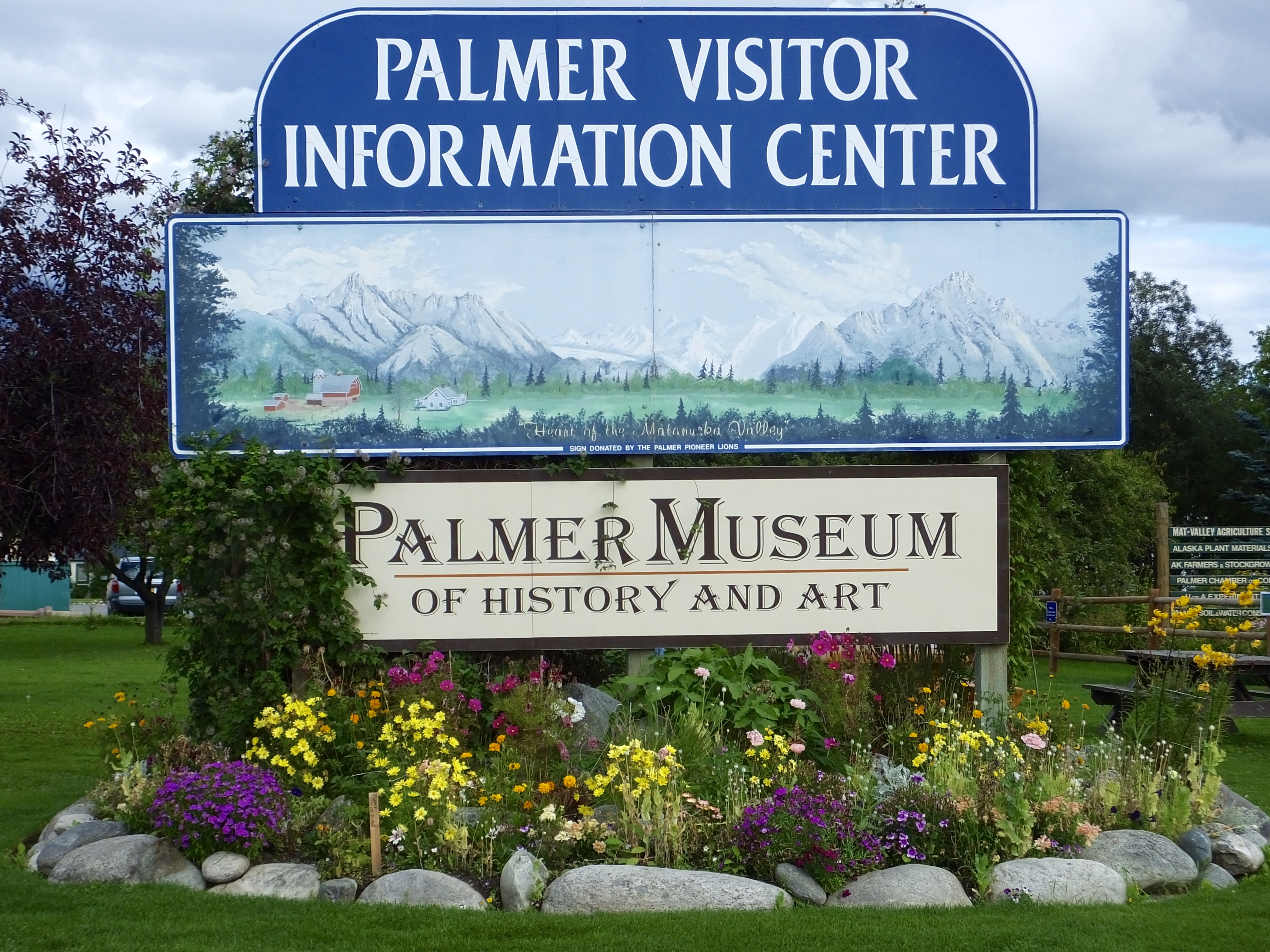 Although we could have taken a short ride to Hatcher Pass to see the mountains and abandoned gold mines and ride a pretty good motorcycle road, we opted instead for a short walk into and around Palmer to see the sights, not that I expected to find much. And then, as I frequently do, I stumbled on an historical gold mine. Not a real gold mine. A metaphorical gold mine. The Palmer Visitor Center and Historical Museum.
I knew of and taught about many public works projects launched during the Great Depression to put the unemployed back to work and bolster the staggering economy. But I didn’t know about the built-from-scratch, planned community in Palmer. In 1933, not much marked the site of Palmer. By 1936, more than 200 re-located farm families and several agriculture related industries had changed the face of Palmer.
Some experts had believed for decades that the land around Palmer had the potential to be prime farm land if forests could be cleared and the land settled with hard-working farm folk. So the Federal Emergency Relief Administration created by President Franklin Roosevelt began a project to move struggling farm families from Michigan, Wisconsin and Minnesota who were of Scandinavian descent across the country by train then up the west coast to Seward by boat then on to Palmer by train. The town had been platted, designs for houses, barns and community buildings had been drawn, and migrant construction workers had been moved to Palmer to clear land and erect buildings with the fallen timber.
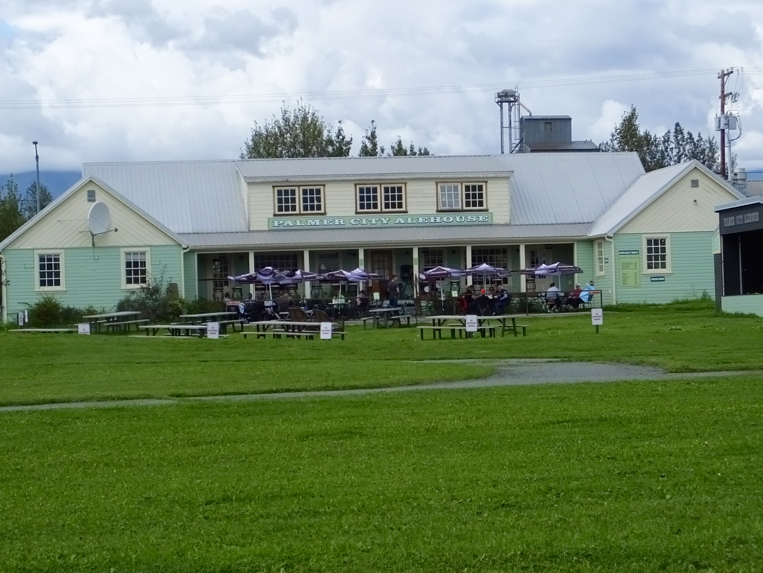 The first year was rough, in part because of the inevitability of screw ups involved in such a huge bureaucratic undertaking, but by the second year houses were raised, land was cleared and former mid-west farmers were tilling Alaskan soil and raising livestock. The organized program in social engineering fizzled after about 10 years when the emerging cold war made anything with a socialist taint anathema, but most of the transplants and their progeny stayed and many of the buildings, including the one in which Mark and I had dinner, are still in use today.
Most importantly, perhaps, Palmer is the agricultural heart of Alaska and home to the annual state fair, where proud farmers display giant vegetables such as 10 pound carrots, 20 pound zucchinis, 30 pound turnips, 100 pound cabbages and, believe it or not, 1,200 pound pumpkins. Genetic culling of seeds and 20+ hours a day of sunlight seem to be the key.
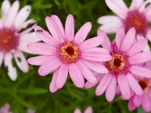
Where vegetables proliferate, so do flowers, and the garden behind the visitor center and museum flourished for all visitors to see and marvel at. Thanks to the folks at the visitor center and museum for enlightening us on an important episode of American and the 49th state’s history.
(Note: Click on any pictures on this page for a larger view.)
Tomorrow a longer ride to Valdez is in store and so is more rain and colder temperatures. The Adventure continues.
Day 25: Not According to Plan
For months, nay for years, I’d thought about and planned my bucket-list halibut fishing trip. I scheduled today’s halibut adventure more than seven months ago. I dreamed about reeling in a 100-pound halibut. I bought a new freezer to hold the enormous shipment of halibut I would send home. I tantalized friends with thoughts of a share of my halibut bounty. I mentioned halibut several times on this blog to whet everyone’s appetite. And then the long-awaited halibut day came. And went. No halibut. Not even any halibut fishing.
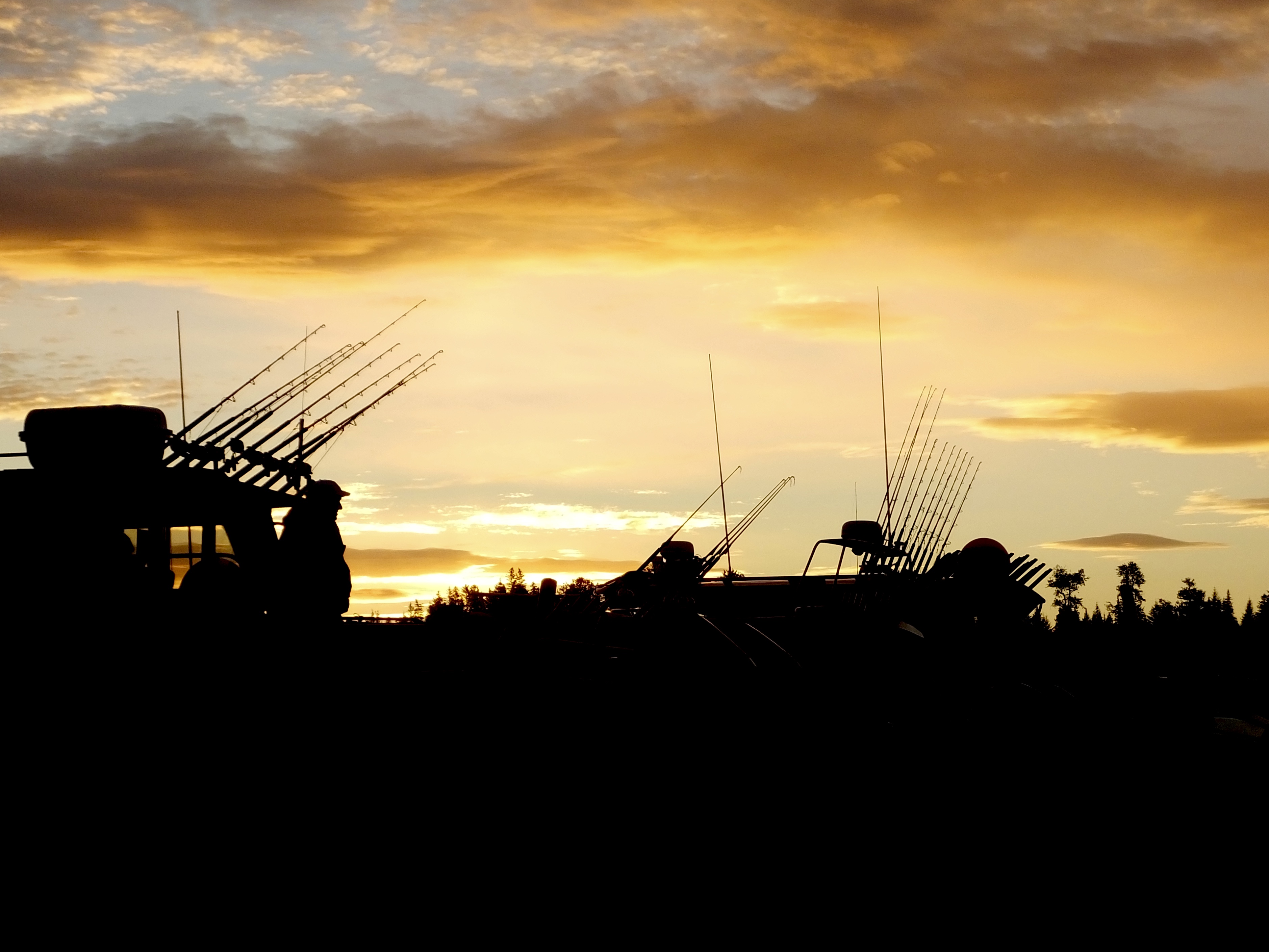
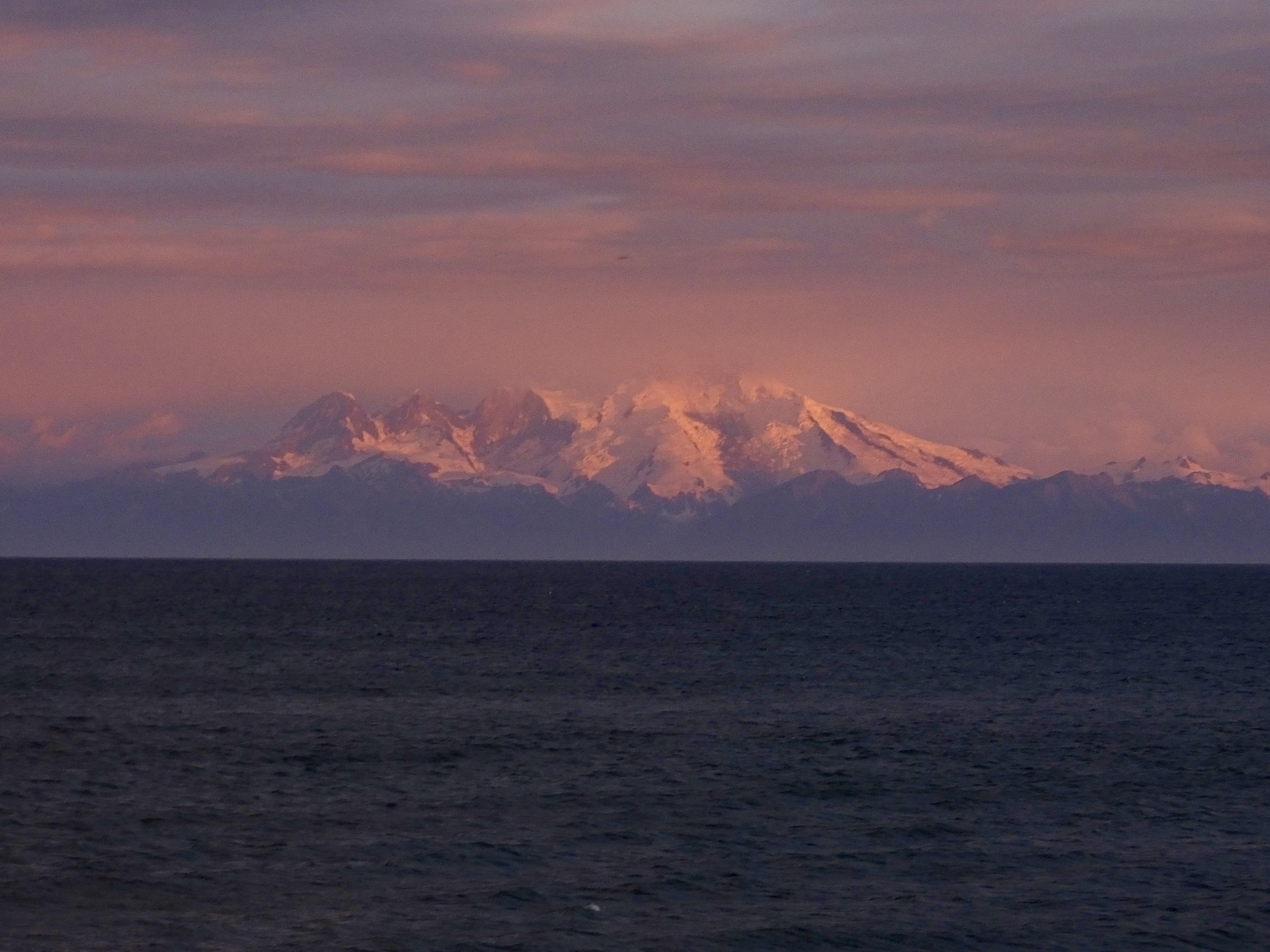 I awoke this morning before the 3:45 alarm could shake off sleep. We left the hotel in the dark for our hour and a half ride to the launch side at Anchor Point with time to spare. We avoided early morning moose and negotiated several road construction stretches. We arrived at our destination as the sun was coming up on what looked like a perfect day and I passed time framing pictures of sunrise-orange snow-covered volcanoes across Cook Inlet and a couple of gorgeous Bald Eagles feasting at the water’s edge.
 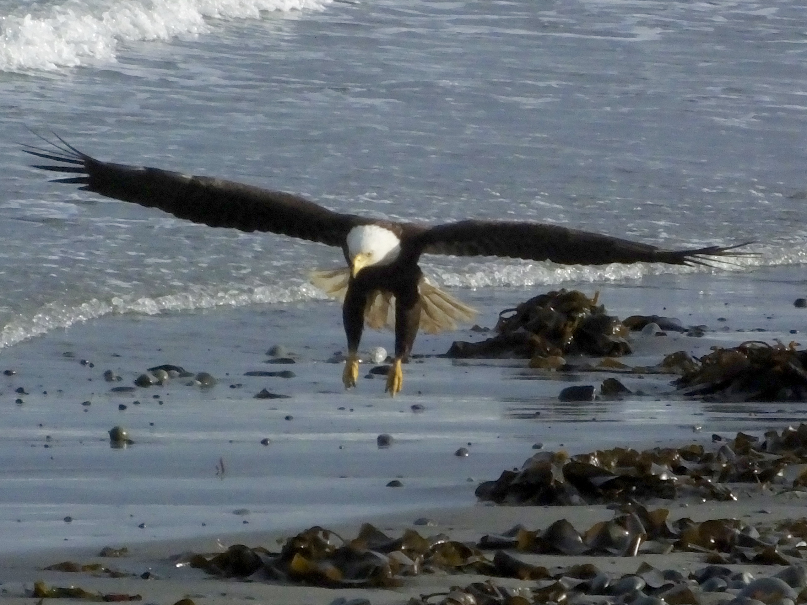 But the six or so captains waiting to launch their boats talked to one another in guarded undertones.
“Are you going?” “I don’t know, are you?” “It’s rough out there.”
The ocean, I learned, was frothing with steep 3′-4′ waves, which would make fishing difficult if not impossible.
“It might be better further out.” “I’ll go.” “Let us know what it’s like.”
 Our captain, Wally of Wally’s Guide Service, told the six fishermen signed up with him to load up. We were going halibut fishing. His 30′ boat sitting on its trailer was backed into the surf by a giant yellow former logging tractor. Wally gunned the twin outboards and backed his craft into deeper water.
For an hour, we bounced across the rolling ridges of water like a motorcycle bouncing along pot-holed Alaskan highways, spray leaping over the cabin that kept us dry while the boat dropped hard into one watery trough after another. Wally kept in touch by radio and cell phone with other captains.
“What’s it like where you’re at?” “Bad and getting worse.”
We continued on.
“Maybe if you went south?” “Arnie’s there and says its no better. He’s headed back.” “Damn.”
We idled for a while, the horizon bobbing up and down while everyone pretended they weren’t getting a little queasy.
“Gentlemen, we’re going back to shore,” Wally resignedly told the six hopeful but increasingly glum fishermen, turned his boat around and set a course back to the launch site. “You wouldn’t have enjoyed fishing in these waves and there’s no guarantee they’ll get smaller. You wouldn’t even be able to stand on the deck.” So back we went to the distant shore.
Guiding a 3o’ boat on a trailer in rough surf is no easy task, but despite scaring the Bjesus out of us as he headed straight for the trailer submerged behind the haul-out tractor at warp speed, Wally nailed the trailer dead center. We came to a quick stop and were hauled back on shore by the big yellow tractor. Our halibut trip–my bucket-list trip– had come to an end with nary a wet line less than three hours after it began.
 While other returning boats were hauled up, Wally apologized again for not being able to complete the trip, but everyone agreed it was the right decision.
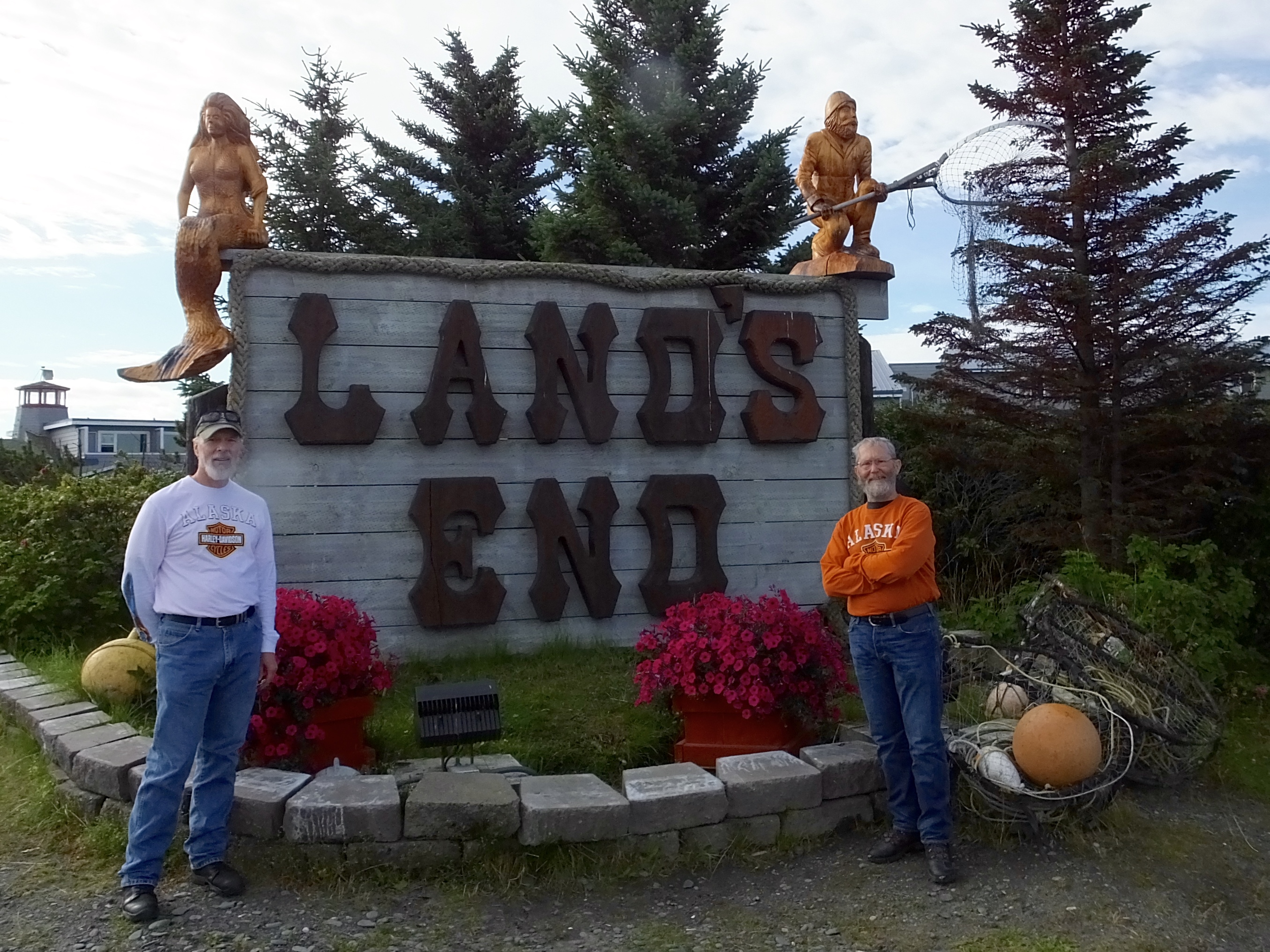
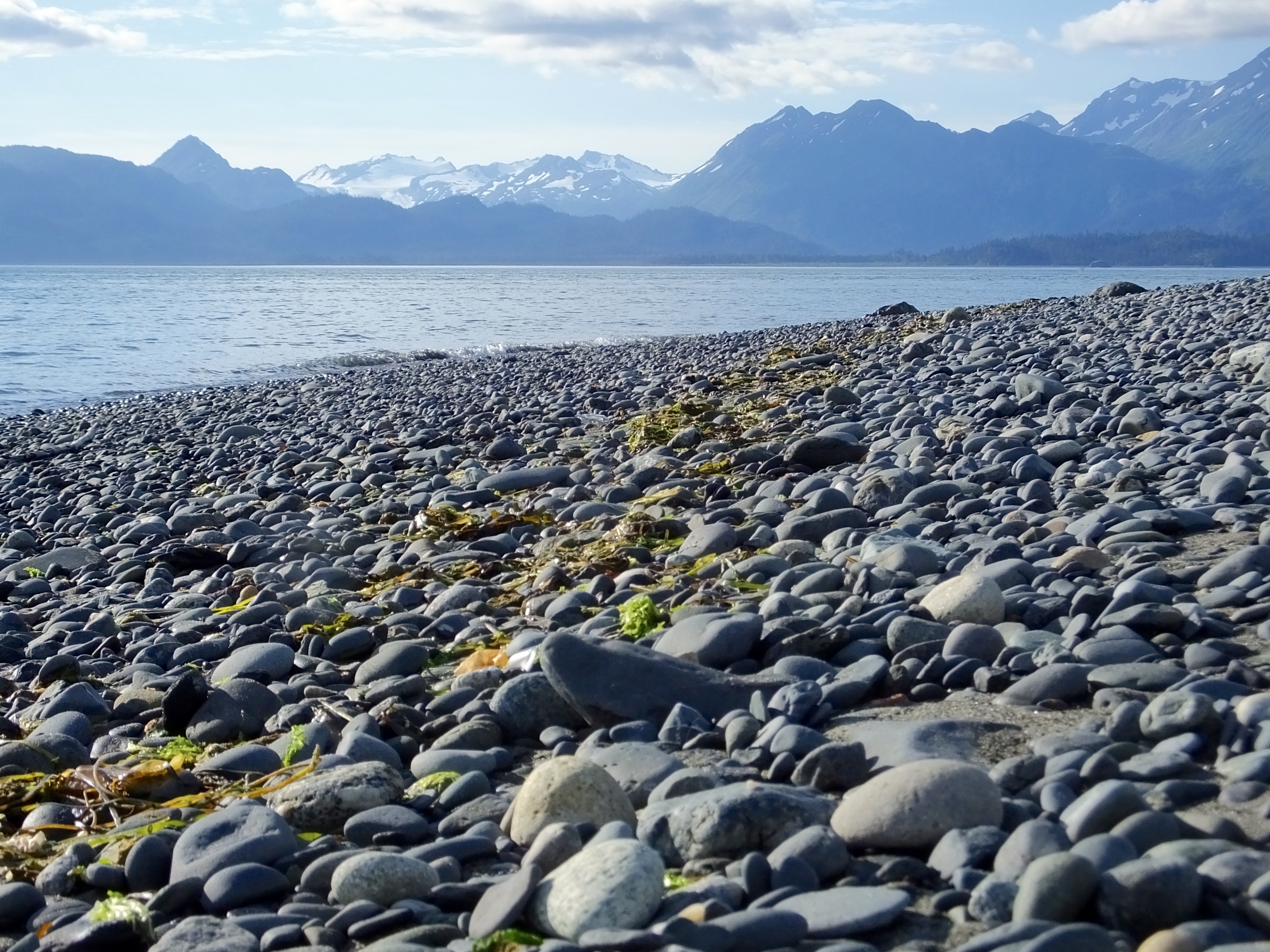 Mark and I had several non-rainy hours to kill, so we headed for Homer 15 miles away to make up for yesterday’s rain out. A ride to the end of the road (literally) on Homer Spit, some hot coffee and a hot, fresh cinnamon roll, some sight seeing in Homer, a visit to the National Wildlife Refuge Visitor Center, a short hike to the beach, and a glimpse of a nesting eagle and her juvenile offspring, and we were back on the road to Soldotna.
There we readied our bikes for tomorrow’s ride to Palmer, repacked our jumbled bags, and commiserated over a dark micro-brew beer about our missed halibut opportunity. Hopefully, I’ll have another chance someday to check off that still unchecked bucket-list item.