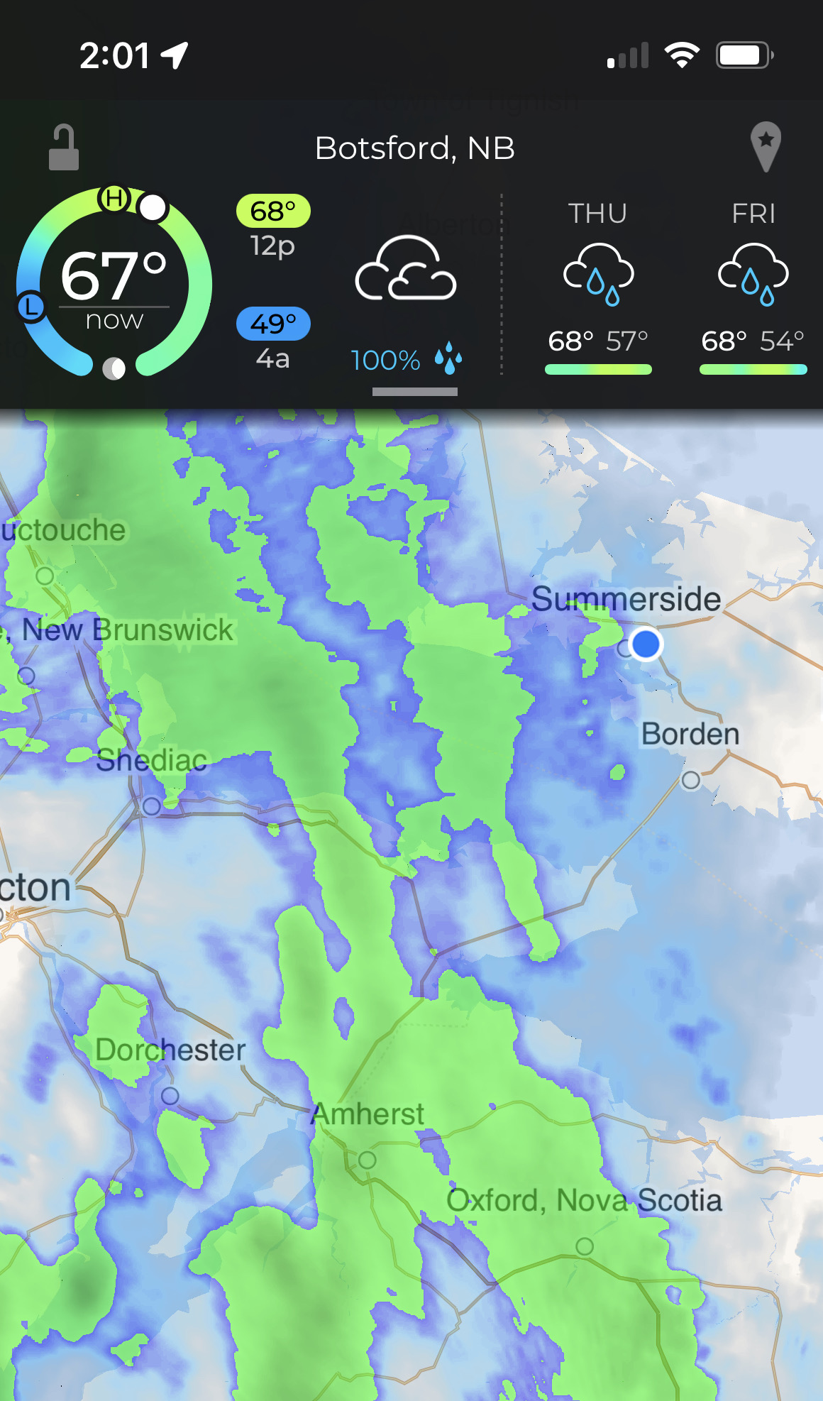
Day 14 CCR: CCR = Cross Canada Rain?
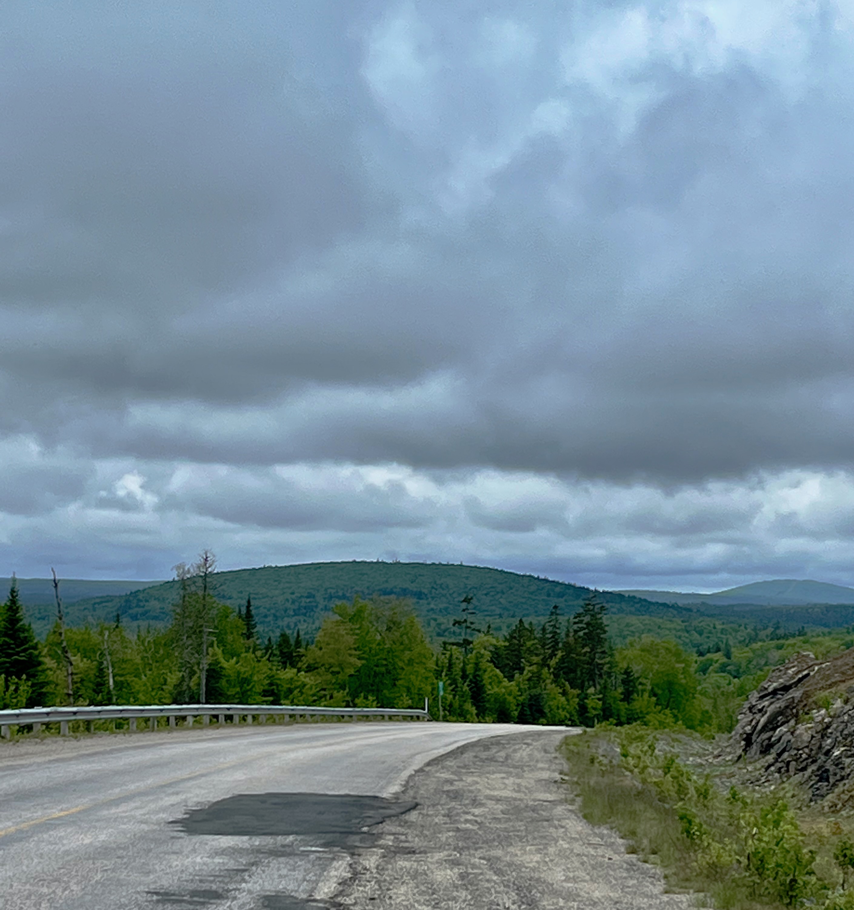
We left Summerside, Prince Edward Island, this morning in a light rain that lasted less than an hour. We then rode under ominously cloudy skies until we were about an hour and a half from our evening destination of Edmunston, New Brunswick, next to the northern tip of Maine. Then it started raining harder than anywhere else on this trip, so far. But since we only had an hour or so to the end of the ride, we pushed on.
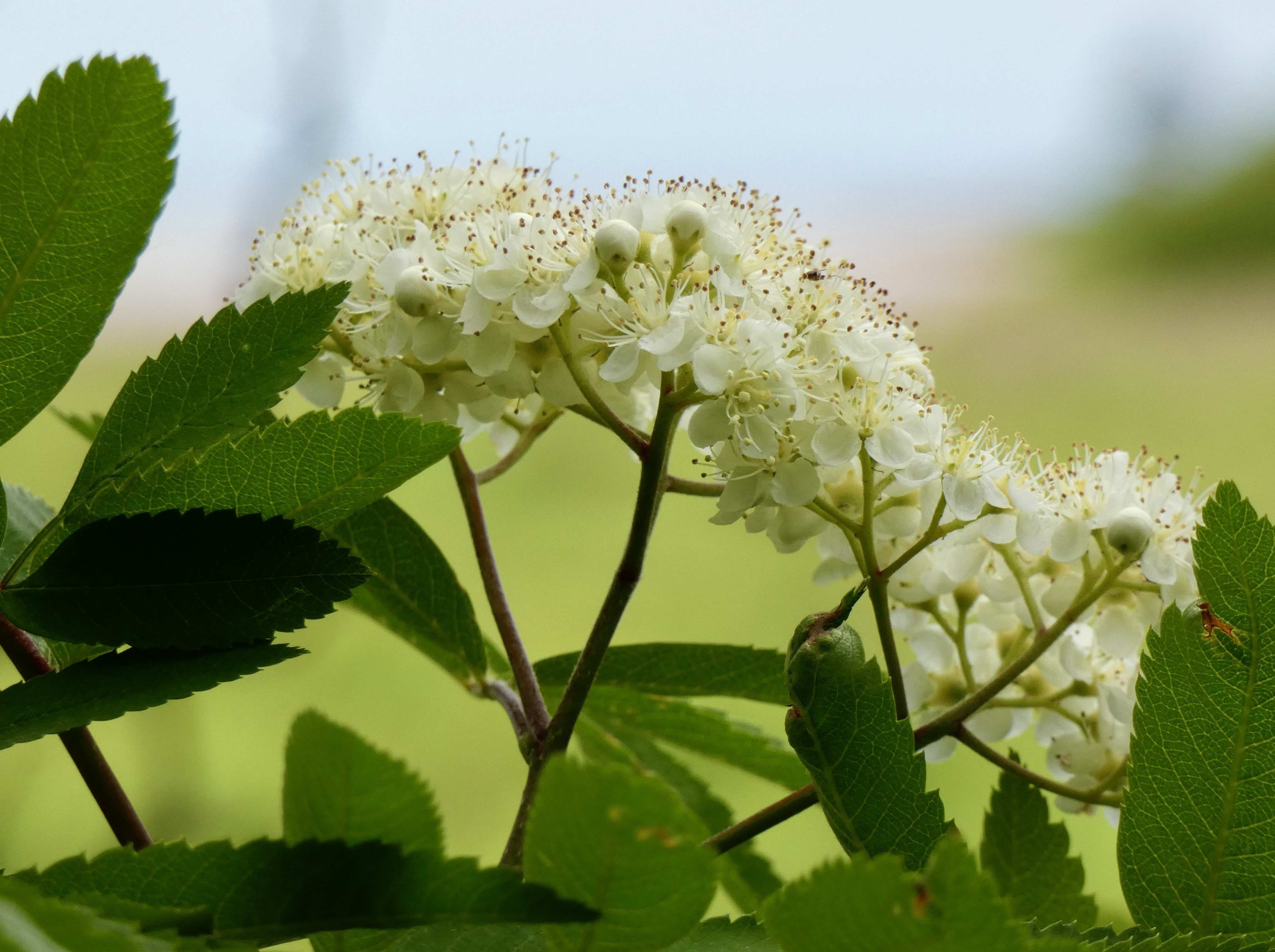
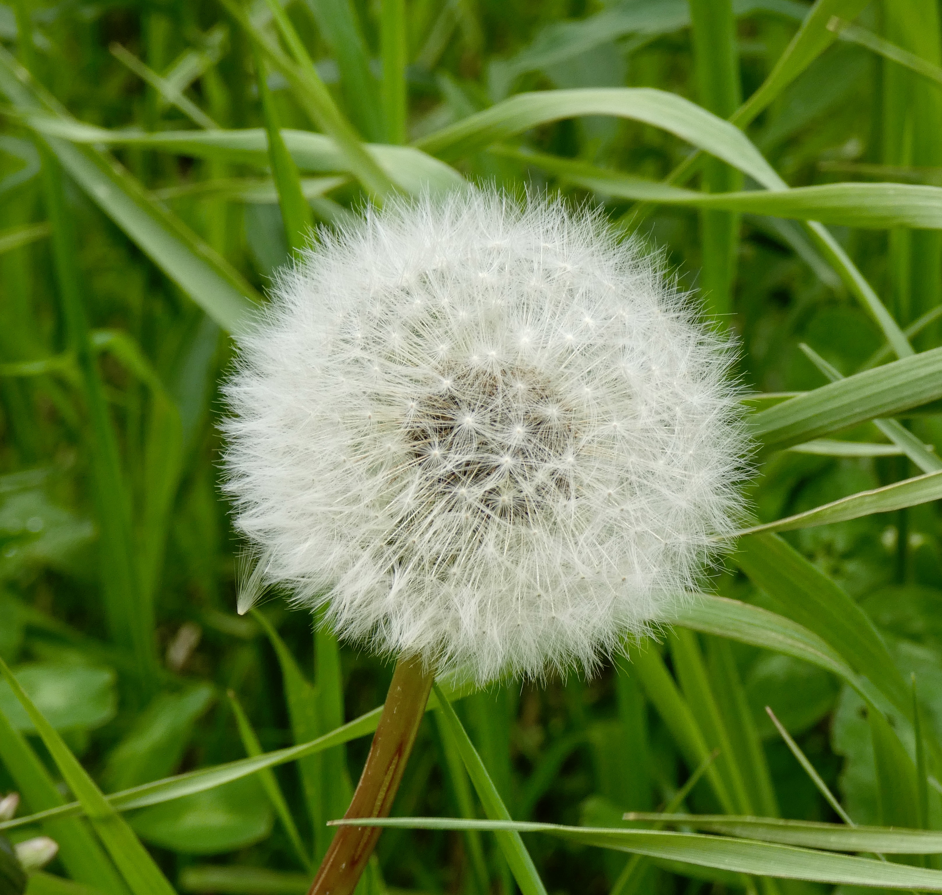
Of course, one of the problems with such a ride is that there weren’t many photo ops, though I stopped long enough in the non-rainy hours to get a couple shots to show the kind of country we spent much of the day in.
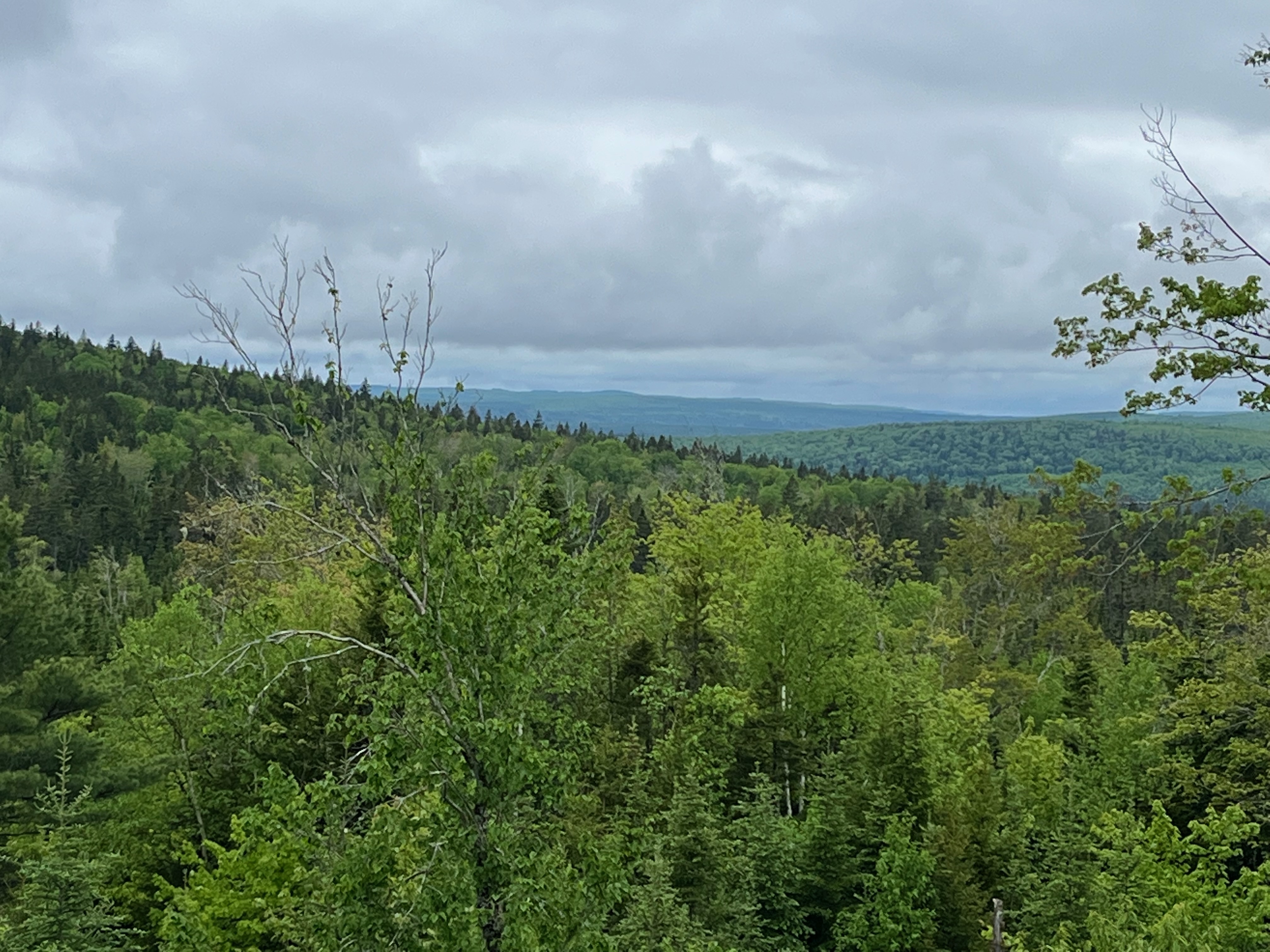
So what I do I write about tonight? I think I’ll describe the ride on Highway 108 seen in the picture above. In western North Carolina where I live is a road well-known to bikers as “The Tail of the Dragon.” Now, this road, US 129, winds from Deals Gap, NC, to Chilhowee Lake in Tennessee. The Dragon is best known for its number-based slogan: “318 Curves in 11 Miles,” indicating its twistiness, tight corners and butt clinching exhilaration as riders seek to avoid serious injury while setting a personal speed record. Highway 108 in New Brunswick isn’t like that at all. In fact, in its nearly 100 mile length from Renous in the east to Plaster Rock in the west, this road probably doesn’t have more than a couple dozen curves. Some sections measure more than five miles without any curves at all. So what makes Highway 108 special? Potholes. That’s right. Potholes. Thousands of them, created by malign forces to bedevil motorcyclists who dare lay tread on its rough asphalt surface. If this road had a slogan it would be something like “4,873 Potholes in 85 Miles.” In fairness to New Brunswick road repair crews, workers do try to fill potholes several times a year, though smoothing them out after they fill them in seems not to have entered their minds. Potholes on Highway 108 are like mushrooms–they just magically appear overnight. And, like mushrooms, they grow very big, very fast.
While the Tail of the Dragon has its curves that must be mastered, Highway 108 has its potholes that must be avoided. Constantly. Indeed, it’s like riding through a virtual video game where you have to respond quickly and sharply to avoid hitting a pothole and having a tire go pfffft and the bike go **&^$&%%!#. And to make the game more exciting, let’s add shade to the road from the tunnel of trees you’re riding through so that distinguishing between filled and unfilled potholes is exponentially difficult. Oh, and let’s throw in occasional wet pavement from a recent shower, or maybe have a 1/2 ton moose dart across the road in front of you from out of the trees and bushes that crowd the road like spectators at the Tour de France. There are lots of variations to this motorcycle video game, all of them designed to ensure a final score of pfffft and **&^$&%%!#. I have to admit, though, it was an adrenaline pumping challenge to run the pothole gauntlet. I was glad, however, when I finished the 85 mile run with no pffft and no **&^$&%%!# because my neck and shoulders ached from tension and jarring around for an hour and a half.
Other than that, we didn’t do much today except look at the clouds and wonder when they would open up on us again. It was 1:30 p,m. if you’re keeping track of such things.
If you haven’t guessed, tomorrow’s forecast is for rain much of the day, but we’re headed for a stop at a Harley dealer for Steve to get a new tire (just worn, not damaged by potholes) and then on to Montreal where I’ll practice my French. Oui?
Day 13 CCR: Seeing Sights on PEI
Before Prince Edward Island was Canadian, and before it was a British territory or colony, it was an minor outpost of the seventeenth-century French empire’s colony of Acadia and was known as Ile Saint Jean. Joining the original Mi’kmaq inhabitants, the first European settlers were mostly French until the British took control of the island under the terms of the Treaty of Paris in 1763, ending the Seven Years War. It remained a British colony for more than 100 years, joining Canada as its seventh and smallest province in 1873.
I offer that brief history lesson because much of the area we rode through today still has a strong French influence on its culture, religion and language and was apparent in place names and religious settings. Many residents in the northwestern part of the island speak French as their primary language, though all are bi-lingual.
In addition to tourism, two of the biggest sectors of the PEI economy are agriculture, especially potatoes, and fishing, especially for lobster. And today we saw examples of all three.
Tourism development included the creation of three scenic loop drives earlier this century: Points East Coastal Drive, Central Coastal Drive and North Cape Coastal Drive. Today we tackled part of the North Cape Coastal Drive, but predictions of rain this afternoon drove us back to our base at Summerside before we could complete the drive through the western and northernmost segments of the island. Nevertheless we saw enough to get a good taste of PEI’s North Cape Coast.
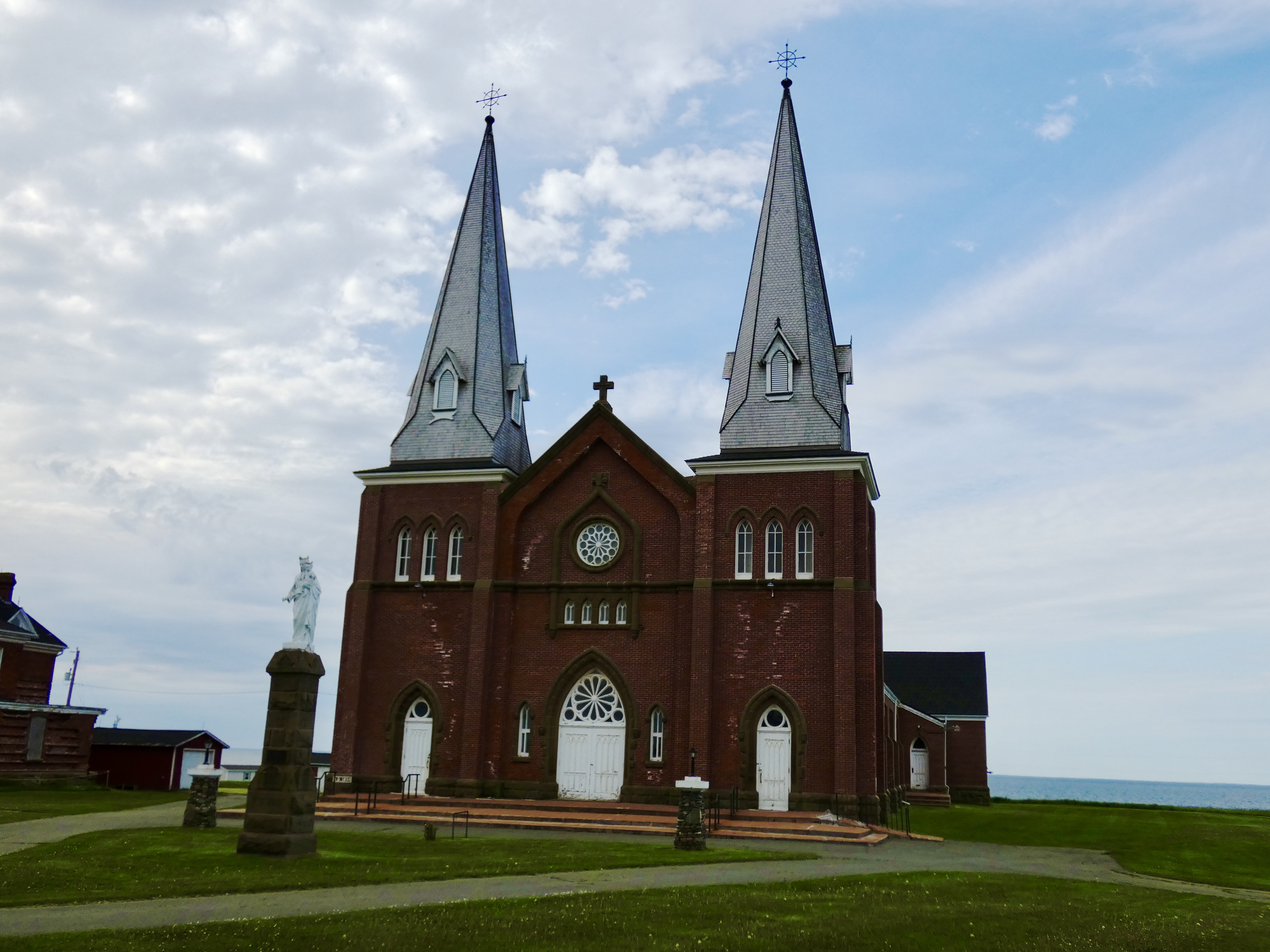

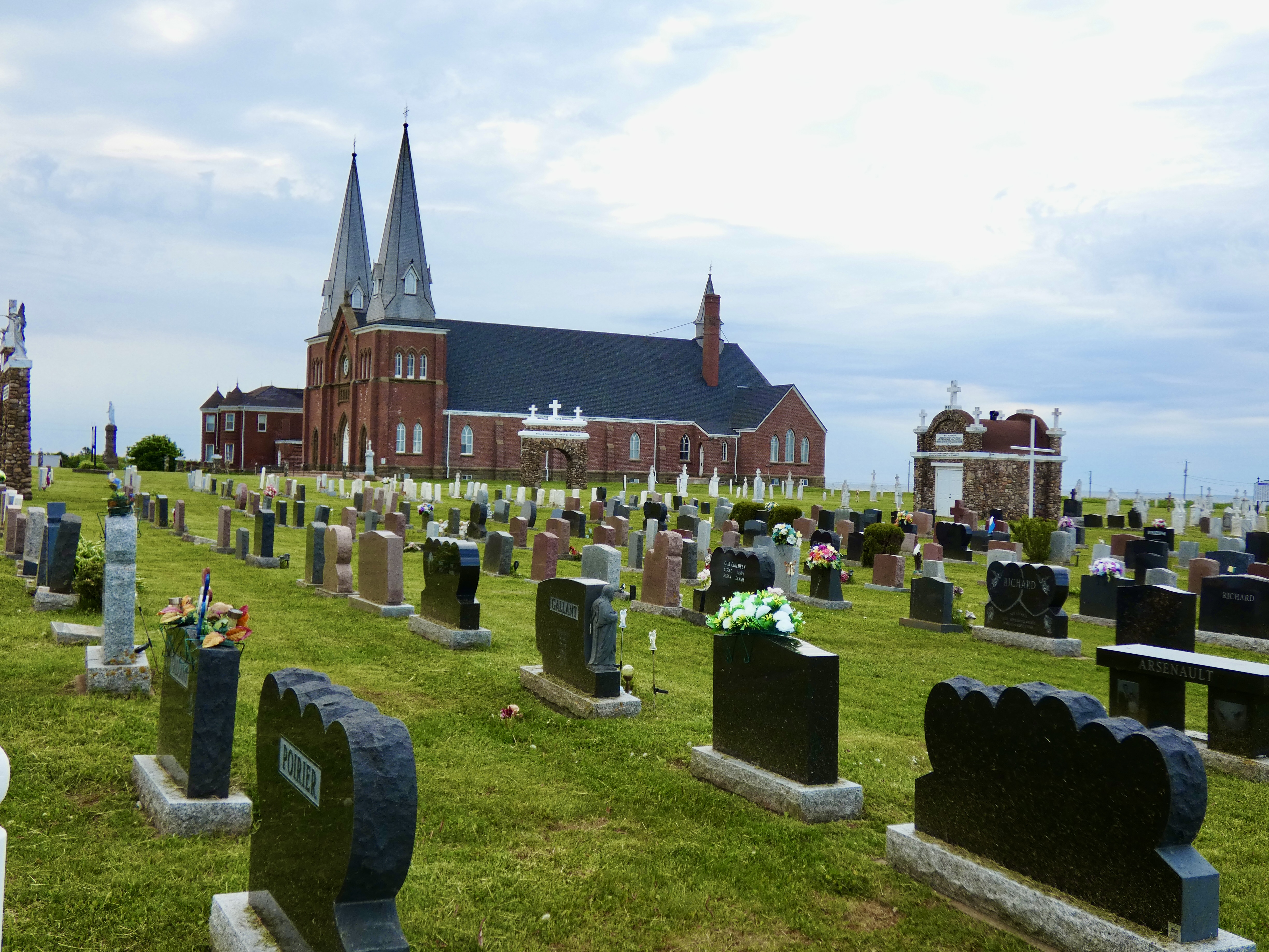
One of the most impressive sights we came on as we motored along the loop drive was the massive French Catholic church at Mont Carmel, about 20 miles from Summerside. The structure dwarfed all other buildings we saw as we rode along the coast, and every brick and stone of the edifice was testimony to the area’s history. The cornerstone had been laid in 1898, but other artistic and structural elements, attached to and detached from the building, had been added over the years. For more than a century and a quarter, this church has been the bedrock of that coastal segment of the Acadian community in PEI.
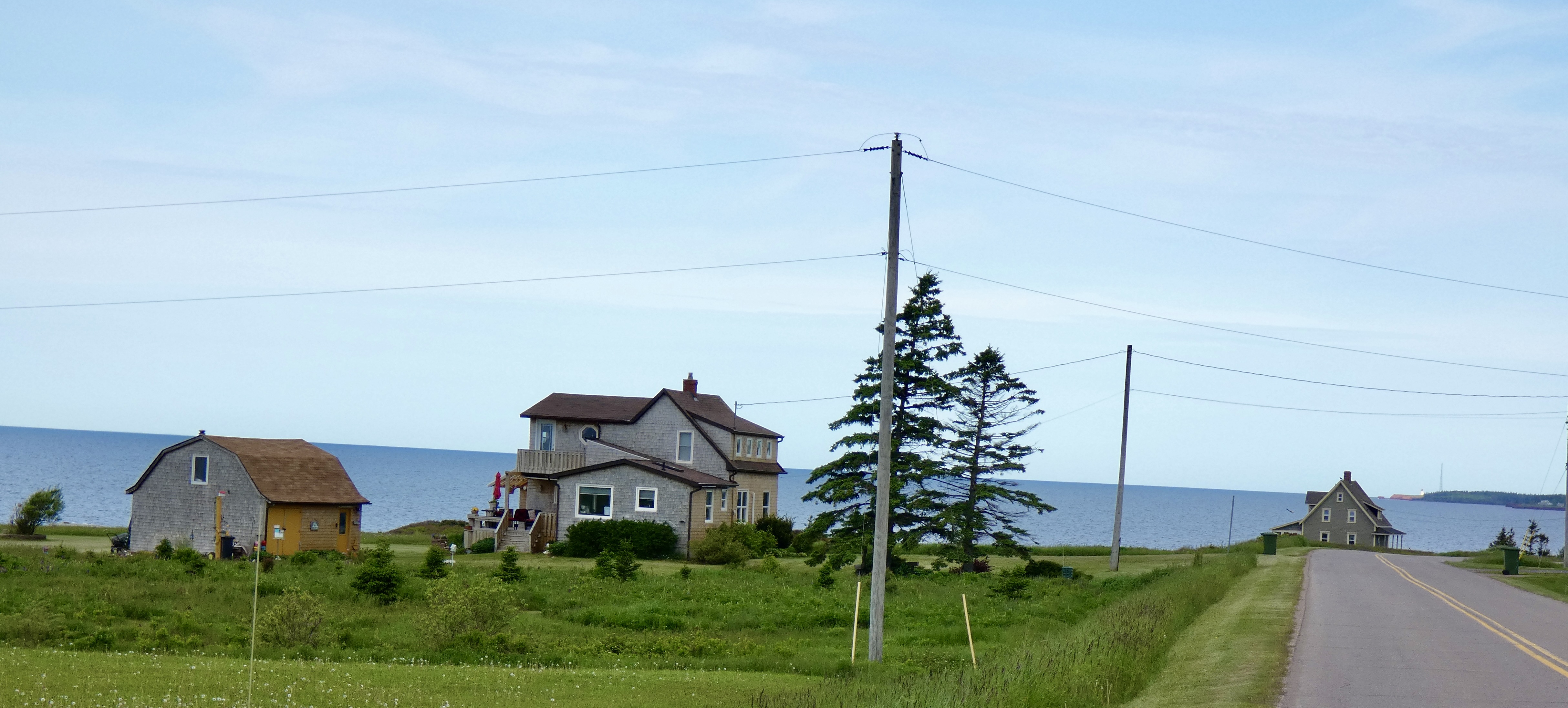
Ocean views are prime property along the North Cape coast and there was little property that didn’t have some living structure on it. It could have been a near-mansion or it could have been a recreational vehicle. More often than not, it was a house similar to the one pictured above. No doubt the land itself was almost always more valuable than whatever house happened to be perched overlooking the sea.
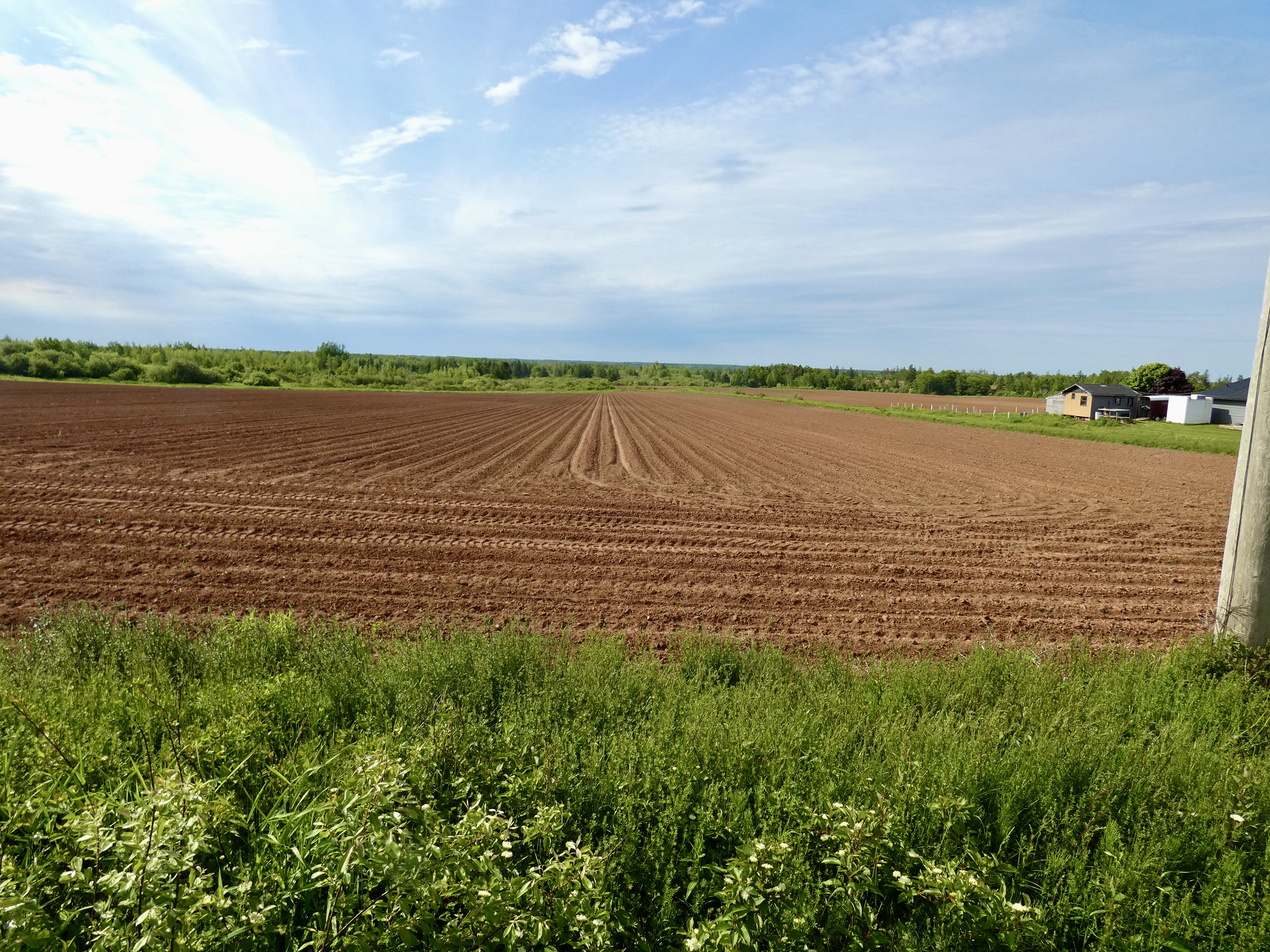
On the other side of the road, though, were liable to be recently plowed fields with very pronounced furrows and ridges. In a month, this acreage will be covered with the verdant green of potato plants and in some places today we could see the first shoots of potato plants breaking through the red soil that colors the area even without plants. PEI, the smallest province of the ten, grows one-quarter of all potatoes consumed in Canada.
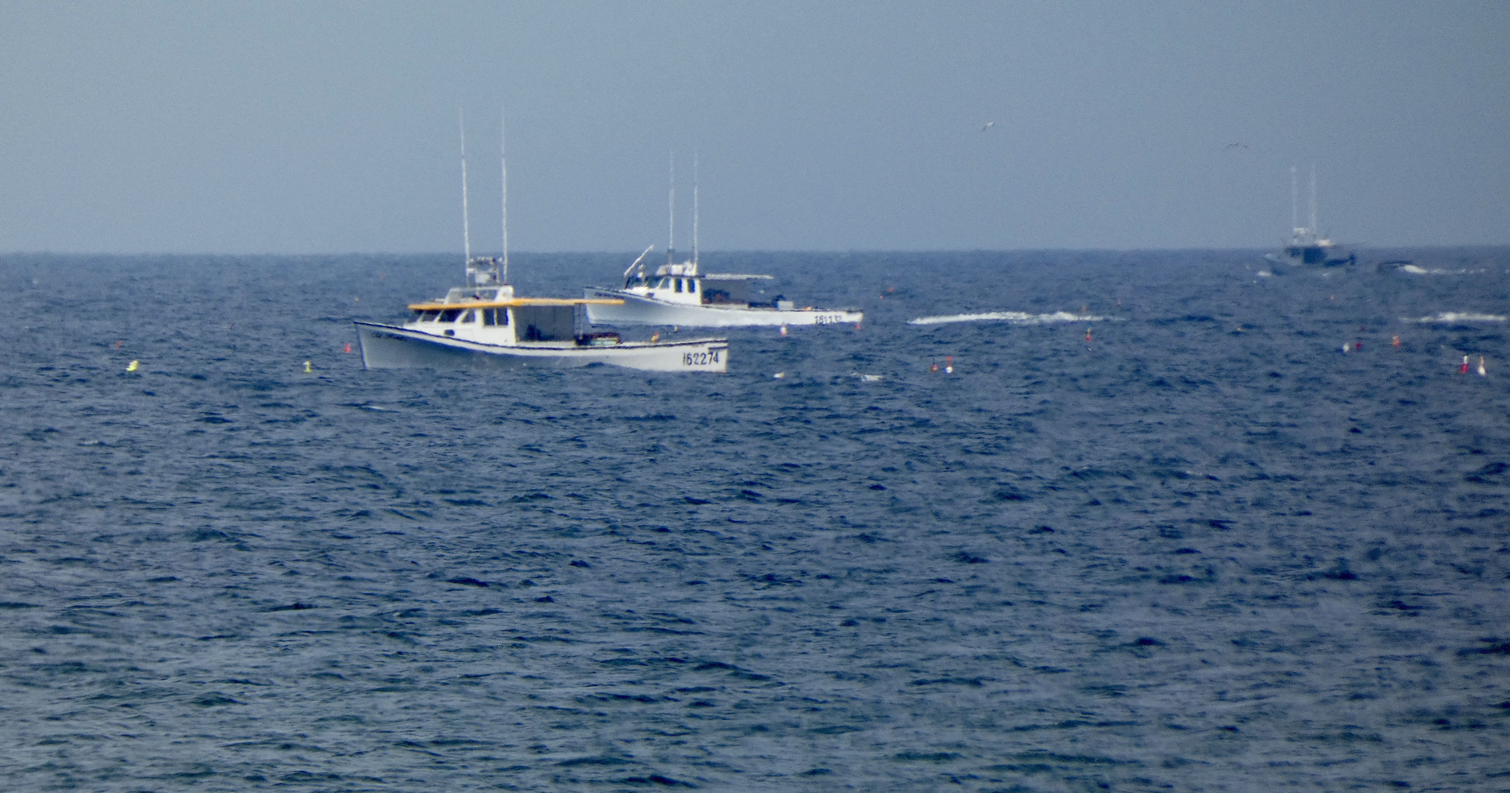
Fishing boats are everywhere. Some are in people’s front yards, but most are tied to a dock or at sea, fishing or lobstering as residents use the sea as much as they do the land to earn a hard living in PEI.
We worked our way north and west, cruising along backroads, many of which I had no intention of taking but Google’s map program kept showing me short-cuts and directing me off the official route. Eventually, I shut down the GPS and relied on colorful North Cape Coastal Drive road signs to direct me. I will here offer a complaint about Canadian traffic engineers. I’m used to road signs directing me to turn exactly at the spot where I’m supposed to turn. But here, they place a sign a quarter of a mile or so before the turn and the driver is forced to guess just where that turn is, resulting in more than one u-turn on today’s ride.
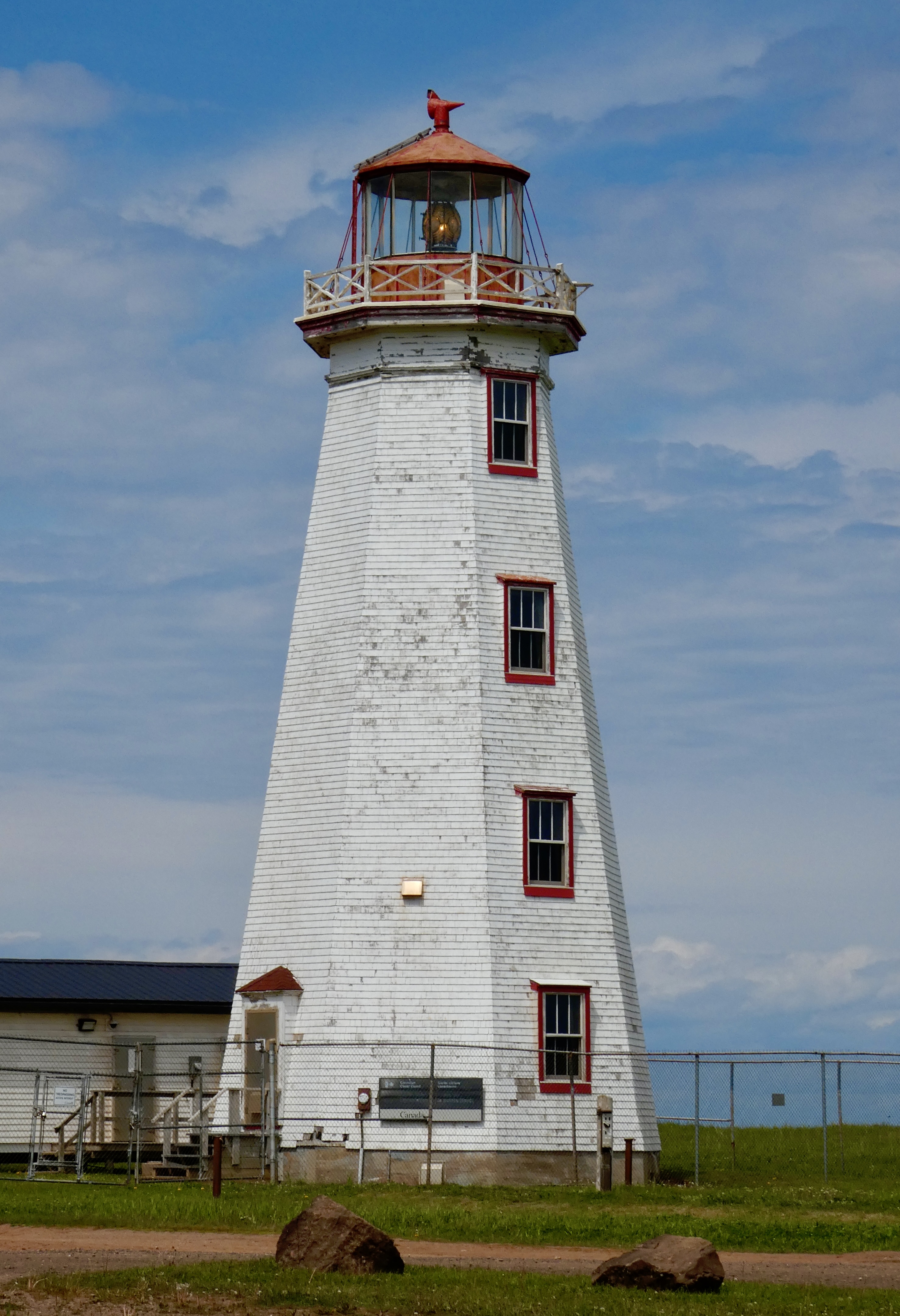
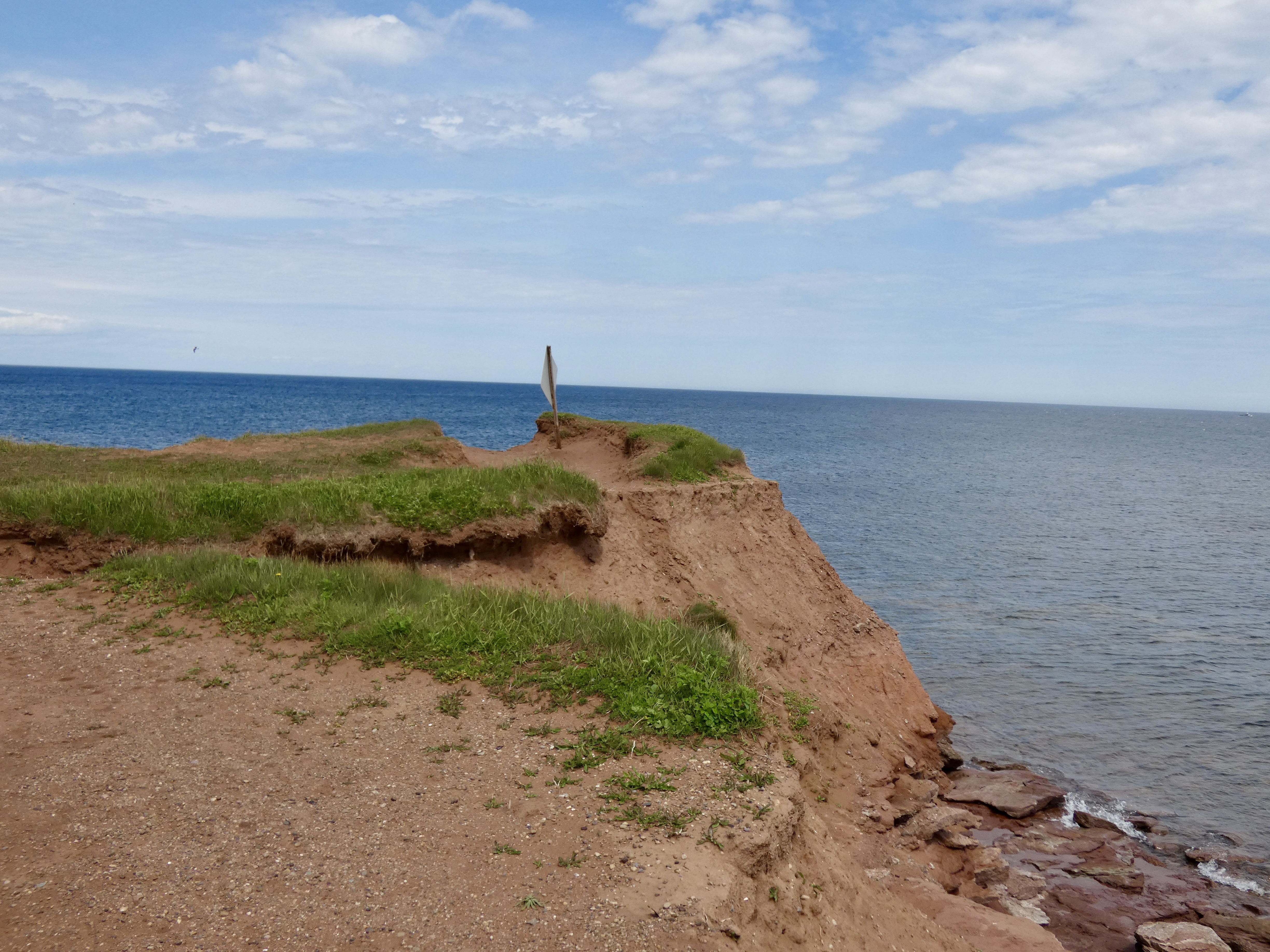
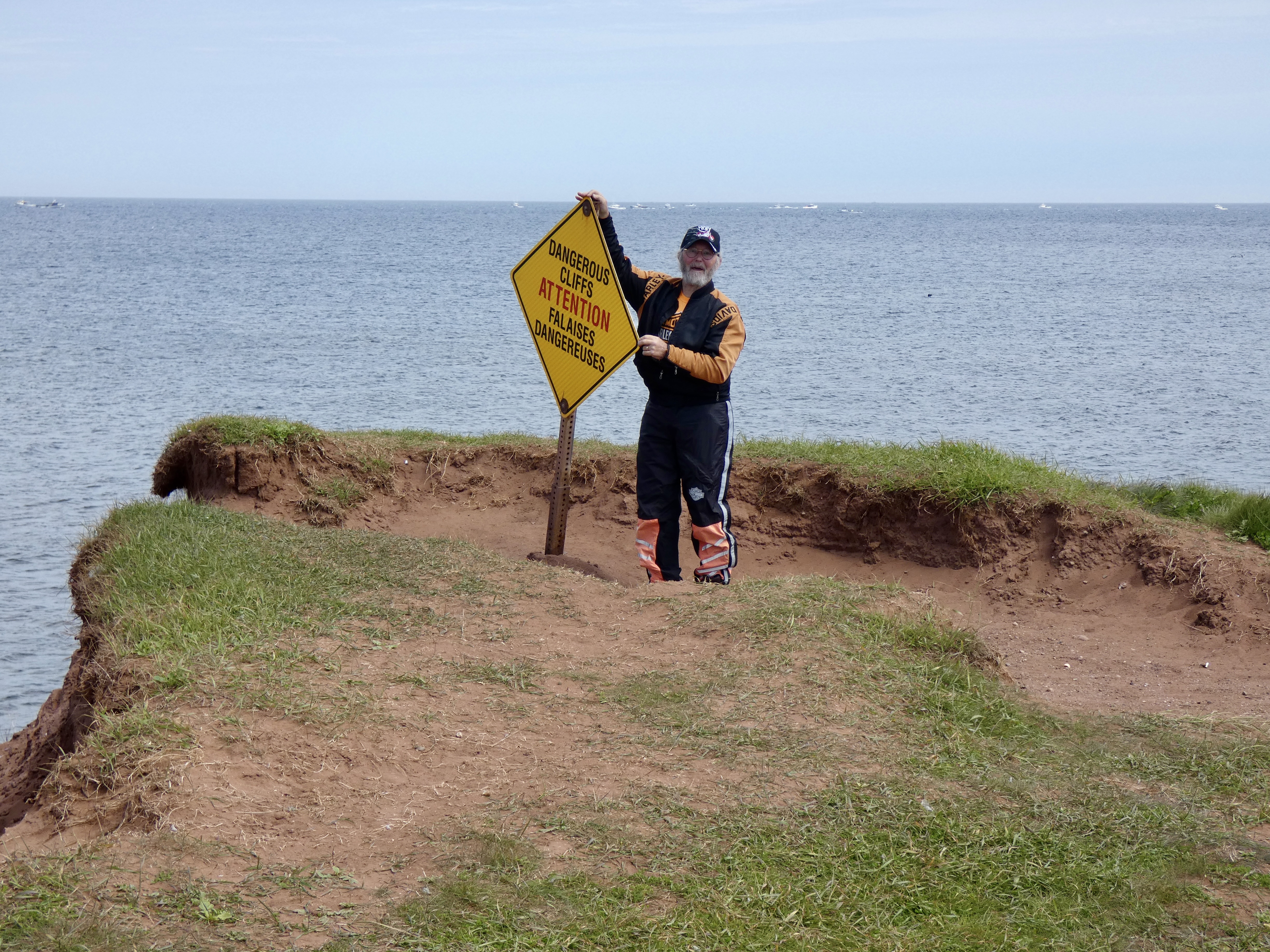
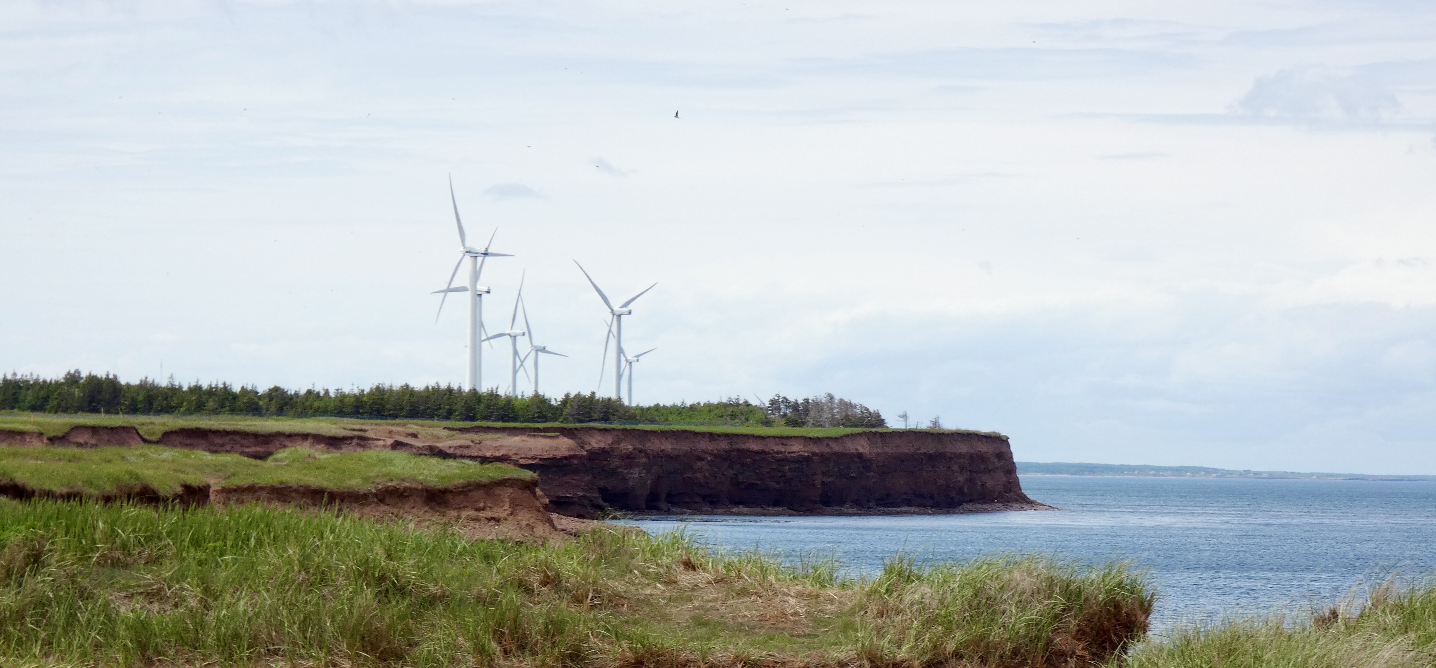
Despite detours and missed turns, we ultimately reached the northern tip of Prince Edward Island. In addition to having an interpretive center, light house, a couple dozen giant wind turbines, a gift shop and restaurant, the northern point of PEI also has the longest natural rock reef in North America, which at low tide stretches more than a mile into the sea. When the tide comes in, what you witness is the meeting of the waters of the Gulf of Saint Lawrence and the Northumberland Straight.
After parking the bikes, we took a short hike along the cliffs of the point to reach the very tip.
Following a quick lunch in Tignish at a local bakery that sold great sandwiches at a bargain price ($6 CAD), a look at the weather radar suggested a rapid return to Summerside was in order. So, after having worked our way up the east coast of the pennisula , we decided to forego a trip along the west coast in favor of a more direct and quicker route down the middle and back to Summerside. We had a few sprinkles on the way back but no serious rain. In fact, despite the ominous looking radar picture, we didn’t get any significant rain all afternoon, though it did wet the roads.
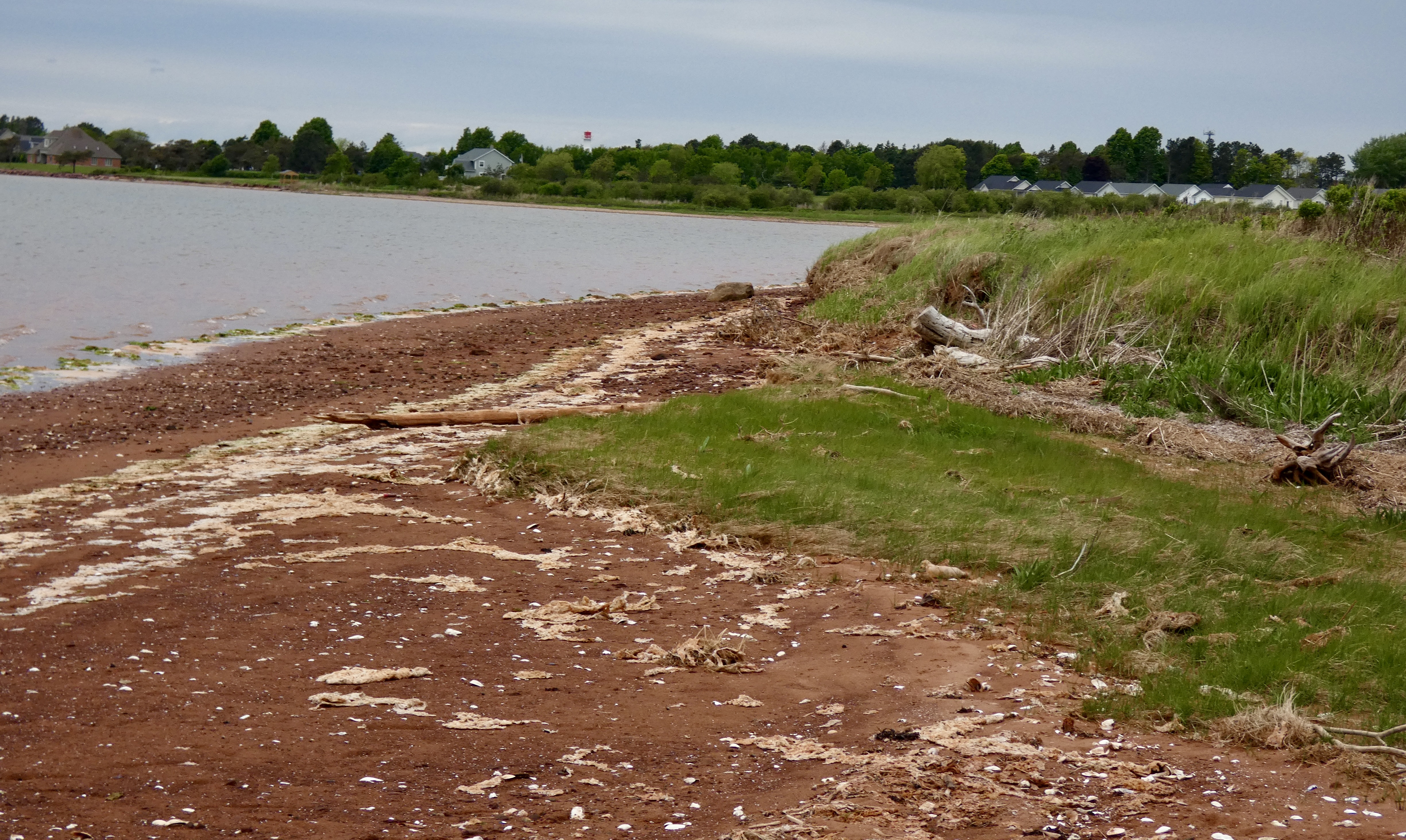
I was glad for a further respite of rain and, after taking care of some future hotel bookings, I took a short hike from our hotel to the beach about a mile away. The owner of the hotel owns 30 acres of land behind it and he is kind enough to mow a path through the field and trees down to the beach for his guests. In addition to getting some exercise, I also got a few more pictures, including one of the ever-present red sand, which is caused by the amount of iron in the soil.

Tomorrow, we leave this beautiful island. I saw more than I did the last time I was here eight years ago, but I still haven’t seen enough. The next time I come to PEI, I’m staying for at least a week and I’m definitely spending more time on the Coastal Drives. For now, it’s off to New Brunswick and points west.
Day 12 CCR: Nice Ride to PEI
For the first time in almost a week we had blue skies and relatively warm (50°) temperatures for today’s ride out of Nova Scotia and into our fourth province: Prince Edward Island (aka PEI). I still wore heated gear in the morning, but by afternoon, even though it was a little chilly I delightedly stowed my heated jacket and gloves in a saddlebag. I sure hope this turn in the weather lasts for a few days.
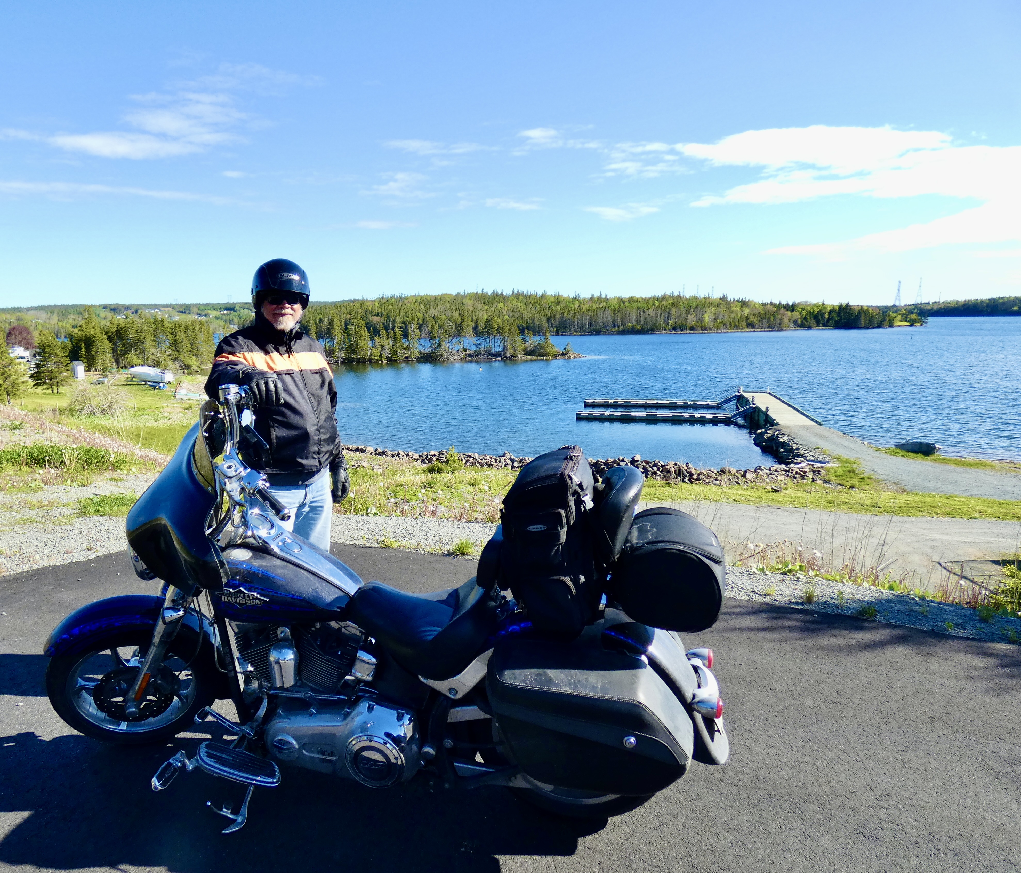
Today’s 300-mile ride started in Sydney, NS, and ended in Summerside, PEI. Between those two points a mixture of roads and scenery kept us entertained most of the day, and Google GPS even took us down some roads (shortcuts, I guess) that I probably would not have chosen but was glad Google did. Several things dominated today’s ride, and one of the most prominent was frequent views of water: small lakes, big lakes, oceans, streams. Northern Nova Scotia has an abundance of water that provides recreation for tourists and residents.
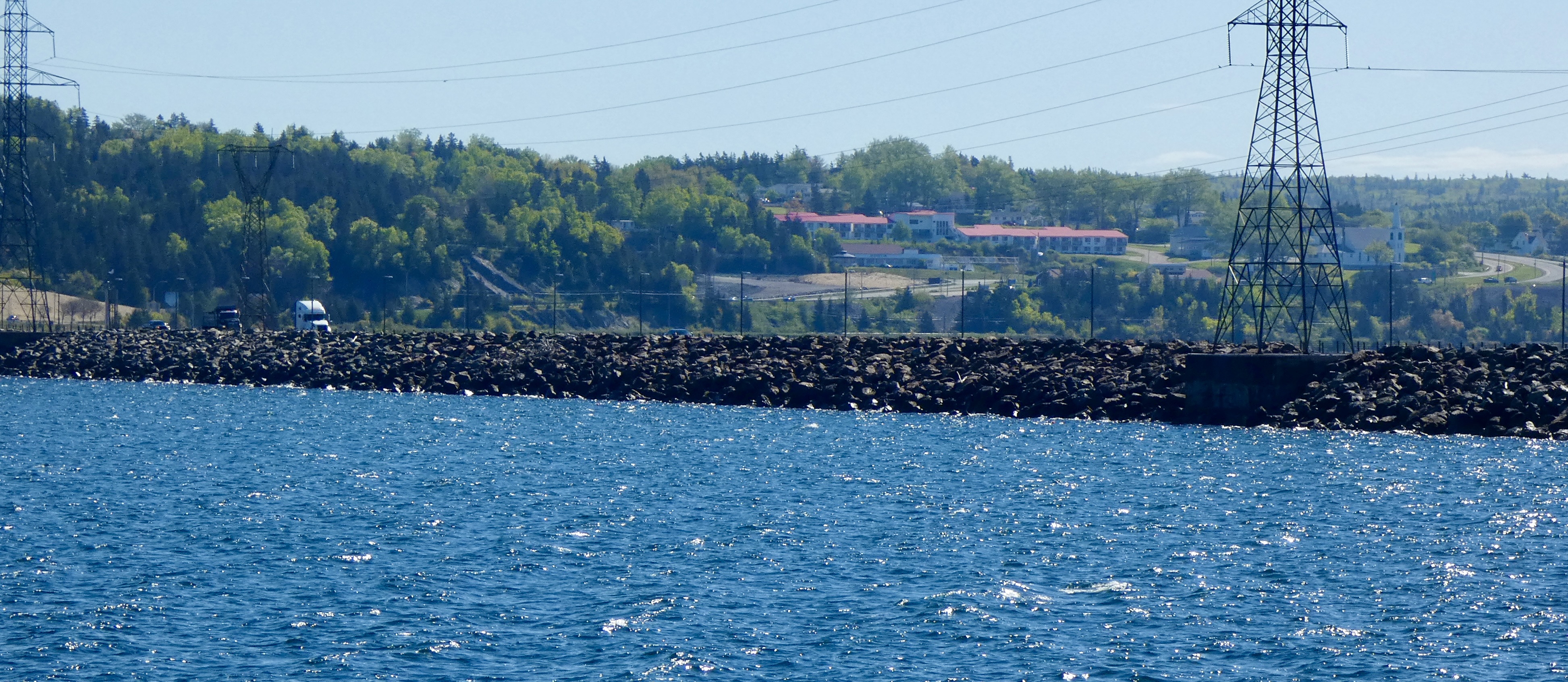
On our way to Newfoundland we rode some of the same roads we travelled today, but with a much impaired view thanks to wind and rain. On Day 6 of the CCR, we crossed the same Canso Causeway we re-crossed today, but there was no stopping for pictures the first time as wind-blown waves crashed over the rocks six feet above the water level and onto the road. Today’s ride across the causeway was considerably drier and we even had a chance to stop for a photo op.
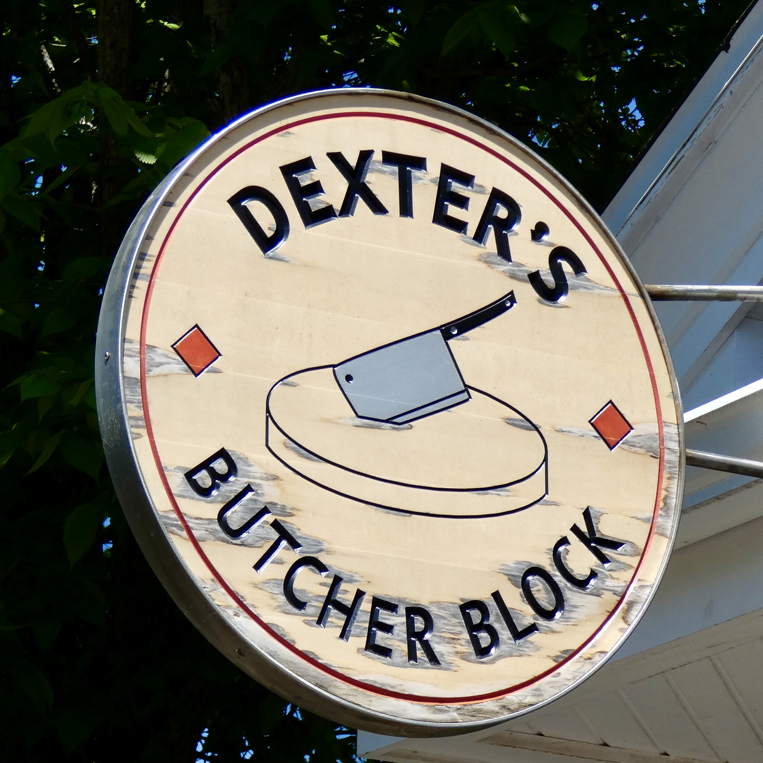
I had planned a lunch stop in Tatamagouche because I like the name and figured we might find something special there. Indeed we did. We discovered a real butcher shop run by two young men since 2017 who seem to be doing a booming business. In addition to selling freshly butchered meats, they also, as a sideline, sell sandwiches made with their meat. I ordered smoked beef and ham before we learned about Donair meat from the butchers. Steve, behind me in line, ordered Donair. We still don’t know exactly what it is, other than it’s beef infused with herbs and spices and then usually shaved and stuffed into a pita sandwich with a variety of vegetables. Very popular in Nova Scotia, said the young butchers. Steve’s sandwich wasn’t shaved meat and it wasn’t on pita bread, but he said the Donair meat was good.

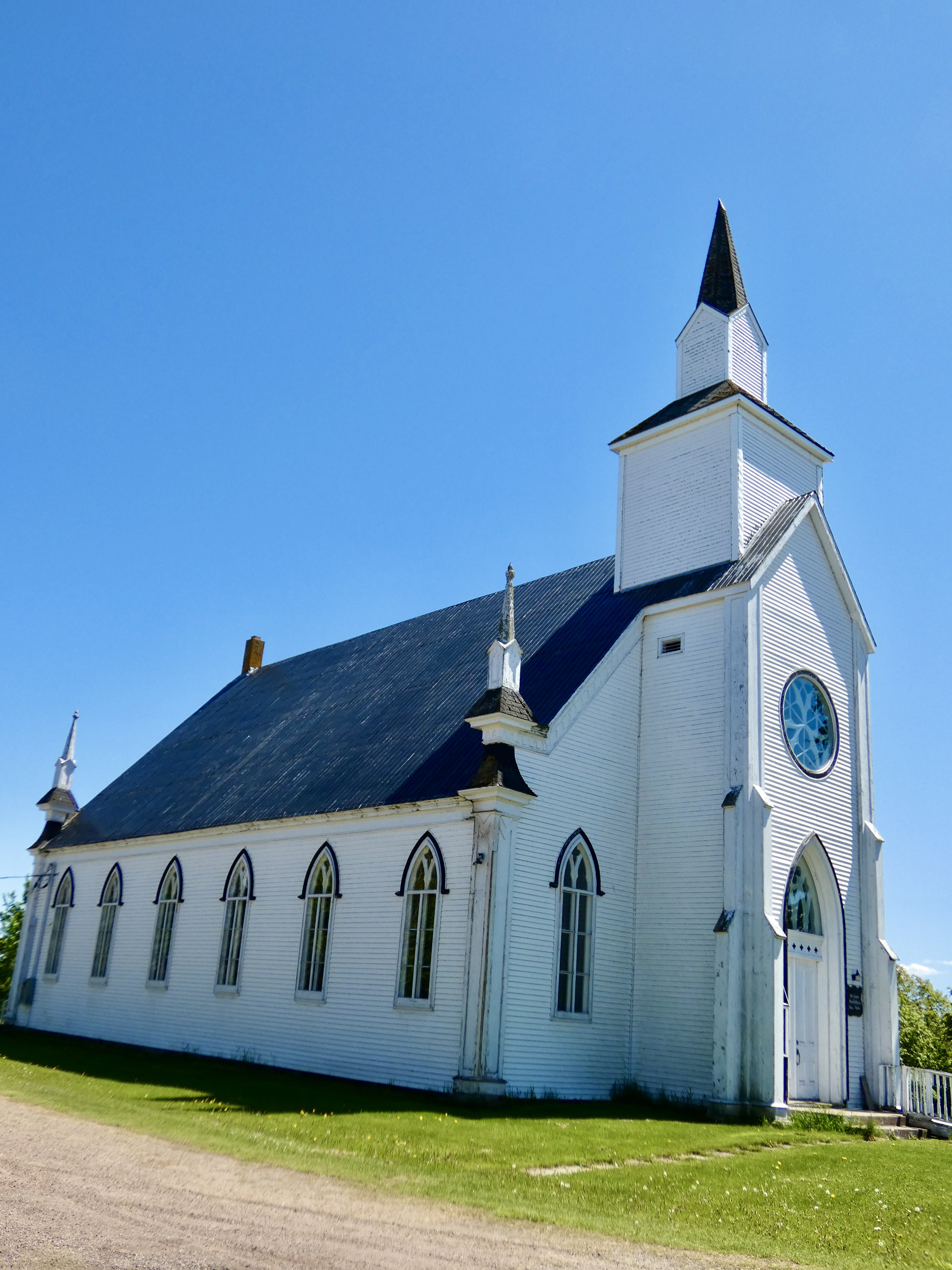
One of the things I like best about riding roads one paved step above cow paths, is the chance to see beautiful old farm houses that have been homes to families for generations or the weather-beaten shanties at the edge of the seas that housed generations of fishers. But I also get to see, around every curve in the road it seems, beautiful old churches, built to demonstrate for years to come the importance of religion to the people who settled this area. I could have taken dozens of pictures of churches today because every community has at least one church whose spires, visible for miles, beckon the faithful.

After we arrived at our mom and pop motel in Summerside, PEI, we gathered 11 days of dirty clothes and headed for a laundromat. An hour and a half later, we were ready to go another 3,500 miles in clean duds.
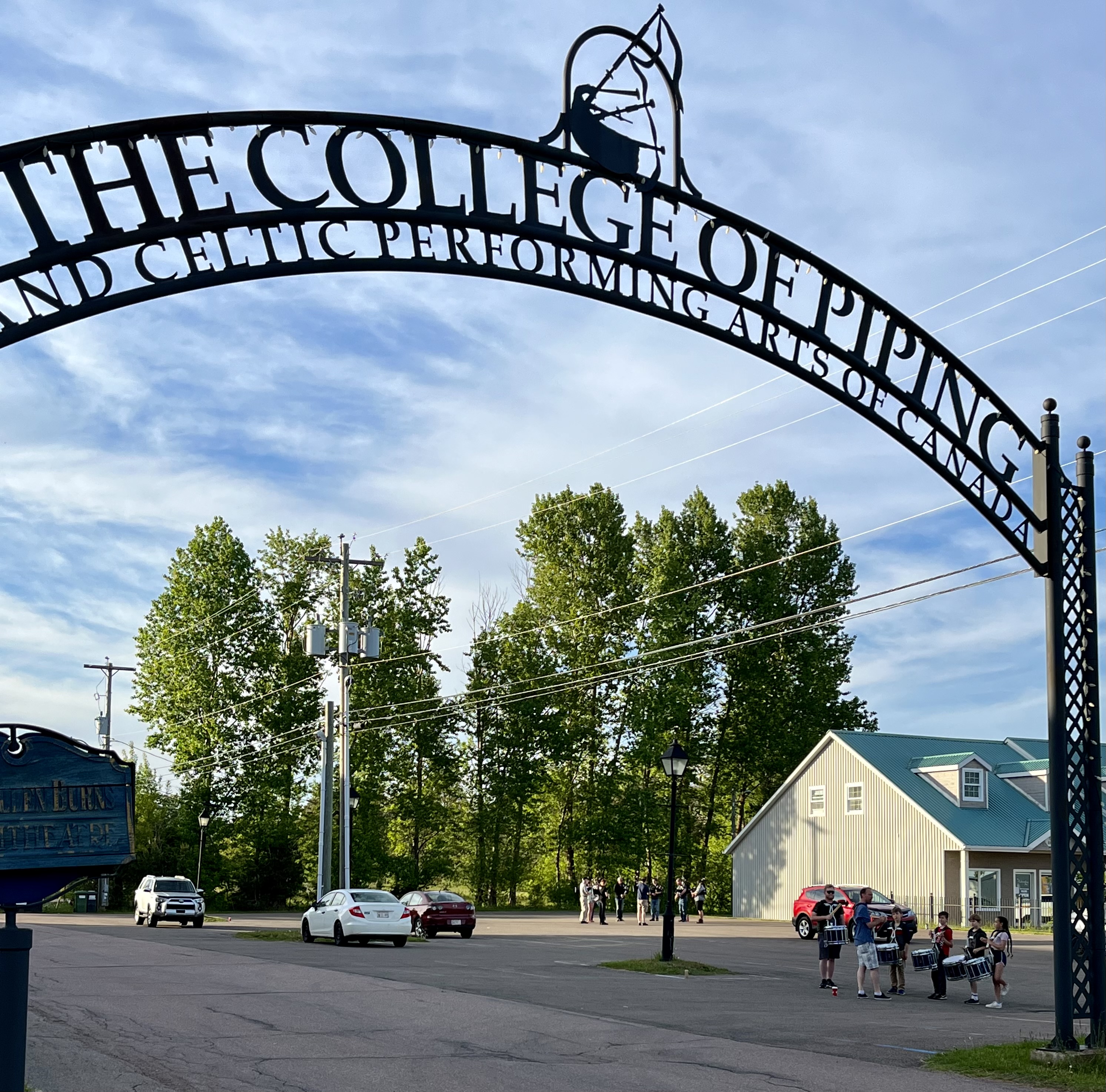
When we walked to a nearby restaurant in our clean clothes, we noticed an interesting sign above a driveway next to a couple of large buildings. “The College of Piping and Celtic Performing Arts of Canada,” declared the steel arch. I decided it probably was unrelated to plumbing or cake decorating and settled on the likelihood that it was related to bagpipes. Sure enough, when we passed by after dinner, a group of pipers were piping and a cadre of kids were practicing their snare drum skills. Another fortuitous encounter created yet another chapter in the adventure that is the CCR. We watched and listened to them pipe and drum awhile, admiring their skills (well, at least the drummers). I even tried my hand at shooting video, though it can’t be posted on the blog and obviously wouldn’t make into the book that will grow out of the blog. Nevertheless, I posted them on YouTube if anyone is interested. (About 30 seconds each Pipers & Drummers)
Tomorrow we have another non-traveling day, though I expect to put some miles on the bikes seeing various parts of PEI and taking in some museums.
Day 11 CCR: Goodbye to Newfoundland and Labrador
It wouldn’t be Newfoundland and Labrador, it seems, if we didn’t ride in at least some rain each day. This morning, once again, we donned heated gear and rain suits before heading south on the Trans Canada Highway (TCH) toward Channel-Port aux Basques and the awaiting Marine Atlantic Highlanders, our ferry back to Nova Scotia. Don’t get me wrong. I love the province of Newfoundland and Labrador and admire the hearty and friendly people, proud of their unique heritage in a challenging land. The rocky, forested land and the surrounding ocean constantly pounding the shore provide a rugged beauty not found in the rest of Canada. But I do wish Steve could have seen it with better weather and through a clear face shield.
As we rode the final 135 miles from Corner Brook to Port-aux-Basques, the light rain gave way to mist which eventually disappeared and left us with dry pavement. Indeed, by the time our ferry pulled away from the harbor, the skies had mostly cleared and the sun showed its face, as if to highlight inversely the soggy conditions we endured for most of our visit. When we arrived in Port-aux-Basques five days ago, the town was completely obscured by clouds and rain. Today the town, named for 16th century Basque whalers who made it a stopping point on their many voyages to the New World (new to Europeans, at least), showed that it really could hold 4,000 hearty souls clinging to its rocky shores.
I’d like to return someday to the Rock, as it is fondly called by many inhabitants. In two visits I’ve seen much of it and was glad this trip contributed to my store of Newfie knowledge. But there are many more towns and villages tucked away on various parts of the island that possess a unique history, often told in small local museums. I want to go there and meet their people.
Newfoundland has a long history, especially when the settlement of the original peoples, the Beothuk, is included and a shout-out is given to the Vikings who briefly settled on its rocky shores in the 11th century. Four other native groups, most prominent among them being the Innu and Mik’maq added their culture and lore to the county, much of it long before European explorers arrived more than 500 years ago and began to make claims to land they didn’t own. British fishermen and British forces ultimately won control of the island after centuries of disputes with France.
Yet, despite its long history, Newfoundland and Labrador (it’s a single province) is the youngest of the 10 provinces, joining the Canadian Confederation of nine other provinces and two territories in 1949, after a popular vote narrowly approved joining Canada. Newfoundland had been self governing since the middle of the 19th century and gained Dominion status in the British Empire in 1907 (equal to that of Canada and New Zealand, for example), with its own government, currency, flag and other governing accoutrements. In the mid-1930s dominion status was interrupted by financial and political difficulties and Newfoundland and Labrador were operated by the Colonial Office in London until after World War II, when the residents voted to join Canada as a province.
Today I said goodbye once again to Newfoundland and Labrador and rode back onto the mainland when our ferry docked about 7 p.m. After riding 2,500 miles to get to Cape Spear from North Carolina and another 570 miles to get off the rock at Port aux Basques, tomorrow the CCR continues to the smallest of the provinces: Prince Edward Island.
Day 10 CCR: Leaving “The Rock”
Another day in Newfoundland, another cold, wet ride.
We departed St. John’s a little after 7:00, knowing we had at least eight hours between departure and arrival in Corner Brook as we crossed nearly the width of Newfoundland in order to catch our ferry back to Nova Scotia tomorrow morning. I expected there might be some light precipitation, but anticipated it would be limited in amount and duration, if we saw any at all. I certainly didn’t expect to encounter it before we made our first planned stop in Gander. Consequently, with dry pavement and temperatures in the mid 40s in St. John’s, we left the capital city without putting on our rain suits over our heated gear.
About 20 miles outside Gander a light mist, almost fog-like surrounded us, and while it never rained, by the time we reached Gander the lower half of our pants legs were soaked and the temperature had dropped to 40°. Chilled, we grabbed a bite to eat, hoping our pants would dry a little if we ate slowly, but they were still wet when we FINALLY put on rain suits and climbed back on the bikes. Fortunately, the combination of heated gear and rain suits warmed us and, happily, the first episode of light moisture ceased about 20 miles the other side of Gander.
We rode through light rain and misty fog several more times during the remaining 225 miles, but that part of the ride wasn’t nearly as uncomfortable as the morning ride with wet pants. Nine hours after we fired up the Harleys this morning, we pulled into our lodging for the night in Corner Brook, glad to finally get fully dry.
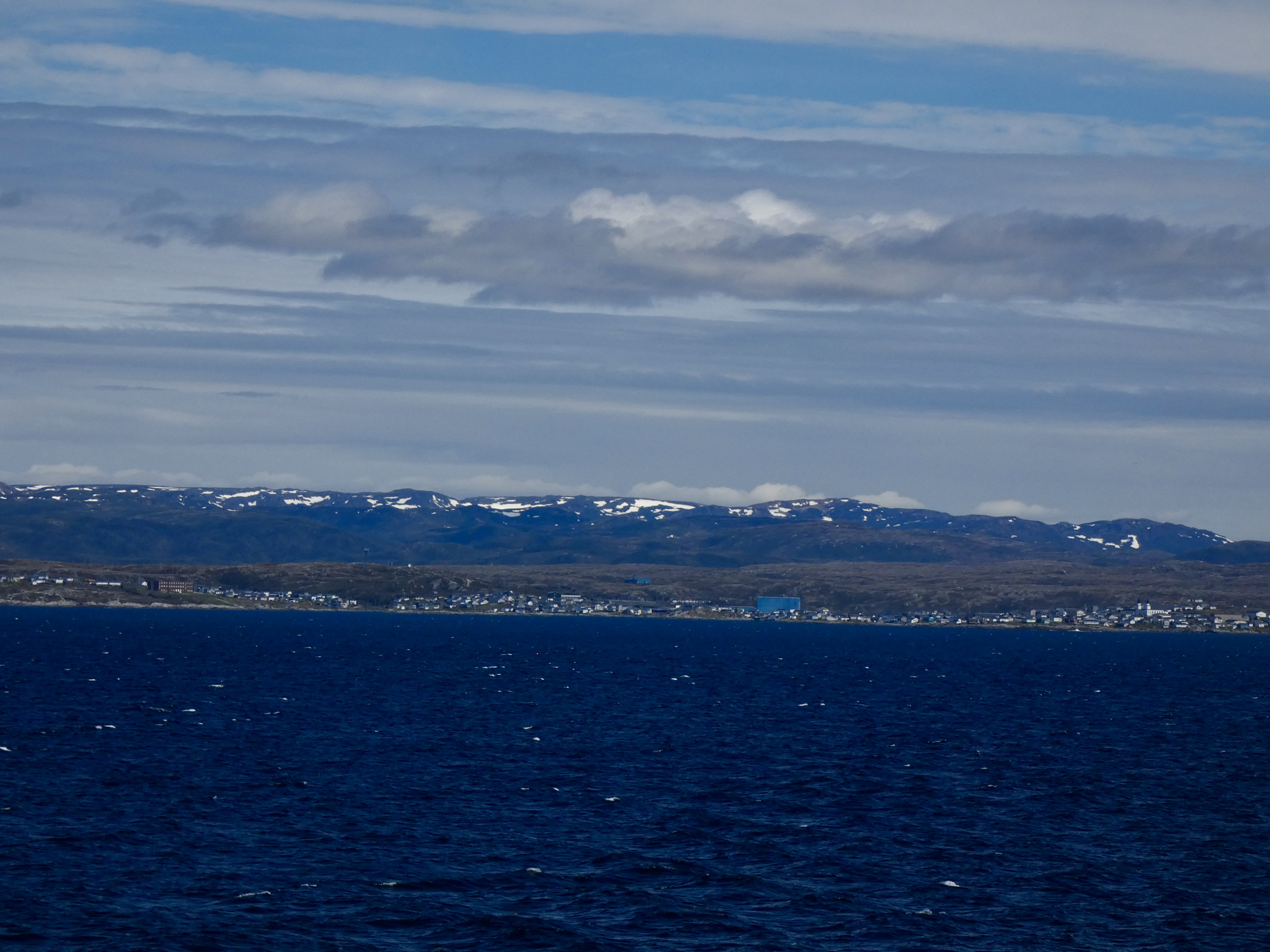
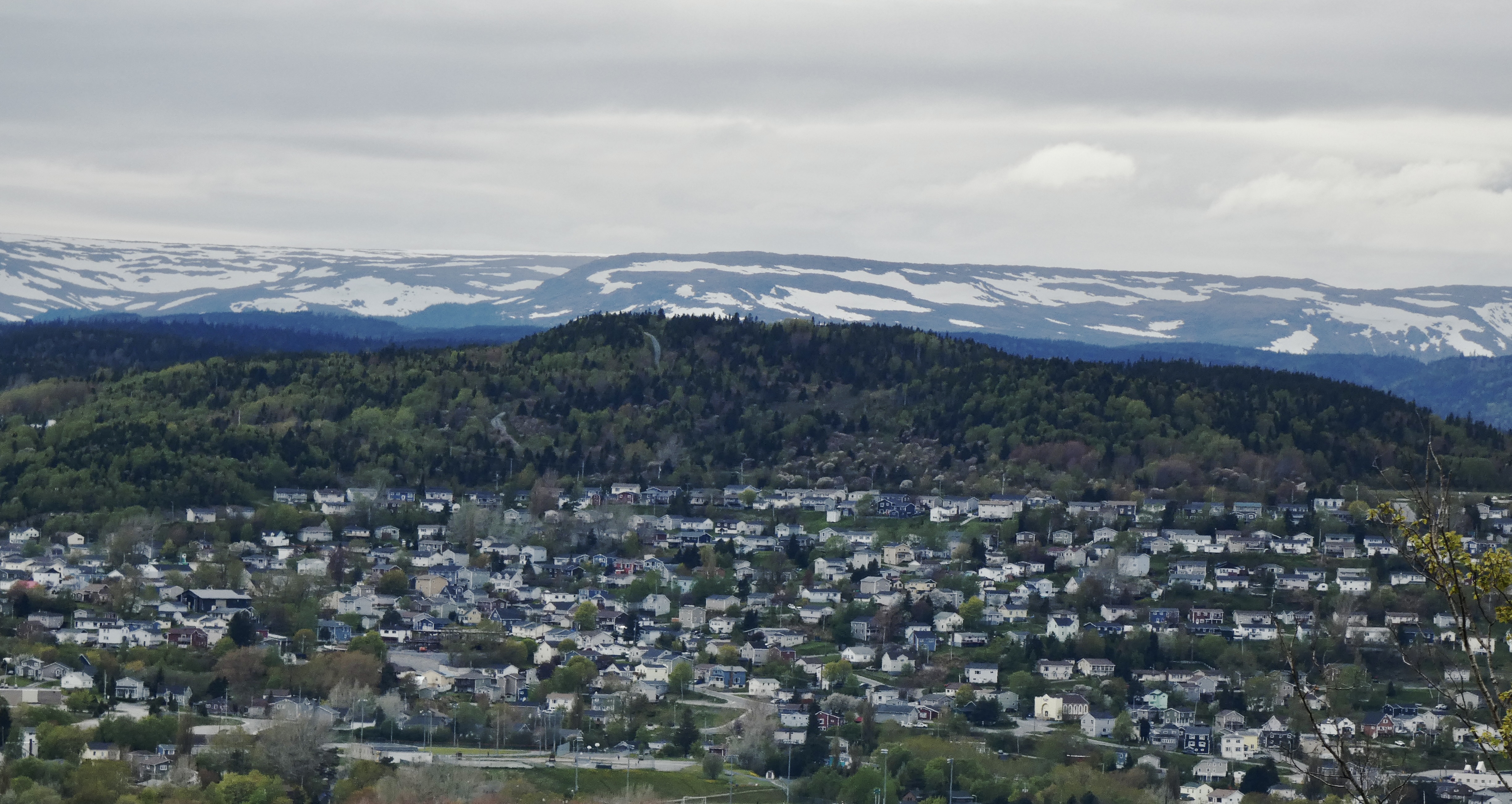
I’ve mentioned several times how cold it’s been in Newfoundland this trip, but the picture below gives a better idea. “Blow Me Down” mountain, visible from our hotel dining room, is part of the “Long Range Mountains” that rise on the west coast of Newfoundland and, in turn, are the northern end of the Appalachian Mountains I see every day from my porch in North Carolina. Blow Me Down Mountain only reaches about 2,500 feet at it’s peak, but the abundance of moisture from the nearby sea and the cold northern climate means snow lasts well into the summer.
Other than a wet ride which kept me more focused on the road than on scenery, not much happened today. I did spot a young bull moose about 20 yards from the edge of the highway, but he never posed a danger and was more interested in eating fresh shoots than interrupting our travels.
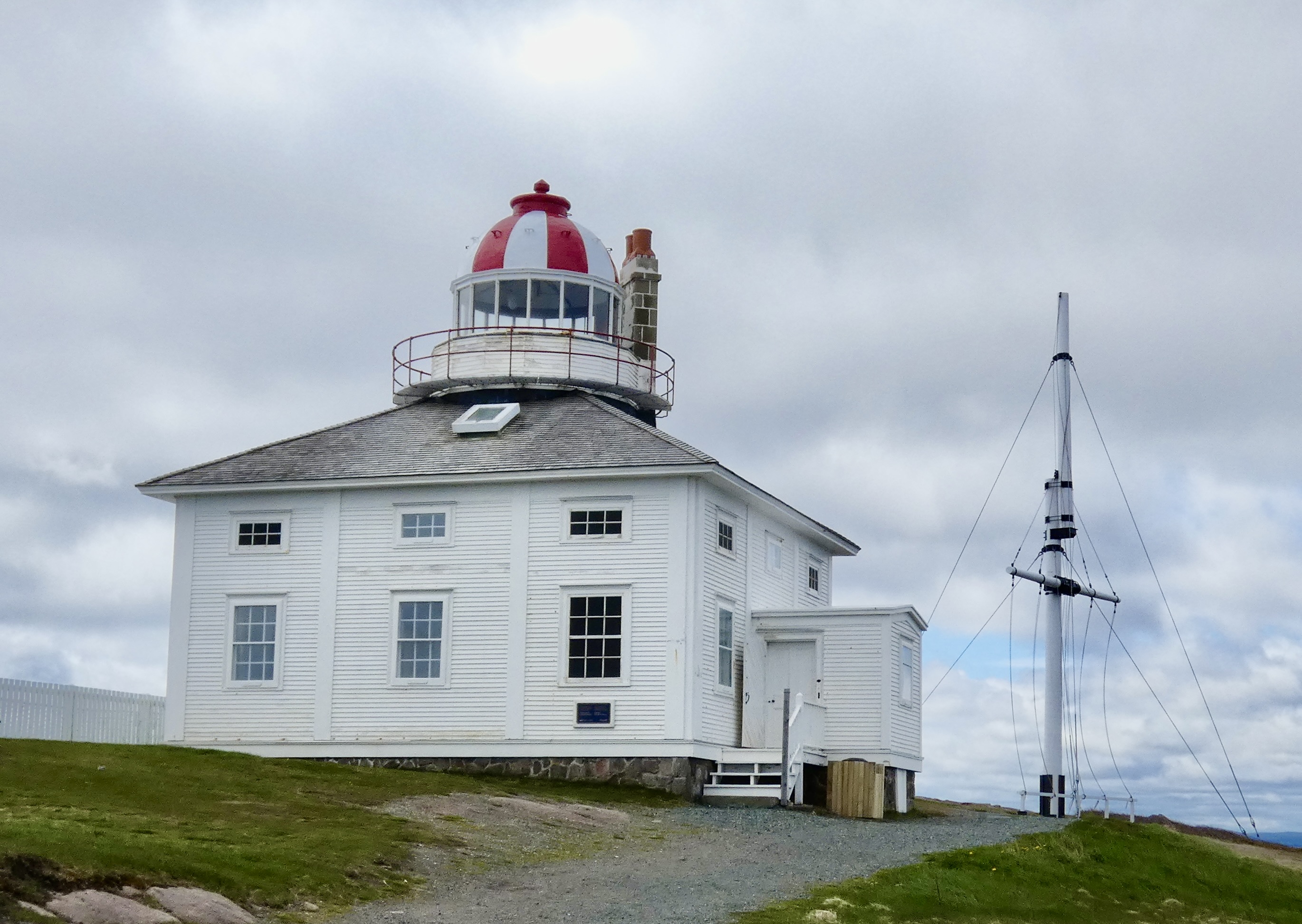
Today’s post adds some of the pictures I took in St. John’s yesterday, mostly of downtown architecture with one more photo of the 1836 Cape Spear lighthouse. Tomorrow, another early start will get us to Channel-Port aux Basques in time to catch the ferry to the mainland.

Day 9 CCR: A Day Off in St. John’s
I built into this trip a half dozen non-riding days to catch my breath, rest my butt, and take a deeper look at the Canada I’m speeding across. Today was one of those days and it paid off. When I rode through Newfoundland and Labrador eight years ago, I touched St. John but didn’t get to experience all of it the way it should be experienced. This time I revisited a couple of the places I had seen before so Steve could see them, but I also got a better feel for the vibrant downtown life and culture and a little more of the city’s rich history.

The morning’s light rain ended by 10 a.m. and so, unencumbered by a rain suit and heated gloves, I caught up on some picture taking. So much so, that some of what I took today may show up in tomorrow night’s blog since we’ll be on the road for more than eight hours tomorrow, riding 425 miles, nearly the width of Newfoundland. I don’t expect too many photo opportunities during tomorrow’s ride, which marks the beginning of our westward trek that will end in three weeks in Victoria, British Columbia.
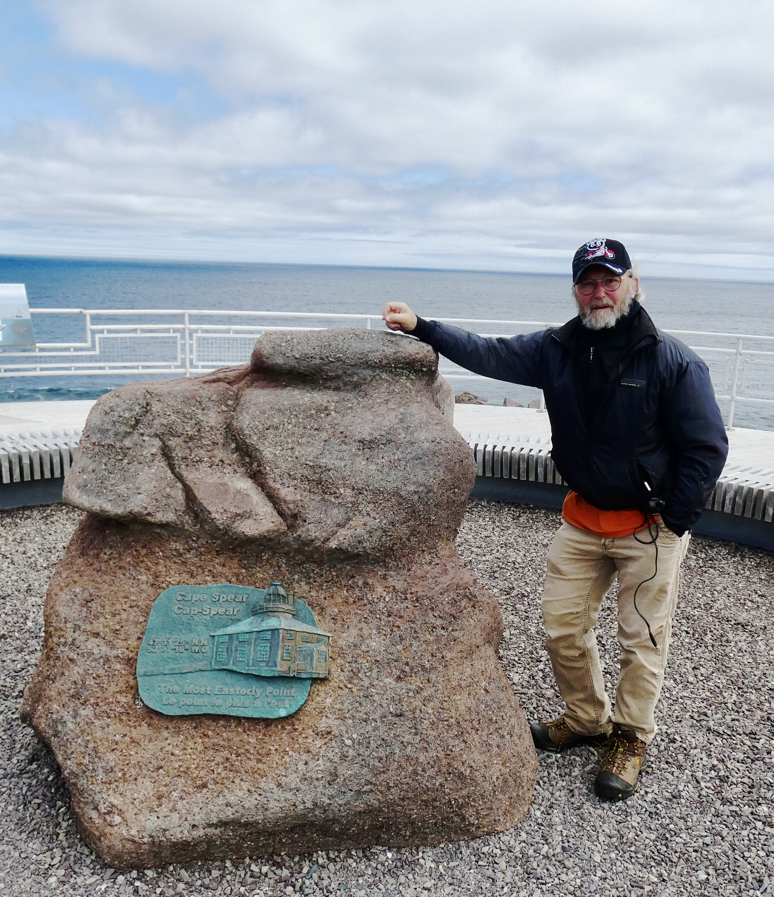
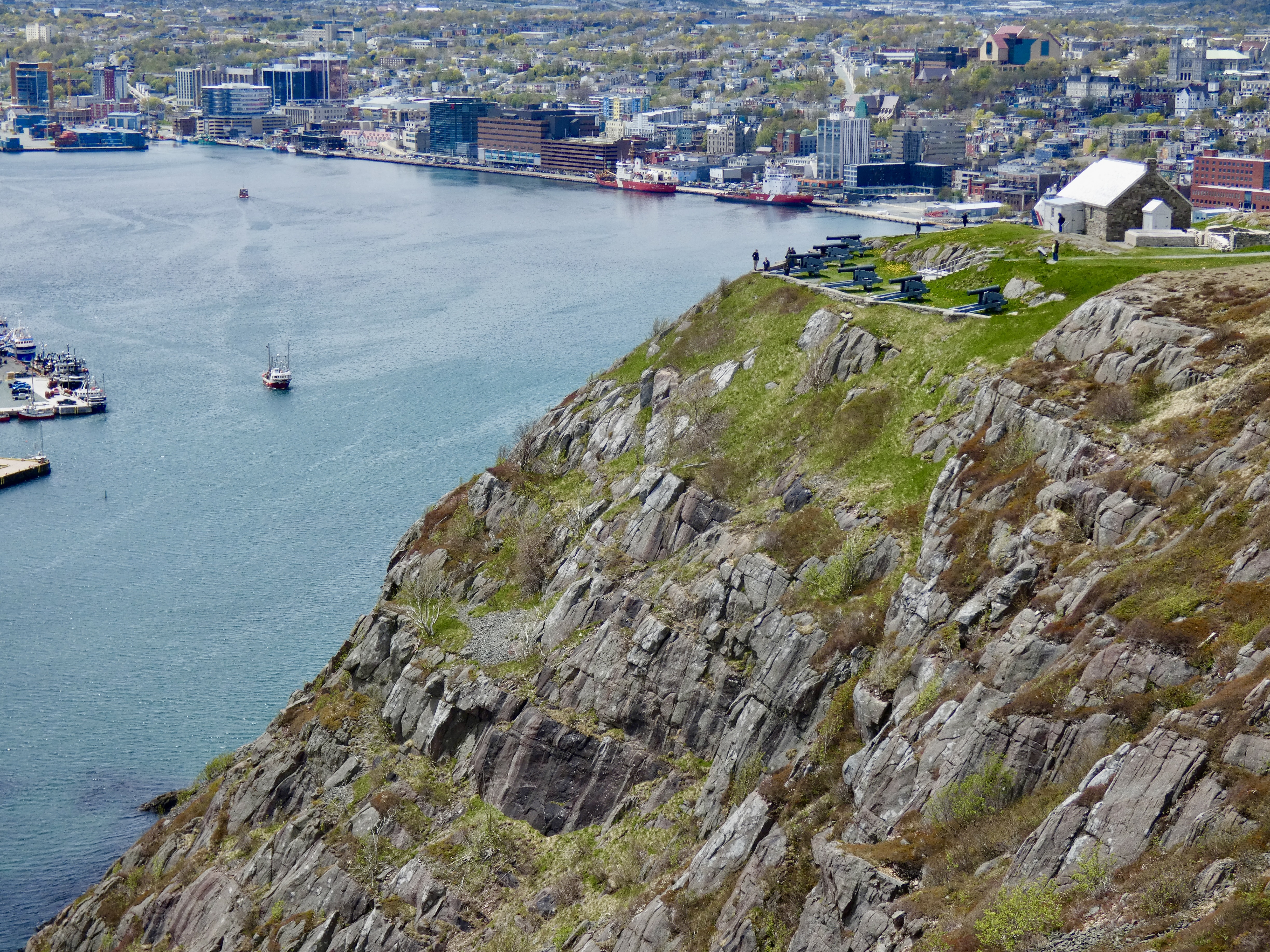
Our first stop this morning was Cape Spear, the eastern-most point in Newfoundland and, in fact, in North America. Go east from that point and the first land you’ll see is Ireland, from where the ancestors of many Newfoundlanders emigrated. Cape Spear has several interesting historical claims, including the oldest lighthouse in Canada and an important military position during WWII. It was the first line of defense for the crucial St John’s Harbor, from which thousands of troops and tons of supplies were shipped to England and the European theater. Two massive gun emplacements are still there for visitors to see, wander through and learn from the exhibits placed there by the Canadian government.
Cape Spear also boasts two light houses, one put in service in 1957 and still in use and the other built in the 1830s and now an historic landmark and teaching facility for Parks Canada visitors. I had toured the historic light house eight years ago so we took a pass on it this trip.

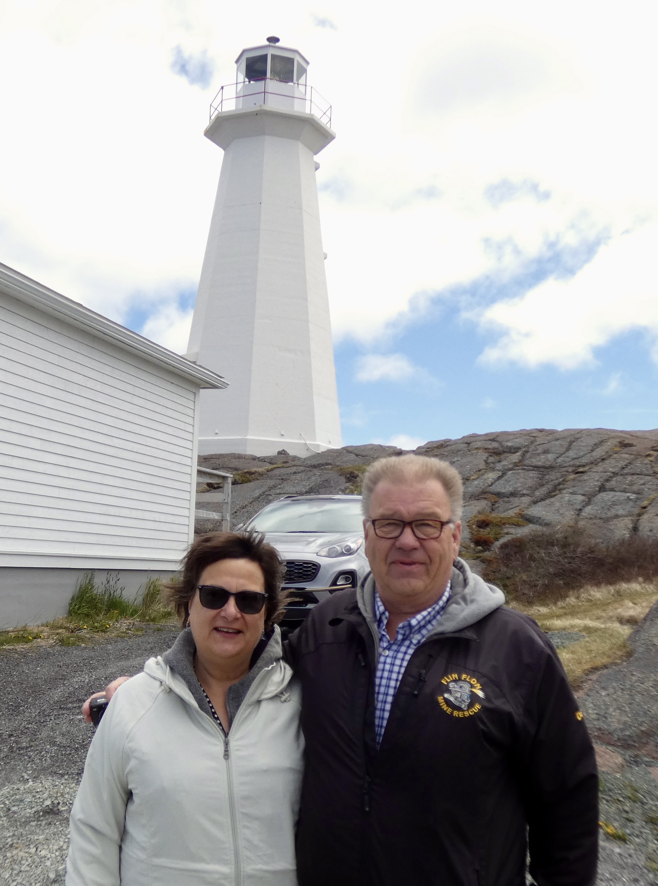
I’ve said repeatedly that Canadians, at least the ones I’ve encountered, are extraordinarily friendly people. Proof of that came again today. As Steve and I walked up the hill to the historic lighthouse, we met a couple coming down. We exchanged common hellos, but then I noticed the man had a jacket indicating he worked in mine rescue in Flin Flon, Manitoba. “We’re going to Flin Flon,” I said, and as they expressed some astonishment I told them that I had selected Flin Flon because the name intrigued me. We talked for a while about Flin Flon, mining, weather, flooding, road conditions, scarcity of gas on the road and other topics that popped up. We may get a chance to see them again when we overnight in Flin Flon in about two weeks. I hope so. They’re nice folks. But then again, they’re Canadian.

Our next stop was back in St. John’s where we visited historic Cabot Tower, located on prominent Signal Hill situated between the ocean and the town, and overlooking the narrows that lead to St. John’s significant harbor. Signal Hill has been important for centuries as a place from which to see ships well at sea and to defend the harbor against invaders by easily lobbing cannon fire onto enemy ships that dared to attack. Cabot Tower was built between 1898 and 1900 to commemorate Queen Victoria’s Diamond Jubilee and the 400th anniversary of John Cabot’s (aka Giovanni Caboto) discovery of the New Found Land. Signal Hill is also historically significant because there in 1901 Marconi first demonstrated that wireless signals could be sent from Europe to America, thanks to the presence of the then unknown ionosphere that allows radio waves to be reflected back to earth. Undersea cables would no longer be needed to communicate between continents and the world began to shrink.

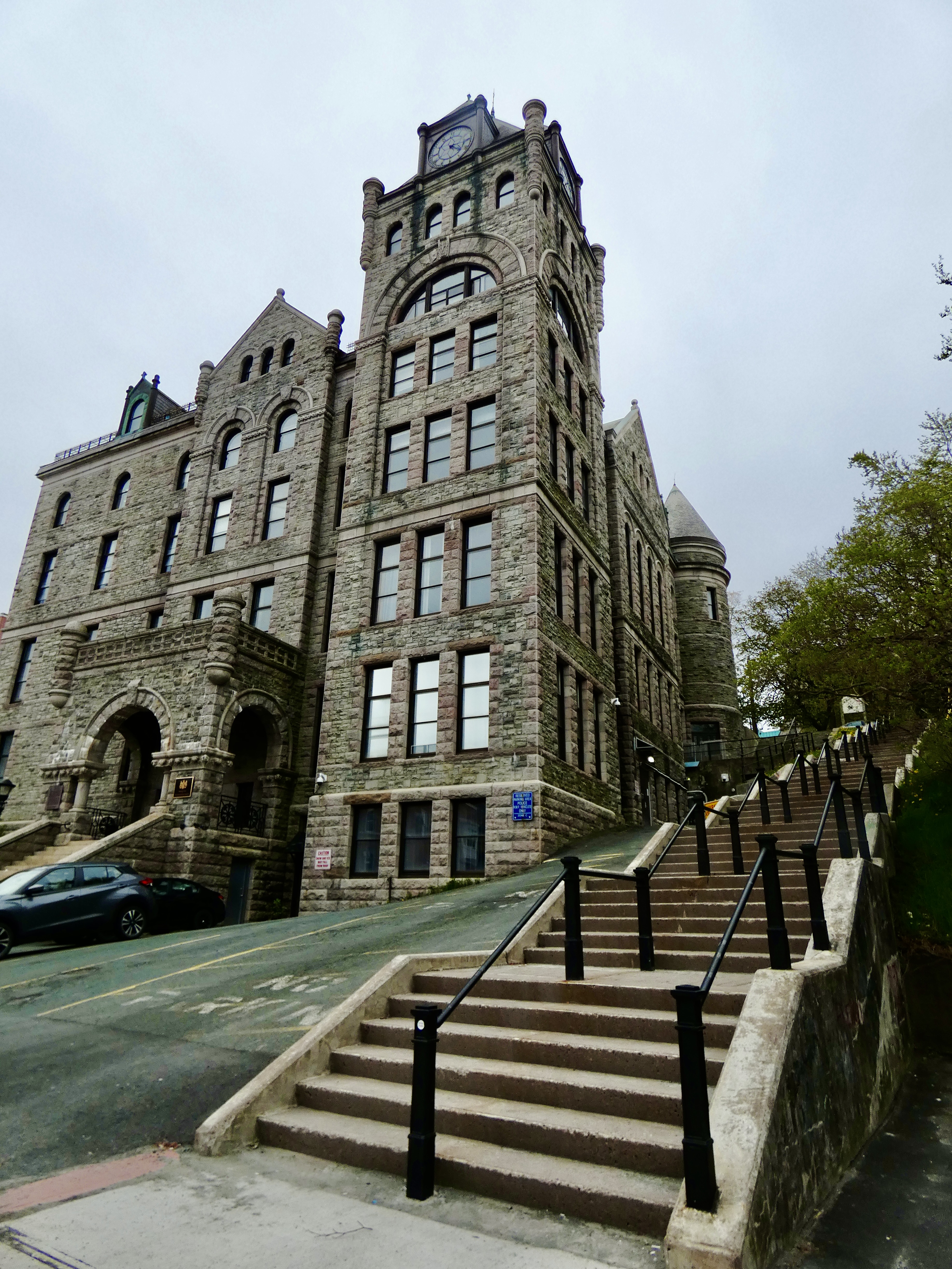
In the afternoon I did what I hadn’t done eight years ago: walk around the downtown area. Four streets stretching about eight blocks constitute much of downtown St. John’s, and that’s what we explored. Many of the stores and shops cater to a strong tourist crowd and plenty of pubs and restaurants lined all four streets. But there were also substantial commercial and government buildings in the same district, including the impressive Newfoundland Supreme Court Building, constructed more than 100 years ago as a symbol of government power and social stability.
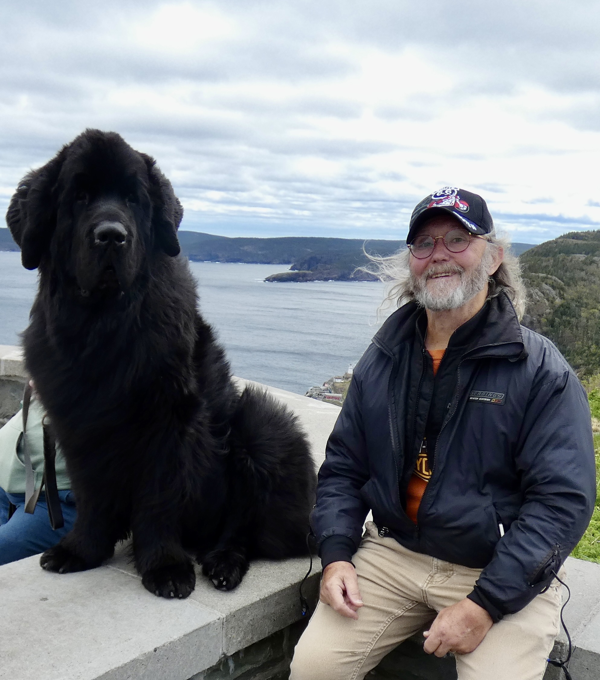
Near the waterfront was the small but powerful Harborside Park that has long been a center of activity for the city. Benches lined gravel walks, plaques honored the living and the dead, a massive sculpture gave lasting tribute to the soldiers, sailors, fishermen and foresters who sacrificed for Newfoundland and for St. John’s in all the wars of the 19th and 20th century. They even paid tribute to two of Newfoundland’s greatest canine contributions with two excellently crafted statues: Newfoundlands (one of whom I met today) and Labrador Retrievers (one of whom used to live with us).


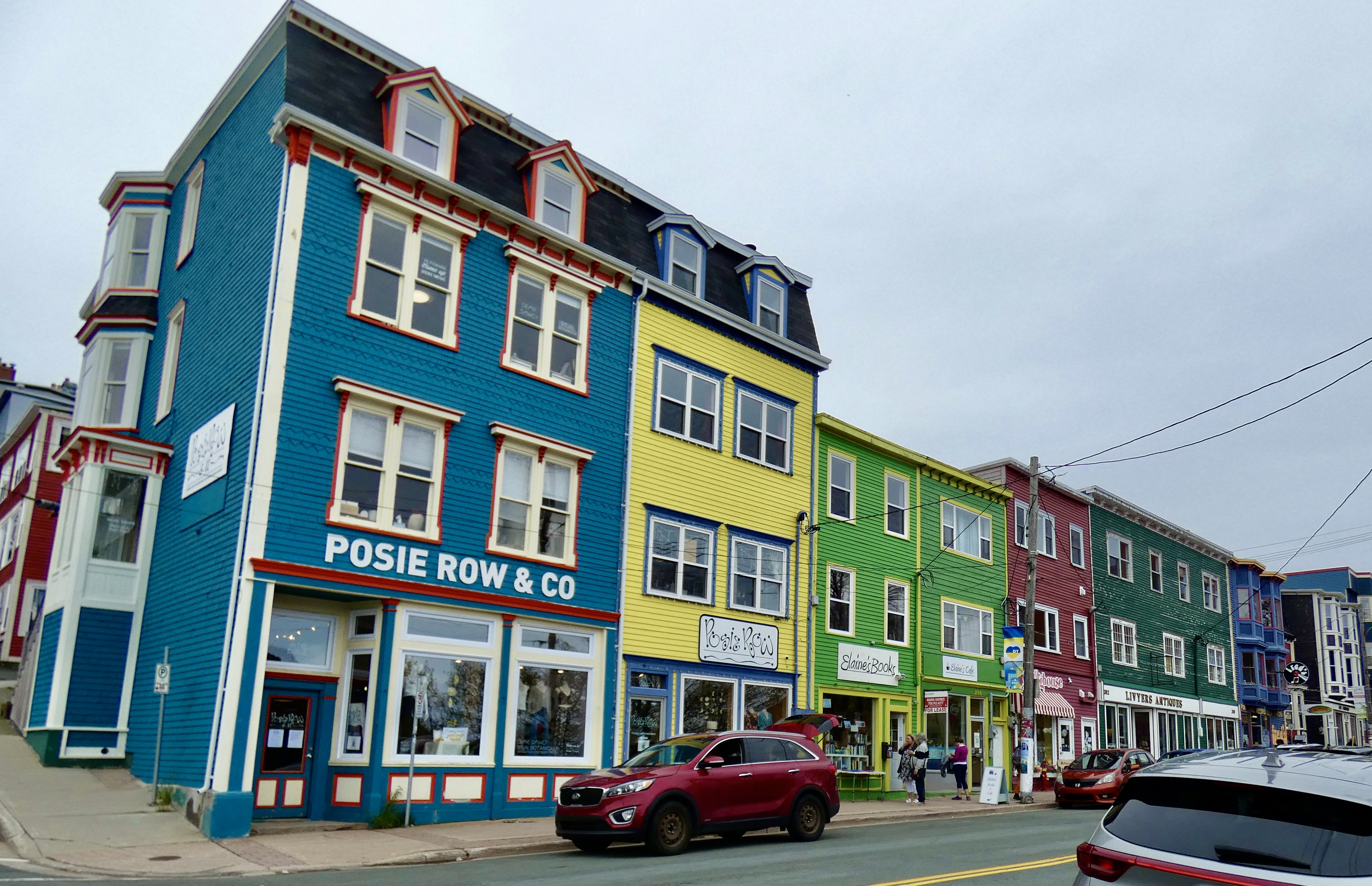
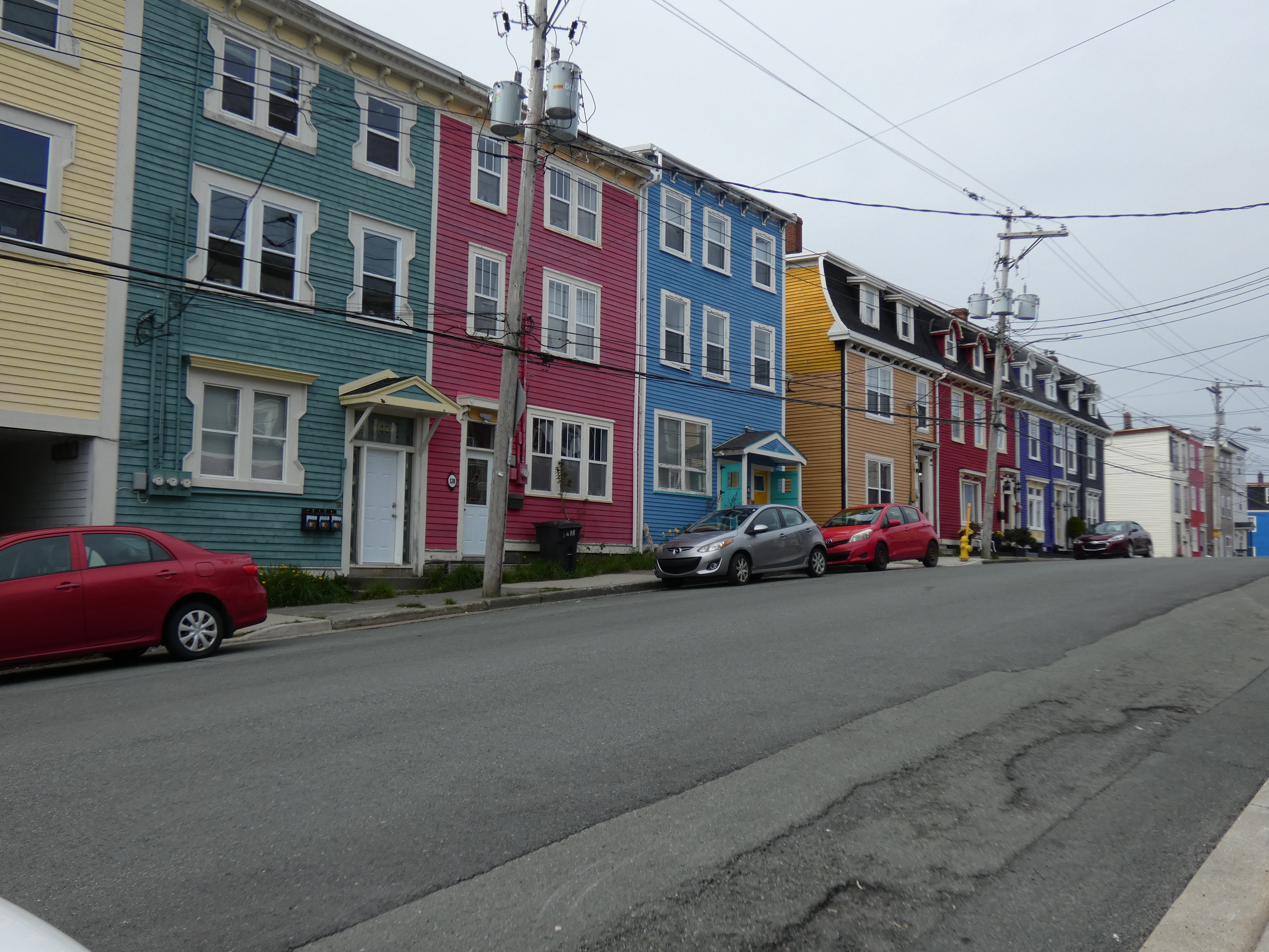
But the most commonly photographed buildings have to be the residential “jelly bean” houses, so named for their brightly colored facades. Vibrant yellows, blues, greens reds and all the colors in-between set off by starkly white or dark colored trim make them a true symbol of St. John’s unique character. Even new buildings on the edges of town have taken on the same flavor and it’s hard not to appreciate the effort so many home and building owners put into personalizing their property.
This evening, we went to O’Reilly’s on George Street on the recommendation of the hotel staff, hoping for more good food and some Celtic music. We ate large again, and a couple of local stouts went down well. But we discovered that the real Newfoundland-Irish musicians don’t start playing until 10:30 or 11:00, and we have to be on the road early tomorrow so we called it a night before the music I hoped to hear even started. Nevertheless, I enjoyed the music we heard, even if it was a little heavy on country music again.

It’s late, and tomorrow is a long day on the road. If I find additional pictures tomorrow night that I should have posted tonight, I’ll add them to tomorrow’s blog.
Day 8 CCR: Better Day Than Yesterday
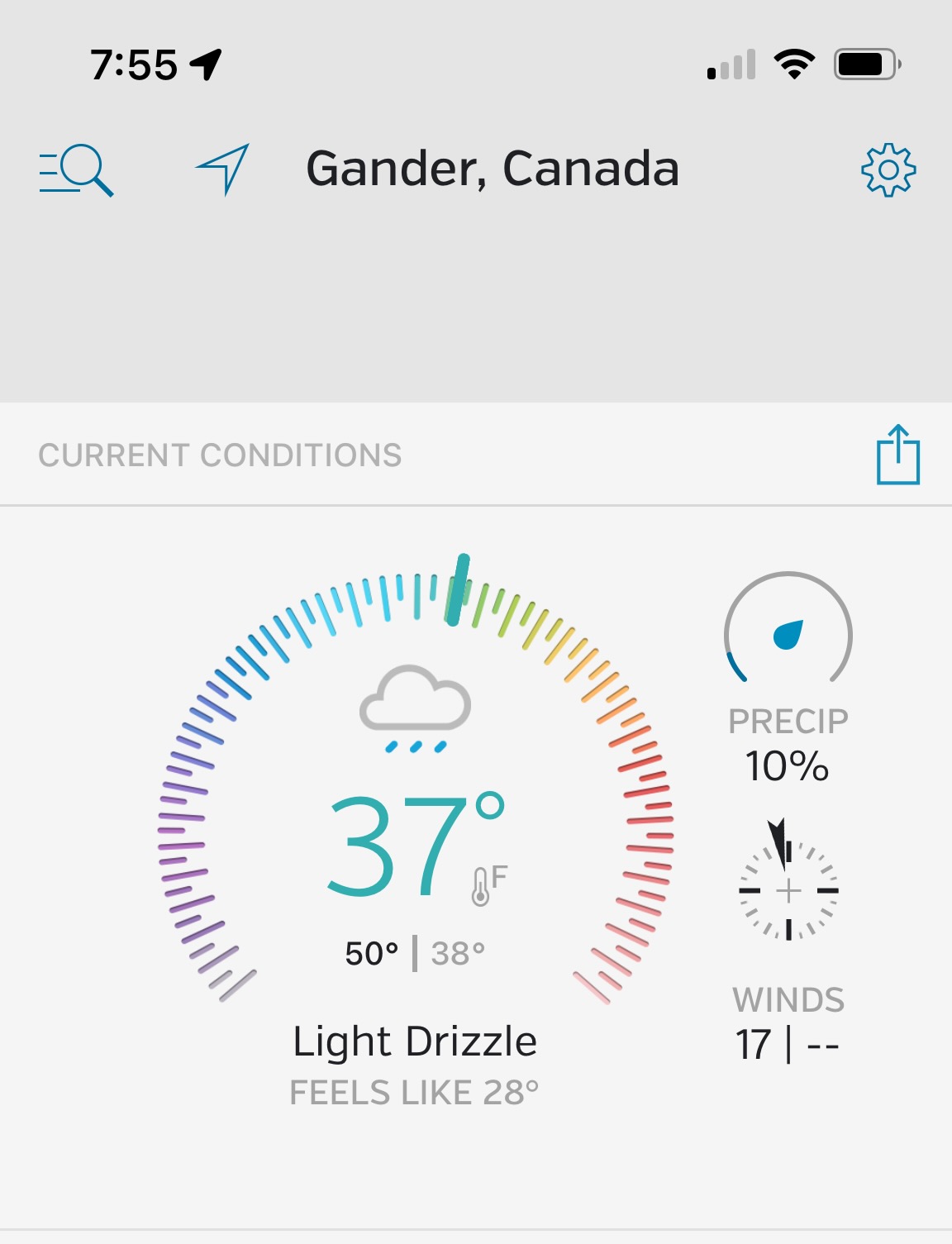
Gander’s temperature was 37° at eight this morning, and the gusty wind blew misty rain sideways. Yet, despite that, today was a much better day than yesterday. We only had 225 miles to ride, so I delayed departing Gander for St. John’s until a little after ten when the temperature warmed to 40°.
We neglected to fill our gas tanks before we left, and Steve has a shorter fuel range than I do by about 50 miles. Since I wasn’t sure how far the next gas station from Gander was, we made a quick return to Gander, filled the tanks and were finally on our way a little before 11:00. As it turns out, there was gas available within Steve’s range, but his low fuel warning light would probably have been on, so backtracking was a good call.
About 50 miles out of Gander the rain stopped and our tires rolled on dry pavement for the first time in several days; there were even widely separated patches of blue showing through the ever-present gray clouds. The temperature must have warmed to the upper 40s, and after yesterday’s chill that felt almost tropical. Dry pavement and warmer temps meant we could cruise comfortably, enjoying the miles of forested, rolling hills that distinguish eastern Newfoundland.
We haven’t seen any moose since we landed on the island, but they lurk in the bushes and forests, choosing odd times to decide to cross the highway. Moose warning signs appear frequently along the roadway, and signs occasionally report the number of moose/vehicle encounters for the year. It’s perfect country for the ungainly ungulates because ponds, lakes and streams are everywhere, providing the lush habitat they thrive in. I don’t think there are any moose predators on the island except cars and hunters (and the occasional unfortunate motorcycle), so their population is large.
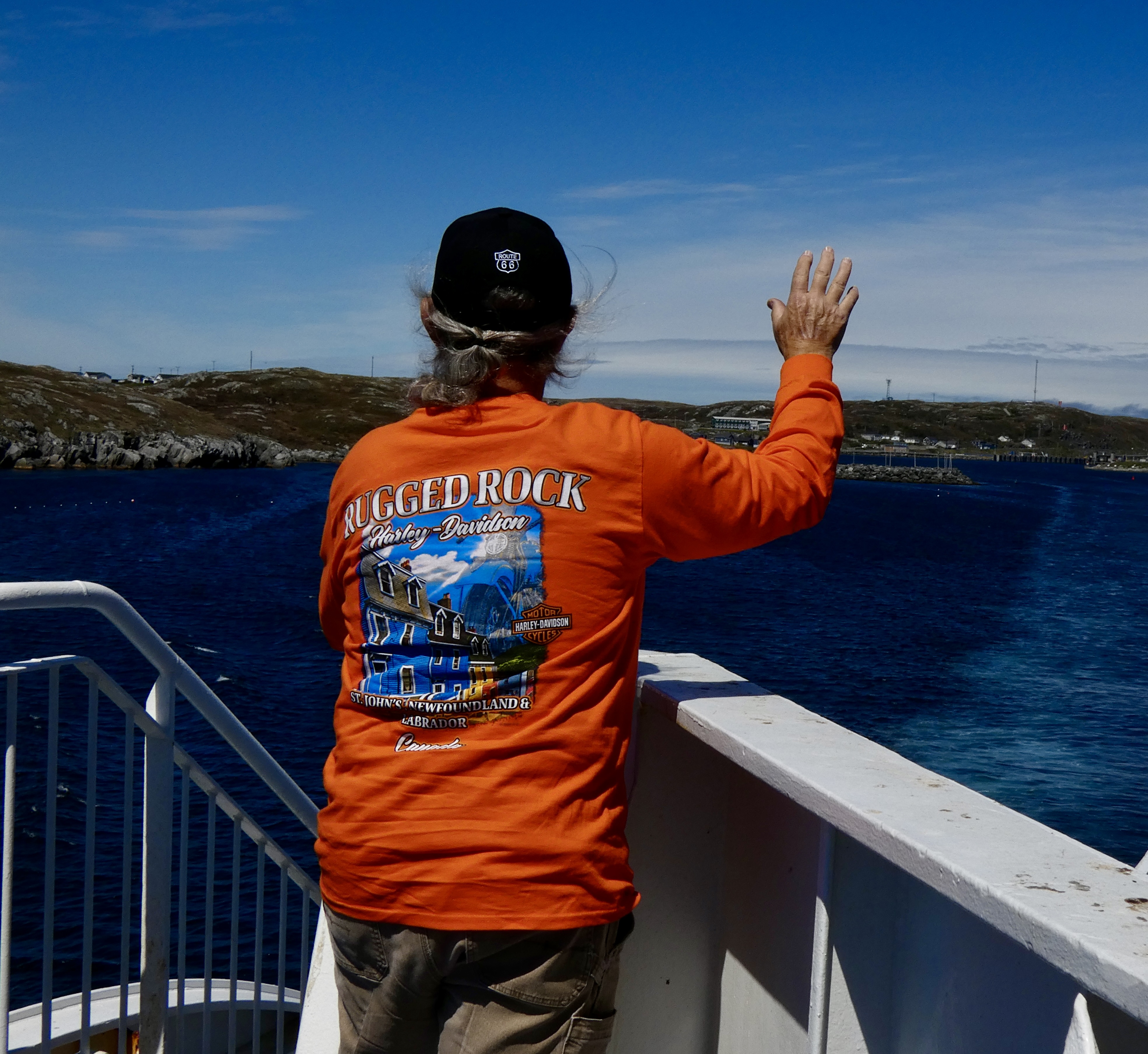
Unfortunately, the good weather didn’t last all the way to St. John’s. Thirty miles before we reached our first destination in the provincial capital, the weather reverted to yesterday’s meteorological maelstrom: hard wind, mizzle and temps near 40°. We made a planned stop at Rugged Rock Harley-Davidson to pick up a couple things and got a warm (literally and figuratively) reception from employees who seemed surprised to see two motorcyclists pull up, the weather being what it was. When they discovered we were from the States, their surprise abated. Given what they see on the news about their southern neighbors, they probably think we’re all a little daft.
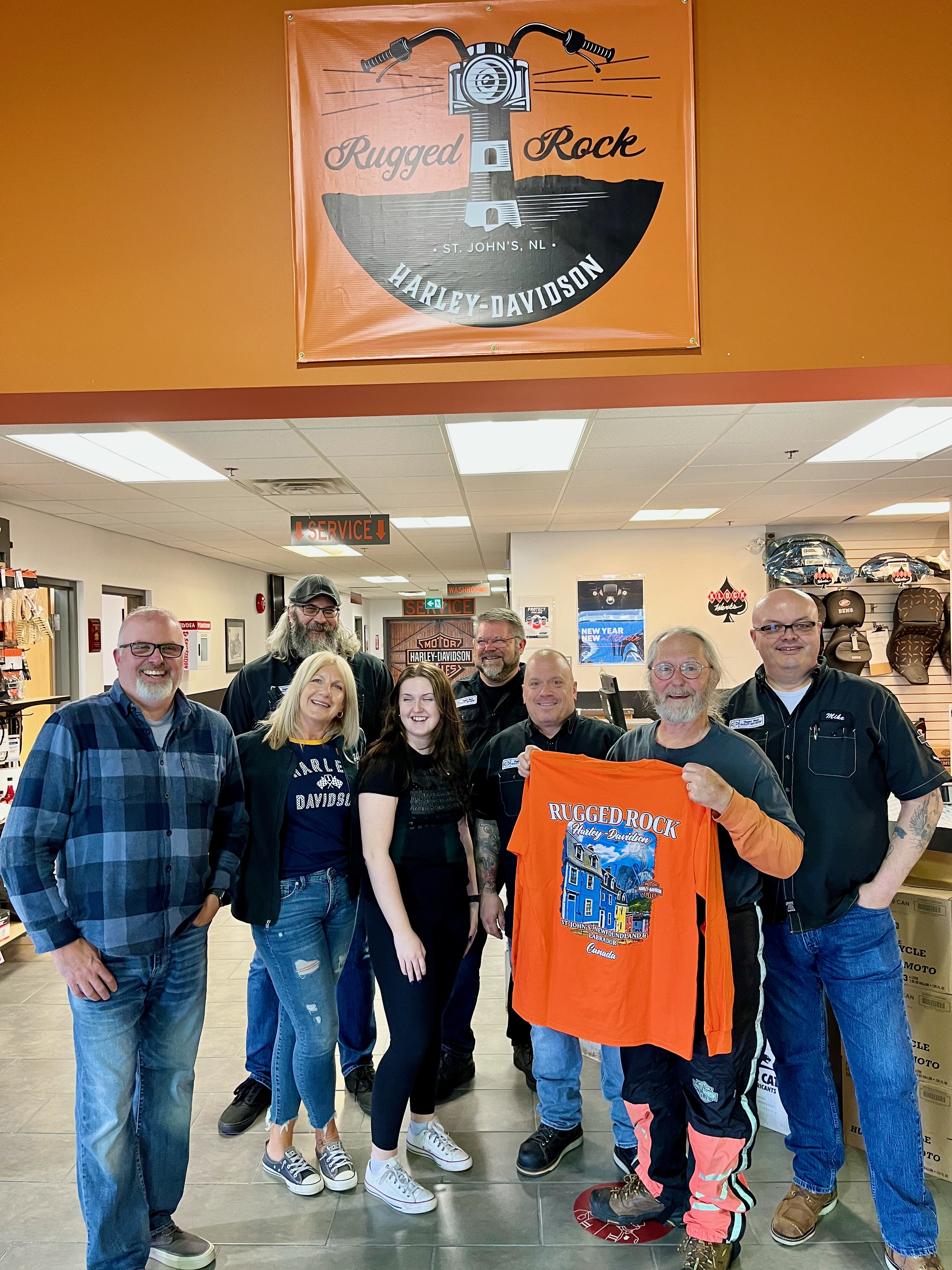
We spent a comfortable half hour or so at the store, enjoying motorcycle conversation with the staff; meeting the manager, his wife and daughter; drinking a cup of HOT FRESH coffee; and making a couple of small purchases. For me, I bought a new t-shirt to replace the one I bought there eight years ago when the dealership operated under a different name (Mile One Harley Davidson). I was wearing that shirt today and the long-time employees recognized the old logo.
One of the many things I liked about Newfoundland in 2014 was the genuine friendliness of the people. That hasn’t changed. Everyone at Rugged Rock HD was welcoming, going out of their way to make fresh coffee, making sure we got what we stopped for, even if it meant pulling things out of inventory that weren’t on the shelves yet. I enjoyed talking with General Manager Sean LeFresne about the times he had ridden in Western North Carolina, including the Tail of the Dragon and Maggie Valley. I told him the next time he was there to do two things: Visit the Wheels Thru Time Motorcycle Museum and contact me so I could buy him a beer and return the hospitality he and his crew graciously showed us.
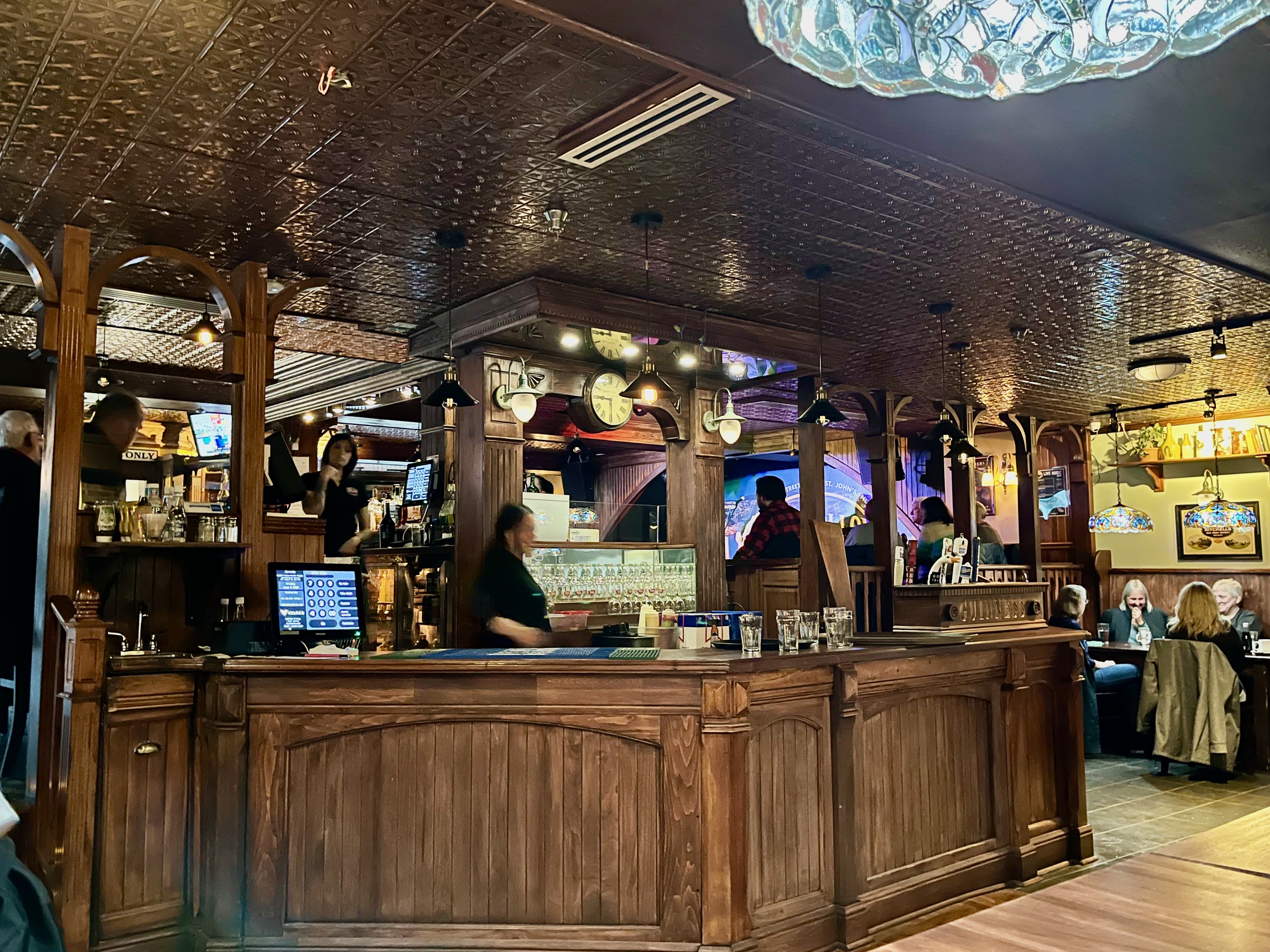
Twenty minutes after we left the Harley store we reached the downtown hotel where we’ll stay for a couple days. After a short wait while they worked to get their computer system back on line, we were checked in. In planning the CCR, I chose a downtown hotel here because nearby George Street is home to three blocks of Irish pubs and I missed the George Street adventure the last time I was here. Not this time. After settling in our rooms, we made our first foray to George Street and have some dinner and a brew. We stuck our heads in a couple places to look around, but settled on Bridie Molloy’s Traditional Irish Pub. While the singer in the pub was good, unfortunately he was singing country music instead of Irish tunes. Tomorrow night we’ll have better luck with the music.
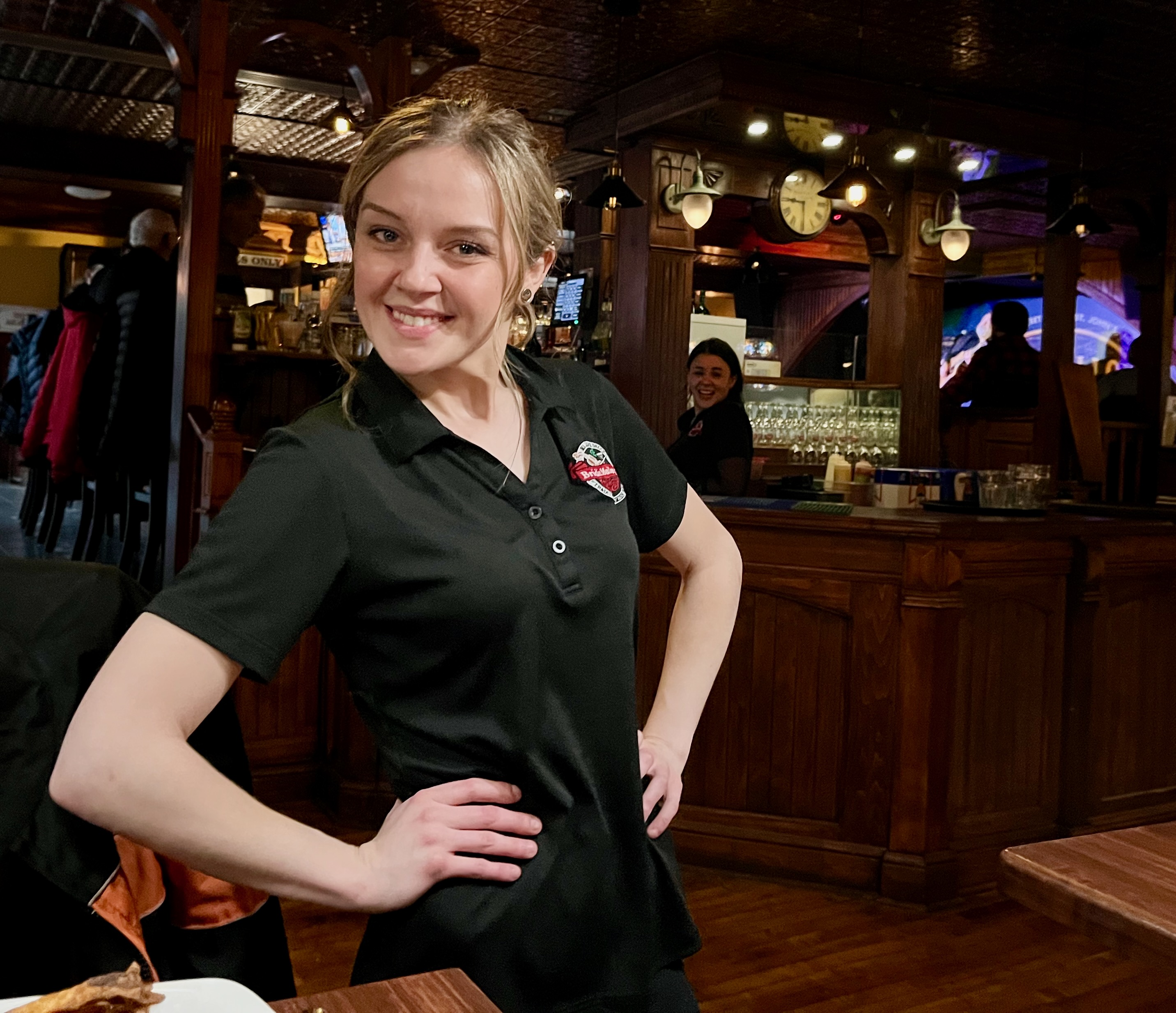
But Bridie Molloy’s turned out to be a good time and the braised lamb shepherd’s pie I ordered was wonderful, especially when washed down with a hearty glass of Guinness. We met and talked with people on either side of us, two women from Manitoba and a couple from Quebec. Lots of laughs and camaraderie. Our wait person, Amanda, was a bundle of energy, running from table to bar to table as she waited on several groups at once, all of whom had as much fun listening to her continuous light-hearted banter as we did.
If I continue to meet people like the crew at Rugged Rock HD and Bridie Molloy’s on the CCR, I can put up with a few days of inclement weather. Tomorrow we’ll sight see in and around St. John’s and tomorrow night we’ll will be back on George Street.
Day 7 CCR: Miserable
Anyone coming to the blog today looking for uplifting stories about interesting people or erudite comments about Canadian culture or colorful photographs of stunning scenery or funny stories about life on the road is out of luck.
Miserable. That pretty much describes today, which started at 5:30 a.m. when the overnight ferry docked early, freeing us from an uncomfortable night of vainly attempting to sleep in a reclining chair surrounded by a snoring symphony in Zzzzz Major. We unstrapped our bikes from the lower vehicle deck, layered into rain and cold weather gear, and exited the ferry at Channel-Port aux Basques into rain, wind and 40° (4° C). By the time we made our first stop 2 1/2 hours later, the temperature had warmed to a blustery 41° and our digits were beginning to go numb. Oh, and I noticed my phone wasn’t fully charged. When I mounted it back on the bike the iPhone notified me that it “detected water in the charging port” and I should let it dry before charging my phone. But since the mizzle (misty drizzle) and light rain continued apace, there was no drying of any one’s port. So we pushed on, dodging enormous potholes barely seen through rain-covered face shields, with a dying phone clamped to my handlebar until we stopped again for fuel–at a pricy $6.78 USD per gallon.
By the time we reached today’s destination in Gander, NL, 355 miles after leaving the ferry, the temperature had risen down to 39°. I think my core temperature was above 90° only because my heated gear and rain suit continued to do their assigned jobs, probably despite having water in their ports. We fumbled through unpacking the bikes with impaired fingers, drug our packs to our rooms, cranked the thermostat to a comfortable 75°, and thawed out in our sauna-like rooms. The phone port must have dried out because once in the room it began to take a charge and now works fine.
I had said early on I wasn’t going to ride on days like today, but that was before I realized that if you don’t book rooms at least a week in advance, there’s a chance you won’t find one when you need it.
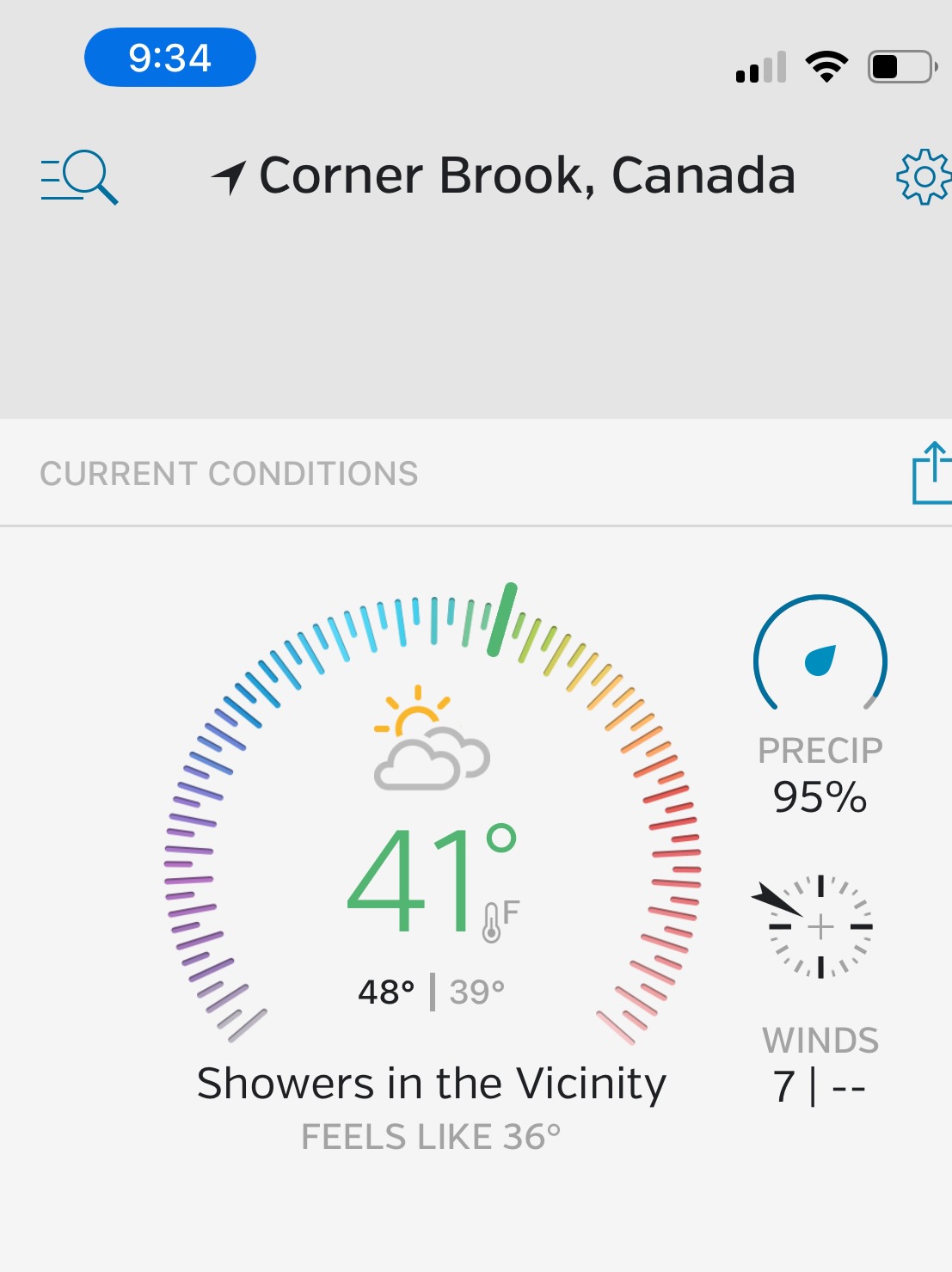
Tomorrow it’s only supposed to rain in the morning and the temperature in St. John’s is predicted to get to 47°, but 25 mph winds blowing off the ocean may make it feel a wee bit colder. By the way, a year ago tomorrow the temperature in St. Johns was 75°. Timing is everything.
Miserable.
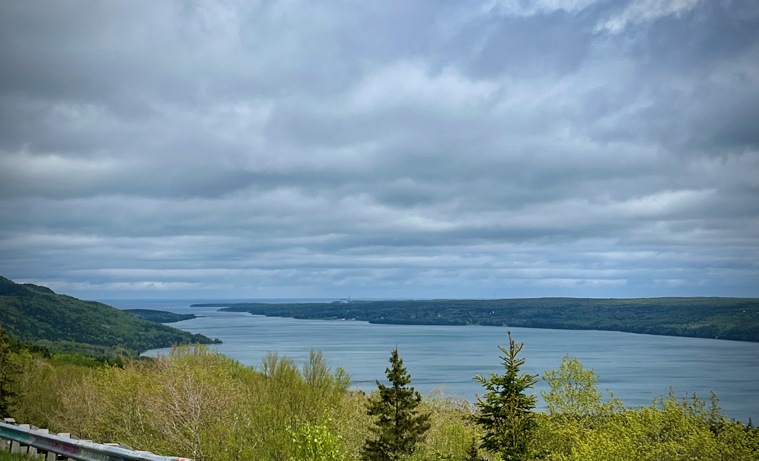
Day 6 CCR: Short, Cold Ride
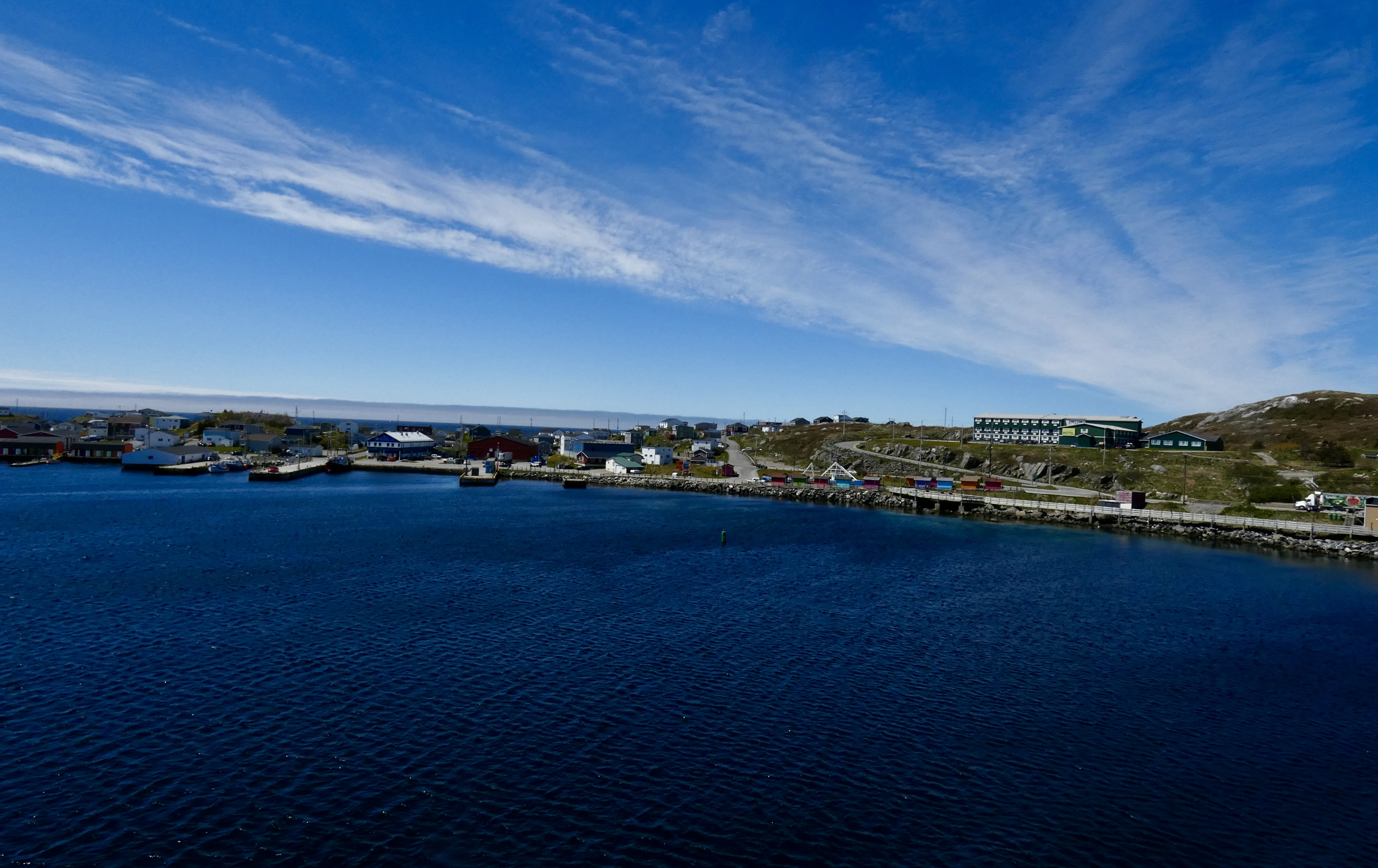
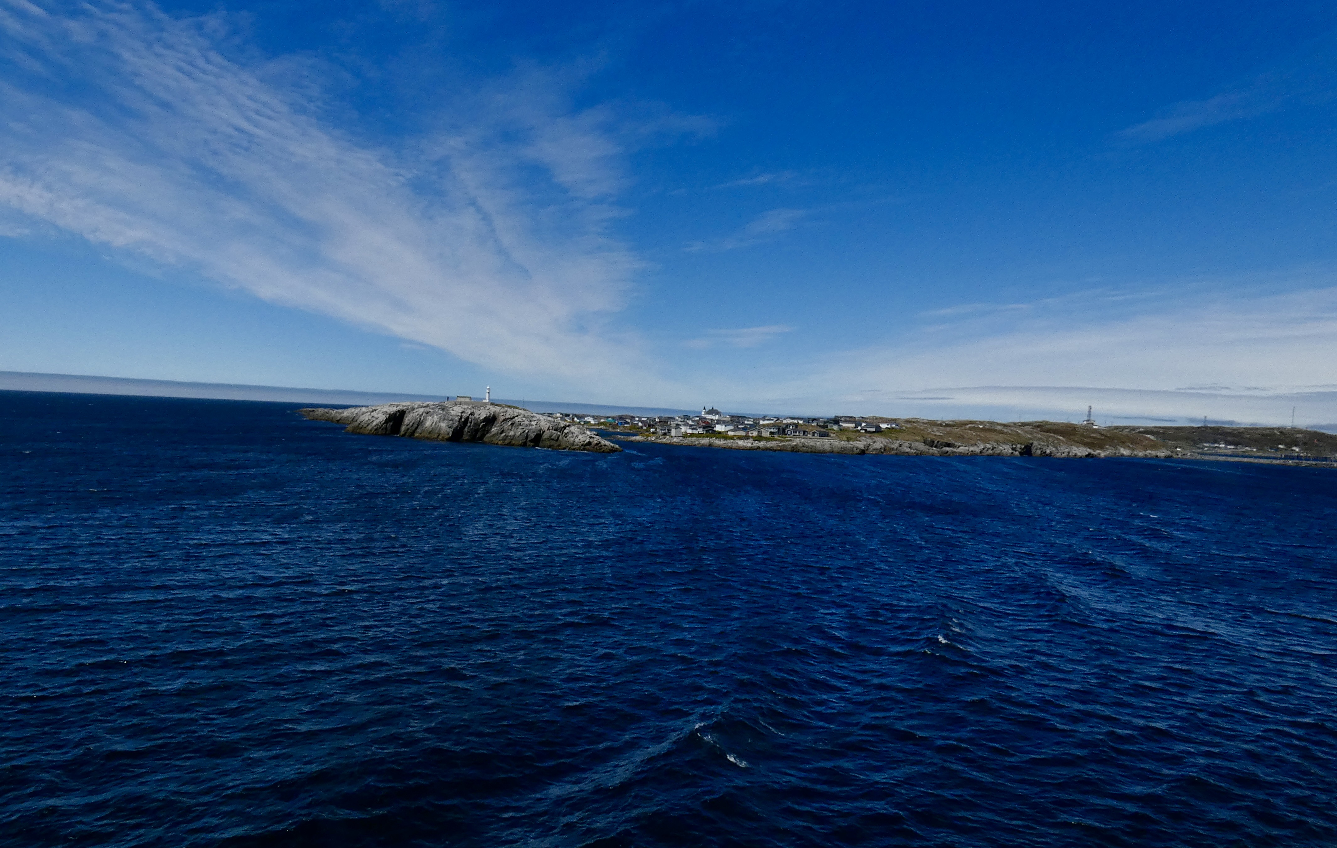
Some days I ride a lot; some days not so much. Today was a short ride day, thanks to cold temperatures and uncertain rain conditions. Had the weather been more favorable, we had time to ride the Cabot Trail on Cape Breton Island, Nova Scotia, before catching our ferry to Newfoundland and Labrador. Although each weather app we checked differed in some degree, all agreed that rain and maybe even snow was possible somewhere along the trail, in addition to strong, steady winds. So, it was a short, cold, windy ride from Antigonish to North Sydney where I’m waiting to board the overnight ferry for the seven-hour trip to Channel-Port aux Basques.
If there was a silver lining to today’s weather issues, it was that I had an opportunity to make sure my cold weather gear was working and that I remembered how to use it. For the first 40 miles or so of today’s ride, I had no heat from my jacket or gloves as 20-25 mph winds buffeted my bike. But I remembered a quirk of the Gerbing heated clothing system I use that requires me to turn the gear on AFTER I start the bike. Once I remembered that and switched the heat regulator off and then on again, blessed heat coursed through my gloves, down my sleeves and across my back. Aw, blessed heat. Riding in windy, cloudy, mid 40s temperatures is much more doable with heated gear. Today’s cold weather test was important, because conditions in Newfoundland tomorrow and the next day are expected to be wetter and colder than Nova Scotia today. We’re hoping to avoid snow. And moose.
I’m disappointed we didn’t ride the World Famous (according to Nova Scotians) Cabot Trail, because the views and the ride are both spectacular. The single scenic picture I took today from an overlook gives some idea of the area’s beauty, but the hidden coves along the trail are even more special, particularly when lighthouses adorn the cliffs and fishing boats bob like toy vessels in choppy waters. Perhaps on our return trip in about a week, time and weather will allow us a chance to ride the trail.
Steve had a minor issue with the throttle on his bike, so we detoured to a former Harley dealer in Sydney in case he needed help or broke something trying to fix the problem and needed a part. He disassembled it in the parking lot, put it back together and apparently fixed the throttle trouble, though he’s still not sure why it occurred in the first place. If that’s the only mechanical issue we have this trip, it will be a good trip. Harleys are reasonably reliable, but two bikes going 11,000 miles each offers a lot of opportunity for problems to arise.
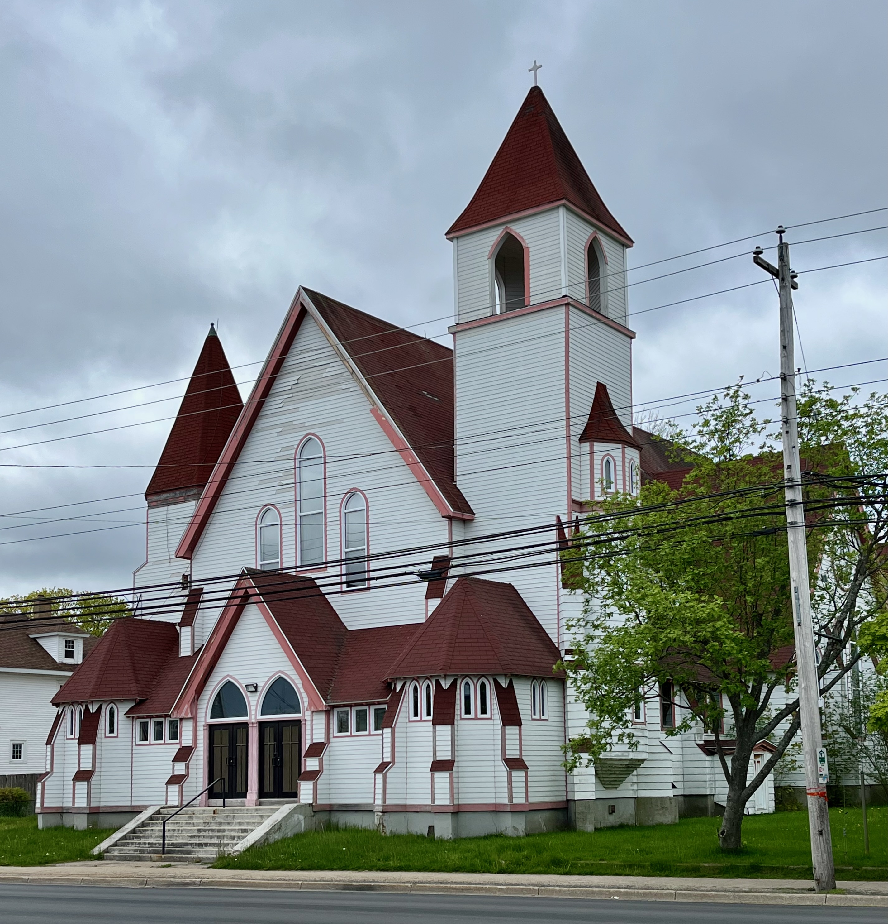
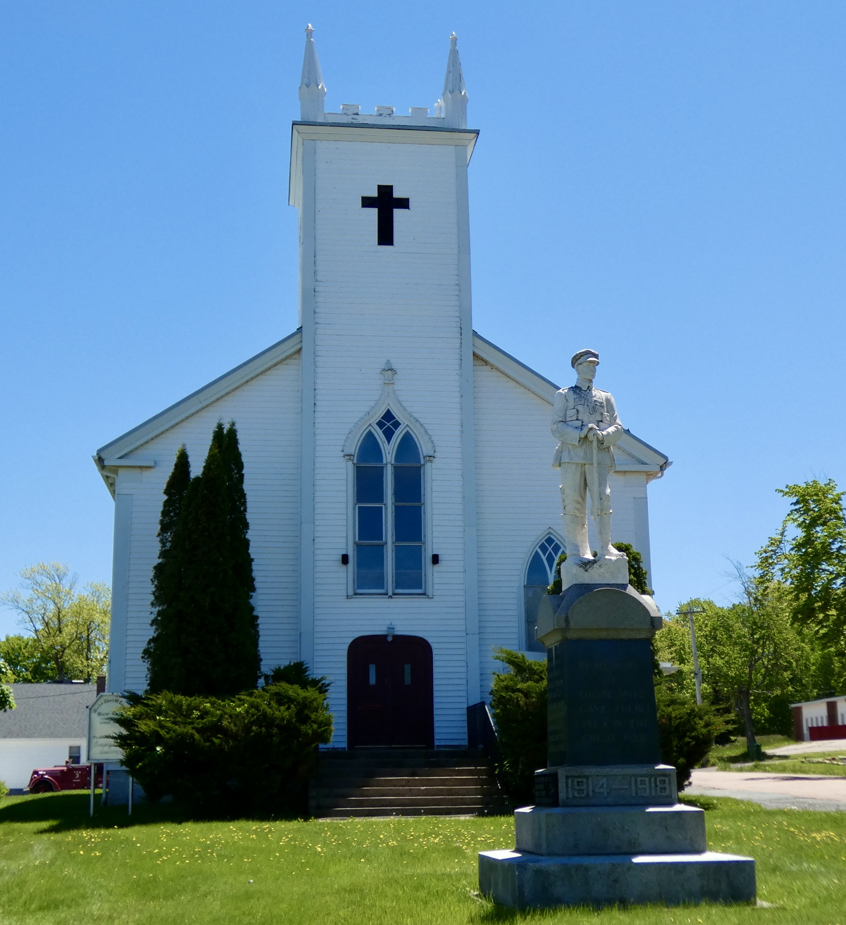
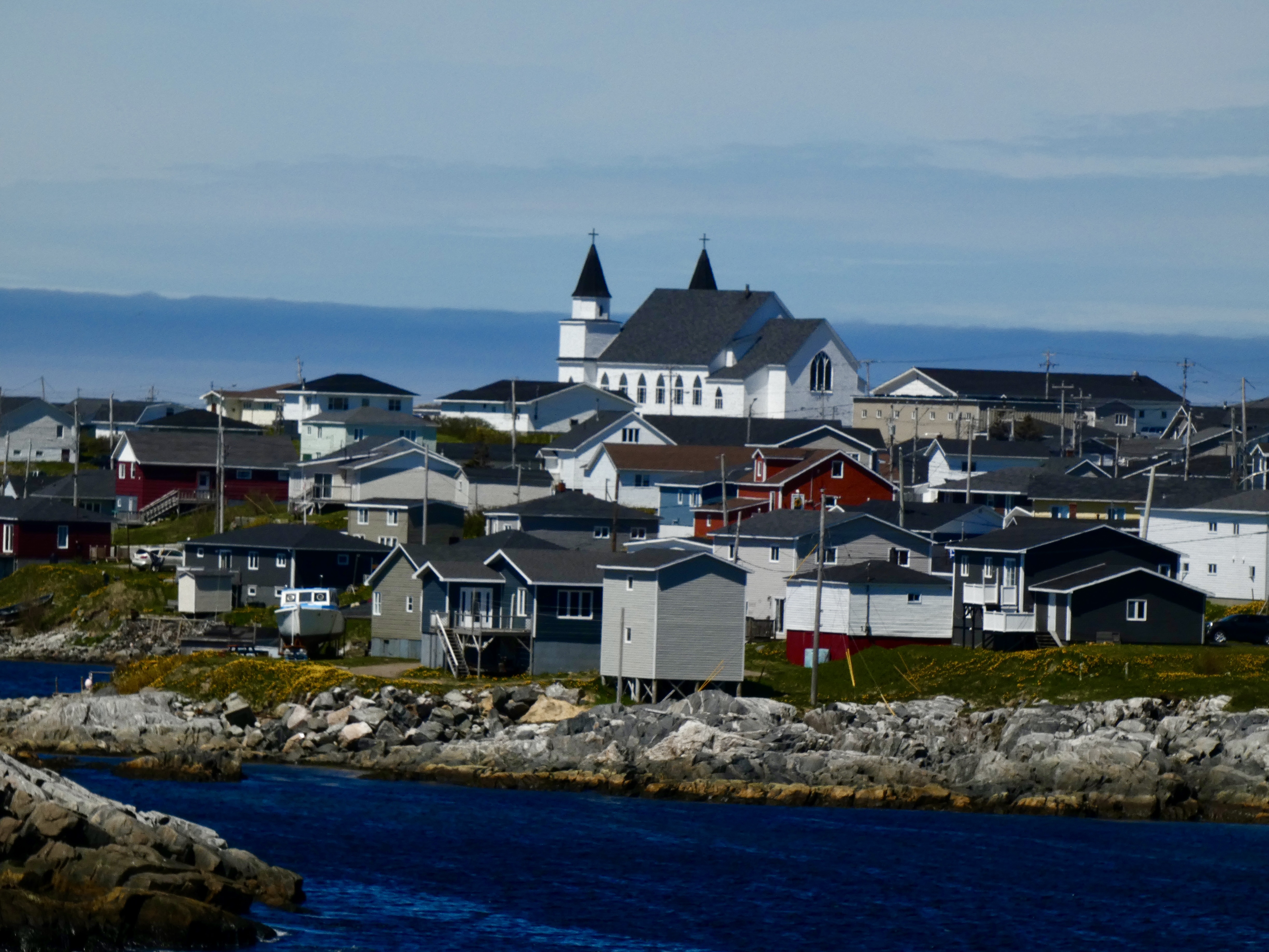
It’s hard to shoot decent pictures with numb fingers and mizzle-coated lenses, so I only got one other photo today. This church in North Sydney, while larger than most, is typical of clapboard construction, which is often lovingly maintained by congregants. These churches and their rising spires are important symbols of resilience within small communities dotting the countryside.
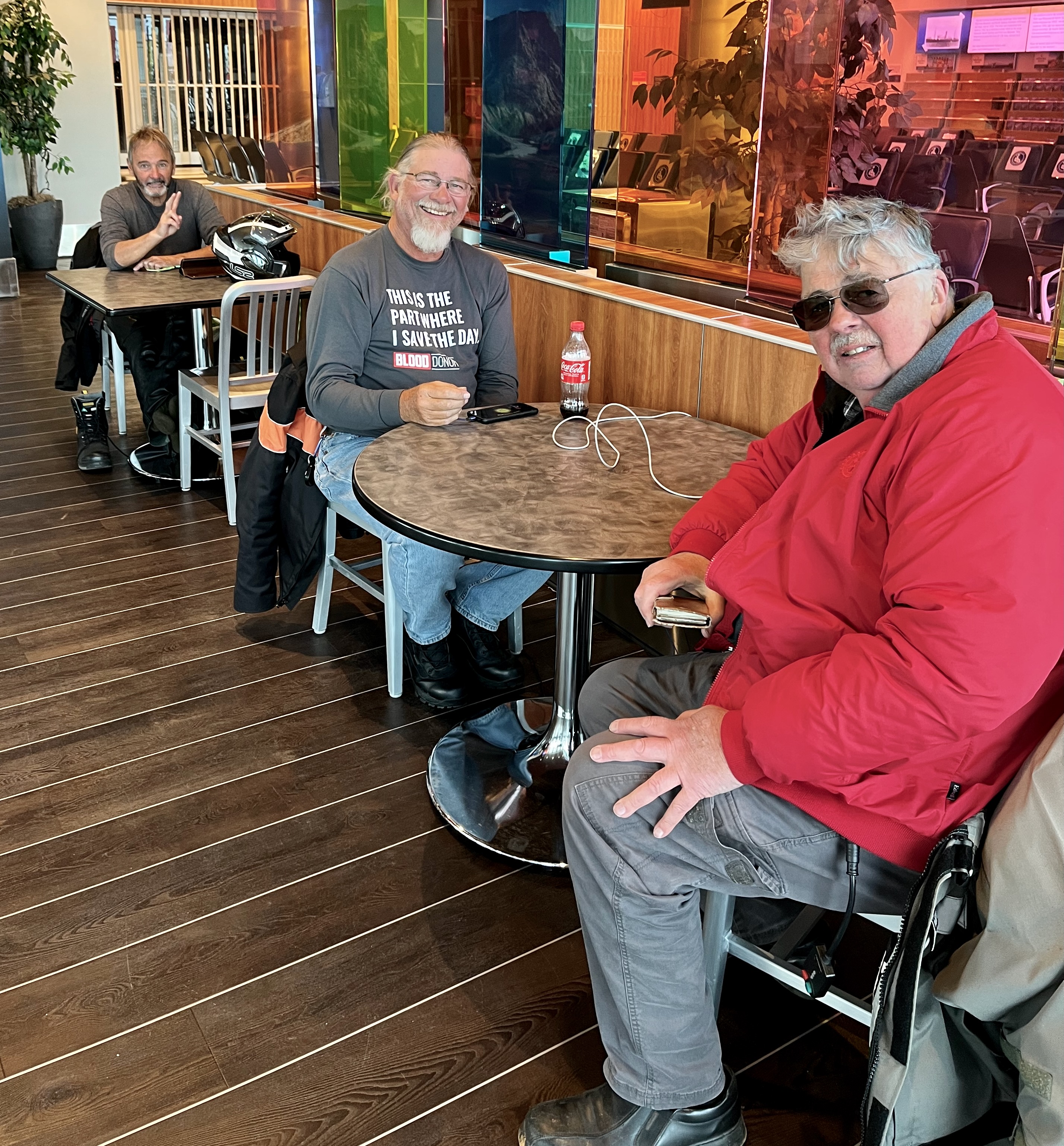
We’ve had to kill several hours in the lounge at the ferry terminal and everyone–including me–turns to their electronic devices to pass the time. But in a few hours we’ll fire up the bikes, ride them into the bowels of the massive sea-going ferry, try to get some sleep, and debark in seven hours in another Canadian province.