
Day 13 CCR: Seeing Sights on PEI
Before Prince Edward Island was Canadian, and before it was a British territory or colony, it was an minor outpost of the seventeenth-century French empire’s colony of Acadia and was known as Ile Saint Jean. Joining the original Mi’kmaq inhabitants, the first European settlers were mostly French until the British took control of the island under the terms of the Treaty of Paris in 1763, ending the Seven Years War. It remained a British colony for more than 100 years, joining Canada as its seventh and smallest province in 1873.
I offer that brief history lesson because much of the area we rode through today still has a strong French influence on its culture, religion and language and was apparent in place names and religious settings. Many residents in the northwestern part of the island speak French as their primary language, though all are bi-lingual.
In addition to tourism, two of the biggest sectors of the PEI economy are agriculture, especially potatoes, and fishing, especially for lobster. And today we saw examples of all three.
Tourism development included the creation of three scenic loop drives earlier this century: Points East Coastal Drive, Central Coastal Drive and North Cape Coastal Drive. Today we tackled part of the North Cape Coastal Drive, but predictions of rain this afternoon drove us back to our base at Summerside before we could complete the drive through the western and northernmost segments of the island. Nevertheless we saw enough to get a good taste of PEI’s North Cape Coast.
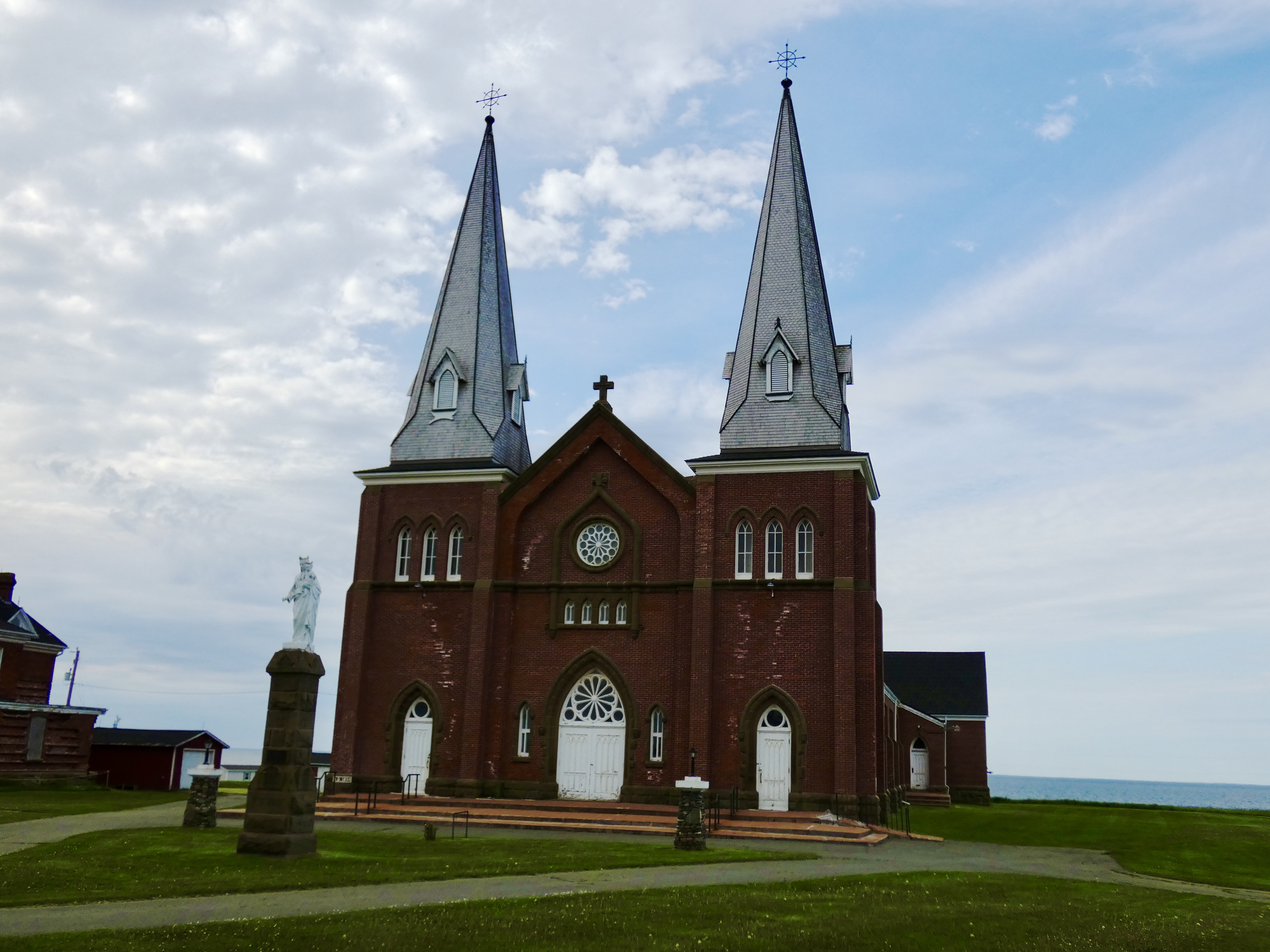

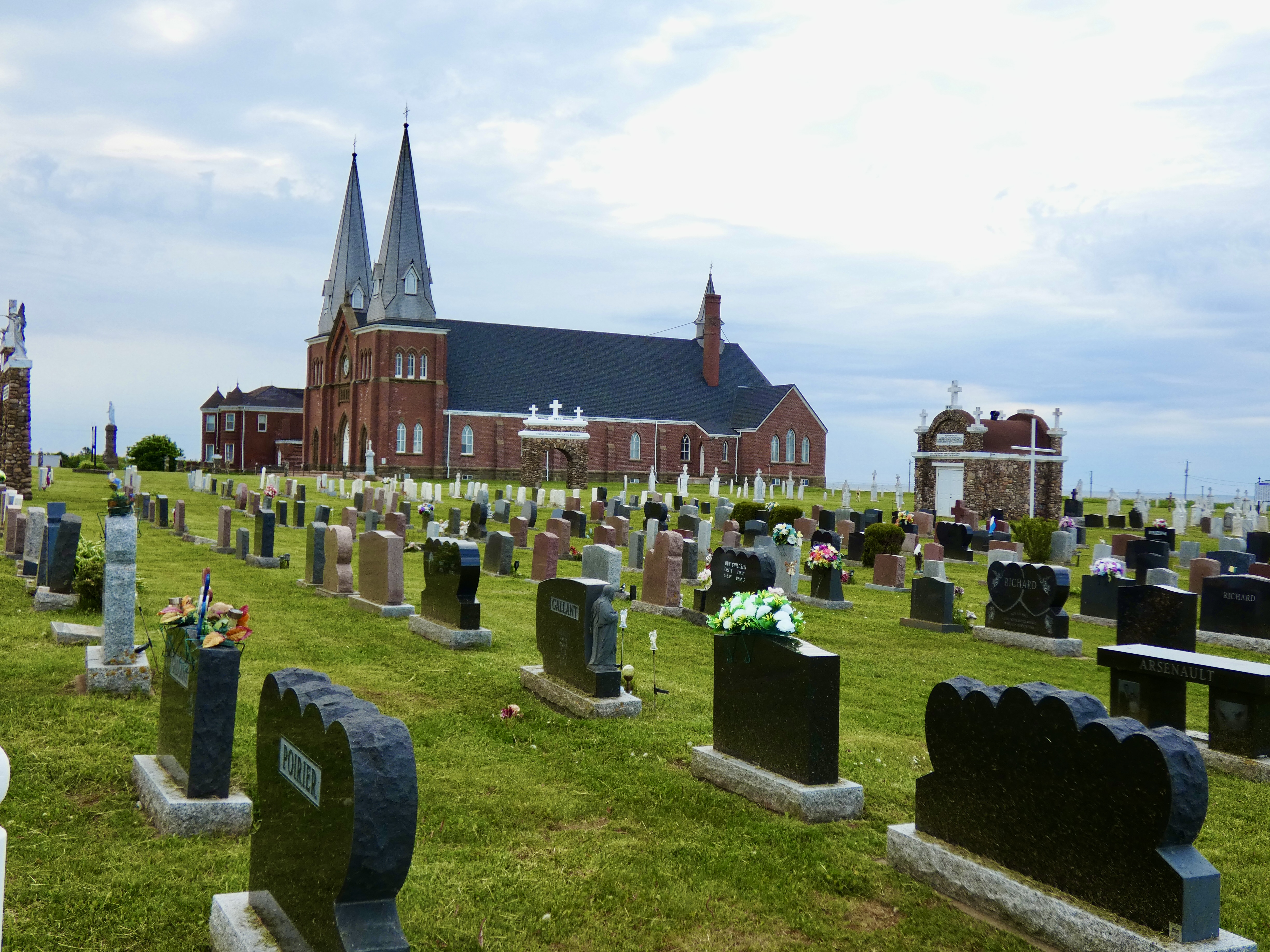
One of the most impressive sights we came on as we motored along the loop drive was the massive French Catholic church at Mont Carmel, about 20 miles from Summerside. The structure dwarfed all other buildings we saw as we rode along the coast, and every brick and stone of the edifice was testimony to the area’s history. The cornerstone had been laid in 1898, but other artistic and structural elements, attached to and detached from the building, had been added over the years. For more than a century and a quarter, this church has been the bedrock of that coastal segment of the Acadian community in PEI.
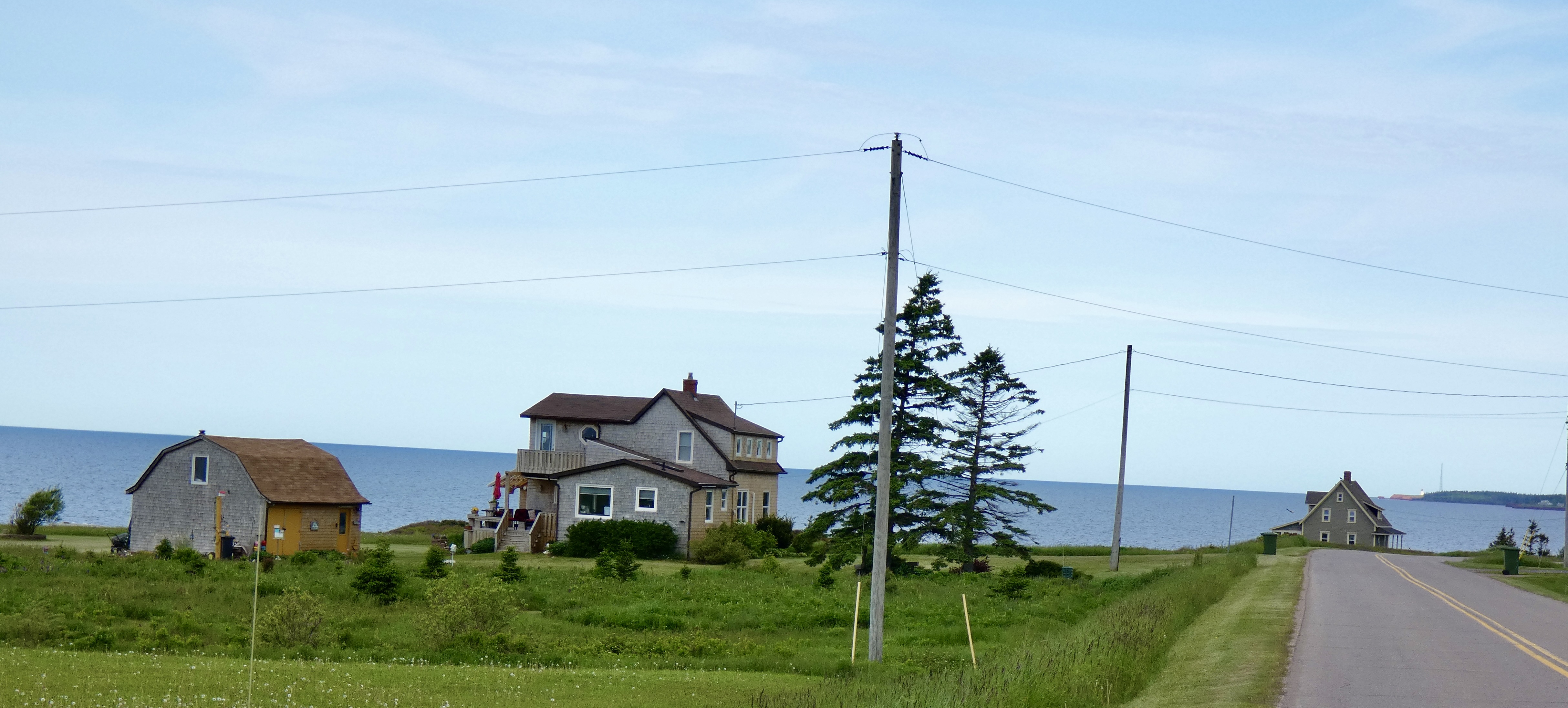
Ocean views are prime property along the North Cape coast and there was little property that didn’t have some living structure on it. It could have been a near-mansion or it could have been a recreational vehicle. More often than not, it was a house similar to the one pictured above. No doubt the land itself was almost always more valuable than whatever house happened to be perched overlooking the sea.
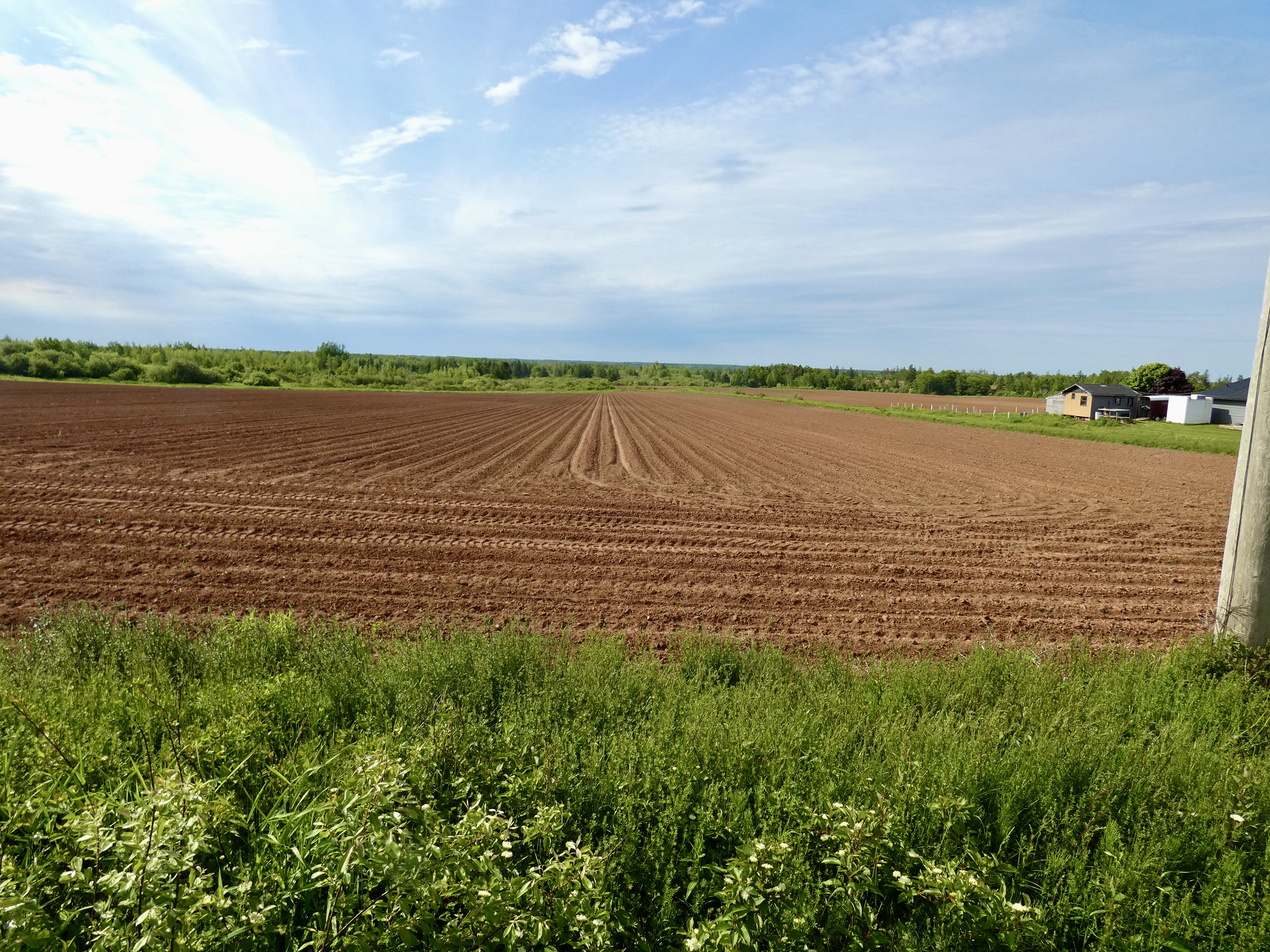
On the other side of the road, though, were liable to be recently plowed fields with very pronounced furrows and ridges. In a month, this acreage will be covered with the verdant green of potato plants and in some places today we could see the first shoots of potato plants breaking through the red soil that colors the area even without plants. PEI, the smallest province of the ten, grows one-quarter of all potatoes consumed in Canada.
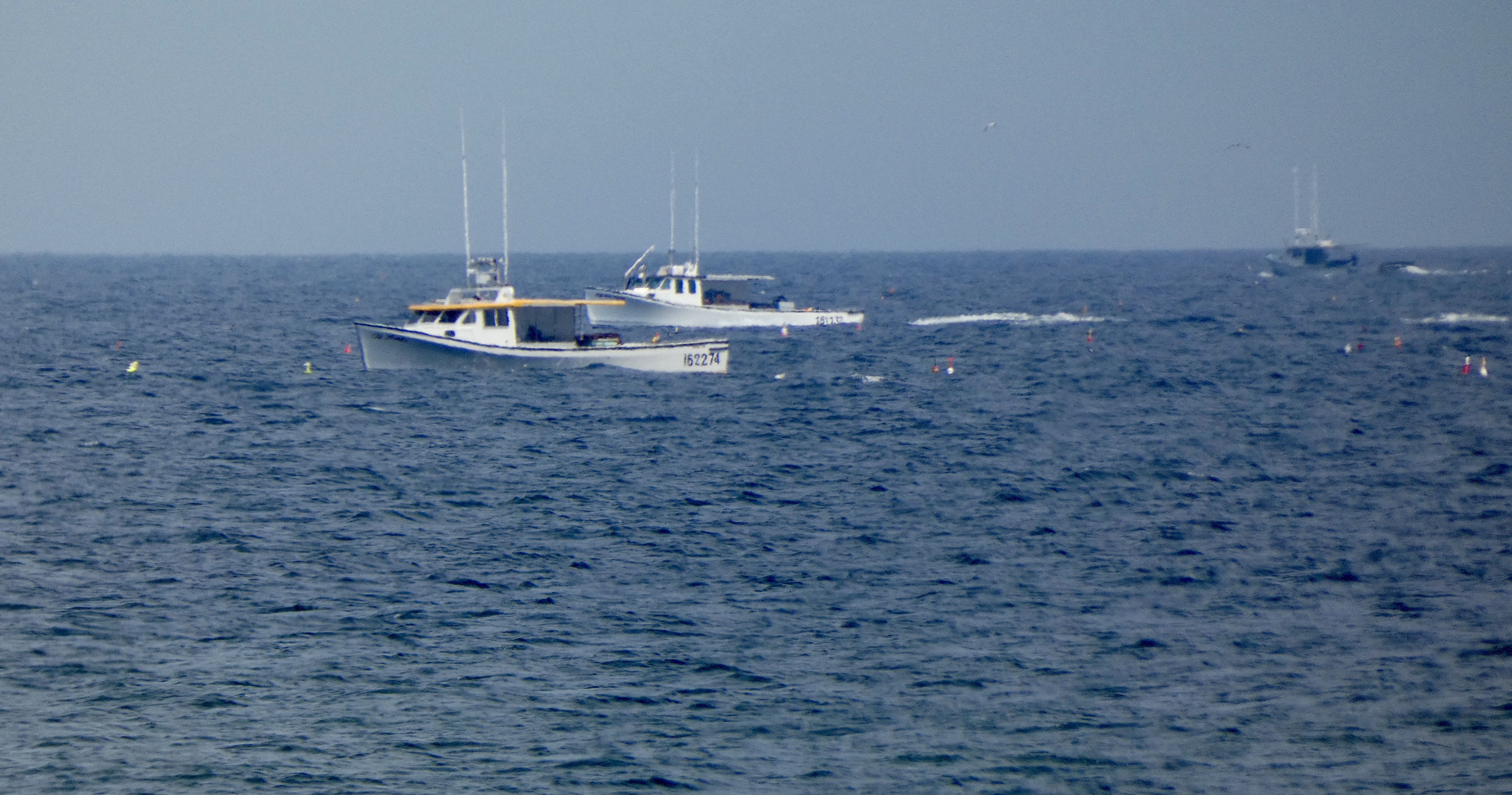
Fishing boats are everywhere. Some are in people’s front yards, but most are tied to a dock or at sea, fishing or lobstering as residents use the sea as much as they do the land to earn a hard living in PEI.
We worked our way north and west, cruising along backroads, many of which I had no intention of taking but Google’s map program kept showing me short-cuts and directing me off the official route. Eventually, I shut down the GPS and relied on colorful North Cape Coastal Drive road signs to direct me. I will here offer a complaint about Canadian traffic engineers. I’m used to road signs directing me to turn exactly at the spot where I’m supposed to turn. But here, they place a sign a quarter of a mile or so before the turn and the driver is forced to guess just where that turn is, resulting in more than one u-turn on today’s ride.
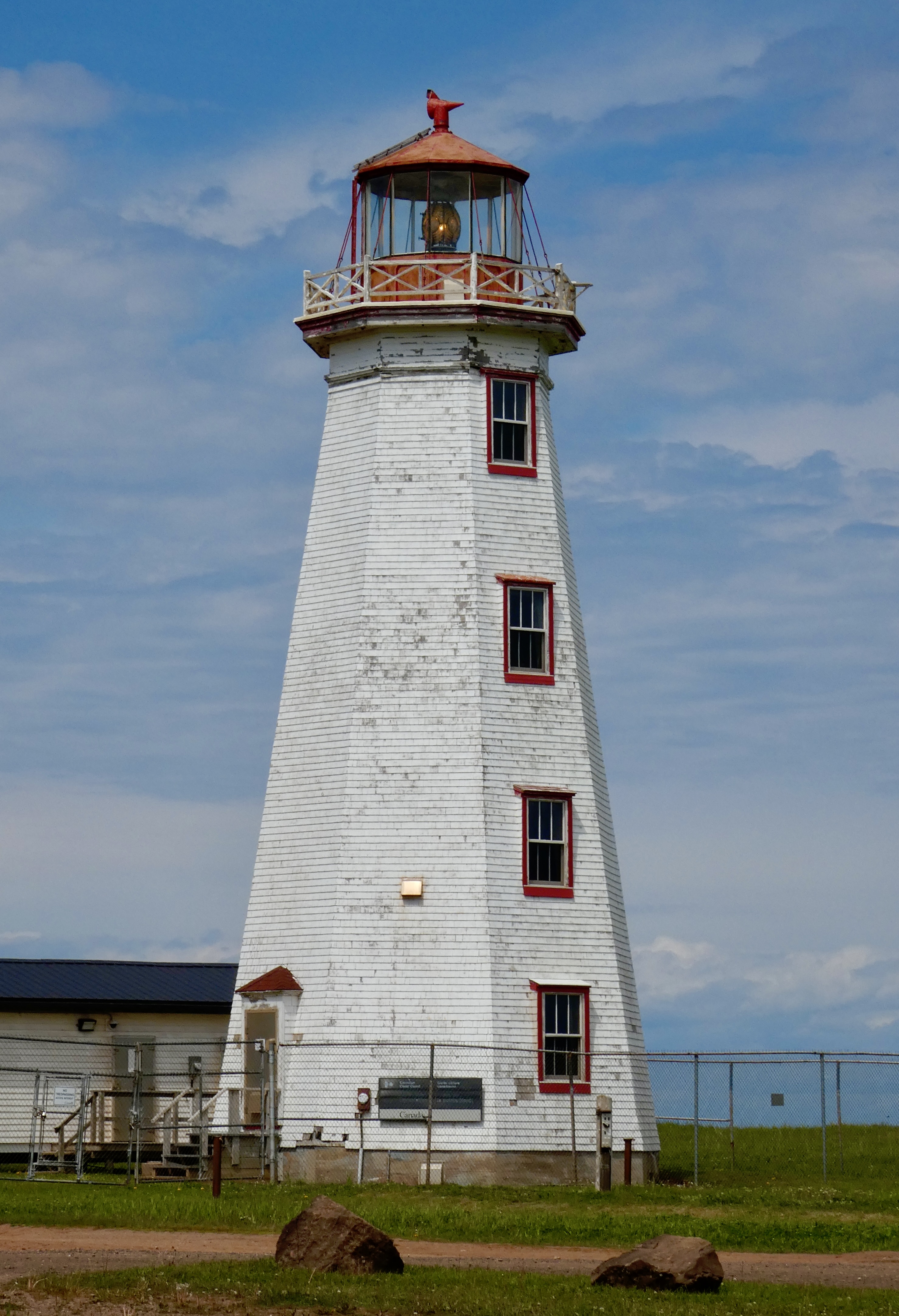
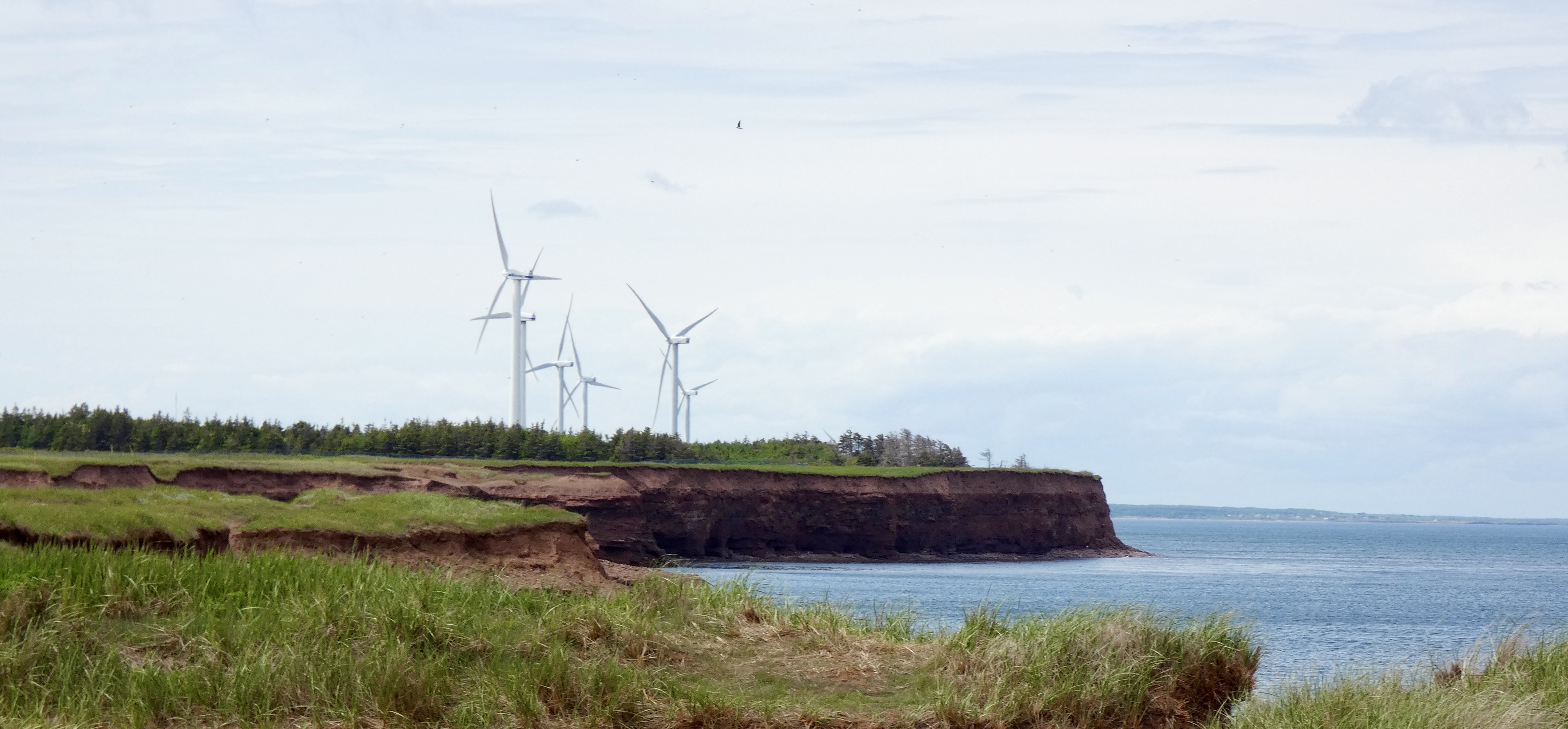
Despite detours and missed turns, we ultimately reached the northern tip of Prince Edward Island. In addition to having an interpretive center, light house, a couple dozen giant wind turbines, a gift shop and restaurant, the northern point of PEI also has the longest natural rock reef in North America, which at low tide stretches more than a mile into the sea. When the tide comes in, what you witness is the meeting of the waters of the Gulf of Saint Lawrence and the Northumberland Straight.
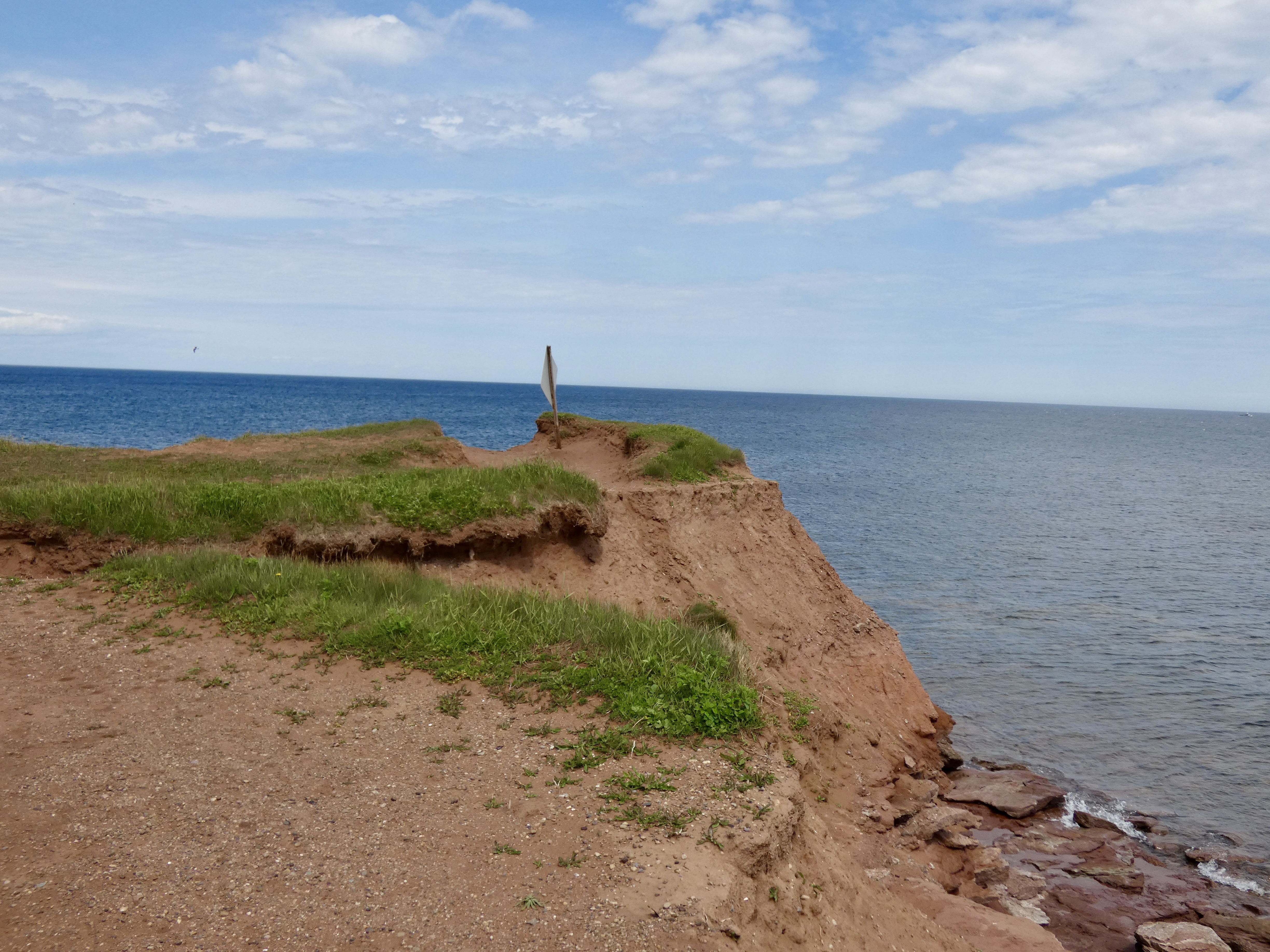
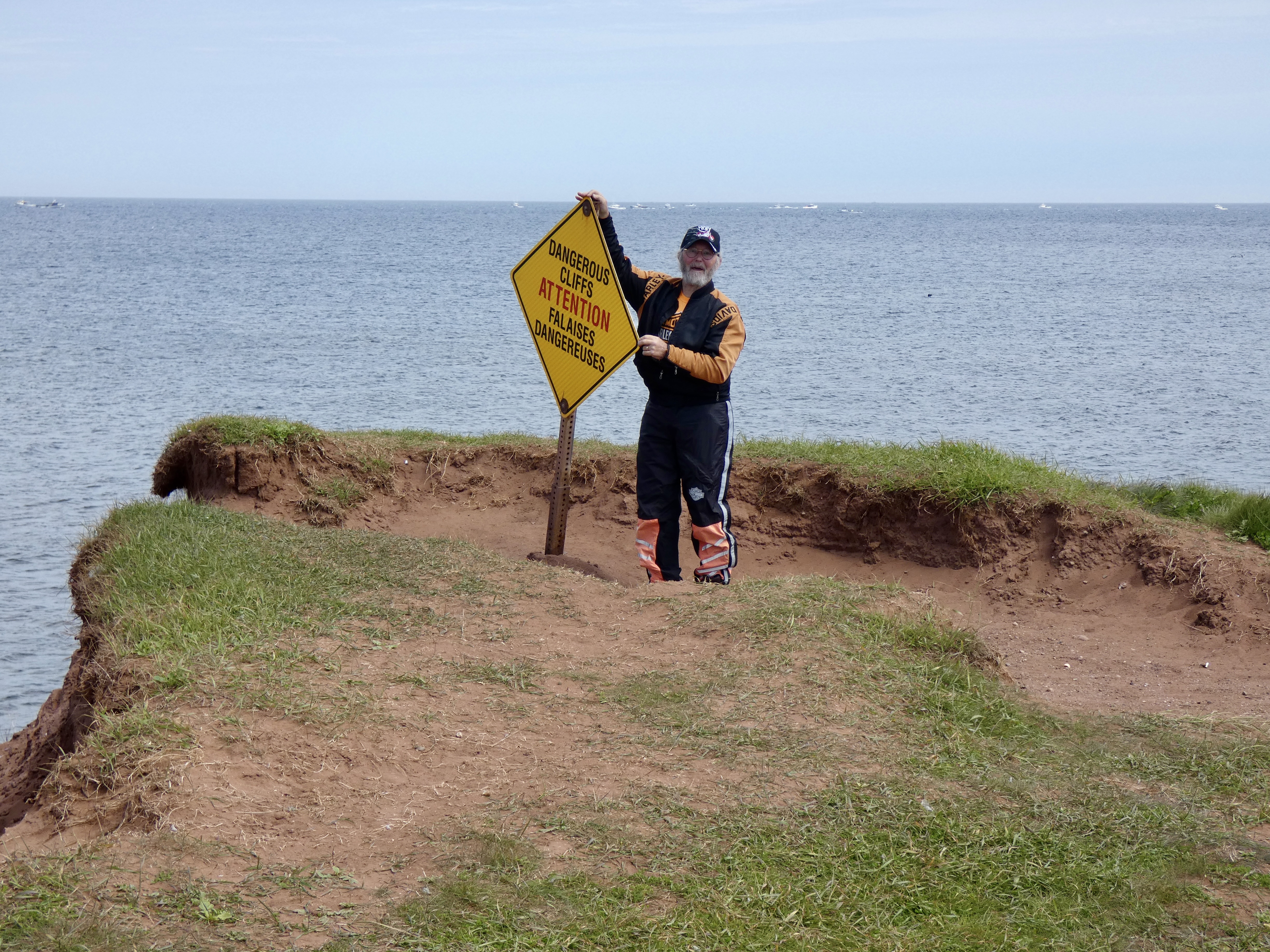
After parking the bikes, we took a short hike along the cliffs of the point to reach the very tip.
Following a quick lunch in Tignish at a local bakery that sold great sandwiches at a bargain price ($6 CAD), a look at the weather radar suggested a rapid return to Summerside was in order. So, after having worked our way up the east coast of the pennisula , we decided to forego a trip along the west coast in favor of a more direct and quicker route down the middle and back to Summerside. We had a few sprinkles on the way back but no serious rain. In fact, despite the ominous looking radar picture, we didn’t get any significant rain all afternoon, though it did wet the roads.
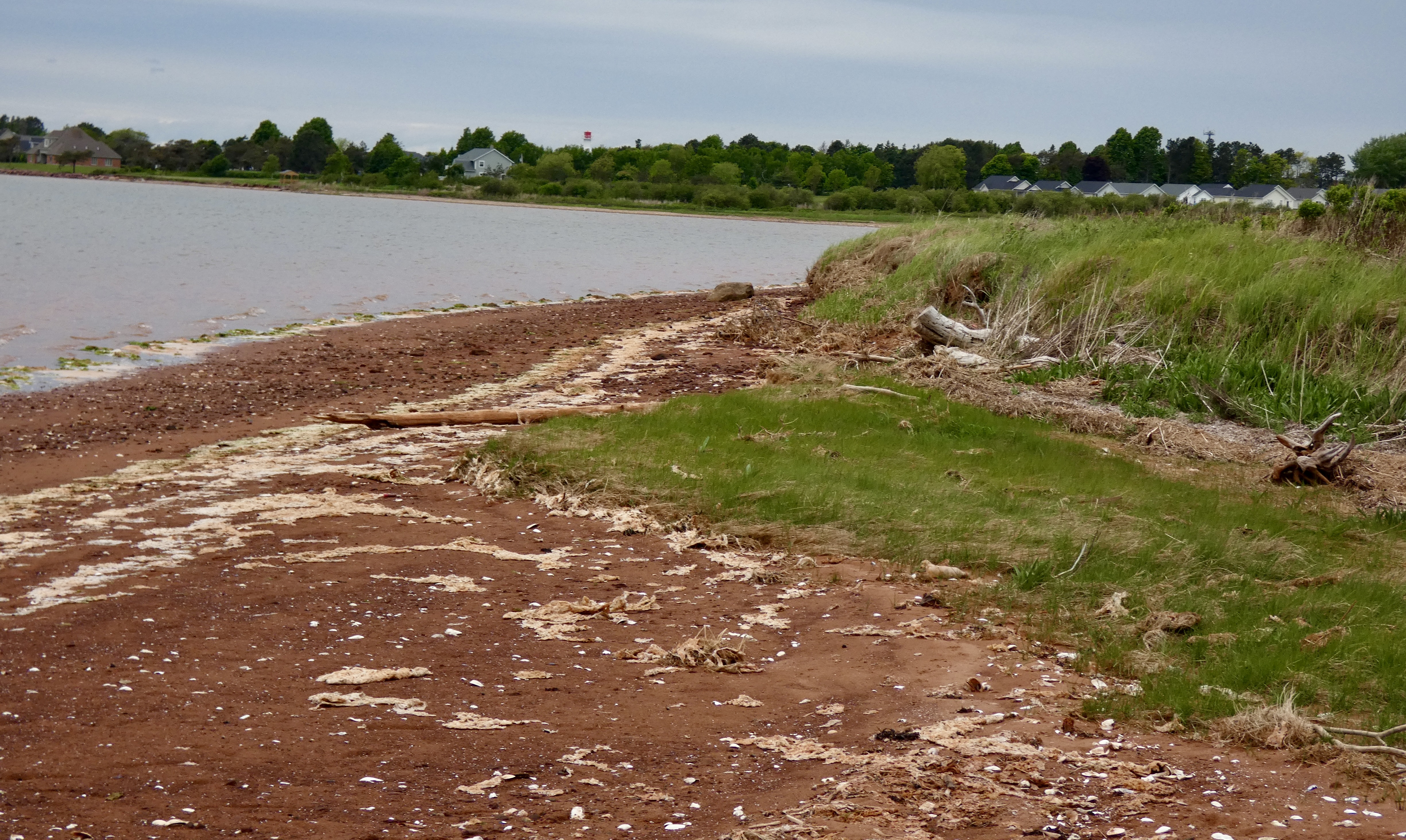
I was glad for a further respite of rain and, after taking care of some future hotel bookings, I took a short hike from our hotel to the beach about a mile away. The owner of the hotel owns 30 acres of land behind it and he is kind enough to mow a path through the field and trees down to the beach for his guests. In addition to getting some exercise, I also got a few more pictures, including one of the ever-present red sand, which is caused by the amount of iron in the soil.

Tomorrow, we leave this beautiful island. I saw more than I did the last time I was here eight years ago, but I still haven’t seen enough. The next time I come to PEI, I’m staying for at least a week and I’m definitely spending more time on the Coastal Drives. For now, it’s off to New Brunswick and points west.

Glad you had a good day. Each day I read, I’m checking it out on a map. PEI doesn’t look like you should often be a mile from anything, especially in Summerside. I guess the scale is a little bigger, eh? Safe travels!
You had us at lobster fishing and they speak french! It’s lovely. I can see why you want to go back. I can see you and Marilyn there for a week or two. I’ll have to add PEI to our bucket list! Be safe!
Did y’all eat seafood? Lobster pie perhaps. Enjoyed the pics.
Ride Safe
The historical architecture is always great to see along with it’s signifigance. Glad the weather held off today. Ride safe.
Another great history lesson of the area. May you be blessed with some nice sunny days.