Day 24 CCR: A Happy Father’s Day
All the planets must have been correctly aligned for Father’s Day because I had a really great day.
Since it was Father’s Day, I got a shout out from older daughter Heather, FaceTime with my patient and understanding wife, FaceTime with younger daughter Hilary and her two littles, Elena Denise and Juliette Lauren, and lovely recognition by my beautiful middle granddaughter in Wisconsin, Hanna Jean. If nothing else had happened today, Father Day hugs from everyone mentioned would have constituted a great day. But there was more. Lots more.
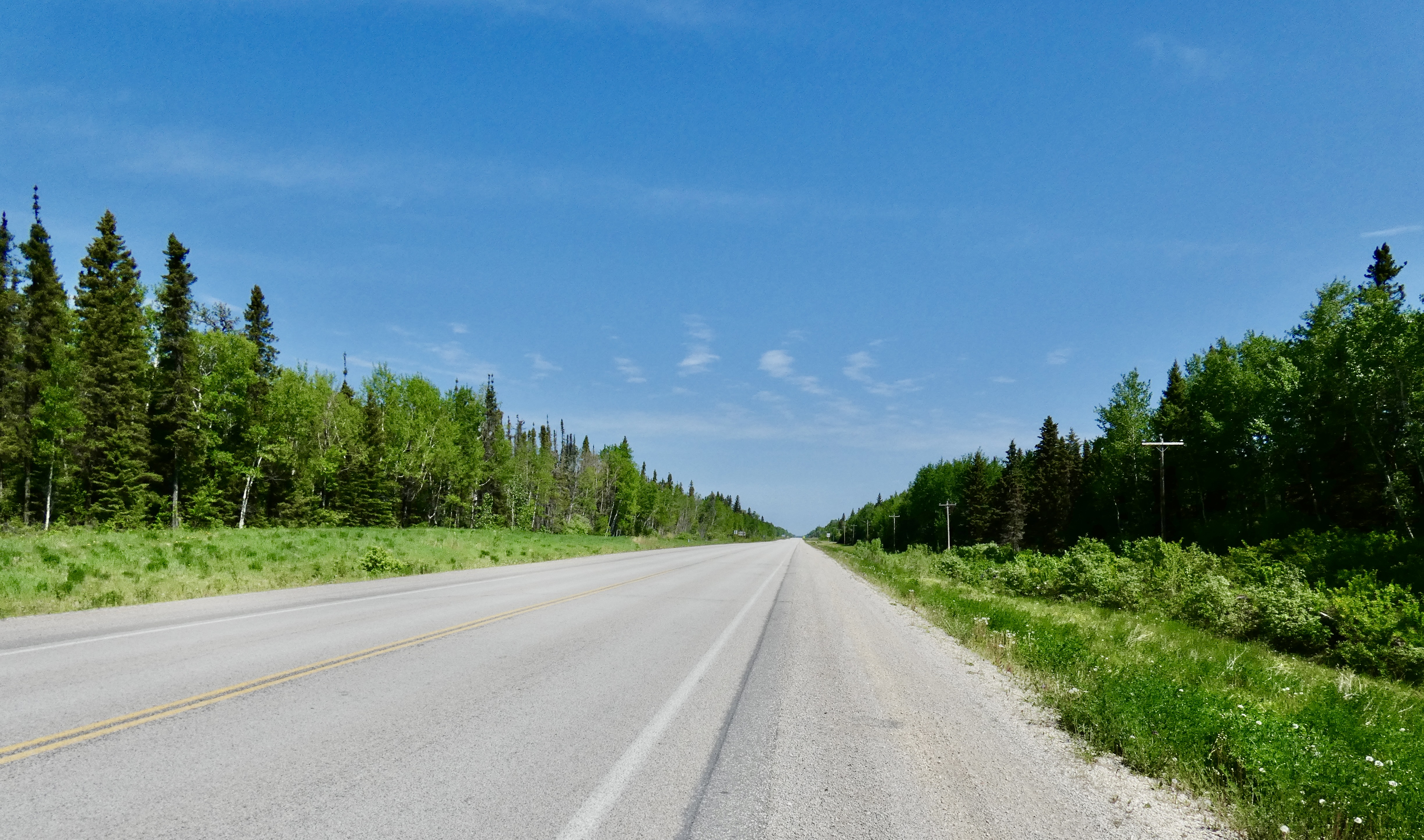
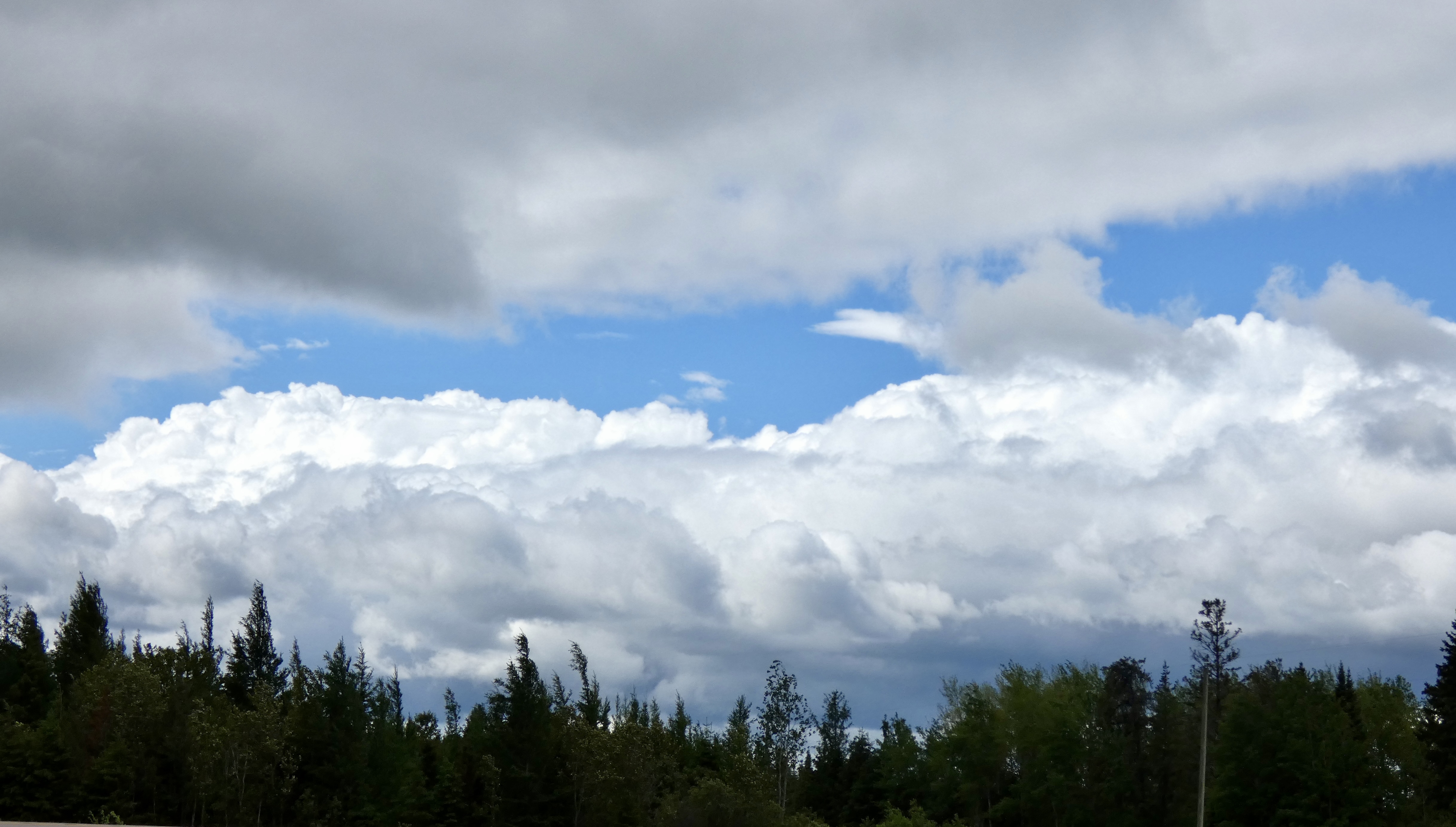
We undoubtedly had the best road day of the entire trip. Under blue skies this morning, we started riding with temperatures in the low 60s and the thermometer climbed to near 80 before the day was done. Today marked the first time since we’ve been riding in Canada that I rode in a t-shirt (long sleeved) all day. And I enjoyed every coatless minute of our five-hour ride to Flin Flon. The highway was mostly smooth, the pace was moderate and I got 56 mph at one of our gas stops.
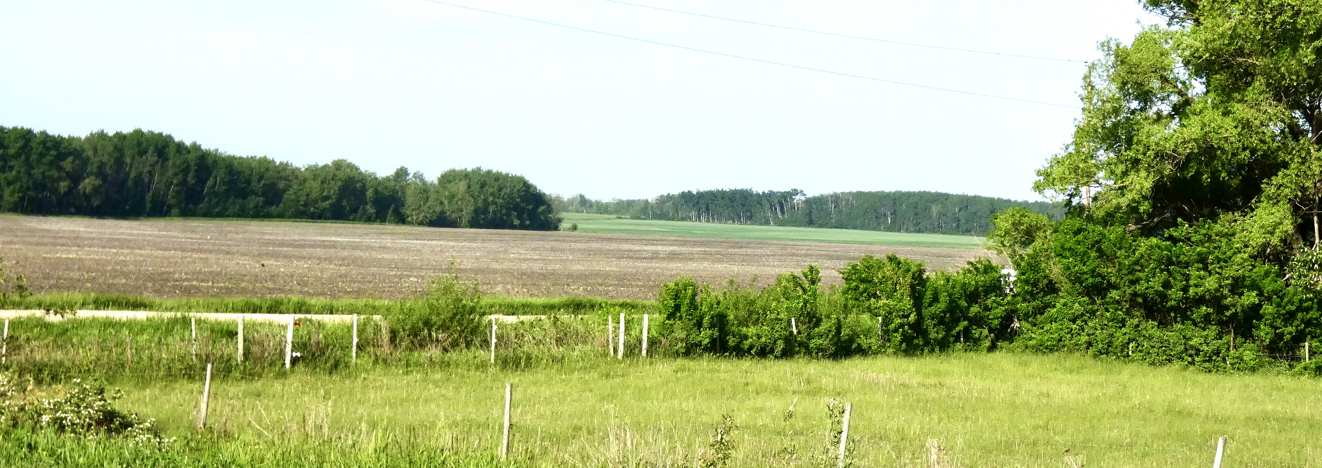
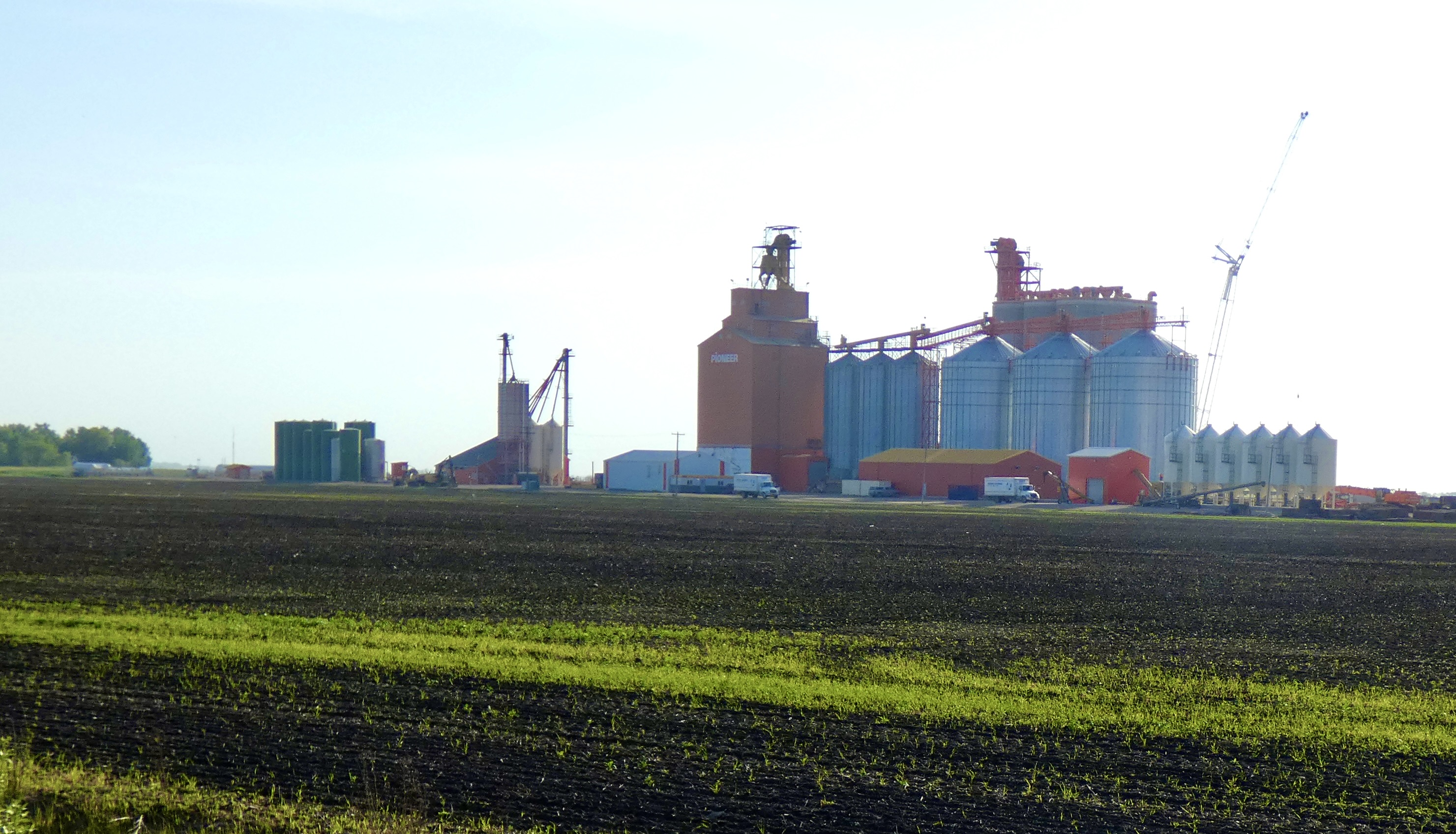
As I noted yesterday, the landscape of south central Manitoba is mostly agricultural, but I didn’t get a chance to take any pictures as we dodged inclement weather. A few miles outside Swan River where we stayed last night, I took a couple shots that were typical of what we had been riding through yesterday and would continue to ride through for about 100 miles today.
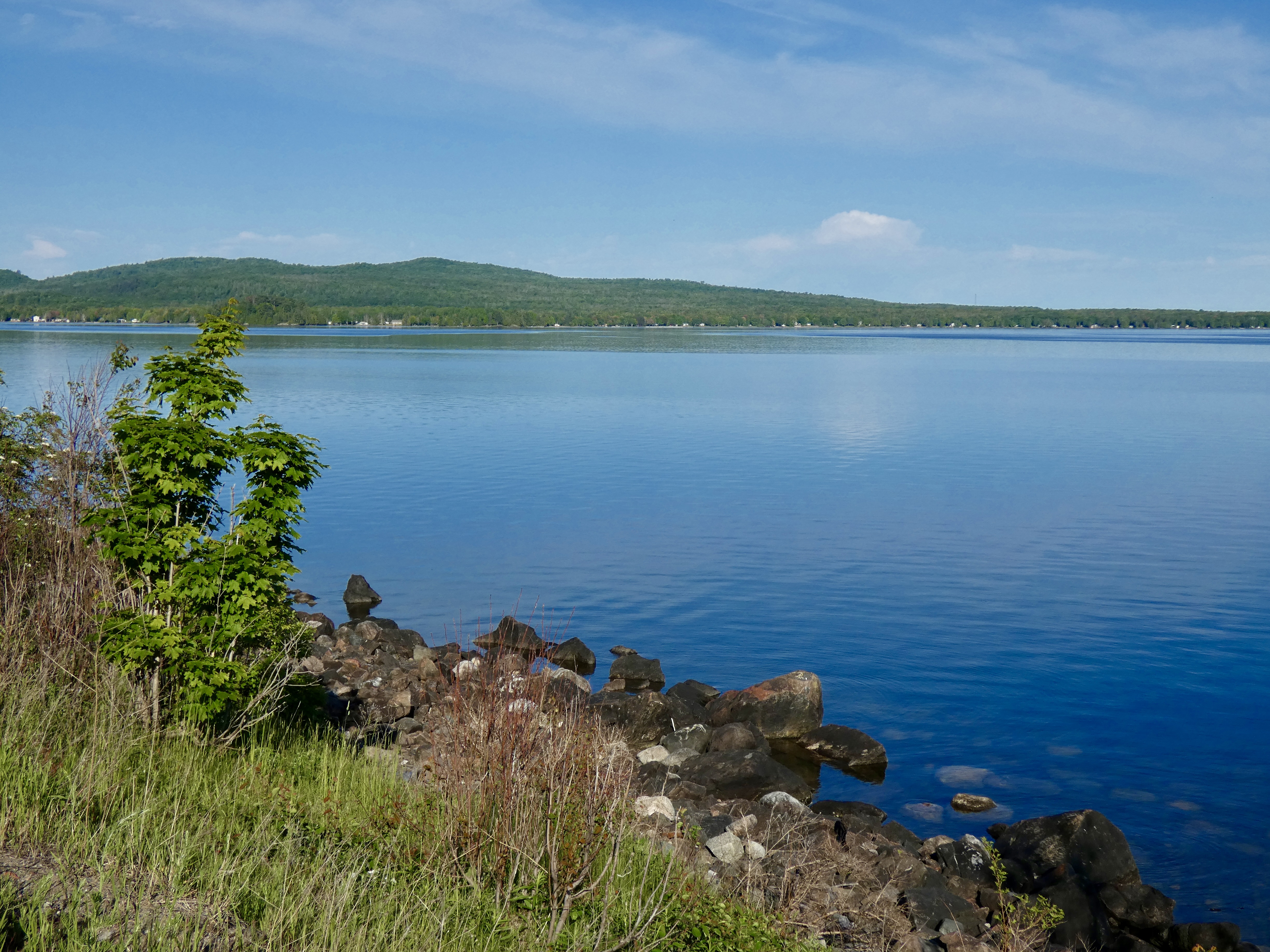
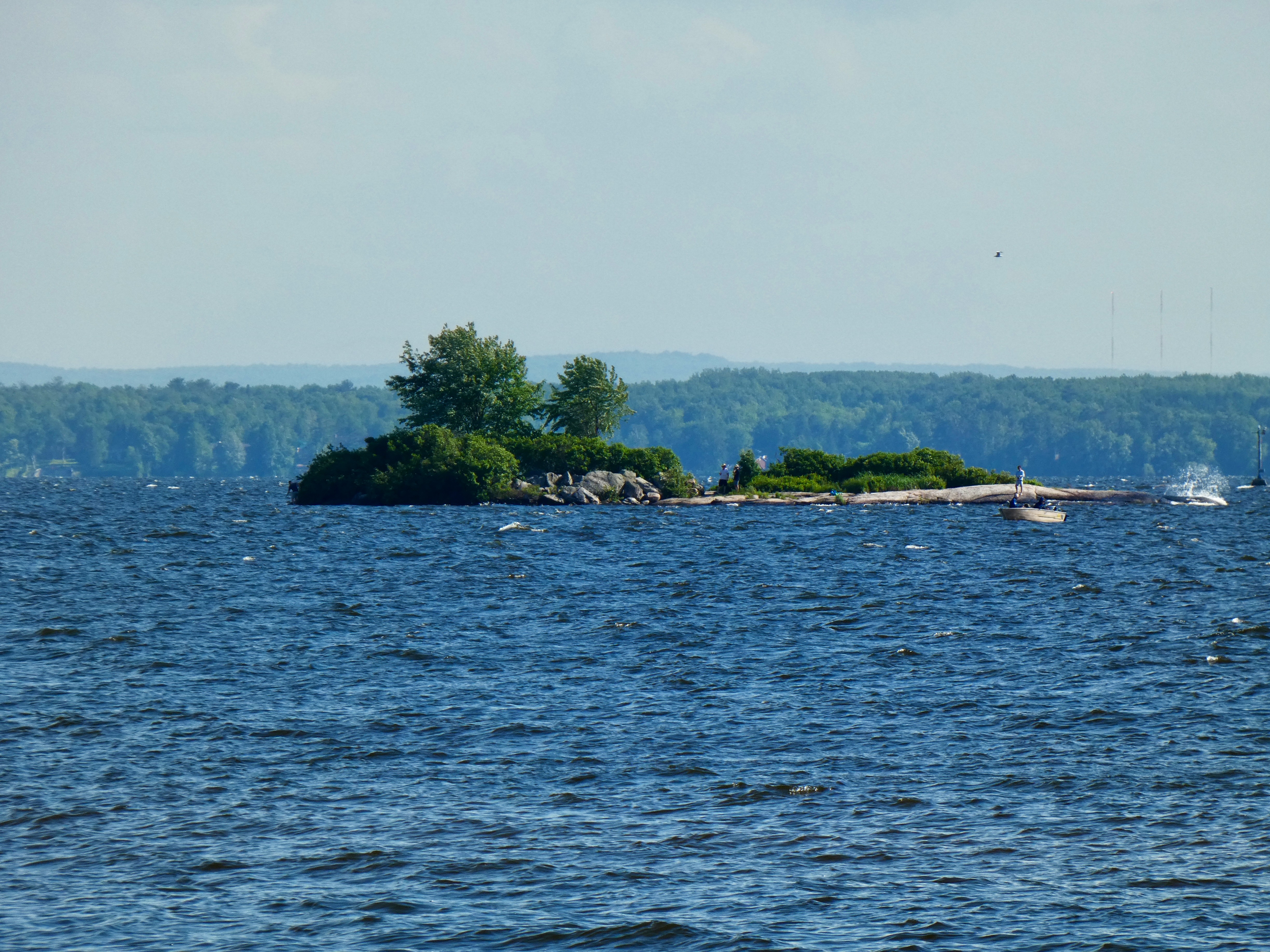
But the landscape was about to change again, this time living up to the road’s place on the Northern Woods and Water Route, which covers the four western provinces and generally stays north of the Canadian Prairies. While Manitoba doesn’t claim as many lakes as its neighbor to the east, it counts more than 100,000 bodies of water within its borders. Soon we had lakes big and small on both sides of us. The fertile fields were mostly gone by the time we traveled half of today’s distance, replaced by dense forests that carpeted the growing number of hills we rolled through.

About 30 miles from Flin Flon we passed through Cranberry Portage. The 2 mile portage referred to in the name was used for more than 2,000 years, originally by First Nation’s people and then by European, mostly French, traders and trappers who moved furs and pelts by canoe from the western part of Canada to Churchill in Hudson’s Bay, where they were loaded on ships destined for the Continent.
With abundant forested habitat I would have been surprised if I hadn’t seen wildlife today. As we left flat farm land and the road cut through the forests, I spotted a doe in the road in front of me. Standing there. In the middle of the road. I got closer. She continued to stand there. Finally, as I slowed to about 10 miles an hour, she took one final look at the two-wheeled intruder in her domain, trotted nonchalantly off the road and walked into the woods. Next on my animal bingo card was a beautiful bald eagle that flapped it’s wide wings lazily as it flew slowly above me. Nice. Herons in small ponds and standing water occasionally launched themselves carefully into the air, gaining altitude with every slow flap of their long wings. But the bingo winner for the day was the black bear that crossed in front of me, never close enough for either of us to be in danger, but close enough that I got a good look at its eyes as it turned toward me before disappearing in to the forest. My lucky day. Riding along at 90 kph, of course, there are no pictures to show of my wild kingdom encounters.
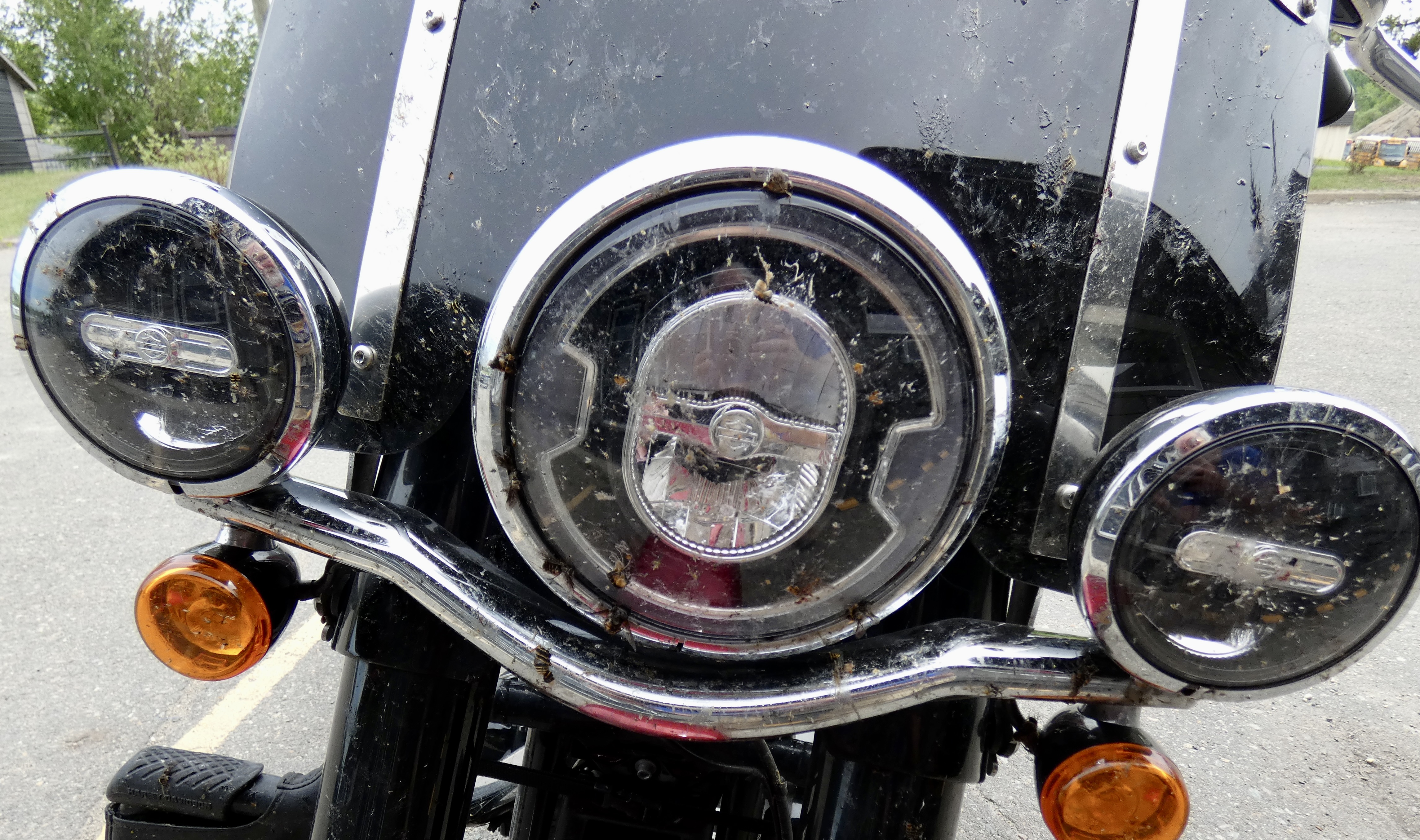
One more animal category deserves mention. Bugs. No, make that BUGS! BIG BUGS. Hundreds of them. Thousands of them. Splat onto my headlight. Splat onto my windshield. Splat onto my helmet. Splat onto my pants. Splat onto my hands until my fingers were sticky. I washed my fingers and my bike as soon as I got to the motel. My pants still have splat on them.
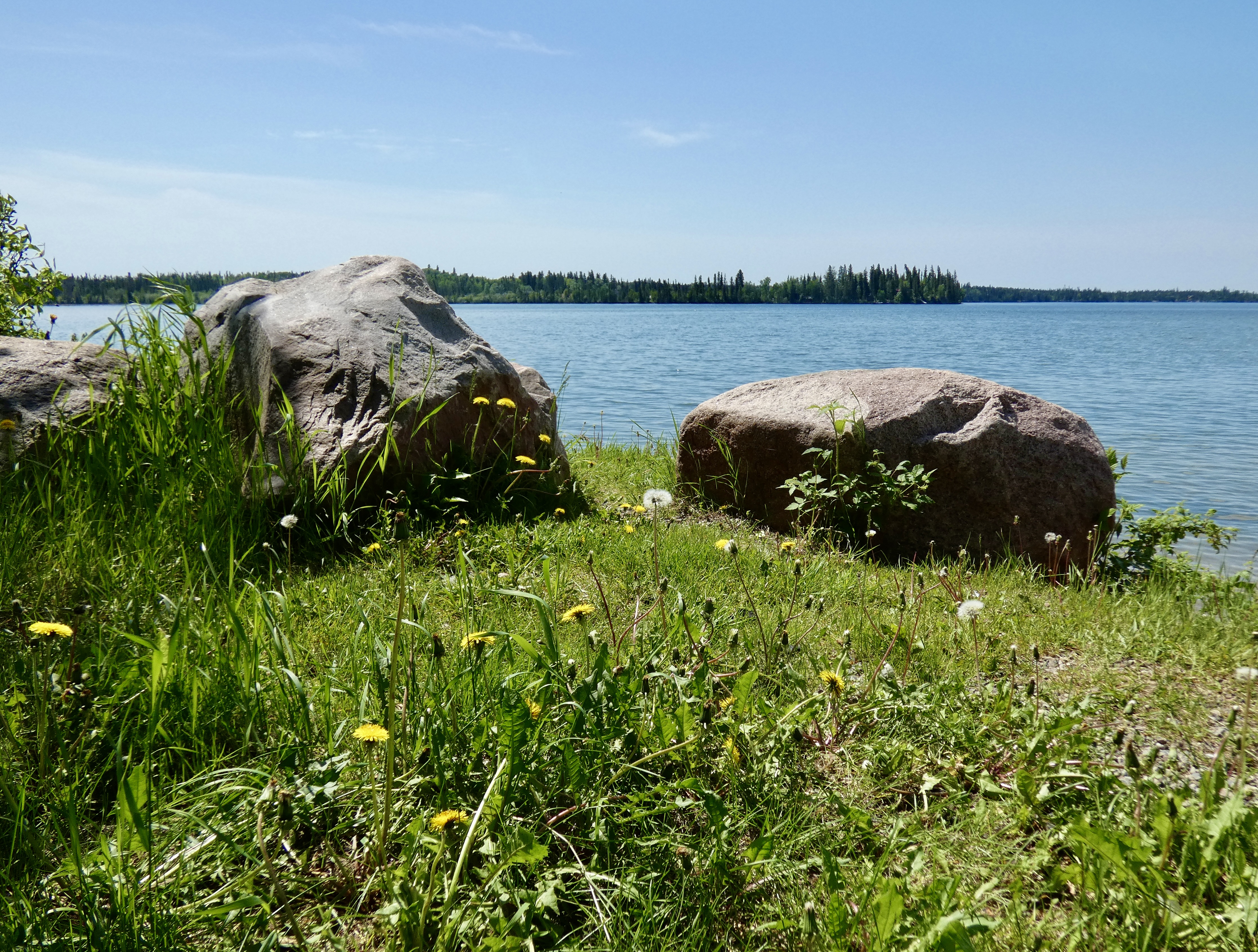
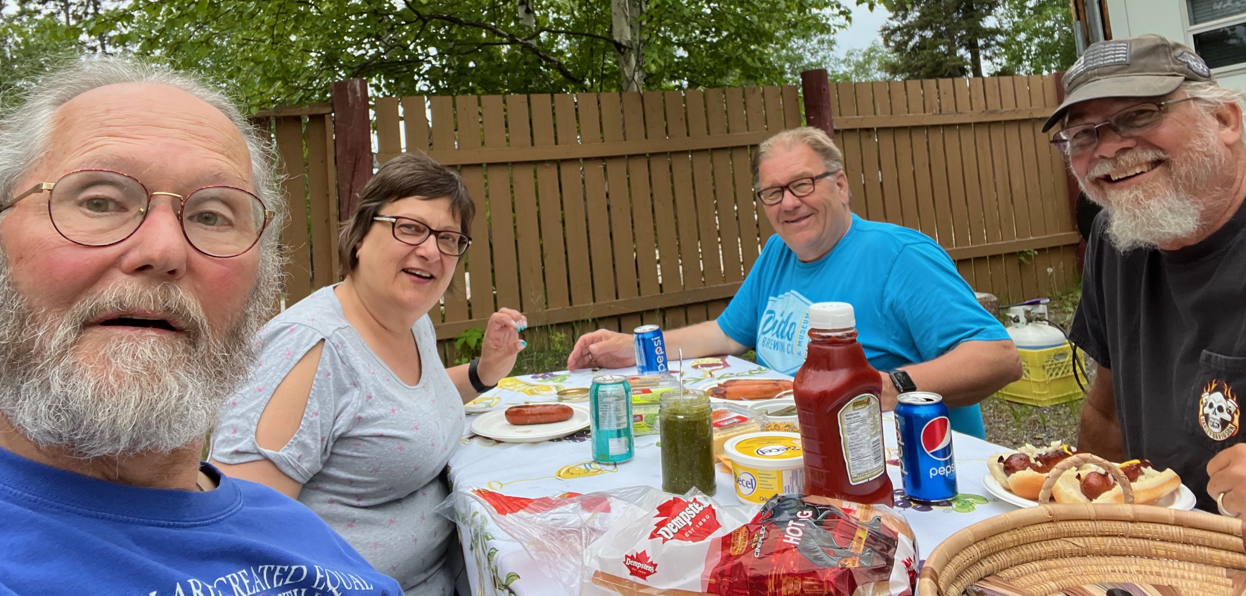
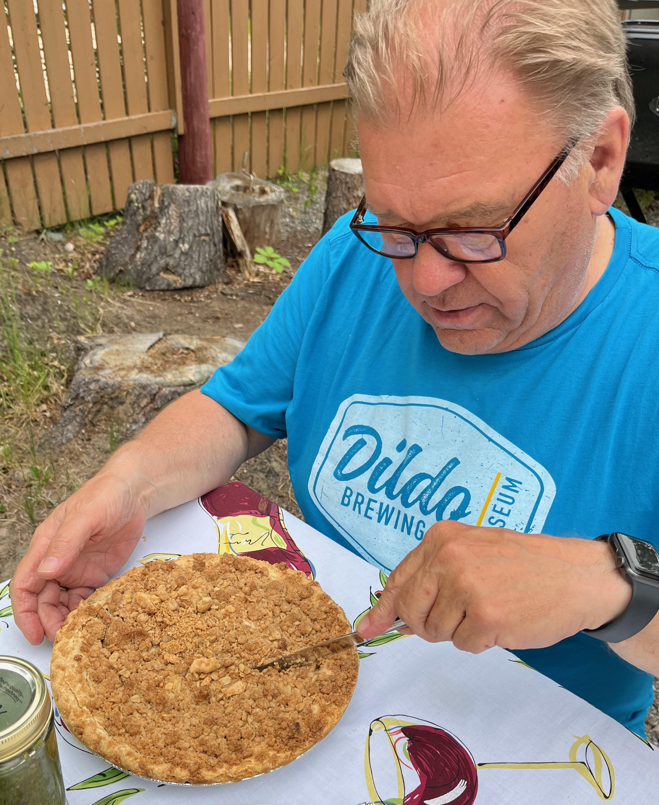
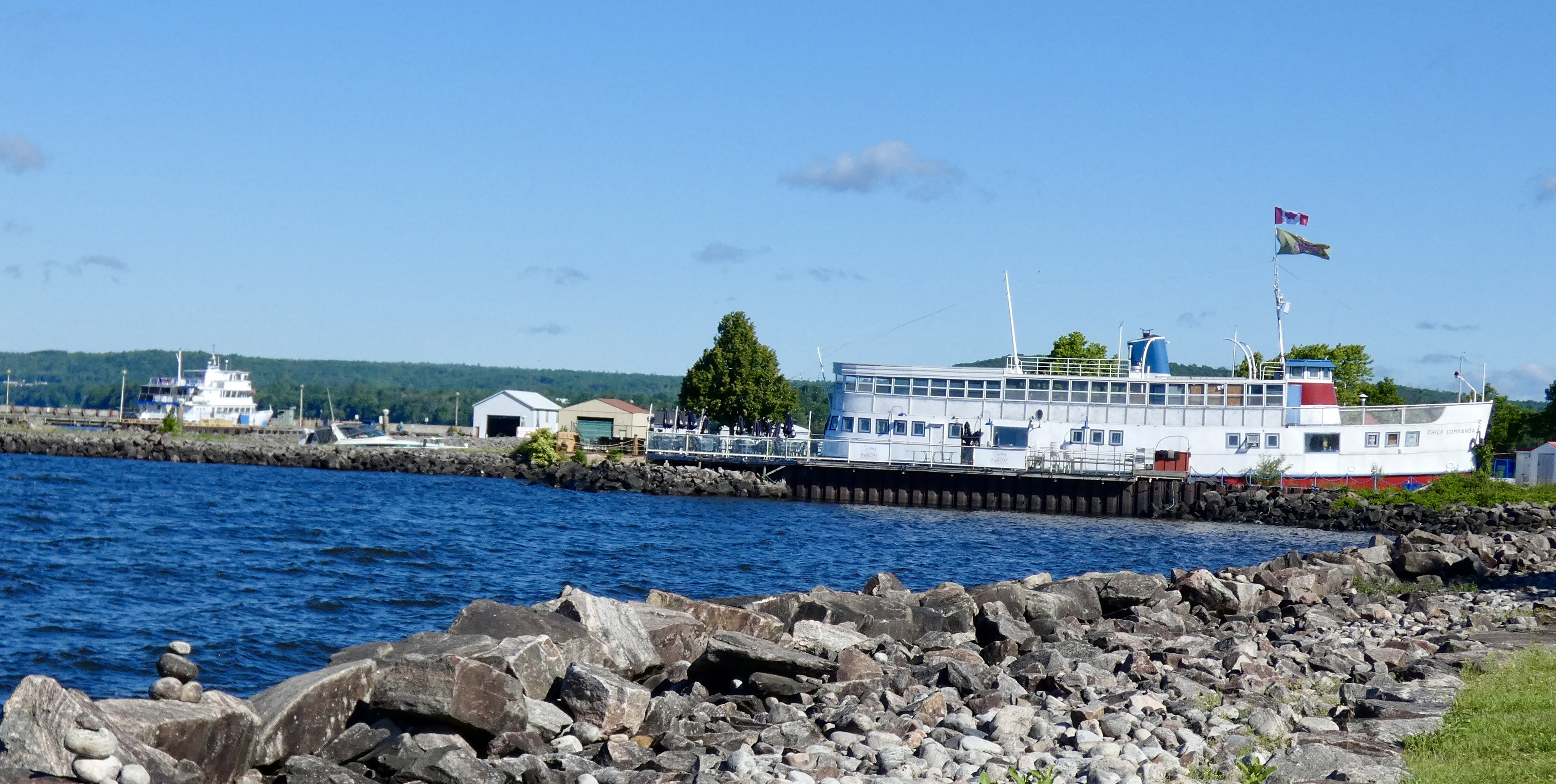
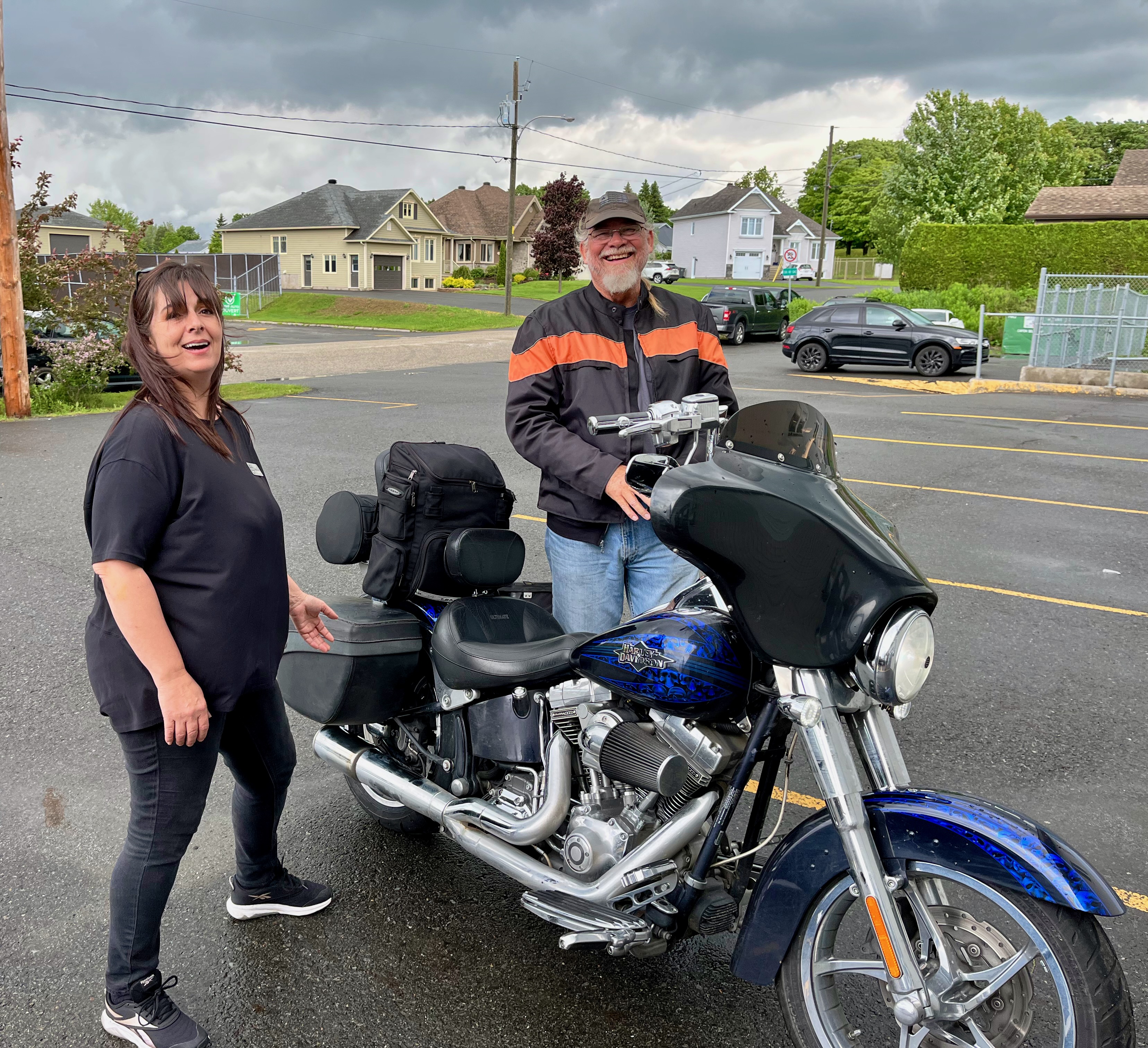
Despite running the bug gauntlet we made it to the nicely remodeled Oreland Motel in Flin Flon and checked in. The friendly and helpful motel clerk (remember, she’s Canadian) let us check in early, and we had time to take care of some business. Susanne, whom we had met in Newfoundland with Don, had asked me to email her when we got to town. I did, and told her we were headed to Subway for a quick sandwich before checking out Flin Flon. While we were at Subway, she and Don showed up. We chatted for a while, and they invited us to join them for a cookout in the evening at a nearby lake. At six o’clock, they stopped by our motel on Don’s 2014 Triumph Trophy, and the four of us rode to the lake where Don put smokies and dogs on the grill. We had a great dinner, fun conversation, a tour of Denare Beach, and yet another reminder why I like Canada so much. It’s because there are so many “amazingly friendly, incredibly helpful, wonderfully courteous Canadians” like Susanne and Don. Don, by the way, is extremely knowledgeable about Flin Flon, having been awarded the Manitoba Lieutenant Governor’s Award for Historical Preservation and Promotion for his work with the Flin Flon Heritage Project. He was also a miner, a mine rescue expert and a firefighter.
As I planned the CCR more than six months ago, I included a stop in Flin Flon because it was off the beaten path and I was fascinated by the name. During the quick tour Steve and I took of Flin Flon this afternoon, we stopped by the Visitor’s Bureau and Flin Flon Station Museum for an obligatory picture of Flinty, the character for whom the city is named. Here’s the story as told at the site of the statue:
Flin Flon is named after Josiah Flintabbatey Flonatin, an adventurer in the “The Sunless City,” a novel by E. Preston Murdock. In 1914, a copy was found in the wilderness of northern Manitoba by a party of prospectors. A year later, these men working claims near the present site of Flin Flon came upon a conical hole having rich showing of gold. Tom Creichton, recalling the adventures of Flintabbatey Flonatin who escaped from an underground lake through a large gold studded hole in the earth’s crust suggested the claims be called Flin Flon. And that is how Flin Flon got its name.

But Flin Flon is more than a town with an odd name. In fact, it’s been an important mining site for a hundred years, though, as it turns out, the mine is shutting down this month. Most of the displaced miners will be offered jobs at another mine site owned by HudBay opening soon. The mine has produced thousands of tons of copper and zinc over the years, though the original prospectors who named the town were looking for gold.
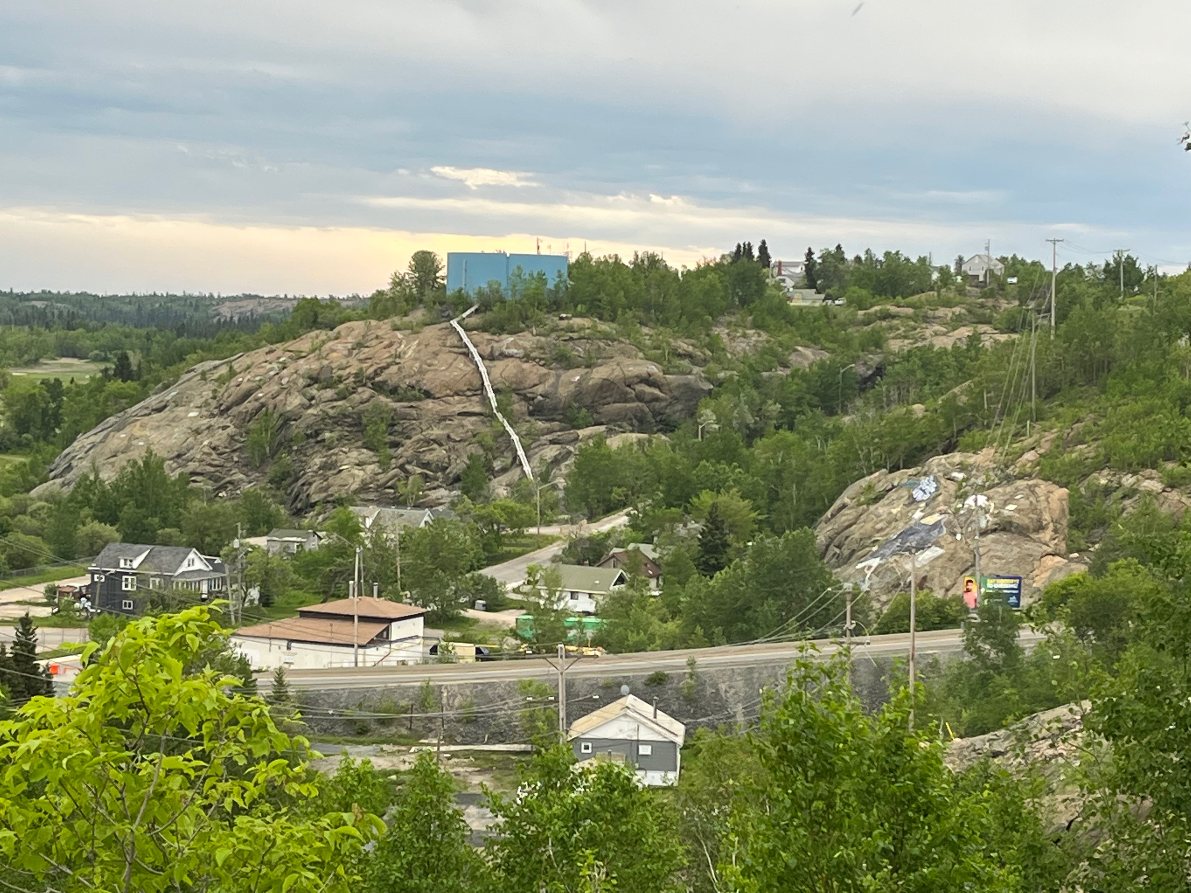
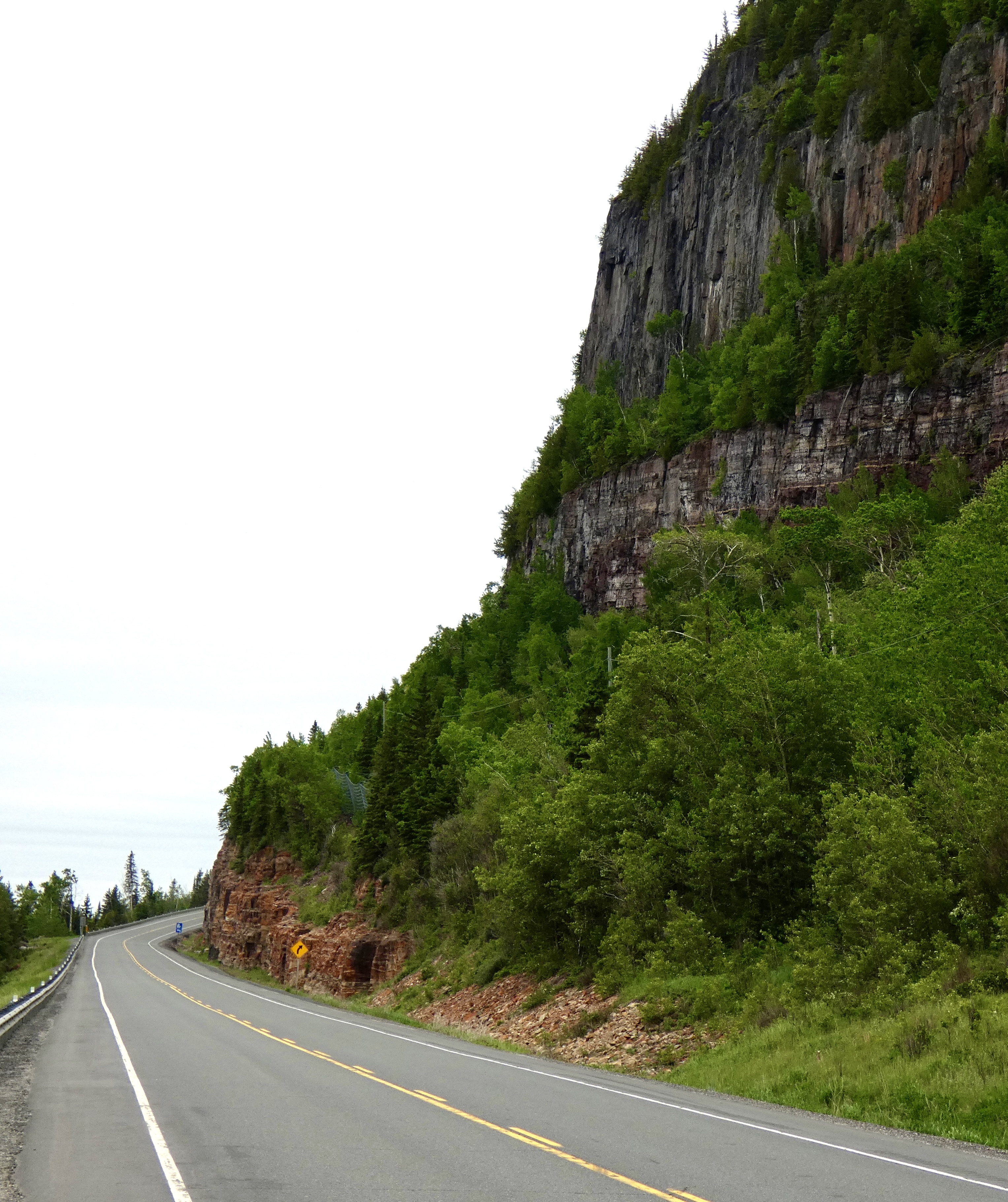
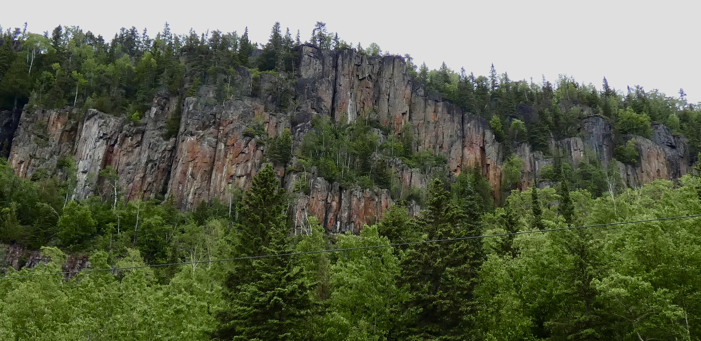
Flin Flon is also known as “The City Built on a Rock” because it, literally, is sitting on rock, the northern edge of the same Canada Shield mentioned when I wrote about Ontario’s landscape. As we approached Flin Flon for the final 30 miles or so, the rocks became more apparent and by the time we got to Flin Flon huge rock outcroppings were visible everywhere.
Tomorrow, we head south and west toward Prince Albert in Saskatchewan, but in order to go south we will first have to go a little farther north, reaching the northernmost point of the CCR. Changing landscapes and new adventures. I can’t wait to get on the road again.
Day 23 CCR: Changing Landscape
In the United States, the area west of the Mississippi River and east of the Rocky Mountains is known as The Great Plains. The same flatland in Canada is known as the Canadian Prairies. Manitoba constitutes the easternmost portion of the Canadian Prairies and today’s ride from Winnipeg (the longitudinal center of Canada) to Swan River, north of the capital, was markedly different from the land we’ve been riding through the past two weeks in Ontario, Quebec, and the Maritime provinces.
Vast grain and hayfields unbroken by forests or hills extended to the horizon almost as soon as we left Winnipeg and continued for much of the ride. When we weren’t riding between fields, we were riding through scrub pasture of mixed trees and grassland and dotted with hundreds of head of cattle and spring calves, one of the primary products of Manitoba’s extensive agricultural economy.
Many of the fields that should be awash in green by mid-June haven’t even been planted yet because this spring has been one of the wettest on record in southern Manitoba. Standing water still pockmarks many of the fields, and creeks and rivers continue to run high. Farmers can’t get into the fields with their giant tractors and planters, so many crops this year will be late or non-existent. At one point, we passed over a new (and unfinished) bridge that had been replaced in recent weeks after being destroyed by flood waters.
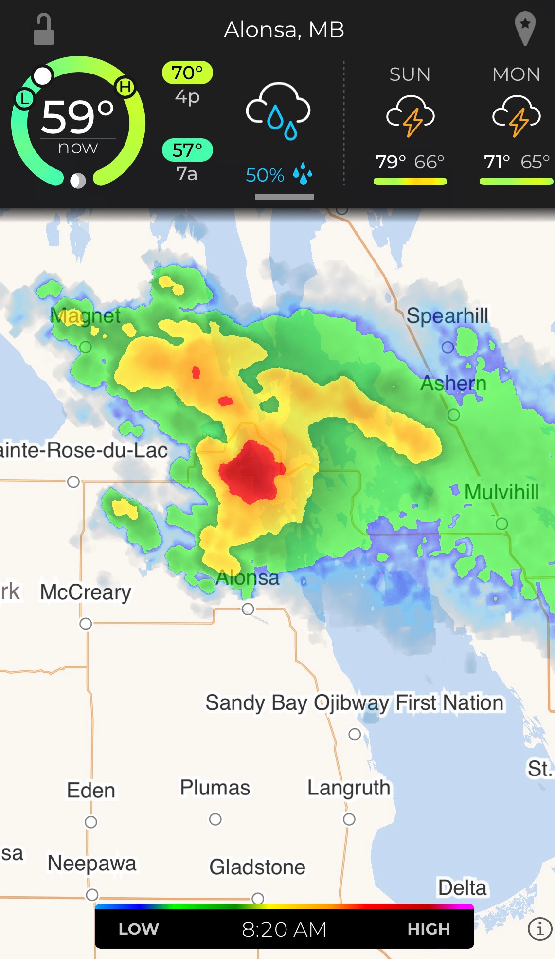
I offer this weather report because once again we were forced to don rain suits in anticipation of strong storms. Fortunately, we dodged the worst of the rain. Turns in the road would send us into clearing skies only to be turned again at the next curve in the road into an approaching or passing storm. Had we ridden into some of the heavy rain we could see in the distance, we would have had to park the bikes because the downpour would have made riding dangerous and seeing next to impossible.
But today we were lucky. We saw lots of rain and some wet pavement but only had light sprinkles fall on us and the bikes. Fortuitous timing, because in several cases we missed heaving rain by no more than 15 or 20 minutes.
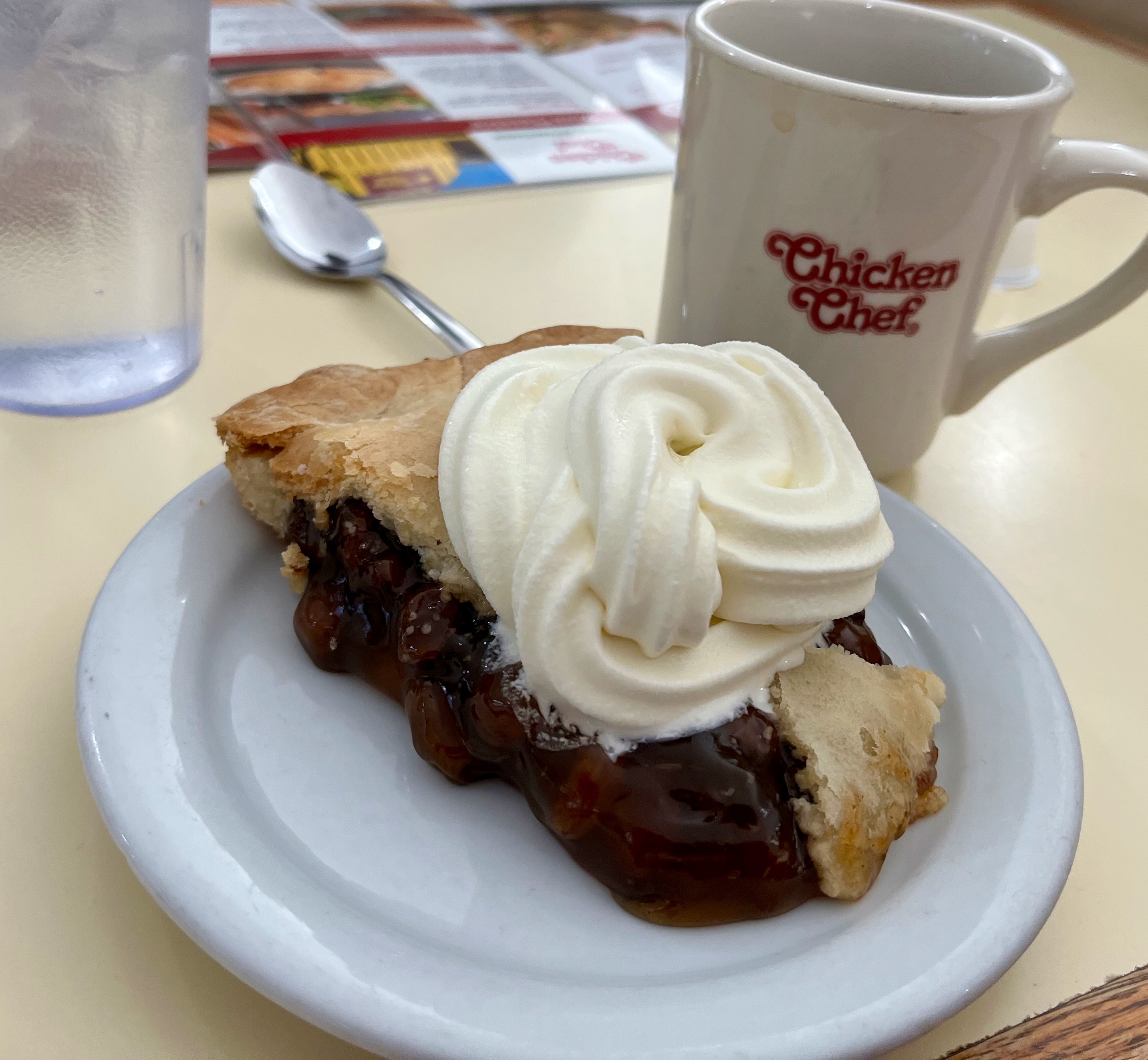
As we rode into Sainte Rose-du-Lac near lunchtime, I spotted a diner I was pretty sure would have pies of various flavors and hues. So I stopped. And I was right. And I had raisin pie and ice cream for lunch, for those who have been wondering where all the pie pictures have gone.
Tomorrow we continue north to a stop I’ve been anticipating for six months. Flin Flon, on the border between Manitoba and Saskatchewan, has an interesting name and will be the northernmost point of the CCR. I hope to catch up over coffee with Susanne and Don, whom we met at Cape Spear at the start of the ride across Canada two weeks ago.
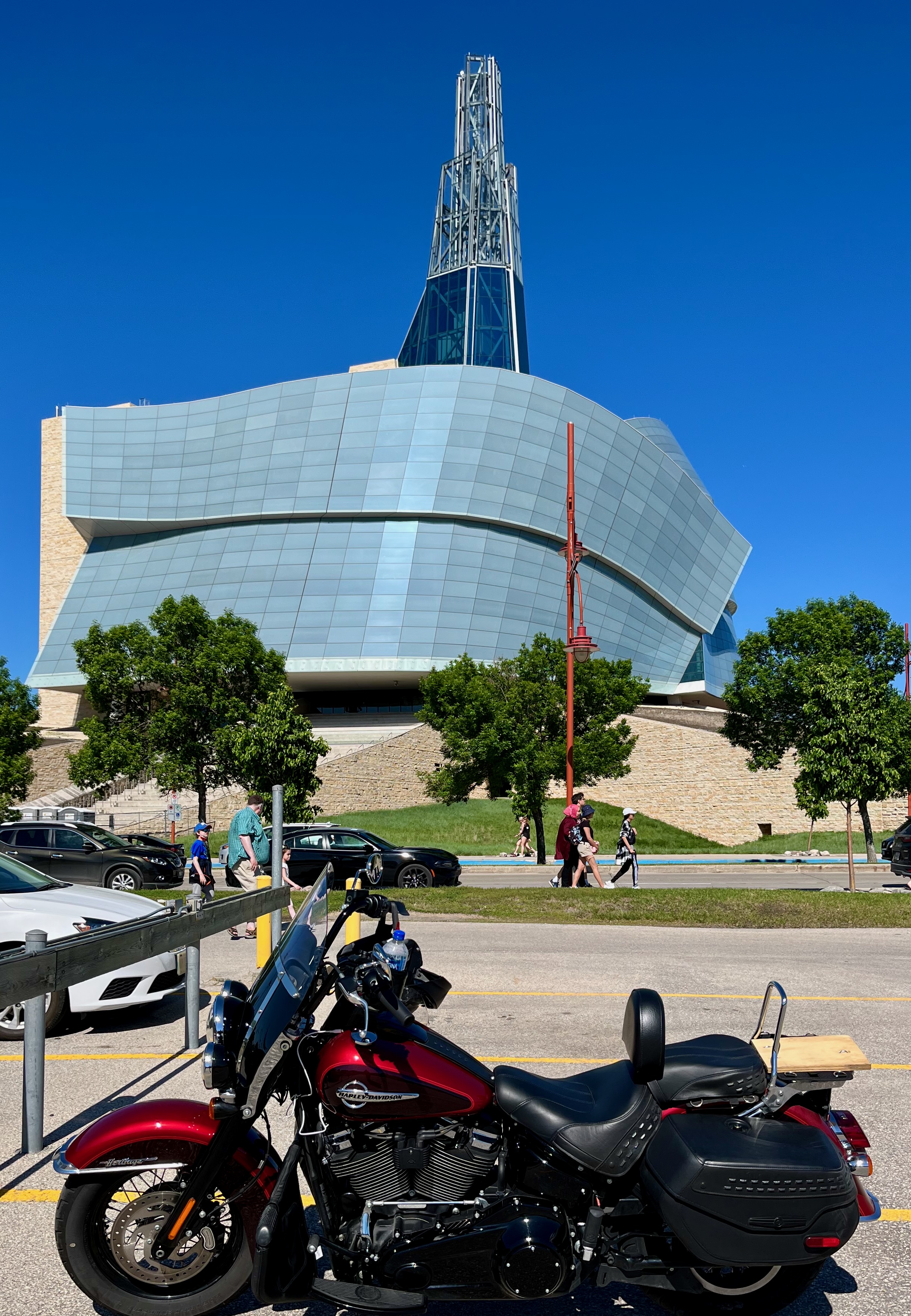
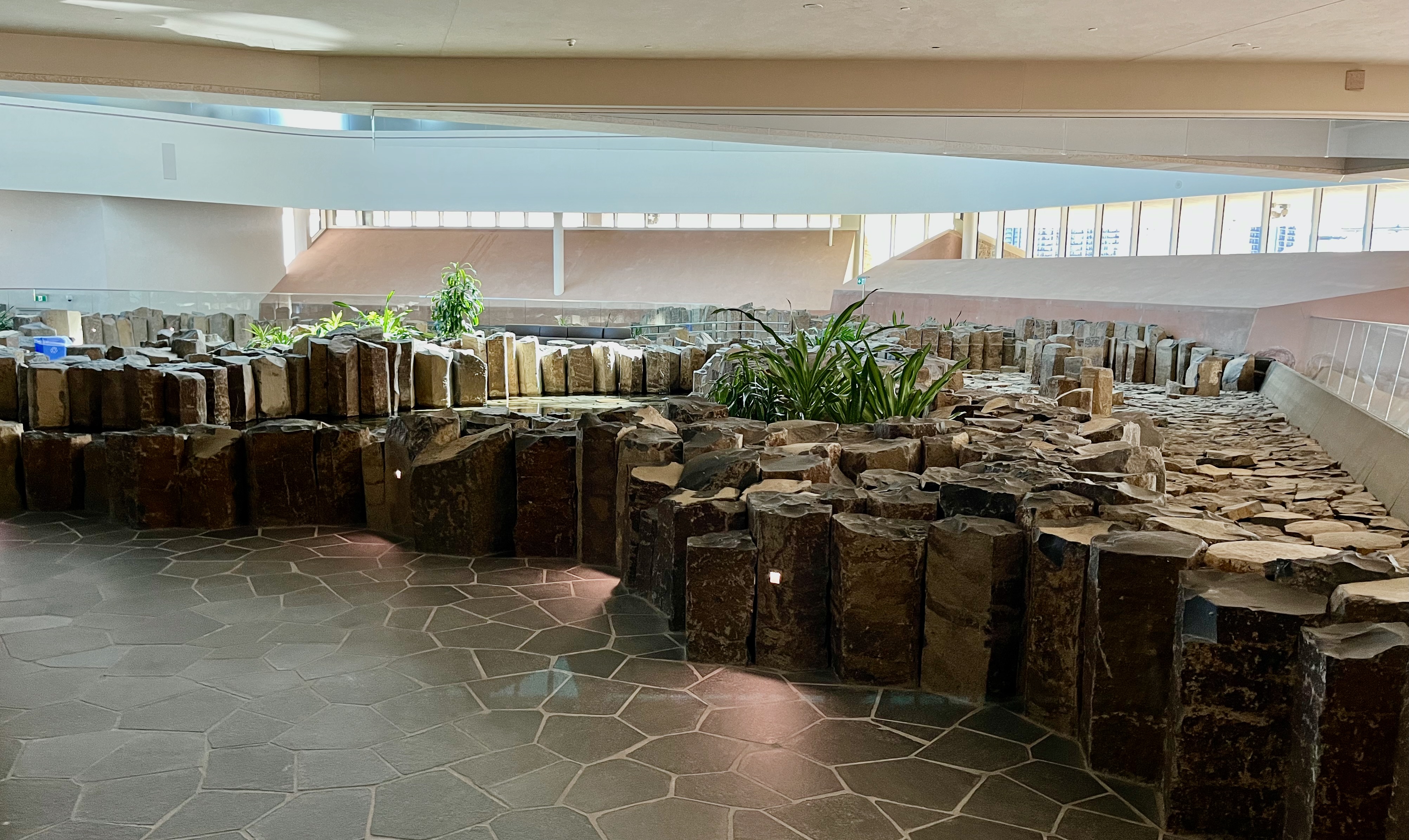
Day 22 CCR: Canadian Museum for Human Rights
When I planned the Cross Canada Ride six months ago, I included a non-riding day in Winnipeg, the capital of Manitoba, and wanted to spend time there learning something about Canada and Canadians. So, I outlined my off-day to include a couple of hours at two museums: The Canada Museum for Human Rights and the Manitoba Museum. I didn’t really know what to expect from either, but I figured I ought to be able to learn something.
Today, I only visited one of the two museums on my checklist. I was there six hours. I could have spent six days, and still not taken in all this first-rate Canada National museum had to offer. The Canadian Museum for Human Rights ranks as one of the top two or three museums I’ve visited, and I’ve visited a few museums. On every long motorcycle trip I take, it seems, I go to places that produce unexpected and special memories. This was one of them. My blog efforts tonight will not do justice to this museum, but I’ll do the best I can.
As I toured the museum, I struck up a conversation with a helpful and friendly member of the staff, more than willing to talk about a workplace she clearly has a passion for. The museum started as the brainchild of Israel Asper, a wealthy, philanthropically-minded Manitoban who envisioned a museum about the Holocaust and other human rights issues. His enthusiasm and commitment attracted other civic leaders and the scope of the project grew. It grew so much, in fact, that the Canadian government decided it should be involved, and parliament voted to create and help fund a new national human rights museum. But officials initially said it should be in Ottawa, the locus of all other Canadian national museums. That plan didn’t fly in Winnipeg, and Ottawa gave in to a Manitoba location, making this the only national museum outside Ottawa.
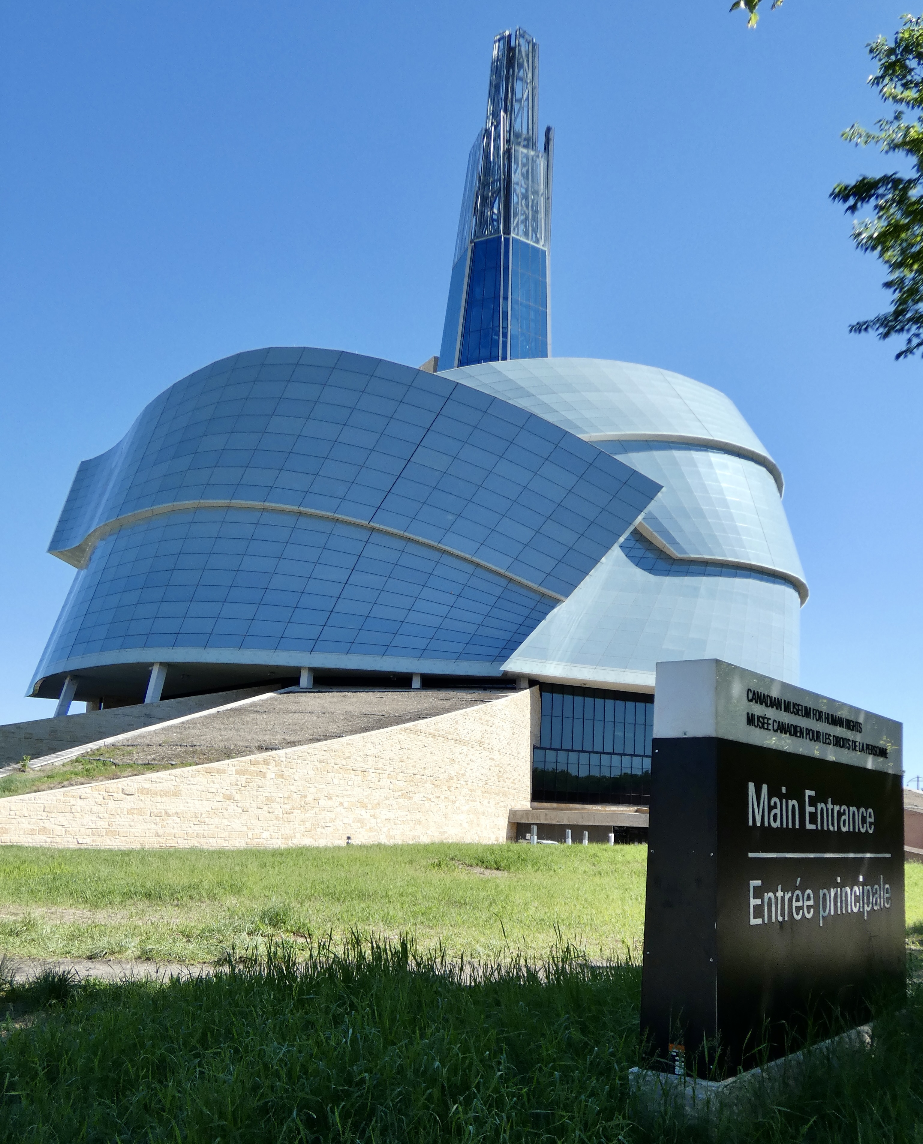
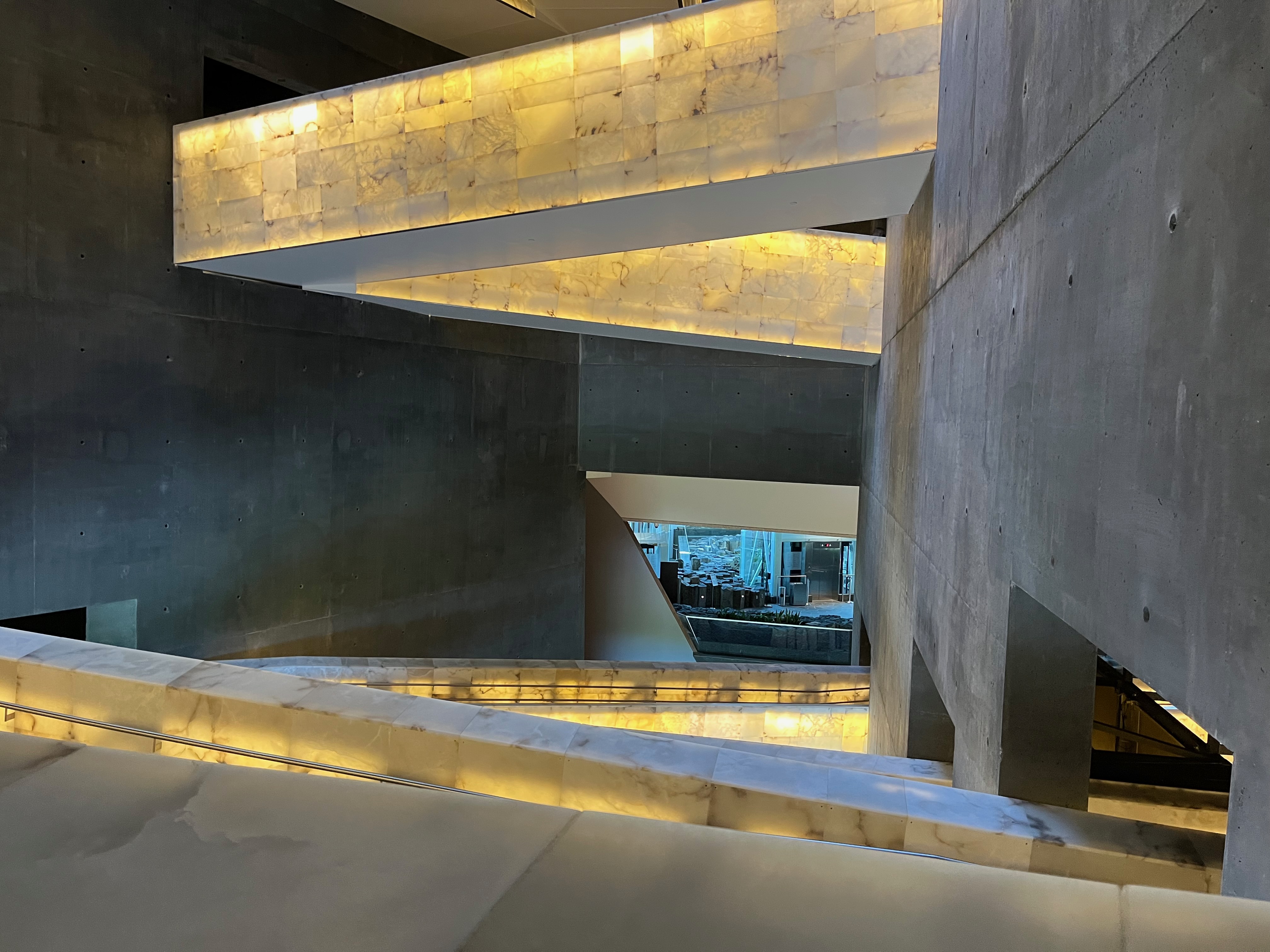
American architect Antoine Predock, won the design competition, and the striking building was completed and the original exhibits installed in 2014. The building itself deserves more than I will say about it, but suffice to say that my best analogy compares it to a complex musical symphony with numerous intricate parts that must work together for the whole to succeed. This building succeeds.
Intricate, angular ramps lined with lighted alabaster sides guide visitors from one level to the next, each level focusing on a different element of human rights. The first level has specially designed space for temporary, professionally-mounted exhibits. The current exhibit challenges the way we think about racism, noting that the brain’s wiring makes it easy for biases and prejudices to take hold, even if we think we’re trying to be anti-racist.
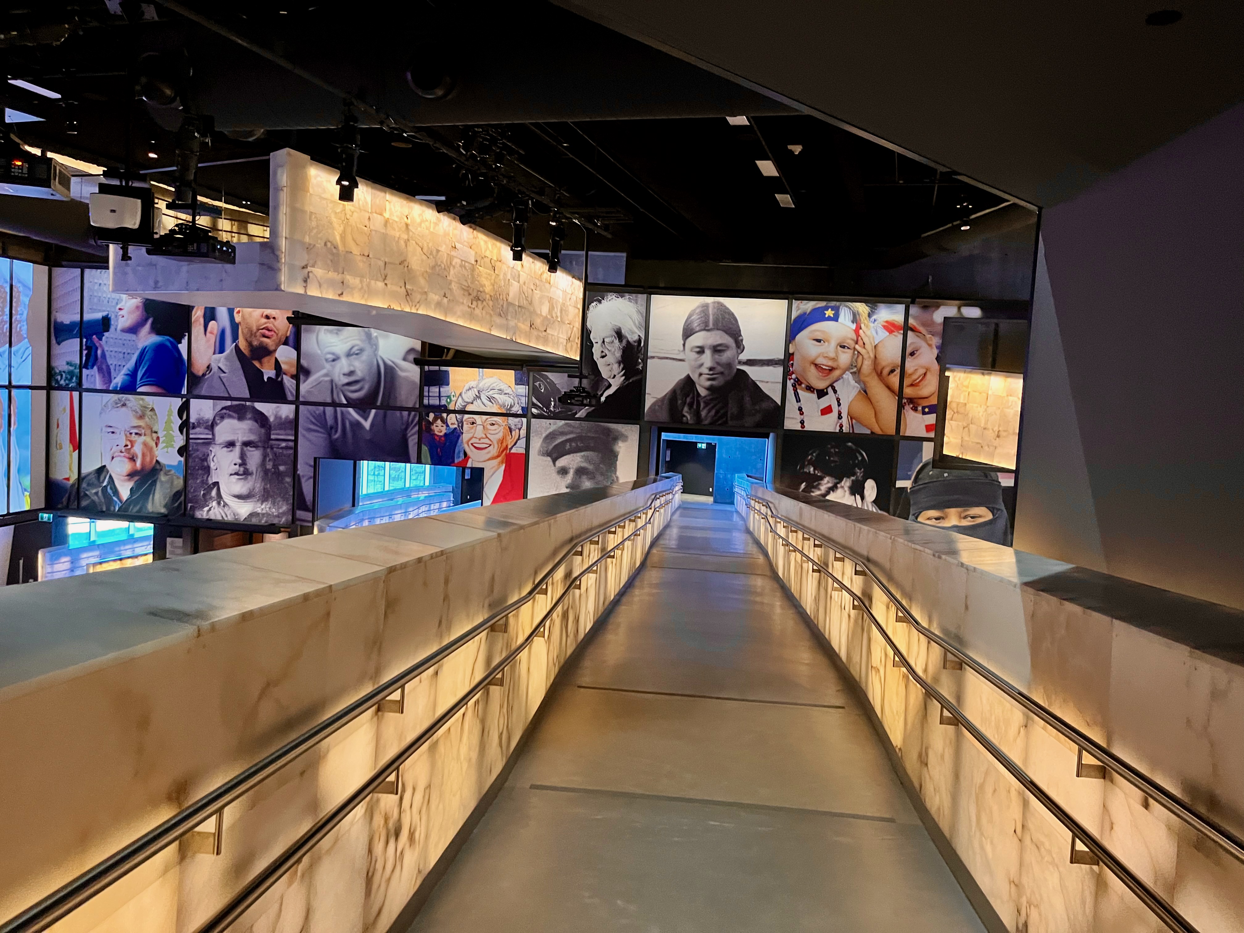
The second level explores what, exactly, are “Human Rights,” pointing out that defining that term over the centuries has challenged philosophers, legal experts, and religious leaders. It also includes a powerful exhibit on indigenous perspectives and the relation of people to mother earth. A third section examined “Canadian Journeys,” with more than two dozen separate kiosks or alcoves tracing Canada’s connection to slavery, the underground railroad, anti-black racism, Chinese exclusion policies, LGBTQ issues, language rights, residential schools designed to destroy indigenous culture, discriminatory polices related to physical or mental differences and many more. In short, this section was inclusive of human rights issues and astutely probed Canada’s checkered past.
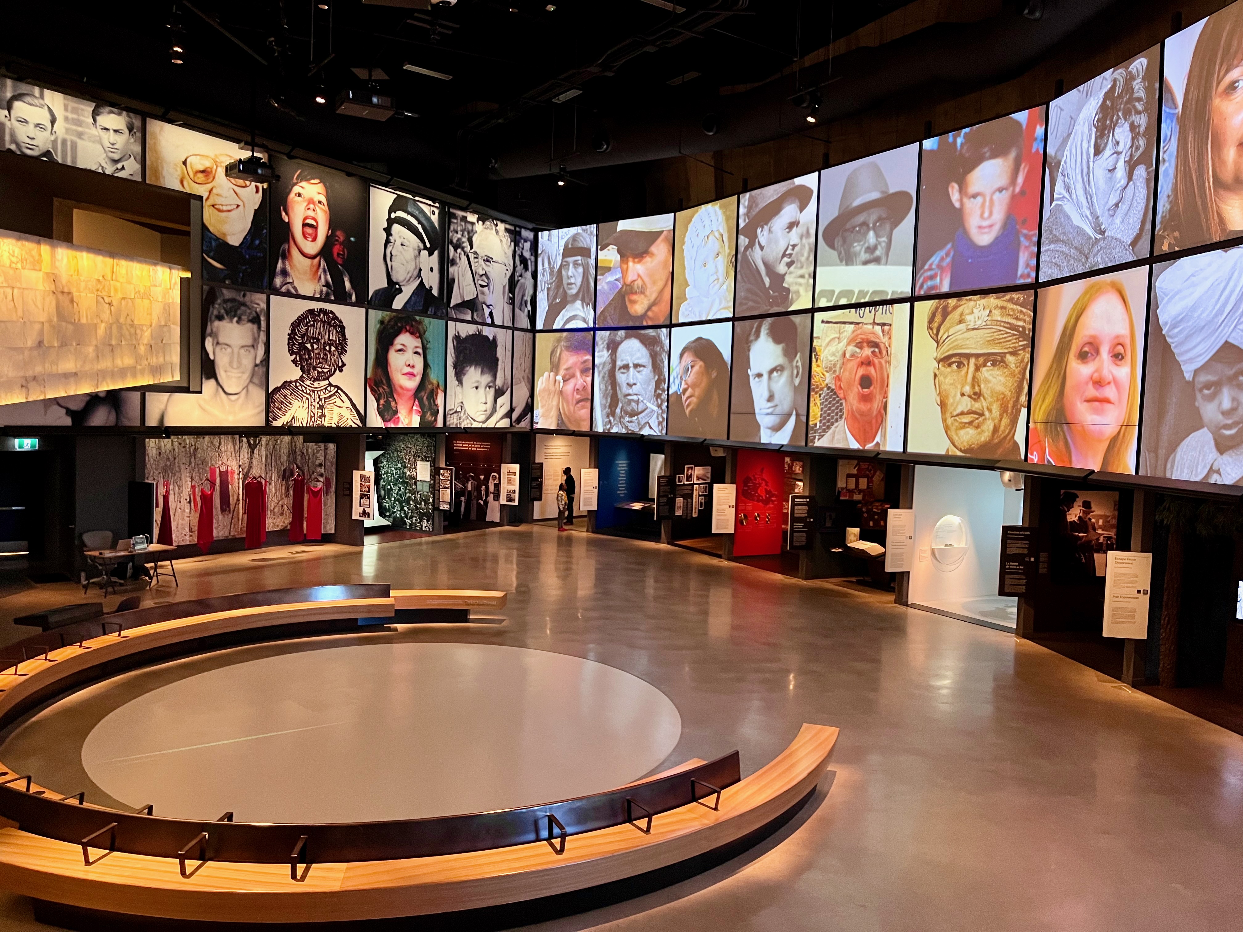
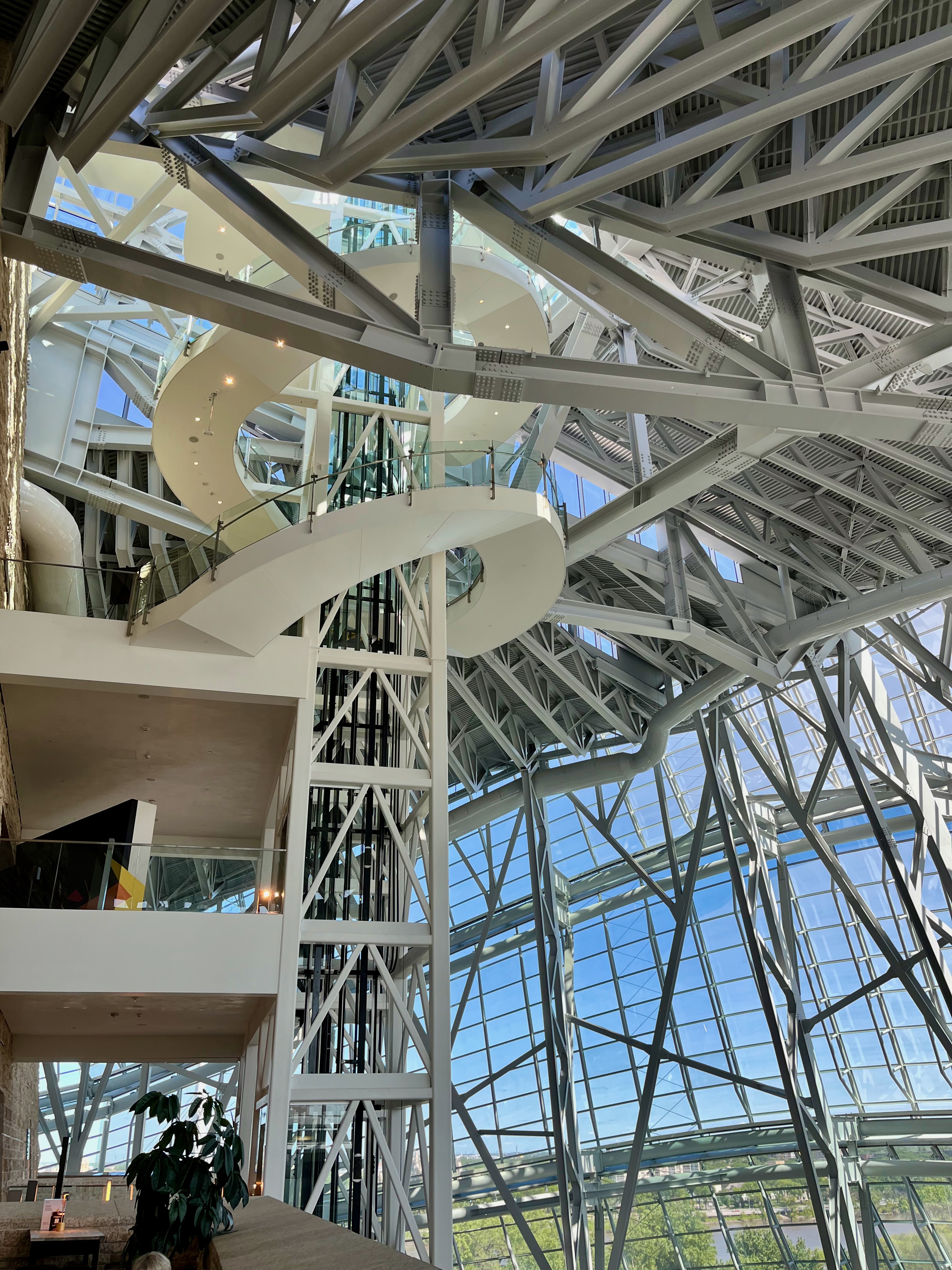
Ascending the ramps inside what seems to be a massive, hollow mountain, other exhibits, all constructed with the latest in museum technology and wizardry, included the Holocaust, the Holodomor in Ukraine in the 1930s when Stalin attempted to starve Ukrainians out of existence, other genocides, current debates among human rights experts, artistic expressions of human rights, and a chance for each visitor to contribute thoughts about human rights past, present and future.
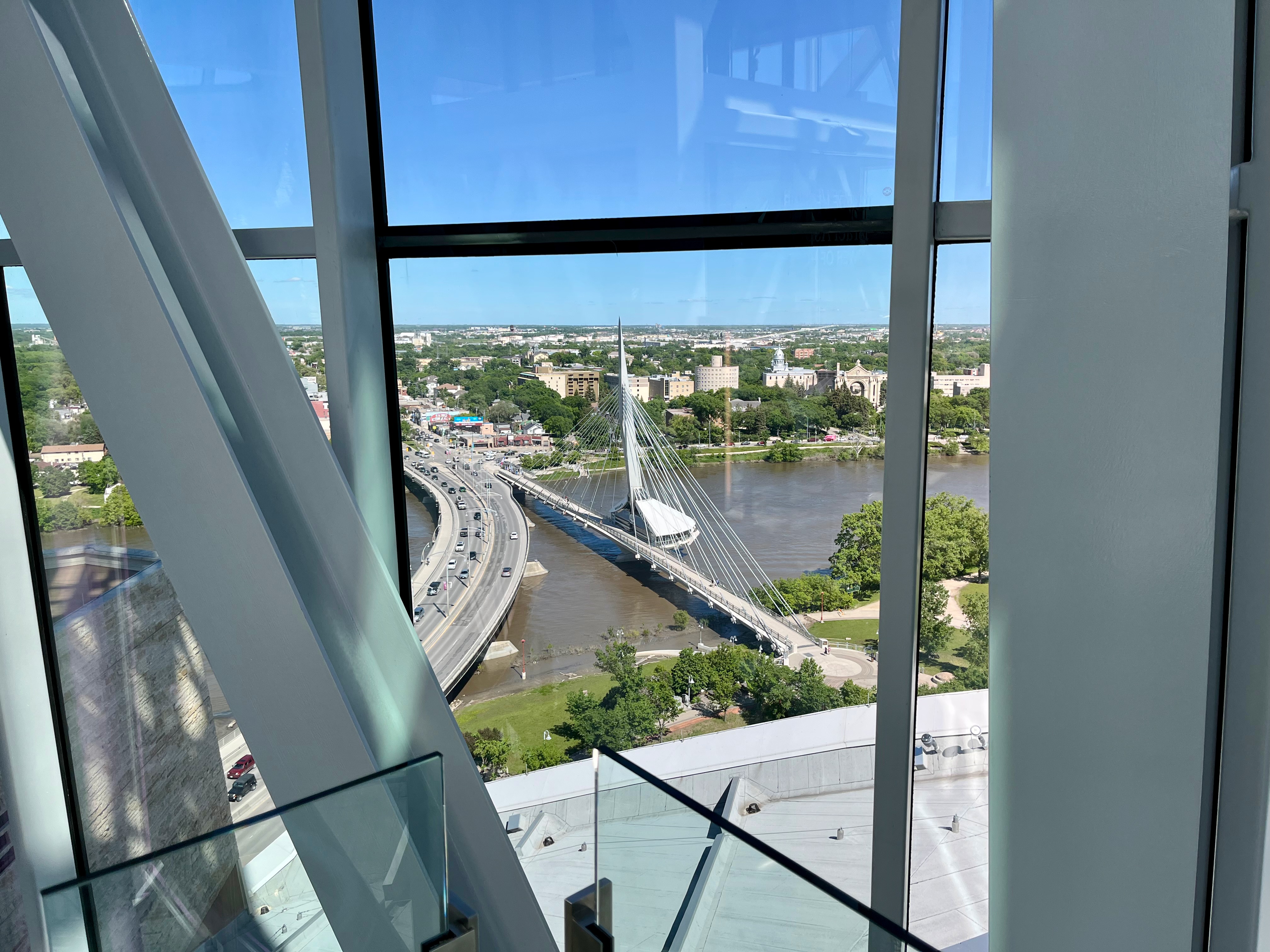
Finally, the glass Tower of Hope rises above all seven levels to a total height of more than 20 stories, giving a panoramic view of Winnipeg and the countryside beyond. Visitors can choose to make the final ascent by elevator or by spiral staircase. I chose the 103 steps.
Did I mention I was impressed with this museum? Really impressed? The exhibits are thoughtful, professionally designed and constructed with the latest techno-magic. The Canadian government uses the museum to explore dark and unpleasant parts of Canada’s past, especially as it relates to indigenous people and immigrants from around the world, and to offer insights into remedying past errors and to how all Canadians can participate in ensuring equity, equality, tolerance and understanding.
I went to this museum anticipating a quick, educational, two-hour tour. Instead, I got an emotional and moving reminder of how evil humankind can be yet how courageous, dedicated, and innovative are the brave souls who stand up to evil for all of us. If one doesn’t leave the Human Rights Museum asking “What can I do to promote and protect fundamental human rights,” then the point of the museum has been missed.
I can’t do the Canada Museum for Human Rights justice. But the people who run it can. Click here for more information.
Tomorrow, it’s back on the road again, headed north to the town of Swan River (pop. 4,000) in the heart of Manitoba’s great outdoors. More adventures await.
Day 21 CCR: It’s an Adventure
Tonight’s abbreviated blog post is brought to you by Morerain and Newt Ire.
As expected, we left Dryden (poorly named under the circumstances since it certainly was not dry) in light to moderate rain, which persisted for three soggy hours as we splashed toward Winnipeg, going through Kenora where Marilyn and I overnighted on my first motorcycle foray into Canada 12 years ago. My new rain suit worked well, except for the part where I neglected to zip the zipper all the way closed and water ran off my helmet and down the front of my shirt. Fortunately, it was an absorbent shirt and water never reached my riding pants, which were kept dry by the rain pants. Oh well.
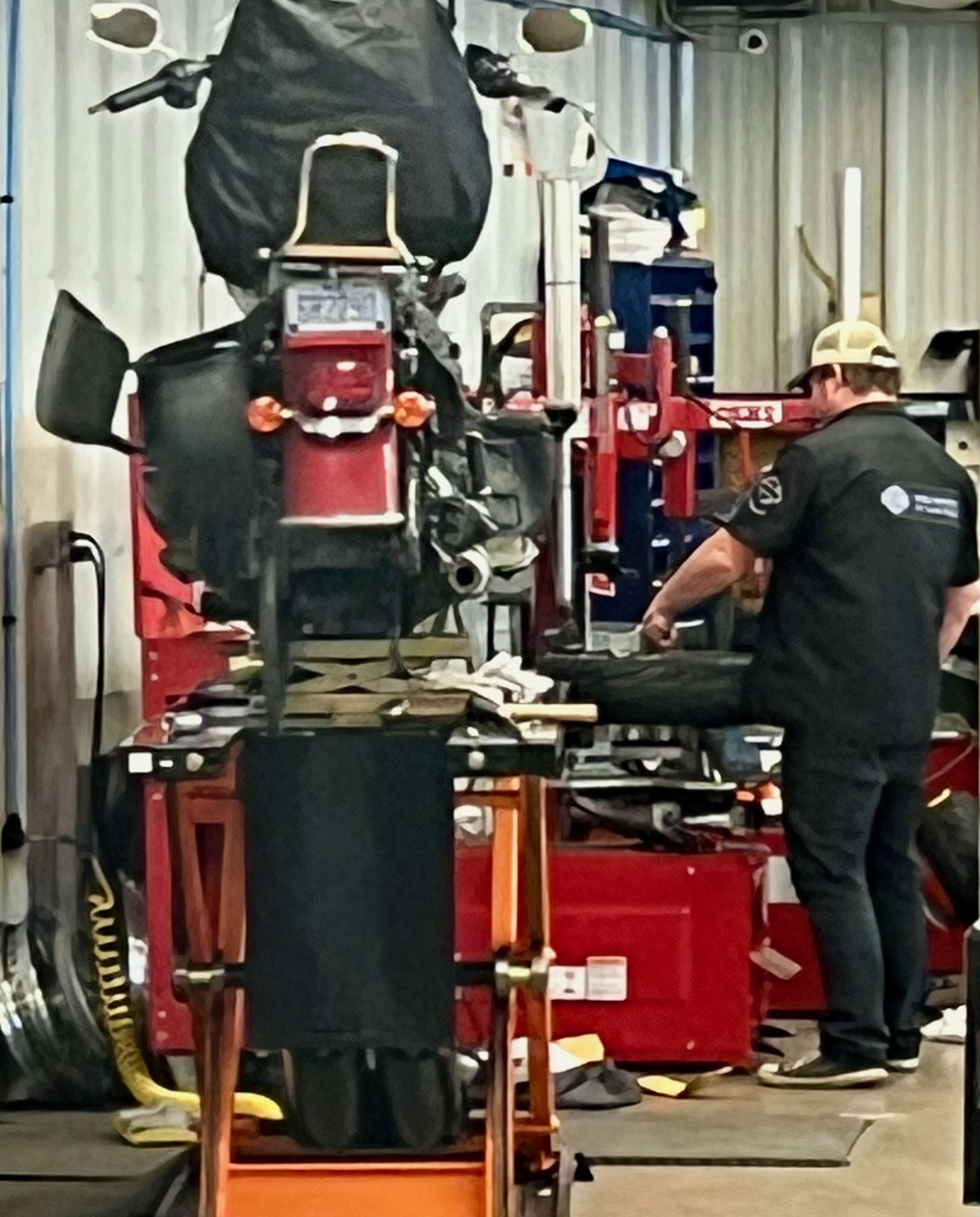
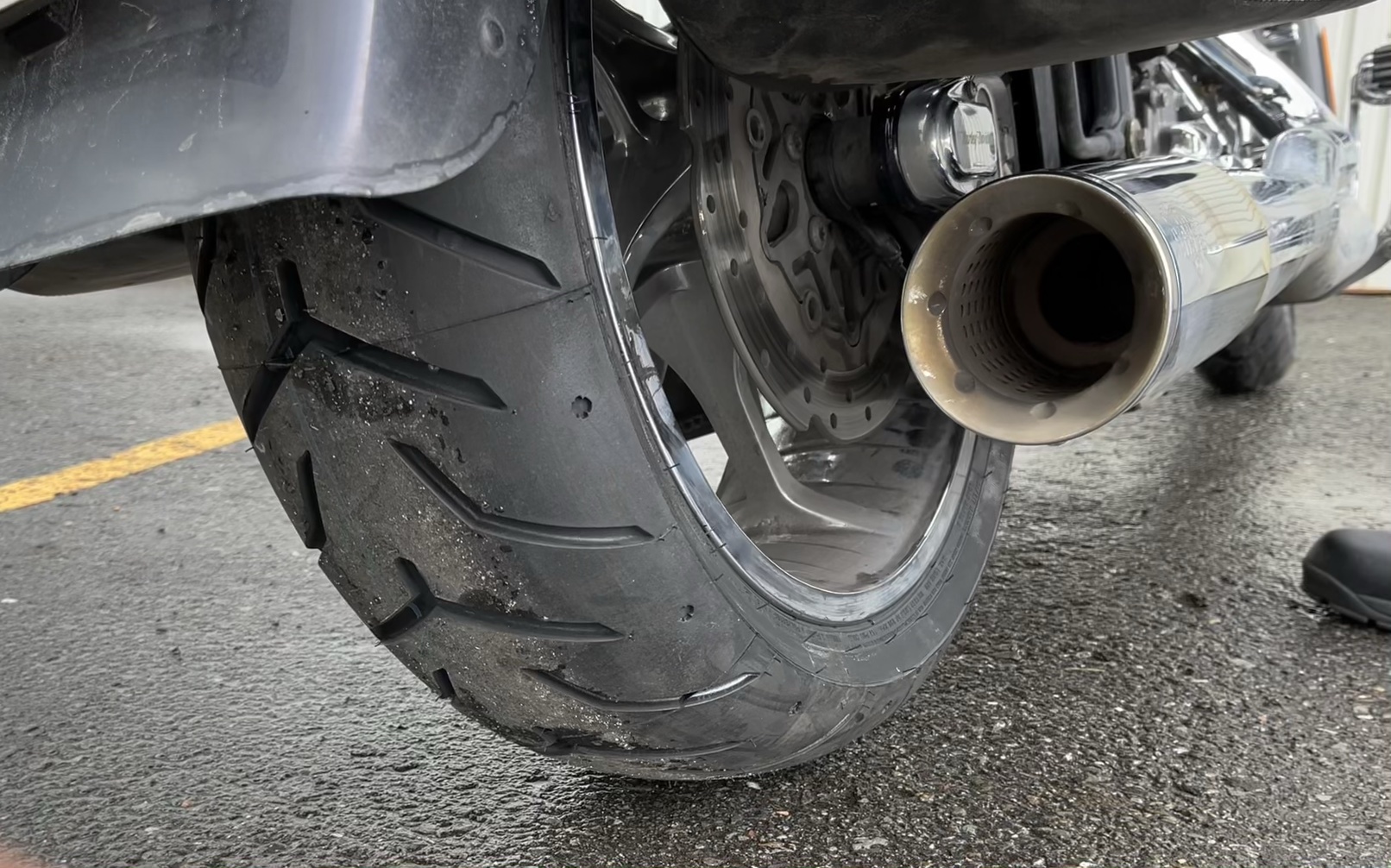
The last hour of our dash to the Winnipeg Harley-Davidson dealer was dry, but menacing gray clouds teased us from time to time, letting a little blue sky through then shutting it off again. Still, we got to the dealership well before my 1 p.m. appointment for a routine oil change and check-up. Well, “routine” until the service writer approached me to say the tech changing the oil reported that my rear tire had only 1-2/32 of tread left. I hadn’t been checking the tires because the bike only had 5,000 6,000 7,000 8,250 miles on the odometer and I expected to go at least 10,000 miles before replacing the tire. Surprised, I went to the service area and examined it myself. Sure, enough, no more than 2/32 remained in the center of the tread, which, by the way, is particularly important when one rides in the rain and wants to maintain a secure grip on the pavement. So, I said sure, put on a new tire. The service writer replied, “We don’t have one, but we think a local tire distributer may have one. We’ll check.” Half an hour later, they had a new and better tire (read: expensive) and the tech started switching the old for the new. Giving him an hour or so, I waited patiently for word that my bike was ready. When nobody came to tell me the good news, I strolled back to the service area, looked through window and noticed the service manager using a drill on my bike. “That’s odd,” I thought because drills aren’t usually standard equipment when changing a tire. The tech, the manager and the service writer noticed me noticing them using a drill on my bike, and the service writer shuffled over to tell me that they had broken a bolt during the tire change process and were removing the broken piece and would have a new bolt installed in no time. Five hours after I rode up to the service department for a one hour appointment, I rode away with fresh oil, an expensive tire, and a new bolt they gave me for free. And they washed the bike. It’s shiny. But it’s going to rain again Saturday.
I had company in my misery. Steve also went in for an oil change and asked them to look at the left front fork, which was leaking oil. They said they could do the oil change and put in a new seal kit for both front forks. And he needed new brake pads, front and rear. Oh, and the drive belt had cracks in the teeth and should be replaced to avoid getting stranded in the middle of Canada with a bike that wouldn’t go anywhere if the belt disintegrated. Except they didn’t have a belt. But there was one at a Harley dealer in Red Deer, about 800 miles away. It so happens that Red Deer is one of my planned stops on the CCR, so they made an appointment for Steve for next Wednesday to get a new belt in Alberta. They couldn’t complete the oil change, brake pads and fork seals before closing time today, so his bike is still there, somewhat disassembled. He ubered to the hotel and will uber back to the dealership tomorrow morning to pick up his bike while I’m visiting a museum.
I’ve said before, my long motorcycle trips are not vacations; they’re adventures. But some adventures are better than others. A day off tomorrow to visit museums for me, then back on the road again. With a new rain suit, new oil and a new tire.
Day 20 CCR: More water, but no rain
The weather gods are pleased with me and have given me three days in a row without rain. Not even enough of a threat to don a rain suit, “just in case.” We will almost certainly leave Dryden in a light rain tomorrow morning, but 225 miles later in Winnepeg, Manitoba, the sun should be shining when we pull into the Harley-Davidson dealer for routine oil changes.
My trip odometer, which I zeroed out in my driveway 20 days ago, rolled past 5,500 miles today. If my trip estimate is correct, I should be near the halfway point of the CCR, in terms of both days and miles. So far so good. We’ve gone through six provinces and three time zones. I’ve seen awesome scenery (when it hasn’t been raining), and, as I expected, have met amazingly friendly, incredibly helpful, wonderfully courteous Canadians throughout the journey. One other item worth noting today: I paid $8.00 USD per gallon for premium gas. Admittedly, I was in the boondocks in Ignace, Ontario, and it was 50 miles in either direction to find another station. The fuel was premium, but $8? The good news is that my bike’s powerful Milwaukee Eight engine is scoring 53 mpg, so that eases the pain a little. Steve’s bike is getting about 42-43 mpg, so his pump pain is more palpable.
The day began with low clouds and fog along Lake Superior, so while I had views of the lake like I did yesterday, the lack of sun made for boring pictures where sky and water run together in a featureless gray. So instead of posting pictures similar to those I took yesterday with better light, I’ll post some shots of the land bordering the lake. If I were a geologist instead of an historian, I could give a much better description of the land we’ve been riding across for the last few days. But I’ll pass on what I know. Two-thirds of Ontario is made up of the Canadian Shield, which means it has very, very old (i.e. precambrian, older than 4 billion years), very hard rocks–e.g. granite, gneiss–at or near the surface. During the last Ice Age, the massive ice sheet that covered all of Canada and much of the northern United States, scraped away most of the surface rocks, leaving the oldest–the shield–at the surface.
It’s impossible to ride through the area and not see huge, building-size rocks everywhere. That same rocky landscape is also responsible for the thousands of lakes I’ve mentioned before. Ontario doesn’t have any real mountains but is nevertheless hilly where we’re riding, a combination of orogeny (mountain building via plate tectonics) and glacial scraping. OK. Enough amateur geology. Here are a couple pictures to show what I’m clumsily trying to say:
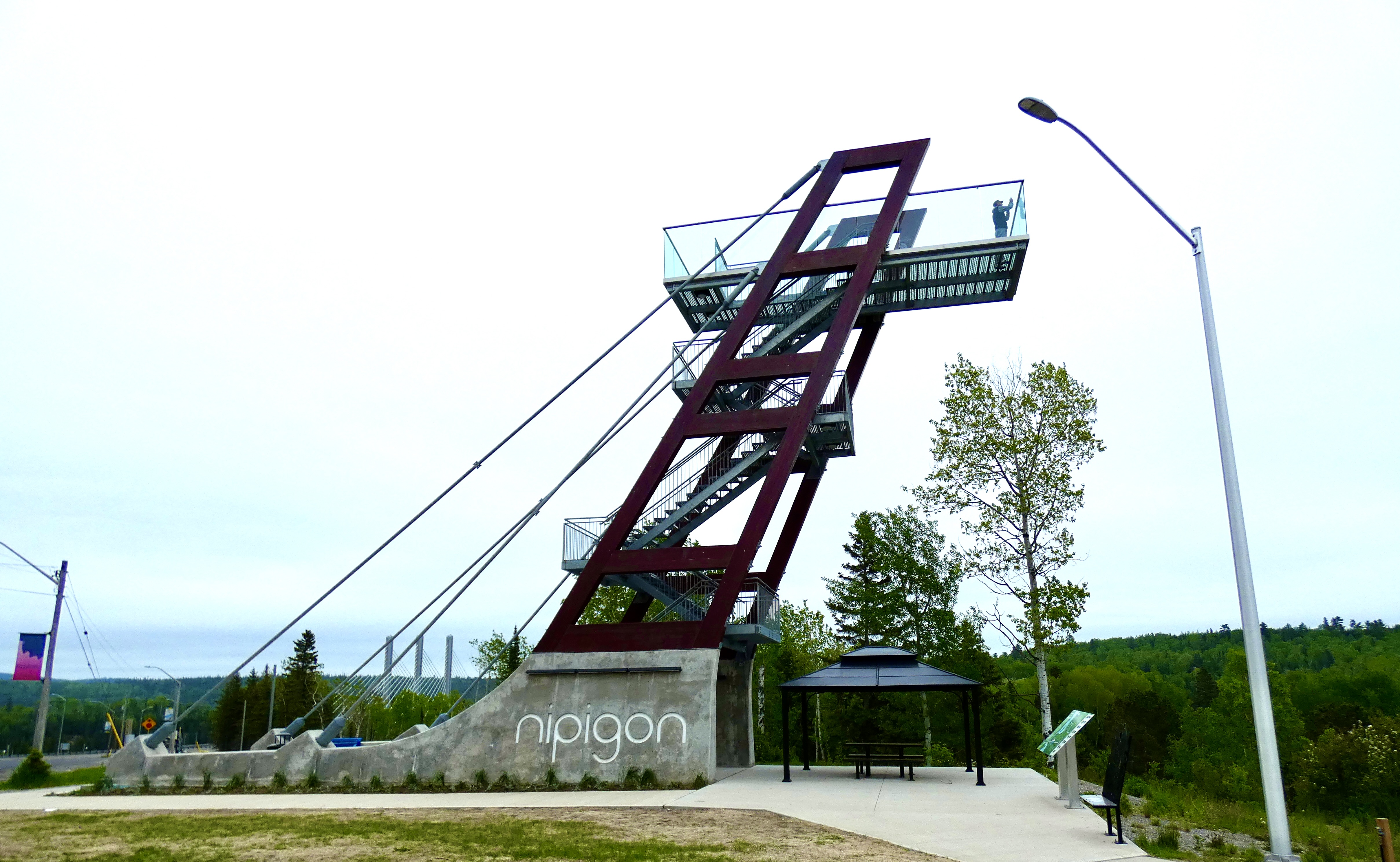
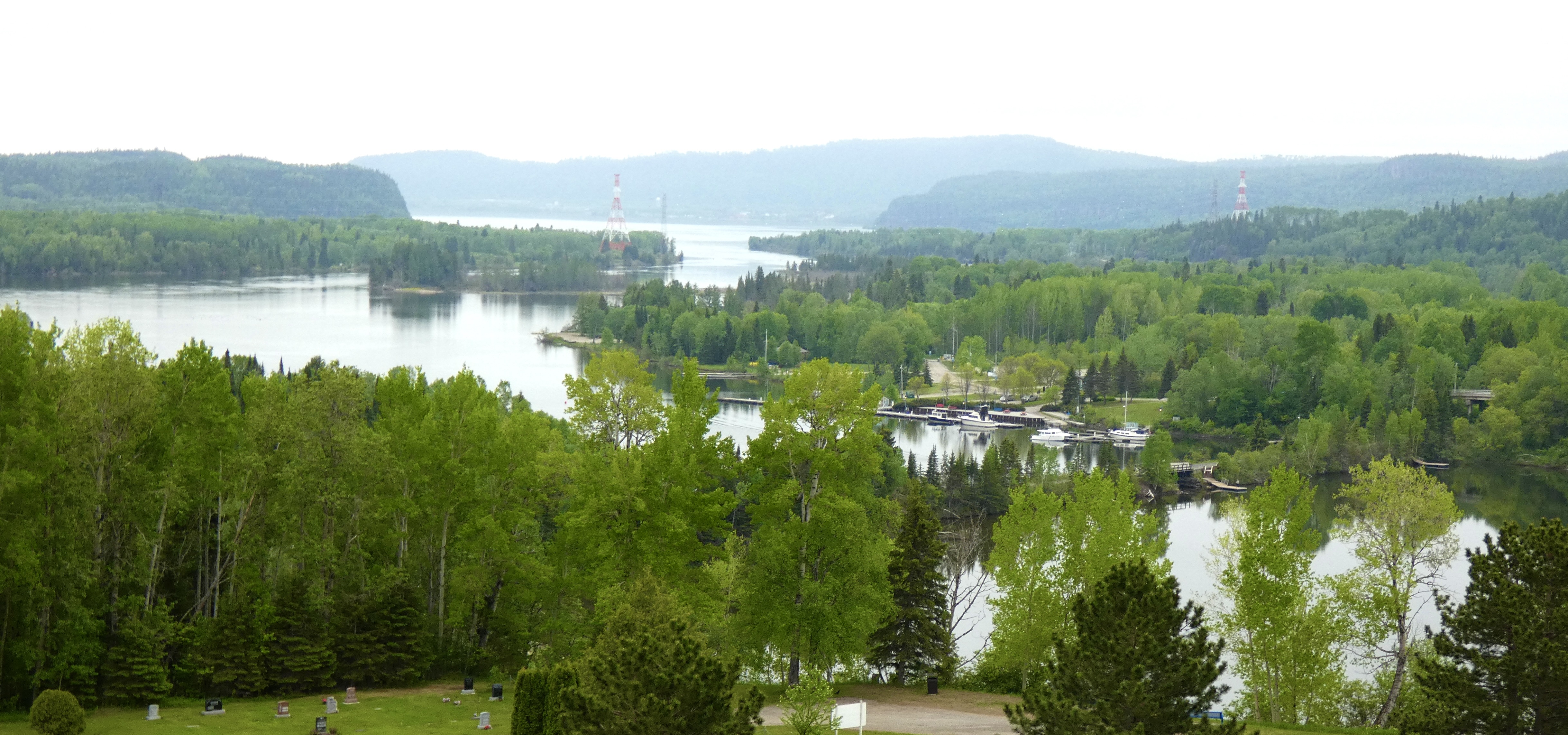
Because it’s hard to stop on the side of a busy highway to take pictures, I look for and try to stop at spots designated as “Scenic Views.” As we were riding into Nipigon near the end of our trip along Lake Superior, I saw not just a site with a scenic view, but with a huge tower designed to give me a better view. I made a quick left into the parking area, grabbed my camera, and started climbing. The view was definitely better from the top of the tower than from the ground down below, but the continued hazy fog blocked some of the long-range view from the top.
Back on the road following my tower descent, we continued our westward path. As I cruised along near Thunder Bay, a highway sign announced the “Terry Fox Overlook and Memorial,” which was not surprising since we had been traveling on a section of the Trans Canada Highway designated as the Terry Fox Courage Highway. I remembered Terry Fox from the early 1980s as someone running to raise awareness about cancer. But I admit my recollection was more than a little hazy. I stopped for a view of Lake Superior. I left with a profound addition to my store of knowledge.
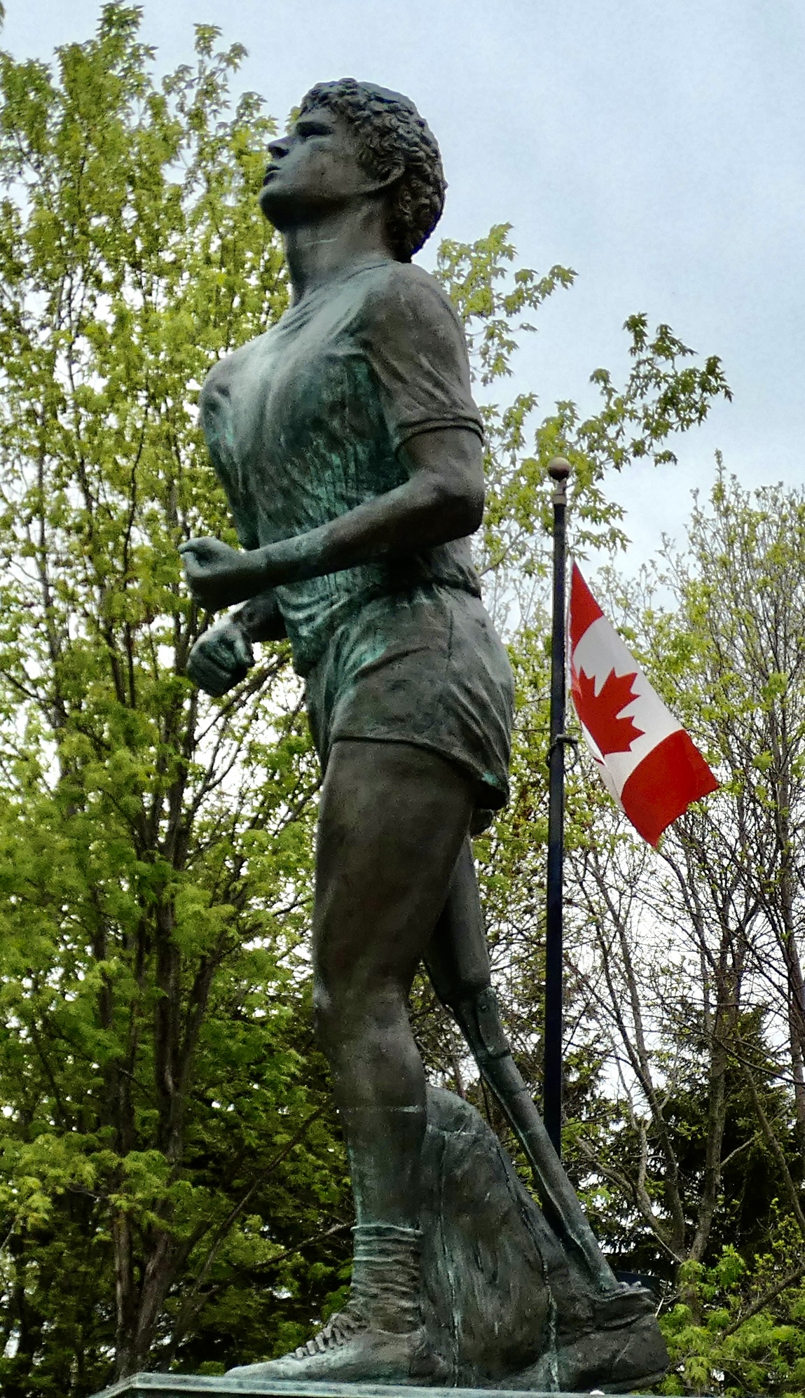
At age 18, Terry Fox was diagnosed with bone cancer, and surgeons amputated his right leg above the knee. Determined to help fight the disease that cost him his leg by raising money for research, he set a goal of running across Canada, 26 miles a day on a prosthetic leg, to bring awareness to a cause he knew so well. His run enthralled and motivated Canadians across the country. He ran a marathon every day in all the provinces through which I’ve travelled the past three weeks. But his cancer returned, this time to his lungs, and his run ended just outside Thunder Bay. He died at age 22, but his fund-raising legacy and his legacy of courage continues to inspire Canadians and people around the world. If you want to learn more about this incredible feat and the young man who performed it, click here.
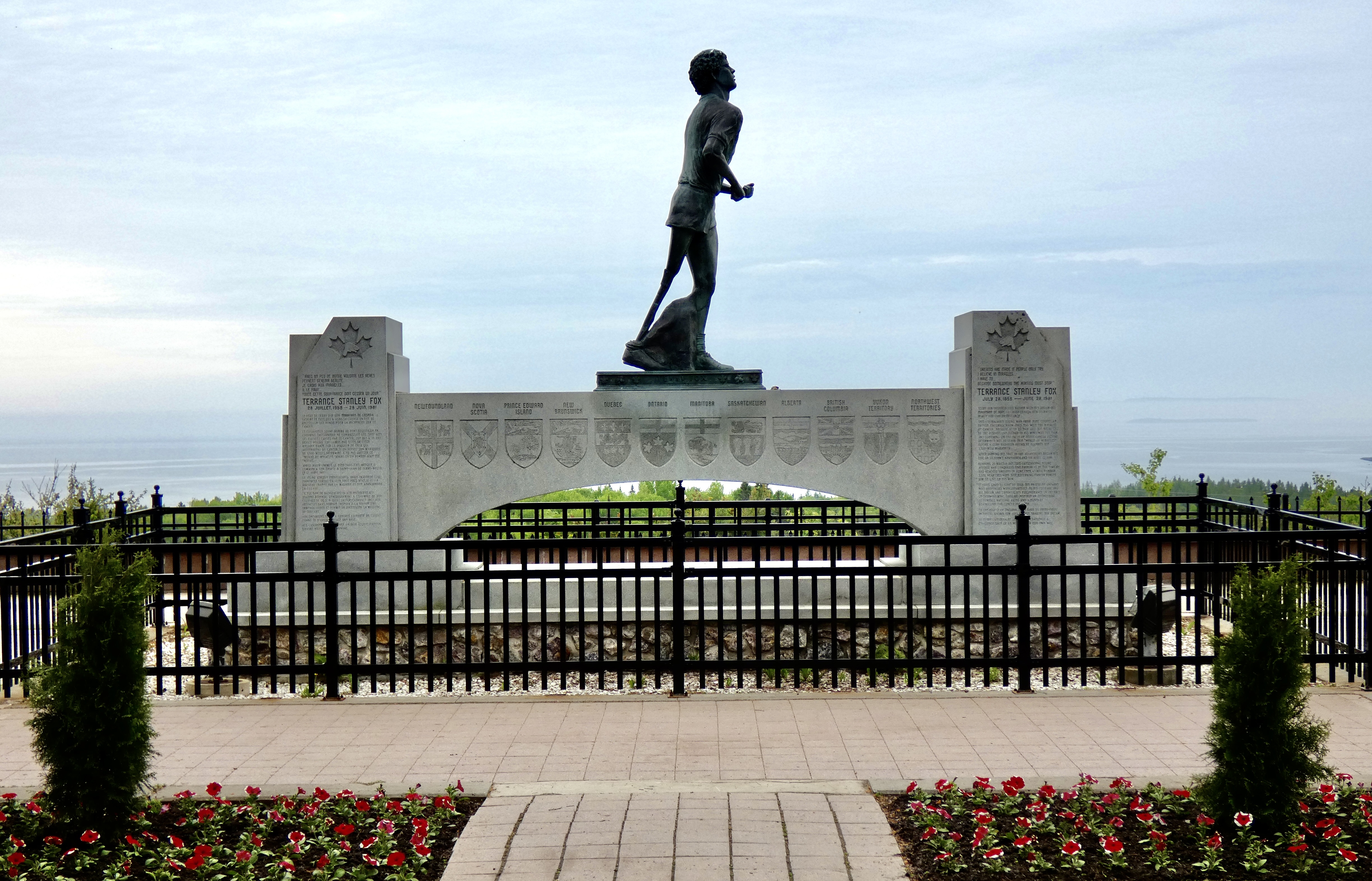
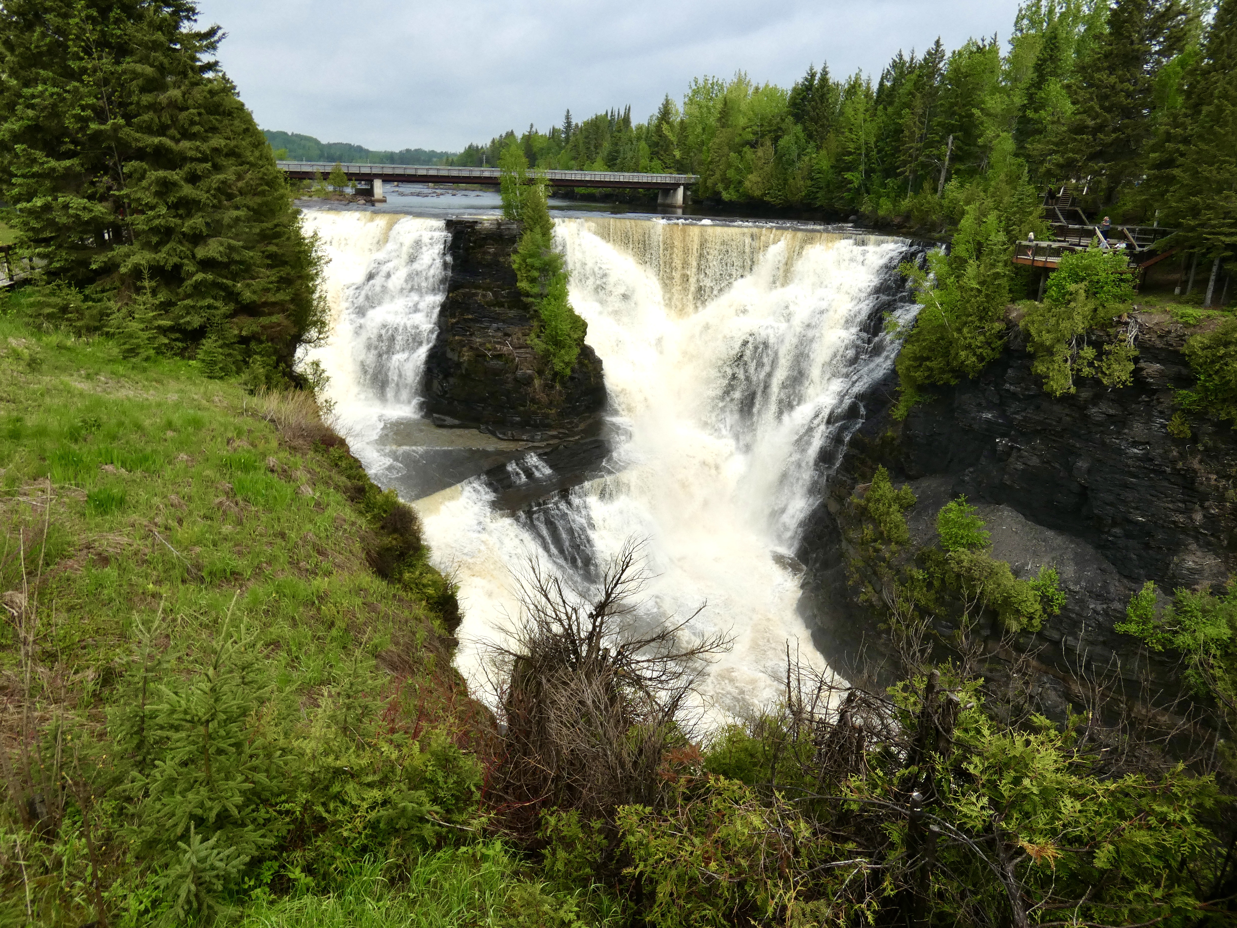
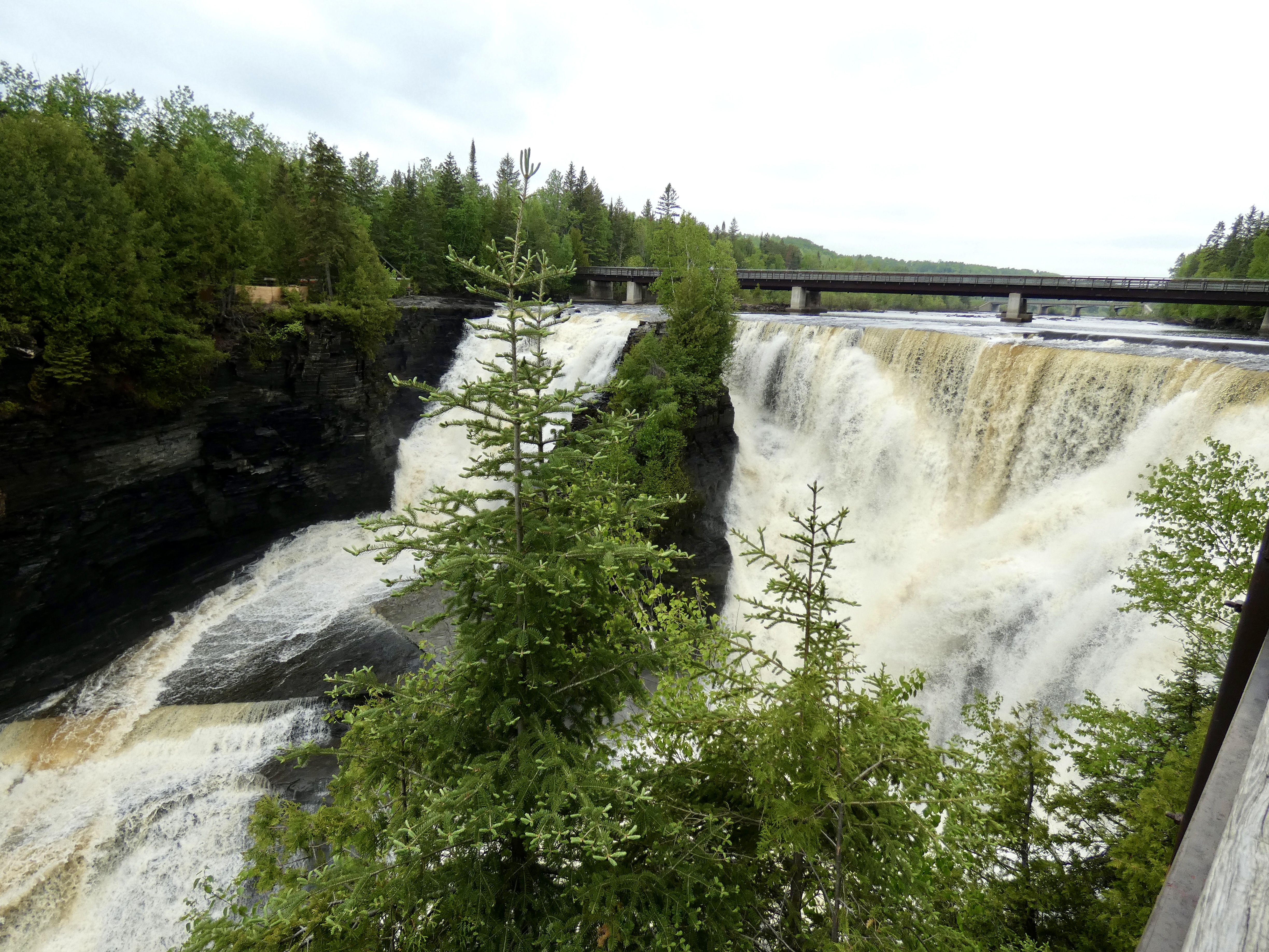
Inside the visitor center at the Terry Fox Lookout, I struck up a conversation with one of the staff who, as it turned out, was another one of those “amazingly friendly, incredibly helpful, wonderfully courteous Canadians” I mentioned earlier. When she found out which direction we were going and how limited our time was, she said there was one place I should visit before leaving the area: Kakabeka Falls, a short distance west of Thunder Bay that required a slight detour.
So we detoured. To Kakabeka Falls Regional Park. I paid the $5.25 parking fee, and since we could both park in one parking spot, the park employee, an “amazingly friendly, incredibly helpful, wonderfully courteous Canadian,” let Steve pass through without paying. The second highest falls in Ontario, water plunges over Kakabeka Falls about 120 feet from the lip of the falls to the canyon below. A footbridge a short distance upriver from the falls gave us a chance to see it and the canyon from both sides of the Kaministiqua River. We spent about an hour taking in this watery spectacle before heading west again on the TCH.

Tomorrow, as we head to Winnipeg, we will cross into our seventh province–Manitoba–and spend four days there as we see sights in the capital and then head north for some small town sights.
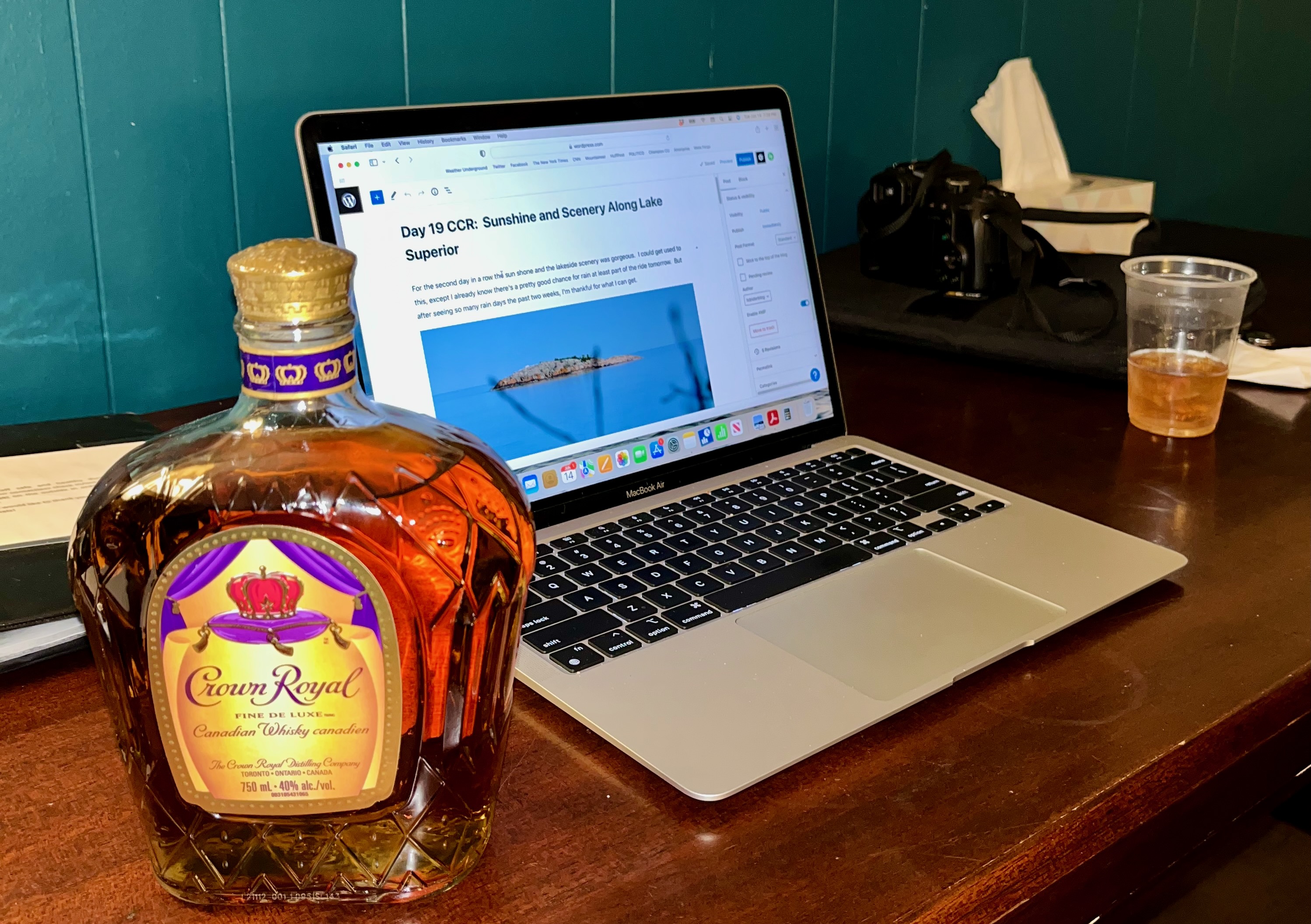
Day 19 CCR: Sunshine and Scenery Along Lake Superior
For the second day in a row sunshine graced us and scenery courtesy of a Great Lake was gorgeous. I could get used to this riding environment, but I already know there’s a pretty good chance for rain during at least part of the ride tomorrow. Oh well, after enduring so many rainy days the past two weeks, I’m thankful for what sunshine I can get.
With Beethoven’s Fifth Symphony providing musical motivation through my bluetooth, we motored out of Sault Ste Marie about 7:45 and soon found a large lake to our left. Today, however, it wasn’t Lake Huron, but Lake Superior, the largest of the five Great Lakes, the largest lake by surface area among fresh water lakes in the world and the third largest by volume. Lake Superior holds 10% of the world’s fresh water and is fed by more than 200 rivers. Clearly, a superior lake. And beautiful.
All morning we skirted the northern shores of this massive lake, though in the afternoon the Trans Canada Highway route to Schrieber, Ontario, where we are tonight, went inland 20 or 30 miles and the big lake disappeared from view. Still, even in the afternoon, we had water in sight much of the time because of the thousands of smaller lakes that dominate much of Ontario’s landscape. Tomorrow morning, shortly after we get on the road, we’ll regain the shore of Lake Superior for more than 100 miles until we reach Thunder Bay and turn northwestward. Two fellow Harley riders we met on the road today said tomorrow’s section is even more impressive than what we rode today; I hope the rain holds off or is sporadic enough to allow a chance to enjoy some of the view they foretold.

An hour into today’s ride we stopped briefly at Chippewa Falls near where the Chippewa River feeds into Batchewana Bay. Because the water flow was low, we hiked up a short trail and onto some of the rocks over which the river tumbles when the flow is higher. As falls go, the height of Chippewa Falls isn’t significant, only about a 20-25 yard drop. But seeing the falls was a nice 15 minute break. As a bonus, a plaque on a monument at the parking lot next to the highway informed us that we were at the halfway point of the 4,860-mile Trans Canada Highway (TCH), which stretches from St. John’s, NL, to Victoria, BC. We haven’t been on the TCH all the time since we left St. Johns because we left it in PEI and parts of New Brunswick, but we have ridden much of the 2,430 TCH miles to get to here. We’ll continue to cruise the TCH until we reach Winnipeg but will then leave it for a week until we pick it up again in Kamloops, BC. The route I created for this trip will be longer than the TCH by about 1,000 miles because of a northern excursion to Flin Flon, Manitoba, and a re-ride of the staggeringly beautiful Ice Fields Parkway in Alberta’s Rocky Mountains.

The plaque also honored a Toronto physician, inventor, bicyclist, and automobile enthusiast named Perry Doolittle, who is credited with being the spiritual father of the TCH, even though he died a decade before it was authorized in 1949 and two decades before it was completed in 1962. In 1925, the 64-year-old Doolittle became the first person to drive a car across Canada, taking 39 days to go from Halifax, NS, to Vancouver in his Ford Model T, including about 800 miles when he had to replace his tires with flanged wheels so he could use railway tracks where no roads existed.
Most readers know that every evening as I write this blog for friends and family, the keyboard is lubricated with a little help from my friend Jack Daniel’s. The lubrication doesn’t interfere with my fingers, but sometimes it probably blurs my efforts at composition and my attention to grammatical detail. At any rate, as they say, when in Canada, do as the Canadians do. So with a nod to my friend Mark and my nephew Shane, I’m going to substitute–temporarily–my Tennessee-based writing companion with a Canadian one, even though it’s a little too smooth for my taste.
I raise my plastic glass and say “Cheers” to all who are joining me on the CCR. Tomorrow’s another day and I can’t wait to get on the road again.
Day 18 CCR: Along Lake Huron
As I write tonight’s blog, I’m currently five miles from the United States; earlier today I was a mile from the border as we skirted Lake Huron on the way to Sault Ste. Marie, Ontario. But it will be at least two more weeks before I’m back on U.S. soil, since I have about 3,500 more miles to ride in Canada to complete the CCR. I still have to transit Manitoba, Saskatchewan, Alberta and British Columbia before I see the Pacific Ocean.
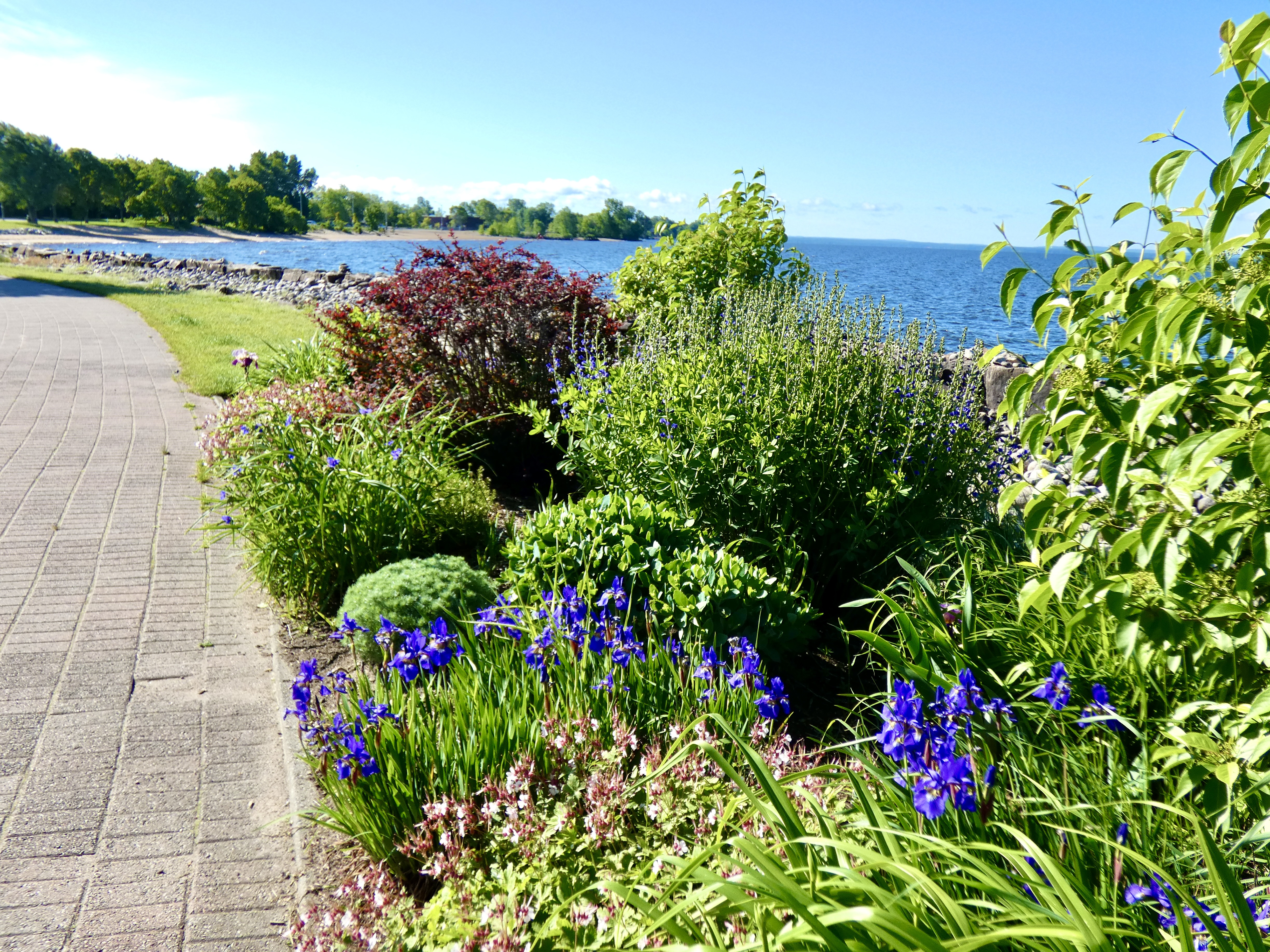
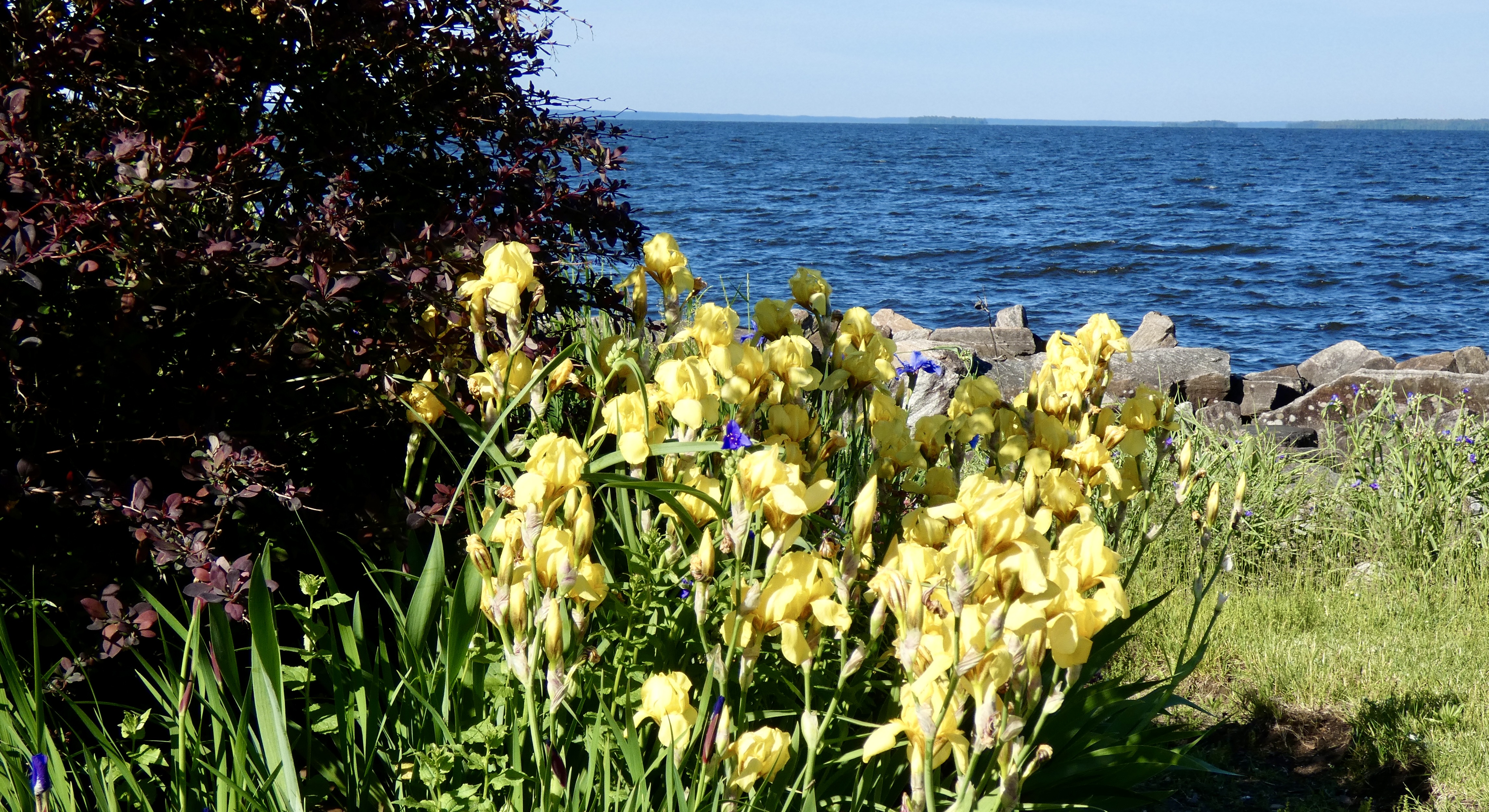
Yesterday I wrote that I wasn’t impressed with North Bay on the shore of Lake Nipissing but that I would look around today before leaving and see what I was missing. I looked around. I had missed a lot. Our motel, as it turns out, was on the very edge of town in a rather rundown area, despite billing itself as a “Hotel and Conference Center.” Knowing that today’s ride was relatively short (270 miles) and could be ridden in five or six hours, I scouted the area and discovered that I had missed a bustling and modern downtown and an absolutely wonderful park on the lakeshore. Consequently we spent an hour taking in what we missed in North Bay yesterday.
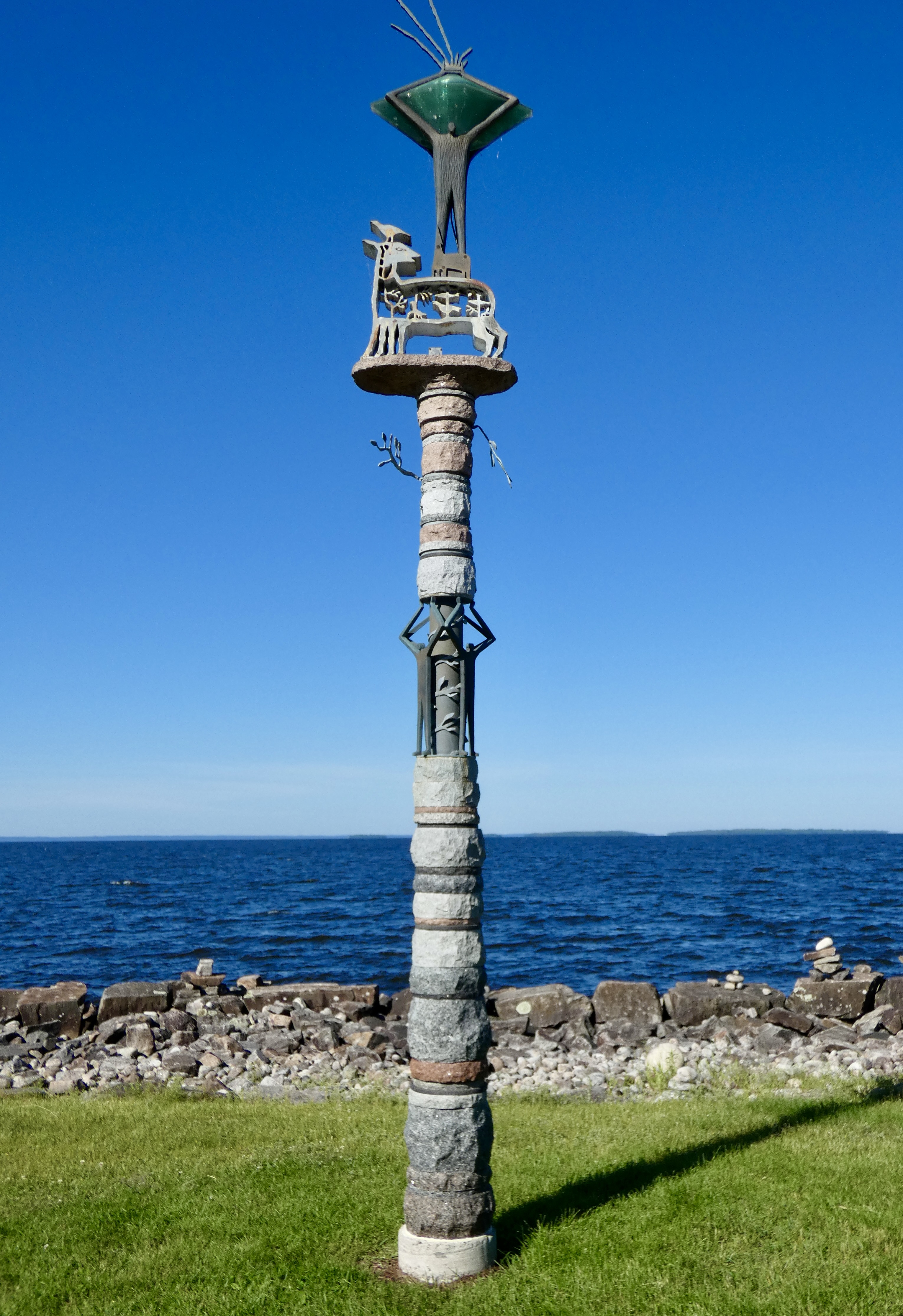
As I admired the park I struck up a conversation with a friendly Canadian walking her dog (there were scores of people walking dogs) and she filled me on some of the details of the park, officially known as the Goulet Golden Mile Park after the former mayor who was the driving force behind its development.
The lakeside park has two carousels with hand carved horses, benches for walkers to rest on, sculptures, monuments, a restaurant inside a landlocked boat, a large parking area with easy access to the walking path/sidewalk, and, of course, unhindered views of the Lake. But most impressive, perhaps, are a dozen separate flower gardens, each maintained by a loyal group of volunteers who not only tend the gardens but raise the funds necessary to maintain them. As it turns out, there are many other parks in the city of North Bay, as well as first rate hotels and restaurants and excursion boats that ply the lake and take tourists to the popular Manitou Islands, eight miles from shore. I’m glad my first impression of North Bay wasn’t my last. If you’re in the area try to stay a day or two. But don’t stay at the Best Western.


We left North Bay a little after ten a.m under mostly blue skies with temperatures in the low 60s and continued our westward path on the Trans Canada Highway, a good road for the most part though some two-lane sections are due for resurfacing. For miles we passed hundreds of beautiful farms carpeted with fecund fields well into the growing season. Ontario, boasting more than 50,000 farms, produces one-quarter of all Canadian farm revenue, with crops that include apples, soybeans, grains, dairy and beef. But most of the land is covered with thick forests growing on hilly, rocky soil. We rode through those forests today, too, and as I noted yesterday we were never long out of sight of water, whether it appeared as small lakes or bogs or rivers and streams or the gigantic Lake Huron.

Tomorrow should be another nice, 300-mile ride as we continue across Ontario, though we may see more rain toward the end of the ride. At least we’ve had plenty of practice riding in the rain.
Day 17 CCR: And Ontario Makes Six
If you look at a map of Quebec, you’ll notice that Montreal is close to the western boundary between Quebec and its neighbor to the west, Ontario. Less than an hour after we said goodbye to Montreal, we crossed into Ontario, our sixth province in two weeks. (New Brunswick, Nova Scotia, Newfoundland and Labrador, Prince Edward Island, Quebec, and Ontario.) We’ll continue the Cross Canada Ride for the next four days in Ontario.
Ontario is big. At more than 1,000,000 square kilometers, it’s seven times bigger than my home state of North Carolina and twice as big as California. Yet it’s only the second largest of the ten provinces. Quebec is #1. But Ontario owns bragging rights for having the most people in Canada, since 40% of all Canadians live here. Think Minnesota with its “10,000” lakes is impressive? Ontario has more than 250,000 lakes, and 62,000 miles of rivers, combining to contain about 20% of the world’s fresh water. Indeed, “Ontario” comes from an Iroquois word meaning “beautiful water.”
Today I saw some of that beautiful water riding past hundreds of lakes large and small. Unfortunately I wasn’t able to stop along the way for pictures because (1) there was usually no place to pull over safely on the Trans Canada Highway and (2) we were once again pelted with fresh water falling from the sky. Yes, another day of riding in the rain, but only for about two or three hours out of the seven hours we rode. The precipitation allowed me to test my expensive new rain suit; it passed with flying colors. I had one small leak through the jacket zipper, but that’s on me because I didn’t fasten the velcro strip covering the zipper tight enough. I’m hopeful that, having put the rain suit to the test, I can now stow it in its carrying bag for a couple days. We’ll see.
Our destination today was North Bay, on the shore of Lake Nipissing. Since we have a relatively short ride tomorrow (270 miles) to Sault Ste Marie, I’m hopeful we’ll have time to see more of the town than we’ve seen so far, because what I’ve seen so far isn’t very impressive. On a walk along the lakeshore I took a couple photographs to post for those who come to the blog for the pictures; if the town offers more opportunity tomorrow (and I think it will), I’ll add to the ones below.

I am now more than 4,500 miles and 17 days into this adventure–not quite half way. It’s been wetter and cooler than I anticipated, but the sights and scenery have been worth it. Tomorrow, more miles, more sights, and more things to learn and share about Canada.
Day 16 CCR: Old Montreal
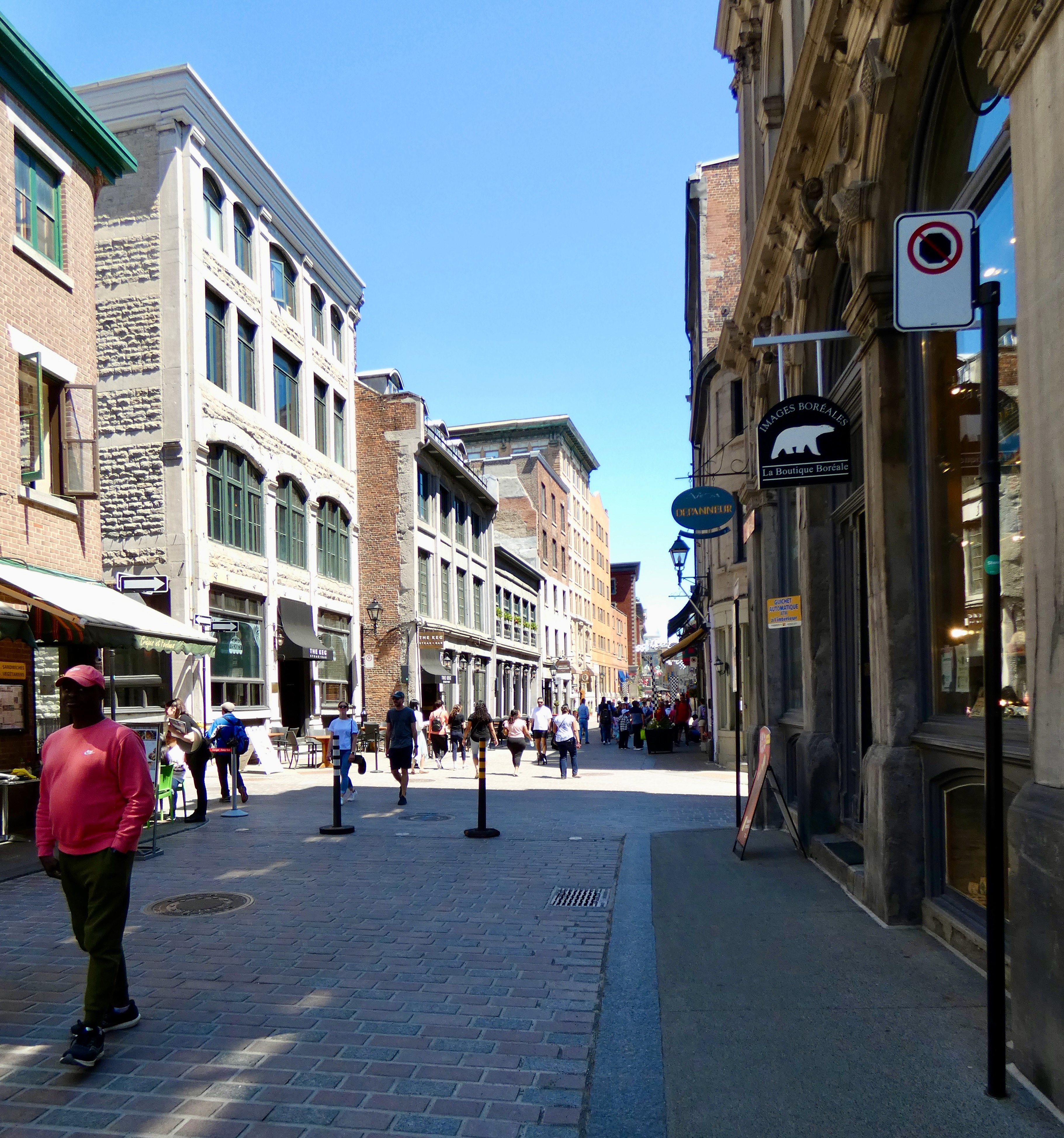
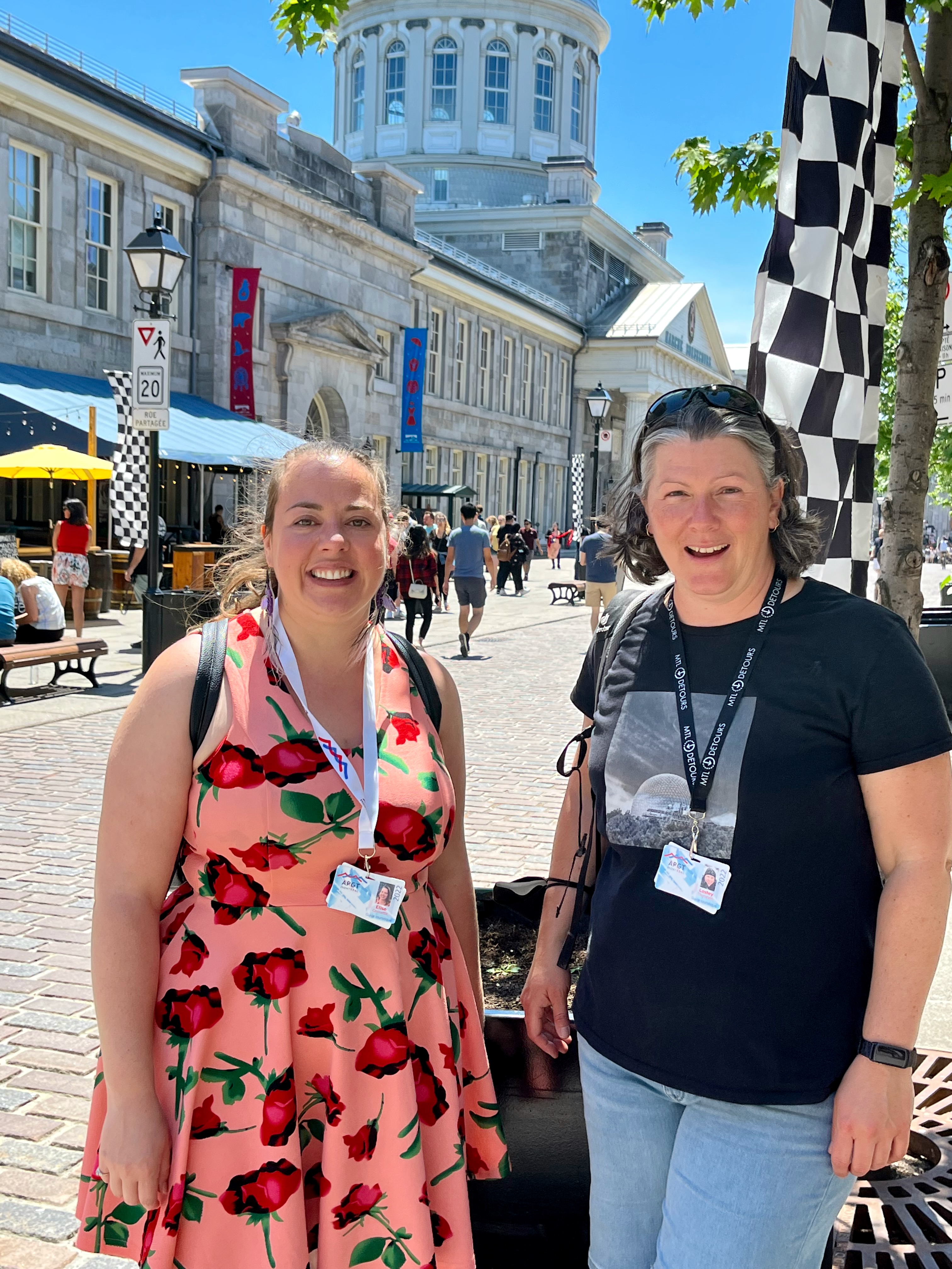
I had planned to go on a downtown walking tour in St. John’s, but adverse weather made that next to impossible. I had planned to go on a long motorcycle tour of Prince Edward Island, but threatening rain chased us back to Summerside before finishing the chosen driving loop. Today was different. Under blue skies with short-sleeve temperatures, a two-hour, walking tour of Old Montreal (Vieux Montréal) led by a wonderfully knowledgable and delightfully personable guide gave me plenty of exercise and a wealth of new information about the earliest settled parts of this amazing island city.
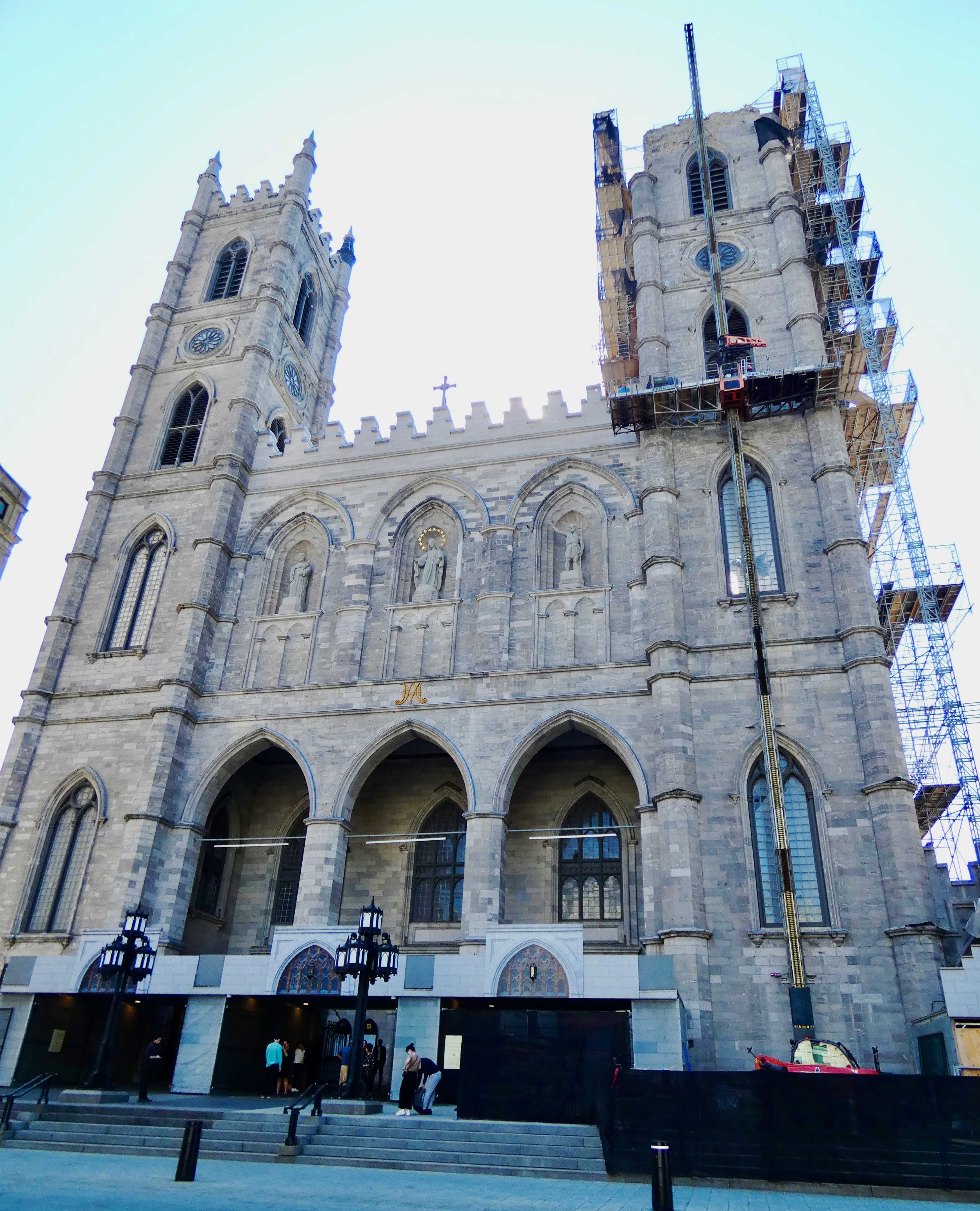
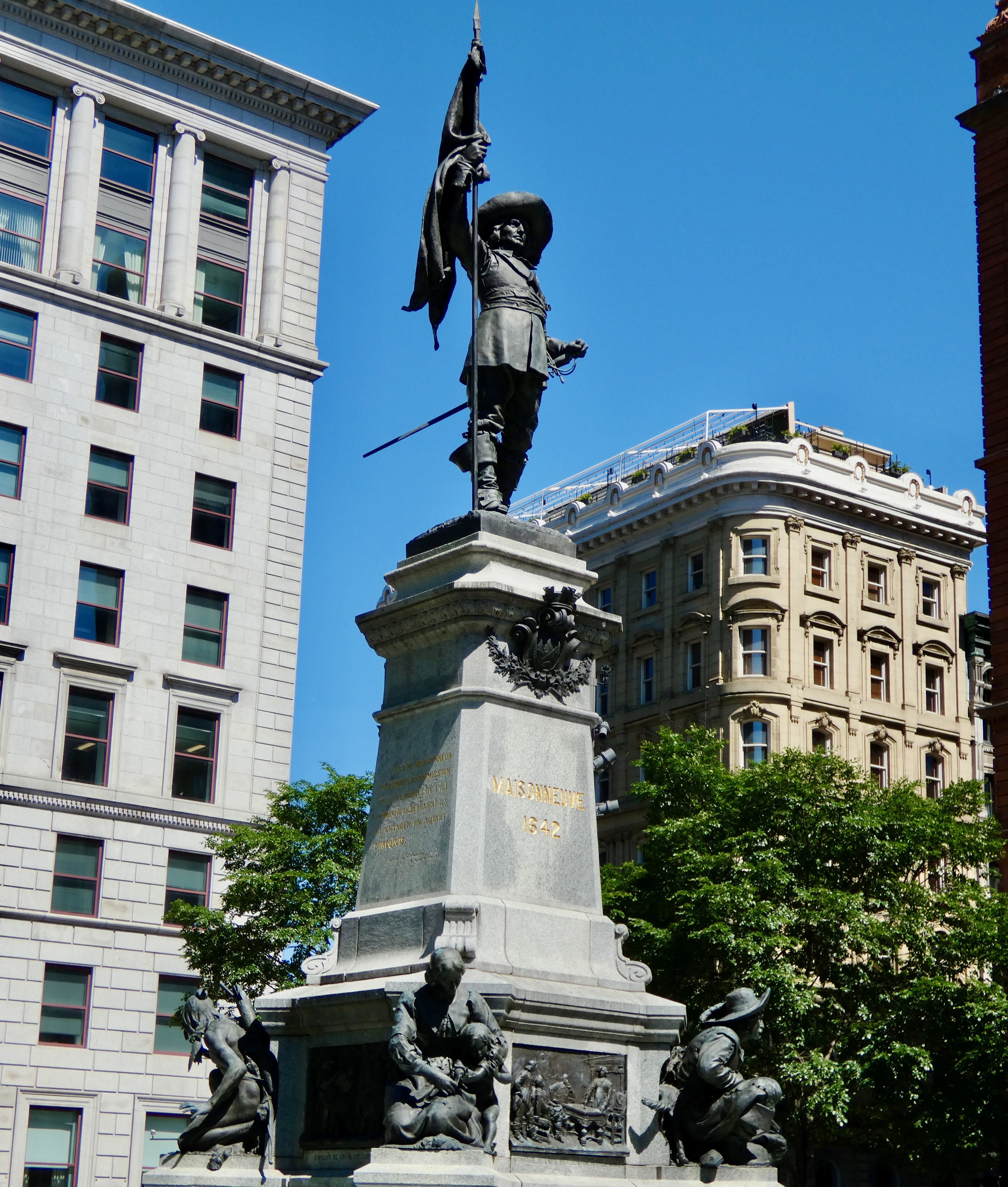
Our tour, arranged through MTL Detours (click here to learn more), began when we met Elise, our guide for the day, at Place d’Armes, a square surrounded by the beautiful Notre Dame Basilica and the Saint Sulpice Seminary on one side, the oldest skyscraper (8 stories, 1888) in the city and the 1930s Art Deco Aldred Building on another, the venerable Bank of Montreal head office on a third, and a building built in 1968 simply referred to as “the black sheep” because it is the definition of “out of place.” In the center of the square stands an 1895 monument to the founding father of Montreal (1642), Paul de Chomeday. Also featured on the monument’s base is Jean Masse, another founder, who, according to Elise, was equal in stature to de Chomeday but never received full credit because of her gender.
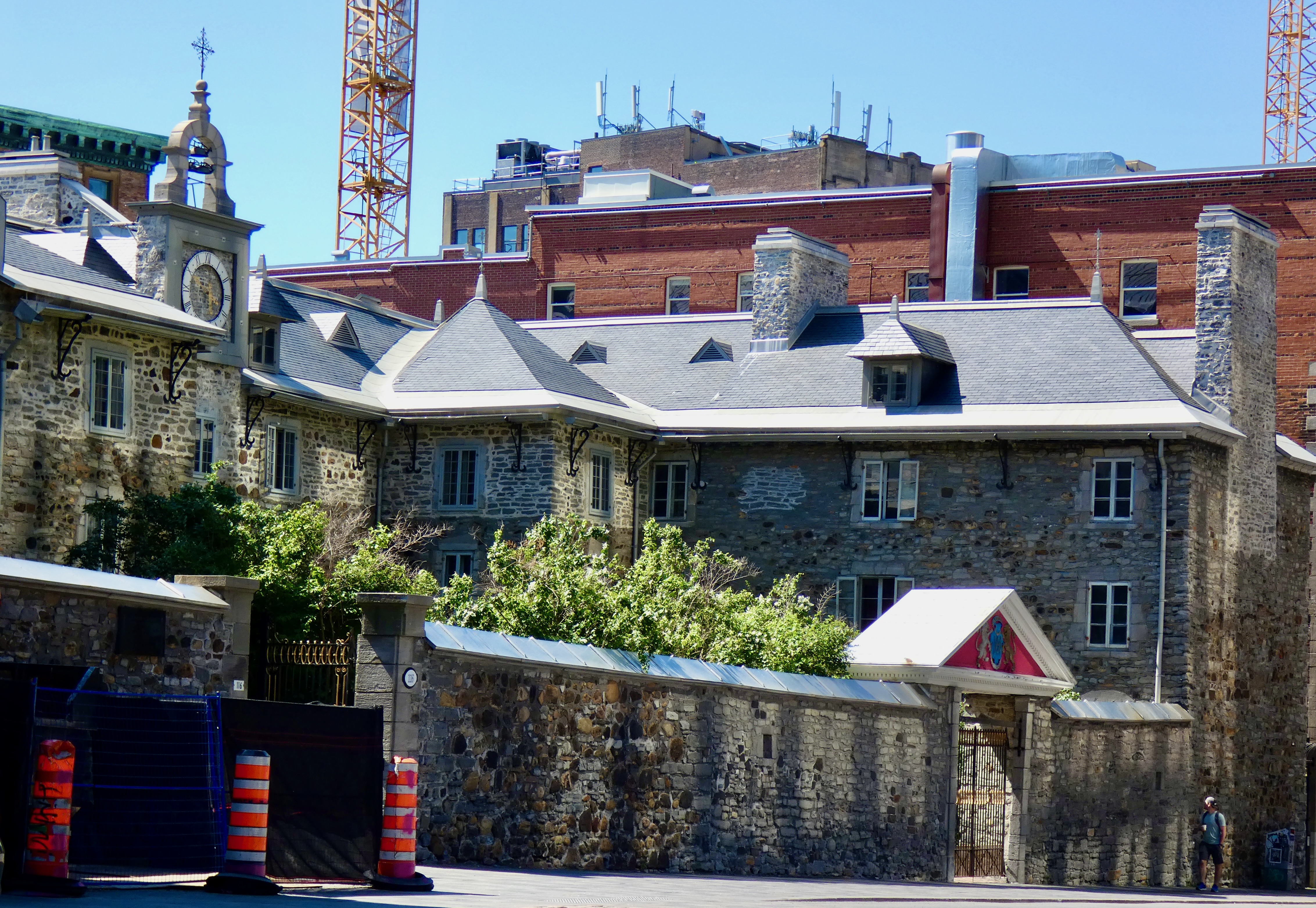
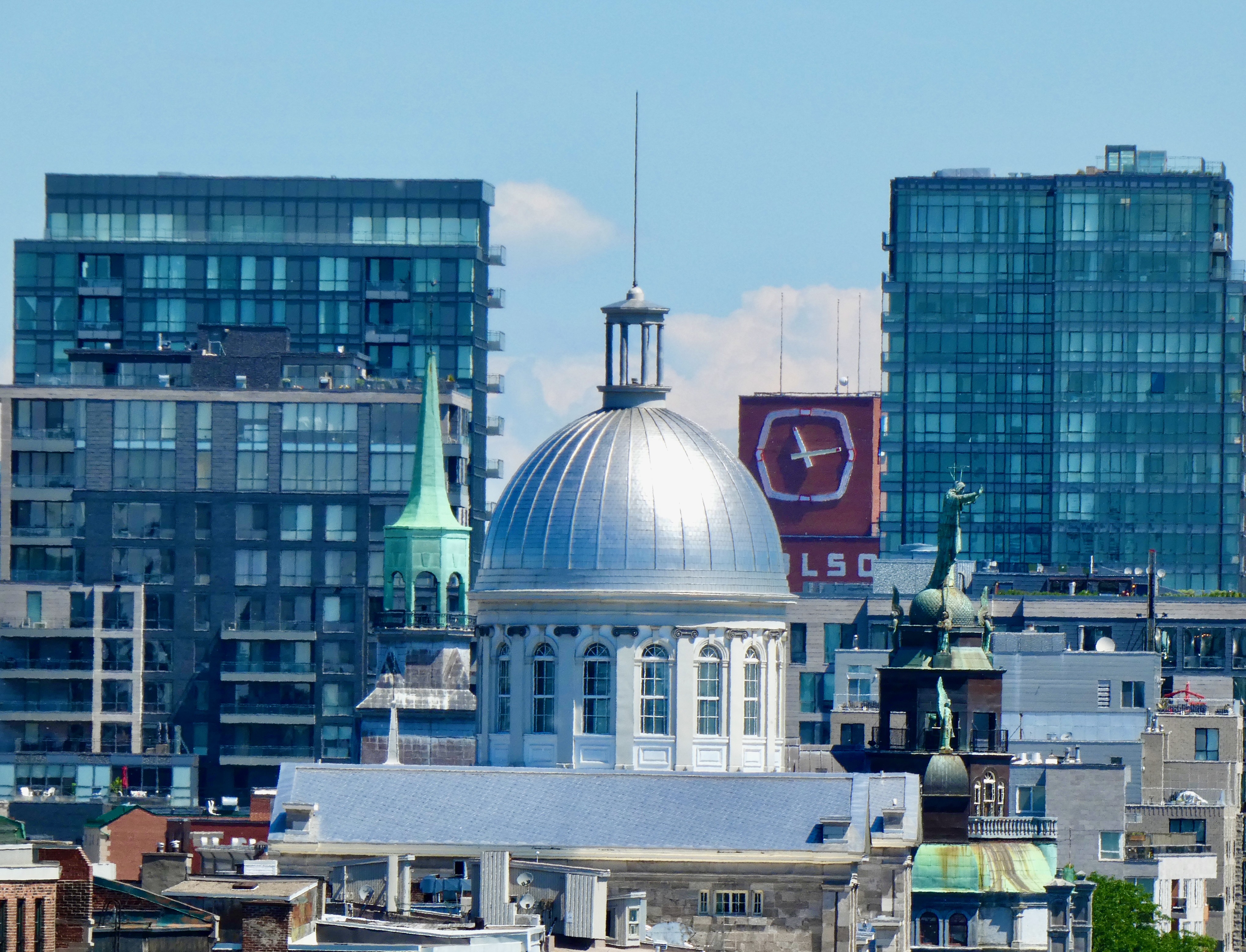
The tour wended its way through several streets and boulevards with informational mini-stops along the way until we took an extended stop at the Museum of Acheology and History, which literally sits on the site where the first settlers encamped, calling their settlement not Montreal but Ville-Marie, and where archeological investigations under the museum are accessible to visitors. But today, our interest was not in the museum’s basement, but on its roof, where, thanks to the cooperation of Museum staff, we got an elevated view of the new and the old city.
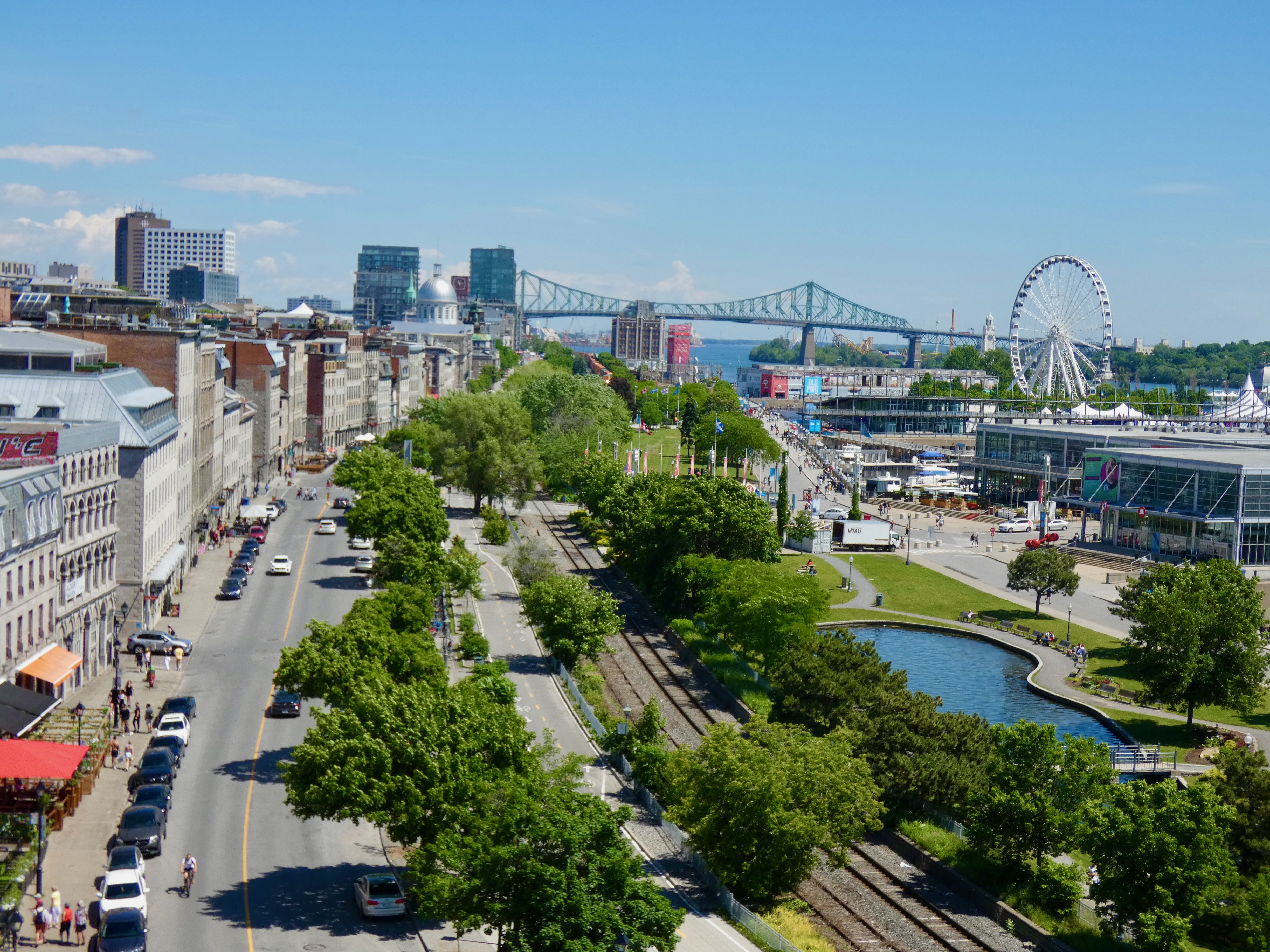
Off the roof top and back down on the streets, we walked through streets that reminded me very much of streets in Europe. Narrow, cobble-stone ways with pedestrians and vehicles battling for supremacy, while onlookers at scores of sidewalk cafes and restaurants and terraces (pronounced in French as tare asses) sipped coffee, ate marvelous viands and enjoyed the sunshine. In fact, Elise, our font of Montreal information, noted that many movies are shot in Montreal when the director wants to portray a scene in Paris or other European city. Around every corner, literally, was a different historical or architectural treasure waiting to be rediscovered.
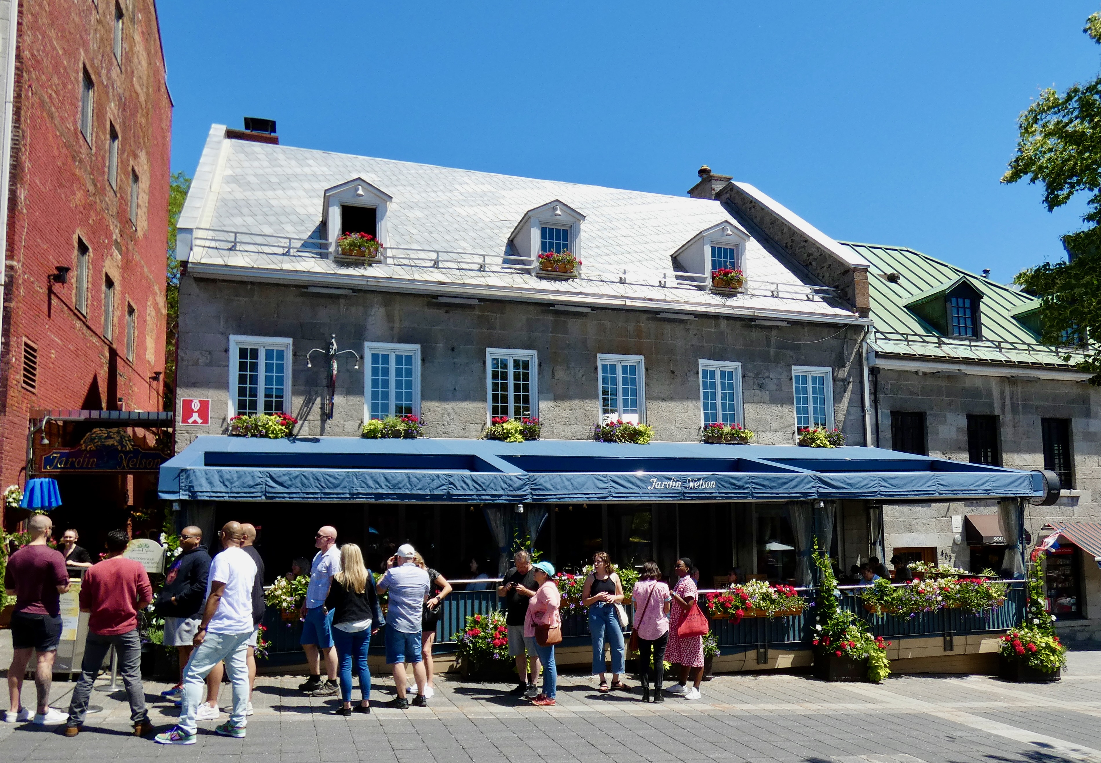
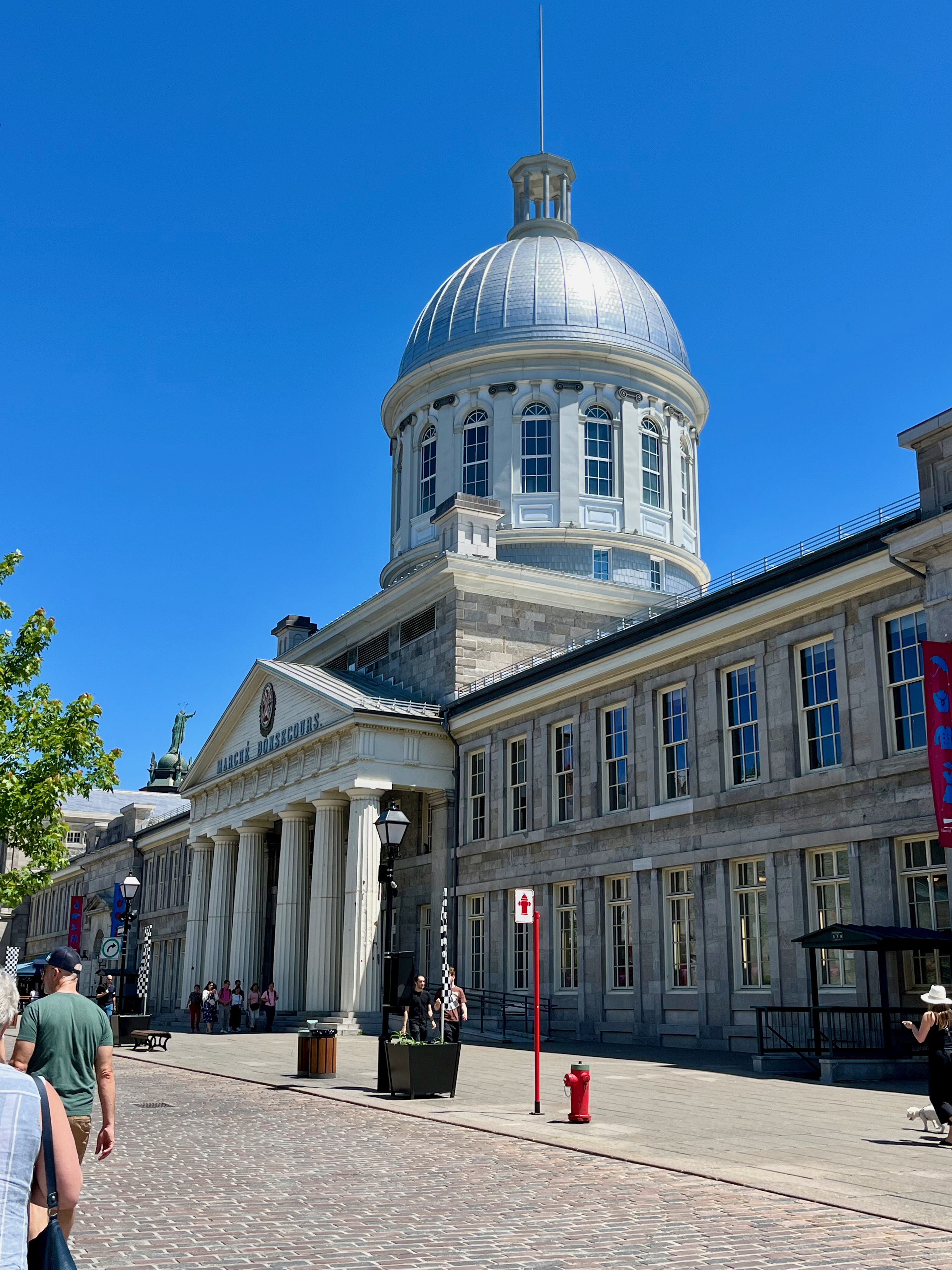
After two enlightening hours of walking, listening, asking questions, getting answers and draining the battery in my camera (I had to resort to cell phone pictures at the end), we passed by the Marché Bonsecours and stopped in front of the Cathedral of Notre Dame Bonsecours. (Bonsecours translates to Good Help). This church is known as “The Sailors’ Church” because boatmen going up and down the St. Lawrence River would stop to pray for their safety as they sailed to distant parts of the world. While I didn’t go inside, Elise pointed out that there are many small boats in the church and its basement given by grateful sailors who believed their prayers had been answered.
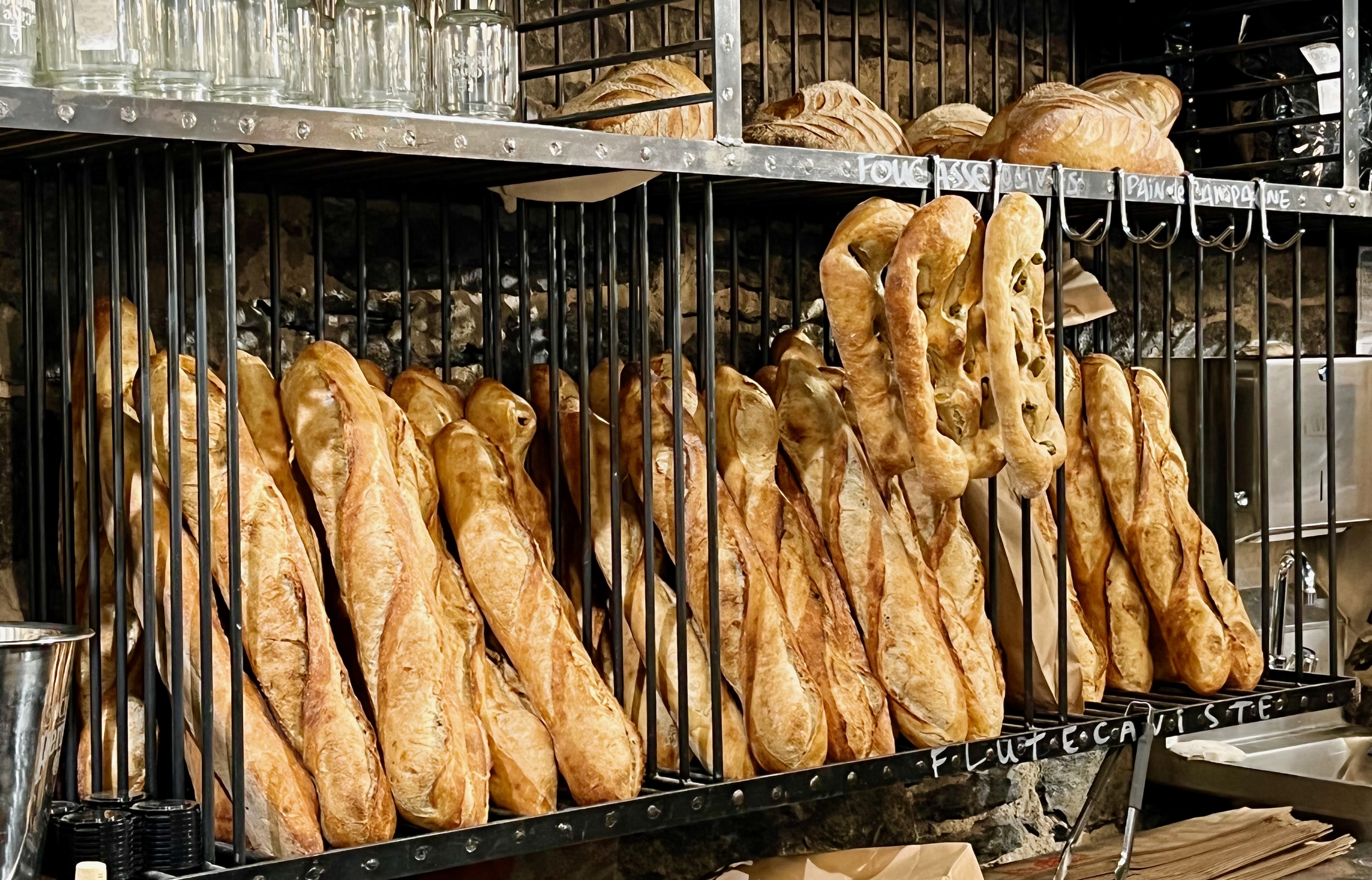
The tour over, it was time for lunch. Taking Elise’s advice, we went to a small bakery under the Marché Bonsecours where they made wonderful sandwiches using their own delicious croissants. We each had a smoked meat sandwich with mustard sauce and cheese. Très bien!
A couple of other notes: After we hiked backed to the parking garage where we parked the bikes three hours earlier, we navigated to the Montreal Harley-Davidson dealer where I found a new set of rain gear that fits. It wasn’t as expensive as Steve’s tire, but close. I hope it rains every day the rest of this trip so I can get my money’s worth. ……Not really.
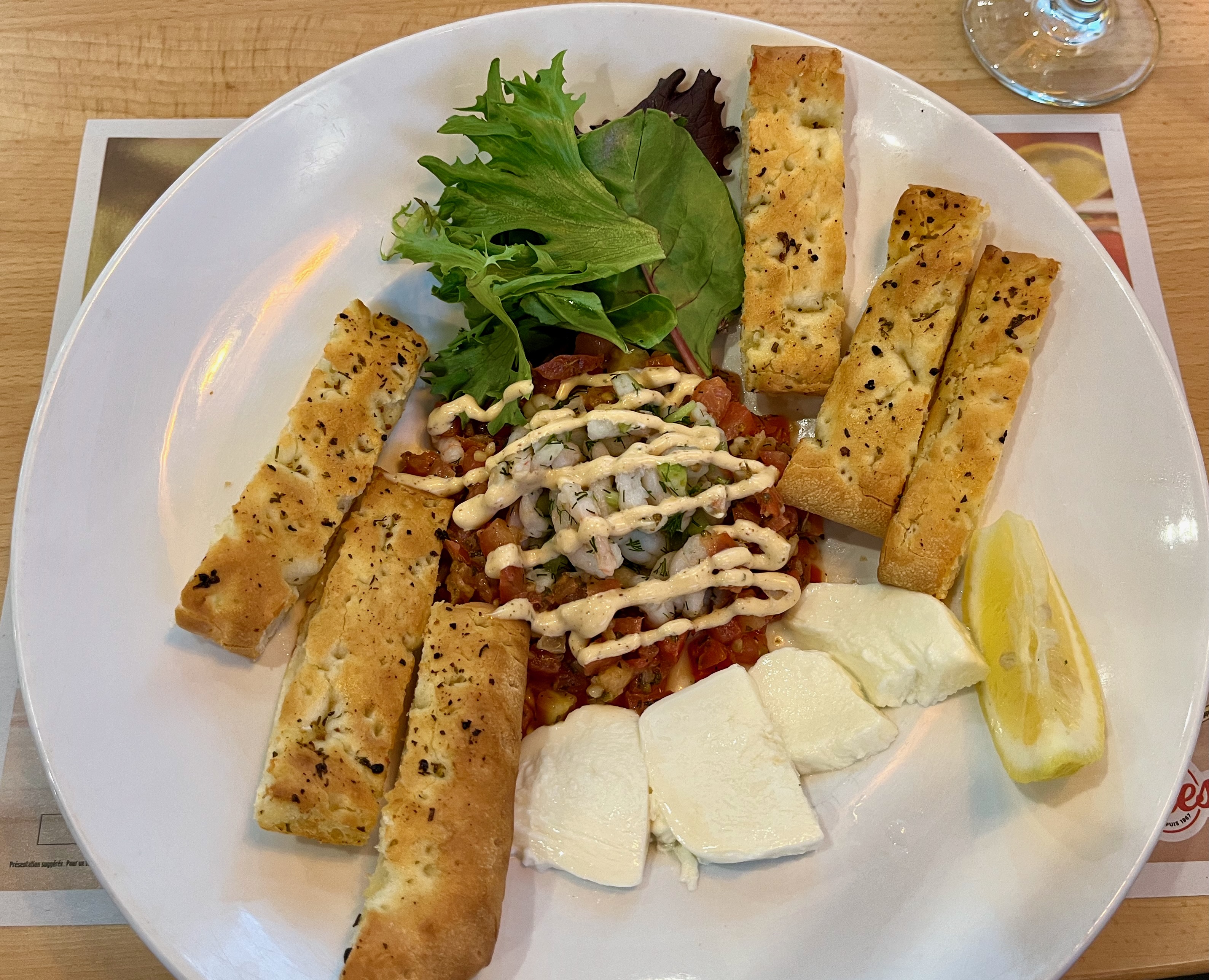
Finally, a friend suggested I take the opportunity while in Montreal to try something different on the menu. So, tonight I had La Gaspesiénne, small Quebec shrimp, celery, green onions and dill, served chilled with fior di latte cheese, taglio crust sticks brushed with herb oil, arugula, and a wedge of lemon. Washed down with a nice light white wine. Bon appétit.
Tomorrow we’re off to Ontario, our sixth province in this Cross Canada Ride celebrating my 75th anniversary as a being.
Day 15 CCR: Steve Gets Tired
A trip featuring 11,000 miles or so means certain motorcycle-related things need to be replaced. Oil for example. And sometimes tires. And sometimes rain gear.
I have planned a stop in Winnipeg at the Harley Dealer next week for a three-hole fluid change (engine, primary and transmission) and Steve has also booked the same. I will have ridden about 5,000 miles since I replaced all the fluids in my bike three weeks ago, and replacing oil in an engine primarily air cooled is crucial. I’ve done fluid changes myself in parking lots on extended rides, but the last time was seven years ago when I was much younger. Now it’s easier to pay Harley to do it for me.
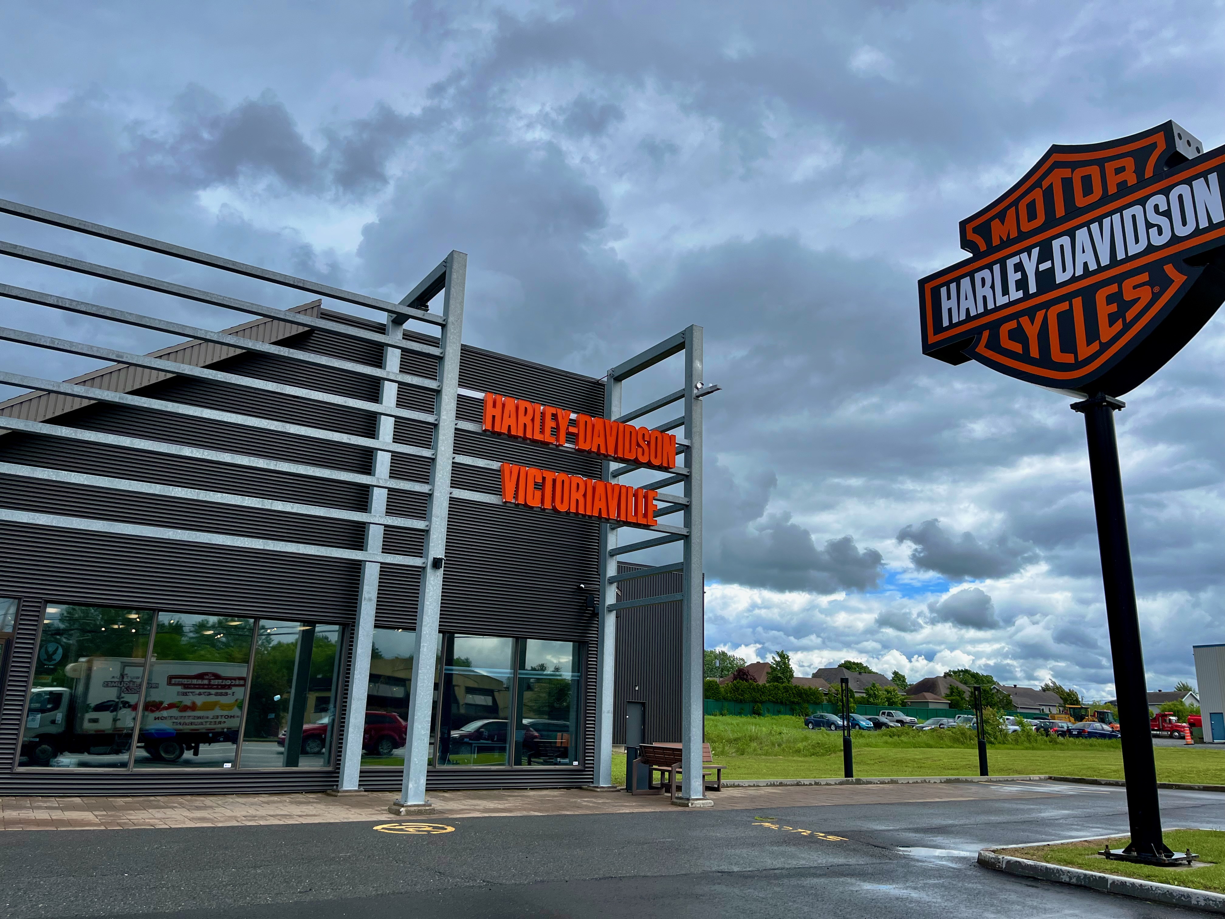
Steve expected to replace his rear tire somewhere on this trip and had planned to do it in Winnipeg next week. But an inquiry to their service department revealed they didn’t have his tire size (it’s a special size) and wouldn’t be able to get one until the end of June. As we go further west, Harley dealers are harder to find, and the possibility of blowing a tire on the windy plains of Manitoba or Saskatchewan with no replacement in sight was not a chance he wanted to take. So he phoned several Harley dealers in Quebec (pronounced KayBek, by the way) and located his specific tire in stock at Victoriaville Harley Davidson, about 100 miles east of Montreal. As they say, a tire in hand is worth two in the bush (I don’t think anyone actually says that but you get my point). He would have liked to get another 1,000 miles out of the one on his bike, but needed to replace it when he had the opportunity.
Although the Victoriaville Harley-Davidson service department was booked solid when he first contacted them, they understood the need of aging road warriors to keep moving and graciously agreed to work him in between a couple other jobs. So we left Edmonton early this morning in the rain (of course) and sped toward Victoriaville, crossing into Quebec, our fifth of ten provinces, through light rain which became a downpour just before we reached Victoriaville about 11:00 a.m.. (The rain becomes important in the next paragraph.)
A couple bikes were already on the rack and the techs were hard at work on those, but they got Steve’s bike in within an hour and went to work changing the tire. Meanwhile, as the service department worked on his bike, we removed our heated gear and rain gear to settle in and wait. It was at that point that I and several other sharp-eyed folks at the dealership noticed that it appeared I had a serious incontinence problem. My crotch was soaking wet and the dark brown water stain on my light brown pants couldn’t be missed. It was not incontinence, however, despite my age, but rather my 12-year old rain pants that had shed most of the seam tape designed to make them waterproof, allowing rain to enter as if through a funnel and stigmatize my nether region. I went to the store’s rain gear section and began a desperate search for a waterproof replacement. Unfortunately, after modeling several different sets of rain gear, with the aid of the extremely helpful clothing manager, nothing fit like it needed to, and I left the store wearing the same leaking rain pants I came in with. But tomorrow the search for waterproofness continues, as we use a non-riding day in Montreal to explore the island city.
Within three hours of our arrival at the dealership, Steve had been properly tired with fresh tread that will actually expel water on a wet road, and we said goodbye to the immeasurably hospitable folks at Victoriaville Harley Davidson. An hour and a half later and only a little wetter, we arrived in Boucherville (French pronunciation Boosheeville) checked into our hotel and happily rid ourselves of anything not completely dry.
Tomorrow, in surprisingly good weather, we’re set to do a walking tour of historic Montreal, followed by my continued quest for new rain gear, just in case it rains on us again during the next four weeks.