
Day 9 CCR: A Day Off in St. John’s
I built into this trip a half dozen non-riding days to catch my breath, rest my butt, and take a deeper look at the Canada I’m speeding across. Today was one of those days and it paid off. When I rode through Newfoundland and Labrador eight years ago, I touched St. John but didn’t get to experience all of it the way it should be experienced. This time I revisited a couple of the places I had seen before so Steve could see them, but I also got a better feel for the vibrant downtown life and culture and a little more of the city’s rich history.

The morning’s light rain ended by 10 a.m. and so, unencumbered by a rain suit and heated gloves, I caught up on some picture taking. So much so, that some of what I took today may show up in tomorrow night’s blog since we’ll be on the road for more than eight hours tomorrow, riding 425 miles, nearly the width of Newfoundland. I don’t expect too many photo opportunities during tomorrow’s ride, which marks the beginning of our westward trek that will end in three weeks in Victoria, British Columbia.
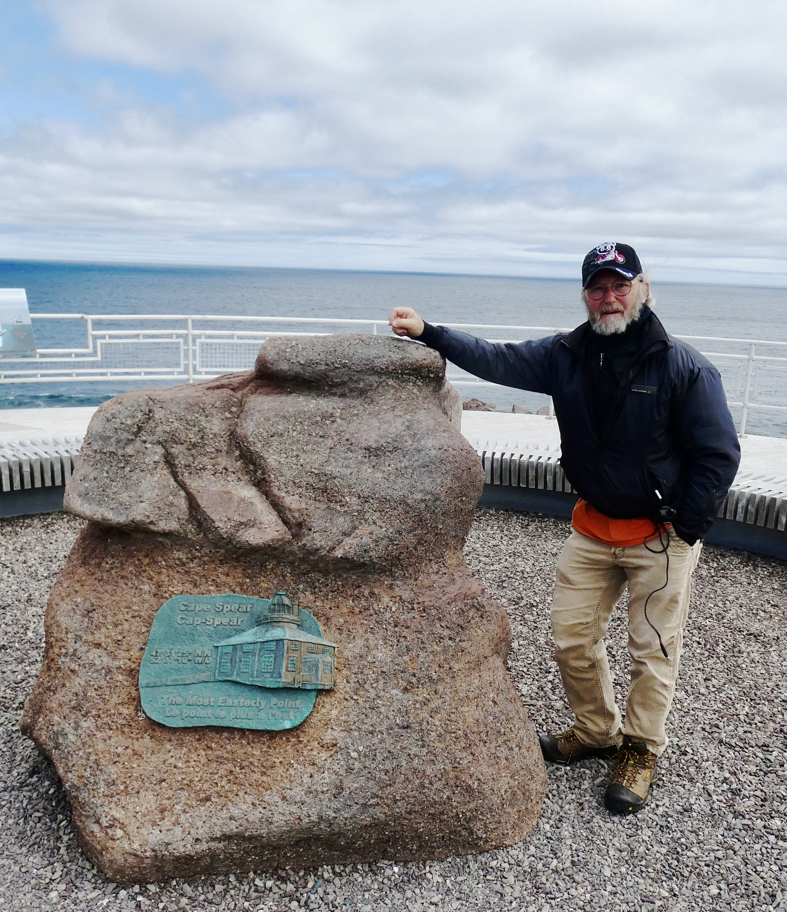
Our first stop this morning was Cape Spear, the eastern-most point in Newfoundland and, in fact, in North America. Go east from that point and the first land you’ll see is Ireland, from where the ancestors of many Newfoundlanders emigrated. Cape Spear has several interesting historical claims, including the oldest lighthouse in Canada and an important military position during WWII. It was the first line of defense for the crucial St John’s Harbor, from which thousands of troops and tons of supplies were shipped to England and the European theater. Two massive gun emplacements are still there for visitors to see, wander through and learn from the exhibits placed there by the Canadian government.
Cape Spear also boasts two light houses, one put in service in 1957 and still in use and the other built in the 1830s and now an historic landmark and teaching facility for Parks Canada visitors. I had toured the historic light house eight years ago so we took a pass on it this trip.

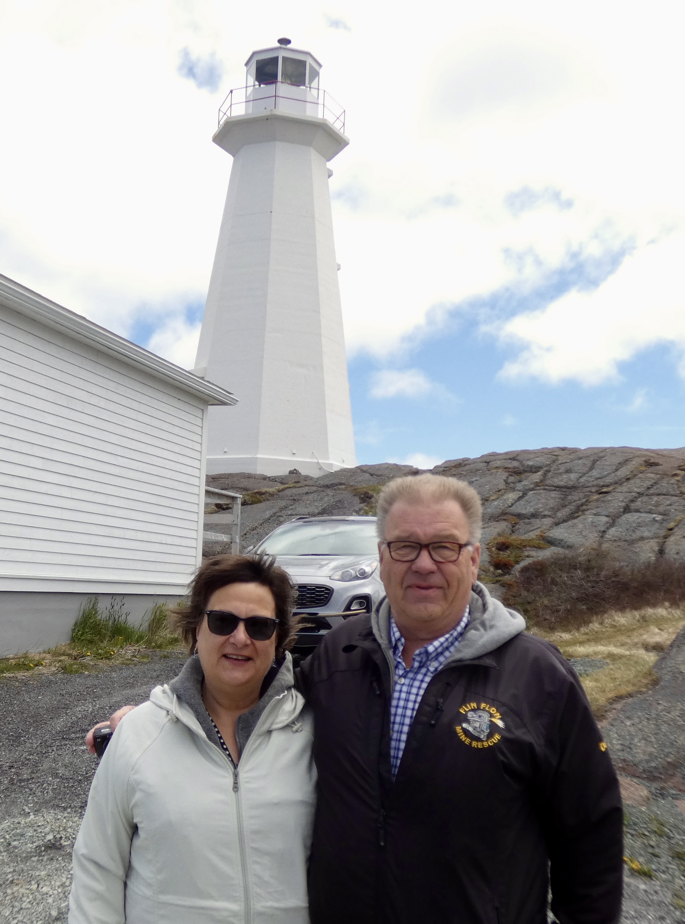
I’ve said repeatedly that Canadians, at least the ones I’ve encountered, are extraordinarily friendly people. Proof of that came again today. As Steve and I walked up the hill to the historic lighthouse, we met a couple coming down. We exchanged common hellos, but then I noticed the man had a jacket indicating he worked in mine rescue in Flin Flon, Manitoba. “We’re going to Flin Flon,” I said, and as they expressed some astonishment I told them that I had selected Flin Flon because the name intrigued me. We talked for a while about Flin Flon, mining, weather, flooding, road conditions, scarcity of gas on the road and other topics that popped up. We may get a chance to see them again when we overnight in Flin Flon in about two weeks. I hope so. They’re nice folks. But then again, they’re Canadian.

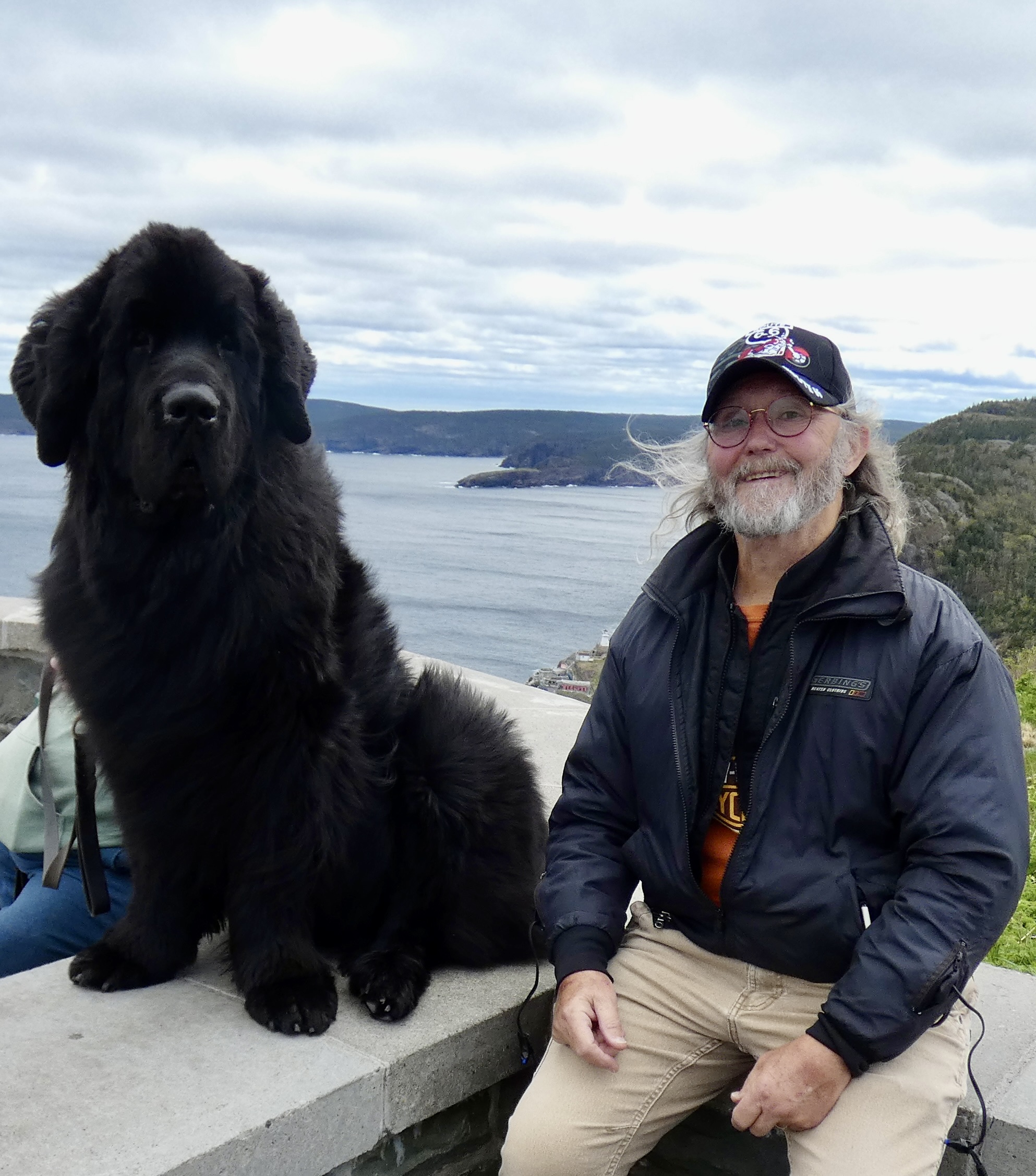
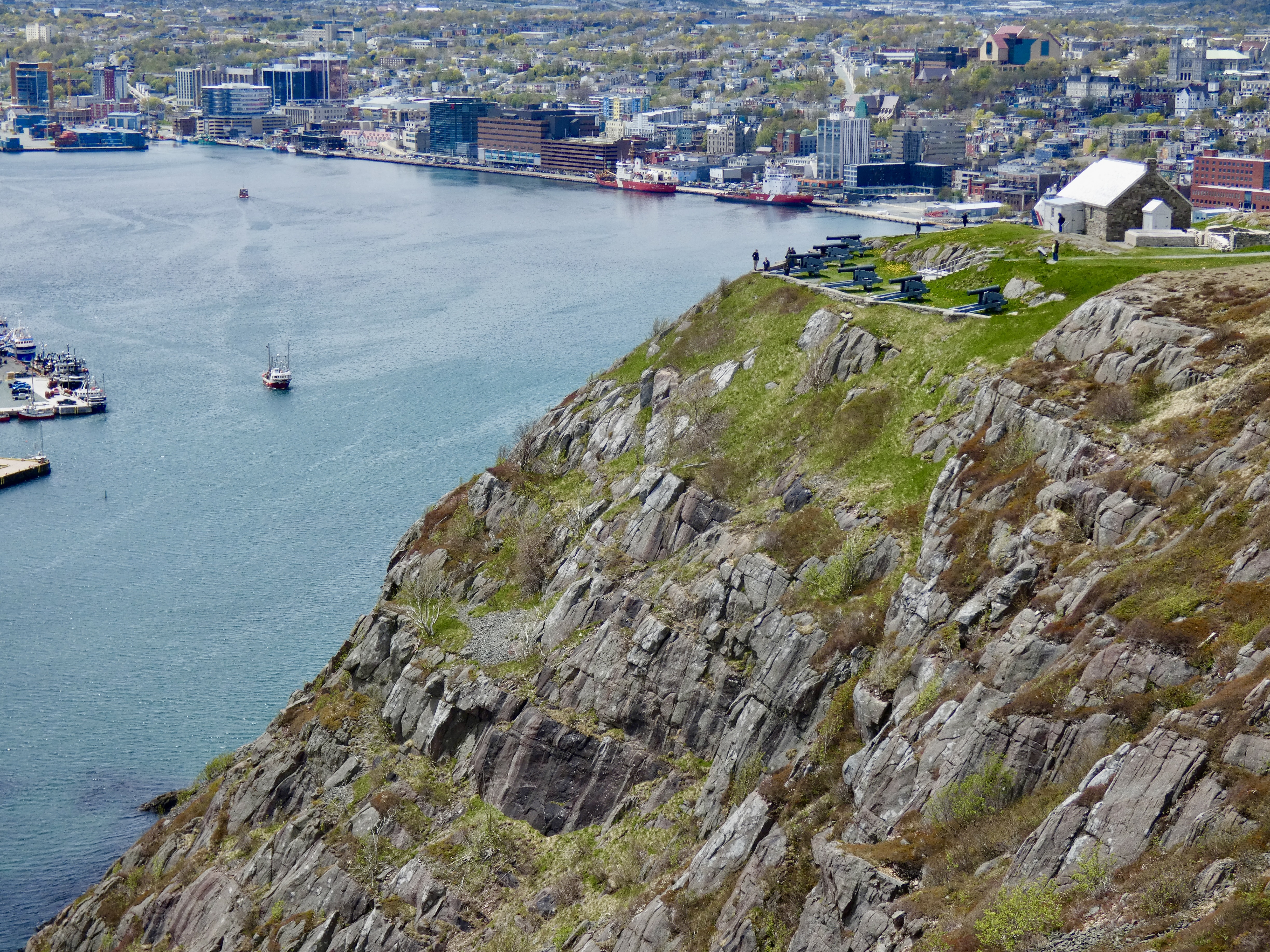
Our next stop was back in St. John’s where we visited historic Cabot Tower, located on prominent Signal Hill situated between the ocean and the town, and overlooking the narrows that lead to St. John’s significant harbor. Signal Hill has been important for centuries as a place from which to see ships well at sea and to defend the harbor against invaders by easily lobbing cannon fire onto enemy ships that dared to attack. Cabot Tower was built between 1898 and 1900 to commemorate Queen Victoria’s Diamond Jubilee and the 400th anniversary of John Cabot’s (aka Giovanni Caboto) discovery of the New Found Land. Signal Hill is also historically significant because there in 1901 Marconi first demonstrated that wireless signals could be sent from Europe to America, thanks to the presence of the then unknown ionosphere that allows radio waves to be reflected back to earth. Undersea cables would no longer be needed to communicate between continents and the world began to shrink.

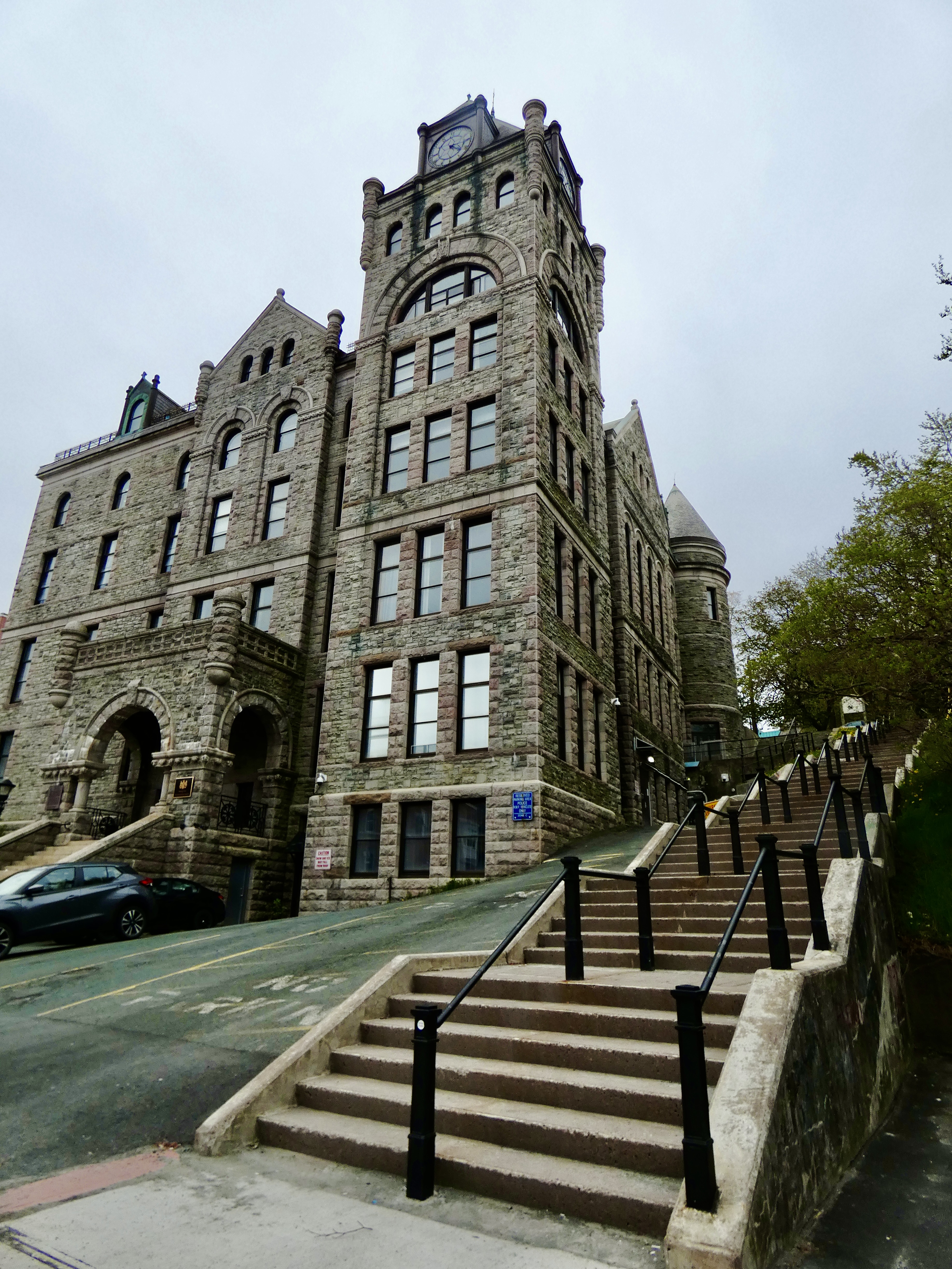
In the afternoon I did what I hadn’t done eight years ago: walk around the downtown area. Four streets stretching about eight blocks constitute much of downtown St. John’s, and that’s what we explored. Many of the stores and shops cater to a strong tourist crowd and plenty of pubs and restaurants lined all four streets. But there were also substantial commercial and government buildings in the same district, including the impressive Newfoundland Supreme Court Building, constructed more than 100 years ago as a symbol of government power and social stability.
Near the waterfront was the small but powerful Harborside Park that has long been a center of activity for the city. Benches lined gravel walks, plaques honored the living and the dead, a massive sculpture gave lasting tribute to the soldiers, sailors, fishermen and foresters who sacrificed for Newfoundland and for St. John’s in all the wars of the 19th and 20th century. They even paid tribute to two of Newfoundland’s greatest canine contributions with two excellently crafted statues: Newfoundlands (one of whom I met today) and Labrador Retrievers (one of whom used to live with us).


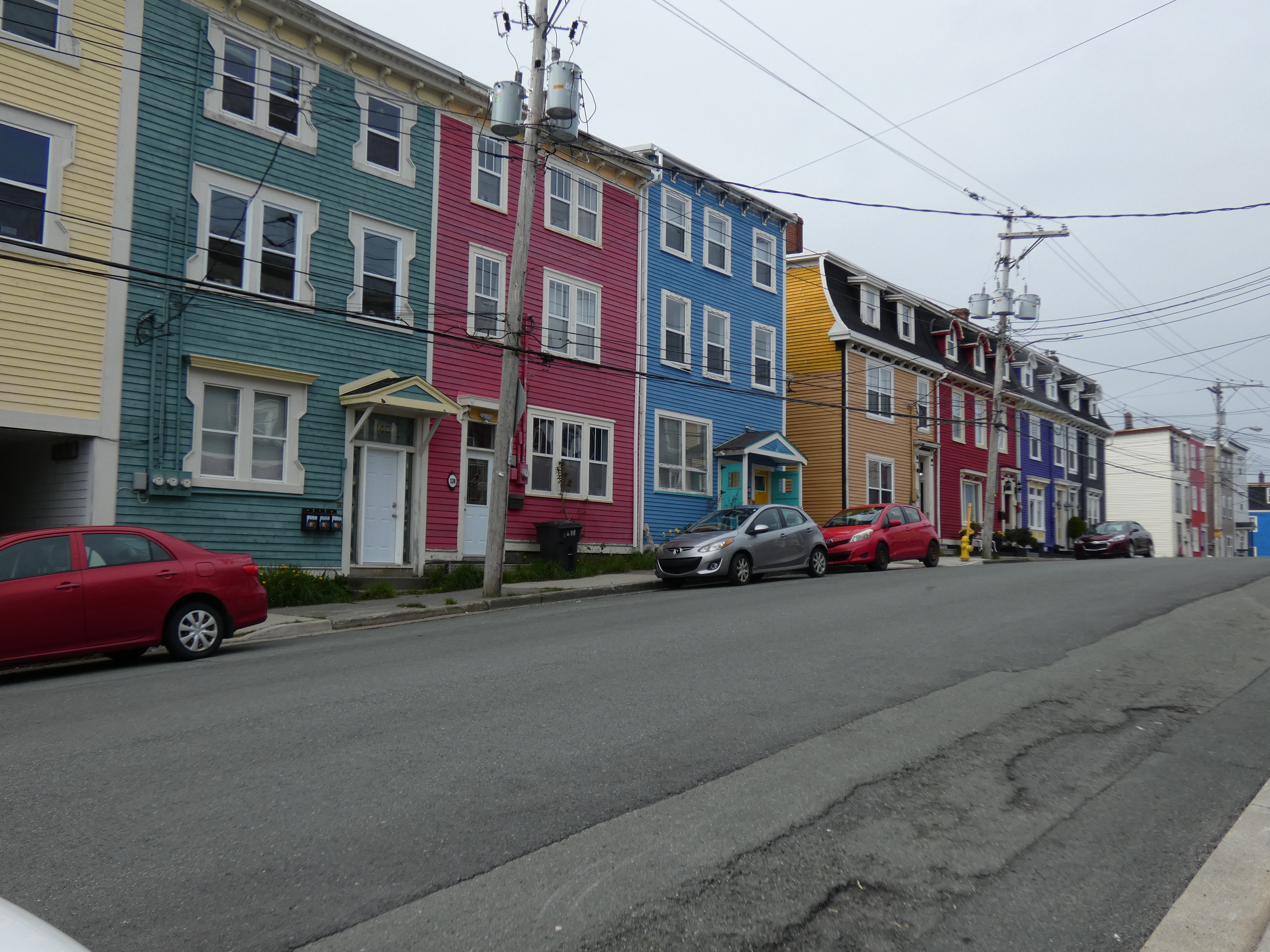
But the most commonly photographed buildings have to be the residential “jelly bean” houses, so named for their brightly colored facades. Vibrant yellows, blues, greens reds and all the colors in-between set off by starkly white or dark colored trim make them a true symbol of St. John’s unique character. Even new buildings on the edges of town have taken on the same flavor and it’s hard not to appreciate the effort so many home and building owners put into personalizing their property.
This evening, we went to O’Reilly’s on George Street on the recommendation of the hotel staff, hoping for more good food and some Celtic music. We ate large again, and a couple of local stouts went down well. But we discovered that the real Newfoundland-Irish musicians don’t start playing until 10:30 or 11:00, and we have to be on the road early tomorrow so we called it a night before the music I hoped to hear even started. Nevertheless, I enjoyed the music we heard, even if it was a little heavy on country music again.

It’s late, and tomorrow is a long day on the road. If I find additional pictures tomorrow night that I should have posted tonight, I’ll add them to tomorrow’s blog.

Beautiful area and always enjoy the historical lessons! Thanks and ride safe!
Good day to rest. Long day today. Enjoying following along.
Ride Safe.
Sorry your first few days were rainy and cold. Wanted to let you know about Ray Mackey. He is a photographer from Newfoundland. His blog on Facebook is amazing. We follow him all the time. You will appreciate his work. Wish you had more time to explore the area. Stay safe and stay well. 👍