
Day 20 CCR: More water, but no rain
The weather gods are pleased with me and have given me three days in a row without rain. Not even enough of a threat to don a rain suit, “just in case.” We will almost certainly leave Dryden in a light rain tomorrow morning, but 225 miles later in Winnepeg, Manitoba, the sun should be shining when we pull into the Harley-Davidson dealer for routine oil changes.
My trip odometer, which I zeroed out in my driveway 20 days ago, rolled past 5,500 miles today. If my trip estimate is correct, I should be near the halfway point of the CCR, in terms of both days and miles. So far so good. We’ve gone through six provinces and three time zones. I’ve seen awesome scenery (when it hasn’t been raining), and, as I expected, have met amazingly friendly, incredibly helpful, wonderfully courteous Canadians throughout the journey. One other item worth noting today: I paid $8.00 USD per gallon for premium gas. Admittedly, I was in the boondocks in Ignace, Ontario, and it was 50 miles in either direction to find another station. The fuel was premium, but $8? The good news is that my bike’s powerful Milwaukee Eight engine is scoring 53 mpg, so that eases the pain a little. Steve’s bike is getting about 42-43 mpg, so his pump pain is more palpable.
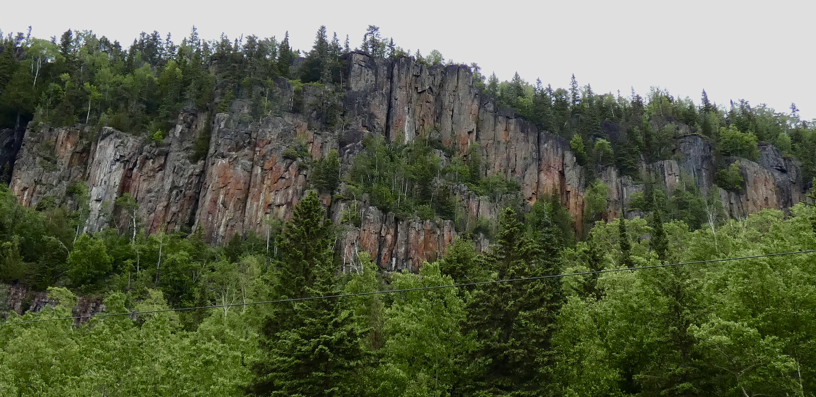
The day began with low clouds and fog along Lake Superior, so while I had views of the lake like I did yesterday, the lack of sun made for boring pictures where sky and water run together in a featureless gray. So instead of posting pictures similar to those I took yesterday with better light, I’ll post some shots of the land bordering the lake. If I were a geologist instead of an historian, I could give a much better description of the land we’ve been riding across for the last few days. But I’ll pass on what I know. Two-thirds of Ontario is made up of the Canadian Shield, which means it has very, very old (i.e. precambrian, older than 4 billion years), very hard rocks–e.g. granite, gneiss–at or near the surface. During the last Ice Age, the massive ice sheet that covered all of Canada and much of the northern United States, scraped away most of the surface rocks, leaving the oldest–the shield–at the surface.
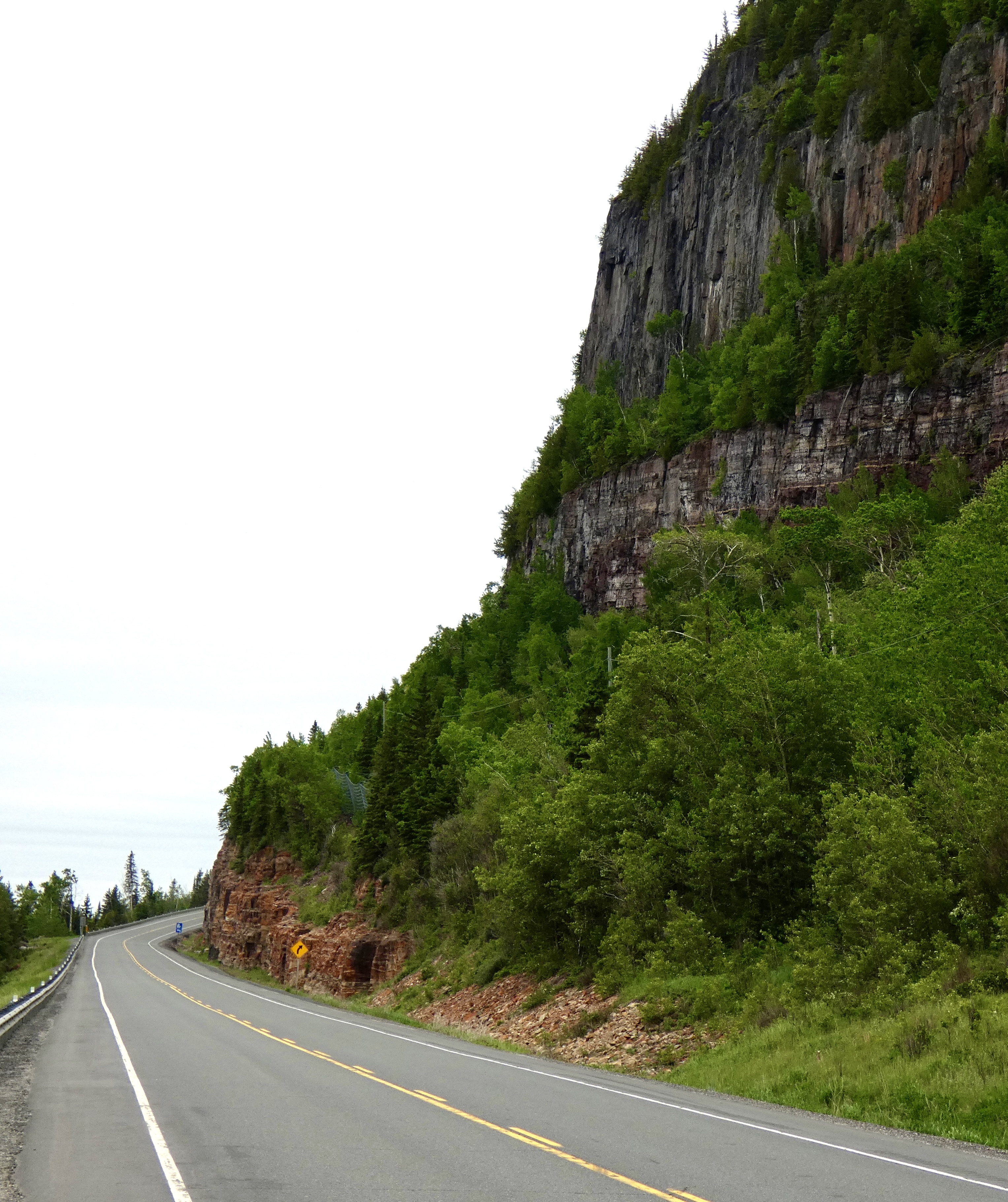
It’s impossible to ride through the area and not see huge, building-size rocks everywhere. That same rocky landscape is also responsible for the thousands of lakes I’ve mentioned before. Ontario doesn’t have any real mountains but is nevertheless hilly where we’re riding, a combination of orogeny (mountain building via plate tectonics) and glacial scraping. OK. Enough amateur geology. Here are a couple pictures to show what I’m clumsily trying to say:
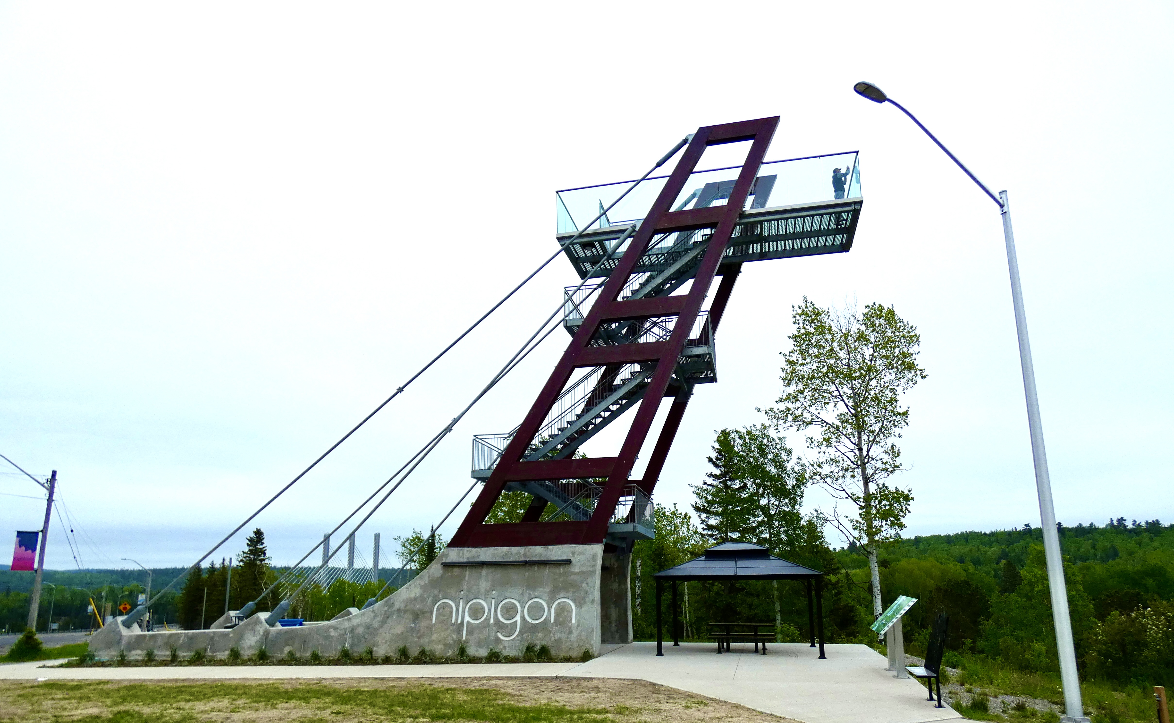
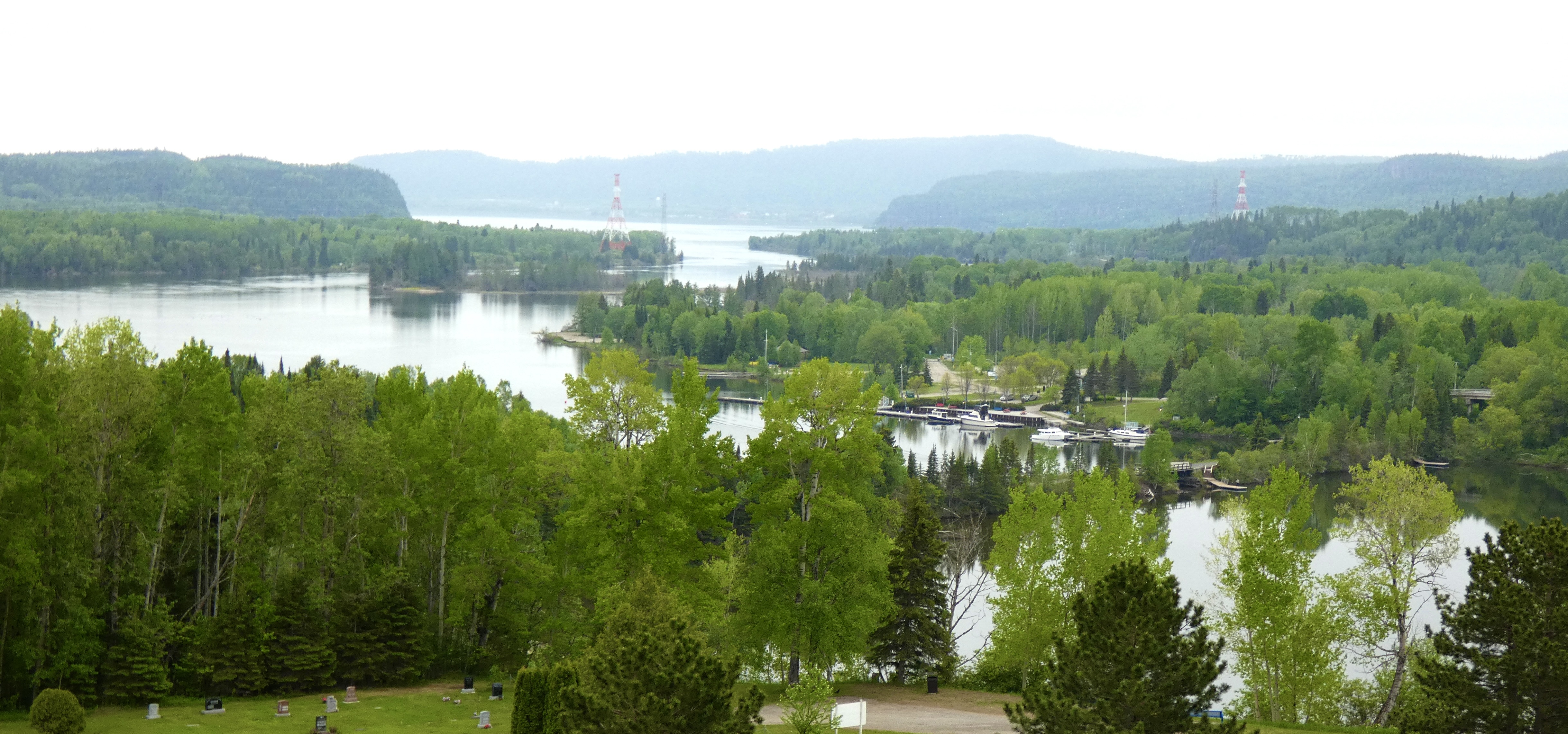
Because it’s hard to stop on the side of a busy highway to take pictures, I look for and try to stop at spots designated as “Scenic Views.” As we were riding into Nipigon near the end of our trip along Lake Superior, I saw not just a site with a scenic view, but with a huge tower designed to give me a better view. I made a quick left into the parking area, grabbed my camera, and started climbing. The view was definitely better from the top of the tower than from the ground down below, but the continued hazy fog blocked some of the long-range view from the top.
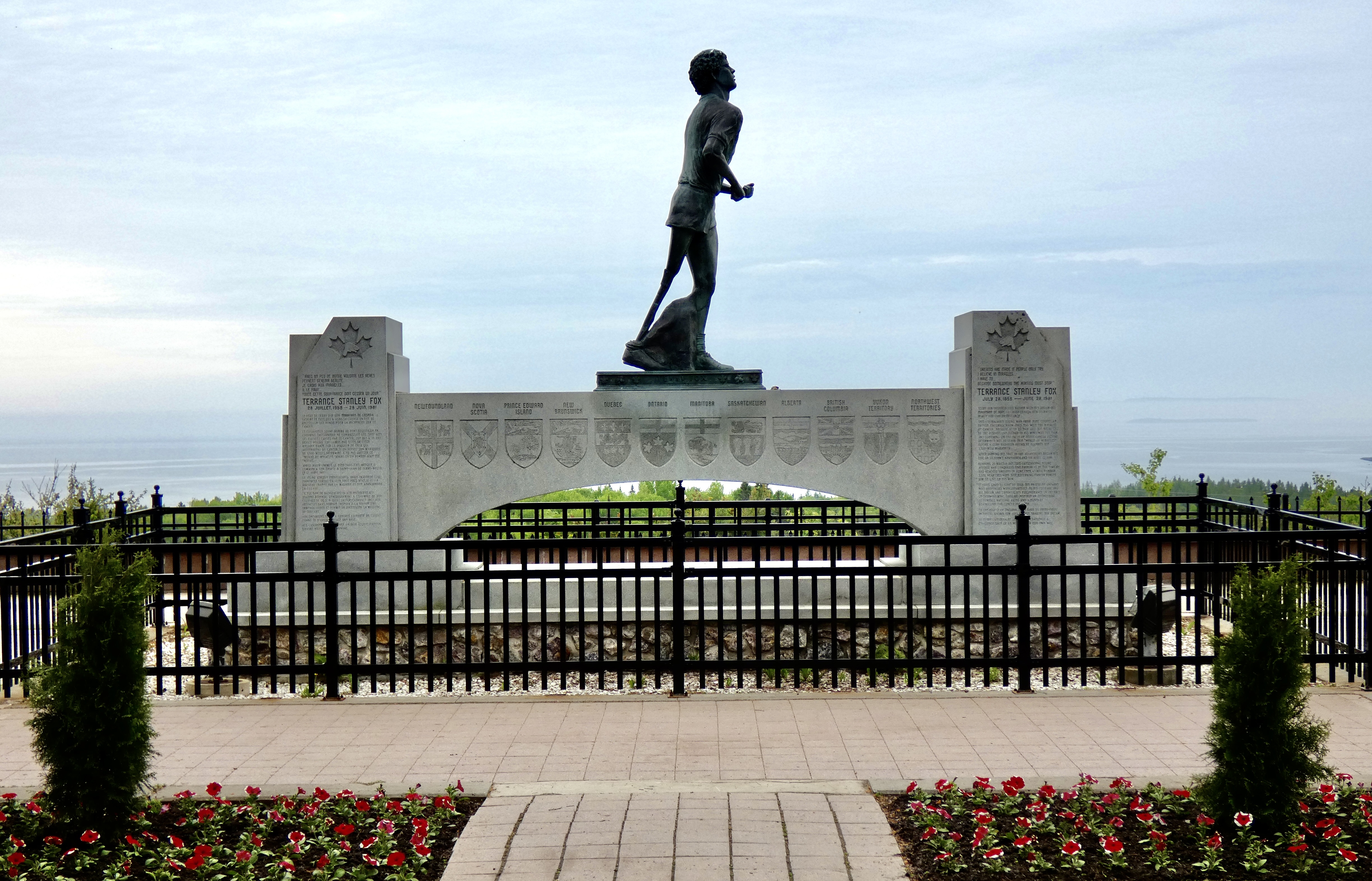
Back on the road following my tower descent, we continued our westward path. As I cruised along near Thunder Bay, a highway sign announced the “Terry Fox Overlook and Memorial,” which was not surprising since we had been traveling on a section of the Trans Canada Highway designated as the Terry Fox Courage Highway. I remembered Terry Fox from the early 1980s as someone running to raise awareness about cancer. But I admit my recollection was more than a little hazy. I stopped for a view of Lake Superior. I left with a profound addition to my store of knowledge.
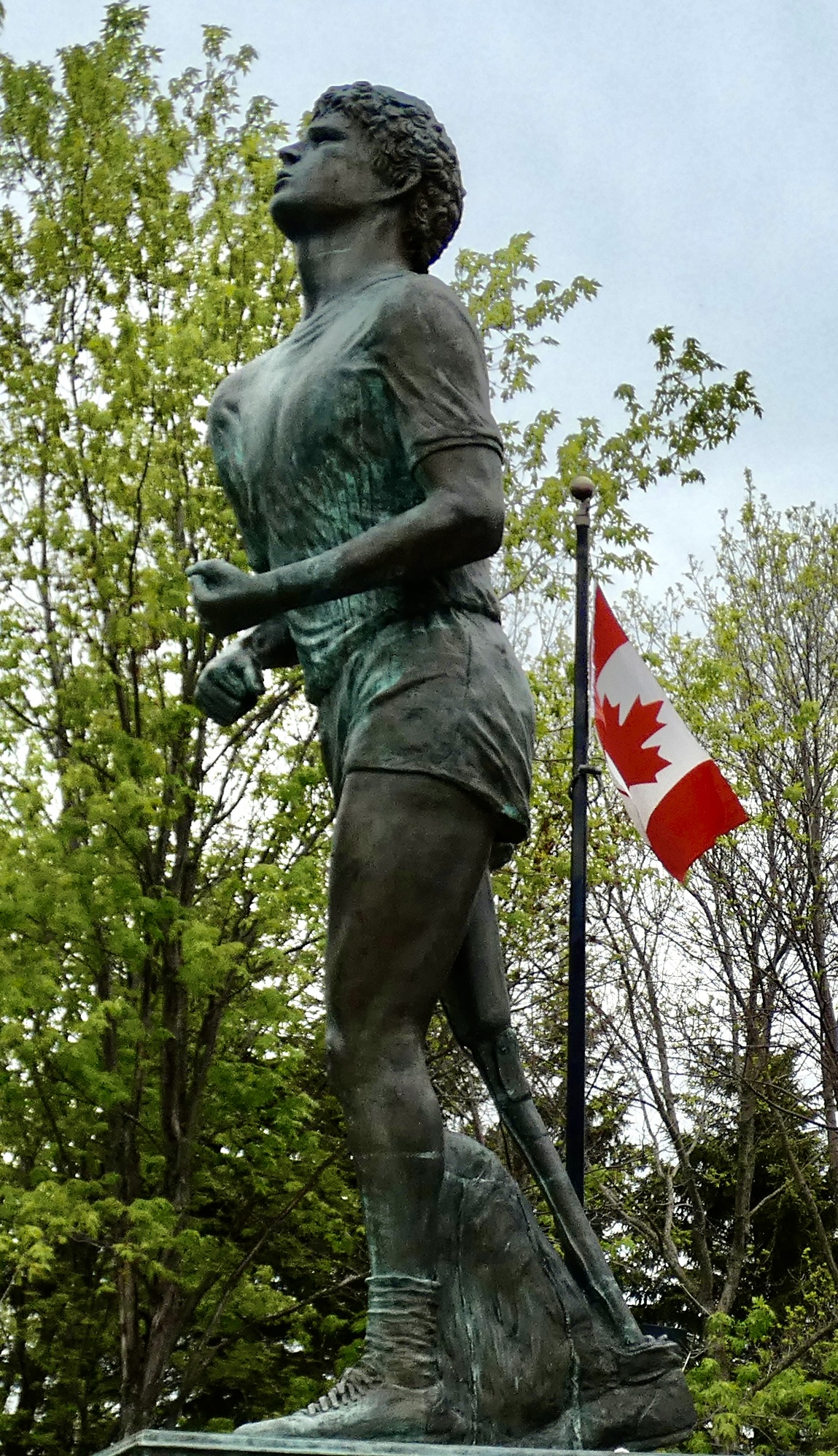
At age 18, Terry Fox was diagnosed with bone cancer, and surgeons amputated his right leg above the knee. Determined to help fight the disease that cost him his leg by raising money for research, he set a goal of running across Canada, 26 miles a day on a prosthetic leg, to bring awareness to a cause he knew so well. His run enthralled and motivated Canadians across the country. He ran a marathon every day in all the provinces through which I’ve travelled the past three weeks. But his cancer returned, this time to his lungs, and his run ended just outside Thunder Bay. He died at age 22, but his fund-raising legacy and his legacy of courage continues to inspire Canadians and people around the world. If you want to learn more about this incredible feat and the young man who performed it, click here.
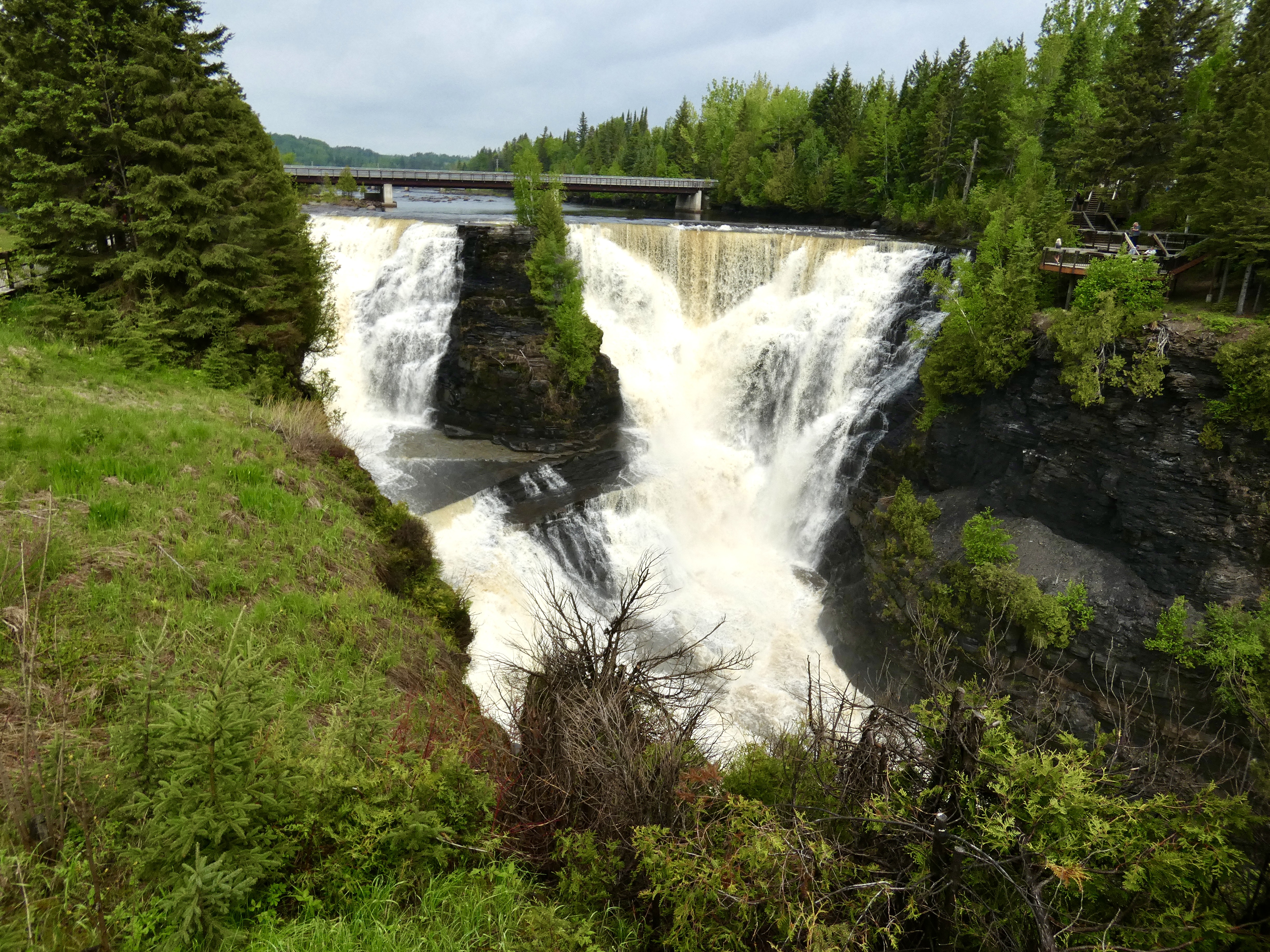
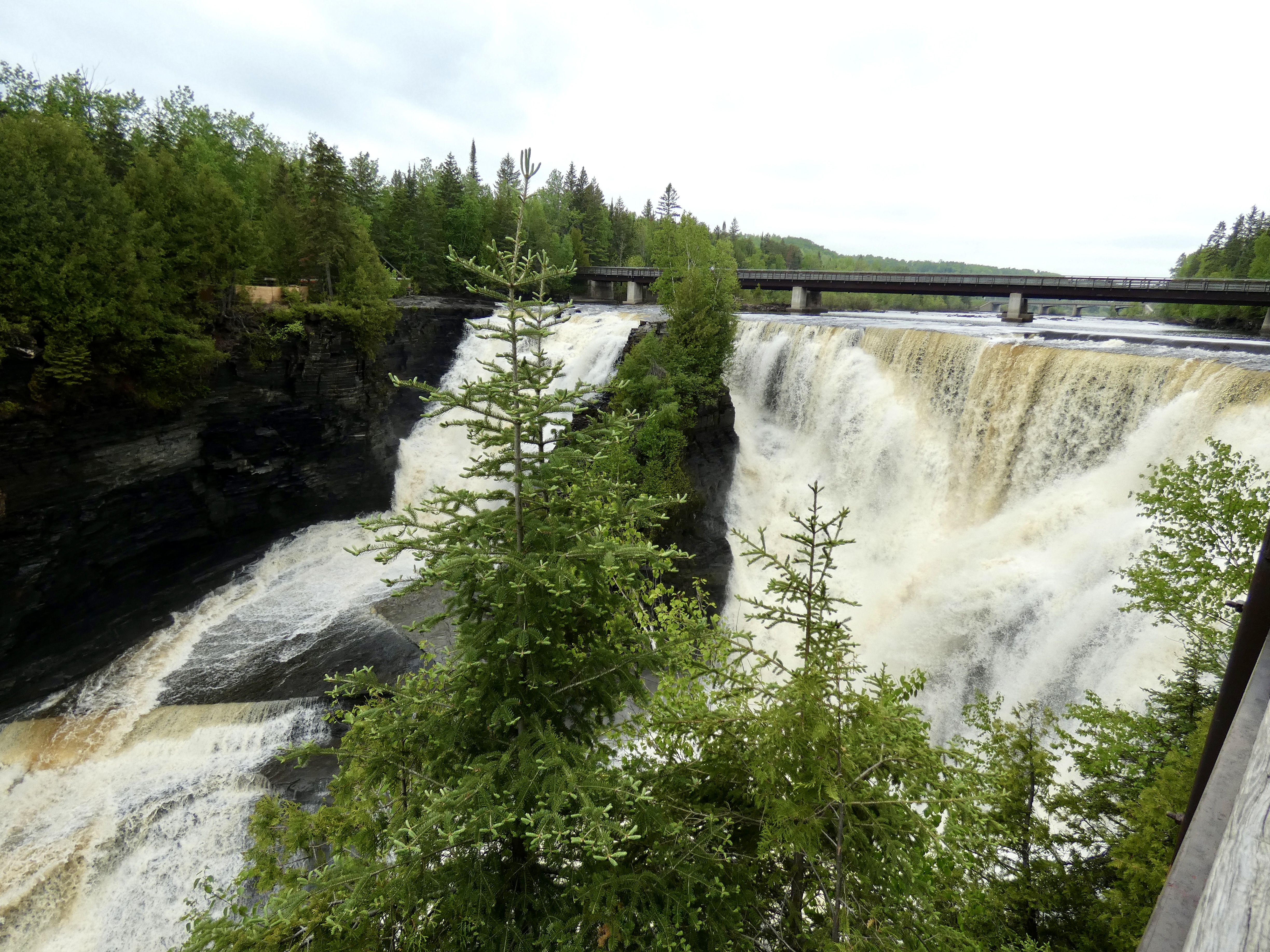
Inside the visitor center at the Terry Fox Lookout, I struck up a conversation with one of the staff who, as it turned out, was another one of those “amazingly friendly, incredibly helpful, wonderfully courteous Canadians” I mentioned earlier. When she found out which direction we were going and how limited our time was, she said there was one place I should visit before leaving the area: Kakabeka Falls, a short distance west of Thunder Bay that required a slight detour.
So we detoured. To Kakabeka Falls Regional Park. I paid the $5.25 parking fee, and since we could both park in one parking spot, the park employee, an “amazingly friendly, incredibly helpful, wonderfully courteous Canadian,” let Steve pass through without paying. The second highest falls in Ontario, water plunges over Kakabeka Falls about 120 feet from the lip of the falls to the canyon below. A footbridge a short distance upriver from the falls gave us a chance to see it and the canyon from both sides of the Kaministiqua River. We spent about an hour taking in this watery spectacle before heading west again on the TCH.


Tomorrow, as we head to Winnipeg, we will cross into our seventh province–Manitoba–and spend four days there as we see sights in the capital and then head north for some small town sights.

Glad the weather held off the rain again. Beautiful water fall and thanks to all the helpful Canadians you have encountered. Ride safe.
The guardian picture took me by surprise. Big Grin! The detour was well worth the time.
Ride Safe