
MHT Day 14: Back to the 1805 Missouri Route
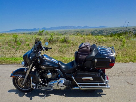
A leisurely beginning today in Billings had me on the road about 9 a.m. and for three hours I had a pleasant ride northward through gigantic fields of hay, mixed prairie grasslands, some hill country and finally next to some small mountains, all under a beautiful blue sky. Then it got hot, and the rest of the afternoon was in the 90s and the thermometer stood at 98 degrees when I parked the bike for the day in Havre, Montana.
As I rode down the black asphalt strip with my booted feet up and the cruise control on, every once in a while I spotted a lone pronghorn or a small group of them grazing near the road. The pronghorn are in North Dakota as well, but I didn’t see any during my passage through there. The men of the Expedition had never seen pronghorns and referred to them throughout their journey as goats. Lewis the naturalist made sure he preserved skins, horns and bones to take back to the scientists in the states to examine.
The mountains in the background are the “Little Rocky Mountains” and were a place of spiritual significance for Natives for hundreds of years before Lewis and Clark paddled past them.
When the Expedition first travelled west across what is now Missouri, trees were in abundance, but the further west they went the fewer trees they would see. By the time they reached North Dakota and, especially, Montana, the only trees to be seen would be those along the Missouri River. When they climbed the river banks and stood atop any of the nearby hills for a long-range look at the vast, unexplored county, their camps on the banks of the Missouri under cottonwoods and willows must have seemed like an oasis in a desert, and in some ways it was.
When I reached the Missouri today on my way north, I crossed it at a point two miles downriver from where the Corps of Discovery camped May 24, 1805, about six weeks after they left the Mandan villages. That day Lewis described the country they were going through:
The country high and broken, a considerable portion of black rock and brown sandy rock appear in the faces of the hills; the tops of the hills covered with scattering pine spruce and dwarf cedar; the soil poor and sterile, sandy near the tops of the hills, the whole producing but little grass; the narrow bottoms of the Missouri producing little else but Hysop or southern wood and the pulpy leafed thorn . . . . game is becoming more scarce, particularly beaver, of which we have seen but few for several days the beaver appears to keep pace with the timber as it declines in quantity they also become more scarce.
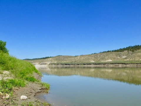
This section of the Missouri is far enough away from the first of the six lower dams that it retains the character of the river that Lewis and Clark saw. I’ve had few opportunities to see it as they saw it, and I stood on shore for several minutes imagining paddling the dugouts or pulling with ropes the larger boats. The water was no doubt clearer 200 years ago before farming, ranching and upriver effluent changed its color.
Upriver, about 30 miles from where I crossed today, is an area known as the Upper Missouri River Breaks National Monument, where the river is accessible only by watercraft. It is the least changed part of the Missouri River since 1805. I had planned to canoe that section of the river for three days with river guides and an historian well-versed in the Lewis and Clark adventure, camping along the way on the same sites Lewis and Clark camped. But when I began to trim this trip down, that outing was cut from the itinerary. Maybe someday I’ll come back and do the canoe trip.
I had one other planned stop today that is only indirectly related to the Lewis and Clark Expedition: The Bear Paw Battlefield, part of the Nez Perce National Historic Park. I have to jump ahead chronologically a little for this part of the blog to make sense.
In the fall of 1805, the Nez Perce in present day Idaho rescued a starving Corps of Discovery after a harrowing, 11-day journey across the Bitterroot Mountains. The Nez Perce also treated them well on the 1806 return trip. So how did our government reward their treatment of the Corps? After the U.S. gained control of the Oregon Territory in 1848, the government began clearing the way for white settlement and gold miners by “negotiating” treaties with the Nez Perce and other tribes that took more and more of their traditional hunting grounds until they were left with only 5% of their original ancestral land. Many Nez Perce, especially younger warriors, refused to go along with this land grab and war broke out in 1877.
On this site in northern Montana the fleeing Nez Perce surrendered and the Nez Perce War of 1877 ended.
Many Nez Perce decided to flee the reservation and seek refuge in Canada. For 126 days covering more than 1100 miles, the American Army chased and sometimes fought with the escaping band. 40 miles south of the Canadian Border, 400 Army troops finally caught up with the 100 Nez Perce men and 600 women and children. They attacked and besieged the camp for seven days before Chief Joseph finally surrendered to General Miles on October 6, 1877, with these words:
I am tired of fighting. Our chiefs are killed. Looking Glass is dead. Tulhuulhulsuit is dead. The old men are all dead. It is the young men who say, “Yes” or “No”. He who led the young men is dead. It is cold, and we have no blankets. The little children are freezing to death. My people, some of them, have run away to the hills, and have no blankets, no food. No one knows where they are, perhaps freezing to death. I want to have time to look for my children, and see how many of them I can find. Maybe I shall find them among the dead. Hear me, my chiefs. I am tired. My heart is sick and sad. From where the sun now stands, I will fight no more forever.

This monument showing Chief Joseph surrendering to Colonel. Nelson Miles stands in mute testimony to a sad part of American history.
The Indians were marched to Oklahoma where many of them died in the following months.
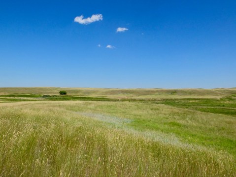
Because of the kindness shown by the Nez Perce to Lewis and Clark, I wanted to pay my respects by standing where Chief Joseph stood. When I went to the NPS-administered Bear Paw Battlefield today, I was the only person there. No tourists. No park rangers. Just me and the silent wind blowing through the tall prairie grass. I was moved by the stillness of the place where so many died and humbled by what was before me.
 My final stop of the day was in Havre, Montana, where nothing related to Lewis and Clark occurred but where my oldest granddaughter, who I had not seen in about 4 years, now lives with her husband and my great-grandson Leo. Leo is in Wisconsin with my daughter enjoying his summer of being spoiled, but I had a nice dinner with Meghan and Wakefield and enjoyed catching up.
For those readers who have expressed concern about the paucity of pie on this trip, please note that this is in front of me in the above picture:


Never knew who Chief Joseph was that I was honored to enjoy the highway named after him. Pie looks delicious! Family is always most important! Ride safe.
After reading Dee Brown’s book, ‘Bury My Heart at Wounded Knee’, in high school, I never forgot the immortal, heart wrenching words from Chief Joseph. Thanks for posting a pix of that hallowed spot of ground. The crew is enjoying your blog…no pie for us other than Little Caesars.
Dennis. That tribute to the suffering of the tribes was excellent
Too often we forget how they suffered just trying to protect their way of life. We need to take any chance we have to undo the “winner writes the history” and correct record. Upon your return let me tell my true tale of the Second Seminole War. I’ll buy the beer 😊