
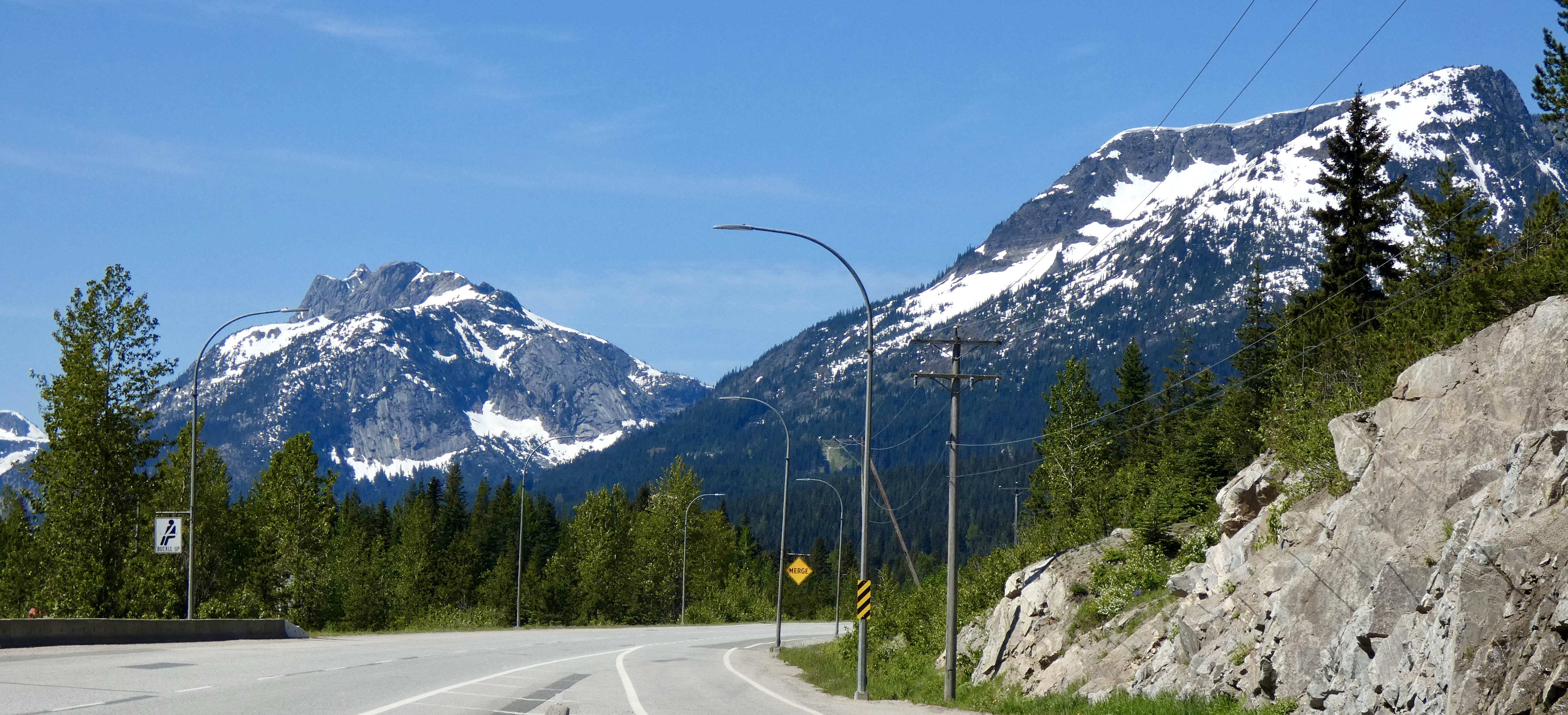
Day 34 CCR: New Ground and Some Familiar Territory
As I looked at possible routes across the western states on the way back east, one stood out because it allowed me to visit a couple sites that I missed on previous long-distance rides. In July and August 2019, as I retraced the 1803-1805 Lewis and Clark expedition, I learned about (1) the series of dams on the mighty Columbia River and (2) the history of the Nez Perce and Chief Joseph. But I missed the biggest dam of all–The Grand Coulee Dam–and I missed seeing the burial site of Chief Joseph.
Today I visited both places.
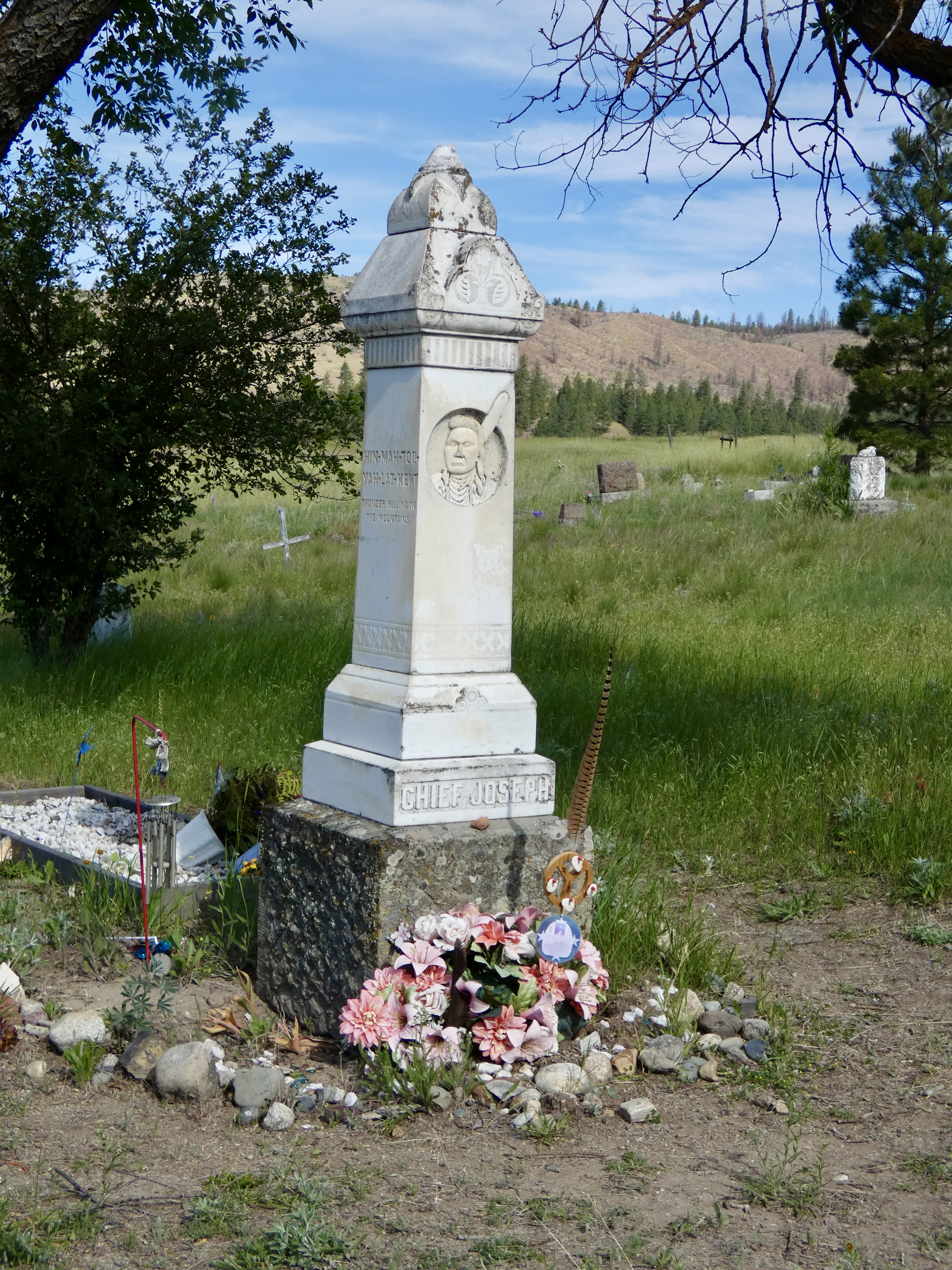
In 1877, U.S. Army troops pursued a small band of Nez Perce (aka Ni Mi Poo), led by Chief Joseph, who were trying to escape the unfair treatment and treaty obligations meted out to the descendants of the people who had saved the lives of Lewis, Clark and their men seven decades earlier. Out numbered and out gunned, Chief Joseph led his people for nearly 1,200 miles as they tried to escape to Canada. They came up 50 miles short at Bear Paws Battlefield in Montana. There, Chief Joseph surrendered with the famous words “From where the sun now stands, I will fight no more forever.” The lies and mistreatment at the hands of the U.S. government continued, though, as the group was sent to Oklahoma rather than back to Idaho as promised. Eventually Chief Joseph did get sent back west, not to his beautiful homeland in Wallowa, but to an arid reservation in Washington state where, according to a coroner, he died of a broken heart in 1904.
He was buried in the Nez Perce cemetery in Nespelem, Washington, and a small monument was erected above his grave in 1905. A trip to the site could do no more than pay respect to this courageous indigenous leader who was betrayed and suffered at the hands of the U.S. government. But pay my respects I did. And I remembered and reflected on his honor and dignity.
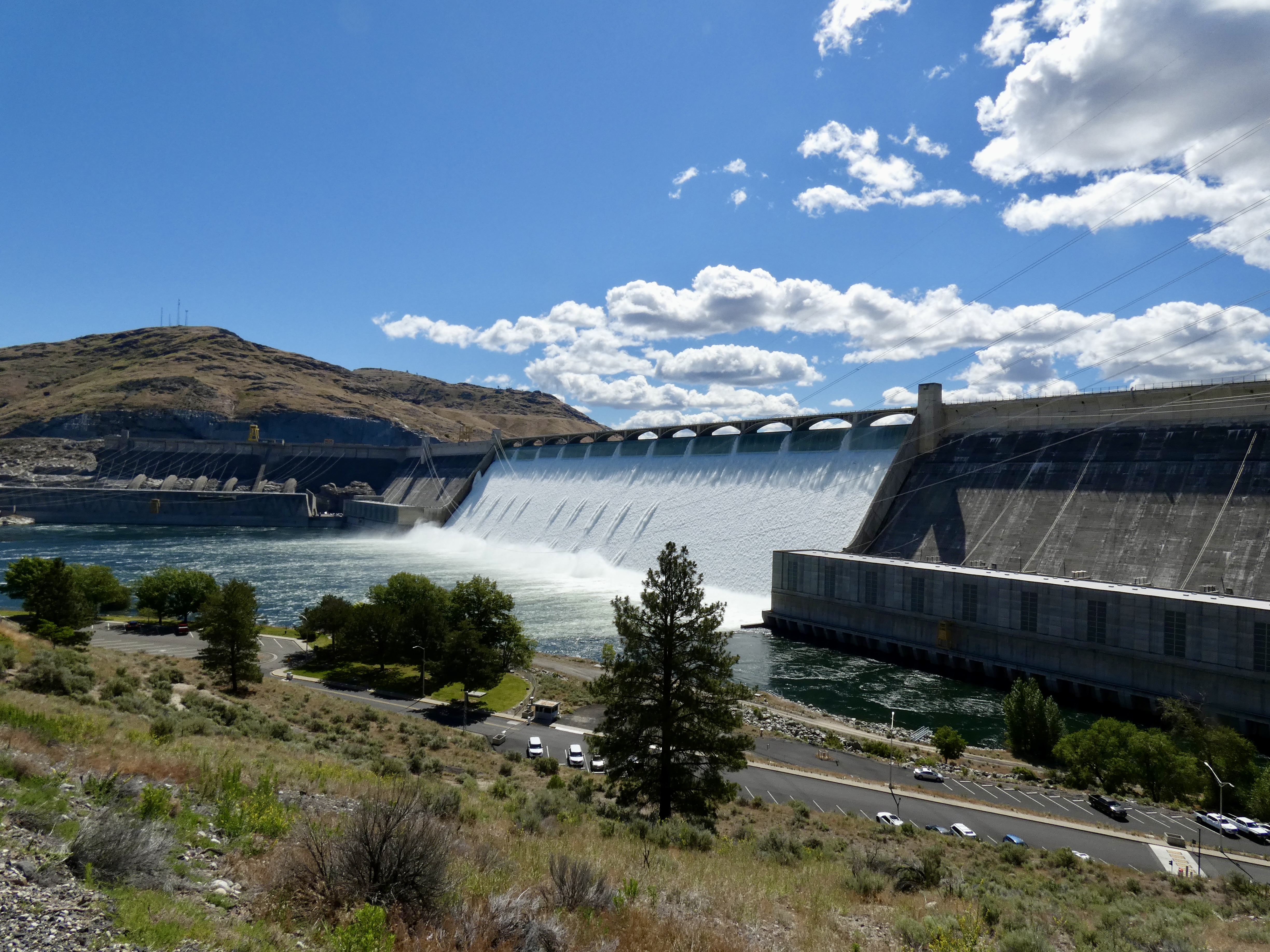
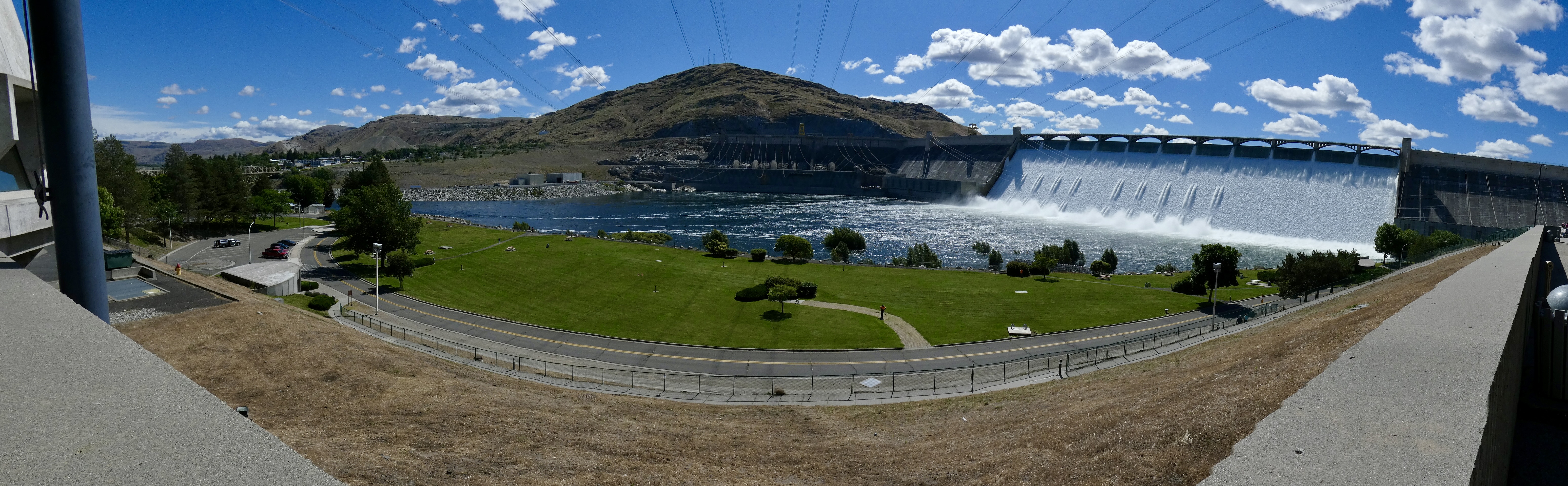
Just a few miles down the road, Grand Coulee Dam straddles the Columbia, creating Lake Roosevelt, which stretches nearly 150 miles to the Canadian border. The dam’s construction was begun in 1933, during the height of the Depression, and thousands of workers and their families moved to the area into new towns built just for them. By the time the US entered WWII in 1941, Grand Coulee Dam was producing power for ship building and aircraft building on the west coast. But not until after the war ended was the dam finished to be used for irrigation as well as power, turning a desert in southeastern Washington into fertile farmland.
When completed, the dam was the largest concrete structure in the world. Additions to the structure in the 1970s made it the largest power plant in the United States. The dam is 550 feet high and a mile wide. In short, it’s an impressive piece of engineering, similar in scope to NASA’s space program and well worth the two-hour side trip.
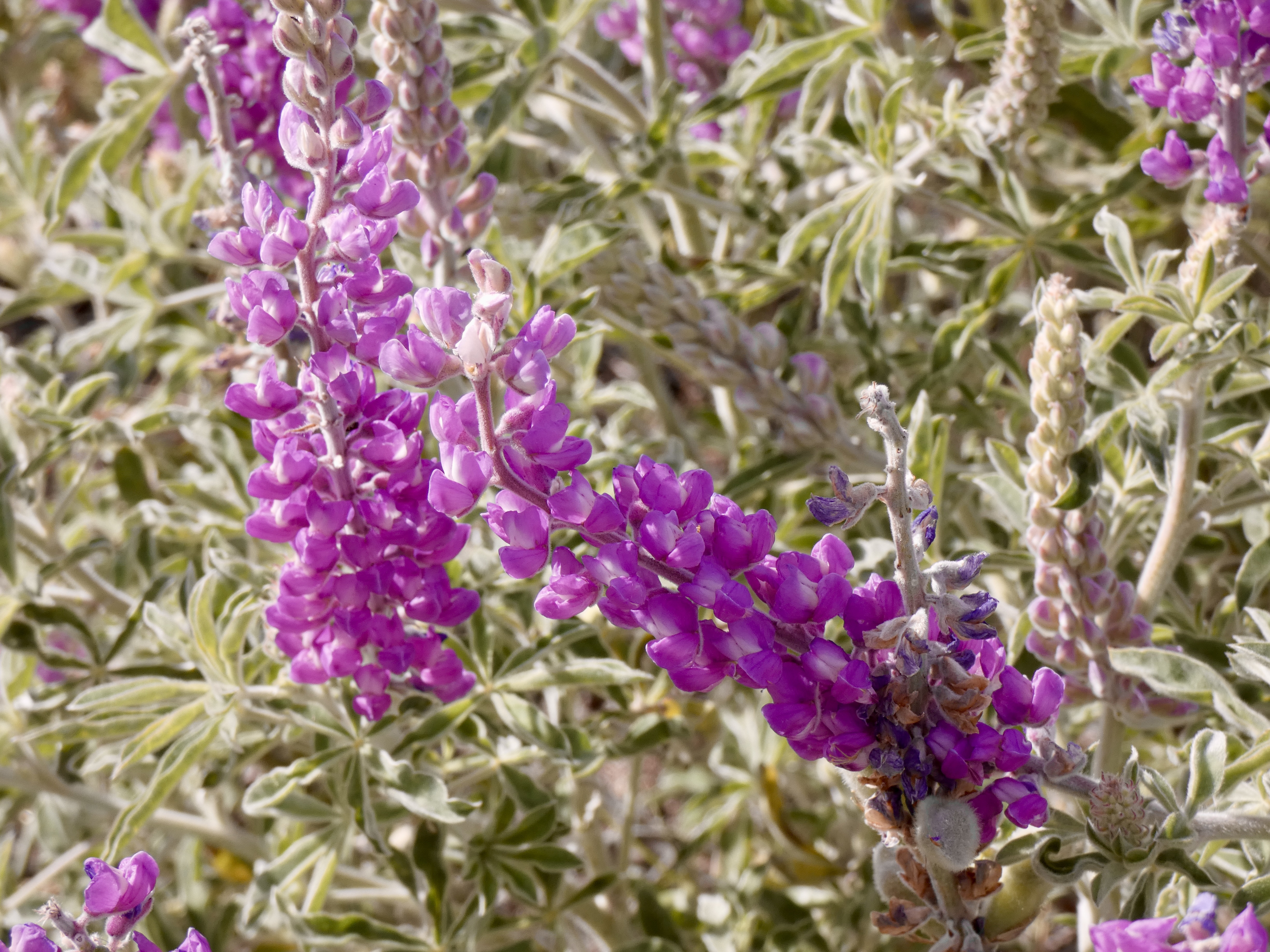
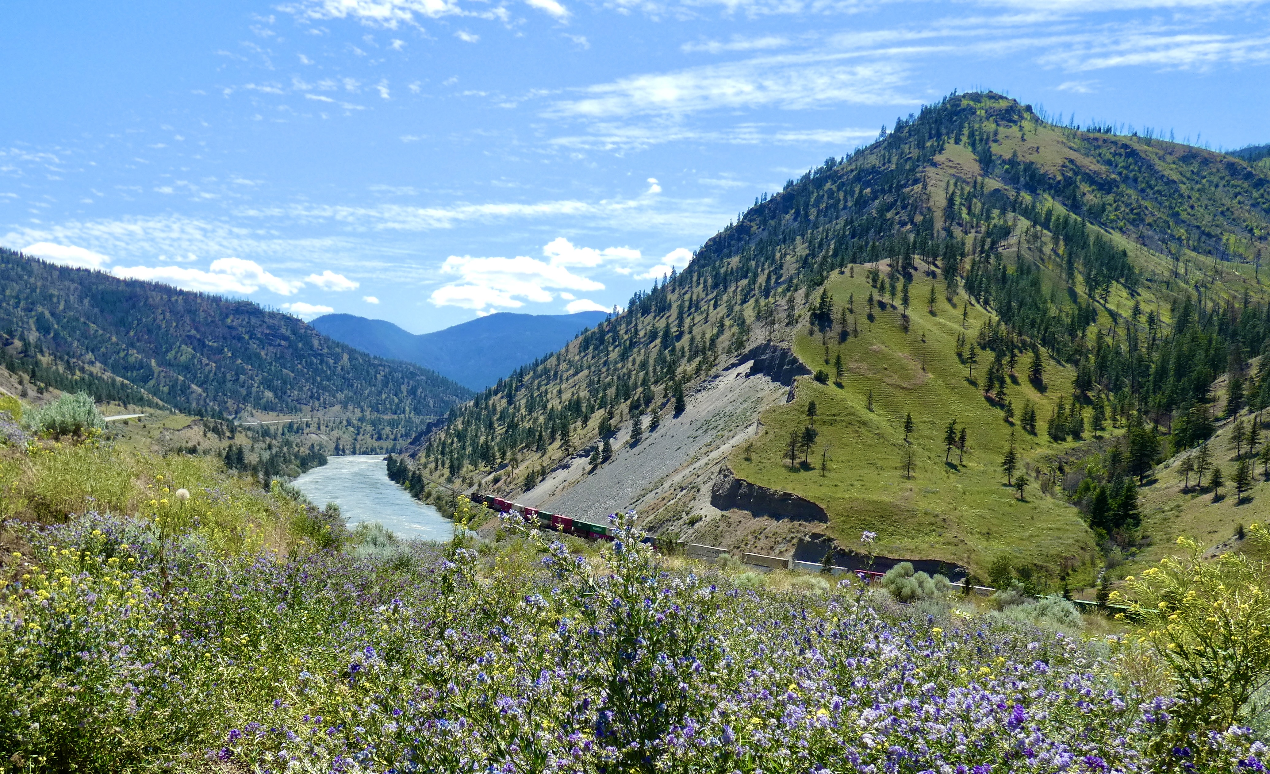
After we left the dam, we headed south and east, through arid ranch county which became fertile farm land covered with alfalfa, grains, and canola fields. Where there wasn’t a crop, the hillsides were often covered with purple flowers growing on a sage-colored plant. My trusty plant identification app declared it to be Silky Lupine, and it did have some similarities to the Lupine that grew everywhere in Prince Edward Island and New Brunswick. Brown soil, green and yellow fields, purple flowers and blue skies. What a palette.

Tonight we’re in Orofino, Idaho, a place I’ve stayed at twice before. Tomorrow we motor over the Bitterroot Mountains that nearly killed Lewis, Clark, et al, but will provide us with a terrific ride into Montana.
Day 33 CCR: Leaving Canada, the North Cascades and a Hitchhiker
The ride across Canada has officially ended now that the border crossing back into the USA has been accomplished. This was a busy day, beginning with an early start, a ferry ride, a border crossing, a trip through the North Cascades, and picking up a hitchhiker.
(Please click on any picture to enlarge it)
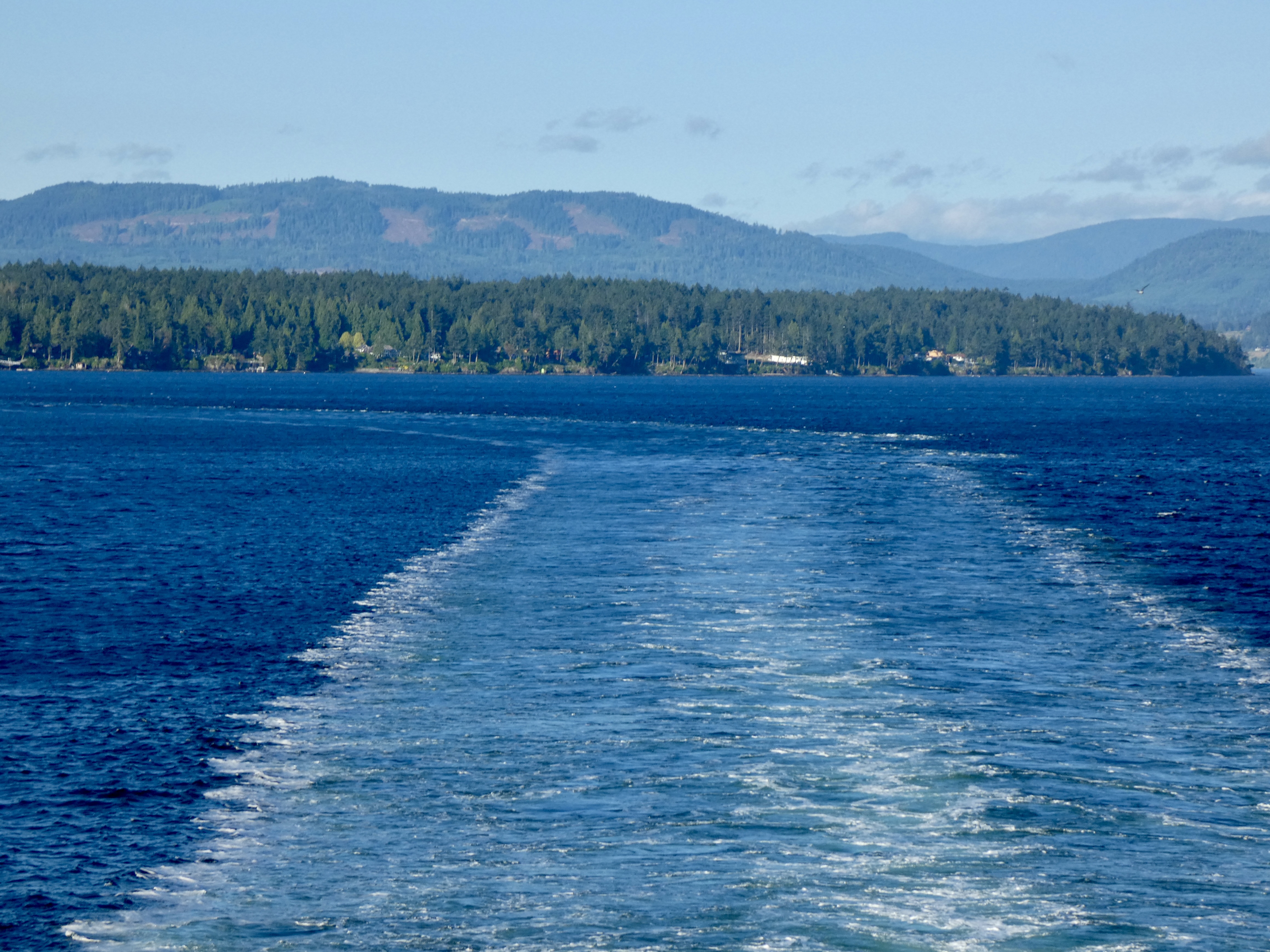
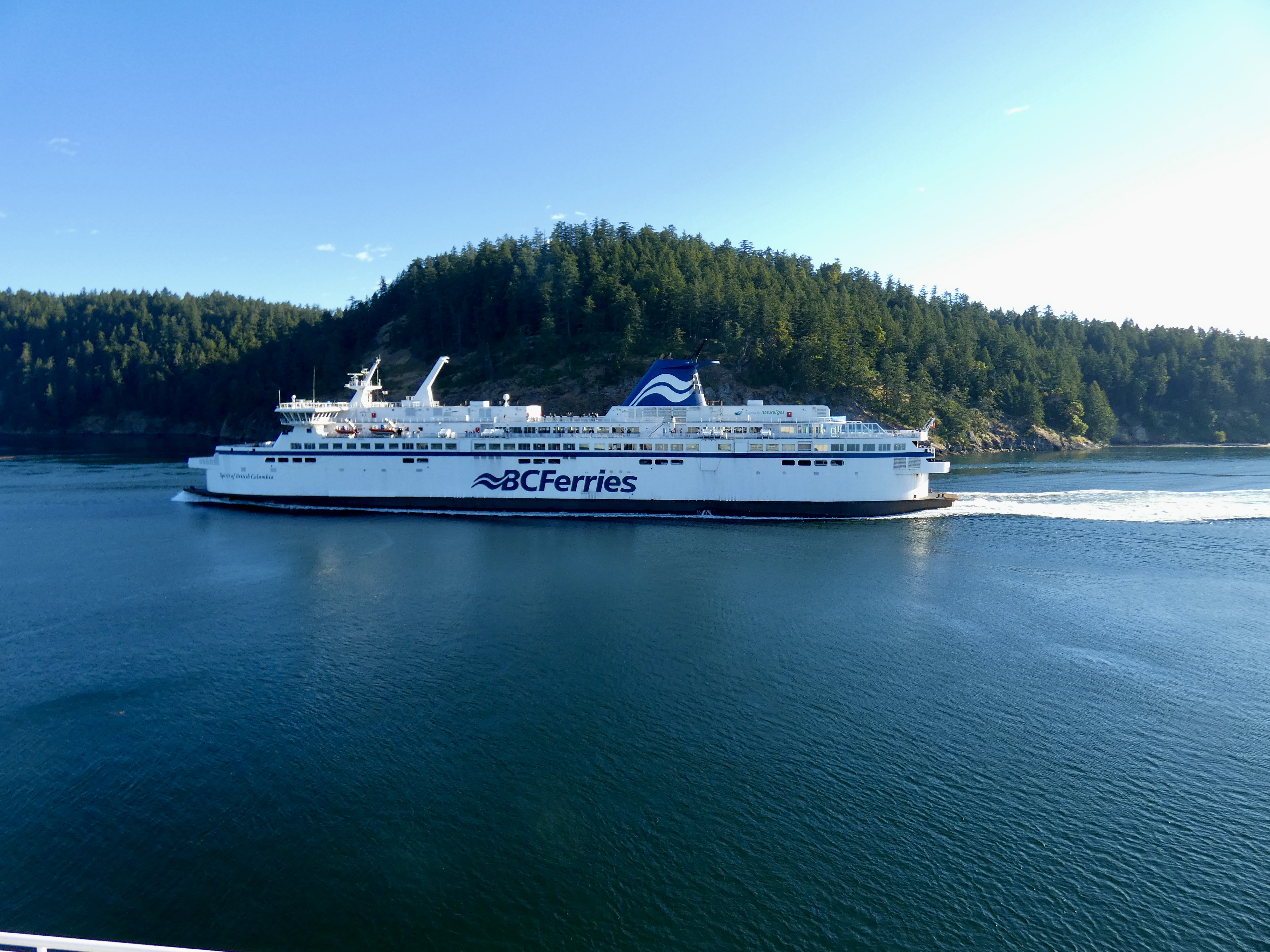
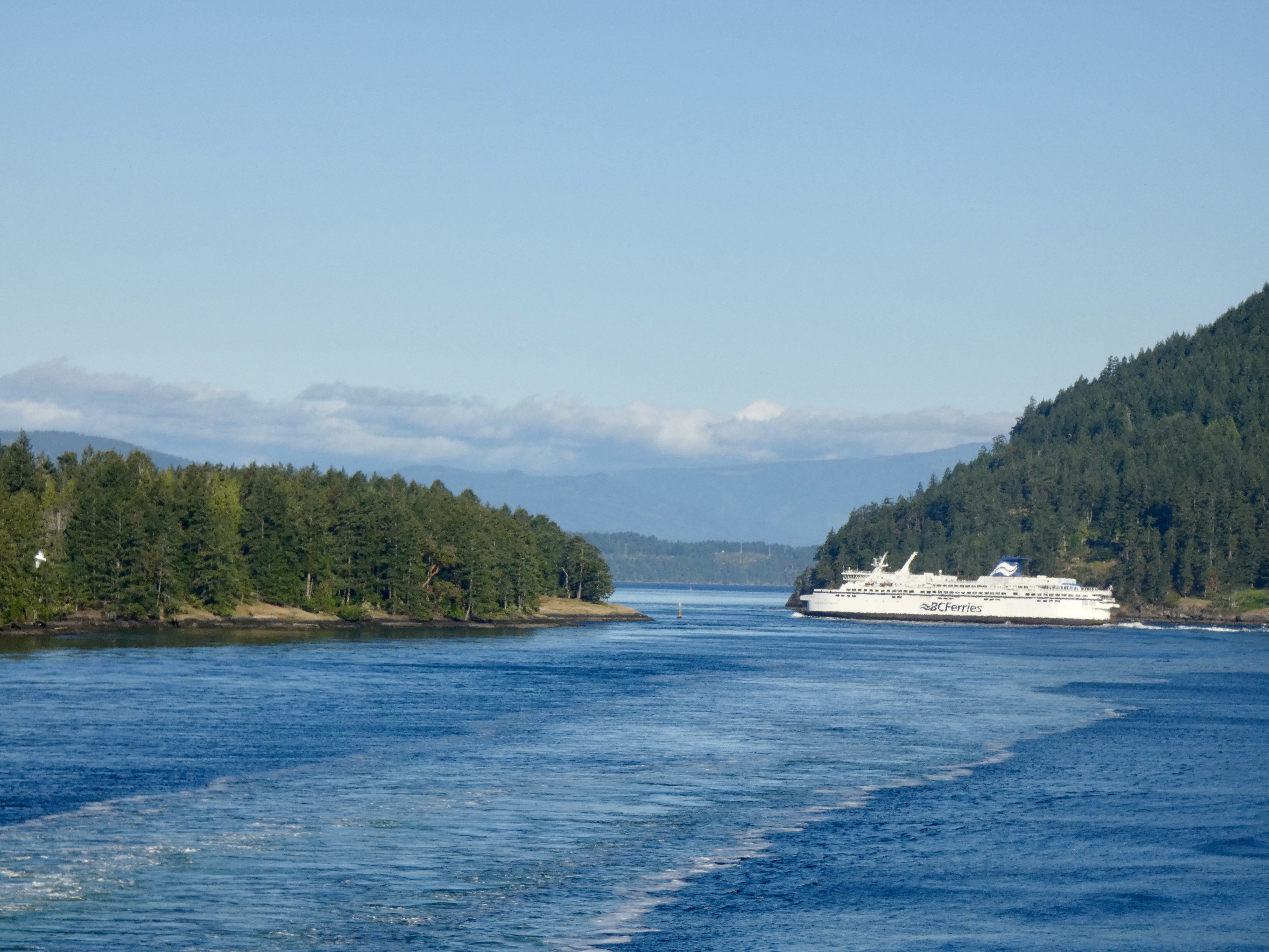
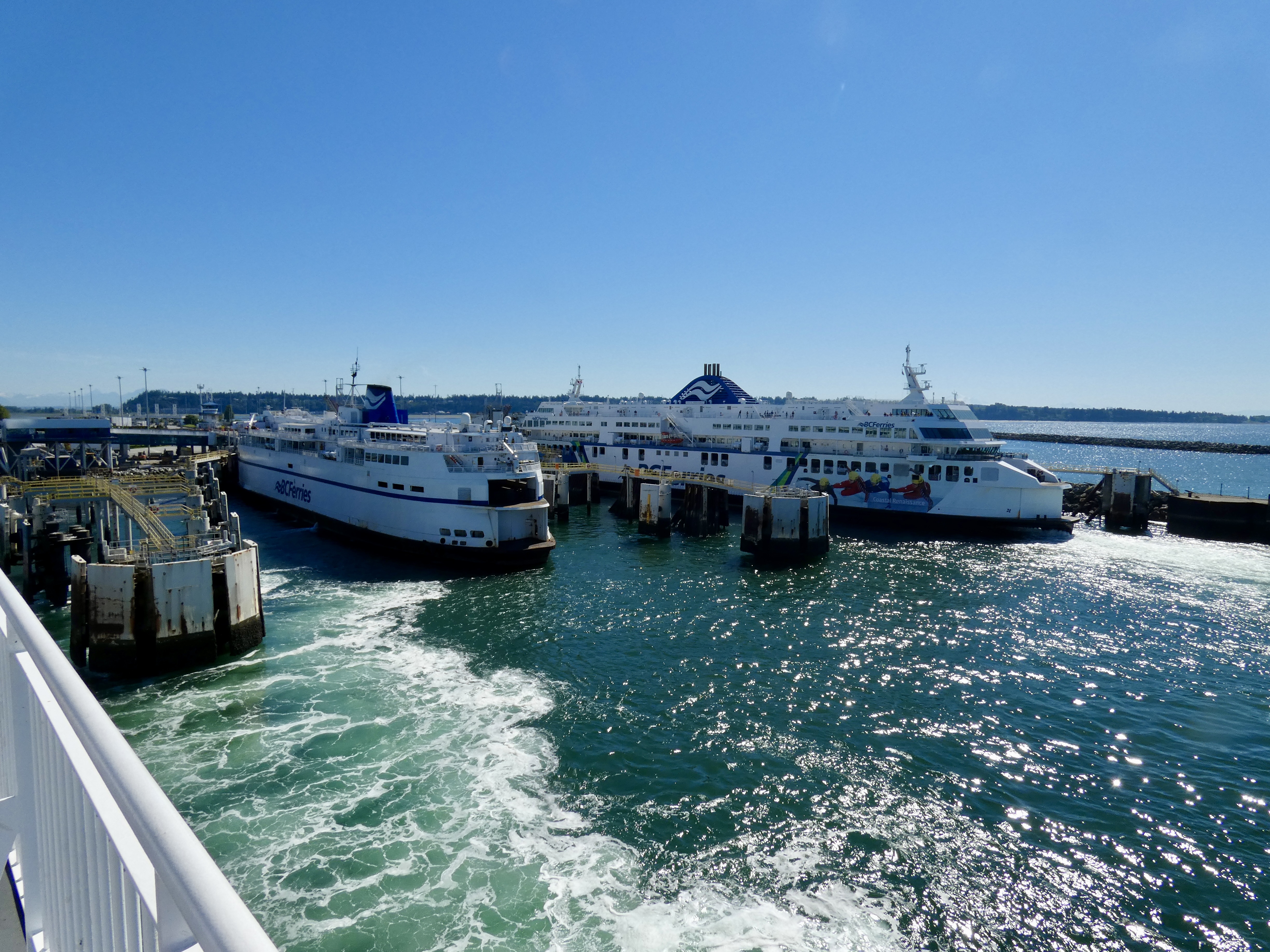
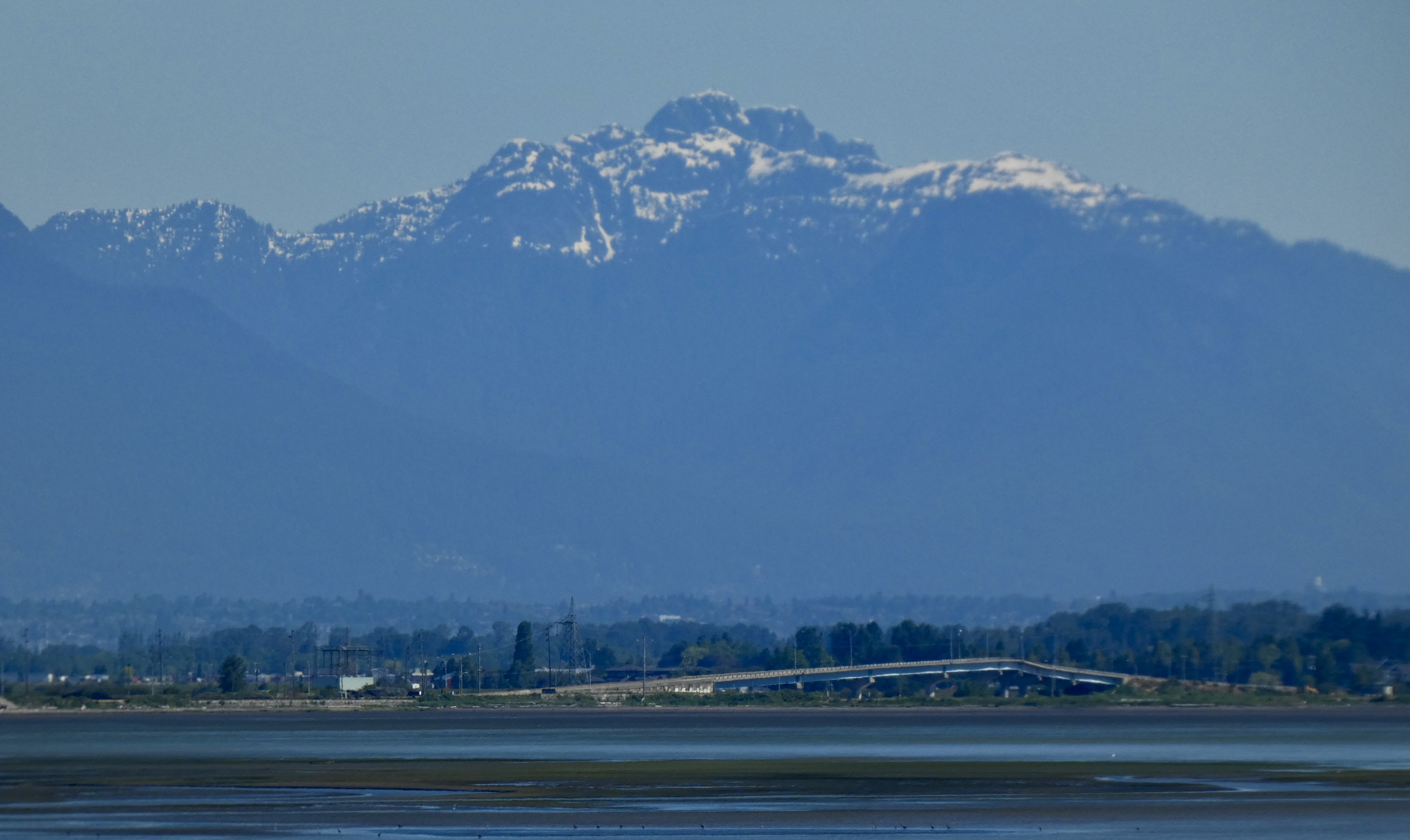
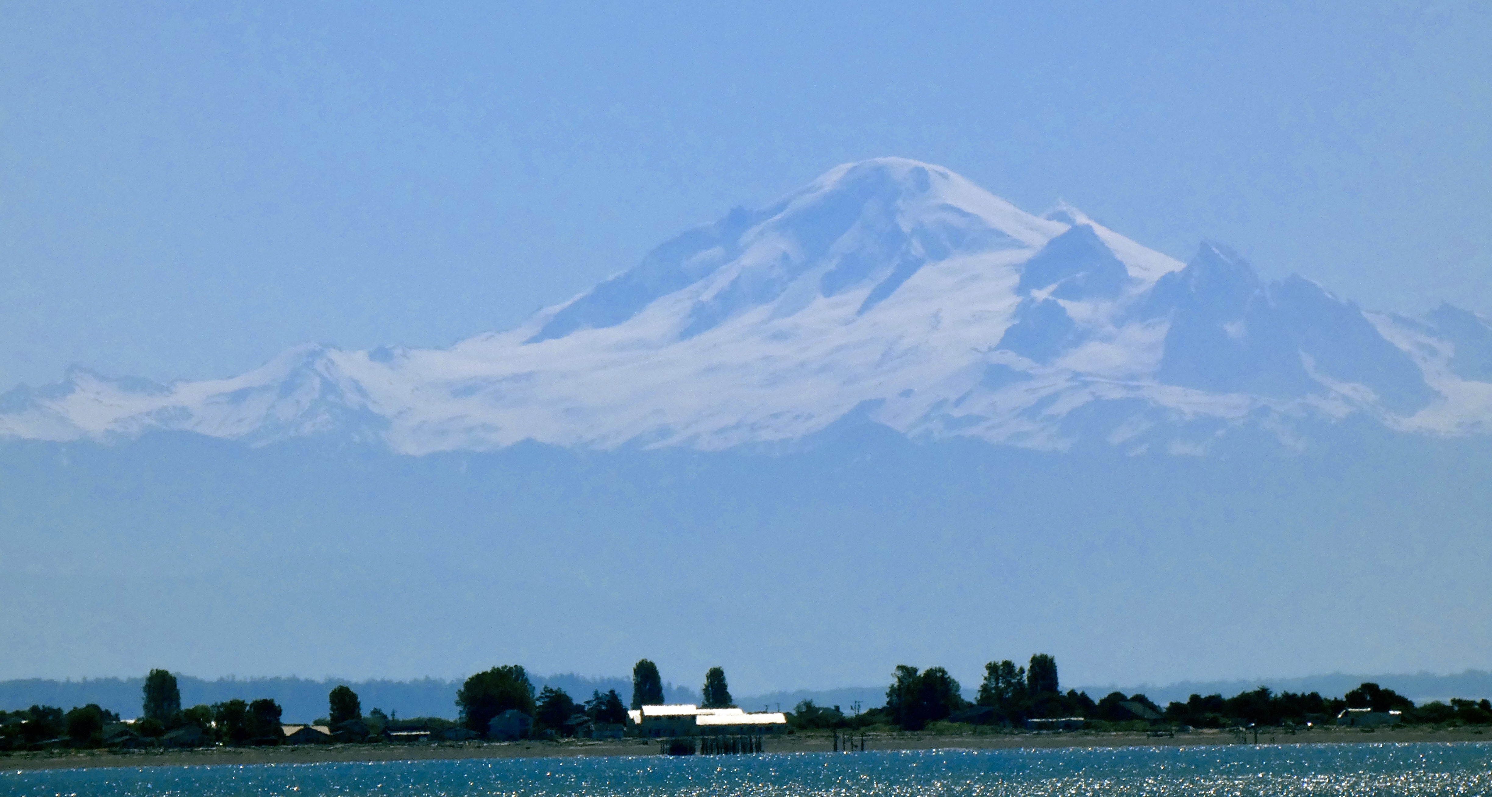
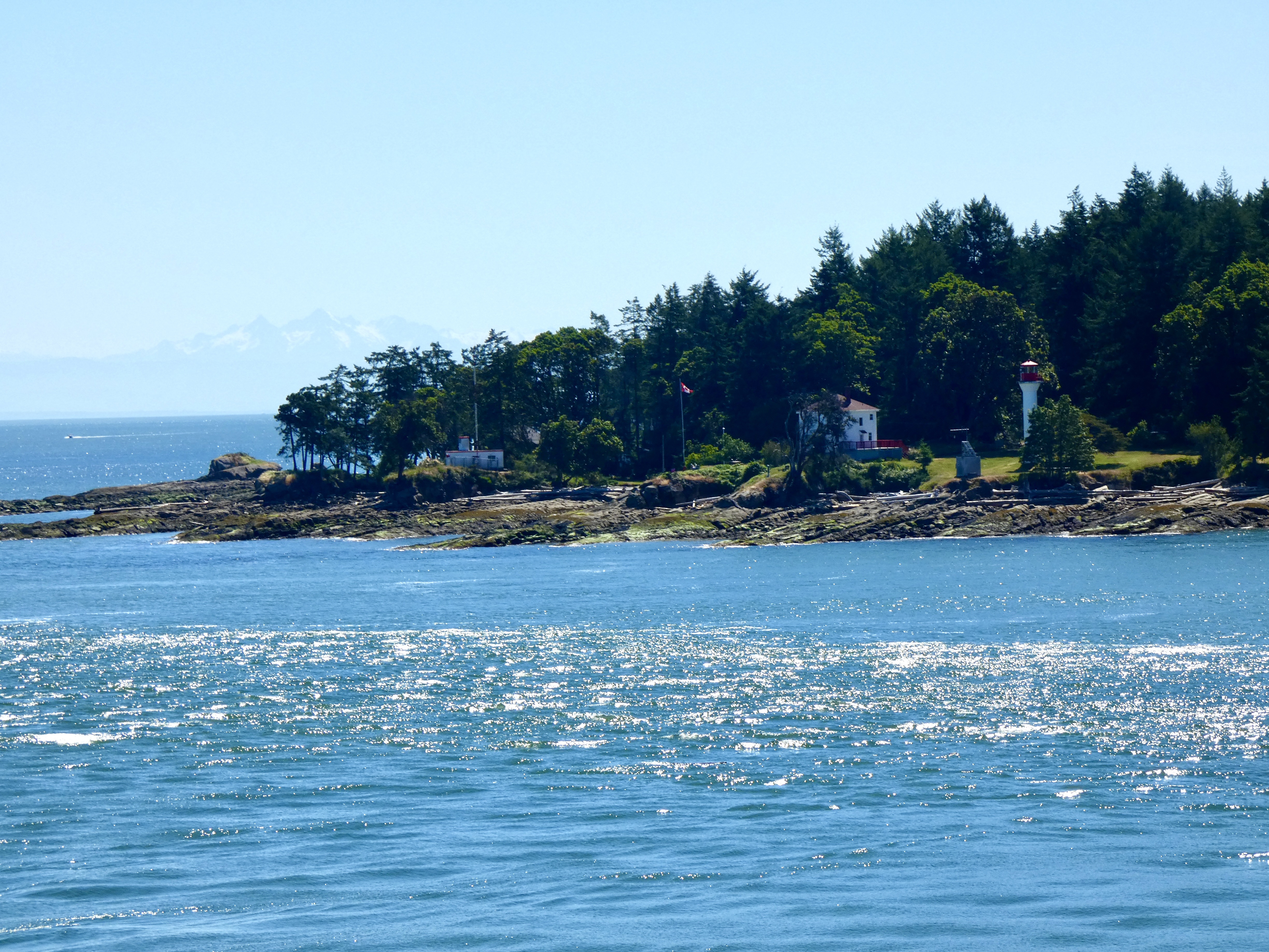
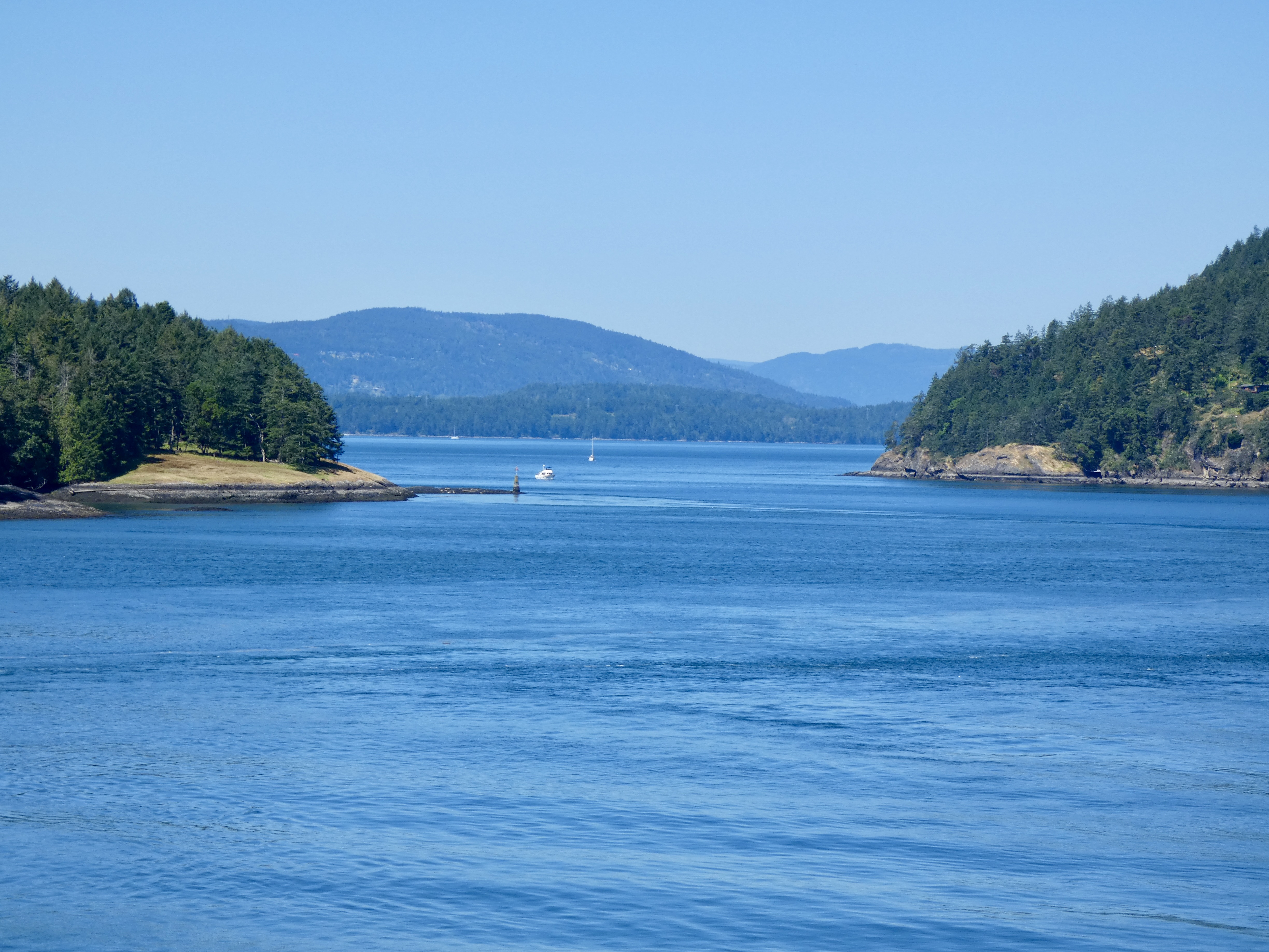
I wanted to catch the 7:00 a.m. ferry from Vancouver Island back to the mainland because I wasn’t sure how long the border crossing would take and also because the next scheduled departure was 9:00 a.m. I wanted to get an early start to have more time to on today’s trip to eastern Washington. We left our hotel a little before 6:00 a.m., made the short ride to the ferry terminal and were the first motorcycles to board the ferry. I spent much of my time on the early morning ferry watching a few of the more than 200 “Gulf Islands” get smaller and smaller as we slowly chugged to the mainland terminal at Tsawwassen. I hope one day to return to Vancouver Island, just as I want to return to most of the places we visited in the past 29 days.
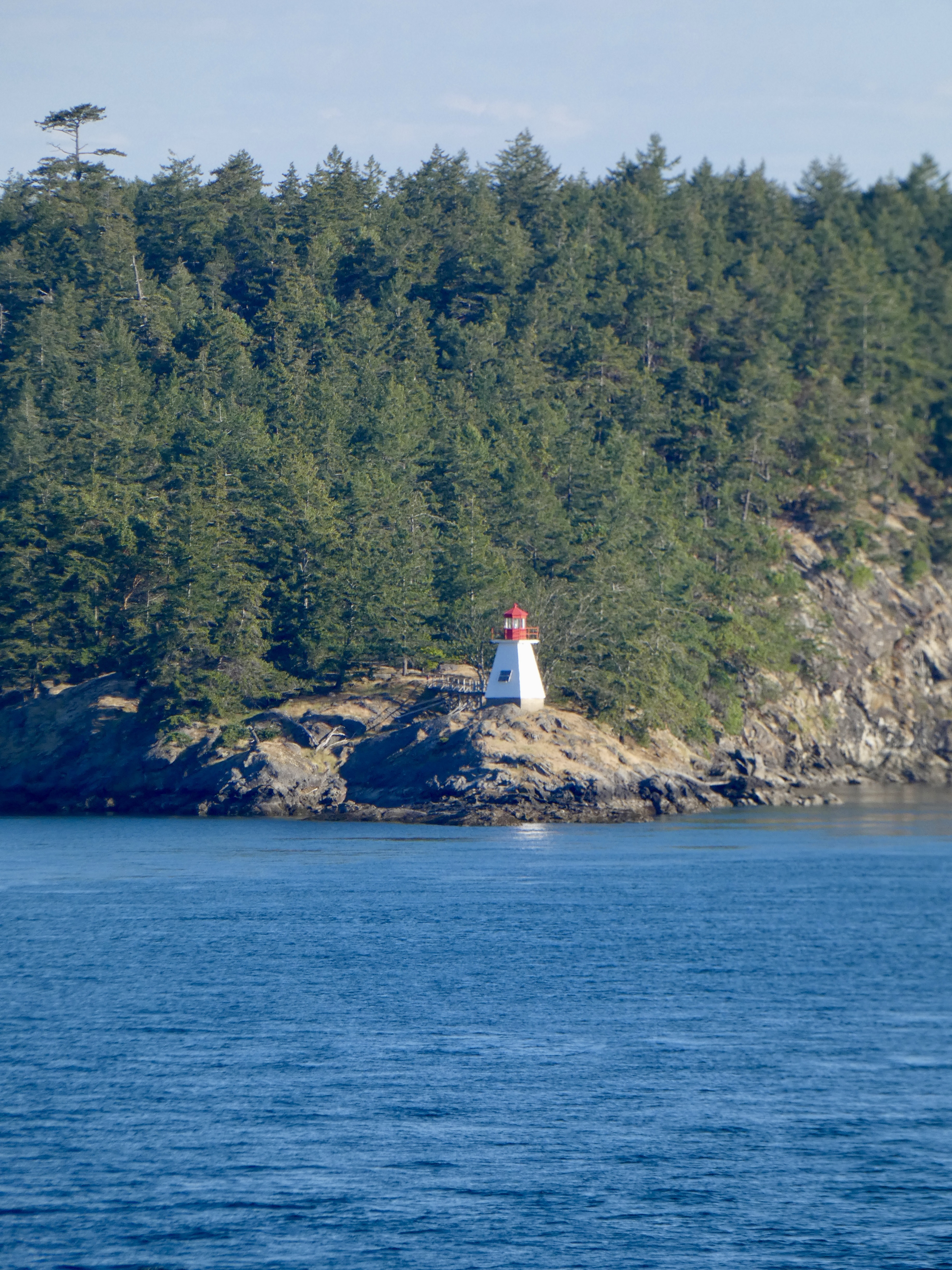
I spent my hour and a half on the ferry eating the sack breakfast provided by our hotel (The Waddling Dog, by the way) and taking pictures of beautiful scenery on a beautiful morning. I also thought about the many places we visited during more than three weeks in Canukia and of the VNCs (Very Nice Canadians) who made the trip special. Fortunately, many of them are in the blog so that when my memory goes I’ll still be able to remember them.
While I was anxious to start riding today, I also wasn’t in any hurry for the ferry to dock. The slower it went, the longer my stay in Canada would last. But, on schedule, the ferry pulled into the terminal at 8:30 and within minutes we fired up the V-Twins and rolled onto hard pavement and the road out of Canada.
The nearest border crossing was only about a 30 minute ride from the ferry terminal and by 9:00 we were in a short line of automobiles waiting to be cleared by U.S. Customs and Border Protection agents. Fifteen minutes later it was my turn. I was pleasantly surprised that the agent examining my documents and asking the routine questions was friendly–other experiences have involved rude and surly agents. A warning sign posted at the crossing said all fruits and vegetables had to be declared, as well as any purchases made in Canada, so I fessed up to the two bananas I bought on the ferry with the last of my Canadian coin and the two t-shirts I bought at Harley dealers. The agent asked to see the fruit secreted in my saddlebag and said if they didn’t have proper stickers on them they would have to go in the trash. Fortunately mine were adorned with proper stickers, and he allowed me to enter my home country schlepping two non-contraband bananas. That was a good start to my return to my native land.
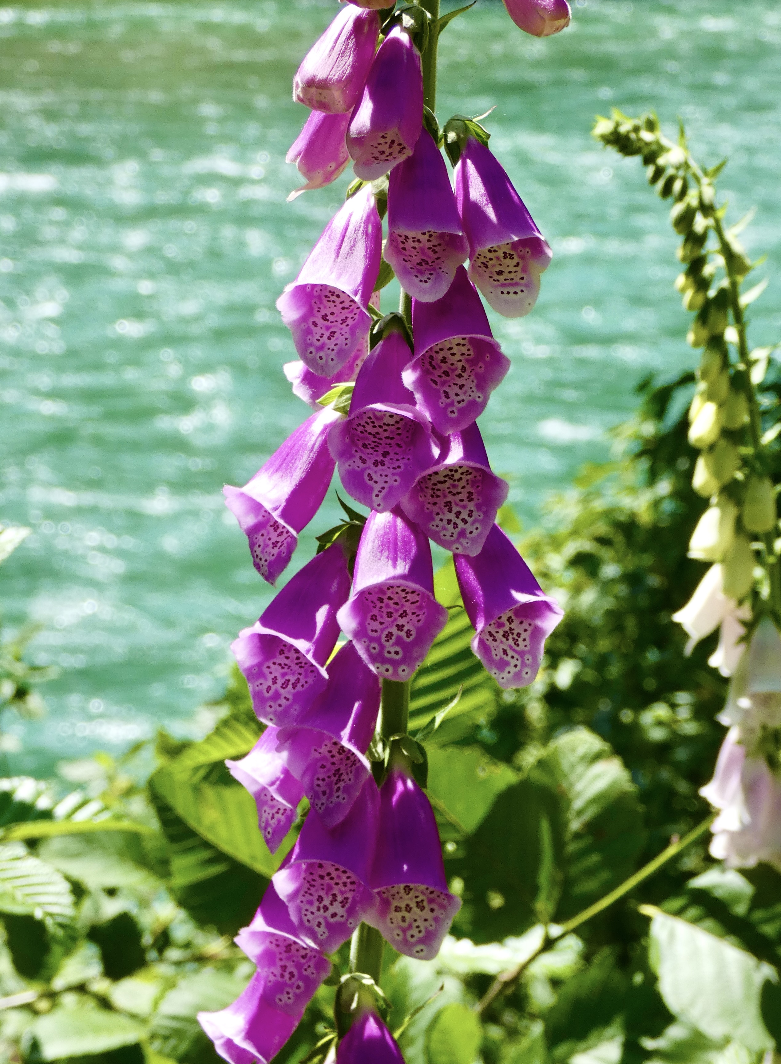
One of colorful things I saw repeatedly for the last week or so was a flower I couldn’t identify even though I had seen them in North Carolina. I finally stopped and my trusty plant identification app told me it was “Common Foxglove.” It may be common, but it’s uncommonly beautiful when it grows by the hundreds along the highways, especially in moist climates. At any rate, now that I know what it is, here’s how colorful it was:
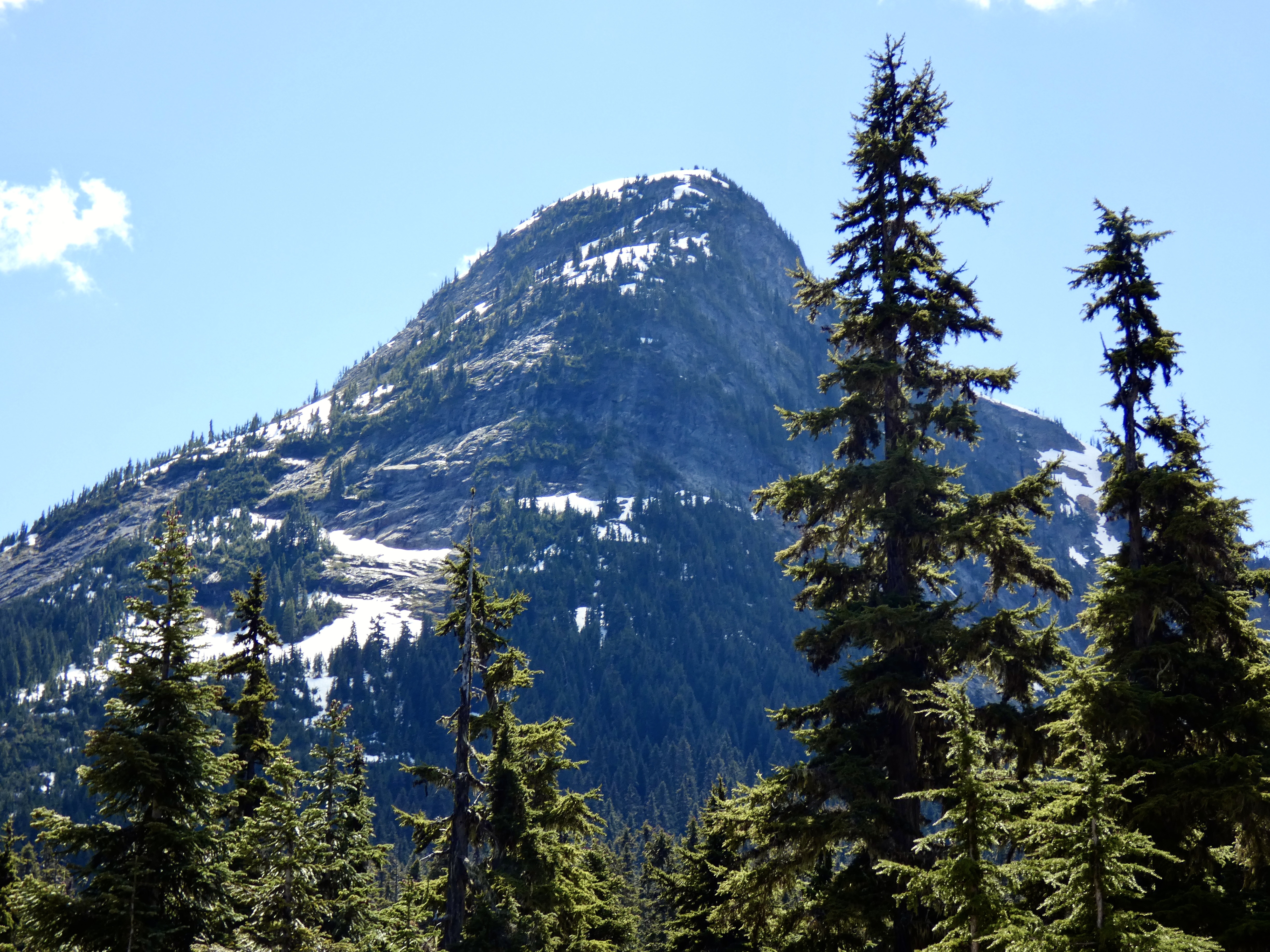
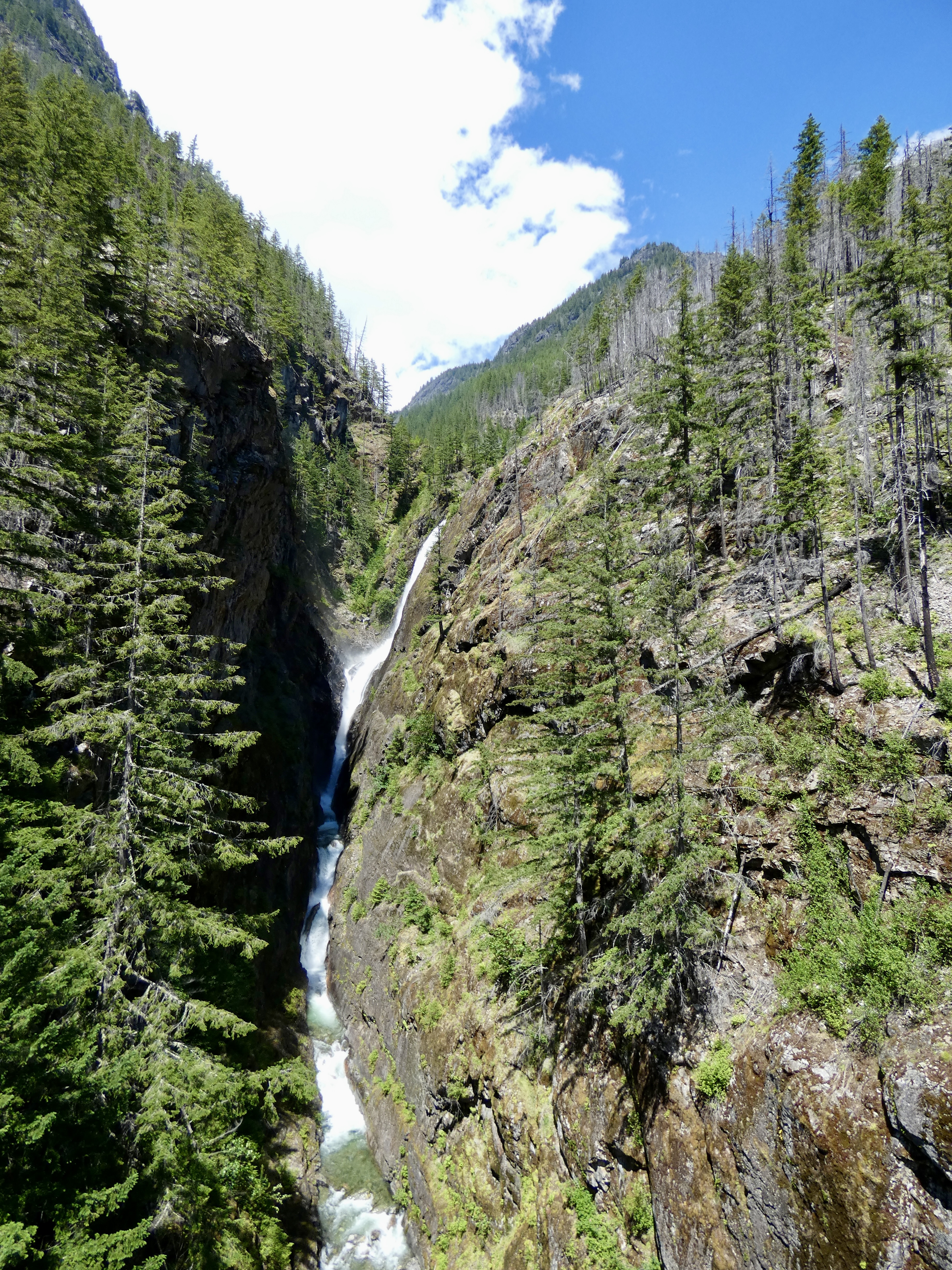
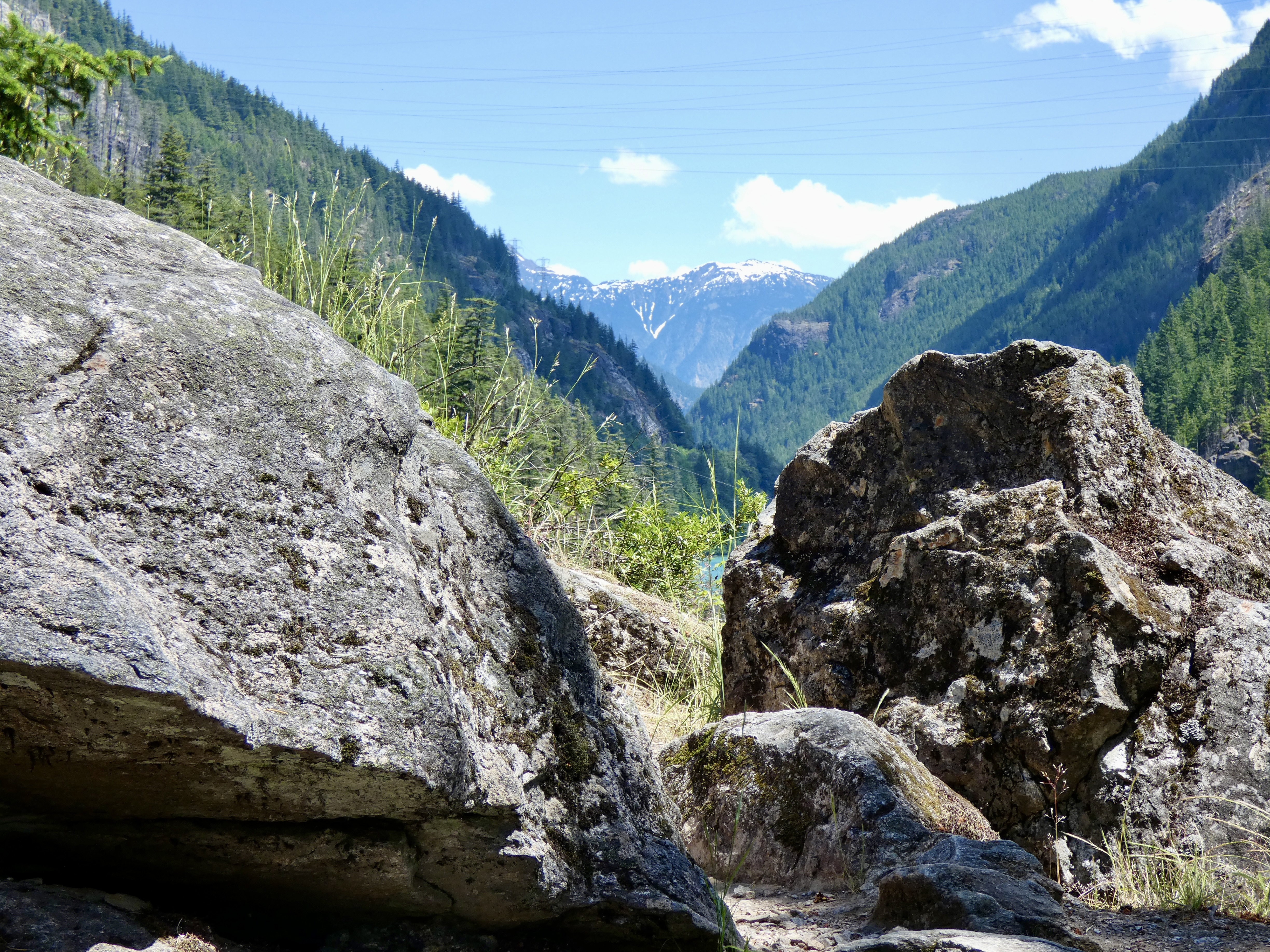
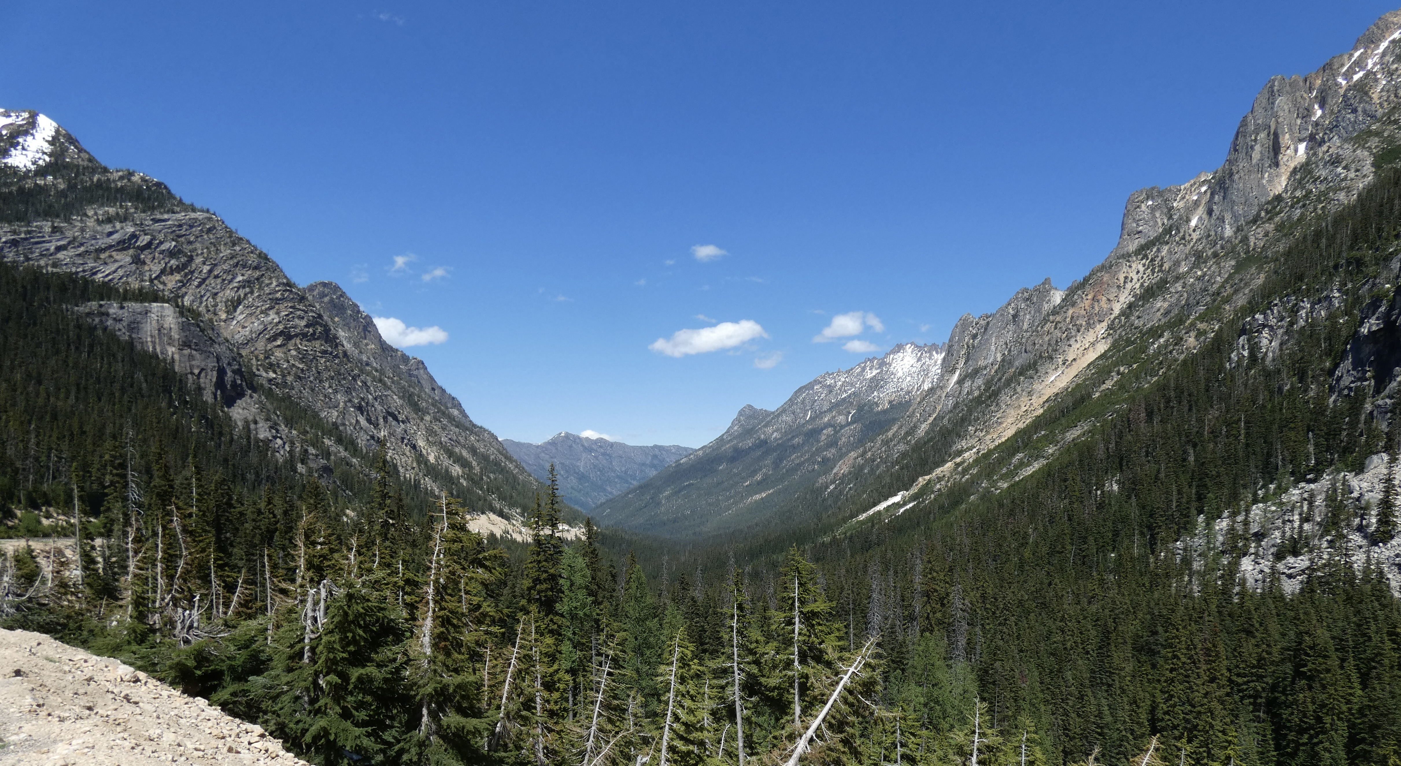
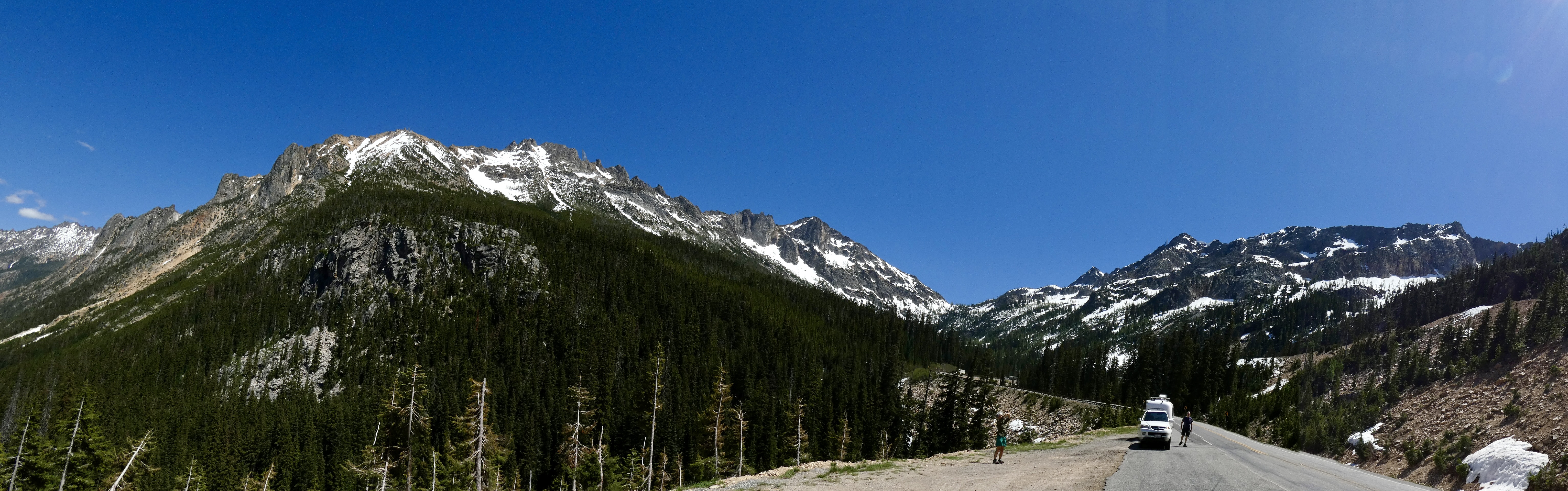
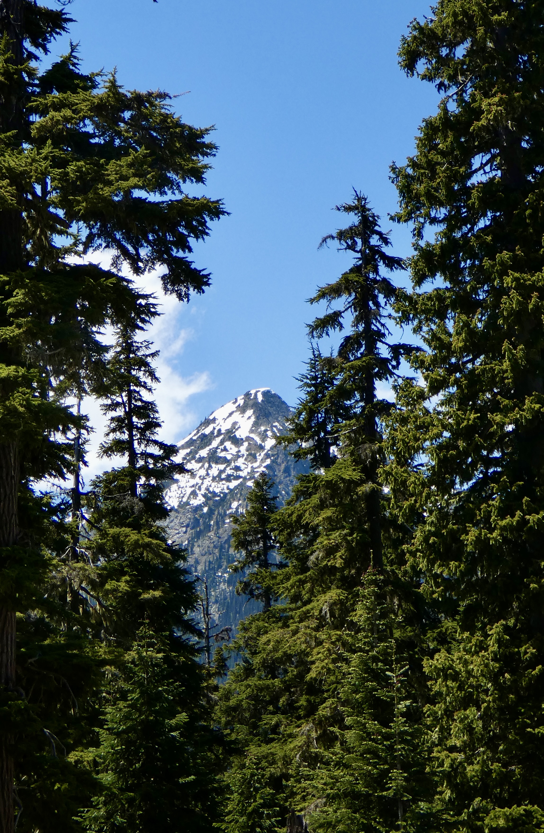
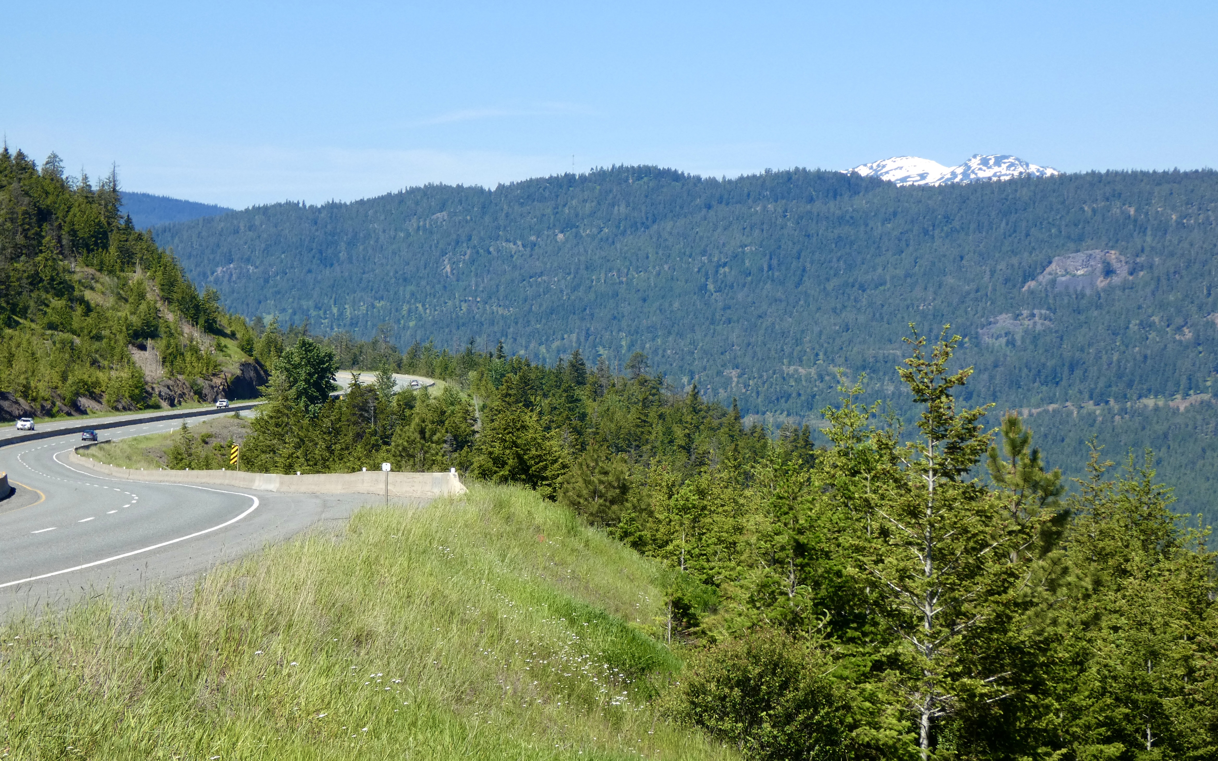
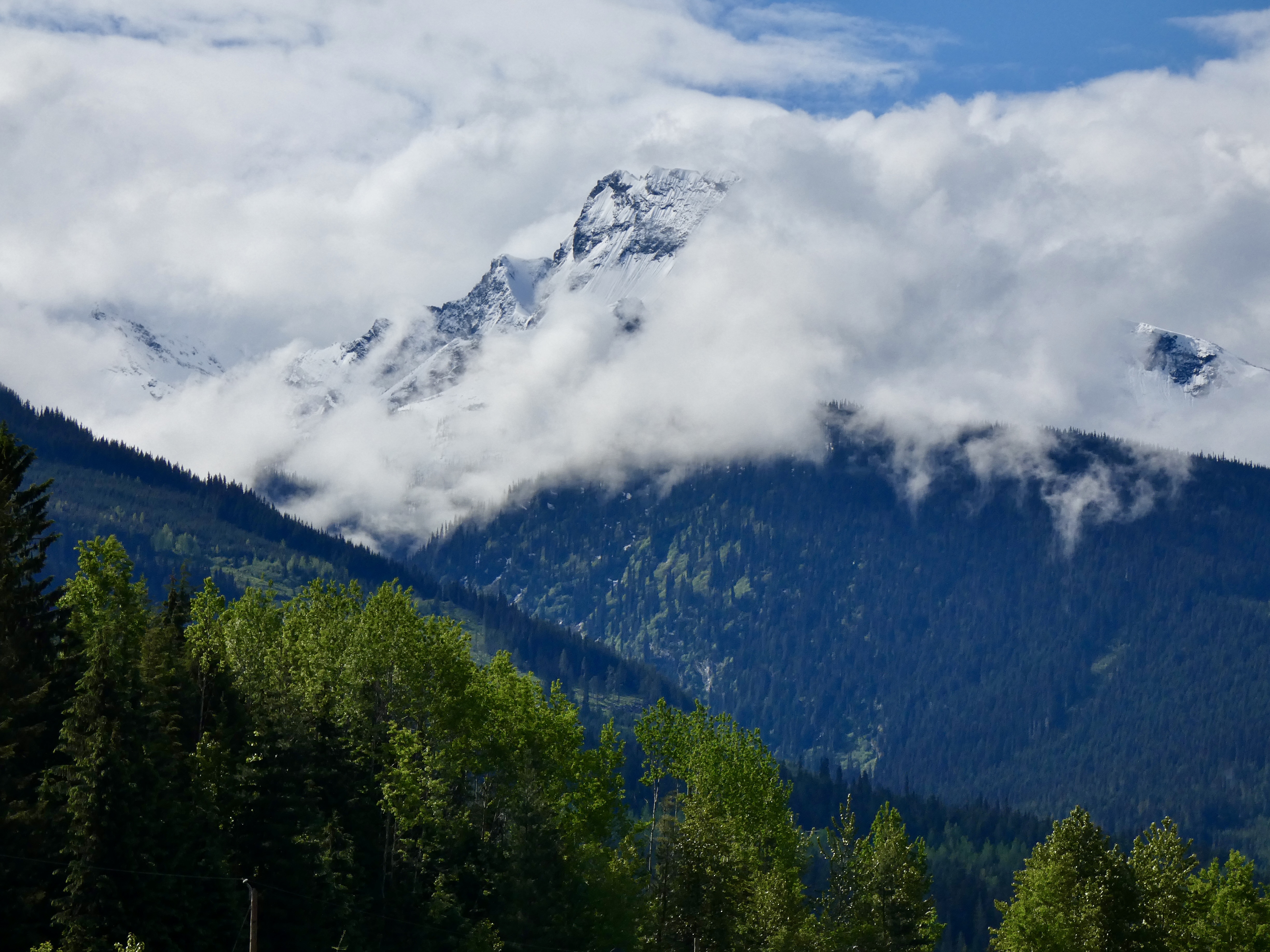
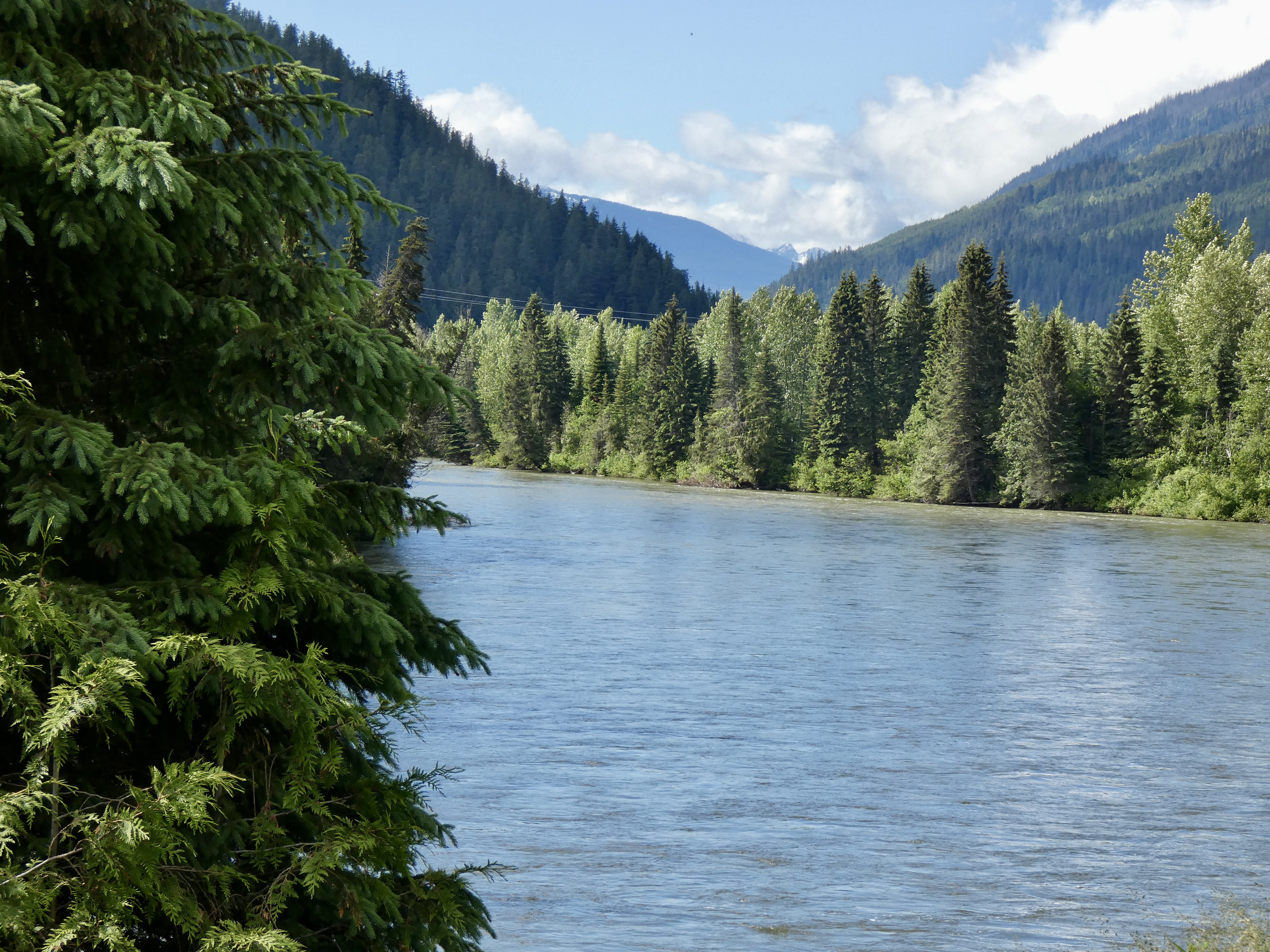
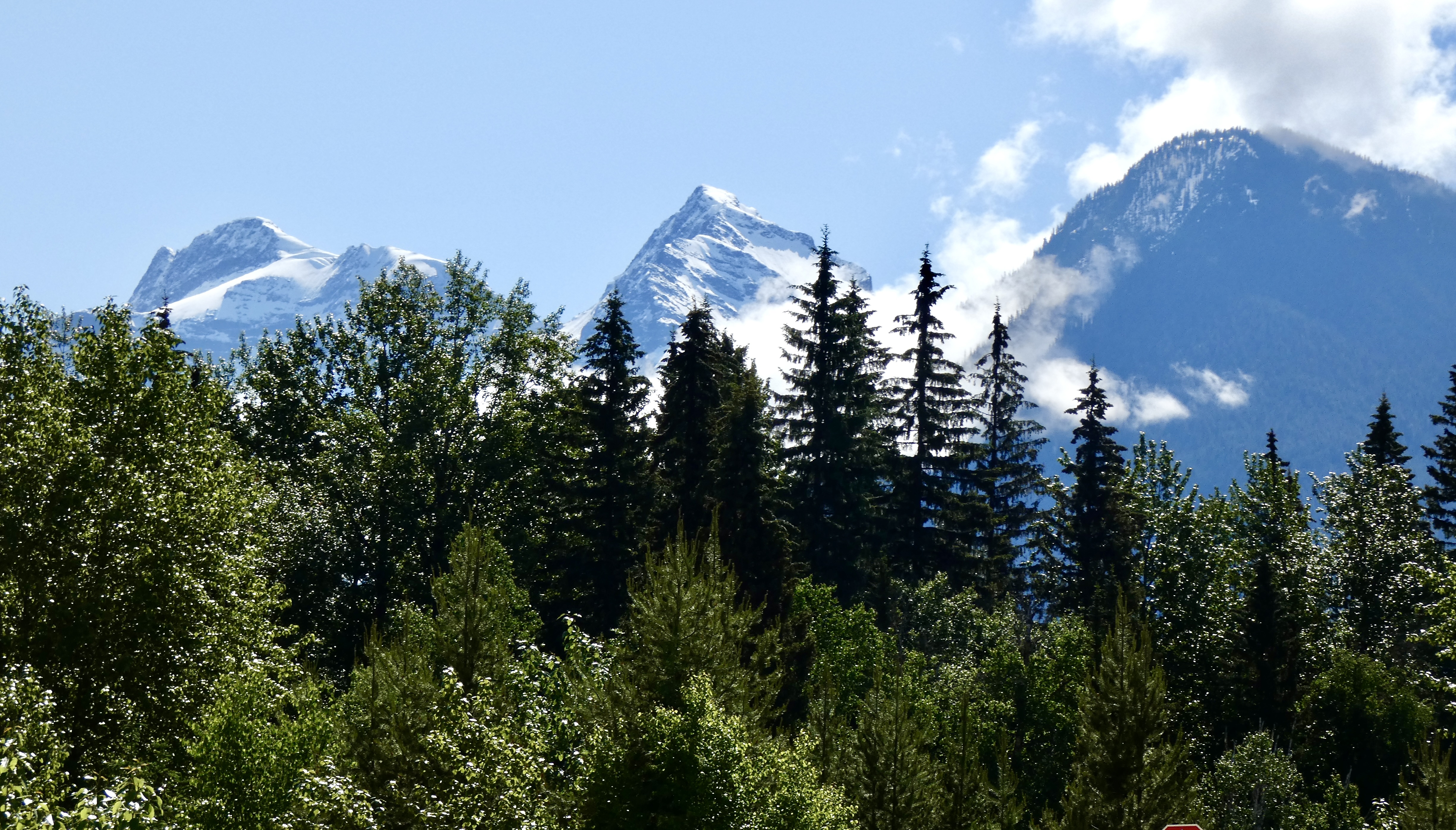
I knew the ride across Washington would involve going through and over the North Cascades, a section of the Cascade range that extends from northern California to southern Canada. But I had never ridden through them and didn’t know quite what to expect. A road sign along the way, however, said “Welcome to the American Alps,” and that gave me a pretty good clue of what lay ahead.
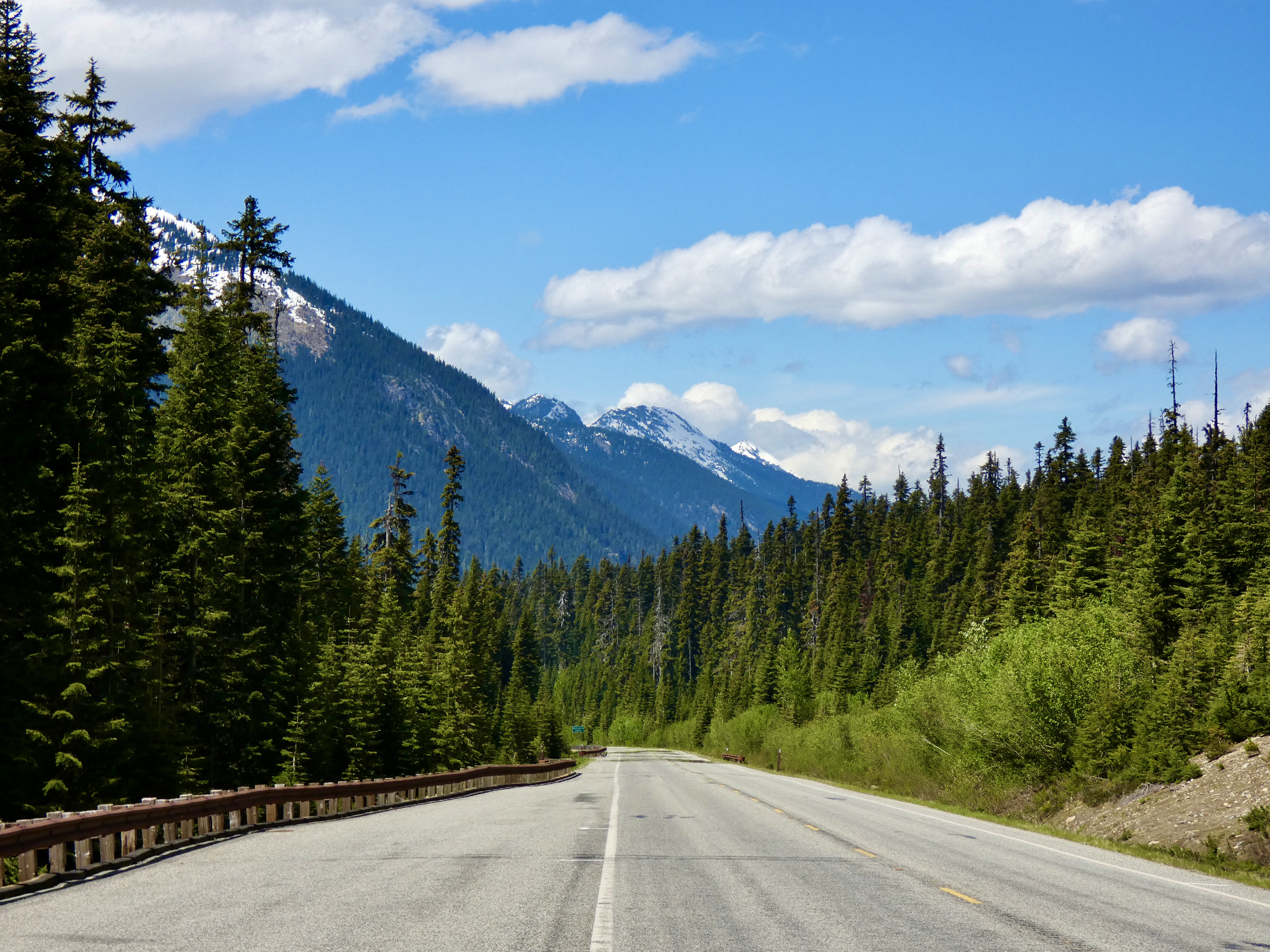
Since I was unable to ride the Icefields Parkway in Alberta this trip, I have to say that today’s ride may have been the best–or at least the most scenic–of all the rides on this trip. Snow covered mountains, glaciers, waterfalls–this ride had it all. I stopped repeatedly to add to my photo documentation of this trip, knowing that any picture I took wouldn’t truly reflect the incredible beauty all around me. But here are some of them:
Astute readers remember that earlier in tonight’s blog I mentioned a hitchhiker. Normally I don’t pick up hitchhikers, for a number of very good reasons, the most important being that I don’t have room on a fully loaded motorcycle. But I saw this one in a ditch by the side of the road and knew I had to stop. I scooped her up and placed her carefully on my bike. But no matter how hard I tried to get her to warm up to me, she never did. She was cold. Very cold. So I dumped her.
Tomorrow the ride continues across Washington and into Idaho. I’m getting closer to home but the CCR blog continues and I’ll keep posting until I get back to North Carolina.
Day 32 CCR: One Final Ride In Canada
Tomorrow we catch a ferry for a 1 1/2 hour ride to Vancouver, then ride 25 miles to the nearest border crossing, and the Canadian portion of the CCR will be completed. So, today, we took one more ride to see just a little more of Canada.
At the beginning of the ride I stopped in at the Victoria Harley-Davidson dealer to purchase another t-shirt so I’d have bookend shirts representing the beginning of the ride and the end of the ride. In St. John’s, Newfoundland, at Rugged Rock Harley-Davidson, I found a cool shirt that represented St John’s well. Unfortunately, the Harley dealer in Victoria didn’t have nearly the selection of shirts, and I finally ended up buying one that just said “Victoria, B.C” and makes me a walking billboard for Harley-Davidson. But at least I have a wearable souvenir from each end of the CCR.
Following the disappointing shirt shopping, we headed west and north along the Vancouver Island south and west coast toward Port Renfrew. Coastal property is primo real estate and Vancouver Island is no exception. There were very few places along the coast that weren’t privately owned, but we stopped at a couple of Provincial Parks and walked to the water’s edge, trying to stretch the CCR a few more yards and our time in Canada a few more minutes.
The ride would have been more exciting if the road had been in better shape. Pavement breaks, heaves and pot holes kept our speed somewhat below the maximum most of the time, and watching for road dangers meant less looking at the beautiful scenery of the Vancouver Bay/Pacific Ocean or the majestic cedars, firs and spruce that cover most of the land on the island.
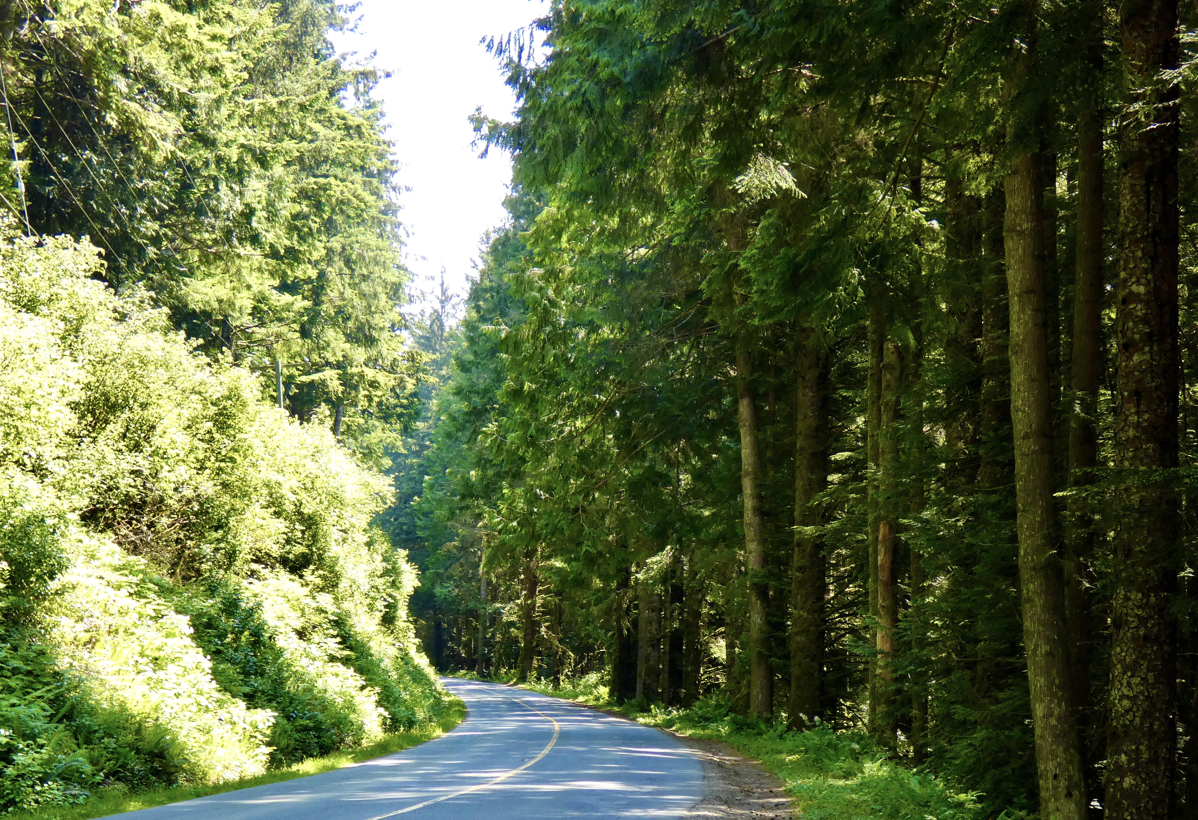
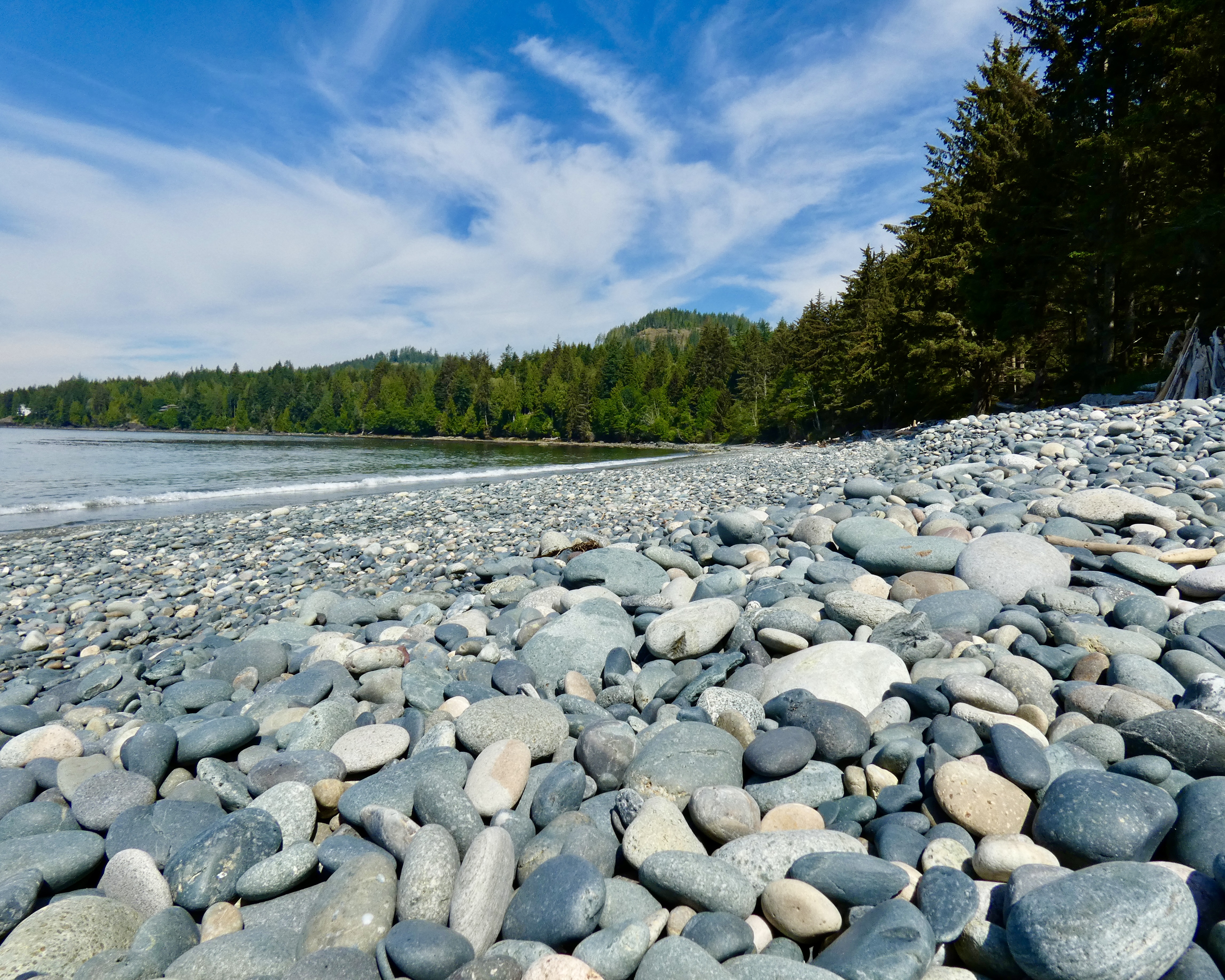
One of the nice stops along the way was French Beach Provincial Park. A short walk from the parking area through massive conifers took us to the beach, where a few early risers were staking out their locations on the beach and at the picnic and playground areas. Don’t think of Florida sand beaches when trying to picture French Beach. Think instead of Pebble Beach with real pebbles. Hundreds of smooth rocks of way more than 50 shades of gray lined French Beach, but nary a grain of sand.
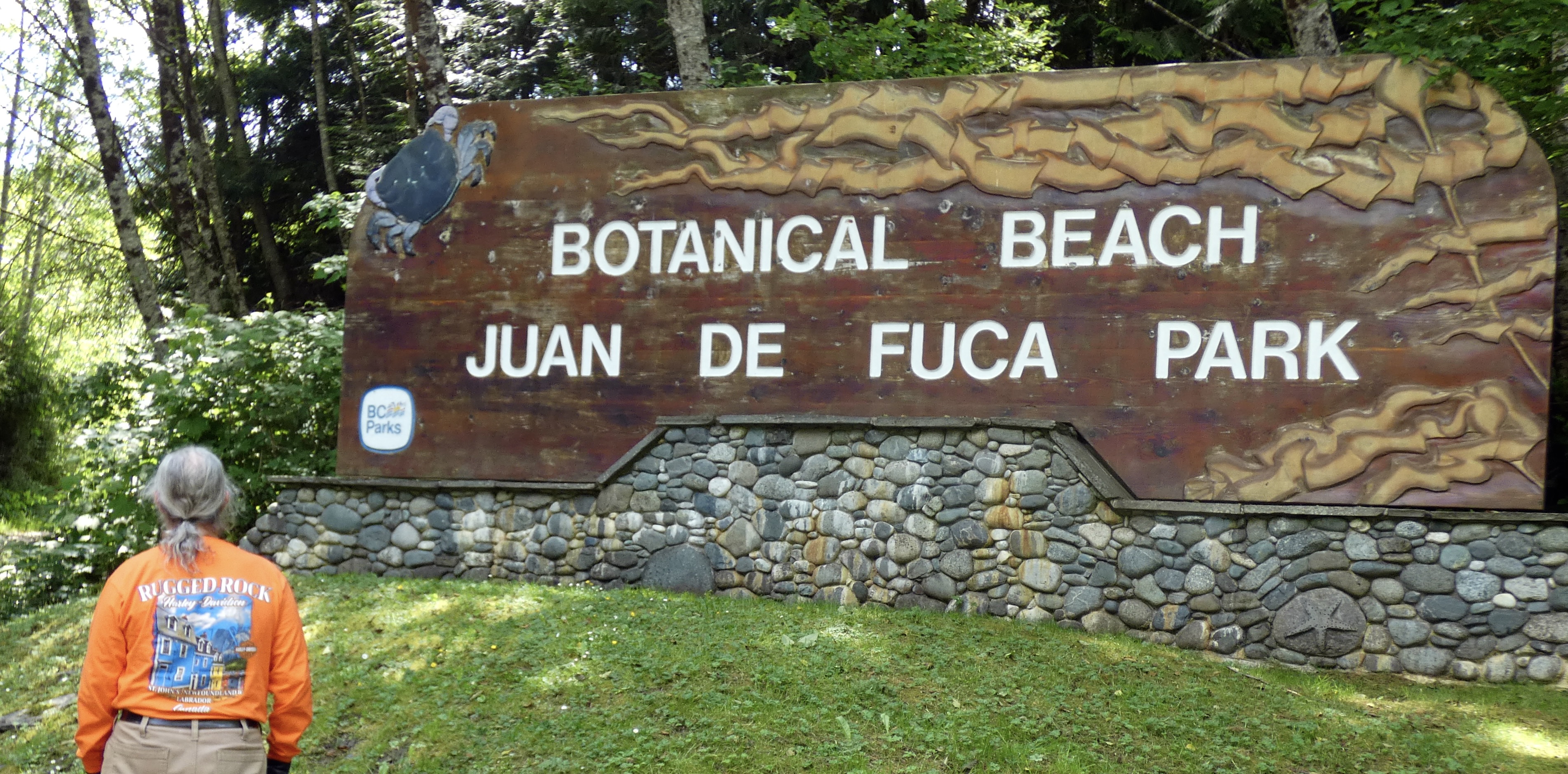
I knew Washington State parallels the southern end of the island but expected when I got to Port Renfrew I would have an unimpeded view of the Pacific Ocean. But Botanical Beach at Juan de Fuca Provincial Park just beyond Port Renfrew required a significant hike from the parking area to the water’s edge. I wanted to move on to the interior, mountainous part of the island, so I contended myself with a photo of the park’s entrance sign. That would be the western-most point of the CCR, just as Cape Spear was the eastern-most point.
Following lunch at a small Port Renfrew cafe that could have included a gigantic freshly-baked muffin if my will power had been less, we headed east away from the Pacific and into the small mountains that make up the interior of the southern part of the island. Once again, serious deficiencies in the road surface kept us from fully enjoying the ride as we tried, not always successfully, to avoid bumps, dips and holes in the road.
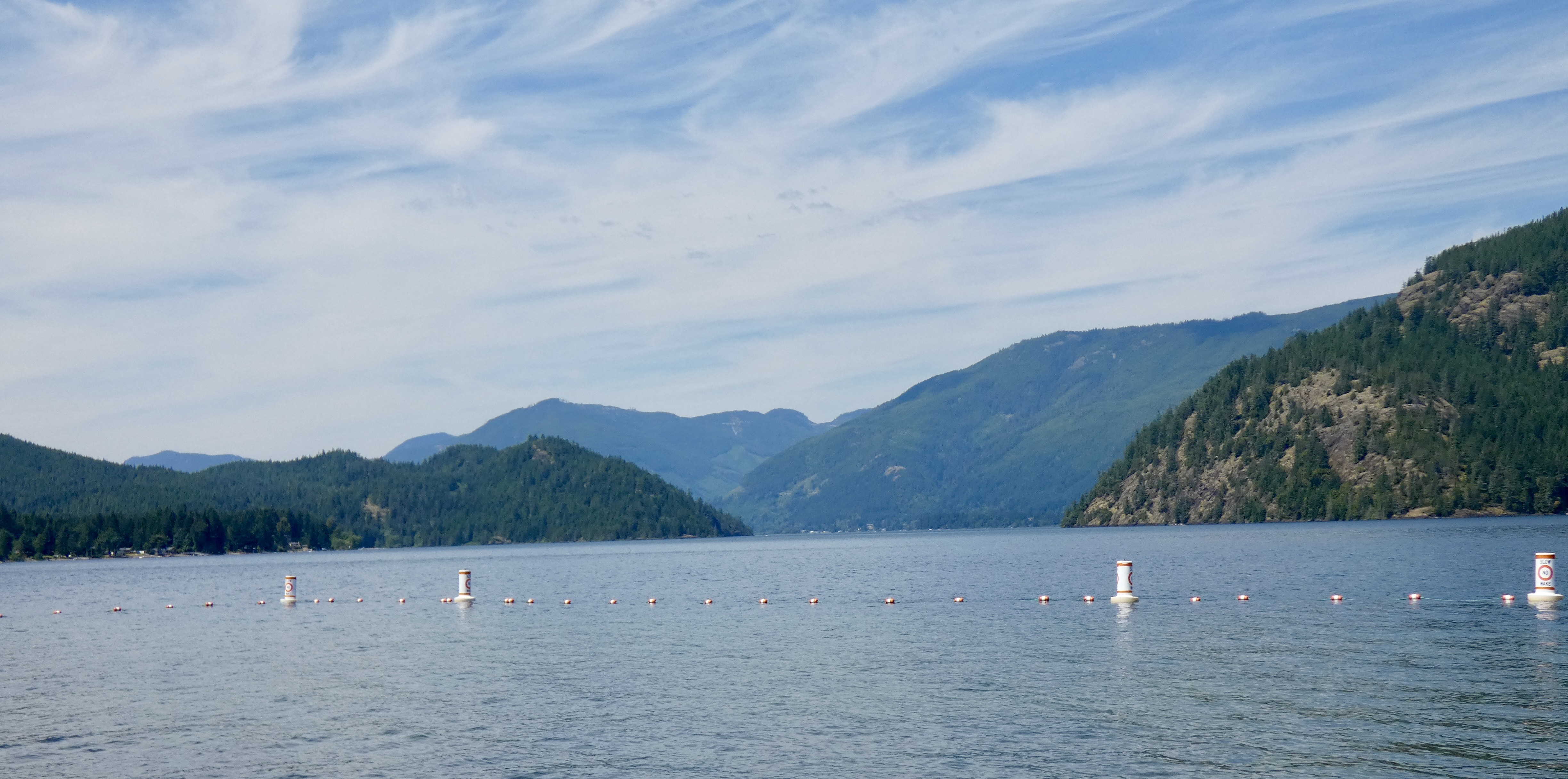
We stopped at a large interior lake, discovered a small community park on its western shore, and then wondered why an amateur DJ had set up his equipment, including a very loud amplifier, and was blasting music to all five of the people on the beach or in the water. It was wierd.
Again, all the prime property seemed to be taken up by private ownership and houses and docks and boats stood in the way of a casual tourist enjoying the views. I’m sure, with enough time (which we didn’t have) peaceful public places could be found along the lake, but we didn’t have the time, so we moved on.
Even though the Canadian portion of the ride will end tomorrow, the blog will continue to be posted until I return to Maggie Valley. Please keep checking in.
Day 31 CCR: The End is in Sight
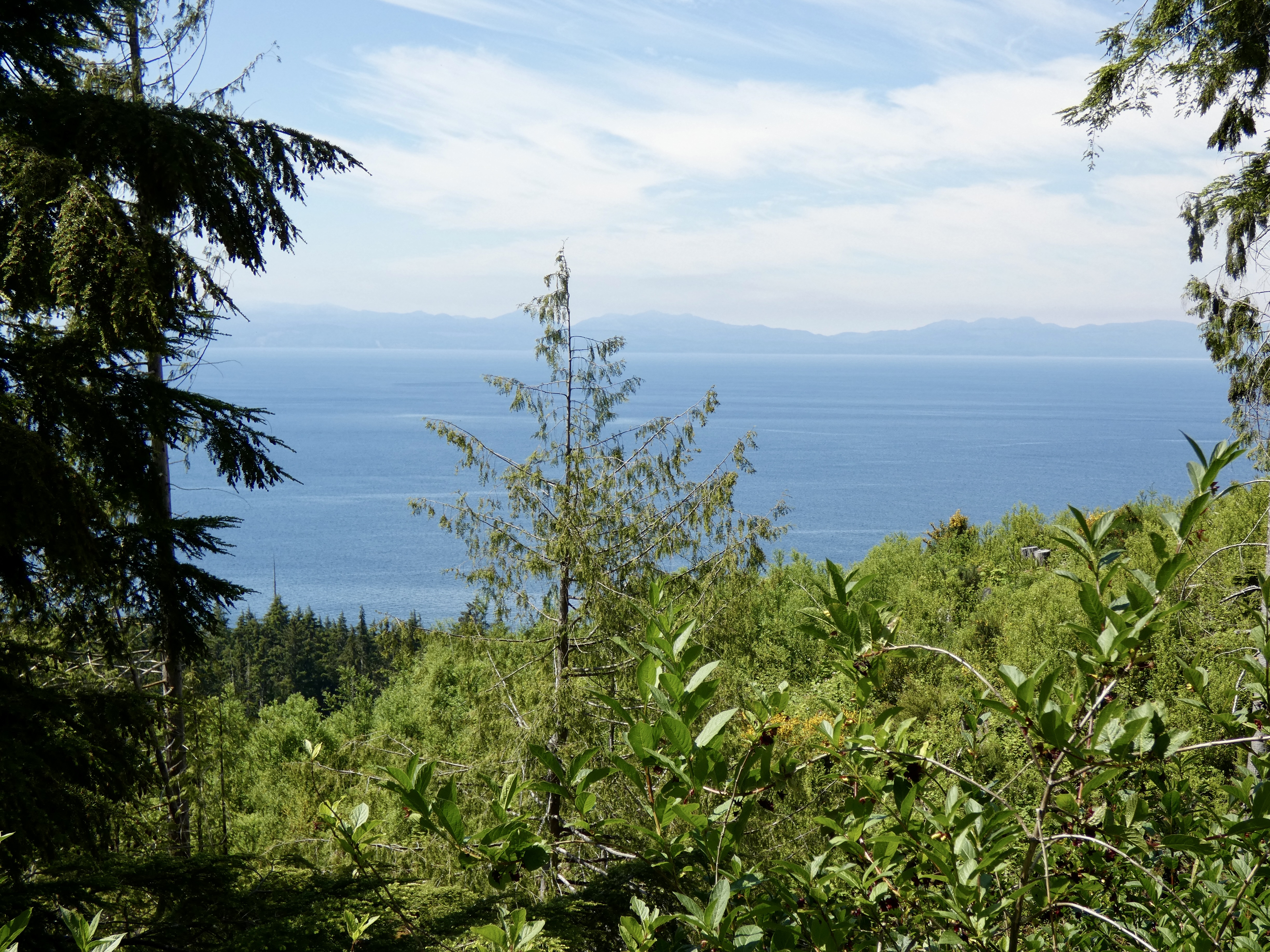
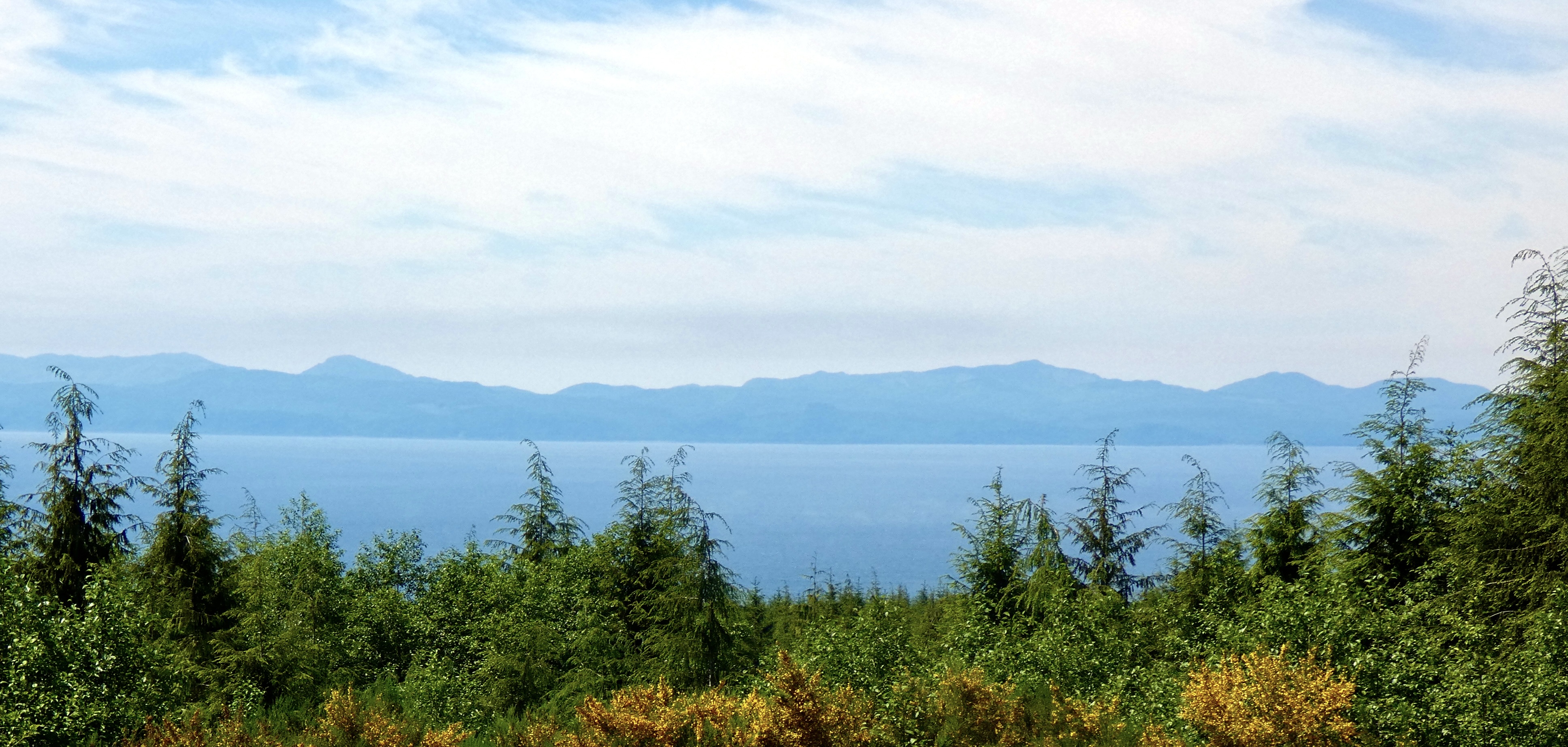
I think the BC Ferry we took from Vancouver to Vancouver Island today was appropriate: The Coastal Celebration. I have now ridden coast to coast across Canada, from Cape Spear, Newfoundland, to Victoria, BC, in celebration of my 75th trip around the sun. I’ve recorded 8,300 miles since leaving Maggie Valley in beautiful western North Carolina, and I still have to ride back home. No, really, I have to ride home. Marilyn says I have to. I can’t keep riding around Canada, despite my strong inclination to do so. Well, maybe one more day. Tomorrow. When I explore part of Vancouver Island. But after that I’m really heading home. 3,200 miles away. On the way home, though, I’m going to plan my next ride.
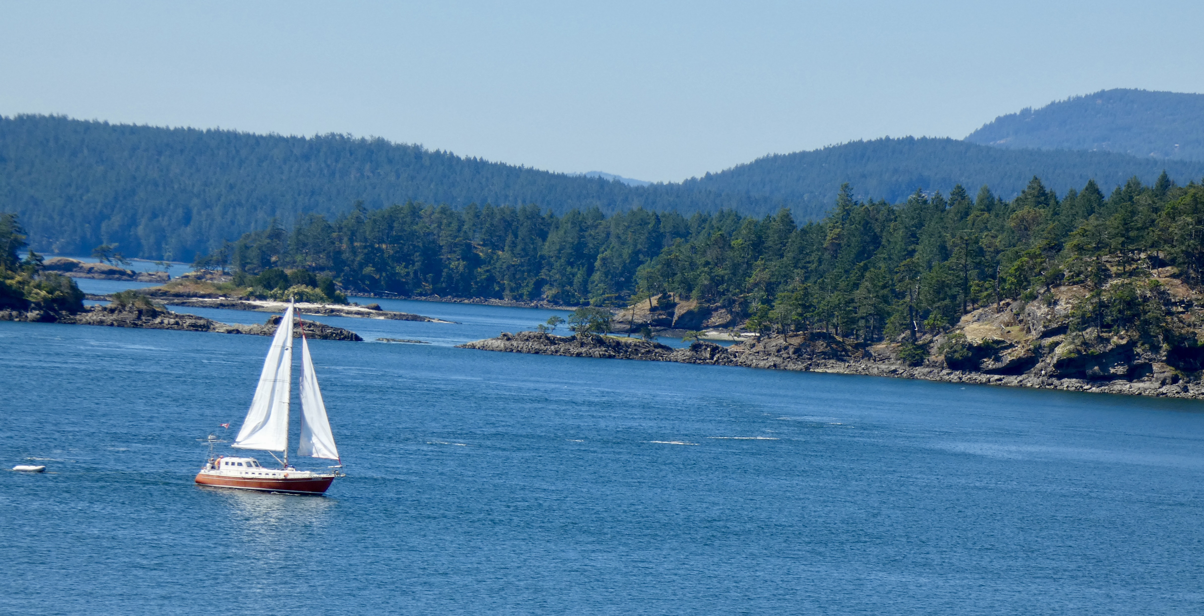
Today’s ride from Hope to Vancouver, only 125 miles, folllowed the Fraser River through the wide Fraser Valley, lined with hundreds of fruit and berry farms, dairy farms and several extremely fragrant saw mills where the pungent odor of spruce, fir and cedar filled the morning air and lit up my olfactory sensors. Light Sunday morning traffic made for an easy and relaxing ride, and we arrived at the Tsawassen Ferry Terminal just before the 10 a.m. ferry sailed, giving me an hour more in Victoria than I anticipated. The ferry ride among the many heavily forested islands in English Bay between the mainland and Vancouver Island, where Victoria, the capital of the province, is located, took an hour and a half. The time on the ferry gave me a chance to relax, enjoy the short cruise and meet several more VNC (Very Nice Canadians), including John Schwartzburg, a retired foreign service official and now professional photographer. John and I talked about photography, Canada, and history for a brief time and, once again, I was reminded that it’s Canadians who make Canada special. (If you want to see some of John’s beautiful photos, including some from the same Viking River cruise Marilyn and I took, click here.)
A slight haze (smog?) obscured distant points from the ferry, but here are some photographs I took along the way. (None of them nearly as good as John Schwartzburg took, I’m sure.)
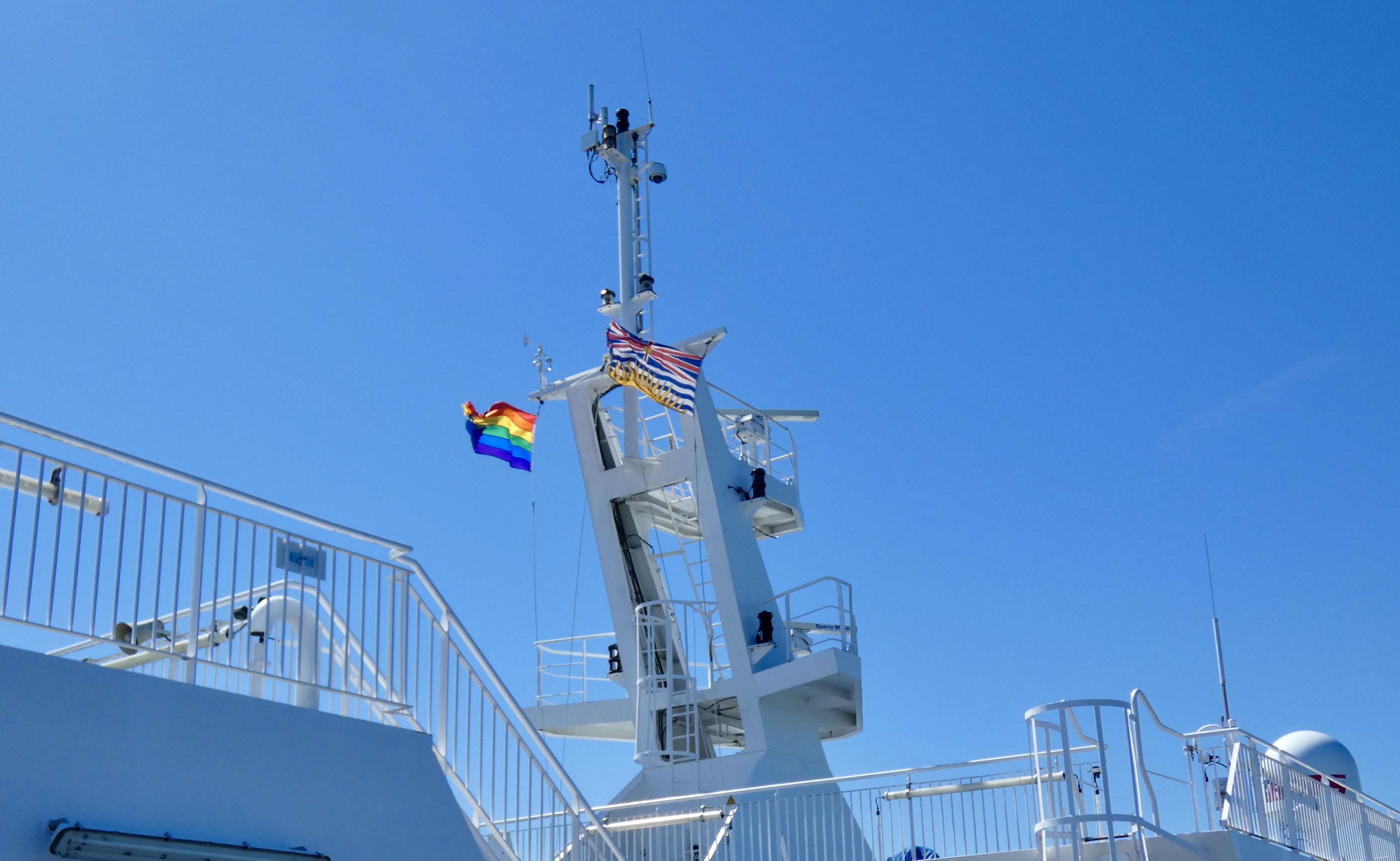
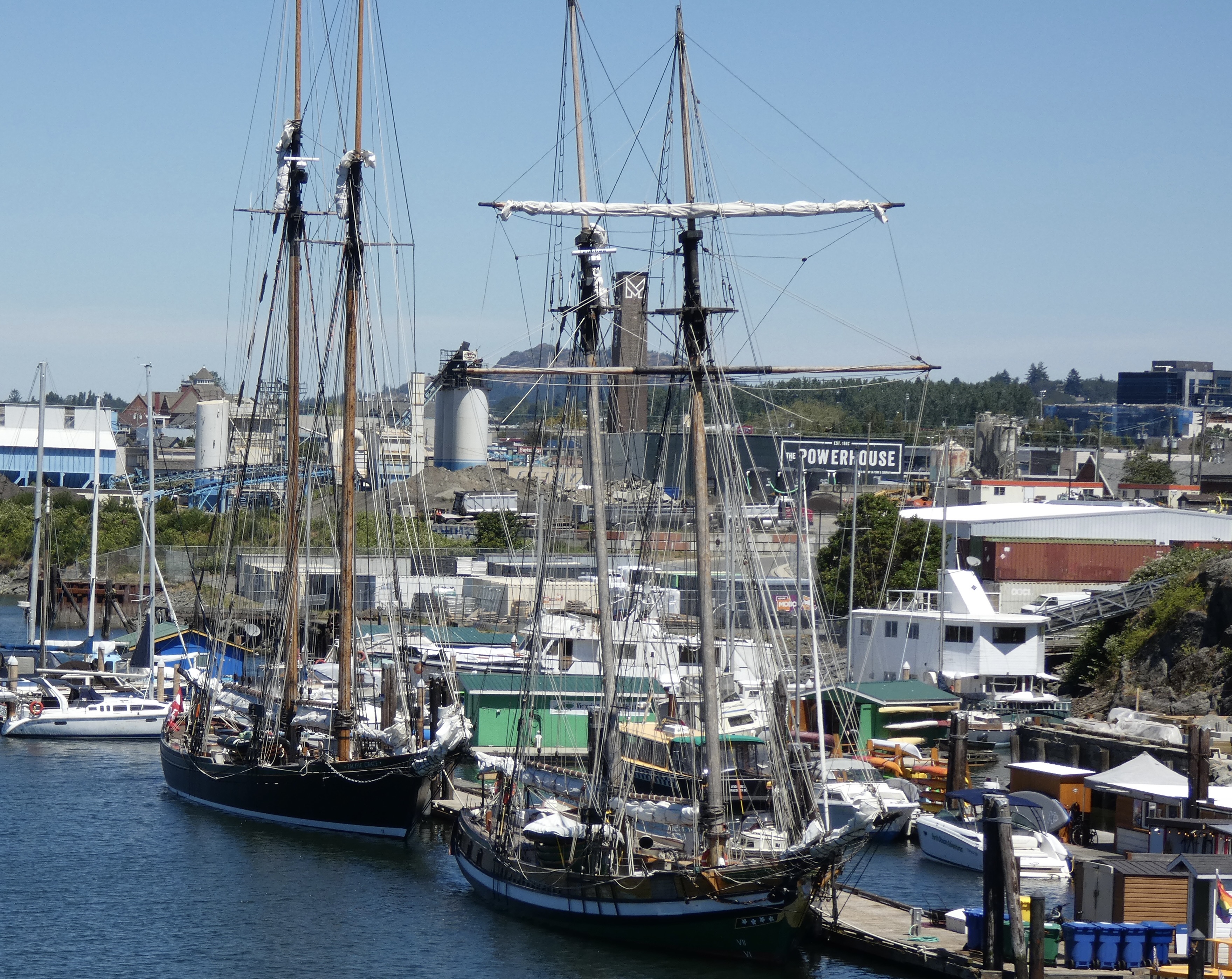
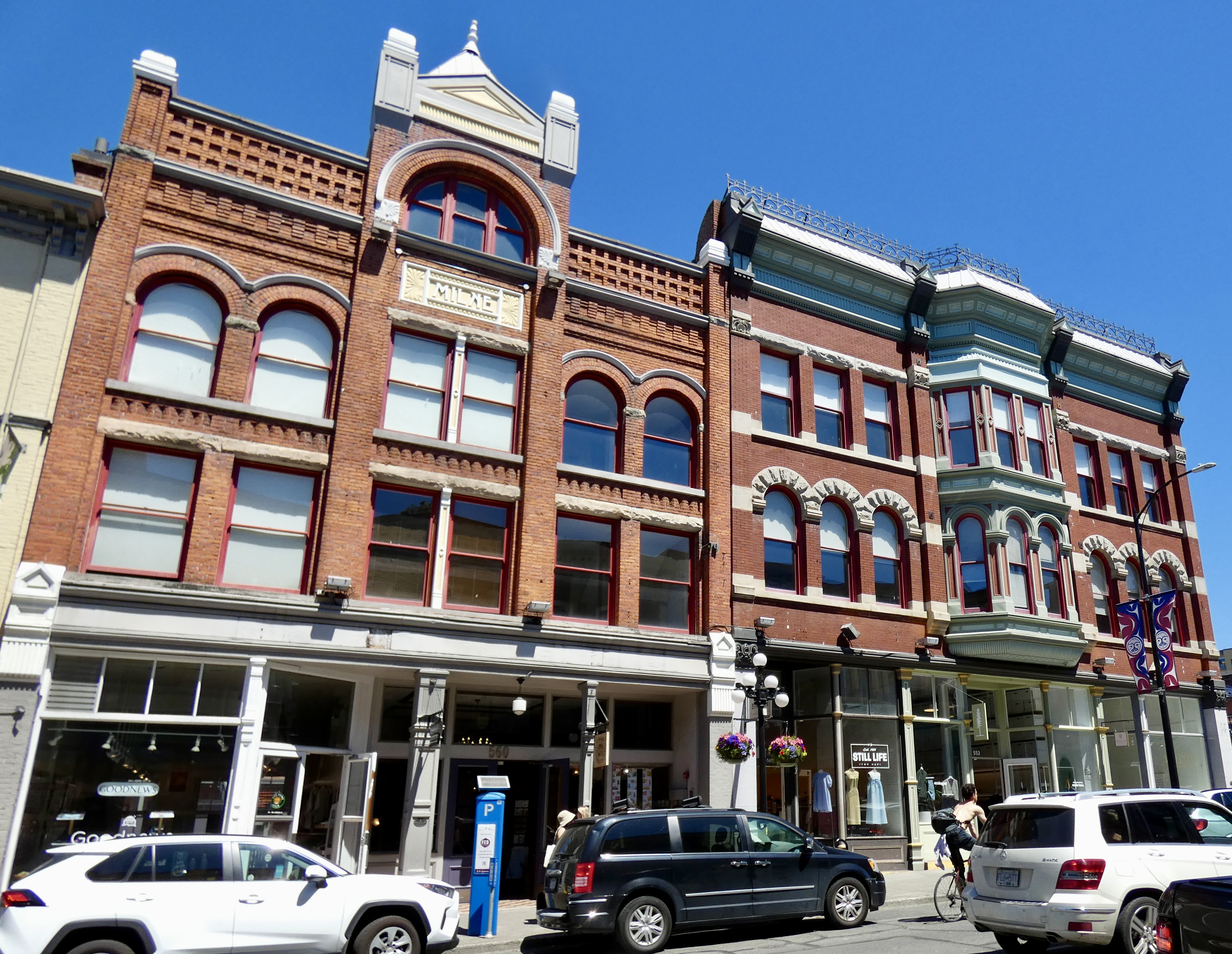
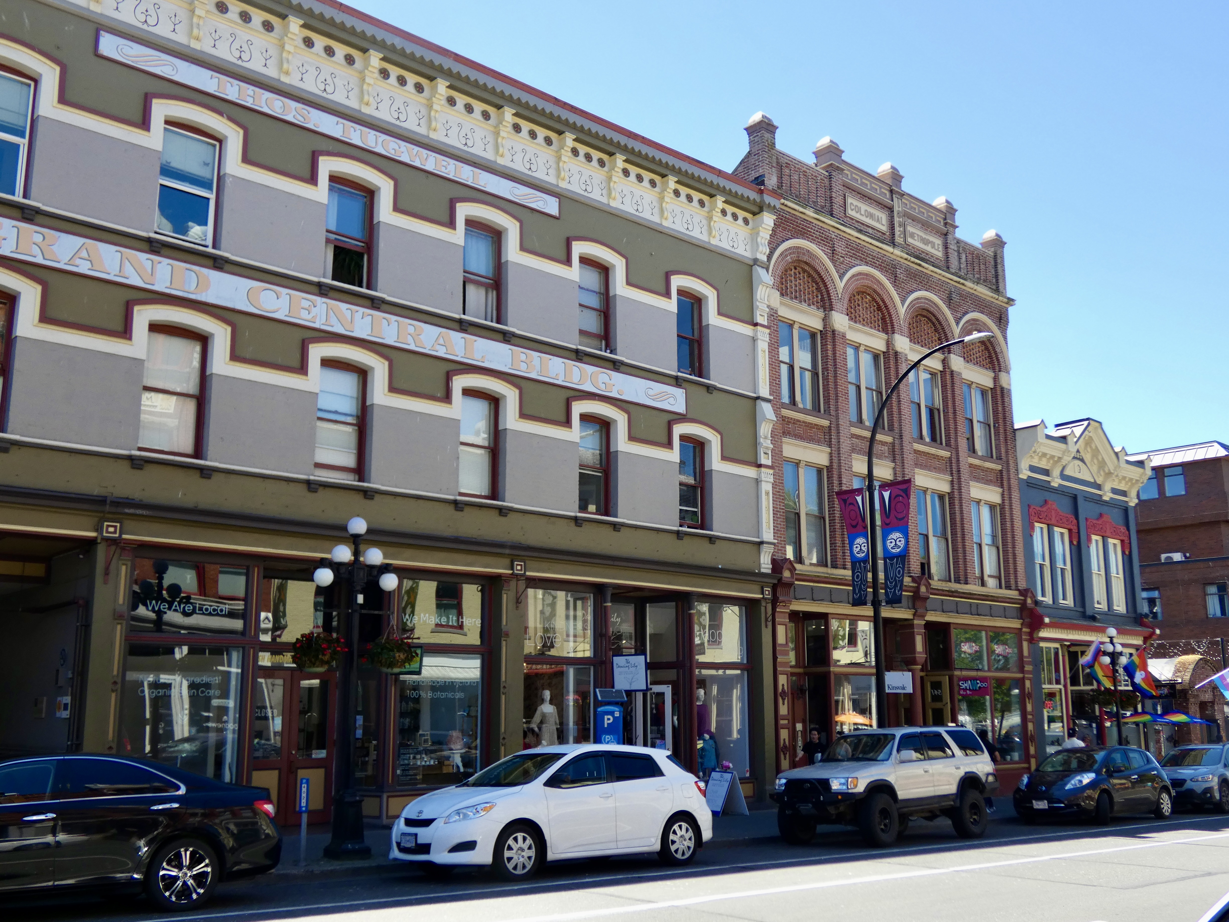
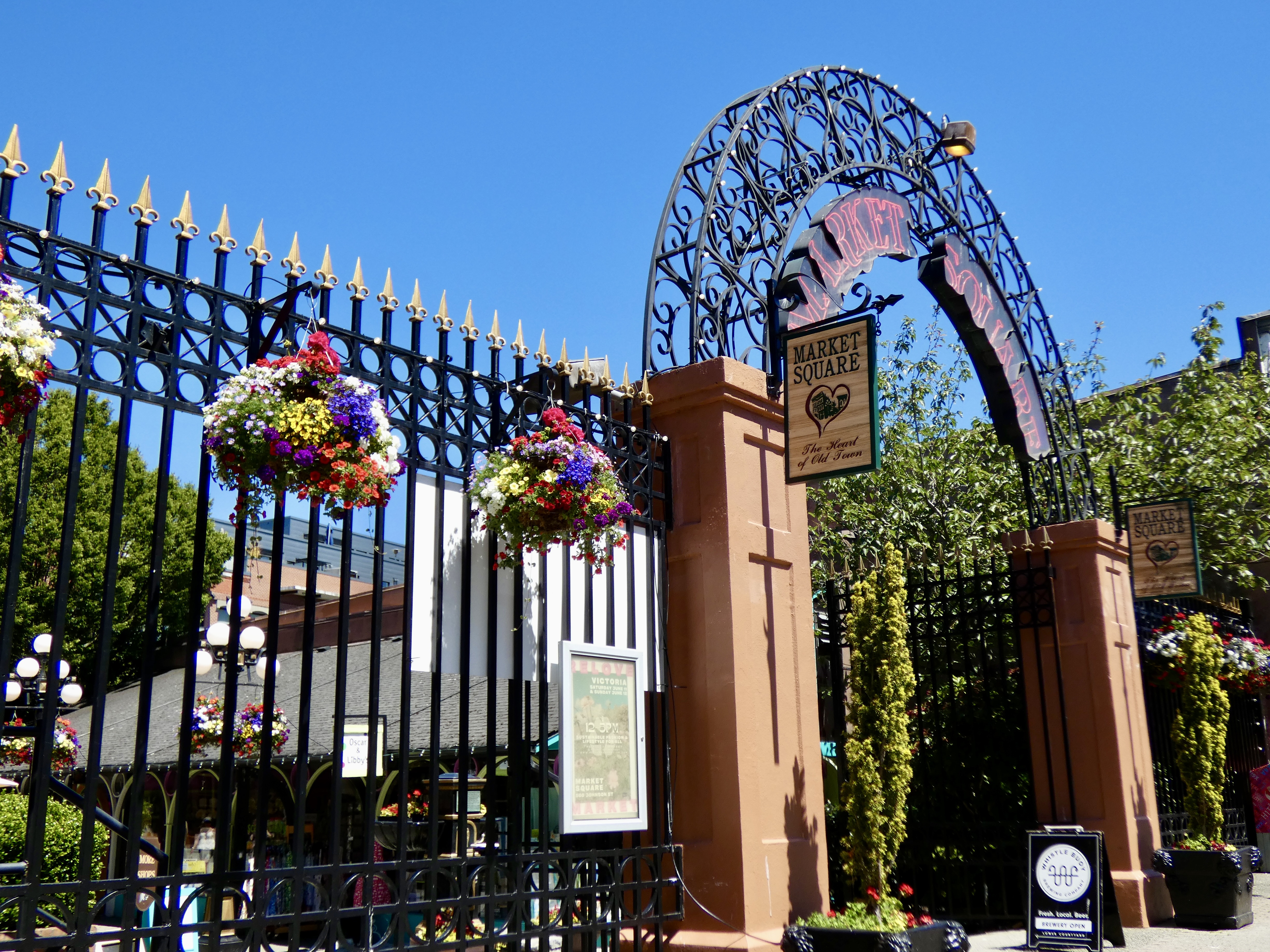
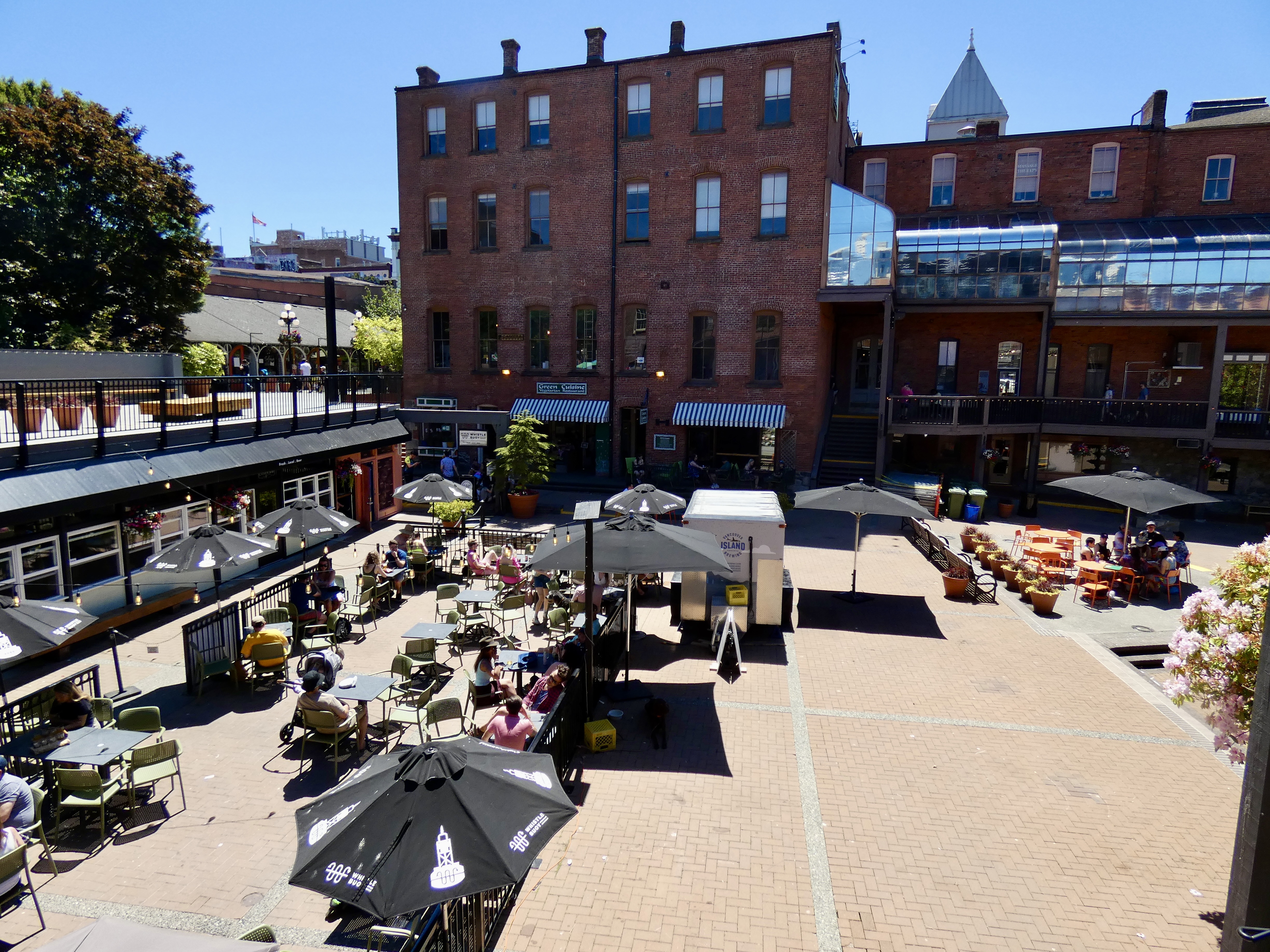
Because we sailed on an earlier ferry than I anticipated, I had several hours to spend in Victoria. I expected I would ride there, look at mostly empty streets, and check out some pre-twentieth century architecture. What I discovered instead was that downtown Victoria is vibrant and packed with people, even on a Sunday afternoon. Before we arrived, there had been a large Pride Parade, and many participants and supporters remained downtown, enjoying the sunny Sunday. But thousands of other people were also walking the streets, shopping at stores advertising support for the LGBTQ community, and stopping for a brew or two at elegant pubs and bars in beautiful old buildings. I even stopped in a real bookstore just to smell the unique ink-on-paper smell only a bookstore can offer. I don’t think today was special in Victoria; I think it was an average summer Sunday in a very vibrant and beautiful city. Why, I wondered as I enjoyed the sights and sounds, are most downtowns in the States empty and depressing on a sunny summer afternoon?
I didn’t take many photos downtown because (1) it was 85° and I was still wearing riding pants and a long-sleeve t-shirt and (2) I was enjoying visiting the stores, coffee shops, ice cream stores, etc. as much as everyone else and forgot I was lugging my camera. Nevertheless I took a few pictures. Here are some of them:
I had considered taking a walking tour of Victoria during tomorrow’s scheduled non-riding day, but have decided instead to ride through the southern tip of the island on my non-riding day, which, I guess, makes it a riding day after all. Victoria is yet another place I want to return to when I have a week, or a month, or a year to spend enjoying the life and views it has to offer. After the CCR, I hope I live an additional 30 years so I can come back to ALL the places that contributed to the high points of this year’s celebratory motorcycle ride.
Tomorrow is my last full day in Canada. Well, my last full day this trip, anyway. I’m going to try to make the most of it with two wheels, a little gas, and an adventuresome spirit. I can’t wait to get on Canada’s roads again.
Day 30 CCR: The Coq, Hope and More
The Coquihala Highway (BC 5) had been lingering in my riding thoughts for several years as I criss-crossed Canada on various trips in and through the county. I had heard about it and put it on my bucket list of roads to ride. Today I crossed it off.
The ride from Kamloops to Hope was a short one–only 125 miles. But the Coq lived up to its billing. It’s a modern four-lane highway, sometimes becoming five or six lanes when additional lanes are needed up or down steep grades to accommodate speed-limited, heavily-loaded 18-wheelers. I was most familiar with the Coq through the “Highway Thru Hell” Canadian TV documentary based on a wrecker and recovery service operating out of Hope that rescues trucks and truckers who slide off the Cog during winter driving. Today I concluded I would rather drive nails through my eyeballs than drive a big rig on the Coq in the winter. Going into Meritt, about halfway to Hope, we descended the longest hill I think I’ve ever been on, and the entire way down I wondered what it would be like to pilot a loaded. 70,000-pound rig with ice and snow covering the road. Throughout its length, the highway has several long and extremely steep grades that quickly become impassable when it snows, and the road frequently closes due to winter conditions. But often not until it’s too late for some poor truck driver.
Today, though, the sun was shining, the temperature hovered around 80 by ride’s end and the Coq seemed tame enough. In my travels across Canada I can’t remember seeing a posted speed limit of 120 kilometers per hour (about 75 mph) but that’s the limit on much of BC 5. And while I was going 120 (75), cars whizzed past me at considerably greater speed, perhaps because in the entire two-hour ride I didn’t see a single law enforcement officer. Even at only 120, it’s hard to take in all the beauty: Soaring snow covered peaks, huge fertile valleys, the fast flowing Coldwater and Coquihala rivers. I stopped a couple times to take in the view and take a picture or two, but for the most part we just kept rolling. I’ve found that where there are beautiful views, there is usually no place to pull over; and where there are places to stop, trees and undergrowth frustratingly block the view you briefly glimpsed at 120 kph a mile back.
Even with a leisurely 9:00 a.m. start, we arrived in Hope around noon and had several hours to kill before we could check in to the Best Continental Hotel. So we went for a motorcycle ride. Of course.
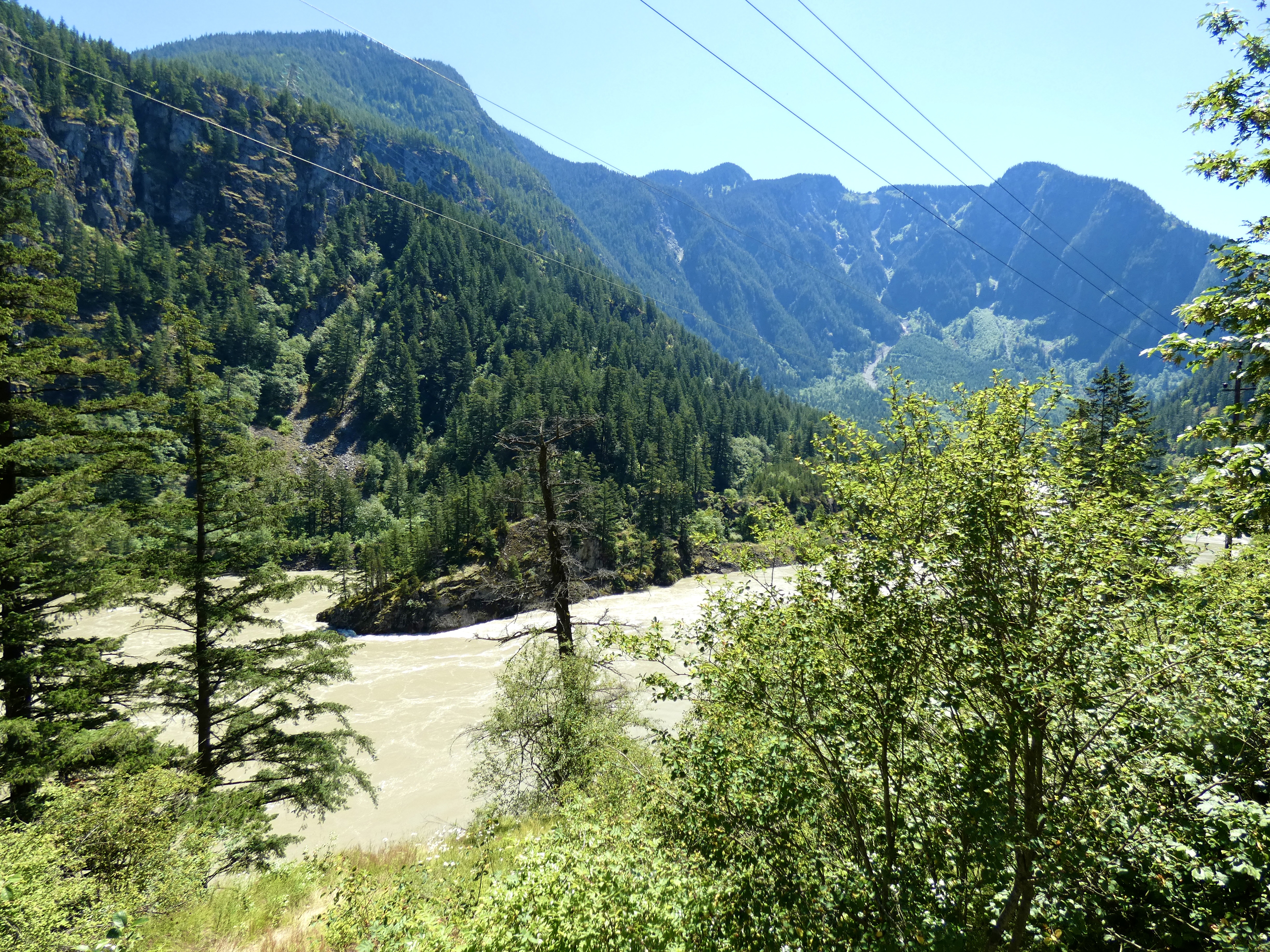
There are two routes to Hope from Kamloops. The short, fast route we took this morning and a longer, scenic route of about 175 miles on the Trans Canada Highway, aka Highway 1. I had wanted to ride both roads, so at noon we started north (east) on the TCH out of Hope, planning to ride as far as we could in two hours, then turn around and retrace our ride back to Hope. Highway 1 follows the mighty Fraser River north to Lytton for about 70 miles, then, where the Thompson River joins the Fraser, the road veers east following the Thompson. Two hours took us about 85 miles up the road, allowing for some photo stops. By then, the landscape had changed dramatically from heavily forested mountain sides to more arid, sparsely-treed mountains. When we went from trees to no trees, the temperature went from 80 to 90, and we turned around and headed back. I would like to have continued on, but four hours on the bike in the afternoon after three hours in the morning, felt like enough riding, and I needed to get back to check on plans for the final three days in Canada.
In between many stops and slow downs for road work, and since I had seen the scenery on the way up Highway 1, I twisted harder on the throttle on the way back to Hope than I had on the outward leg. Even with the bike fully loaded, it handled the curves well; I felt like I had had a real motorcycle ride and not just a tourist’s pace. There’s a road in Idaho I think I’ll ride the same way.
Tomorrow it’s another short ride as we reach Vancouver and a catch a ferry to Vancouver Island and Victoria. The CCR is approaching its conclusion, but a couple more Canadian riding days remain, eh?
Day 29 CCR: Sunshine, Mountains and A River
After yesterday’s cold, wet ride, I needed a hefty dose of better scenery and better weather. Today I got both. What a relief.
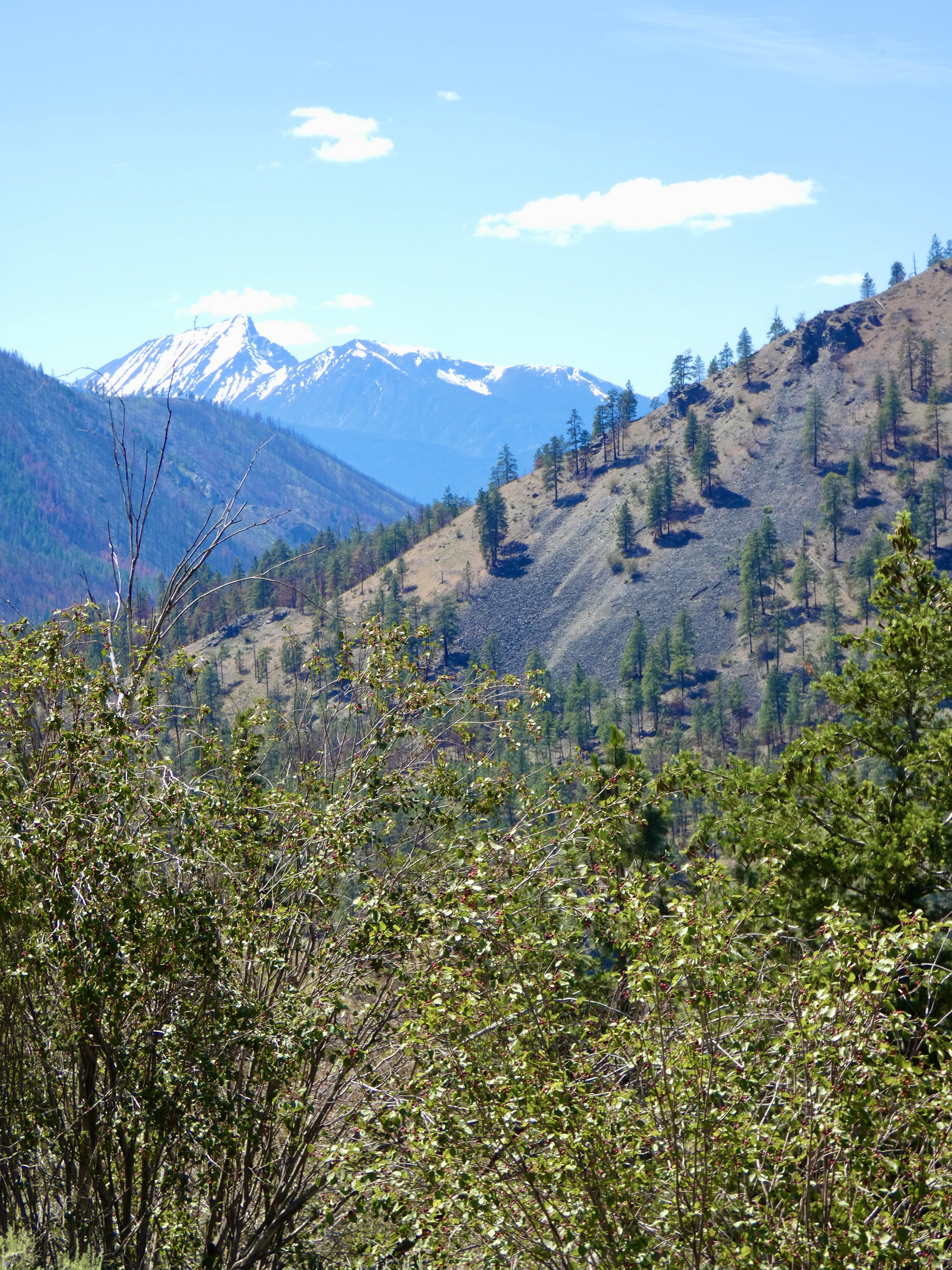
I knew snow-covered mountains surrounded us yesterday, but I never saw a single white-capped peak, hidden as they were by fog and rain. The big mountains lining the Icefields Parkway remained largely unseen by us today, hidden by smaller but still substantial peaks that were our view. Nevertheless, the short 225-mile ride south on Highway 5 through the North Thompson Valley to Kamloops provided enough scenic mountain views through the high, white clouds lingering in the area to mostly satisfy my CCR desire to see Canada’s Rockies in their rugged splendor.
From Valemount, where we spent last night, to Kamloops, the highway hugs the North Thompson River, which, due to the inordinate amount of rainfall in late spring and early summer, is pushing at its banks and in a couple places had spilled onto farmland. The road crosses and recrosses the river a half dozen times, and the old bridges and winding road made for a gratifying, though not challenging, ride. Besides, I was mostly content to remain at the speed limit or below so I could look up and enjoy the scenic valley and the mountains that form it.
As we left Valemount, construction crews and heavy equipment were busy working along the road. I thought at first they were making this relatively busy road a four-lane highway to improve traffic flow. But their work didn’t always parallel the highway. Eventually, we realized they were building a pipeline (especially when we saw piles of large diameter pipe, duh.) I checked online and what I read indicates it’s an expansion or twinning of an existing oil pipeline that will send oil south from Alberta’s oil fields. Rather than feed the United States with additional cheap oil, the pipeline, terminating in Vancouver, will allow Canadian oil to be sold on the world market at a higher price. The construction project, with its hundreds of large pieces of equipment and thousands of workers, extended the entire distance of today’s ride. There can’t be much unemployment in British Columbia because the number of workers involved with this pipeline is enormous. Once again, the CCR has helped me better understand what Canada has to offer and how it spars with the economic giant to the south.
I’ve ridden many roads in Canada on my previous five trips to this country, but today’s ride was a new one for me, as will be tomorrow’s trip on the Coquihalla Highway, known to some as the Highway Thru Hell because of it’s starring role in the eponymous Canadian television show. I was surprised today that the snow capped peaks we first saw in Valemount dwindled as we motored further south and the valley widened to produce substantial ranch and farm land in the fertile soil of the valley floor. By the time we got to Kamloops, the dry land was covered with sage.
Tomorrow The Coq and Hope. Can’t wait to see what they have in store for us.
Day 28 CCR: The Adventure Continues
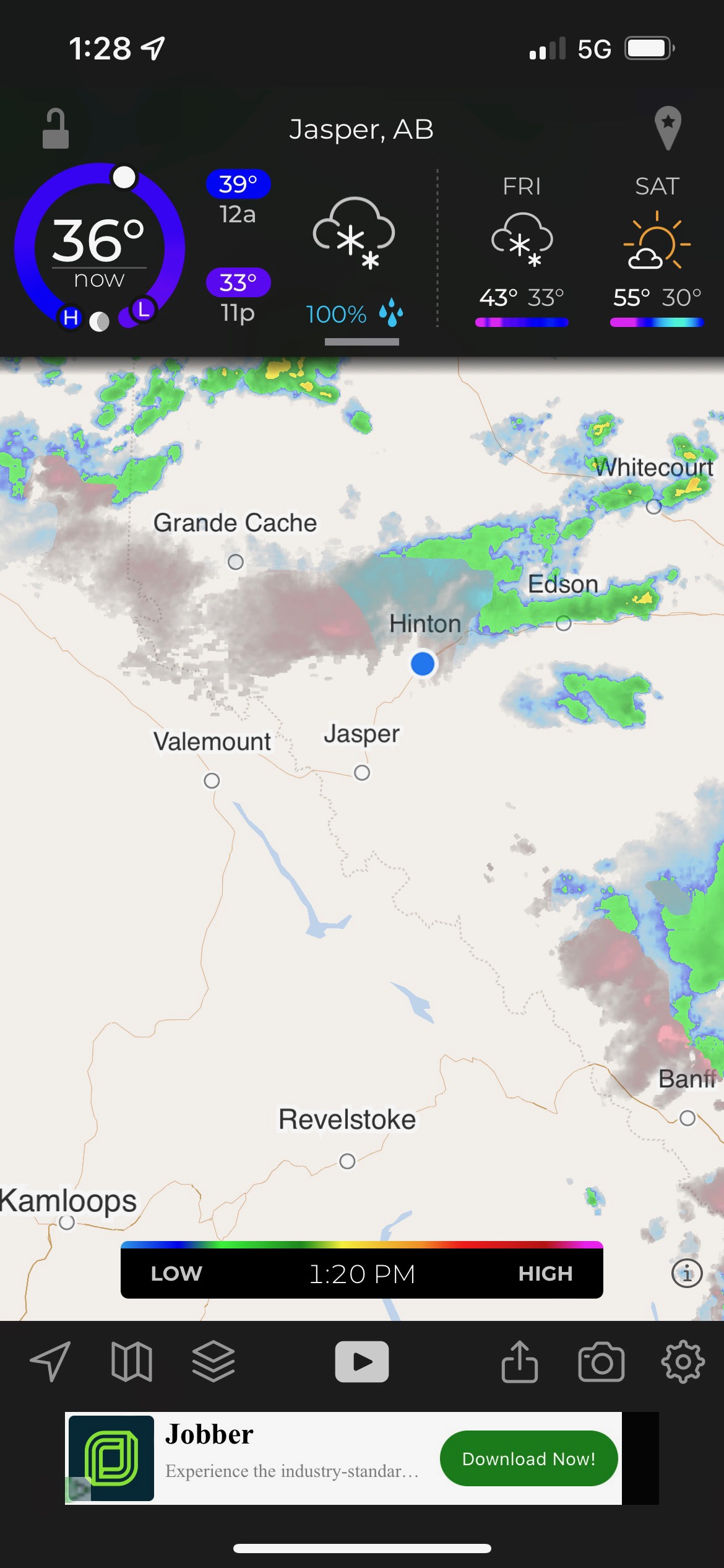
Astute readers will quickly notice there are no pictures in today’s post and only one screen shot. But the screen shot should explain why there are no pictures. 36° in Jasper at 1:30 in the afternoon. Rain to the east; snow and ice to the west and moving south with a 100% chance of rain and probably some snow or sleet as well.
Yeah, just another average day on the Cross Canada Ride.
Six months ago when I planned the CCR, I knew today would be the best riding day of the entire trip because it would find me on the Icefields Parkway, marveling at the mountains and exhilarated by the ride. But last night I decided to forego the Icefields Parkway. It was an easy decision, actually, because the Parkway would yield few pleasures today. But it would harbor a lot of cold rain, maybe some snow and a decidedly unpleasant ride. And distracted tourists would still clog the road, making the ride more all the more hazardous.
So, after checking the weather forecast one more time and assuring myself that not riding the Parkway was the right decision, I suited up once more with long underwear, riding pants, rain pants, light jacket, heated jacket, balaklava and rain coat and at 7 a.m. left our hotel in Red Deer in heavy rain. When I’m completely suited up in multiple layers of gear, I’m like young Ralphie Parker in the movie classic A Christmas Story when he goes out to play in the snow and can’t move because of all the layers his mother encased him in.
As expected, the early morning rain lasted only 30 minutes, and for the next three hours we zigged and zagged north and west on various roads, which bypassed most of the mountain ride. Even as we skirted the mountains, we still contended with a cold (mid 40s) ride. But at least we and the pavement were dry. At Entwistle, we connected with Highway 16, better known as Yellowhead Highway, the main highway west out of Edmonton going over the Canadian Rockies.
Somewhere on the Yellowhead Highway between Edson and Hinton, the rain, which I knew was coming, came. Still, it wasn’t heavy, and temperatures remained in the mid 40s. By the time we got to Hinton (where Mark and I stayed in 2016 after riding the Icefields Parkway on a much nicer day) the rain was heavier and the temperature dropped to 40°. And then it got worse.
When we stopped in Hinton for hot chili to sustain us through the next three hours, I checked the weather and made the screen shot displayed in today’s post. The rain was mostly behind us, but the moving radar image indicated that the pink and blue colors (i.e. sleet and snow) were moving south, potentially into our path. Fortified by chili and coffee, we started the climb to Jasper (the northern terminus of the Icefields Parkway). The rain grew heavier and was accompanied by low clouds, fog, drizzle, mist and other similarly unpleasant weather phenomena. The temperature continued to drop into the mid 30s. But we pushed on, up the Yellowhead, hoping either to beat the worst of the weather or to have the temperature stay in the mid-30s and turn the sleet to rain. The latter seemed to be the case, because after Jasper all we contended with was heavy to moderate, cold rain. As we passed Jasper, I looked up, hoping to catch a glimpse of the awesome snow-covered mountain peaks that line the Parkway, but all I saw were clouds.
Our heated jacket/vest and gloves mostly did their jobs, though by the end of the ride the gloves had absorbed so much moisture they began to leak and lose their warming properties. For me, the glove issue only affected the final 30 minutes or so of the ride. My rain suit kept me dry, except for some leakage at the bottom of one pant leg where I probably didn’t fasten the velcro tight enough. Steve had some clothes that needed to be dried out at the hotel.
Sorry there are no pictures today. Pulling over, unhooking heating cables, removing gloves, taking a picture of rain or cloud-covered mountains, restoring the cables, trying to put wet fingers into uncooperative gloves, and merging safely back into traffic on wet roads with a face shield that only allows 50% visibility didn’t seem like a good plan. Tomorrow I’ll have better weather and better photo ops.
Challenges and adversities make rides like the CCR an adventure, but I have to admit I’m ready for a little less adventure, thank you very much. There may be some rain early in the morning, but by the time we arrive in Kamloops in the afternoon we should see low 70s and sunshine.
Today was a challenge, but in all the rain and drizzle and cold, I entered the 10th Canadian province of this trip and the fifth time zone. Not bad for an old man. I can’t wait to get on the road again.
Day 27 CCR: Surprises–Pleasant and Otherwise
Today, Steve scheduled more work on his bike, this time a primary drive belt that needed to be replaced. But we started the day in Lloydminster, AB, and the part and the dealership that would install it was in Red Deer, about 220 miles away. To ensure the service department had enough time to get the repairs done today, we needed to arrive as early as possible, which meant a quick breakfast and kickstands up at 6:15 a.m. Four hours later, with no stops for photos along the way, we pulled into Gasoline Alley Harley-Davidson in Red Deer and the techs started working on his bike. Steve waited; I had a museum to visit.
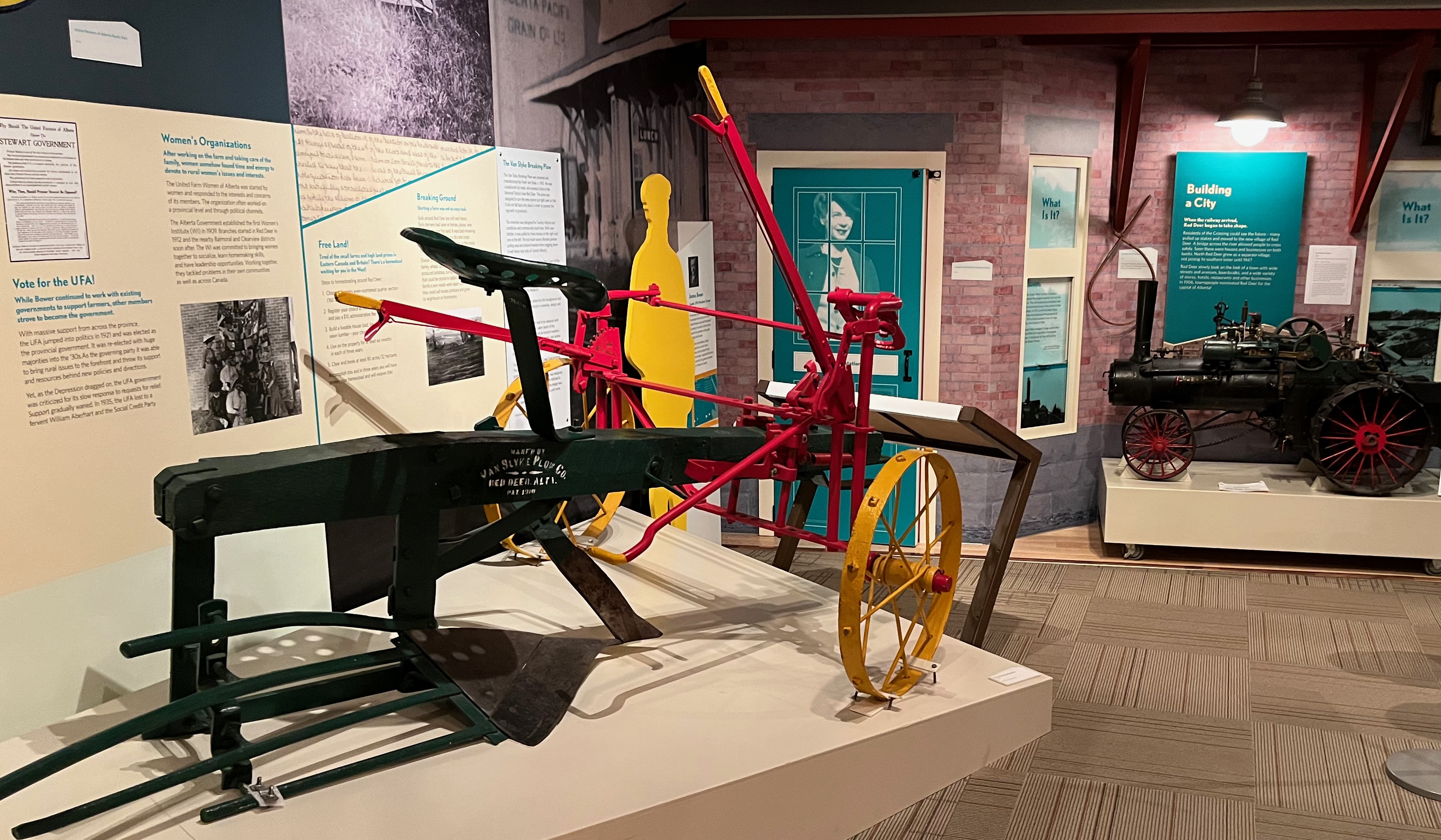
I had planned to go to Red Deer Museum + Art Gallery even without an early start, because the ride would only be about four or five hours and I would have time in the afternoon to check out the MAG, as it’s referred to locally. I wasn’t sure what to expect, but I anticipated seeing a simple local museum display in a refurbished “historic” building along with some art work by local painters. I was pleasantly surprised when I pulled up to the Red Deer Museum + Art Gallery and discovered a relatively new building. That boded well for professional exhibits on the inside. But I still wasn’t prepared for what I found.
The MAG is housed in a modern building owned and maintained by the City of Red Deer (pop. 100,000) in Rotary Recreation Park, which besides the museum contains a recreation center, skating rink, picnic facilities, playground, water feature for children and more. But the Museum and Art Gallery inside the building are operated and funded independently and governed by a Board of Directors. As soon as I entered the museum I knew this was not a standard local history museum.
Thoughtful exhibits traced the history of Red Deer, from its aboriginal beginnings, through European settlement and economic development based primarily on agriculture. Exhibits covered political developments (and disagreements), immigrants and the value they bring to a community, and a look at the infamous Residential Schools, one of which was located near Red Deer and whose horrid record of cultural genocide was on display for everyone to see. The museum also houses a research center and one of the best clothing and fabric collections in Alberta. I didn’t get a chance to talk with the director or the exhibits curator, but I wish I could have told them how impressed I was with the museum and their efforts to honestly educate museum visitors.
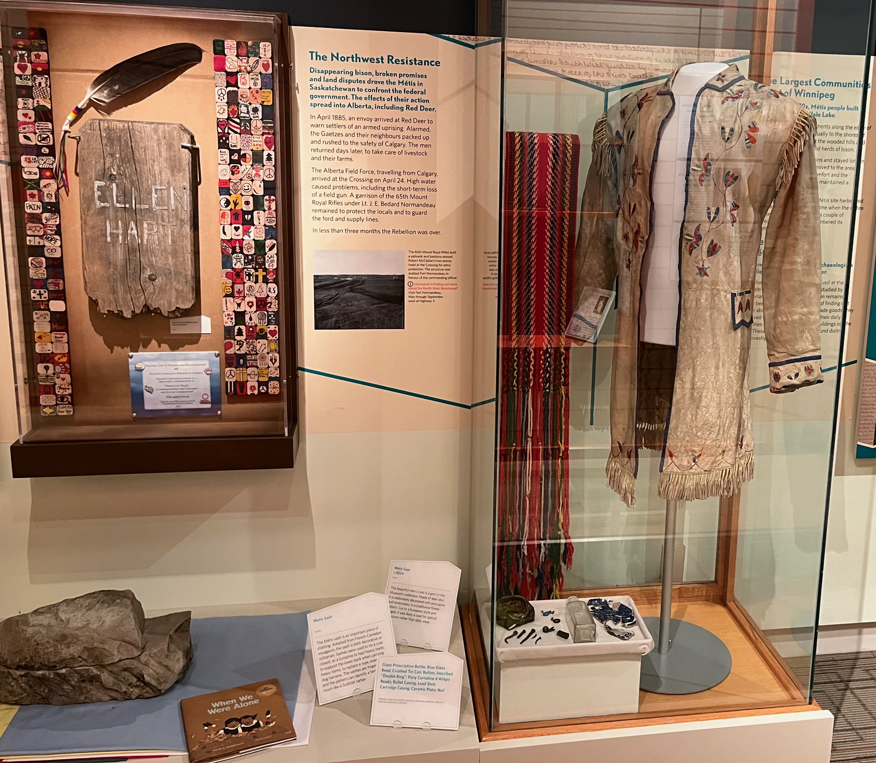
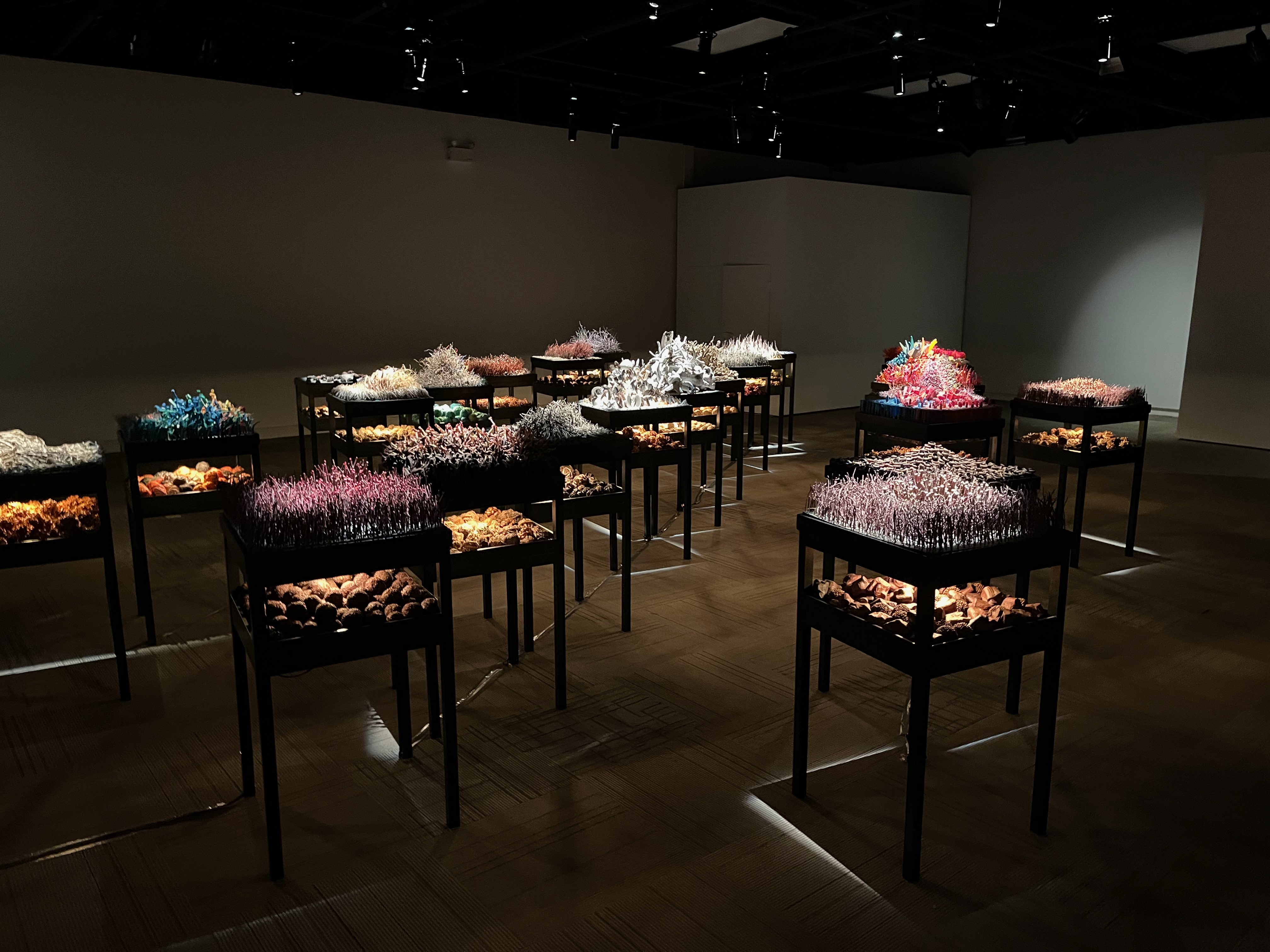
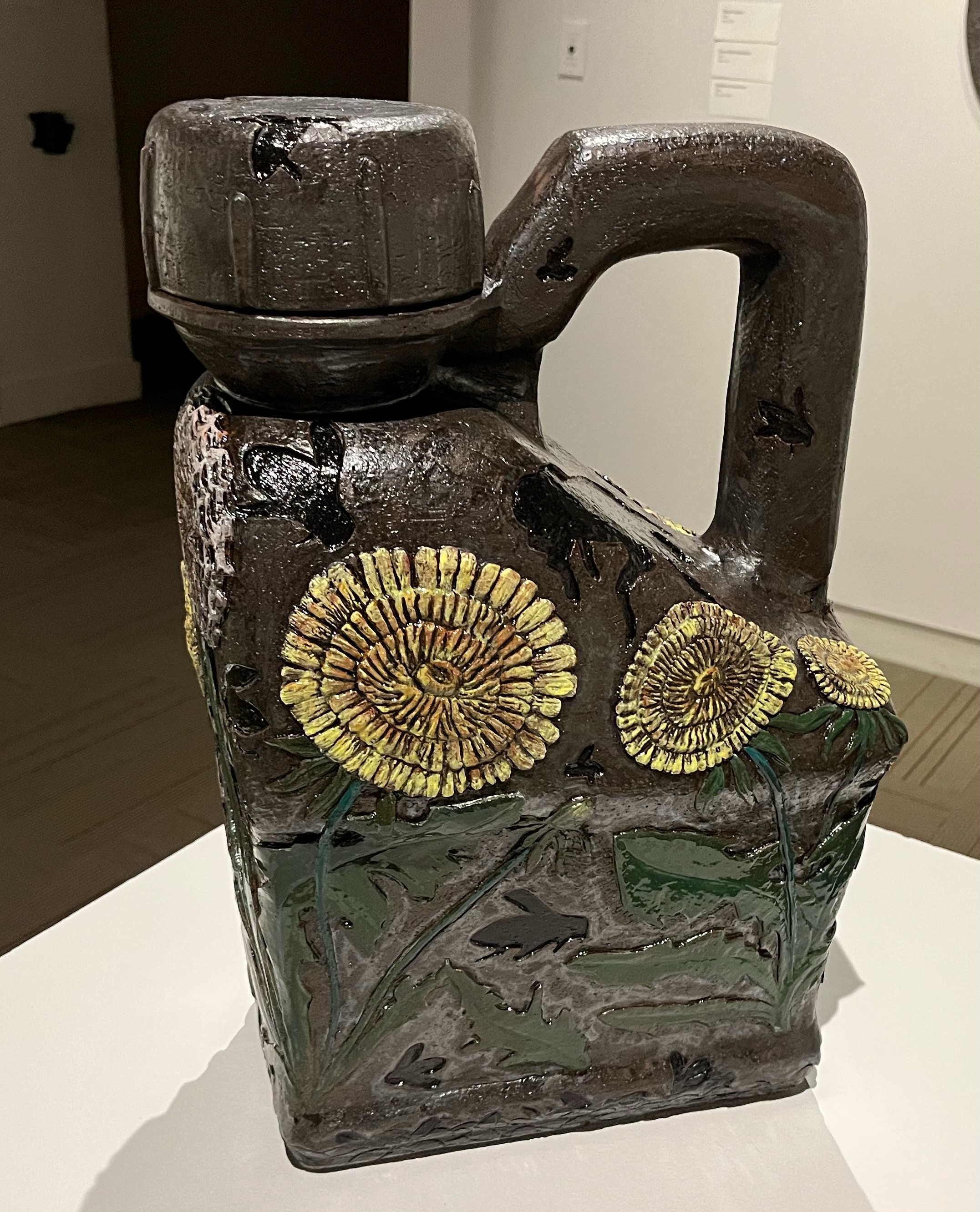
After spending several hours in the historical museum and knowing I could have spent several more, I entered the next gallery and was surprised again, this time by the quality of art in the two current exhibits. The first, “Tracing Tides: A Topographical Investigation” featured sculptures by a long-time and widely shown Canadian artist, Lyndal Osborne. A series of wooden boxes contained sculptures designed to bring to mind underwater life near beaches in Newfoundland and her native Australia. Osborne used items she found at low tide to create sculptures showing changes in nature and the human impact on the environment. In the photographs below I focus on two examples of her work.
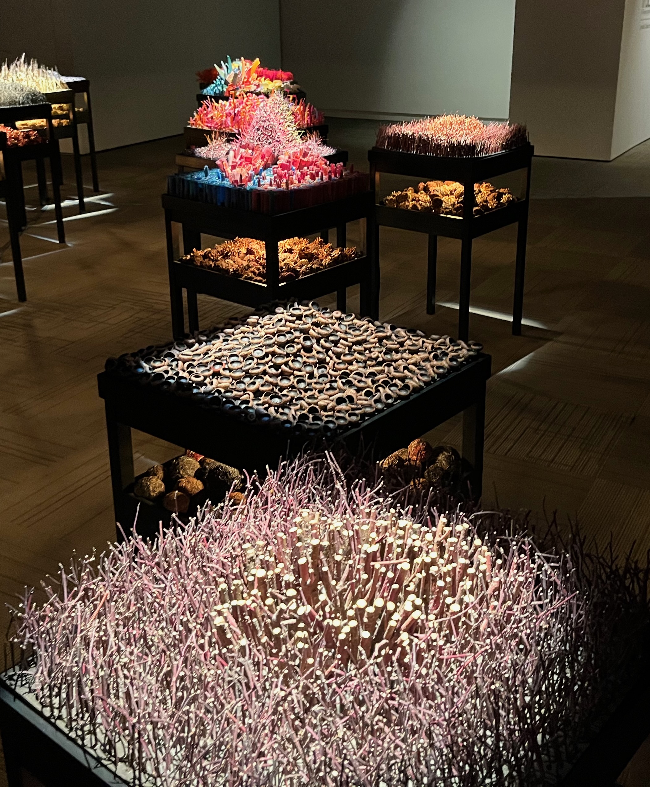
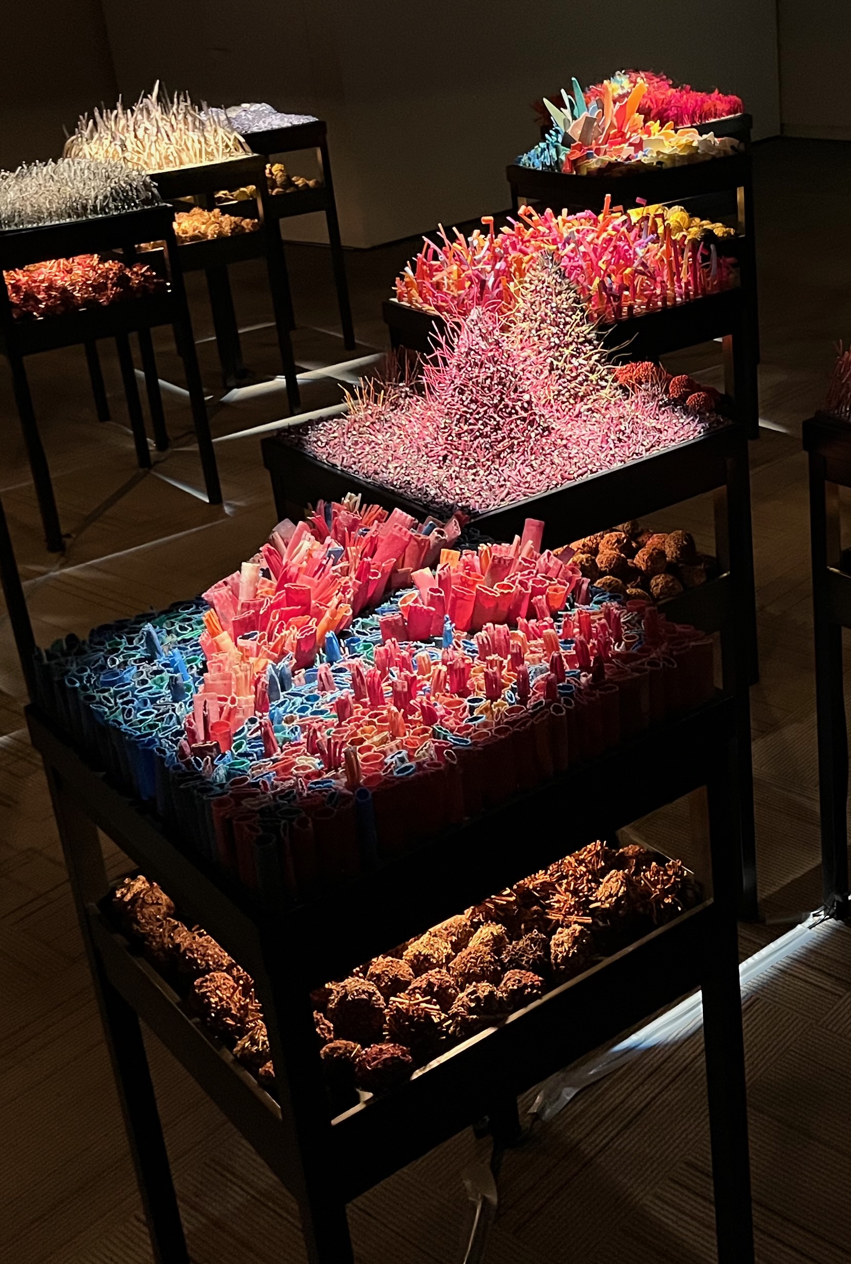
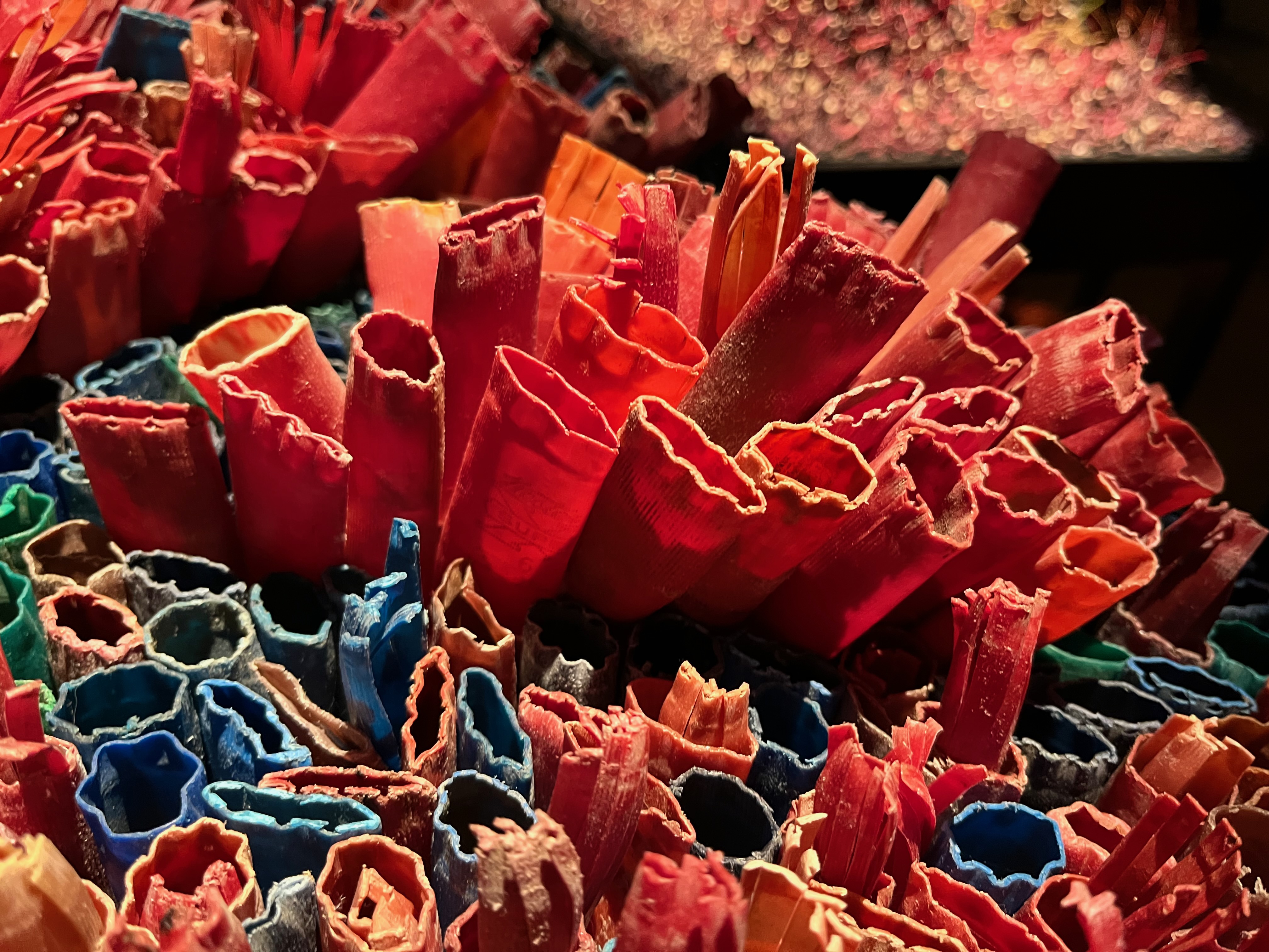
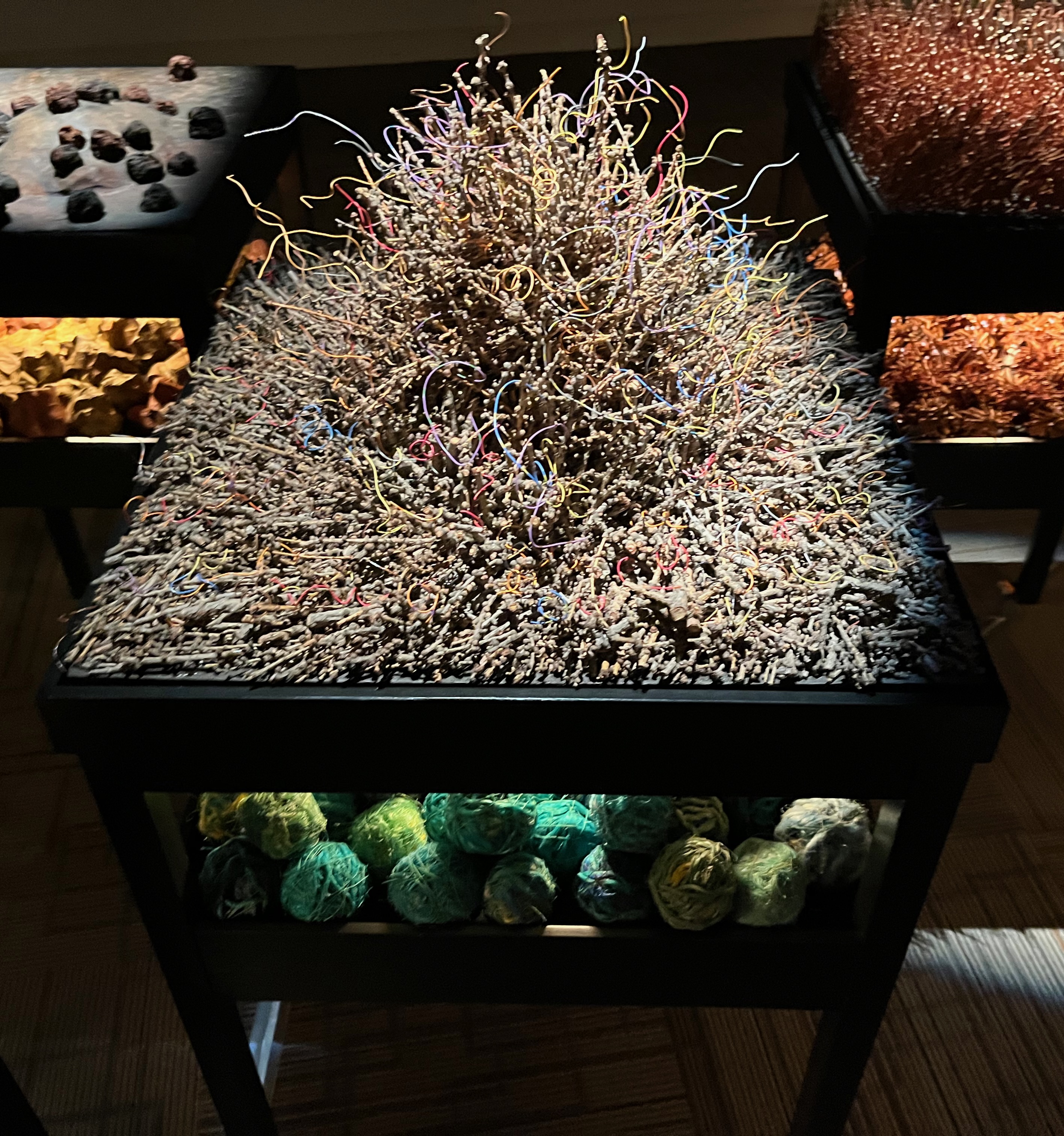
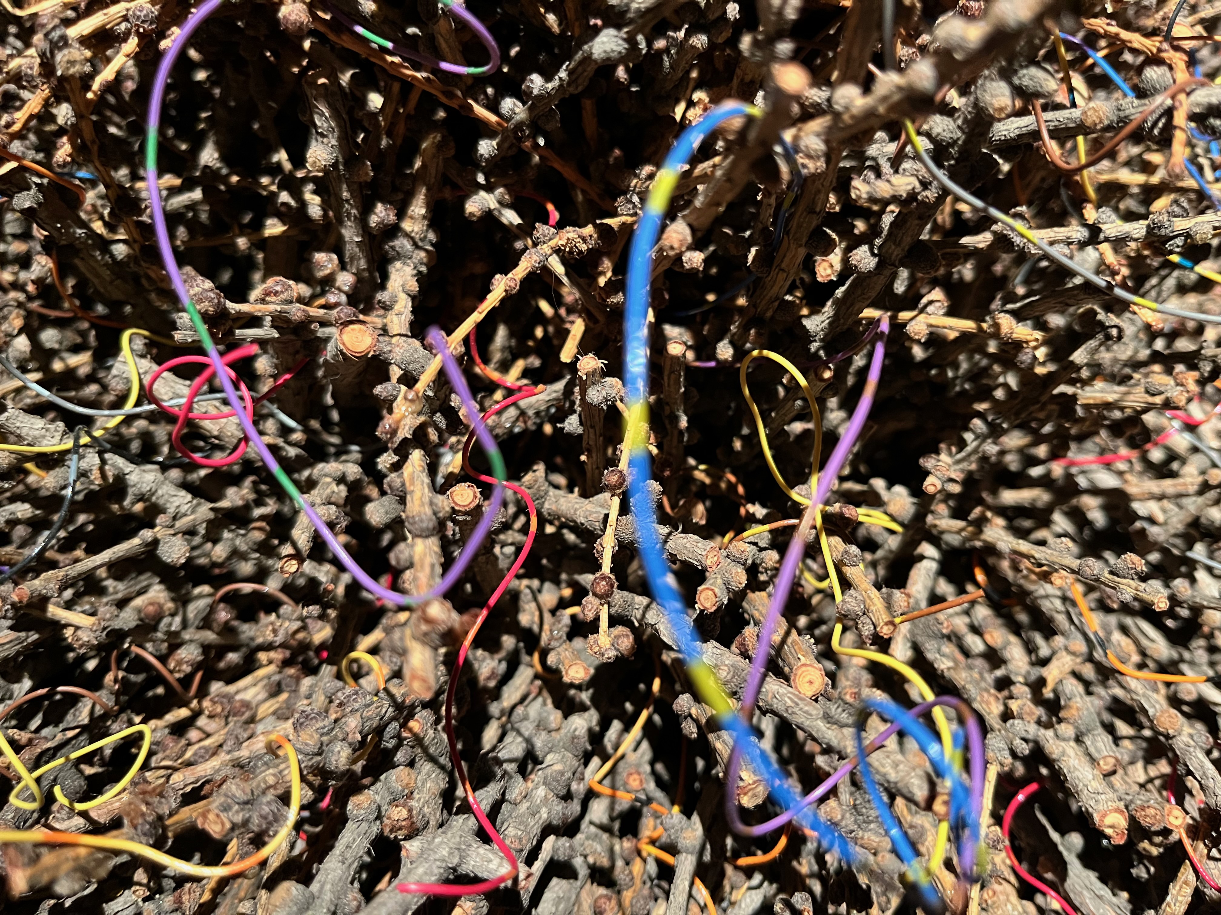
Unfortunately a two-dimensional view of the exhibit doesn’t do it justice. But the exhibit effectively used both natural and industrial objects to take a unique look at environmental changes and degradation.
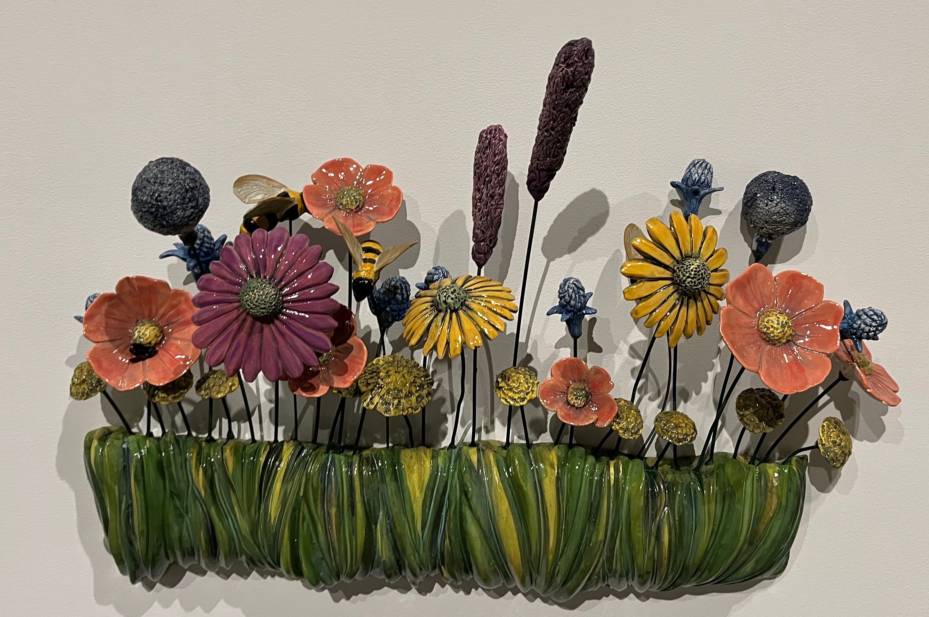
The second art exhibit featured a now-local artist, Dawn Detarando, born and schooled in Massachusetts and at the University of Wisconsin, who focused on the bees that pollinate plants on the land where she and her husband live outside Red Deer. What she noticed long before she started her sculpture project (which included about 30 items) was that bees were stressed by pesticides and herbicides widely used on lawns and on crops and by wild weather swings. Working with clay, wire and paint, she showed how science and climate change are affecting the ability of all species of bees to do what they do best: pollinate flowers and other plants.
Today’s post is different from most of what I post, but (1) it shows what I did today that I thought was important and (2) it shows the value of not underestimating local cultural centers that reflect a community’s values and that can teach volumes with only a few of hours of careful observation.
One final story from today. At the end of three hours in MAG I was so enthralled with the exhibits I didn’t know it was raining until one of the staff pointed it out. Raining!?!? It was fallin’ a frog strangler flood and my travel luggage strapped to my bike was uncovered. I dashed into the downpour, covered my bags but not before they were soaked, and returned to the MAG soaking wet. In 20 minutes the storm had passed, the sun came out, I rode to my hotel and dried everything. No harm done. But the rain gods once again showed me who was in charge.
Speaking of rain. More is forecast for tomorrow. All day. Everywhere I had planned to ride. Oh, and temperatures are going to be in the mid-40s. Tomorrow was supposed to be the best ride of the CCR with a cruise along the Icefields Parkway in awe of the towering, snow covered Canadian Rocky Mountains. I think I’ll take an alternate route that won’t take me as high or be as cold but will still get me just as wet. I can’t seem to get a break with the weather.
Day 26 CCR: Happy National Indigenous Peoples Day
Detours and unexpected meetings turn long-distance motorcycle rides into great learning adventures and a chance to see a lot more countryside. Today’s intentional detour of about 100 miles was no exception. Even though we started riding this morning in a light drizzle, all radar and weather forecasts suggested we would be out of it shortly, and within 30 minutes after rolling away from the hotel, we were on dry pavement with bluing skies.
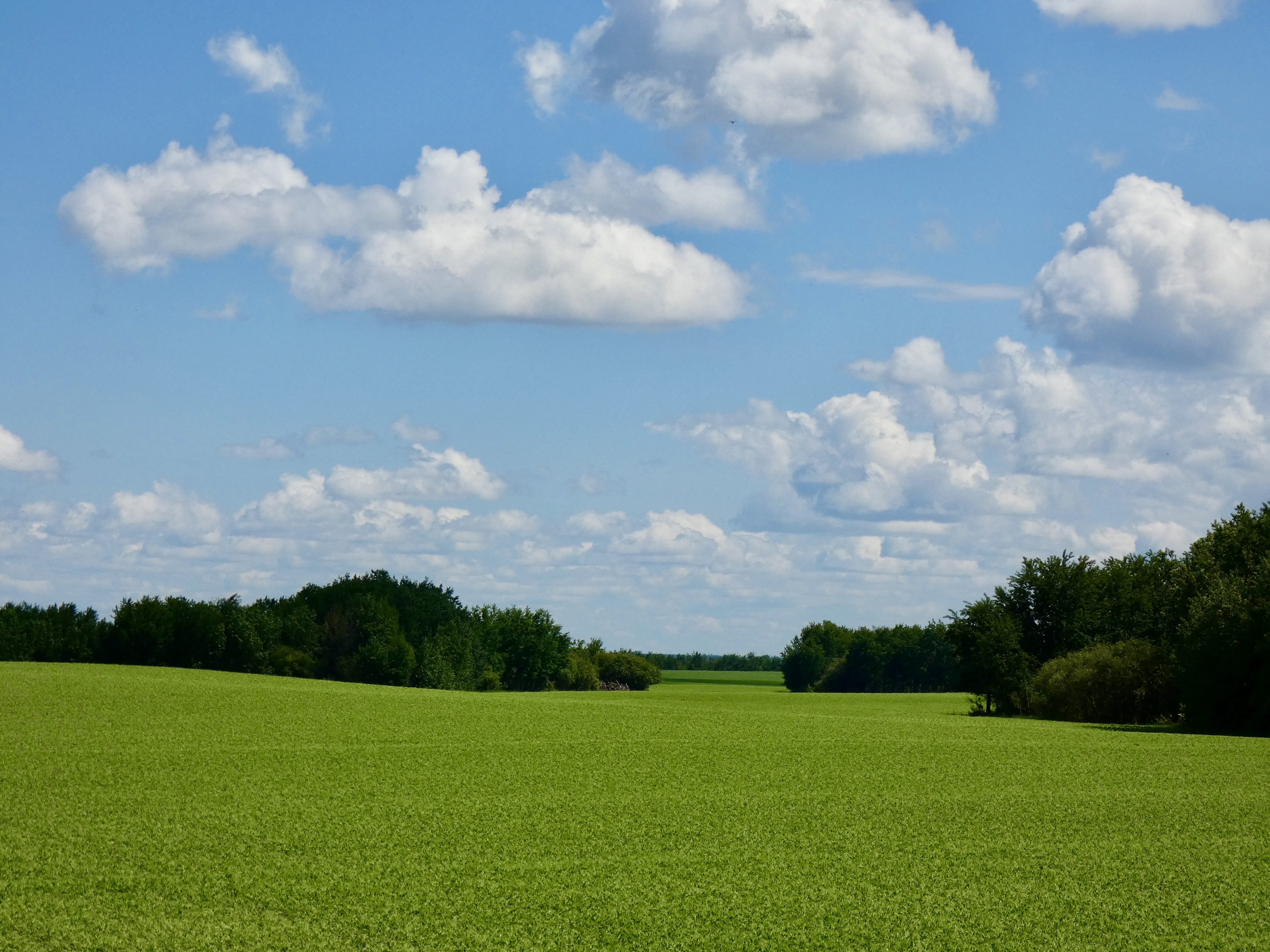
The distance from Prince Albert to Lloydminster is only about 200 miles and could have been a very short ride. But the ride would have been east to west with little change in scenery. I wanted more. So I rerouted us about 45 miles north which added nearly 100 miles to the total. I wanted to watch farm land turn into grazing land and then into forests and lakes, which I expected it to do during that detour. And I got what I expected. Saskatchewan is known as the breadbasket of Canada because it has 40% of the arable land in the country, grows the bulk of the country’s canola and lentils, is one of the leading producers of mustard seed in the world, and has a substantial cattle and meat packing industry, along with various forest products. Today I think we saw all of that, but because my crop identification skills are next to nothing, I’m not positive.
By the time our first gas stop rolled around in Big River, rain was a thing of the past. We shed our rain gear but kept our jackets on because the temperature was still only in the 50s. At the gas stop we spoke for a while with one of the workers there about our travels, and as we were leaving he told us to watch out for bears on or near the road. Great, I thought. Photo ops. But, to my disappointment, the only bear we saw was one by the side of the road that had been killed by a car, probably within the last 12 hours. The only other critters we saw were a couple of deer. But we had mostly blue skies and reasonably decent road so I’m not complaining.
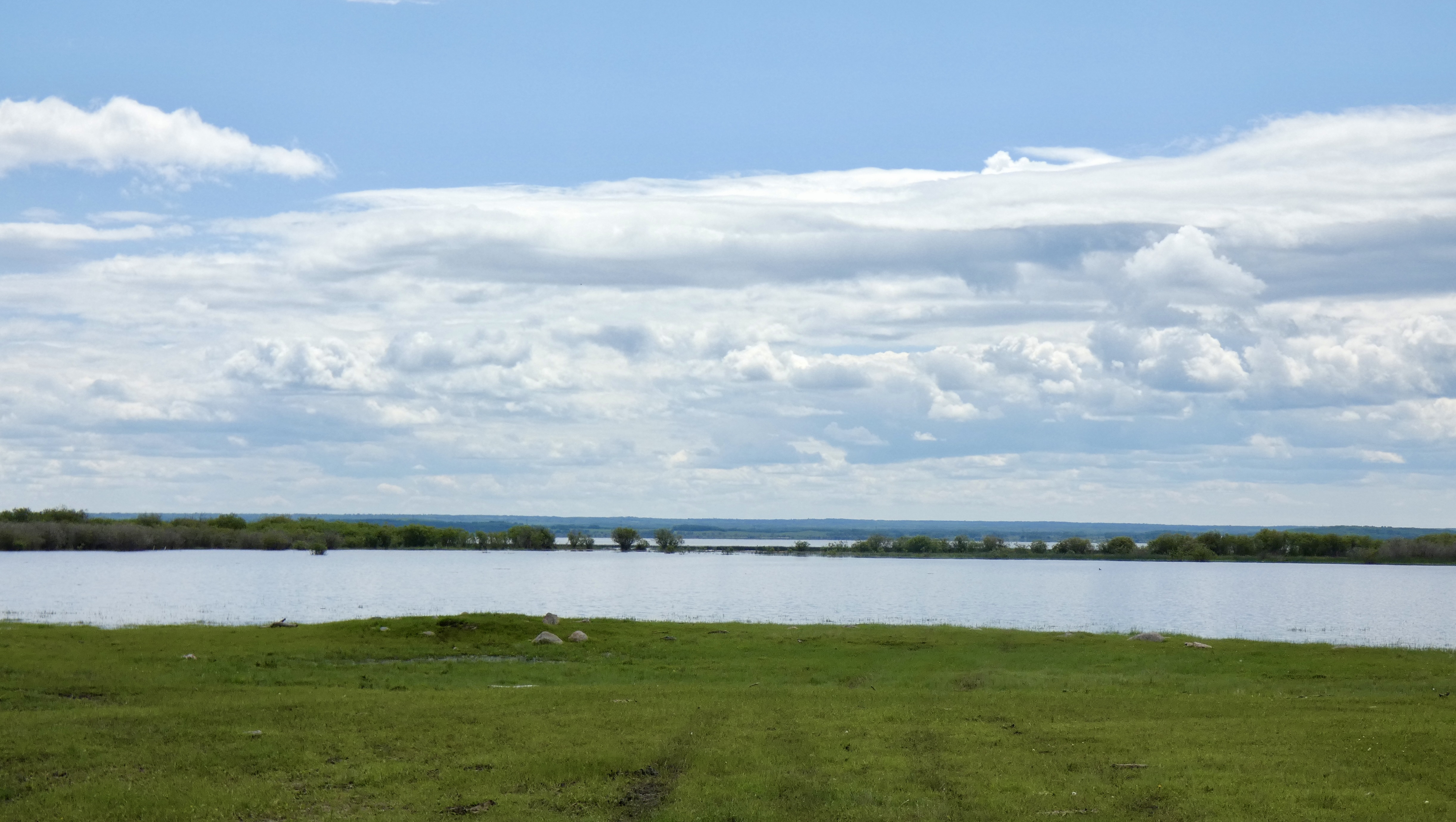
While Saskatchewan doesn’t have as many lakes as Ontario, it equals Manitoba’s 100,000 count. As we rode through the changing landscape, we could see lakes big and small through the trees or beyond a field green with fresh shoots of something. Some hills began to appear in the final miles of our northern diversion, which also made for great lookouts when the road climbed to the top and no trees blocked the view. In some instances, we had an horizon of 10-15 miles with a mix of trees, crops and lakes between us and the horizon. All that green topped with blue skies and white-gray clouds made for stunning views.
The ride was great, the scenery was wonderful, but once again, it was the people who made my day. Meadow Lake is of the largest towns on today’s route (about 5,000 residents), and I decided to make it a lunch stop for a quick bite to eat. We rode down the main street, saw a gathering of people listening to music in front of the “Northwest Friendship Centre,” and parked our bikes. As I stood listening to the music (American country music), I wondered what the occasion was. While musicians entertained, a group of women had grills fired up and were putting hamburger patties between buns and wrapping them in foil. Someone in the crowd saw me standing and listening and asked if I had eaten yet. No? Well go grab yourself a hamburger and a hot dog. Lunch was my reason for stopping in Meadow Lake, so I went to the ladies, who handed me a burger, fixings and a bottle of water. I joked with one of them and asked if they knew I was riding across Canada and was that the reason for the free food and music. No, she said, we’re celebrating Aboriginal Peoples Day and we’re glad you stopped here on your way across the country.
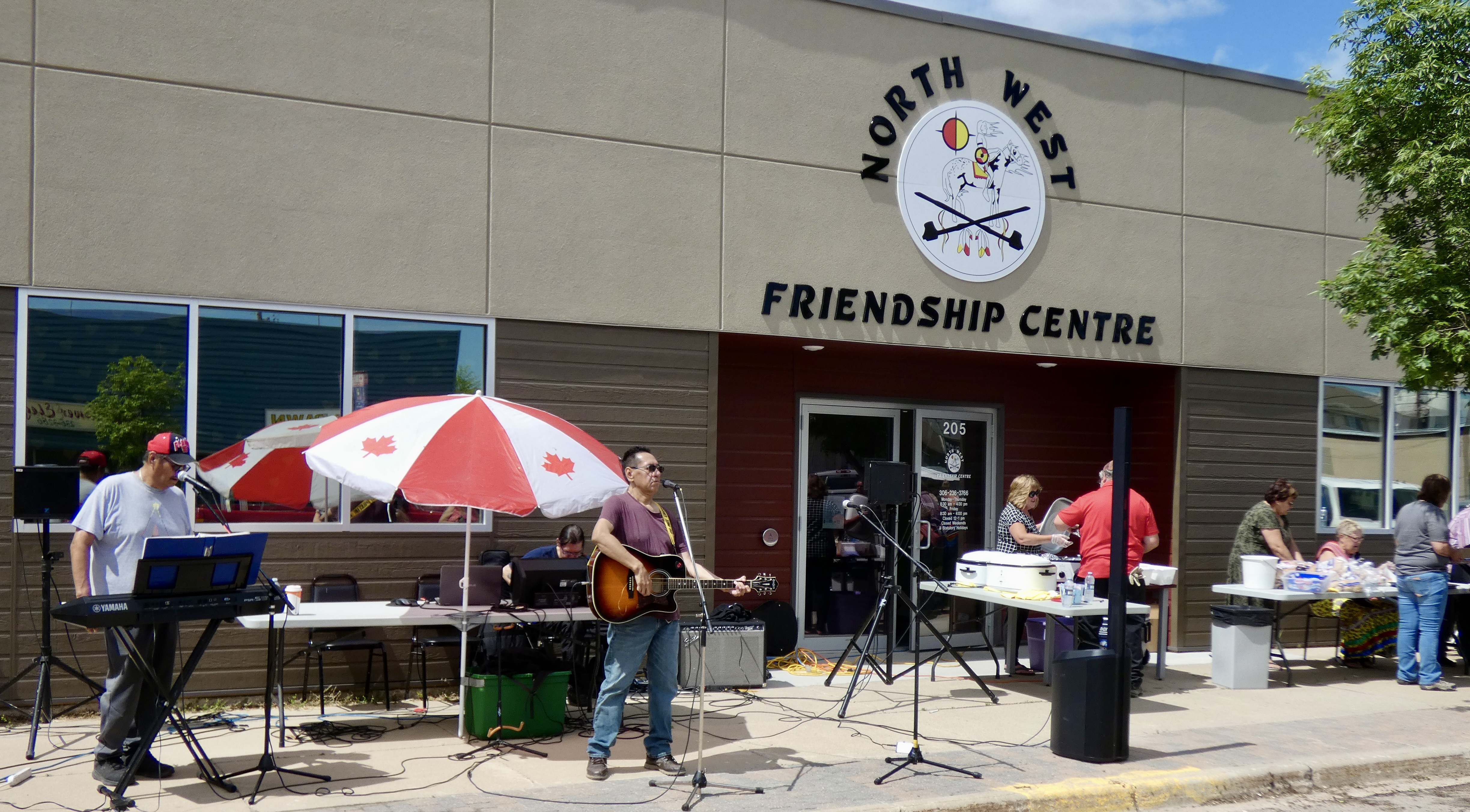
It turns out June 21 in Canada is National Indigenous Peoples Day (aka Aboriginal Peoples Day) when, across Canada, the cultures and contributions of First Nations, Inuit and Metis people are recognized and celebrated. Although not a statutory holiday, the day is widely observed across Canada, especially by groups and organizations like the Friendship Centre in Meadow Lake. The Friendship Centre, said my hamburger contact, works especially with families and with children who have been take from their parents by Social Services. She went on to explain that because of a breakdown in aboriginal culture in modern Canada as many people without urban skills moved to cities, many parents have no idea how to raise children. As a result, Social Services steps in but doesn’t have the resources to meet all the children’s needs. That’s where the Friendship Centre, one of ten in Saskatchewan, comes in. People helping people and improving the quality of life for those in need. I didn’t get to talk long with any of the ladies, all of whom worked in some capacity at the Friendship Centre and were busy cooking and serving, but what I learned was both heart breaking and heartening.
For the third time (Whitehorse, Yukon Territory, 2013; Witset, BC, on the Yellowhead Highway 2015; and Meadow Lake, SK, 2022) First Nations people have graciously invited me, a stranger, to share a meal with them. Each time I have been moved by their graciousness, their openness and their hospitality. And each time my view of human nature has gotten a positive boost.
Tomorrow we’re off to Red Deer where Steve hopes to get a new drive belt put on his bike while I explore another museum.
Day 25 CCR: Short Ride, Nice Visit
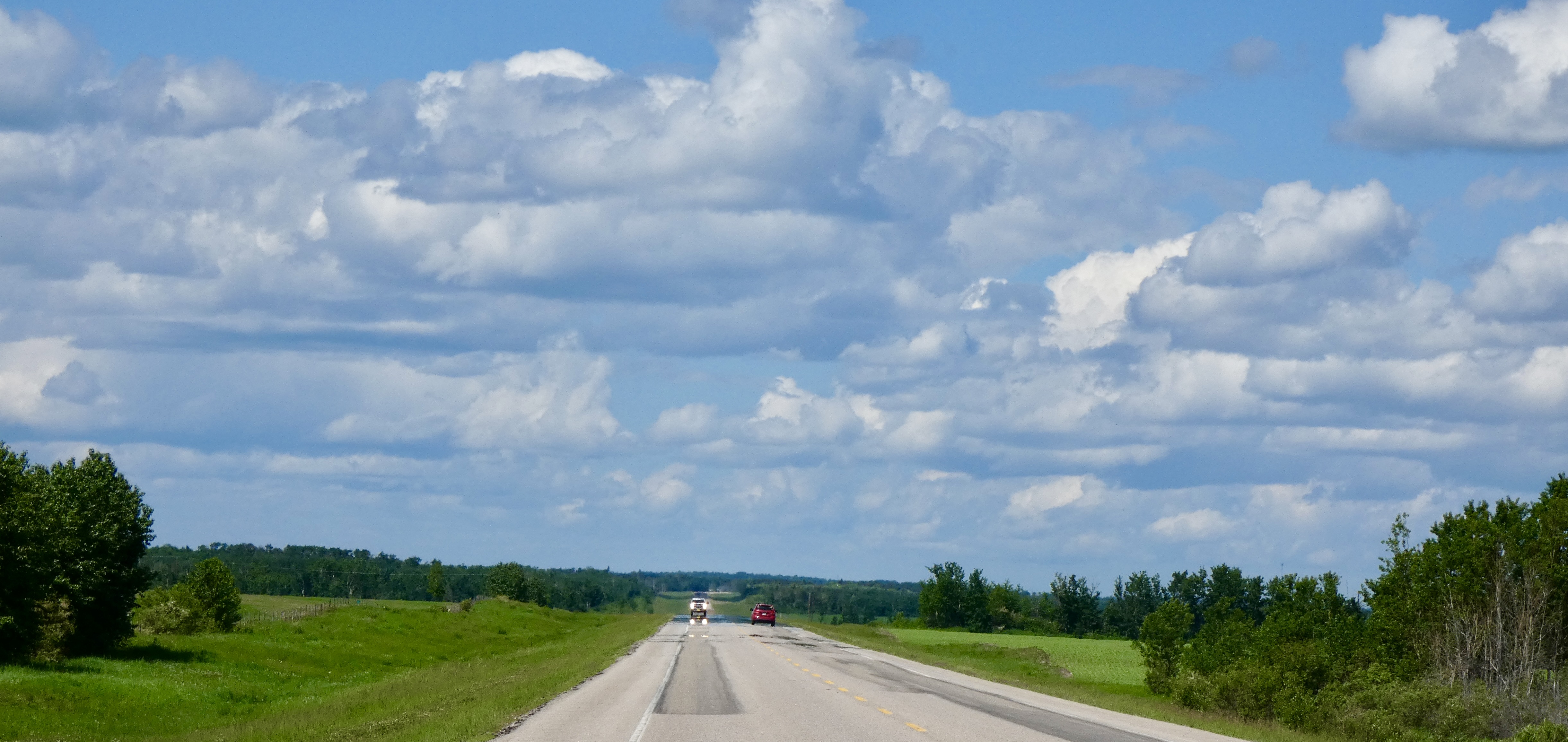
Beginning today and for three of the next four days, I planned to make short rides, in part to allow myself a chance to catch up if I had to delay for weather or mechanical reasons and in part just to slow down and enjoy a chance to take serendipitous detours. That plan worked out well today.
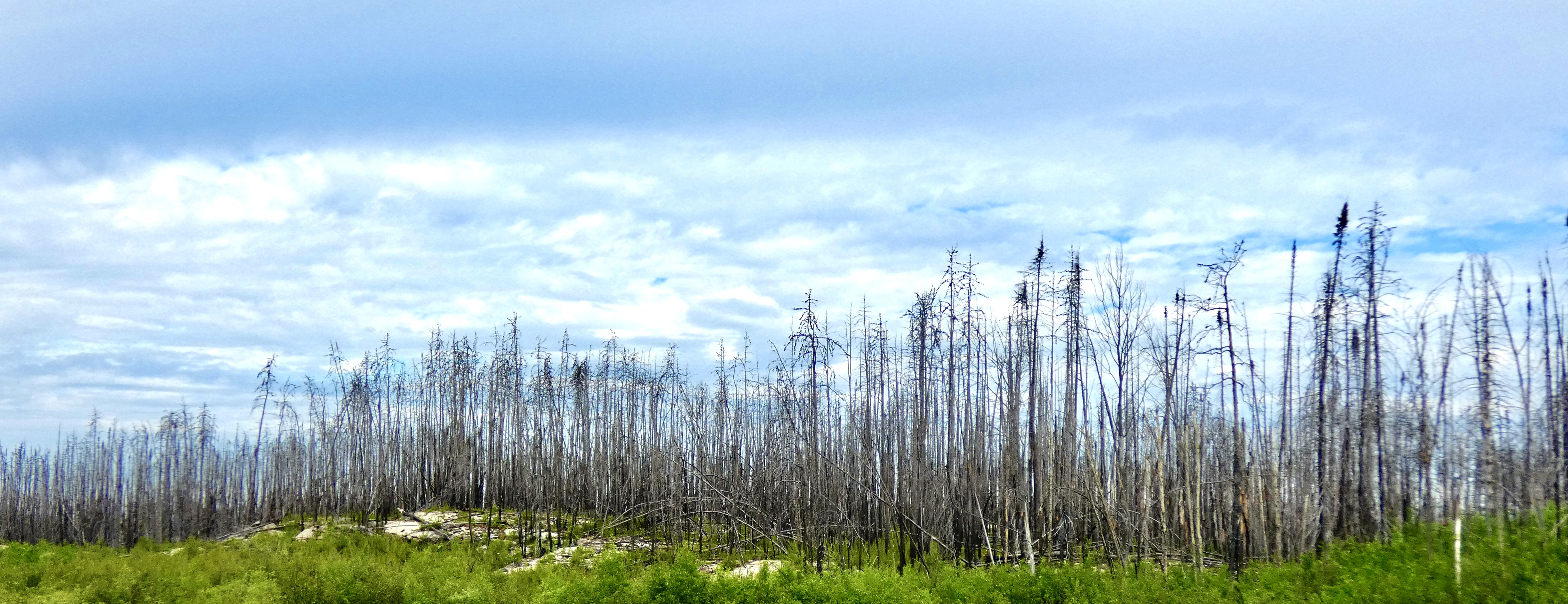
We pulled out of the Oreland Motel in Flin Flon, chose a Tim Horton’s for breakfast at a convenience store that didn’t have any indoor seating, ate sitting on our bikes, then headed down the road, expecting and getting a changing landscape again. Don and Susanne had told us we would see a burned over area as a result of a large forest fire, and for about 20 miles we had nothing but scorched trees to look at as the Canadian Shield slowly gave way to flatter, forested land.
Our only real concern today was finding gas along this lonely stretch of road that has no real gas stations for about 200 miles. My bike could go about 270 miles on a tank, but 200 miles begins to approach Steve’s “running on fumes” condition. At about 130 miles into today’s ride, and right where we thought it would be was a small store/farmhouse/bakery that advertised “Gas.” We pulled in and the lady who came out to greet us, seeing we were on motorcycles, said there was premium gas down at the resort by the lake, a half mile away. We thanked her and carefully putted down the dirt road toward the lake and the Moose Horn Lodge.
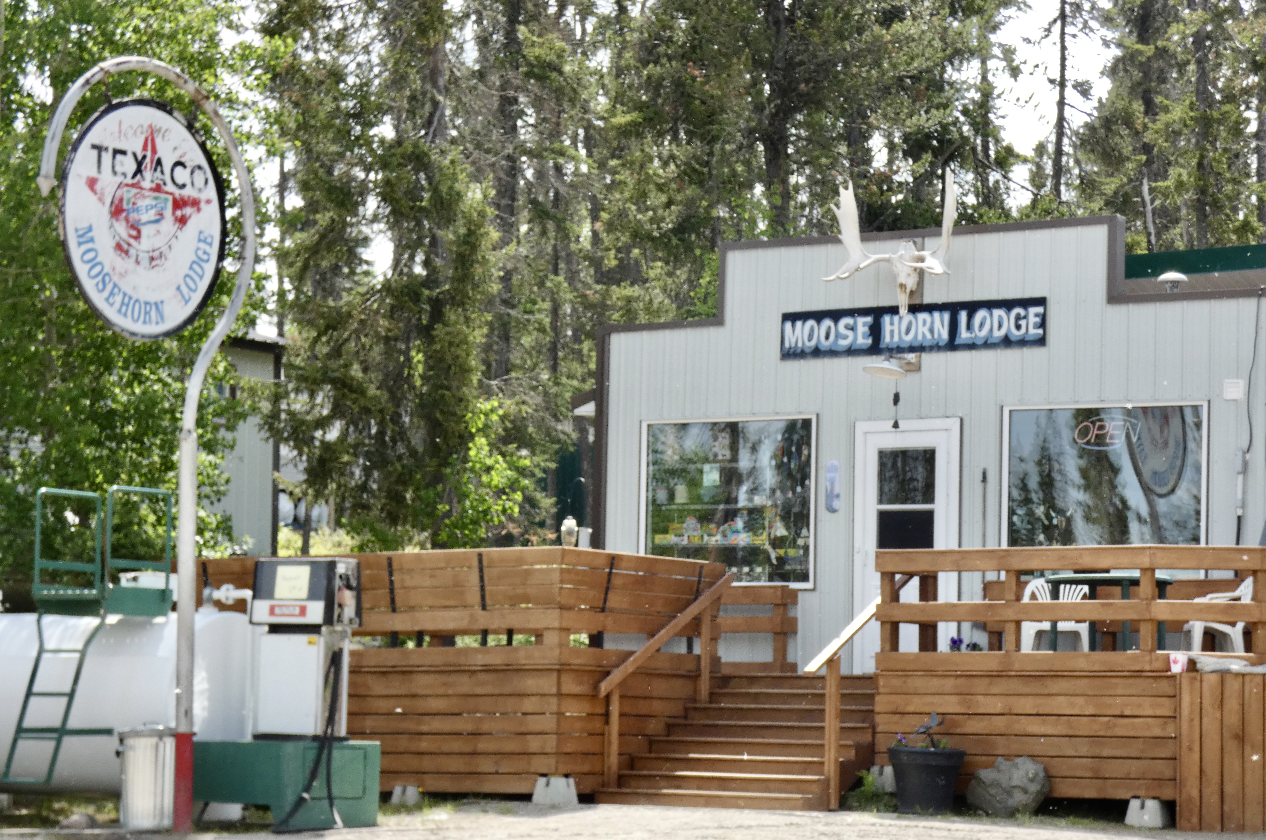
But the premium gas wasn’t the best part. The lady who came out to help with the pump was the best part. Of the whole day. Smiling and laughing, she set the pump and said come on in to pay. Once again, I had discovered that common breed of Canadians like Don and Susanne who seem to be everywhere I go. Since I had only had coffee and an apple fritter for breakfast, I was ready for something more substantive. Like coffee and a candy bar. I asked if she had coffee and she happily went to the back to make me a cup, which she insisted on giving to me. As I started to pay for the candy bar, I notice a sign that advertised homemade Date Squares. She said they’re in the cooler. And there they were, just like my mother used to make. The candy bar went back in the box and I settled in to drink fresh coffee and eat my nostalgic date bar. And get to know Carol Savage.
She told us she and her husband, Daryl, farmers from near the town of Hudson Bay, Saskatchewan, (not the bay itself) about three hours drive away, decided five years ago to bid at an auction on the Moose Horn Lodge and campground. They still own their farm and lease the land, but now they’re full-time proprietors of the lodge and campgrounds on Little Bear Lake in Saskatchewan and love it. And what’s not to love (except maybe the winters).
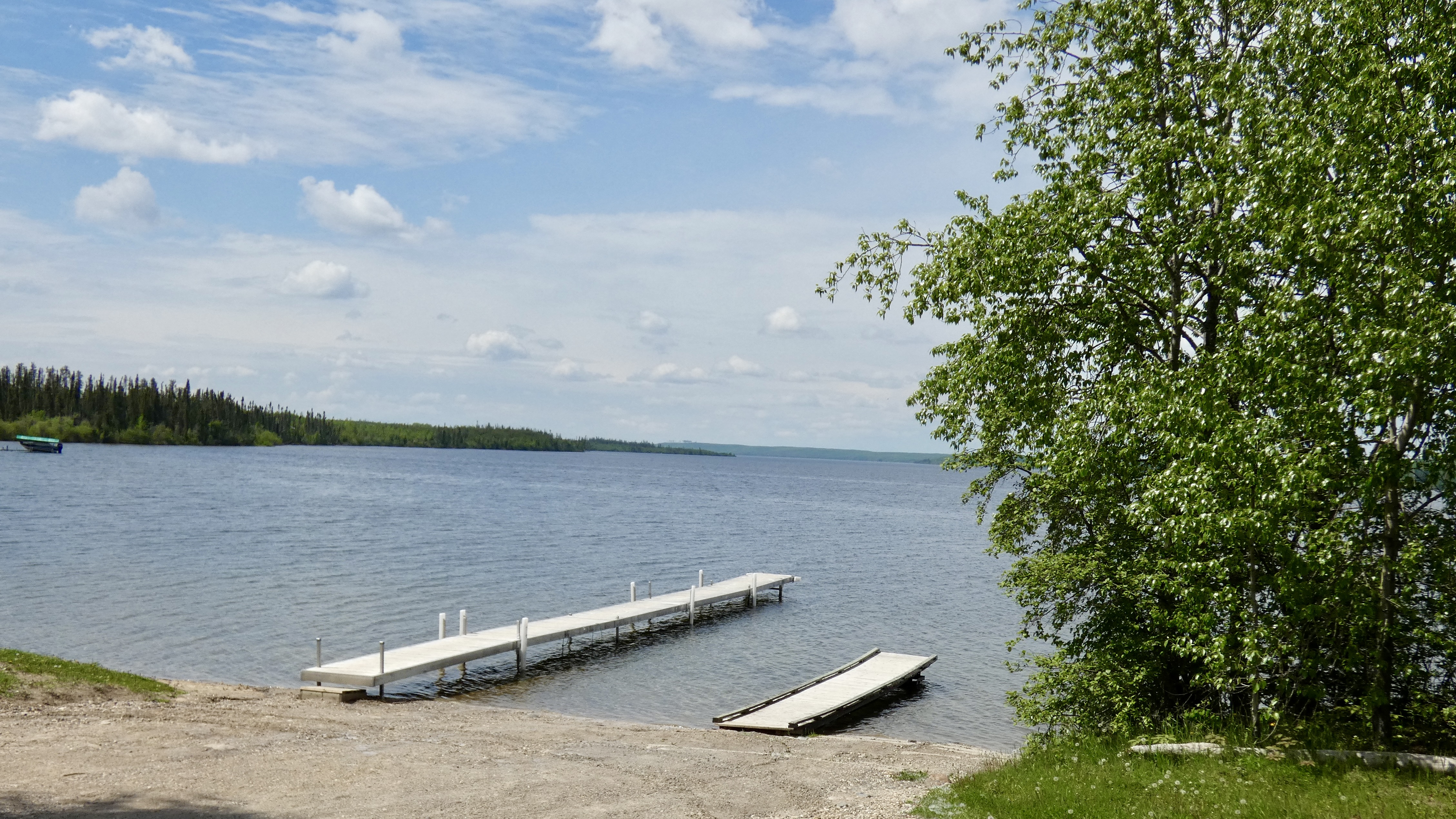
Daryl was gone, taking care of business, but I wish we had had the chance to meet him, too. I imagine he is as personable as Carol. For an hour, long after my wonderful Date Square was gone, we talked and laughed. She asked about us–where we were from, what we did before we became full-time motorcycle riders, where we had travelled. And she told us about her and Daryl’s travels to the States, to Costa Rica, to the Panama Canal. She told us about her parrot that talks at inopportune times. She told us about fishing on Little Bear Lake and showed us a mounted 30 pound lake trout Daryl had caught a couple years earlier. She told us about some of the campers who had been camping there before she and Daryl bought the place and continue to come back year after year. She was, in all ways, a delight and another example of these amazing Canadian people who keep me coming back to this beautiful country.
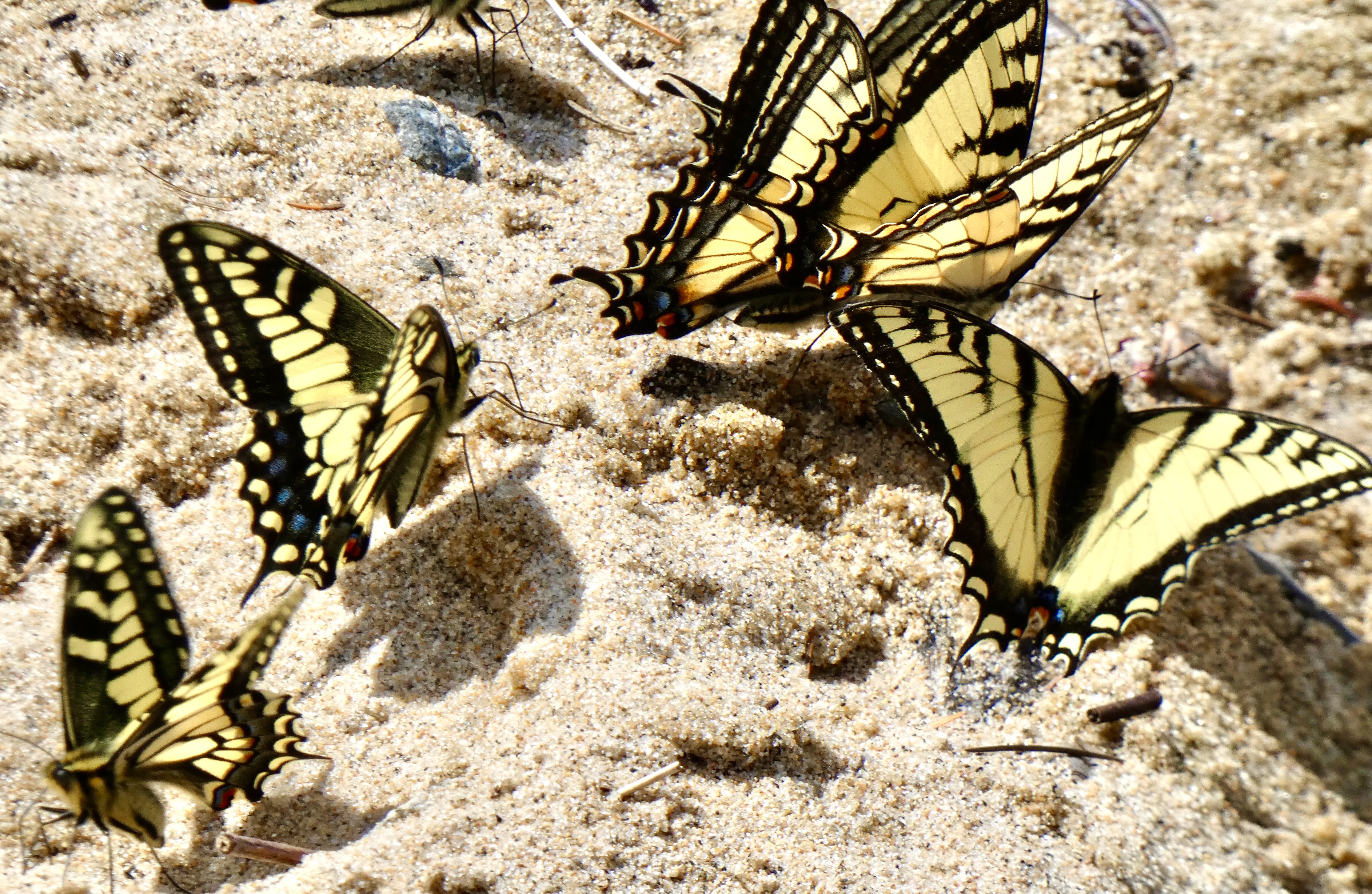
I walked down to the beach to look around at the 13-mile long lake and thought how nice it would be to spend a day or two or maybe a month or two fishing for lake trout and pike and walleye and sitting by a campfire at night talking to neighbors and sharing fish stories. But, after watching a swarm of yellow swallowtail butterflies have a very active conversation among themselves, it was time for us to leave delightful Carol Savage and beautiful Little Bear Lake and get back on the road to Prince Albert for the night.
It’s unlikely I’ll ever get back to Moose Horn Lodge. But not impossible. Who knows? It’s a beautiful place with friendly Canadians. A nice combination.
Down the highway a few more miles, I took the turn my GPS directed me to take to Prince Albert, but after about a quarter mile, the asphalt ended and a long stretch of packed dirt road opened before me. How long a stretch, I didn’t know. Maybe a mile or two or maybe ten or twenty of fifty. With rain still a possibility, the prudent move seemed to be to turn around and take an alternative route I knew would get us there but that was about 15 miles longer. I chose prudent and turned around.
I had expected we would see rain again today about 150 miles into our 250 mile ride. I was wrong. It waited until we got to within 20 miles of Prince Albert. We suited up once more, rode through a few sprinkles, and got to our hotel before the heavy downpour unleashed on Prince Albert. Given our experience with rain this trip, I’ll take today’s light shower anytime.
A short ride scheduled tomorrow to Lloydminster. But maybe I’ll make another detour. They seem to work out well.
