
Day 34 CCR: New Ground and Some Familiar Territory
As I looked at possible routes across the western states on the way back east, one stood out because it allowed me to visit a couple sites that I missed on previous long-distance rides. In July and August 2019, as I retraced the 1803-1805 Lewis and Clark expedition, I learned about (1) the series of dams on the mighty Columbia River and (2) the history of the Nez Perce and Chief Joseph. But I missed the biggest dam of all–The Grand Coulee Dam–and I missed seeing the burial site of Chief Joseph.
Today I visited both places.
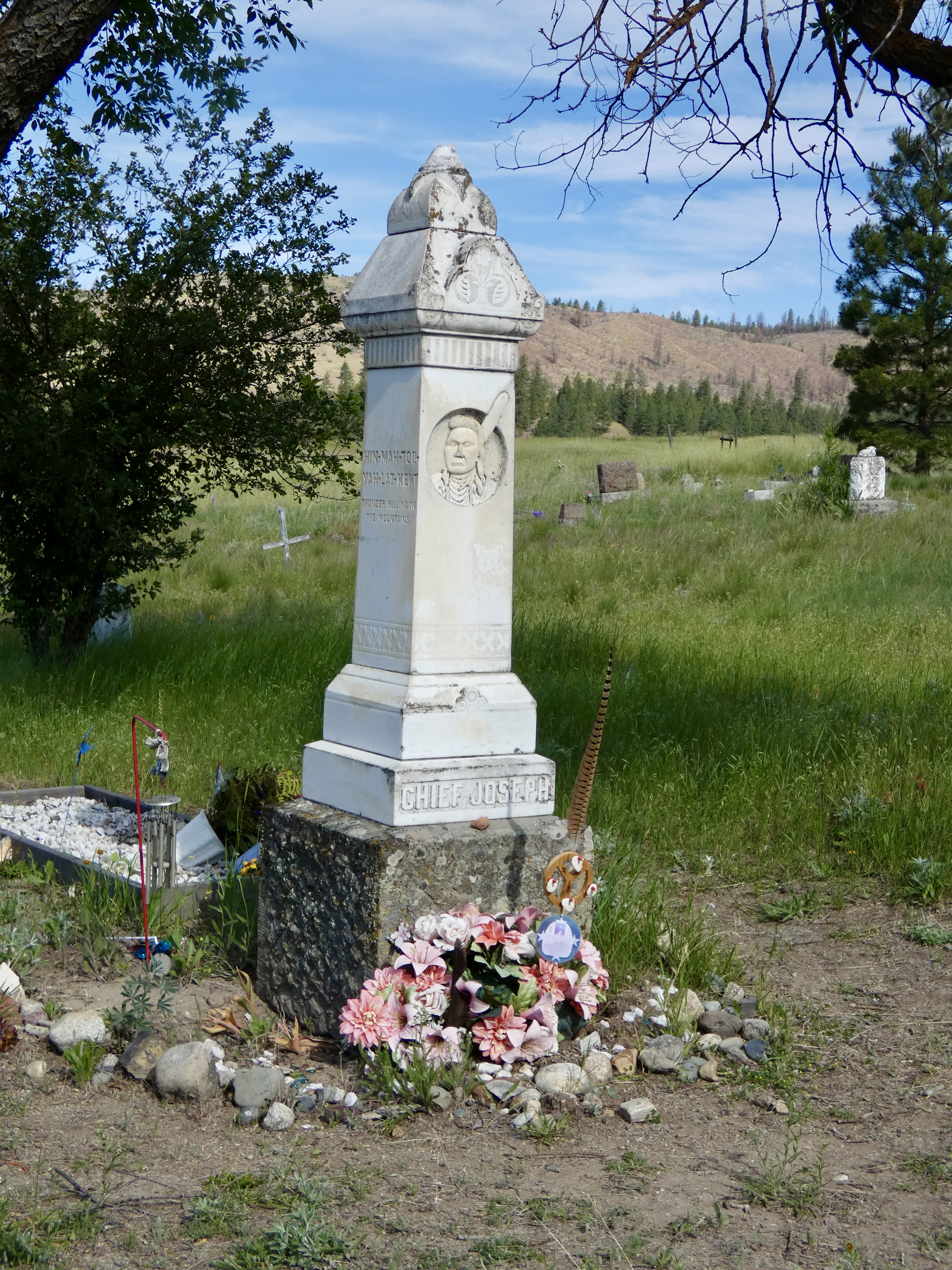
In 1877, U.S. Army troops pursued a small band of Nez Perce (aka Ni Mi Poo), led by Chief Joseph, who were trying to escape the unfair treatment and treaty obligations meted out to the descendants of the people who had saved the lives of Lewis, Clark and their men seven decades earlier. Out numbered and out gunned, Chief Joseph led his people for nearly 1,200 miles as they tried to escape to Canada. They came up 50 miles short at Bear Paws Battlefield in Montana. There, Chief Joseph surrendered with the famous words “From where the sun now stands, I will fight no more forever.” The lies and mistreatment at the hands of the U.S. government continued, though, as the group was sent to Oklahoma rather than back to Idaho as promised. Eventually Chief Joseph did get sent back west, not to his beautiful homeland in Wallowa, but to an arid reservation in Washington state where, according to a coroner, he died of a broken heart in 1904.
He was buried in the Nez Perce cemetery in Nespelem, Washington, and a small monument was erected above his grave in 1905. A trip to the site could do no more than pay respect to this courageous indigenous leader who was betrayed and suffered at the hands of the U.S. government. But pay my respects I did. And I remembered and reflected on his honor and dignity.
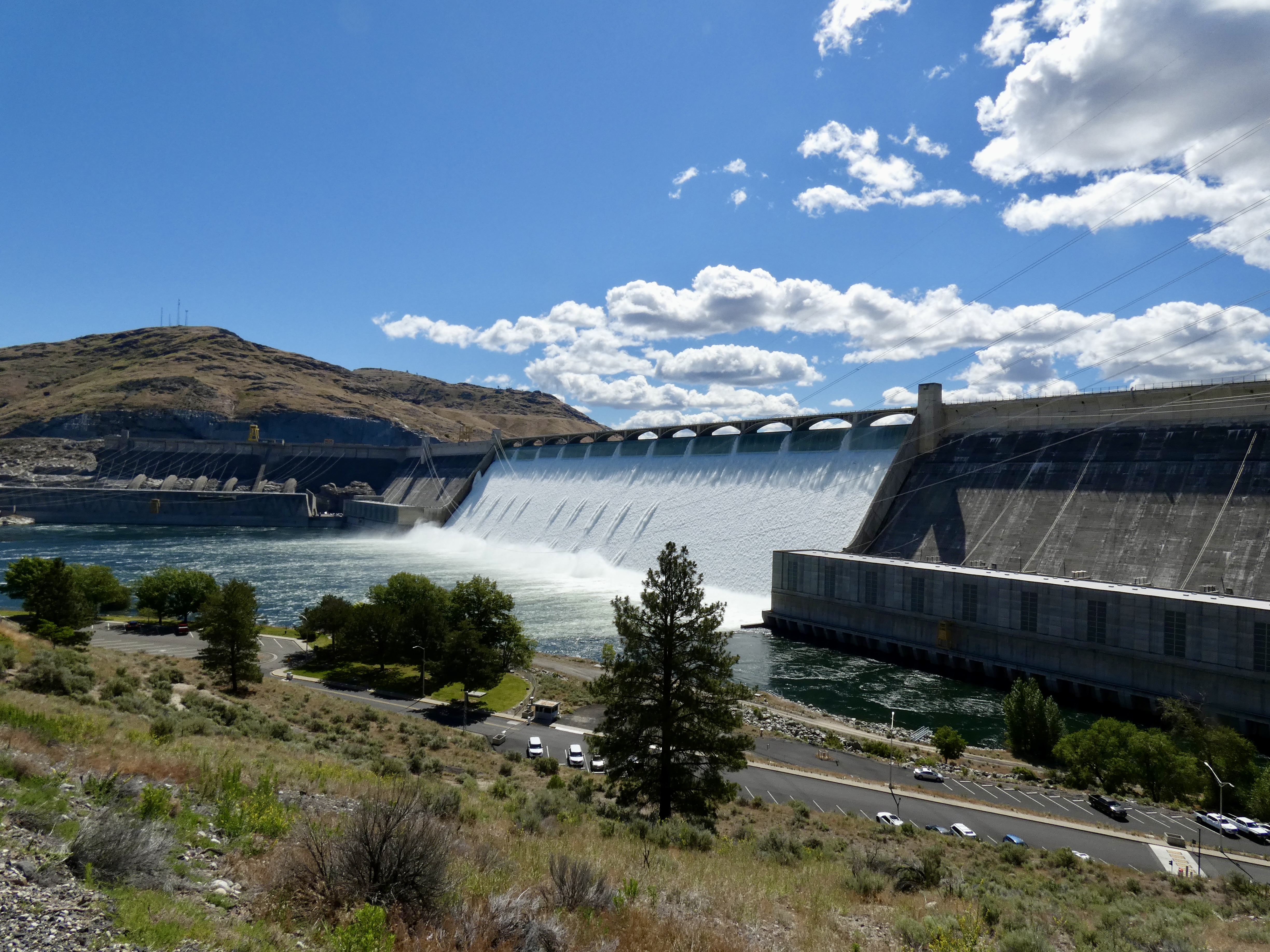
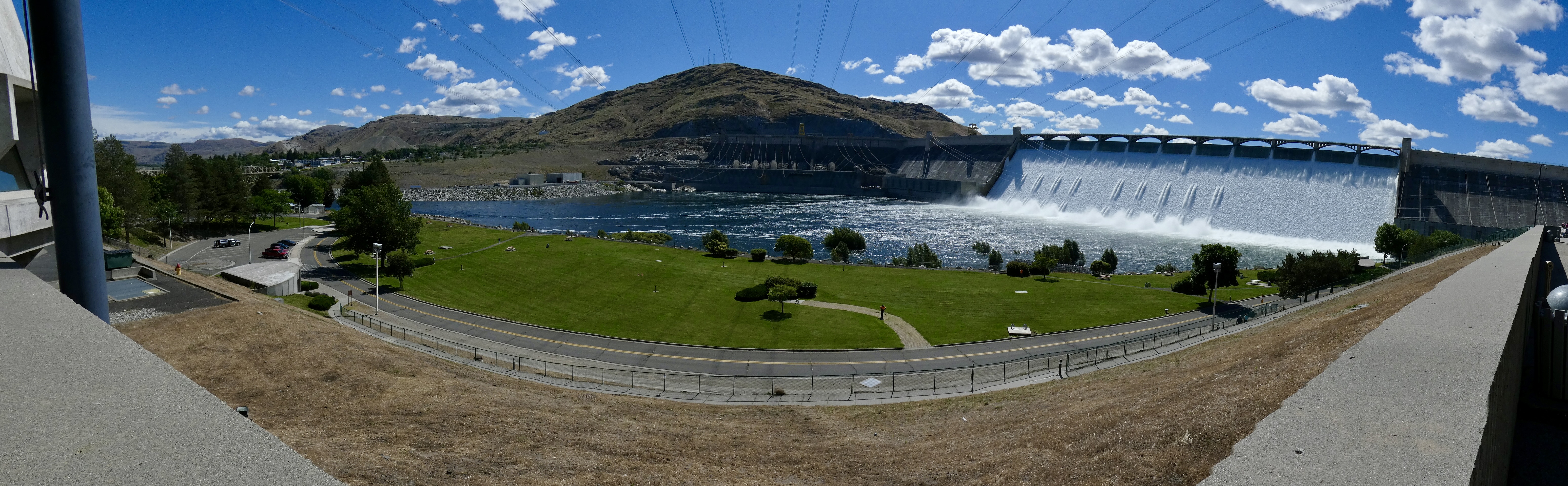
Just a few miles down the road, Grand Coulee Dam straddles the Columbia, creating Lake Roosevelt, which stretches nearly 150 miles to the Canadian border. The dam’s construction was begun in 1933, during the height of the Depression, and thousands of workers and their families moved to the area into new towns built just for them. By the time the US entered WWII in 1941, Grand Coulee Dam was producing power for ship building and aircraft building on the west coast. But not until after the war ended was the dam finished to be used for irrigation as well as power, turning a desert in southeastern Washington into fertile farmland.
When completed, the dam was the largest concrete structure in the world. Additions to the structure in the 1970s made it the largest power plant in the United States. The dam is 550 feet high and a mile wide. In short, it’s an impressive piece of engineering, similar in scope to NASA’s space program and well worth the two-hour side trip.
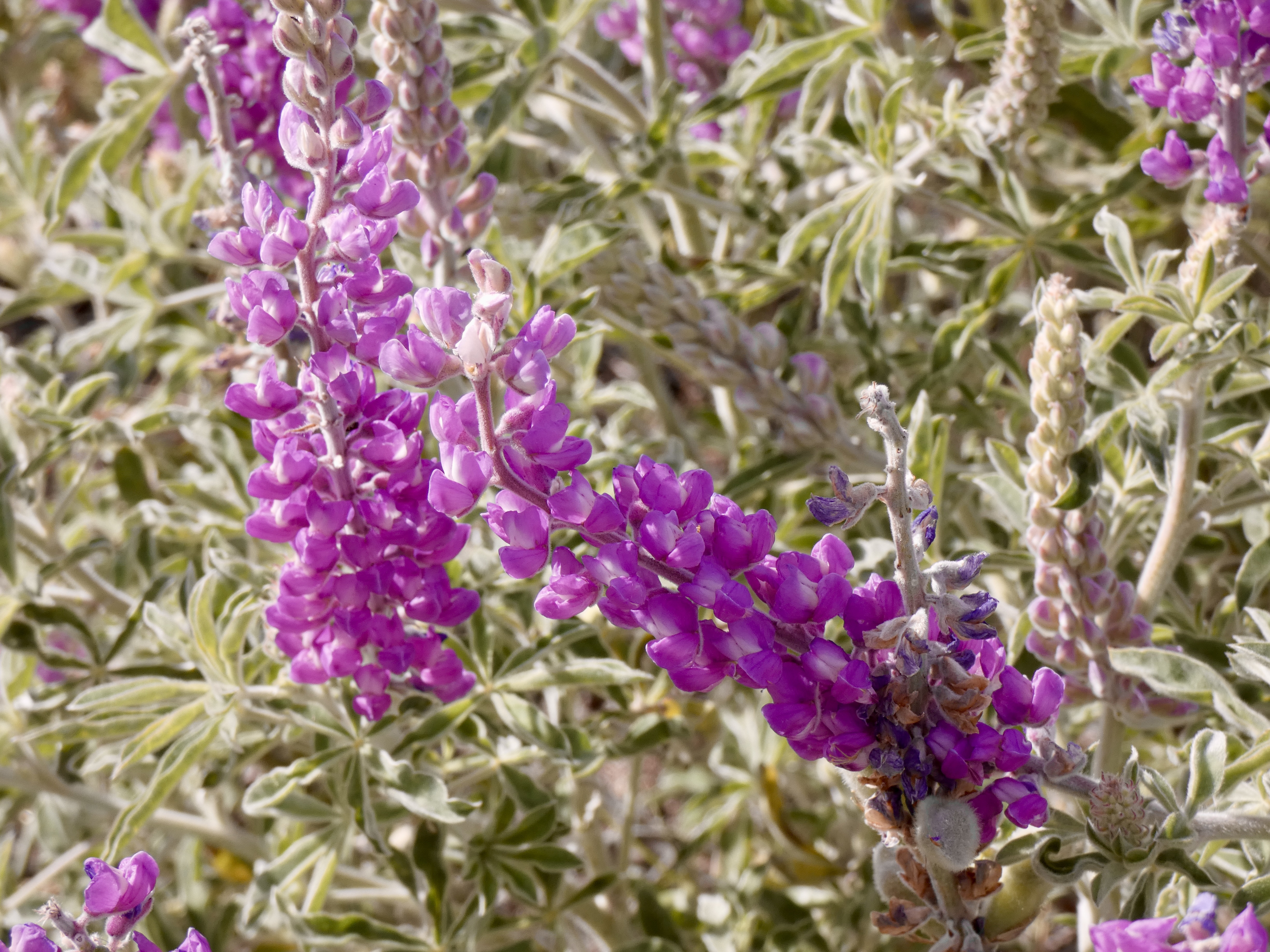
After we left the dam, we headed south and east, through arid ranch county which became fertile farm land covered with alfalfa, grains, and canola fields. Where there wasn’t a crop, the hillsides were often covered with purple flowers growing on a sage-colored plant. My trusty plant identification app declared it to be Silky Lupine, and it did have some similarities to the Lupine that grew everywhere in Prince Edward Island and New Brunswick. Brown soil, green and yellow fields, purple flowers and blue skies. What a palette.

Tonight we’re in Orofino, Idaho, a place I’ve stayed at twice before. Tomorrow we motor over the Bitterroot Mountains that nearly killed Lewis, Clark, et al, but will provide us with a terrific ride into Montana.

Looks like blue skies and open roads. A great day.
Ride Safe.
Another great history lesson and beautiful pictures! Ride safe.