
Day 30 CCR: The Coq, Hope and More
The Coquihala Highway (BC 5) had been lingering in my riding thoughts for several years as I criss-crossed Canada on various trips in and through the county. I had heard about it and put it on my bucket list of roads to ride. Today I crossed it off.
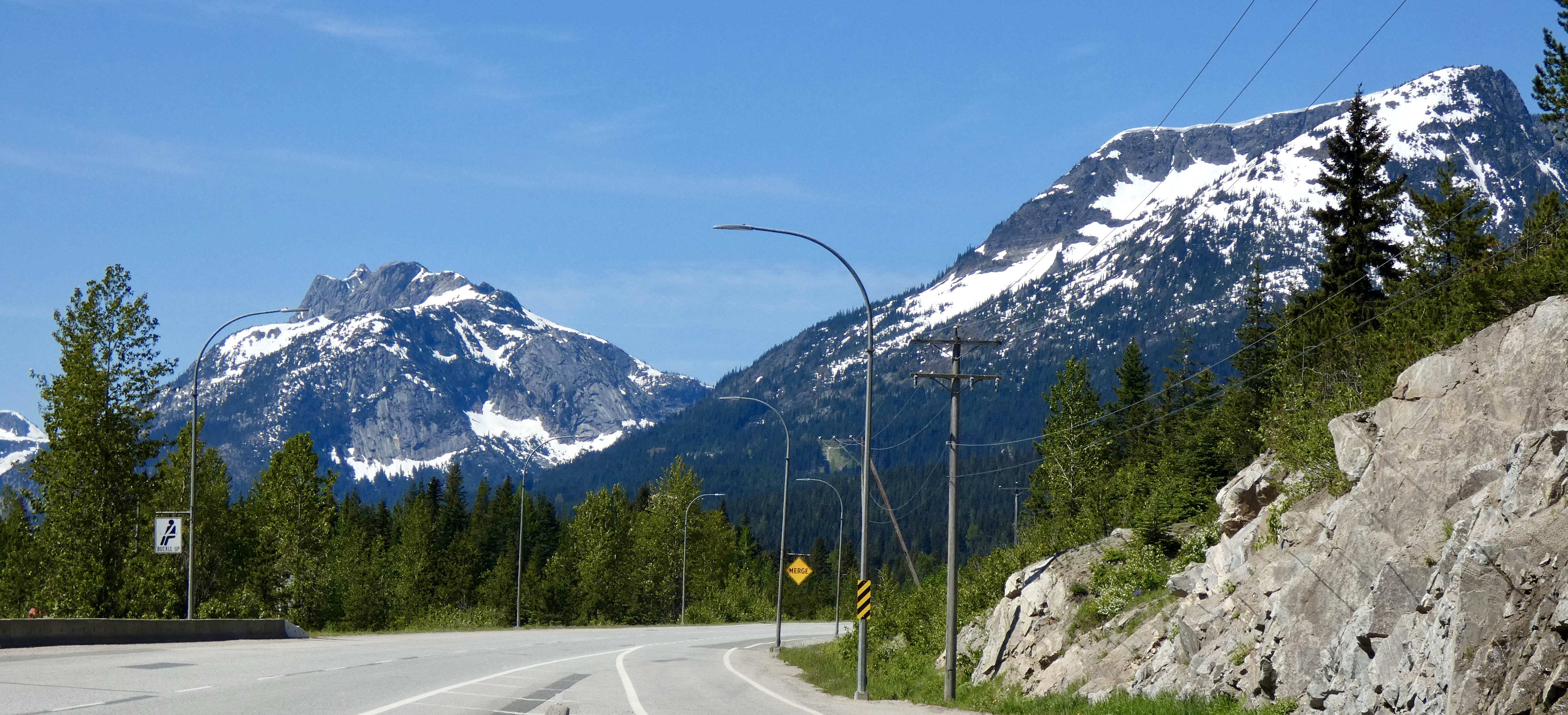
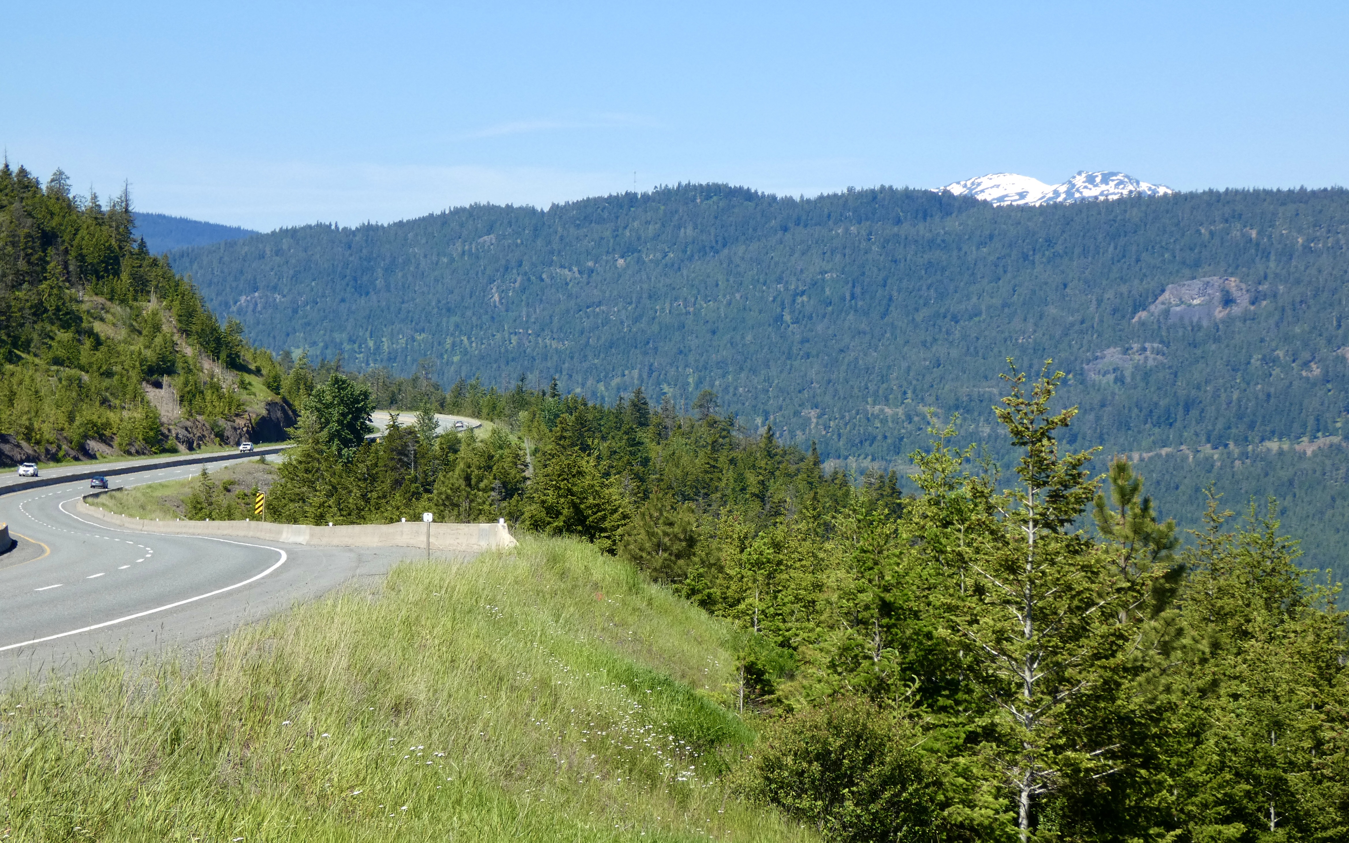
The ride from Kamloops to Hope was a short one–only 125 miles. But the Coq lived up to its billing. It’s a modern four-lane highway, sometimes becoming five or six lanes when additional lanes are needed up or down steep grades to accommodate speed-limited, heavily-loaded 18-wheelers. I was most familiar with the Coq through the “Highway Thru Hell” Canadian TV documentary based on a wrecker and recovery service operating out of Hope that rescues trucks and truckers who slide off the Cog during winter driving. Today I concluded I would rather drive nails through my eyeballs than drive a big rig on the Coq in the winter. Going into Meritt, about halfway to Hope, we descended the longest hill I think I’ve ever been on, and the entire way down I wondered what it would be like to pilot a loaded. 70,000-pound rig with ice and snow covering the road. Throughout its length, the highway has several long and extremely steep grades that quickly become impassable when it snows, and the road frequently closes due to winter conditions. But often not until it’s too late for some poor truck driver.
Today, though, the sun was shining, the temperature hovered around 80 by ride’s end and the Coq seemed tame enough. In my travels across Canada I can’t remember seeing a posted speed limit of 120 kilometers per hour (about 75 mph) but that’s the limit on much of BC 5. And while I was going 120 (75), cars whizzed past me at considerably greater speed, perhaps because in the entire two-hour ride I didn’t see a single law enforcement officer. Even at only 120, it’s hard to take in all the beauty: Soaring snow covered peaks, huge fertile valleys, the fast flowing Coldwater and Coquihala rivers. I stopped a couple times to take in the view and take a picture or two, but for the most part we just kept rolling. I’ve found that where there are beautiful views, there is usually no place to pull over; and where there are places to stop, trees and undergrowth frustratingly block the view you briefly glimpsed at 120 kph a mile back.
Even with a leisurely 9:00 a.m. start, we arrived in Hope around noon and had several hours to kill before we could check in to the Best Continental Hotel. So we went for a motorcycle ride. Of course.
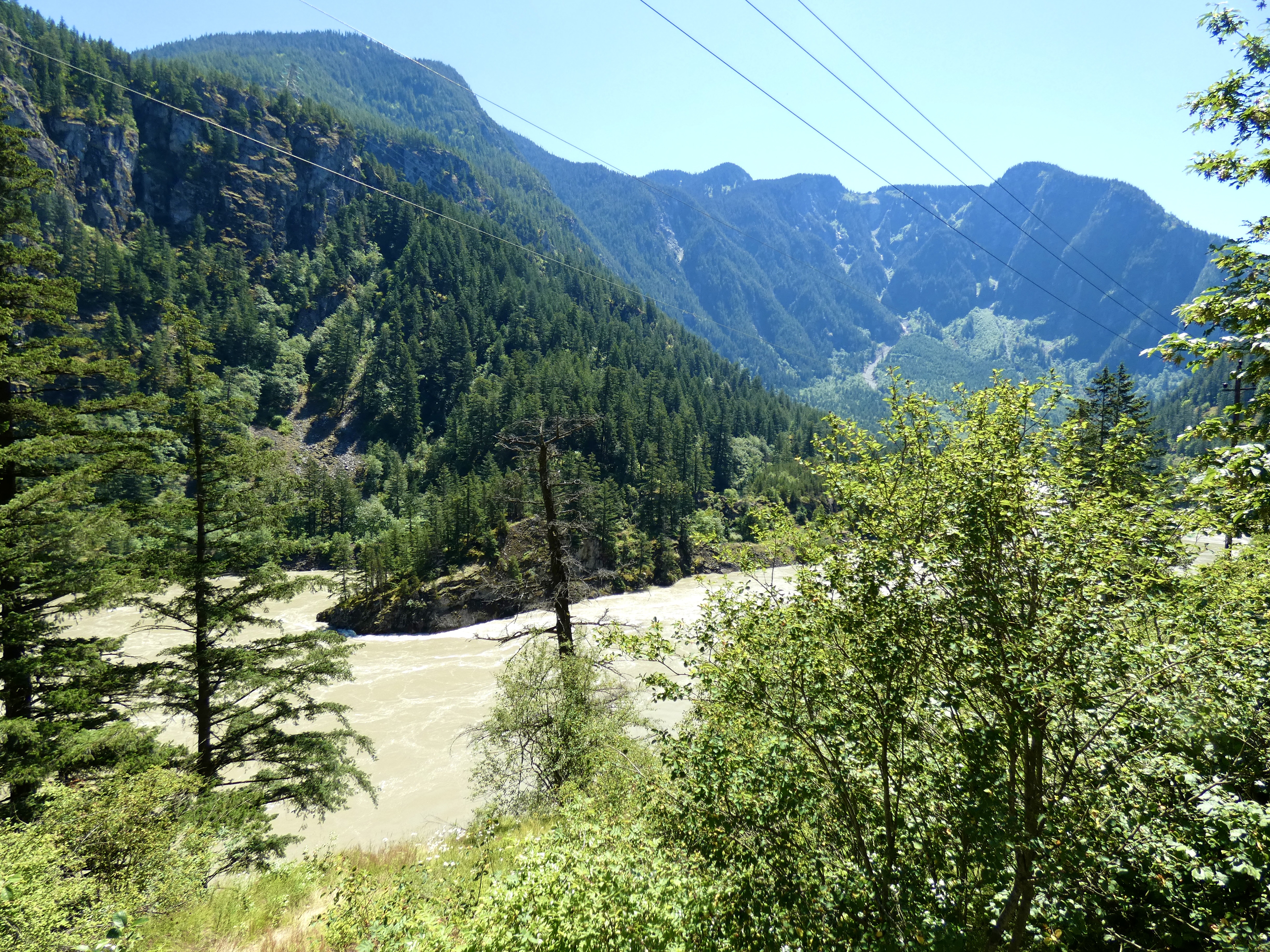
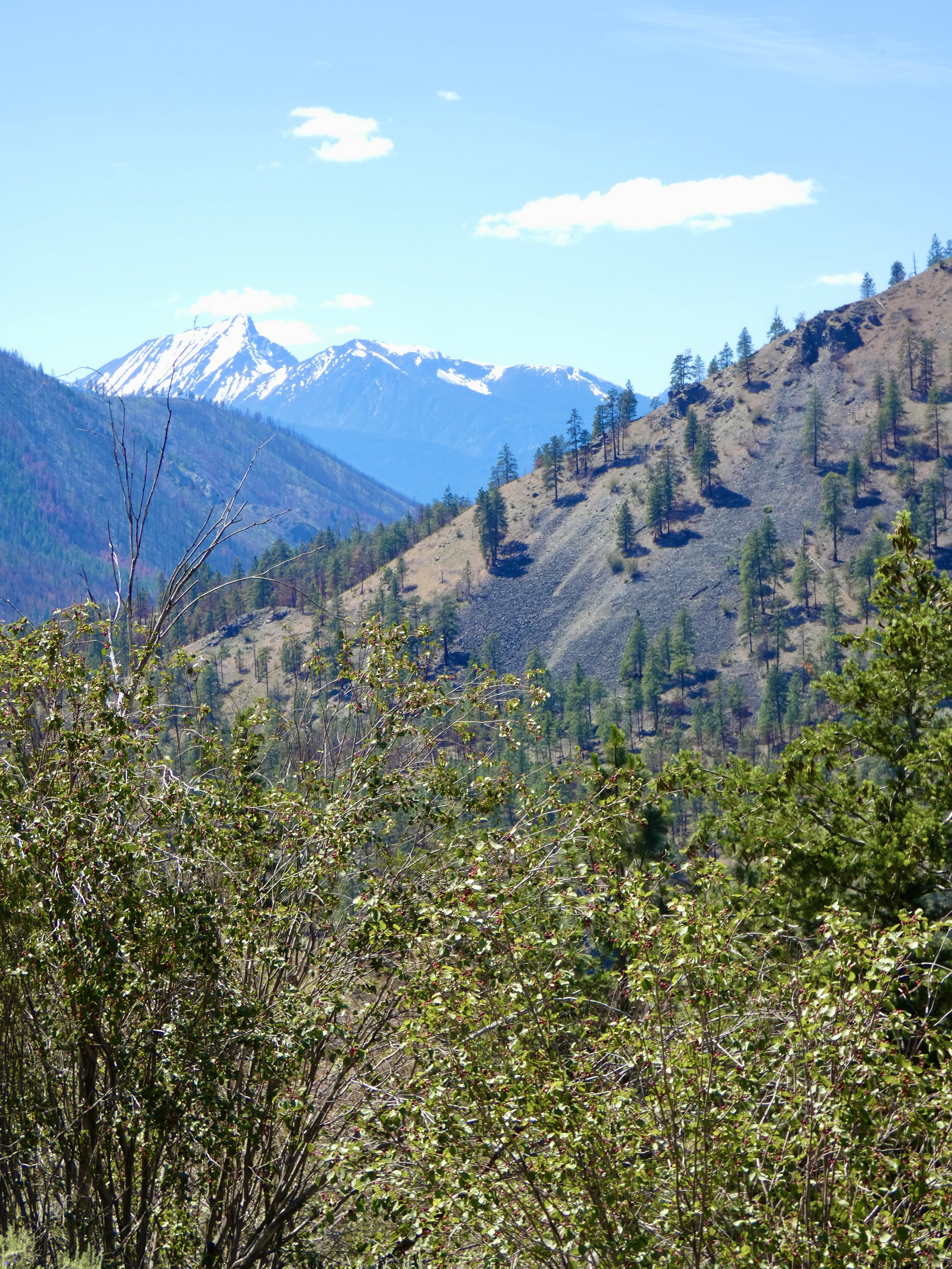
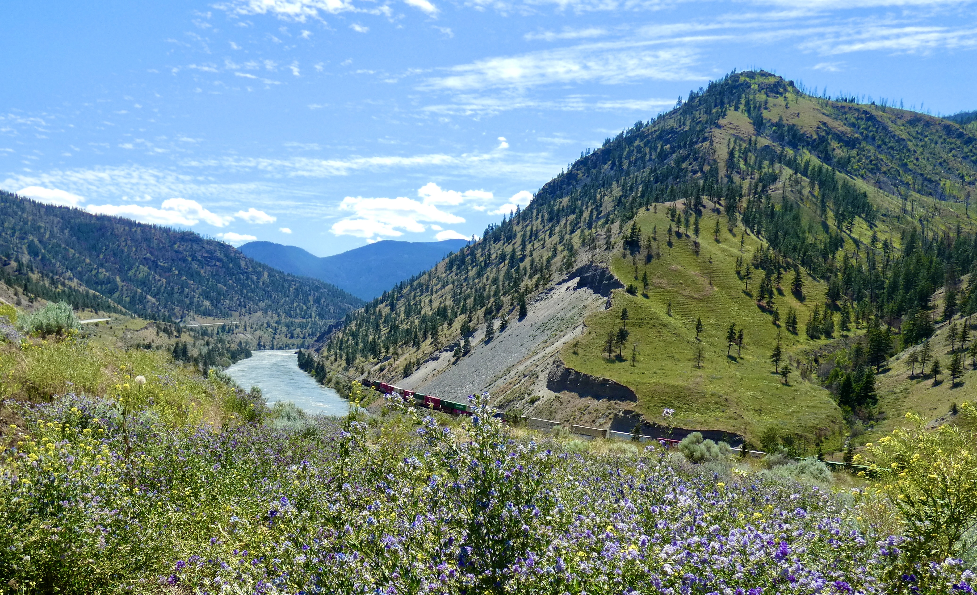
There are two routes to Hope from Kamloops. The short, fast route we took this morning and a longer, scenic route of about 175 miles on the Trans Canada Highway, aka Highway 1. I had wanted to ride both roads, so at noon we started north (east) on the TCH out of Hope, planning to ride as far as we could in two hours, then turn around and retrace our ride back to Hope. Highway 1 follows the mighty Fraser River north to Lytton for about 70 miles, then, where the Thompson River joins the Fraser, the road veers east following the Thompson. Two hours took us about 85 miles up the road, allowing for some photo stops. By then, the landscape had changed dramatically from heavily forested mountain sides to more arid, sparsely-treed mountains. When we went from trees to no trees, the temperature went from 80 to 90, and we turned around and headed back. I would like to have continued on, but four hours on the bike in the afternoon after three hours in the morning, felt like enough riding, and I needed to get back to check on plans for the final three days in Canada.
In between many stops and slow downs for road work, and since I had seen the scenery on the way up Highway 1, I twisted harder on the throttle on the way back to Hope than I had on the outward leg. Even with the bike fully loaded, it handled the curves well; I felt like I had had a real motorcycle ride and not just a tourist’s pace. There’s a road in Idaho I think I’ll ride the same way.
Tomorrow it’s another short ride as we reach Vancouver and a catch a ferry to Vancouver Island and Victoria. The CCR is approaching its conclusion, but a couple more Canadian riding days remain, eh?

Glad you were able to fit a motorcycle ride into the trip.
Ride Safe
Glad you had a safe experience on the Coq, the TV series can’t do it justice for the beauty! Enjoy your last days riding in Canada!
Ride safe.