
Day 3 CCR: Getting through NYC
Today was going to be an easy ride from Bethlehem to Hampton, New Hampshire, one final step closer to Canada. But for some reason, nothing is ever easy.
I routed the ride on the Google Map GPS using a round-about track that kept us well west and north of Newark and New York City. It was a few miles longer, but avoided whatever city traffic would be out on a Sunday holiday weekend and had fewer tolls. I didn’t really need to see the NYC skyline, which I’ld seen before on a ride that took me through downtown NYC.
So, I dutifully followed the arrow on my Google map app as we left Bethlehem and headed east. But we kept going east beyond what I expected. I thought to myself, “shouldn’t we be going north somewhere along this route,” but the arrow kept taking us east. OK, I thought, “Google GPS knows the route better than I do,” and I was also keeping my eye on the traffic, which continued to build as we went further east through Pennsylvania and into New Jersey. When I saw signs for Newark, the Lincoln Tunnel and the George Washington Bridge, I was pretty sure that we weren’t on the route I expected to be on.
Google Maps apparently thinks it knows what I want better than I do and decided to show me a shorter route, almost into the heart of NYC. On the map image below, the BLUE line is the route I wanted to go. The GRAY line is the route Google Maps imperiously decided we should take instead.
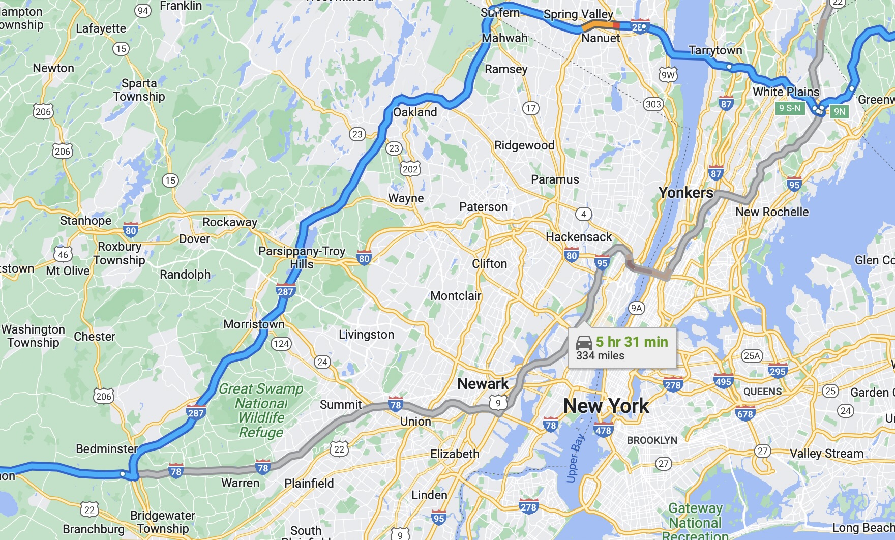
Although it would have been worse if Google had decided to take me into the Lincoln Tunnel instead of over the double-decker George Washington Bridge (of Bridgegate fame a few years ago), we still saw a lot more of NYC and its kamikaze drivers than I expected to see. Steve stayed glued to my tail as I tried to pick the correct lanes that accorded with the ever-updating GPS map on my handlebar-mounted iPhone, even though picking the appropriate lane sometimes meant crossing several other lanes quickly while avoiding swarming drivers bound for various Memorial Day Weekend barbecues, picnics, pig roasts or whatever festivity they had planned. Of course, by the time I got to the New York side of the Hudson River, I knew that, while not lost, I was at least a little confused. Still, I followed the moving arrow, believing that ultimately Google and its smirking, know-it-all, shortcut-seeking engineers would ultimately get us where I wanted to spend the night.
Once the GRAY line joined the BLUE line on the map above I was back in semi-familiar territory and we enjoyed a beautiful ride through the Connecticut countryside on the Merritt Parkway (US 15) before heading into Massachusetts (skirting Boston) and arriving in New Hampshire, butt-puckered from our brush with NYC but safe and sound.
One of the problems with riding Interstates and parkways all day is that there are no good places to pull off and meet goat-hiking women or take pictures of beautiful scenery. There was beautiful scenery in the New England countyside today, but, unfortunately, no pictures.
Our rooms tonight are in Hampton, NH, just south of Portsmouth, in an older but adequate motel on US 1, the main north-south highway from Maine to Florida before the construction of the Interstate 95. The best part about being away from the Interstate is the chance to find local eateries rather than choosing unenthusiastically among cookie-cutter chain restaurants. Tonight we found a local brick-fired pizza restaurant (The Community Oven) with a large craft beer selection. I had a couple of Maine-brewed stouts to wash down one of the best pizzas I’ve ever had, due to the fire-roasted tomatoes and carmelized onions that nicely balanced the spicy sausage. Macy, our server, said it was a good pizza and she was right. Thanks Macy.
Tomorrow we’ll ride the final section of our initial U.S.-based leg of the CCR and cross into Canada at Saint Stephen, New Brunswick. I had hoped for some sight-seeing on the beautiful Maine coast along the way, but Canada has a Covid-related program that requires visitors to pre-set a time to enter the country and I don’t want to be late for our 2:00 p.m. date with the Canadian border authorities.
So, on Memorial Day we’ll enter Canada where we’ll spend the next 30 days figuring out kilometers and kilograms, eh?

Just wow on the trip towards the city. Glad y’all made it through. Pizza always sounds good.
Ride safe.
Glad you both made it safely through the city! Hopefully Google Maps will treat you better as you travel on. Ride safe!